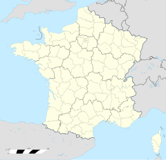
Dietwiller
| Dietwiller | |
|---|---|
|
| |
 | |
 | |
| Verwaltung | |
| Land |
|
| Region |
|
| Département | Haut-Rhin (68) |
| Arrondissement | Mulhouse |
| Kanton | Brunscht |
| Kommunalverband | Mulhouse Alsace Agglomération |
| Amtlicha Name | Dietwiller |
| Maire | Robert Marc Riss (2014-2020)[1] |
| Code Insee |
68072 |
| Boschtlaitzahl |
68440 |
| Aiwohner | |
| Aiwohner | 1.417 |
| Flech | 11,06 km2 |
| Bevelkerungsdicht | 118,9 Iiw./km2 |
| Lach | |
| Koordinate | 47° 41′ 29″ N, 7° 24′ 05″ E / 47.691388888889°N,7.4013888888889°EKoordinate: 47° 41′ 29″ N, 7° 24′ 05″ E / 47.691388888889°N,7.4013888888889°E |
| Hech | 262 m |
| Website | |
| http://www.mairie-dietwiller.fr | |
Dietwiller (franzesisch Dietwiller, daitsch Dietweiler) isch e franzesische Gemää im Département Haut-Rhin (Owwaelsass) in de Rechion Grand Est (bis 2015 Elsass).
D Gemää gheat zum Kanton Brunscht un zum Arrondissement Mulhouse.
Geografie
[Schaffe | Om Gwelltegschd schaffe]Dietwiller licht 8 km vun Mìlhüüse uf 262 m NN.
Gschicht
[Schaffe | Om Gwelltegschd schaffe]Dietwiller isch im Johr 1128 zum easchte Mol gnennt worre.
Verwaltung
[Schaffe | Om Gwelltegschd schaffe]De Maire vun Dietwiller isch de Robert Marc Riss. Dietwiller gheat zum Kommunalvaband Mulhouse Alsace Agglomération.
Bevelkerungsentwicklung
[Schaffe | Om Gwelltegschd schaffe]| Johr | 1968 | 1975 | 1982 | 1990 | 1999 | 2008 |
| Aiwohner | 337 | 470 | 1053 | 1258 | 1189 | 1325 |
Dialekt
[Schaffe | Om Gwelltegschd schaffe]De elsässisch Dialekt vun Dietwiller gheat zum Owerrhaialemannisch.
Weblinks
[Schaffe | Om Gwelltegschd schaffe]Fußnote
[Schaffe | Om Gwelltegschd schaffe]- ↑ (franzesisch) Liste des maires au 25 avril 2014 (data.gouv.fr)
Aschedswiller | Bàrtene | Brìnke | Brüebi | Brunscht-Dìdene | Chàppele | Chems | Dietwiller | Flàxlànde | Gaispìtze | Halfrànzchìlech | Ketzige | Làndser | Màschgetz | Niederstaibrunn | Obermàschgetz | Oberstaibrunn | Rànzwiller | Schlierbi | Sierez | Stätte | Üffe | Wàhlbi | Wàltene | Zäsige | Zìlse | Zìmmersche |

