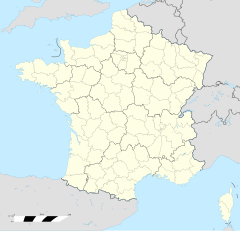
Saint-Hubert (Moselle)
Erscheinungsbild
| Saint-Hubert | |
|---|---|
|
| |
 | |
 | |
| Verwaltung | |
| Land |
|
| Region |
|
| Département | Moselle (57) |
| Arrondissement | Metz |
| Kanton | Le Pays Messin |
| Kommunalverband | Haut Chemin-Pays de Pange |
| Maire | Roland Sallerin (2014-2020)[1] |
| Code Insee |
57612 |
| Boschtlaitzahl |
57640 |
| Aiwohner | |
| Aiwohner | 234 |
| Flech | 16,04 km2 |
| Bevelkerungsdicht | 14,4 Iiw./km2 |
| Lach | |
| Koordinate | 49° 13′ 26″ N, 6° 19′ 59″ E / 49.223888888889°N,6.3330555555556°EKoordinate: 49° 13′ 26″ N, 6° 19′ 59″ E / 49.223888888889°N,6.3330555555556°E |
| Hech | 217 m |
| Website | |
| http://www.mairiesthubert57.fr | |
Saint-Hubert (daitsch Sankt Hubert) ìsch e franzesische Gemää im Département Moselle in de Rechion Grand Est (bis 2015 Rechion Lothringe).
D Gemää gheat zum Kanton Le Pays Messin im Arrondissement Metz.
Verwaltung
[Schaffe | Om Gwelltegschd schaffe]De Maire vun Saint-Hubert isch de Roland Sallerin. Saint-Hubert gheat zum Kommunalvaband Haut Chemin-Pays de Pange.
Bevelkerungsentwicklung
[Schaffe | Om Gwelltegschd schaffe]| Johr | 1968 | 1975 | 1982 | 1990 | 1999 | 2008 |
| Aiwohner | 146 | 164 | 187 | 173 | 197 | 223 |
Dialekt
[Schaffe | Om Gwelltegschd schaffe]De draditionell Dialekt (Patois) vun Saint-Hubert gheat zum Lorrain.
Weblinks
[Schaffe | Om Gwelltegschd schaffe]Fußnote
[Schaffe | Om Gwelltegschd schaffe]- ↑ (franzesisch) Liste des maires au 25 avril 2014 (data.gouv.fr)
Antilly (Moselle) | Argancy | Ay-sur-Moselle | Burtoncourt | Chailly-lès-Ennery | Charleville-sous-Bois | Charly-Oradour | Ennery (Moselle) | Failly | Flévy | Glatigny (Moselle) | Hayes (Moselle) | Les Étangs | Malroy | Noisseville | Nouilly | Sainte-Barbe (Moselle) | Saint-Hubert (Moselle) | Sanry-lès-Vigy | Servigny-lès-Sainte-Barbe | Trémery | Vigy | Vry

