Bedfordshire
| Hrabstwo ceremonialne | |||
 Woburn Abbey, siedziba książąt Bedford | |||
| |||
| Państwo | |||
|---|---|---|---|
| Kraj | |||
| Region | |||
| Siedziba | |||
| Powierzchnia |
1235 km² | ||
| Populacja (2011) • liczba ludności |
| ||
| • gęstość |
498,1 os./km² | ||
| Szczegółowy podział administracyjny | |||

| |||
| Liczba unitary authorities |
3 | ||
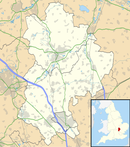
Położenie na mapie
| |||
| Strona internetowa | |||
Bedfordshire – hrabstwo ceremonialne i historyczne we wschodniej Anglii, w regionie East of England, zaliczane do tzw. Home Counties. Do 2009 roku hrabstwo pełniło także funkcję administracyjną jako hrabstwo niemetropolitalne.
Powierzchnia hrabstwa wynosi 1235 km² a liczba ludności – 615 100 (2011)[1]. Największym miastem hrabstwa jest Luton, w sąsiedztwie którego znajduje się międzynarodowy port lotniczy Londyn-Luton. Drugie pod względem wielkości jest Bedford, dawna stolica hrabstwa. Inne większe miasta na terenie Bedfordshire to Leighton Buzzard oraz Dunstable.
Na wschodzie Bedfordshire graniczy z hrabstwem Cambridgeshire, na południu z Hertfordshire, na zachodzie z Buckinghamshire a na północy z Northamptonshire.
Podział administracyjny
[edytuj | edytuj kod]Obecny
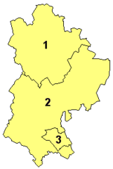
[edytuj | edytuj kod]W skład hrabstwa wchodzą trzy jednostki administracyjne typu unitary authority:
Do 2009
[edytuj | edytuj kod]
Przed reformą administracyjną przeprowadzoną w 2009 roku Bedfordshire było hrabstwem niemetropolitalnym, w którego skład wchodziły trzy dystrykty. Jako hrabstwo ceremonialne Bedfordshire obejmowało wówczas dodatkowo jedną jednostkę typu unitary authority.
- Bedford
- Mid Bedfordshire
- South Bedfordshire
- Luton (unitary authority)
Mapa
[edytuj | edytuj kod]
Uwagi
[edytuj | edytuj kod]- ↑ Stolica Bedfordshire do 2009 roku, gdy hrabstwo przestało pełnić funkcję administracyjną.
Przypisy
[edytuj | edytuj kod]- ↑ Table P04 2011 Census: Usual resident population by five-year age group, local authorities in England and Wales. Office for National Statistics. [dostęp 2012-07-24]. (ang.).
- ↑ Office for National Statistics: KS101EW - Usual resident population. [w:] 2011 Census [on-line]. Nomis – Official labour market statistics, 2013-02-12. [dostęp 2022-06-05]. (ang.).
- ↑ Office for National Statistics: Built-up Area to Local Authority District (December 2011) Lookup in England and Wales. [w:] Open Geography Portal [on-line]. [dostęp 2022-06-05]. (ang.).
- ↑ Office for National Statistics: Built-up Area Sub Divisions (December 2011) Boundaries. [w:] Open Geography Potal [on-line]. [dostęp 2022-06-05]. (ang.).
Bibliografia
[edytuj | edytuj kod]- Bedfordshire, [w:] Encyclopædia Britannica [dostęp 2012-03-07] (ang.).


