Castelbello-Ciardes
Aspetto
| Castelbello-Ciardes comune tagliàne | ||
|---|---|---|
 | ||
| ||
| Nome ufficiale | Castelbello-Ciardes/Kastelbell-Tschars | |
| State | ||
| Reggione | ||
| Provinge | ||
| Coordinate | 46°38′00″N 10°54′00″E | |
| Altitudine | 587 m s.l.m. | |
| Superficie | 53 km² | |
| Crestiàne | 2 329 | |
| Denzetà | 44 cr./km² | |
| Fraziune | Colsano, Juvale, Lacinigo, Montefontana, Montefranco, Montetrumes | |
| Comune 'nzeccate | Laces, Naturno, Senales, Ultimo | |
| CAP | 39020 | |
| Prefisse | 0473 | |
| Codece ISTAT | 021018 | |
| Cod. catastale | C062 | |
| Nome javetande | castelbellesi / Kastellbeller | |
| Site istituzionale | ||
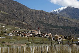
Castelbello-Ciardes éte 'nu comune tagliáne de 2.329 crestiáne.
Categorije:
- Stub
- Prefisso telefonico locale uguale a Wikidata
- Codice ISTAT uguale a Wikidata
- P18 lette da Uicchidate
- P94 differende sus Uicchidate
- P281 uguale sus Uicchidate
- P806 uguale sus Uicchidate
- P856 differende sus Uicchidate
- P2044 uguale sus Uicchidate
- P2046 differende sus Uicchidate
- Comune d'u Trendine-Ìrte Adige
- Comune d'a provinge de Bolzano
- Pàggene cu le mappe


