Doues
Aspetto
| Doues comune tagliàne | ||
|---|---|---|
 | ||
| ||
| State | ||
| Reggione | ||
| Provinge | ||
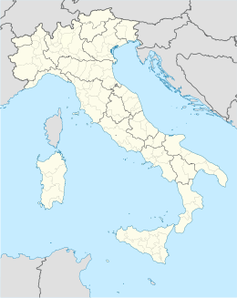
| Coordinate | 45°49′00″N 7°18′00″E | |
| Altitudine | 1,176 m s.l.m. | |
| Superficie | 16 km² | |
| Crestiàne | 418 (2007) | |
| Denzetà | 26 cr./km² | |
| Fraziune | Aillan, Bovier, Champ-Mort, Champsavinal, Chanet, Châtellair, Chez-Croux, Condemine, Coudrey, Coudrey Dessus, Crêtes, Dialley, Haut-Prabas, Javiod, La Bioulaz, La Cerise, La Chenal, La Cleyvaz, La Coud, La Crétaz, La Perrouaz, Lusey, Meylan, Orbaney, Planavilla, Plan d'Aillan, Plataz, Ploutre, Posseil, Prabas, Torrent. | |
| Comune 'nzeccate | Allein, Etroubles, Gignod, Ollomont, Roisan, Valpelline. | |
| CAP | 11010 | |
| Prefisse | 0165 | |
| Codece ISTAT | 7024 | |
| Cod. catastale | D356 | |
| Nome javetande | doiardi o doyards | |
| Patrone | San Biagio | |
| Sciurne festive | 3 febbraio | |
| Site istituzionale | ||
Doues éte 'nu comune tagliáne de 418 crestiáne.
Valle d'Aosta Comune d'a Provinge de Aosta
| Allein · Antey-Saint-André · Aosta · Arnad · Arvier · Avise · Ayas · Aymavilles · Bard · Bionaz · Brissogne · Brusson · Challand-Saint-Anselme · Challand-Saint-Victor · Chambave · Chamois · Champdepraz · Champorcher · Charvensod · Châtillon · Cogne · Courmayeur · Donnas · Doues · Emarèse · Etroubles · Fontainemore · Fénis · Gaby · Gignod · Gressan · Gressoney-La-Trinité · Gressoney-Saint-Jean · Hône · Introd · Issime · Issogne · Jovençan · La Magdeleine · La Salle · La Thuile · Lillianes · Montjovet · Morgex · Nus · Ollomont · Oyace · Perloz · Pollein · Pont-Saint-Martin · Pontboset · Pontey · Pré-Saint-Didier · Quart · Rhêmes-Notre-Dame · Rhêmes-Saint-Georges · Roisan · Saint-Christophe · Saint-Denis · Saint-Marcel · Saint-Nicolas · Saint-Oyen · Saint-Pierre · Saint-Rhémy-en-Bosses · Saint-Vincent · Sarre · Torgnon · Valgrisenche · Valpelline · Valsavarenche · Valtournenche · Verrayes · Verrès · Villeneuve |
Categorije:
- Stub
- P625 uguale sus Uicchidate
- Prefisso telefonico locale uguale a Wikidata
- Codice ISTAT differente da Wikidata
- P18 lette da Uicchidate
- P94 differende sus Uicchidate
- P281 uguale sus Uicchidate
- P806 uguale sus Uicchidate
- P856 differende sus Uicchidate
- P2044 differende sus Uicchidate
- P2046 differende sus Uicchidate
- Comune d'a Valle d'Aosta
- Comune d'a provinge de Aosta
- Pàggene cu le mappe

