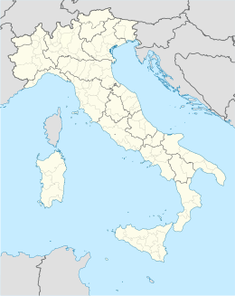
Santa Sofia (FC)
Aspetto
| Santa Sofia comune tagliàne | ||
|---|---|---|
 | ||
| ||
| State | ||
| Reggione | ||
| Provinge | stemma Forlì-Cesena | |
| Coordinate | 43°57′00″N 11°54′00″E | |
| Altitudine | 257 m s.l.m. | |
| Superficie | 148,56 km² | |
| Crestiàne | 4 238 (2008 (fonte Istat)) | |
| Denzetà | 28,53 cr./km² | |
| Fraziune | Berleta, Biserno, Bleda, Burraia, Cabelli, Campigna, Camposonaldo, Chalet Burraia, Collina di Pondo, Corniolo, Isola, Monte Falco, Rifugio La Capanna, San Martino, Spinello | |
| Comune 'nzeccate | Bagno di Romagna, Civitella di Romagna, Galeata, Pratovecchio (AR), Premilcuore, San Godenzo (FI), Sarsina, Stia (AR) | |
| CAP | 47018 | |
| Prefisse | 0543 | |
| Codece ISTAT | 040043 | |
| Cod. catastale | I310 | |
| Nome javetande | santasofiesi | |
| Patrone | Santa Lucia da Siracusa | |
| Sciurne festive | 13 dicembre | |
| Site istituzionale | ||
Santa Sofia (FC) éte 'nu comune tagliáne de 4.245 crestiáne.
Categorije:
- Pagine con argomenti di formatnum non numerici
- Stub
- P625 uguale sus Uicchidate
- Prefisso telefonico locale uguale a Wikidata
- Codice ISTAT uguale a Wikidata
- P94 differende sus Uicchidate
- P281 uguale sus Uicchidate
- P806 uguale sus Uicchidate
- P856 differende sus Uicchidate
- P2044 uguale sus Uicchidate
- P2046 differende sus Uicchidate
- Comune de l'Emilie-Romagne
- Comune d'a provinge de Forlì-Cesena
- Pàggene cu le mappe

