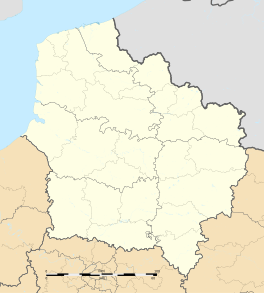
Dompierre-sur-Helpe
Appearance
Dompierre-sur-Helpe | |
|---|---|
| Coordinates: 50°08′44″N 3°52′02″E / 50.1456°N 3.8672°ECoordinates: 50°08′44″N 3°52′02″E / 50.1456°N 3.8672°E | |
| Kintra | Fraunce |
| Region | Hauts-de-France |
| Depairtment | Nord |
| Arrondissement | Avesnes-sur-Helpe |
| Canton | Avesnes-sur-Helpe-Nord |
| Intercommunality | Deux Helpes |
| Govrenment | |
| • Mayor (2008–2014) | Jean-Pierre Libert |
| Area 1 | 13.2 km2 (5.1 sq mi) |
| Population (1999)2 | 1,036 |
| • Density | 78/km2 (200/sq mi) |
| Time zone | UTC+1 (CET) |
| • Summer (DST) | UTC+2 (CEST) |
| INSEE/Postal code | 59177 /59440 |
| Elevation | 132–191 m (433–627 ft) (avg. 165 m or 541 ft) |
| 1 French Laund Register data, that excludes lochs, ponds, glaciers > 1 km² (0.386 sq mi or 247 acres) an river estuaries. 2 Population withoot dooble coontin: residents o multiple communes (e.g., students an militar personnel) anerly coontit ance. | |
Dompierre-sur-Helpe is a commune in the Nord depairtment in northren Fraunce.
Heraldry
[eedit | eedit soorce] |
The airms o Dompierre-sur-Helpe are blazoned : Azure, a chevron argent between 3 eagles Or langued and armed gules. (Dompierre-sur-Helpe and Écuélin uise the same airms.)
|
See an aw
[eedit | eedit soorce]References
[eedit | eedit soorce]| Wikimedia Commons haes media relatit tae Dompierre-sur-Helpe. |


