Los Angeles Coonty
Appearance
The "Scots" that wis uised in this airticle wis written bi a body that haesna a guid grip on the leid. Please mak this airticle mair better gin ye can. |
Los Angeles Coonty | |
|---|---|
| County of Los Angeles | |
| Eik-name(s): "L.A. County" | |
 Location o the coonty in Californie | |
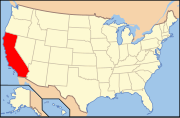
 Californie's location in the contiguous Unitit States | |
| Coordinates: 34°3′N 118°15′W / 34.050°N 118.250°WCoordinates: 34°3′N 118°15′W / 34.050°N 118.250°W | |
| Kintra | |
| State | |
| Region | Soothren Californie |
| Metro area | Greater Los Angeles Area |
| Shapit | 18 Februar 1850[1] |
| Named for | |
| Coonty seat | Los Angeles |
| Lairgest ceety | Los Angeles |
| Incorporatit ceeties | 88 |
| Govrenment | |
| • Teep | Cooncil–manager |
| • Bodi | Board of Supervisors |
| • Board of Supervisors[2] | |
| • Chief executive officer | Sachi A. Hamai (interim) |
| Area | |
| • Total | 12,310 km2 (4751 sq mi) |
| • Laund | 10,510 km2 (4058 sq mi) |
| • Water | 1,790 km2 (693 sq mi) |
| Highest elevation | 3,069 m (10068 ft) |
| Lowest elevation | 0 m (0 ft) |
| Population | |
| • Total | 9,818,605 |
| • Estimate (2014)[5] | 10,116,705 |
| • Density | 800/km2 (2,100/sq mi) |
| Time zone | UTC-8 (Paceefic Time Zone) |
| • Summer (DST) | UTC-7 (Paceefic Daylicht Time) |
| ZIP codes | 90001–90899, 91001–93599 |
| Aurie codes | 213, 310/424, 323, 562, 626, 661, 747/818, 909 |
| FIPS code | 06-037 |
| GNIS featur ID | 277283 |
| Website | www |
Los Angeles Coonty, offeecially the County of Los Angeles,[6] wi a population o mair nor nine million fowk, is the maist populous coonty in the Unitit States. It haes 88 incorporatit ceeties an mony unincorporatit auries an at 4,083 square mile (10,570 km2) it is lairger than the combined auries o the states o Rhode Island an Delaware. The coonty conteens mair nor ane quairter o aw Californie residents an is ane o the maist ethnically diverse coonties in the kintra.[7]
References
[eedit | eedit soorce]- ↑ "Chronology". California State Association of Counties. Archived frae the original on 29 Januar 2016. Retrieved 6 Februar 2015.
- ↑ "Board of Supervisors". County of Los Angeles. Archived frae the original on 6 Februar 2015. Retrieved 1 December 2014.
- ↑ Mount San Antonio in the San Gabriel Mountains, on border with San Bernardino County.
- ↑ Sea level at the Pacific Ocean.
- ↑ a b "American Fact Finder - Results". United States Census Bureau. Archived frae the original on 4 Apryle 2015. Retrieved 7 Apryle 2015.
- ↑ "Los Angeles County". lacounty.gov. Archived frae the original on 6 Mairch 2012. Retrieved 17 Januar 2021.
- ↑ "Newsroom: Population: Census Bureau Releases State and County Data Depicting Nation's Population Ahead of 2010 Census". Census.gov. Retrieved 23 August 2012.
Freemit airtins
[eedit | eedit soorce]| Wikimedia Commons haes media relatit tae Los Angeles County, California. |


