Mosfellsbær
Appearance
Mosfellsbær | |
|---|---|
 Mosfellsbær | |
 Location of Mosfellsbær | |
| Coordinates: 64°10′7.08″N 21°42′47.61″W / 64.1686333°N 21.7132250°W | |
| Country | Iceland |
| Region | Capital Region |
| Constituency | Southwest Constituency |
| Government | |
| • Mayor | Haraldur Sverrisson |
| Area | |
| • Total | 185 km2 (71 sq mi) |
| Population (2020)[1] | |
| • Total | 12,073 |
| • Density | 61.96/km2 (160.5/sq mi) |
| Postal code(s) | 270, 271, 276 |
| Municipal number | 1604 |
| Website | mosfellsbaer |
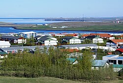
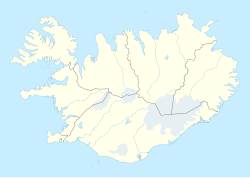
Mosfellsbær is a town and municipality in southwest Iceland. It is 12 kilometres (7 miles) east of the national's capital, Reykjavík. In 2020, 12,073 people lived there.
References
- ↑ "Population by municipalities, sex and age 1 January 1998-2019 - Current municipalities". PX-Web. Retrieved 7 April 2019.
Other websites
Wikimedia Commons has media related to Mosfellsbær.
- Official website (in Icelandic)


