Indre, Loire-Atlantique
Appearance
Indre
Endrez/Antr | |
|---|---|
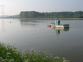
 The River Loire at Basse-Indre | |
| Coordinates: 47°11′58″N 1°40′12″W / 47.1994°N 1.67°W | |
| Country | France |
| Region | Pays de la Loire |
| Department | Loire-Atlantique |
| Arrondissement | Nantes |
| Canton | Saint-Herblain-1 |
| Intercommunality | Nantes Métropole |
| Government | |
| • Mayor (2008–2014) | Jean-Luc Le Drenn (Socialist Party) |
| Area 1 | 4.72 km2 (1.82 sq mi) |
| Population (2006 estimate) | 3,688 |
| • Density | 780/km2 (2,000/sq mi) |
| Time zone | UTC+01:00 (CET) |
| • Summer (DST) | UTC+02:00 (CEST) |
| INSEE/Postal code | 44074 /44610 (Basse-Indre and Haut-indre), 44620 (Indret) |
| Dialling codes | 02 |
| 1 French Land Register data, which excludes lakes, ponds, glaciers > 1 km2 (0.386 sq mi or 247 acres) and river estuaries. | |
Indre is a city in France at the Atlantic Ocean. It is the south eastern end of the Brittany.
Indre has about 3,643 inhabitants.
St.Hermeland's Church
[change | change source]


