Kreuzlingen
Kreuzlingen | |
|---|---|
 Kreuzlingen in early-October 2009 | |
| Coordinates: 47°38′N 9°10′E / 47.633°N 9.167°E | |
| Country | Switzerland |
| Canton | Thurgau |
| District | Kreuzlingen |
| Government | |
| • Mayor | Andreas Netzle |
| Area | |
| • Total | 11.49 km2 (4.44 sq mi) |
| Elevation | 397 m (1,302 ft) |
| Population (31 December 2018)[2] | |
| • Total | 21,997 |
| • Density | 1,900/km2 (5,000/sq mi) |
| Time zone | UTC+01:00 (Central European Time) |
| • Summer (DST) | UTC+02:00 (Central European Summer Time) |
| Postal code(s) | 8280 |
| SFOS number | 4671 |
| Localities | Emmishofen, Kurzrickenbach |
| Surrounded by | Bottighofen, Constance (Konstanz) (DE-BW), Kemmental, Lengwil, Tägerwilen |
| Twin towns | Wolfach (Germany), Cisternino (Italy) |
| Website | www SFSO statistics |
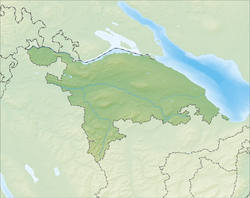
Kreuzlingen is a municipality in the district of Kreuzlingen in the canton of Thurgau in Switzerland. It is the second largest city of the canton, after Frauenfeld, with a population of over 18,000.
In 1874, the municipality of Egelshofen was renamed Kreuzlingen. It reached the present size with the adding of Kurzrickenbach in 1927 and Emmishofen in 1928.
Geography
[change | change source]It is located on Lake Constance. It is halfway between Schaffhausen and Rorschach.
History
[change | change source]The name of the municipality stems from the Augustinian monastery Crucelin, which was later renamed Kreuzlingen Abbey. It was built in 1125 by the Bishop of Constance, Ulrich I. In the Swabian War and the 30 Years' War after the siege of Constance by Swedish troops, Kreuzlingen Abbey was burned down by the people of Constance. The monks were blamed for having supported the enemy. In 1650, the monastery was rebuilt in its present location. Because of secularization in 1848, the buildings became a school. The chapel became a Catholic church
People already lived in the area during the Bronze Age. Celtic and Roman coins and artifacts show that people were settled in the area pre-writing. Kurzrickenbach is first mentioned as Rihinbah in 830, Egelshofen is mentioned as Eigolteshoven in 1125, and Emmishofen is mentioned as Eminshoven in 1159. The territory, except for the Augustinian monastery, belonged to the Bishop of Constance.
Until the beginning of the 19th century, the centre of Kreuzlingen was still largely agricultural. The first steamboats began to operate on Lake Constance in 1824. The first train line to Romanshorn was finished in 1871, and the second to Etzwilen in 1875. This brought commerce and industry to the area. In 1874, Kreuzlingen became the capital of the district, instead of the previous capital, Gottlieben. However, until World War I, Kreuzlingen was a kind of suburb of Constance. Most of its profits went to German firms. The war made Kreuzlingen more independent.
The Sanatorium of Bellevue (1857-1980), which occupied part of the old monastery, played an important role in the history of Kreuzlingen. In 1842, a man called Ignaz Vanotti from Constance bought a large area of land and constructed a building to house the emigrant press of Bellevue in 1843, which had been in Römerburg. In 1857, Ludwig Binswanger, a psychiatrist from Münsterlingen bought the property and opened a private sanatorium. The clinic was very modern and stayed in the control of the Binswanger family for nearly 120 years. Important psychiatric discoveries, particularly under the founder's grandson's control, especially in the development of existential psychotherapy, were made at the sanatorium. However, few of its buildings remain.
Economy
[change | change source]Most of the people in Kreuzlingen made a living in the wine industry. However, because of diseases and bad harvests, the last wine grapes were raised in Kreuzlingen in 1938.
Today, the local economy is mostly shopping and handcraft, with the largest employer being a clothing maker.
References
[change | change source]- ↑ 1.0 1.1 "Arealstatistik Standard - Gemeinden nach 4 Hauptbereichen". Federal Statistical Office. Retrieved 13 January 2019.
- ↑ "Ständige Wohnbevölkerung nach Staatsangehörigkeitskategorie Geschlecht und Gemeinde; Provisorische Jahresergebnisse; 2018". Federal Statistical Office. 9 April 2019. Retrieved 11 April 2019.
Other websites
[change | change source]![]() Media related to Kreuzlingen at Wikimedia Commons
Media related to Kreuzlingen at Wikimedia Commons


