Pickens County, South Carolina
Appearance
Pickens County | |
|---|---|
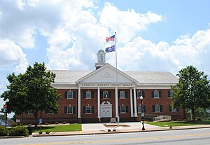
 Pickens County Courthouse | |
| Motto: "Adventure Starts Here" | |
 Location within the U.S. state of South Carolina | |
 South Carolina's location within the U.S. | |
| Coordinates: 34°53′07″N 82°43′24″W / 34.885368°N 82.723377°W | |
| Country | |
| State | |
| Founded | 1826 |
| Named for | Andrew Pickens |
| Seat | Pickens |
| Largest community | Easley |
| Area | |
| • Total | 512.75 sq mi (1,328.0 km2) |
| • Land | 496.94 sq mi (1,287.1 km2) |
| • Water | 15.81 sq mi (40.9 km2) 3.67% |
| Population (2020) | |
| • Total | 131,404 |
| • Density | 264.43/sq mi (102.10/km2) |
| Time zone | UTC−5 (Eastern) |
| • Summer (DST) | UTC−4 (EDT) |
| Congressional district | 3rd |
| Website | www |
Pickens County is a county in the northwest part of the U.S. state of South Carolina. As of the 2020 census, its population was 131,404.[1] Its county seat is Pickens.[2] The county was created in 1826.[3]
References
[change | change source]- ↑ "QuickFacts: Pickens County, South Carolina". United States Census Bureau. Retrieved January 20, 2024.
- ↑ "Find a County". National Association of Counties. Retrieved 2011-06-07.
- ↑ "South Carolina: Individual County Chronologies". South Carolina Atlas of Historical County Boundaries. The Newberry Library. 2009. Archived from the original on January 3, 2017. Retrieved March 21, 2015.
