Sindh
Sindh
سنڌ سندھ | |
|---|---|
 Ranikot Fort "(Great Wall of Pakistan)". | |
|
| |
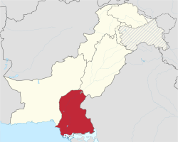
 Location of Sindh in Pakistan | |
 Map of Sindh, Pakistan | |
| Coordinates: 24°52′12″N 67°33′00″E / 24.87000°N 67.55000°E | |
| Country | Pakistan |
| Established | 1 July 1970 |
| Capital | Karachi |
| Largest city | Karachi |
| Government | |
| • Type | Province |
| • Body | Provincial Assembly |
| • High Court | Sindh High Court |
| Area | |
| • Total | 140,914 km2 (54,407 sq mi) |
| Population (2012 census preliminary)[1] | |
| • Total | 55,245,497 |
| • Density | 390/km2 (1,000/sq mi) |
| Time zone | UTC+5 (PKT) |
| Main Language(s) | Other: Punjabi, Pashto, Balochi, Saraiki[2][3][4] |
| Assembly seats | 168[5] |
| Districts | 27 |
| Towns | 119 |
| Union Councils | 1108[6] |
| Website | sindh.gov.pk |
Sindh (Sindhi: سنڌ) (Urdu: صوبہ سندھ) is a province in Pakistan. The provincial capital of Sindh is Karachi. Sindh has a population of 47.9 million people and an area of 54,407 mi² or (140,914 km²). The provincial region of Sindh is larger than Greece but smaller than Tajikistan,
Etymology
[change | change source]The province of Sindh and the people inhabiting the region are named after the river known as the Sindhu River and now called the Indus River.
The Greeks who conquered Sindh in 325 BC under Alexander the Great called it Indós, hence the modern Indus. A study said, the Ancient Gypsy hail from Sindh from the Rohri Taluka in the Sukkur District[7]
History
[change | change source]Sindh (Sindhi: سنڌ) is one of the provinces of Pakistan. Sindh was home to one of the world's oldest civilizations, the Indus Valley Civilization which is 5,500 years old[8] 'Hind' word is also derived from the words 'Sindh' and while its worth noting that Hind was known because of Sind by the early Persian and Arabs [9]'. On the 26th of June in 1947 Sindh joined Pakistan by a majority vote of members of the 1947 provincial legislature.
| Provincial flag | Flag of Sindh | |
|---|---|---|
| Provincial seal | Emblem of Sindh | 
|
| Provincial animal | Sindh Ibex | 
|
| Provincial bird | Black wood partridge | |
| Provincial fish | Catla | |
| Provincial crop | Cotton | |
| Provincial flower | Nelumbo indica | |
| Provincial tree | Neem | 
|
| Provincial fruit | Watermelons | |
| Provincial dish | Sindhi biryani | |
| Provincial dance | Sufi dance | |
| Provincial instrument | Yaktaro | |
| Provincial sport | Malakhra |
Related pages
[change | change source] Media related to Sindh at Wikimedia Commons
References
[change | change source]- ↑ "Sind - type and level of administrative division". World Gazetteer. Archived from the original on 2012-12-08. Retrieved 2009-08-19.
- ↑ "Percentage Distribution of Households by Language Usually Spoken and Region/Province, 1998 Census" (PDF). Pakistan Statistical Year Book 2008. Federal Bureau of Statistics - Government of Pakistan. Archived from the original (PDF) on 18 November 2008. Retrieved 15 December 2009.
- ↑ "Sindh (province, Pakistan)" at Britannica Online Encyclopedia
- ↑ "About Sindh Archived 2010-06-20 at the Wayback Machine" at SindhToday.net
- ↑ "Provincial Assembly Seats". Archived from the original on 2014-12-14. Retrieved 2012-04-06.
- ↑ "Government of Sindh". Archived from the original on 2019-06-16. Retrieved 2012-04-06.
- ↑ HYDERABAD: Gypsies hail from Sindh, claims Dr Kazi
- ↑ https://www.khanacademy.org/humanities/world-history/world-history-beginnings/ancient-india/a/the-indus-river-valley-civilizations#:~:text=There%20is%20evidence%20of%20settlement,from%201900%20to%201300%20BCE.
- ↑ https://www.wisdomlib.org/definition/hind
Other websites
[change | change source]- "Sindh at a glance". Pakistan Almanac.


