Snodland
Appearance
| Snodland | |
|---|---|
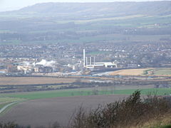
 View over the Medway Gap from Blue Bell Hill with Snodland and the Horseshoe Reach meander of the River Medway with the paper mills in front, and the North Downs behind | |
| Population | 10,211 (2011 Census)[1] |
| OS grid reference | TQ699514 |
| District | |
| Shire county | |
| Region | |
| Country | England |
| Sovereign state | United Kingdom |
| Post town | SNODLAND |
| Postcode district | ME6 |
| Dialling code | 01634 |
| Police | Kent |
| Fire | Kent |
| Ambulance | South East Coast |
| UK Parliament | |
Snodland is a small town on the River Medway, located between Rochester and Maidstone in Kent. It is about 27 miles from central London,
It has a railway station called Snodland railway station.
References
[change | change source]- ↑ "Civil Parish population 2011". Neighbourhood Statististics. Office for National Statistics. Archived from the original on 20 October 2016. Retrieved 24 September 2016.
