Alstonville
Utseende
| Alstonville | |
| By | |
| Land | |
|---|---|
| Delstat | New South Wales |
| County | Rous |
| Parish | Tuckombil |
| LGA | Ballina Shire |
| Koordinater | 28°49′54″S 153°26′04″Ö / 28.83167°S 153.43444°Ö |
| Folkmängd | 5 648 (2011)[1] |
| - tätort | 5 006 (2006)[2] |
| Tidszon | AEST (UTC+10) |
| - sommartid | AEDT (UTC+11) |
| Postnummer | 2477 |
| Geonames | 2177999 |
|
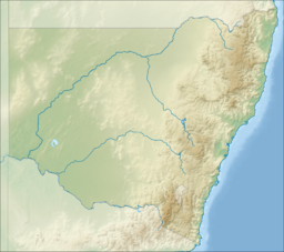
Alstonvilles läge i New South Wales
| |
Alstonville är en by i delstaten New South Wales i Australien. Folkmängden uppgick till 5 648 år 2011.
Kommunikationer
[redigera | redigera wikitext]Alstonville är beläggen på landsvägen Bruxner Highway.
Befolkningsutveckling
[redigera | redigera wikitext]Befolkningsutveckling i hela orten, inte bara tätorten.

Referenser
[redigera | redigera wikitext]- ^ Australian Bureau of Statistics. ”2011 Census QuickStats: Alstonville (State Suburb)” (på engelska). http://www.censusdata.abs.gov.au/census_services/getproduct/census/2011/quickstat/SSC10032?opendocument&navpos=220. Läst 3 augusti 2012.
- ^ Australian Bureau of Statistics. ”2006 Census QuickStats: Alstonville (Urban Centre/Locality)” (på engelska). http://www.censusdata.abs.gov.au/census_services/getproduct/census/2006/quickstat/UCL101000?opendocument&navpos=220. Läst 5 april 2012.
Befolkningsutvecklingskällor
[redigera | redigera wikitext]- Australian Bureau of Statistics. ”2006 Census QuickStats: Alstonville (State Suburb)” (på engelska). http://www.censusdata.abs.gov.au/census_services/getproduct/census/2006/quickstat/SSC16047?opendocument&navpos=220. Läst 5 april 2012.
- Australian Bureau of Statistics. ”2011 Census QuickStats: Alstonville (State Suburb)” (på engelska). http://www.censusdata.abs.gov.au/census_services/getproduct/census/2011/quickstat/SSC10032?opendocument&navpos=220. Läst 3 augusti 2012.
Externa länkar
[redigera | redigera wikitext] Wikimedia Commons har media som rör Alstonville.


