�������� � �
�� �
��� � ������ �� ���� ��� ������ �� ���� ���
� �� ���� �� � �� ���� ���� �
����� ����� �� ������ ��� �� �� �� � ��� ������� ��� �� ��� � ��� �� ��
� ��� �������� ��� ��� �� ��������� !���� ��� ������� "������� !� ���������
�� �� �� ���� � ���� ���������� �� ���� ���
� ���� � �� � �� �� #��� $ �� ��
%�� �� &���� � �� � !�� "���� ����������� �� � ��� �� ������� ��� �� ��
� �� � ��� ���� � ��
�� � �� ' �� �� �� � (���� ���
� ����� � ��
� �" �� )� � � ���� � !���� �� � ��� �� *�� � �� � (���� %��� �� ������� ��
� � �+�� � ��,� ��� #� �� ��)�� -����� ���� ������.���� ��� � ������ � �� ��
$���� �� � ��/����������� � � �� ���� ���� ������� �������� �� �� ��
�� ����� �� �� ������ �� � ������� ������ �� �� � ���� "��� ��!�� ���� �
� ����� ��� � ��� ��� �� ��� � �� ����������� "�� � ����� � � � �� �
� " ��/ �� ��� ���������
�� � ��
�����������
�������� � � �� � ������
������������� ���
$��� �� ���� ��������0 ��� �+���� ������(��������
������� ������� � �� ��� ����� ��)�� �
���� � ��
�����!� ��������12�2��3������� �����
�
���� �� �45 � ���5#��
��� � � �������% �&�
���� �������� �" �� ��3��� ��� ������� ������������
45 �6�&�� ��� ��������� ������� �� ���� �� � � ��
�� ���� ���� ������ �
���
�����������������
�����������
� �� ������������ �� ��
������������
��� ��� �� �� ������ ��� � �� � ������
�������������
��� ��� �� �� ������ ��� �
� � ������
����� � ��� ������� ���� ��� ������
� ��� ���� � ����������! �� ���
����������� ����� �
�������� � �� �� ��� ����� ���� ���� ��� � ���� �������� ���� ���� ���� �
� ���� �������� ��� ������ ���� ��� �� ������ ����� ��� ���� ����
��� � ���� ��������� ���
��� ����������������� � ��� ���� ��������������������� ��������� �!�� ��� ��� � � �
"���� ��� ��� ��� �� � ��� ������ # ����� ���� �������� ���� ������������ $ ������ ��!%
� ����!� ����� � ������ ��� ��� & ���� ��$ � ���� ' ������ ��� ����� ������� ����
' ������ ��� ���� (�$�������� �� ��� � ���� '������ ��� ���� # ����%� �������� ���%
)��� � � ���%�* ���� � ���%�' �������� �������� $ ������� ���'�������� ����
� �� ����� �������+������ ������� ���������"�� ��%�� � �� ��� �������&����
���� ' ������ ��!� ���� # ���� ����� ���������� � � ���� ��� ����
���� $,���� ���
� �������(����� �����������$��������� ���
�������� � � � �� ��� ����� ����� ��� �-� � �� ����
�� � ���� �������� ���� . �� ���� �
� ���� �������� ��� �� � � � � � ����� ����� ��� � �� ���� �� � ���� ��������� ���� ��� ����
�������� � � �� � � ��� � �� �������� ����������� �� ��������� �!�� �� �
"�-� �� ��� � �� � ��� ����� �� � �� � ���������� ��� � � � ����� ��� ��(� �� ��� �� ��� ��%
�� ������� ���������� ����� ��� ����� ��� �� �������� �������� ��� �� �� �� ������ �� ����
����� �. ��� ��� ��� ���� �� %������ ��� �� %� ������� �� %��� ���� �� %������ �
�� ������� � �� � ����� $�� ���� � � ��� �� �� � ������ ��� � � � $���� � � ��� ��� $ -� ��� ��
�� ������ ��� �� �� � �� � � � �� � � -� ��� ��� ����� � ���� ��� ���� ��� �� �� �� �
�� ��� ��� ����� �������� ��������� � ����� ��� ������ � ����� ����-� �-���
/�����������/������� ����$$$ ����� �� ��
0��� ��������� ���
1"��1"#�23.�" ���� ������ ���
� ��������������������� � ��� ��� ����
4���& �������)��*�5�/� �+)
*����� !�6 ����!&�� �7!8%�779:9�& ���� ���%�����
2� ������ �;� �!����� ��� ��
� �����)��� �-
*�� ��������� �� ���������&������
�������� ��� ���� ��� ��
� ���������������������
/��-��� ��<�:=9>�4���& �������)��*�5�/� �+)
"����3� �������� ���� ���"������ � ��� ����� �& ���� ����:=9>
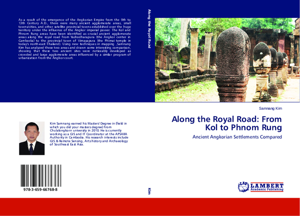
�Along the Royal Road:
From Kol to Phnom Rung,
Ancient Angkorian Settlements Compared
Samnang Kim
Edited by
Frederick B. Goss
Bangkok
Institue of Asian Studies, Chulalongkorn University
��CONTENTS
Foreword
v
Preface
ix
Introduction
1
Ancient Settlements at Kol
11
Ancient Settlements at Phnom Rung
61
Comparison between Kol and Phnom Rung
109
Summary and Conclusion
141
References
146
The Author
153
��Foreword
The Institute of Asian Studies (IAS) is an interdisciplinary academic
research institute within Chulalongkorn University functioning as an interinstitutional organization, with the aim to promote interdisciplinary studies bearing
on Asian affairs. The Institute’s activities include conducting research, organizing
academic seminars and training, exchanging scholars and publishing books and
journals relating to Asian issues. The Institute also develops audio-visual aids to
promote interest in Asian affairs among the general public.
Along the Royal Road: From Kol to Phnom Rung, Ancient Angkorian
Settlements Compared is derived from a MA thesis that provides interesting
information and analysis on an ancient relation between the Angkorian kingdom and
the northeastern part of Thailand, before the emergence of Ayudhya as a new
political center in mainland Southeast Asia. This publication is a part of the English
publication project of the IAS.
This volume has been supported financially by the “Dr. Wolfgang Wittwer
Memorial Fund” tenable at the IAS. The Fund was jointly established by the IAS
and the Volkswagen Foundation in memory of Dr. Wolfgang Wittwer who headed
the Asian Studies Program of the Volkswagen Foundation and passed away during
his term of duty in the 1980s. This project aims at promoting selected thesis of
young scholars in areas relating to Asia at the international level and meets our
primary mission in creating a better understanding of the Thai perspective on Asian
issues among English readers. The IAS also plans to publish many more interesting
research works of the same category.
We are profoundly grateful to the author and his advisor for their
contribution to this volume. Needless to say, without their cooperation this
�vi
Foreword
publication would have been impossible. Special thanks is also due to Dr. Wolfgang
Wittwer Memorial Fund for support and contribution to the publication, and Dr.
Khien Theeravit who has put a great deal of effort in establishing this English
publication project.
Sunait Chutintaranond
Director, Institute of Asian Studies
Chulalongkorn University, Bangkok,
September, 2011
�Foreword
In selecting Kim Samnang’s MA thesis titled A Comparative Study of
Ancient Settlements at Kol in Cambodia and Phnom Rung in Thailand for
publication, no doubt Chulalongkorn University has made a judicious decision. At
least two main reasons may be stressed here.
The topic itself is a very original and attractive one, dealing with a
comparative study of two sites, both archaeological and still living today. Both are
situated on the axis of the royal road departing from the Angkor capital to the big
area marked by the Phimai temple. One is located close to the capital, compared to
the other which is rather distant but impressive by its position on an important hill.
Although both are Angkorian, are the lay-out patterns of the two sites similar, i.e.,
did the two respective communities share the same model of space organization, or
did a “provincial” one have a distinct view or way of life?
Another merit of this work relates to the appropriate use of modern
technology and tools; for instance, the results of different remote sensing surveys
followed by meticulous checks carried out several times on the ground at the Phnom
Rung area in Thailand, and Kol area in Cambodia.
One must recall that in addition to his own and praiseworthy work,
specially oriented to his dissertation, Kim Samnang previously benefited from the
results of a collective investigation involving different researchers from various Thai
and Cambodian institutions. He himself actively participated in and contributed to
the Khmer-Thai project called “Living Angkor Roads Project”, initiated by Dr. Surat
Lertlum, which is a model of collaboration between countries for the sake of
knowledge.
�viii
Foreword
I feel honored that Chulalongkorn University has invited me to have a look
on this important work.
Ang Choulean
The Royal University of Fine Arts
Cambodia
�Preface
This work is an outgrowth of my research and study for a master’s degree
from Chulalongkorn University. I became interested in this topic as a result of my
work at APSARA National Authority, the government authority overseeing the
management, preservation and conservation of the legacy of the Angkorian Empire.
My interest is in mapping and geography, and this study gave me an opportunity to
combine my interest with research on Angkorian history. In addition, I am hoping
this volume will help highlight and strengthen the close historical relationship
between Cambodia and Thailand.
In the course of my research and study, I received the assistance and advice
from many people, to all of whom I am grateful. First, I would like to express my
gratitude to my professor Dr. Ang Choulean who has been my educator and advisor
on Cambodian history, especially regarding the ‘Civilization of Angkor’, and for
other countries in Southeast Asia since I have been on the staff of APSARA
Authority. I am also indebted to Mr. Im Sokrithy and the Living Angkor Road
Project, and Dr. Surat Lertlum, head of Living Angkor Project for providing me with
a clearer understanding of research archaeologies and ideas for the development of
this research. As well, I wish to thank Dr. Klairung Amratisha, my principal advisor
for my MA thesis and Dr. Surat Lertlum, my thesis co-advisor.
I would also like to express my gratitude to Dr. Sunait Chutintaranond, the
Director of Southeast Asian Studies, and my committee chairman. Moreover, I am
grateful to all the professors and lecturers at Chulalongkorn University who
provided me with great knowledge of Southeast Asian. My heartfelt thanks go to
Mr. Hong Kimcheang and Mr. Meak Chantheng, who encouraged and helped in
Bangkok; Mr. Tosapon Ketwut, who assisted to provide and find the GIS datasets;
Assoc. Prof. Dr. Poomjit Ruangdej, Ajarn Jarunee and Ms. Ny and her relatives in
�x Preface
Buriram Province, who facilitated in the collection of data at Phnom Rung; as well
as all the Cambodian students and friends who shared their many ideas and support.
This research and current volume could not have been accomplished
without the financial support of the Rockefeller Foundation and Chulalongkorn
University. In this regard, I would like to thank the Institute for Asian Studies for
selecting my research for publication.
Last, my profound appreciation goes to my wife, Khut Vuthyneath and my
parents-in-law, for all their effort taking care my daughter, and my family for their
encouragement and moral support throughout my time of study.
Samnang Kim
Siem Reap, Cambodia
�Introduction
The existence of the ruins of Khmer sacred worship monuments and other
archaeological remains, together with a large number of important inscriptions in the
territory to the northwestern part of the former Angkor capital centered near the
great Tonle Sap Great Lake, including the area of present-day Northwest Cambodia
and Northeast Thailand, indicates that numerous significant Khmer monument sites
in this area were spread throughout this region from the 6th or 7th centuries onward
(see Aymonier 1999a; Aymonier 1999b; Lunet de Lajonquière 1902, 1907, 1911;
Coedès 1942, 1951, 1953, 1954; Wolters 1974; H.R.H. Sirindhorn 2004; LARP
2007, 2008). Afterwards, with the emergence of the Angkorian Empire from the 9th
to the 13th centuries AD, the Angkorian kings expanded their territory over almost
the entire mainland Southeast Asia.
As a result of this emergence, many ancient agglomerate areas, small
towns/cities, other satellite provincial towns, public route networks, and small and
large sacred worship temples were established over the huge territory under the
influence of the Angkor imperial power. Two of these areas, Kol, on the outskirts of
the present-day Siem Reap area of Cambodia, and Phnom Rung, in the northeastern
part of present-day Thailand, have been identified as crucial ancient agglomerate
areas along the royal road from YaĞodharapura (the Angkor center) to the provincial
town of Vimayapura (Prasat Phimai). One was located close to the Angkor center,
while the other one would be considered as having been in the provincial sphere.
The density of ancient settlements spread over these areas is evidence that
both the Kol and Phnom Rung regions had been occupied since prehistoric times,
and that both of these areas noticeably were developed as large, crowded areas
during the Angkor period. In this aspect, it would appear that Kol and Phnom Rung
were influenced by a similar program of urbanization from the Angkor court. Under
1
�2 Introduction
the same domination of the Angkor court, similarities and differences are apparent
in these two areas, and it is these that are the subject to the study detailed herein.
Historical Background
Thousands of years before the emergence of the Angkorian empire in the
9th century AD, the region located on a sloping terrain running from the northeast to
the southwest between the northern part of the Tonle Sap Great Lake and Kulen hill
(‘mountain of lychee’) in the northwestern part of present-day Cambodia was the
location of ancient settlements of humans evidenced by a number of pre-historic
archaeological sites in this region. According to studies by Elizabeth Moore and
Richard Engelhardt using the UNESCO-ZEMP database, at least 60 to 69 prehistoric habitation mound sites in the Angkor plain have been identified, with some
of the sites possibly dating to the Neolithic period (Moore 1993, 1998; Engelhardt
1996). As noted by Bernard Philippe Groslier, in the urban complex of the Angkor
capital, these pre-historic sites include Prasat Ak Yum, Prasat Baksei Chamkrong,
Prasat Chau Say Tevoda and Prasat Trapeang Phong (Ang, Prenowitz and
Thompson 1998: 26-30; Engelhardt 1996: 154; Stark 2004: 93-95). In addition to
circular moated sites, at least three very well-known pre-historic sites have also been
found to the northwest of the Western Baray: Phum Reul and Phum Lovea (Ang,
Prenowitz & Thompson 1998: 26-30; Moore and Freeman 1998; Engelhardt 1996;
Stark 2004) and Phum Snay, a looted site, situated a bit further from Angkor
(O’Reilly, Domett and Pheng 2006).
After the emergence of the Angkor civilization, some of these pre-historic
sites were occupied by pre-Angkorian and Angkorian settlements. In the present-day
Siem Reap region, at least two main groups of pre-Angkorian sites can be found
around the Western Baray in the vicinity of the first capital of Angkor, HariharƗlaya
(Ang, Prenowitz and Thompson 1998). In the first group, there have been a number
�Along the Royal Road 3
of pre-Angkorian sites found: one significant pre-Angkorian city known as “Banteay
Choeu” or “Wooden Fortress”; Prasat Ak Yum (8th century); Prasat Prei Kmeng (7th
century); Prasat Khnat; Prasat Kok Po (8th century); Prasat Roluh; and Phum Prasat
(Ang, Prenowitz & Thompson 1998: 31-32). It is noteworthy that at Prasat Kok Po,
and its complex, and Prasat Prei Khmeng, a ninth-century Angkorian king,
Jayavarman III, paid attention to maintaining these sites as worship places and
celebrated ritual ceremonies well into the Angkor period.
In another group of pre-Angkorian settlements, remains can be found of a
few pre-Angkorian temples erected in the vicinity of the Roluos region: Prasat
Trapeang Phong; Prasat Svay Pream; Prasat Prei; Prasat He Phka; and Prasat Olok.
Unlike the Western Baray region, the eleventh-century Angkorian kings maintained
important cults at the pre-historic and pre-Angkorian site known as Prasat Trapeang
Phong (Ang, Prenowitz and Thompson 1998: 32-34; Stark 2004).
With respect to the northeast region of present-day Thailand, the area has
remained the scene of a complex situation until today. Significant historical features
of the past in this region with regard to archaeological evidence from excavations
and other inscription sources have been newly discovered. With the presence of the
Chi and Mun Rivers, it can be assumed that there were at least 250 to 300 ancient
prehistoric sites situated along their valleys, both non-moated and moated sites
(Supajanya and Vallibhotama 1972; Moore 1988). According to Charles Higham
and Rachanie Thosarat (2004), the settlements in this region can be dated to at least
some thousands of years ago through the evidence from their excavations from 1992
to 2001 under the umbrella of a long term research program entitled “The Origins of
the Civilization of Angkor”. As a result, four important prehistoric sites were
discovered, both un-moated and moated: the Ban Lum Khao site, falling in the late
Neolithic and Bronze period; Non Muang Kao dated to the Iron period; Noen ULoke dated to the Bronze and Iron periods; and Ban Non Wat dated to the early
�4 Introduction
Neolithic period – all of them located along the lower and upper Mun Rivers
(Higham and Thosarat 2004).
With the occupation of numerous ancient settlements around this area,
Angkorian kings showed interest in expanding their power and territory in this
region during the 6th-7th century. As a result of a systematic survey of the Khmer
sites in Northeast Thailand by Groslier in 1977, about 250 ancient Khmer sites
covering over existing prehistoric and Dvaravati (Mon) sites were identified;1 some
of which have collapsed with only the basements remaining. Some of these sites
were erected together with inscriptions during the reign of King Bhavavarman and
Citrasena (Mahendravarman) in the 6th-7th centuries. Interestingly, several
inscriptions refer to Citrasena’s military victories beyond the Dangrek Mountain
range; for example, inscription K.1106 found at Prasat Phimai (Groslier 1977;
Vickery 1998: 75).
After King Jayavarman II proclaimed himself King of Kings or universal
monarch (chakravartin) on the top of Mahendrapura (Kulen Mountain today) in 802
AD, Angkor power started to centralize and expand until it became a great empire
covering the mainland of Southeast Asia (Ang, Prenowitz and Thompson 1998). In
the following periods, the Angkorian kings conquered territory, especially in the
northwestern part of present-day Cambodia and present-day Northeast Thailand,
where existing settlements had been located since pre-historic and pre-Angkorian
times. Through the explorations of Lunet de Lajonquière from 1901 to 1911,
hundreds of Khmer temples and other ancient settlements were depicted on his
archaeological maps (Lunet de Lajonquière 1902-1911). In addition, Aymonier
studied Khmer temples and inscriptions that had mushroomed widely to the
northwest of Angkor, particularly in the region of present-day Northeast Thailand
1
Dvaravati is the name of a Mon civilization established in the lower Chao Phraya River valley in
present-day Thailand which flourished from the 6th to the 13th century. Source: “Dvaravati,” 01
March 2010 <http://www.britannica.com/ EBchecked/topic/174783/Dvaravati>.
�Along the Royal Road 5
(Aymonier 1999a; Aymonier 1999b). For example, Prasat Phimai, Prasat Phnom
Wan, Prasat Phnom Rung, and Prasat Muang Tam are large significant worship
monuments built between the 9th to 13th centuries during the Angkor period (see
Briggs 1999 [1954]; Talbot and Janthed 2001; Jacques and Lafond 2007). In
addition, toward the latter part of the Angkor period, it is apparent that the mega
infrastructures and other giant public construction projects during the reign of King
Jayavarman VII in the 13th century were continuously developed and expanded
throughout the empire. After successfully driving away the Cham from Angkor,
Jayavarman VII started to reorganize the kingdom by focusing on building up small
or large temples and extending his authority to more territory than his ancestors had
previously done. He paid strong attention to his people by launching a number of
public welfare programs, such as the network of public hospitals (arogyasalas)
throughout the kingdom (Kapur and Sahai 2007). In this regard, the late 12th century
inscription of Ta Prohm temple mentioned clearly that “…102 hospitals
(Arogyasalas) were built in cities and in various provinces…” (Coedès 1906: 80,
Face C: Stanza CXVII).2 As well, 121 rest-house chapels or dharmasalas3 were built
along the principal routes throughout the Kingdom as noted in the Prasat Preah
Khan inscription (Coedès 1942: 60-161; Maxwell 2007: 84-85). Similarly, the Sdok
Kak Thom Inscription, translated by Coedès in 1943, described the general public
infrastructures as well: “…rest-houses and water structures were built along the
roads for the convenience of travelers….” In this regard, the arogyasalas and
dharmasalas that were associated with the royal route were clearly constructed to
2
According to Briggs, these hospital temples were built in dedication to Bhaishajyaguru, the god of
healing (Briggs 1999 [1951]). In addition, Briggs illustrated the spirit of the inscriptions that were
found at a hospital temples in stanza 13, which states “…He (Jayavarman VII) suffered from the
maladies of his subjects more than from his own; for it is the public grief which makes the grief of
kings, and not their own grief...” (Briggs 1999 [1951]: 233).
3
“Dharmasala”, as used by Louis Finot, refers to a temple where people used to worship and take a
rest during a long journey to other cities along the road (Finot 1925a). A Chinese envoy, Zhou Ta
Daguan, who visited Angkor in the late 13th century, recorded in his notes the following: “…along
the grand roads there are rest stations which they called Samnak….” In this sense, he is comparing
“Samnak” with the Chinese post halts along the main highways (Pelliot 1902: 173).
�6 Introduction
facilitate communication between this region and the Angkor center (Ishizawa and
Tamura 1999; LARP 2007, 2008).4
Kol and Phnom Rung
According to previous studies by the Living Angkor Road Project (LARP)5
(2007, 2008), Im et al. (2007), Preeyanuch (2005) and the Thai Fine Arts
Department (FAD) (1993), Kol and Phnom Rung, along with their surrounding
areas, became densely populated agglomerate cities/areas located along the principal
royal road from Angkor to Phimai during the Angkor period. This is evidenced by
the presence of numerous sacred Khmer monument sites and other ancient
settlements, many of which were the achievement of Jayavarman VII, such as
worship temples, dharmasalas, arogyasalas and local road networks. Given the
expansion of Angkor in terms of territory and civilization, especially from the 9th
century onward, it is obvious that the central of power based at YaĞodharapura
exerted more and more influence on this sphere. Kol is geographically very close,
about 50 kilometers from the capital, but Phnom Rung can be considered as having
ϰ
The stele inscription of Preah Khan, made between 1211 and 1213 AD during the reign of
Jayavarman VII, contains significant information concerning Preah Khan and other shrines and
temples built on the command of this king. Lines 122-126 on side D of this inscription describe the
establishment of fire shrines along the roads that linked the capital city of Angkor to other cities in
several directions. The inscription reads as follows:
122. On the roads from Yasodharapura (Angkor) to the [capital] city of Campá (Vietnam),
there are fifty-seven buildings that are staging posts with fire,
123. [On the road] from the city (Angkor) to VimƗyapura (Phimai, in north-east Thailand),
there are seventeen houses of fire. [On the road] from the city (Angkor) to Jayavatí, and from
thence to Jayasiȝhavatí,
124. thence to Jayaváravatí, thence to Jayarájagiri, and from Jayarájagiri to holy Suvírapurí,
125. and thence up to YaĞodharapura (Angkor), there are forty-four fire-houses; and there is
one on holy Súryaparvata,
126. one at holy Vijayádityapura, and one at Kalyáçasiddhika. Altogether, there are one
hundred and twenty-one. (Maxwell 2007: 84-85)
5
Living Angkor Road Project (LARP) is an international collaboration project between Cambodia
and Thailand established in 2005. LARP focuses on traces of Angkorian royal road networks
leading from the Angkor center to Angkorian peripheral satellite towns/cities in present-day
Thailand and Laos PDR. So far, LARP has discovered traces of a royal road from the Angkor
center in Cambodia to Vimayapura (Prasat Phimai) in Thailand and their associated ancient
settlements along this route.
�Along the Royal Road 7
been located rather in a provincial sphere, around 162 kilometers from the capital
(Map 1-1).
Map 1-1: General maps of the Kol and Phnom Rung agglomerations
and the limits of the study areas.
In the Kol area some pre-historic sites have been discovered, some of
which were later occupied by pre-Angkorian and Angkorian settlements (Im et al.
2007). 6 For example, the round moated site of Kok Preach Chang Er and Kok
Anglong Thom were clearly occupied in pre-historic periods, probably during the
Stone Age, as evidenced by the presence of stone tools and pre-historic ceramic
fragments and the physical characteristic of the sites (Im et al. 2007: 334-336).
Additionally, the discovery of stone tools at an un-dated temple (likely from either
the pre-Angkorian or Angkorian period) indicates that this was a pre-historic site,
now known as Kok Prasat Prei Kou (Im et al. 2007: 334-336). Interestingly, the reuse of a pre-Angkorian lintel at Prasat Ta Kam, a hospital chapel, indicates
6
It should be noted that, according to the time frame of this research, which is defined to be from
the 9th to 13th centuries during the Angkor period only, the pre-historic and pre-Angkorian sites are
not focused on in detail and have been excluded in making the comparisons in this study.
�8 Introduction
significant development of this area, with temples built over existing sites during the
reign of Jayavarman VII. In addition, the inclusion of the name LokeĞvara, known as
“JagadƯçvara”, indicating the first emergence of Mahayana Buddhism in the 8th
century, was also found at this temple (Finot 1925b; Coedès 1951: 89).
In light of the fact that the Kol area had been occupied since pre-historic
times, and later was continuously developed during the pre-Angkorian and
Angkorian period, this area unquestionably played a crucial role as an agglomerate
city/area during that time. In this respect, urban developments, in terms of road
networks and other public infrastructure, were established following and respecting
the existing settlements. For example, the royal road from Angkor to Phimai turned
in order to pass this area and intersected two cross roads connecting to the central
villages/communities. This diversion appears to be a unique characteristic of the
royal road, as it can rarely be seen in other areas or along the other royal roads built
during the Angkor period (communication with Dr. Surat Lertlum 2010).
Furthermore, even though this is a relatively small area, significant public
infrastructure was built in the immediate vicinity, such as a main sacred worship
temple, a hospital chapel, a rest-house chapel and a number of water reservoirs, or
“baray”.
Along the same royal road from Angkor to Phimai, Phnom Rung and its
surrounding areas was another ancient agglomerate cities/area occupied since the
pre-history period and continuously developed during the pre-Angkor and Angkor
periods, as evidenced by the density of ancient settlements, with the ruined brick
basement of Prasat Phnom Rung and the dates of the 7th and 8th centuries found in
inscription K.384 being significant evidence of this fact (Preeyanuch 2005; H.R.H.
Sirindhorn 2004: 7). As well, within a radius of 10 kilometers from Prasat Phnom
Rung, there are many ancient sites from pre-historic times (Preeyanuch 2005; LARP
2007, 2008). For example, Ban Ta Ko Village site, Ban Bu Village site and Talong
�Along the Royal Road 9
Kao Village site have been classified as pre-historic sites as made evident by the
remains of stone tools and the physical characteristics of the sites, both moated and
un-moated (Preeyanuch 2005: 110-113, 258; communication with Dr. Surat Lertlum
2010). More interestingly, in the vicinity of Phnom Rung, two arogyasalas and one
dharmasala were established during the reign of Jayavarman VII, with the distance
of the two hospital chapels, Prasat Kuti Rushi Muang Tam and Prasat Kuti Rushi
Nong Baray, located not far from each other. The close proximity of these two
hospital chapels appears to be a special case which rarely occurred elsewhere in the
territory of the Angkor Empire (communication with Dr. Surat Lertlum 2010).
Moreover, the presence of large water reservoirs is also considered significant in
establishing this area as an ancient agglomerate city/area and indicates a level of
social development attempting to emulate the urban complex settlements at the
Angkor capital.
A New Approach of Study
A relatively new knowledge of comparative study of the development of
ancient settlements was introduced to analyze and compare these two agglomerate
areas by utilizing Geographic Information System (GIS), Remote Sensing and
archaeological study approaches. A series of aerial photographs from 1945, 1954-7,
1967, 1976 and 2004, satellite images from 2000 and 2007, and other topographic
vector data were applied to interpret ancient traces that were analyzed, together with
survey data from the field gathered using GIS and Remote Sensing applications.
To provide a clearer idea of the ancient settlements in the aforementioned
agglomerations, this advanced mapping technology was applied to identify and draw
the archaeological structures to understand local settlement relationships and
developments of the Kol and Phnom Rung areas. From this, the development of the
�10 Introduction
ancient settlements and a comparison of these settlements, both at Kol and Phnom
Rung, were examined.
�
 Samnang Kim