Academia.edu no longer supports Internet Explorer.
To browse Academia.edu and the wider internet faster and more securely, please take a few seconds to upgrade your browser.
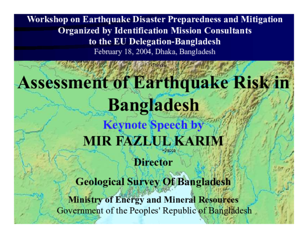
Assessment of Earthquake Risk in Bangladesh
Assessment of Earthquake Risk in Bangladesh
 Mir F Karim
Keynote Speech: Workshop on Earthquake Disaster Preparedness and Mitigation Organised by Identification Mission Consultants to the EU Delegation-Bangladesh February 18, 2004, Dhaka, Bangladesh ABSTRACT Seismic hazard assessment of an earthquake prone region involves a wide range analysis of seismological and geological data and engineering characterization of geological materials. The earthquake history of Bangladesh and surrounding region indicates that the country is seismically active. The regional geological setup of the landmass is complex due to the juncture of Himalayan Arc of northeast India and the India-Myanmar plate subduction to the east. The plain-land topography of Bangladesh musk the subsurface depositional variations and all geological structures except in the hilly region. Seismic hazard assessment is not simple for such covered complex geological environment. This paper present the basic factors related to geology, tectonic environment and geotechnical conditions for rationale seismic hazard assessments. An attempt is made to understand the relationships among tectonic setting, structural and crustal configuration of Bengal basin to classify the earthquake source areas. Three types of earthquake sources areas are identified: a. Intra-plate source areas, b. Transitional source area and c. Inter-plate source area. The seismic behaviour of these source areas is deeply related with the tectonic structure and basement or crustal configuration of Bengal basin. Epicenter locations of recent earthquakes in Bangladesh indicate that there are number of active faults in these source areas. The physical attributes and exact locations are not known. A detailed investigation on the geometry and mechanics of these active faults is essential to determine the relationship among geo-technical behaviour of materials, local geological constraints and ground response. An account on these relationships are presented in this paper.
Related Papers
Seismic hazard assessment of an earthquake prone region involves a wide range analysis of seismological and geological data and engineering characterization of geological materials. The earthquake history of Bangladesh and surrounding region indicates that the country is seismically active. The regional geological setup of the landmass is complex due to the juncture of Himalayan Arc of northeast India and the India-Myanmar plate subduction to the east. The plain-land topography of Bangladesh musk the subsurface depositional variations and all geological structures except in the hilly region. Seismic hazard assessment is not simple for such covered complex geological environment. This paper present the basic factors related to geology, tectonic environment and geotechnical conditions for rationale seismic hazard assessments. An attempt is made to understand the relationships among tectonic setting, structural and crustal configuration of Bengal basin to classify the earthquake source areas. Three types of earthquake sources areas are identified: a. Intra-plate source areas, b. Transitional source area and c. Inter-plate source area. The seismic behaviour of these source areas is deeply related with the tectonic structure and basement or crustal configuration of Bengal basin. Epicenter locations of recent earthquakes in Bangladesh indicate that there are number of active faults in these source areas. The physical attributes and exact locations are not known. A detailed investigation on the geometry and mechanics of these active faults is essential to determine the relationship among geo-technical behaviour of materials, local geological constraints and ground response. An account on these relationships are presented in this paper.
Bangladesh is a south Asian developing country which is used to struggle with various natural disasters and the earthquake is one of them. Bangladesh is one of the most earthquake vulnerable countries of the world. Here we have tried to discuss about the risks of earthquakes in Bangladesh and the historical earthquakes that occurred in Bangladesh and its surrounding regions with some information. After that we have analyzed the earthquakes that were generated in Bangladesh and it’s very close regions(between 20.35° N to 26.75°N Latitude and 88.03° E to 92.75° E Longitude) for the last forty years. We have observed that under the area of concern most of the earthquake occurred were not devastating but the occurrences of those small magnitude earthquakes have been increasing significantly
2021 •
Chittagong District is one of the most significant and flourishing coastal regions in the southeastern part of Bangladesh. It lies in the active tectonic framework which has experienced several major earthquakes in the past. Due to its economic, cultural and military significance, it is of utmost importance that the structures are safe from seismic hazards. Seismicity database of Mw ≥ 3 from 1900 to 2020 has been used to provide extensive insight into historical earthquakes and also facilitate accurate predictions. The seismic sources have been adopted from the Seismo-tectonic Atlas of India and adjoining regions with a control region of radius 500 km from the political boundary of Chittagong district. The Peak Ground Acceleration (PGA) values were computed at the bedrock level, surface level PGA was calculated using the NEHRP soil amplification relations for Chittagong city, and corresponding response spectrum was plotted. Using these PGA values, hazard contours for the Chittagong city and district have been developed for the ease of seismic design of structures in the future.
The nature and the distribution of the earthquake events in different seismic zones of the country are intrinsically related to various tectonic elements. The increased frequency of earthquake events in Bangladesh in the last 30 years suggests reviving tectonic activity. In case of severe earthquake and increased probability of earthquakes the risk on the loss of life and damage to the property in Bangladesh will be quite high. Four severest risk zones in the country are inferred those include northern part of Dinajpur, Rangpur, Mymensingh, Sylhet, Tangail, northern part of Dhaka, Khulna, Jessor, Kushtia, and Chittagong. Considering the devastating impact of such impending earthquake on land and society and the lack of adequate infrastructures for earthquake studies, the installation of network of high-sensitivity modern seismographs with all components is immediately needed. Valid predictions of earthquakes can thus be made and warnings are issued in order to minimize loss of lives...
2016 Annual Meeting Southern California Earthquake Center (SCEC) Poster
SITE-SPECIFIC EARTHQUAKE HAZARD CHARACTERIZATION FOR DHAKA CITY, BANGLADESH2016 •
Seismic hazard characterization is the foremost module for earthquake risk management in a seismically vulnerable region. The mega city Dhaka in Bangladesh is considered by many researchers as one of the riskiest cities in the world due to many non-engineered construction practices and poorly studied tectonic boundary conditions. The city is built on a Plio-Pleistocene terrace, located within the subsiding Bengal basin. The records of historical earthquakes indicate that three large magnitude earthquakes occurred during the last 150 years within and in close proximity to Bangladesh. Magnitudes of these earthquakes ranged from 6.9 to 8.7 occurring between 1885 and 1918. These events caused moderate damage to buildings and other infrastructures in Bangladesh, but the damage in Dhaka city were negligible. It is believed that the 6.9 magnitude Bengal earthquake occurred at about 50 km from the city, although there are multiple controversies about the location of the epicenter. Many consider that the epicenter of this earthquake was 170 km away from Dhaka city and others inferred the epicenter to be somewhere along Madhupur fault, approximately 50 km away. The 1885 Bengal, 1897 Great Indian, and 1918 Srimangal Earthquakes are considered as the seismic sources for site-specific seismic hazard characterization. The peak ground acceleration (PGA), peak ground velocity (PGV), spectral accelerations (SA) of different periods have been calculated at the ground surface based on recently developed ground motion prediction equations and site amplification factors. The amplification factors are predicted from the average shear wave velocity to a depth of 30 m (Vs 30), which are estimated using various geophysical and geotechnical investigations. The study reveals that the city is built on a very firm ground where seismic risks are manageable provided the engineering structures adhere to the norms of seismic regulations and building codes. Citation Karim, M. F., Rahman, Z. M., Kamal, M., & Siddiqua, S. (2016, 08). Site-specific earthquake hazard characterization for Dhaka City, Bangladesh. Poster Presentation at 2016 SCEC Annual Meeting.
Seismic status in Bangladesh has been investigated using earthquake data recorded by the global network of USGS during 1980 to 2016. Seismicity parameters such as magnitude of completeness í µí± í µí± , í µí±-value and a-value are being estimated. It has observed that the overall í µí±-value in and around Bangladesh is of 0.84, which is seemed to be seismically active zone. As, reliable í µí±-value assessment can lead to better seismic hazard analysis, reliable magnitude of completeness í µí± í µí± can lead to í µí±-value assessment of an area, this work has dealt and estimated magnitude of completeness í µí± í µí± using various techniques for the whole region for a reliable estimation. Estimated í µí± í µí± is obtained to be around 3.9-4.7, which lead to í µí±-value of 0.93. Spatial variations of í µí± í µí± and í µí±-value have been investigated for 1 o ×1 o horizontal and vertical rectangular regions for the study area between 18-29°N and 84-95°E. Estimated í µí± í µí± and í µí±-value along with í µí±-value are then averaged for the common regions in the pair of horizontal and vertical regions. Results are then being presented in the form of maps. The findings resemble as, the í µí± í µí± is low at the border line of N-W Bangladesh, and a line from Cox's Bazaar to Sylhet through Hill tracts. Remain parts belong to the í µí± í µí± value of 4.1-4.2, thus the í µí±-value obtained is varying from 0.68 to 1.2, where, the value is higher at region in Chittagong and Barisal division that extends toward north through part of Dhaka to Sylhet and lower at Rajshahi, Rangpur and part of Khulna division, while í µí±-value is varying from 5.0 to 7.2 mostly from west to east.
National Workshop on Earthquake Risk Mitigation Strategy in North East February 24-25, 2011, Guwahati, Assam
EARTHQUAKE GEOLOGY, GEOMORPHOLOGY AND HAZARD SCENARIO IN NORTHEAST INDIA: AN APPRAISAL2011 •
RELATED PAPERS
2020 •
Healthy Tadulako Journal (Jurnal Kesehatan Tadulako)
UJI STABILITAS SEDIAAN HAIR TONIC KOMBINASI EKSTRAK DAUN PANDAN WANGI (Pandanus amarillyfolius) DAN HERBA PEGAGAN (Centella asiatica)2021 •
Elenco Monumenti Oristano A-M
Elenco dei Monumenti del Periodo Nuragico in Sardegna - Oristano A-M2024 •
2015 •
2015 •
Cactaceas Y Suculentas Mexicanas
Estructura genética y filogeografía en cactáceas2013 •
Bulletin Instrumentum
Instrumentum 59, June 2024 (60 p.)BMC research notes
Junior Rounds: an educational initiative to improve role transitions for junior residents2017 •