Fields of Fire:
Researching and Modeling Peleliu’s
WWII Invasion Beaches
Toni L. Carrell, Madeline J. Roth, Jennifer F. McKinnon
2020
�Historic photographs clockwise from upper left: NARA RG-127; U.S. Navy Seal Museum; Hatch Collection,
National Museum of the Pacific War
�Fields of Fire:
Researching and Modeling Peleliu’s
WWII Invasion Beaches
Grant Agreement No. GA-2287-17-015
Final Report
Toni L. Carrell, Madeline J. Roth, Jennifer F. McKinnon
2020
This material is based upon work assisted by a grant from the Department of the Interior, National Park Service. Any opinions,
findings, and conclusions or recommendations expressed in this material are those of the author(s) and do not necessarily reflect the
views of the Department of the Interior.
Obtain copies from
Department of the Interior, National Park Service
American Battlefield Protection Program
1849 C Street, NW, Room 7228
Washington, DC 20240
�Portion of a 1944 Japanese Defensive Plan showing fields of fire. Beleliu Museum
�Executive Summary
The focus of this project is the World War II (WWII) Battle of Peleliu that began on September
12, 1944 in the Palau Islands in the Caroline Island archipelago. The scope of the project is
limited to the Peleliu invasion beaches, designated as White 1, White 2, Orange 1, Orange 2,
and Orange 3, to approximately 30 meters (100 ft.) inland. Seaward, it includes the lagoon, the
reef, and the immediate area just beyond the reef.
This project is the first effort to study the Peleliu WWII invasion beaches and the offshore
battlespace. It is a Phase I historical and archival research effort and follows guidelines for
identification activities as defined by the Secretary of Interior Standards for Archeology and
Historic Preservation. The methodology focused on the results from prior archaeological
investigations, archival background research, primary and secondary accounts of the battle,
historic maps, photographs, a battlefield visit, and reconnaissance survey.
KOCOA battlefield analysis is used to understand the activities that influenced the invasion and
the decisions and limitations imposed by the natural terrain and built environment upon the
amphibious landing and the invasion beaches.
The impacts of post-war scrap salvage have been so great as to dramatically influence the
survivability of the underwater cultural heritage (UCH) of the submerged battlefield. As a result,
only a limited number of UCH sites were located.
Based upon prior archaeological investigations, historical accounts, invasion and post-invasion
land modifications to the project area, the KOCOA analysis, and the results of a site visit and
reconnaissance survey, this report assesses the cultural heritage sites that remain.
iii
�Table of Contents
Executive Summary.........................................................................................................................iii
Table of Contents ............................................................................................................................iv
List of Figures ................................................................................................................................. vii
List of Tables ................................................................................................................................... xi
List of Acronyms and Abbreviations ............................................................................................... xi
Acknowledgements....................................................................................................................... xiii
Chapter 1: Introduction ................................................................................................................ 14
Introduction............................................................................................................................... 14
Methodology, Limitations ..................................................................................................... 14
Legislation and Jurisdiction.................................................................................................... 15
Chapter 2: Previous Research, Archival Resources, Repositories ................................................ 16
Previous Research ..................................................................................................................... 16
Archival Resources and Repositories Consulted ....................................................................... 18
Chapter 3: Historical Background 1911-1945 ............................................................................... 21
The Palau Islands 1911-1941..................................................................................................... 21
The Palau Islands in WWII, 1941-1945...................................................................................... 24
Pre-Assault Air Operations and Reconnaissance................................................................... 26
Operation STALEMATE II ....................................................................................................... 27
Amphibious Strategy and Planning ....................................................................................... 28
UDT Operations ..................................................................................................................................... 30
Japanese Defences on Peleliu................................................................................................ 32
Pre-Assault Bombardment .................................................................................................... 36
The Assault............................................................................................................................. 37
White Beaches 1 and 2 ........................................................................................................................ 42
Orange Beaches 1 and 2 ..................................................................................................................... 45
Orange Beach 3 ...................................................................................................................................... 48
D-Day Plus .............................................................................................................................. 50
iv
�The Aftermath of the Battle ...................................................................................................... 52
Chapter 4: Peleliu Invasion Beaches and KOCOA Analysis ........................................................... 53
Introduction............................................................................................................................... 53
Pre-invasion Beach Reconnaissance ......................................................................................... 56
D-Day Landing and Initial Assault .............................................................................................. 58
White Beaches ....................................................................................................................... 59
Orange Beaches ..................................................................................................................... 65
Summary of KOCOA Features and Battlefield Boundaries ....................................................... 69
Battlefield, Core, and PotNR Boundaries .............................................................................. 69
Chapter 5: Landscape Modification and Salvage .......................................................................... 72
Introduction............................................................................................................................... 72
Orange Beaches......................................................................................................................... 72
Pontoon Causeway and Harbor ............................................................................................. 73
Airfield Complex .................................................................................................................... 76
Base Development................................................................................................................. 78
Orange Beach Cemetery ........................................................................................................ 80
Orange Beach Shoreline and Marina Dumpsites .................................................................. 82
White Beaches........................................................................................................................... 83
Post War Salvage ....................................................................................................................... 84
Chapter 6: Potential Losses and Invasion Beach Investigation .................................................... 87
Potential Losses in the Project Area.......................................................................................... 87
Peleliu Invasion Beach Investigation ......................................................................................... 88
Terrestrial Inshore Survey ..................................................................................................... 89
Previously Recorded Japanese Defensive Positions................................................................ 91
Previously Unrecorded Japanese Defensive Positions ........................................................... 91
Sites Inshore of the Invasion Beaches........................................................................................... 96
Lagoon Survey...................................................................................................................... 101
Reef Towed Swimmer Survey .............................................................................................. 106
Chapter 7: Modeling ................................................................................................................... 111
Introduction............................................................................................................................. 111
v
�Site Location Analysis .............................................................................................................. 115
White Beaches 1 and 2 ........................................................................................................ 115
Orange Beaches 1, 2, and 3 ................................................................................................. 117
Chapter 8: Conclusion ................................................................................................................. 122
References Cited ......................................................................................................................... 124
Appendix 1: Sites Investigated and Documented ....................................................................... 132
Appendix 2: Modern Finds ......................................................................................................... 136
vi
�List of Figures
Figure 1. Sites identified during the 1981 survey by Denfeld. Denfeld 1988:5, Figure 21. .......... 16
Figure 2. Location of Palau in the Western Caroline Island. USMC map n.d. .............................. 21
Figure 3. Japanese Mandated Islands in 1921. United States Military Academy, 1941............... 22
Figure 4. Palau Islands. Hough 1950:5, Map 2.............................................................................. 23
Figure 5. The extent of Japanese military control in the Pacific. The two-pronged battle plan to
the Japanese home islands went through Palau to the Philippines. Major battles indicated in
red. U.S. forces offensive drive strategy indicated in blue. NPS, War in the Pacific National Park,
n.d. ................................................................................................................................................ 25
Figure 6. The first wave of LVT(A)s move toward the invasion beaches, passing through the
inshore bombardment line of LCI gunboats, September 15 1944. Cruisers and battleships are
bombarding from the distance. The landing area is hidden by dust and smoke. Photographed
from a USS Honolulu (CL-48) plane. NARA RG-80-G-283533. ...................................................... 29
Figure 7. UDT teams documented an array of obstacles offshore of the Orange beaches, similar
to the double row of wooden posts at Scarlet 1 and 2 on the opposite side of the island from
the invasion beaches. Navy Seal Museum, 2002.0034.19. .......................................................... 30
Figure 8. UDT Team 6 map of obstacles and blast ramps for the amphibious landing at Orange 3.
Logsdon 1944. NARA RG-38, Box 788. .......................................................................................... 31
Figure 9. Andy Anderson, GM1/c, of UDT 7, with a J-13 mine at Peleliu. This type of ‘horned’
mine was particularly dangerous because it was so unstable. Navy Seal Museum, 2002.0034.12.
....................................................................................................................................................... 32
Figure 10. Japanese defensive plan. Garand and Strobridge 1971:74 Map 3 by E.L. Wilson;
reproduced in Hough 1950:38, Map 5.......................................................................................... 34
Figure 11. U.S. Scheme of Maneuver for Peleliu Operation. Hough 1950:20, Map 4.................. 39
Figure 12. Aerial view of White Beaches 1 and 2 on D-Day, September 15, 1944. White 1 and 2
were assigned to the 1st and 3rd Battalions, 1st Marines. Company K, 3/1 is on the extreme
north flank. The “Point” is on the northern promontory. NARA RG-127, USN Photo 283745. ... 40
Figure 13. The LVTs move toward the invasion beaches, September 15, 1944. NARA RG-80-G283533. ......................................................................................................................................... 42
Figure 14. Assault on Peleliu showing assigned beaches for each Marine Regiment. USMC
Historical Center, 1950, Map by R. Johnstone.............................................................................. 43
Figure 15. Marine riflemen take temporary shelter behind an LVT. The name of the LVT [The
Bloody Trail] was more than prophetic. DOD Photo, USN 95253. ............................................... 45
Figure 16. D-Day Showing disposition of troops. Hough 1950:56, Map 6 by E.L. Wilson. ........... 46
Figure 17. Marines landing on Orange Beach 1. Burning amtracs in the distance. NARA RG-127.
....................................................................................................................................................... 47
vii
�Figure 18. Japanese anti-tank ditch on Orange 3 providing cover for 7th Marines Command Post
on D-Day. DOD Photo, USMC 94939............................................................................................. 49
Figure 19. Operational Assault objectives September 15 to October 15, 1944. U.S. Army of
Military History, Battle of Peleliu, Source:
http://www.army.mil/cmh/brochures/westpac/p27(map).jpg, 2005......................................... 51
Figure 20. U.S. Invasion Objectives at Peleliu. Top inset: Location of Landing Beaches in Palauan
Archipelago. Bottom inset: Location of Landing Beaches on Peleliu Island. Image by Roth/Ships
of Discovery................................................................................................................................... 57
Figure 21. Reconnaissance Map of the White Beaches created by UDT 7. Burke 1944. NARA RG38. ................................................................................................................................................. 58
Figure 22. Smoke from the naval and aerial bombardment rises from Peleliu the morning of
September 15, 1944. Photograph taken from USS Clemson. Bureau of Aeronautics Materials,
247290. ......................................................................................................................................... 60
Figure 23. Japanese beach obstacles and fields of fire from coastal defenses on the White
beaches. Although most of the range markers were removed by UDT 7, they remain in this
image to aid reader with artillery visualization. Artillery caliber sizes and associated ranges were
calculated from 2018 site investigation and previous investigation of coastal defenses (Denfeld
1988; Price et al. 2012; Price and Knecht 2015). Map by Roth/Ships of Discovery. .................... 61
Figure 24. Burning amphibious vehicles off White beaches 1 and 2 on September 15, 1944. The
White/Orange coral promontory is visible with smoke rising behind in center of image. Note
range markers and posts off the beach. Bureau of Aeronautics Materials, 46697. .................... 63
Figure 25. The White/Orange promontory, seen on the right, caused minimal delay in troop
movement on White 2. By the time Davis reached the area, the majority of men were already
nearing the airfield. Frederick R. Findtner Collection, USMC Archives, 2-10. .............................. 64
Figure 26. Lt. (jg) “Butch” Robbins, UDT 7, with a Japanese J-13 “horned” mine at Peleliu, 1944.
National Navy UDT Seal Museum 2001.0105.14. ......................................................................... 65
Figure 27. Japanese beach obstacles and fields of fire from coastal defenses on the Orange
beaches. Artillery caliber sizes and associated ranges were calculated from 2018 site
investigation and previous investigation of coastal defenses (Denfeld 1988; Price et al. 2012;
Price and Knecht 2015). Map by Roth/Ships of Discovery. .......................................................... 66
Figure 28. KOCOA terrain features on the Peleliu Landing Beaches. Map by Roth/Ships of
Discovery. ...................................................................................................................................... 70
Figure 29. Suggested Battlefield, Core, and Potential National Register Boundary following 2018
fieldwork. Map by Roth/Ships of Discovery. ................................................................................ 71
Figure 30. Within hours of landing on the beaches, the Seabees began clearing damaged
equipment and materiel. Norm Hatch Photo Collection, National Museum of the Pacific War,
Image Peleliu 031, 1944. ............................................................................................................... 73
viii
�Figure 31. Seabees and engineers, working under fire, had this causeway operative by D+ 6 to
bridge the reef at the Orange beaches. Angaur Island at the top edge. Hough 1950:22. ........... 74
Figure 32. UTD 6 blasted a 15 ft wide channel through a shallow rock and gravel area in
preparation for a pontoon causeway (right). Logdson 1944. NARA RG-38.................................. 75
Figure 33. The construction of the harbor completely reconfigured the former area of the
causeway and a small unnamed islet. The UDT map overlays the current configuration of the
area. Graphic, Roth/Ships of Discovery. ....................................................................................... 75
Figure 34. Orange beach harbor construction, May 15, 1945. Orange beaches to the right. U.S.
Department of the Navy, Bureau of Yards and Docks, 1947:331................................................. 76
Figure 35. Japanese airfield on Peleliu on September 16, 1944, taken by a TBM-1C off USS San
Jacinto (CVL30). View to south. Orange beach in the upper right. NARA RG-80-G, Box 960...... 77
Figure 36. Airfield complex March 1945 showing the amount of development immediately
inshore of the Orange beaches. Military housing and other development extended along the
shore at the Orange beaches and inshore of White Beaches (upper left). NARA RG-127........... 77
Figure 37. View to the north along the Orange beaches showing extensive shoreline
modifications. By July 1945, the development extended to less than 10 m (33 ft.) of the shore,
destroying the Japanese defensive positions. NARA RG-127. ...................................................... 78
Figure 38. Detail from 1946 map of Peleliu titled “Ngarmoked NW-D, Palau Islands.” Note
southern harbor and tent areas on the White and Orange beaches. U.S. Army Map Service,
1946. ............................................................................................................................................. 80
Figure 39. A September 1944 aerial view of Orange Beach shows a portion of the extensive
Japanese tank traps and complexity of foxholes. Beginning of cemetery circled. NARA RG-127
(after Knecht et al., Figure 4.5, pg. 52). ........................................................................................ 81
Figure 40. Orange Beach cemetery with chapel in background. In 1946-47, all of the remains of
service personnel were removed and transferred to Manila, Hawaii, or the mainland. NARA RG127 (after Knecht et al. 2012:62). ................................................................................................. 82
Figure 41. View toward “The Point” at the north end of White Beach 1 showing the quantity of
heavy equipment and supplies being offloaded. Note the presence of a row of obstacles in the
lagoon. NARA RG-127. .................................................................................................................. 84
Figure 42. Landing craft, Orange Beach, Peleliu, March 1951. UHM Library Digital Image
Collections, Margo Duggan, accessed February 11, 2020,
https://digital.library.manoa.hawaii.edu/items/show/7808. ...................................................... 85
Figure 43. Landing craft, Peleliu, March 1951. UHM Library Digital Image Collections, Margo
Duggan, accessed February 11, 2020,
https://digital.library.manoa.hawaii.edu/items/show/7727. ...................................................... 86
Figure 44. Survey areas. Map Roth/Ships of Discovery. ............................................................... 89
Figure 45. Section of an August 1944 Japanese defensive plan. The red arrows are the Japanese
presumed US avenues of approach for the invasion. The blue arrows represent the fields of fire
ix
�of the gun emplacements across the invasion beaches and reef. The blue half-circles on the
beaches represent general defensive positions. Peleliu State Museum...................................... 90
Figure 46. UDT 6 reconnaissance map Orange beaches 1 and 2. Note the rows of wood posts to
the left and right of the cleared channels. Logsdon 1944. NARA RG-38, Box 788. .................... 111
Figure 47. UDT 6 reconnaissance map Orange 1. Note the row of mines (center) posts (left and
right) and 50 Kg aircraft bombs (far right). Logsdon 1944. NARA RG-38, Box 788. ................... 112
Figure 48. Japanese defensive positions map with invasion beach overlay shows the intensity of
the enfilading fire directed at the beaches. Approximate locations: White beach black lines,
Orange beach orange lines. Map section extracted from 1944 Japanese map, courtesy Peleliu
Museum. Illustration Carrell/Ships of Discovery. ....................................................................... 113
Figure 49. UDT 7 reconnaissance map of White Beaches 1 & 2. NARA. Note the presence of
range markers in approximately 3 ft. of water (indicated by X), and barbed wire closer in to
shore (indicated by x-x-x). Immediately inshore is a line of rifle pits. Burke 1944. NARA RG-38.
..................................................................................................................................................... 114
Figure 50. Sites identified at White Beaches 1 and 2, and the northern portion of Orange 1. Map
Roth/Ships of Discovery. ............................................................................................................. 116
Figure 51. Sites identified at Orange beaches 1, 2, and 3 (top to bottom). Map Roth/Ships of
Discovery. .................................................................................................................................... 118
Figure 52. Landing beach obstacles, blast channels, and cleared paths offshore of the Orange
beaches. Map Roth/Ships of Discovery. ..................................................................................... 120
x
�List of Tables
Table 1. Estimated Japanese Weapons on Peleliu and Ngedebus ............................................... 36
Table 2. Ships Involved in the Naval and Aerial Bombardment ................................................... 37
Table 3. Overview of KOCOA Attributes (after NPS 2016:5 and Babits et al. 2011) .................... 53
Table 4. Terrain Features and KOCOA Attributes Associated with Peleliu Amphibious Invasion 54
Table 5. Previously Recorded Japanese Defensive Positions ....................................................... 91
Table 6. Previously Unrecorded Japanese Defensive Positions ................................................... 92
Table 7. WWII Sites Inshore of the Invasion Beaches................................................................... 96
Table 8. WWII Lagoon Sites ........................................................................................................ 102
Table 9. WWII Reef Sites ............................................................................................................. 106
List of Acronyms and Abbreviations
AA
ABPP
AT
BB
CA
cal
CBD
CL
CP
CV
CVE
D+
DD
DMS
DOD
DOI
DON
DUKW
ft.
HPO
Anti-Aircraft
American Battlefield Protection Program
Anti-tank
Battleship
Heavy Cruiser
caliber
Construction Battalion Detachment
Light Cruiser
Command Post
Aircraft Carrier
Escort Carrier
Assault Day + 1, 2, 3 etc.
Destroyer
Destroyer minesweeper
Department of Defense
Department of the Interior
Department of the Navy
Amphibious truck
feet
Historic Preservation Officer
xi
�IJA
IJN
km
LCI
LCI(G)
LCUs
LCT
LCM
LCVP
LSD
LST
Lt. Col.
Lt. Gen.
LVTs
LVT(A)s
KOCOA
m
mm
NARA
NHCC
NOAA
NPS
OPC
RCT
RG
SCRU
SCUBA
TF
UCH
UDT
U.S.
USN
UXO
WWII
YMS
Imperial Japanese Army
Imperial Japanese Navy
kilometers
Landing Craft, Infantry
Landing Craft, Infantry, Gunboat
Landing Craft, Utility
Landing Craft, Tank
Landing Craft, Mechanized
Landing Craft Vehicle, Personnel
Landing Ship, Dock
Landing Ship, Tank
Lieutenant Colonel
Lieutenant General
Landing Vehicle, Tracked
Landing Vehicle, Tracked, Armored
Key terrain, Observation, Cover and concealment, Avenue of approach and
withdrawal
meters
millimeter
National Archives and Records Administration
Naval History and Heritage Command
National Oceanic and Atmospheric Administration
National Park Service
Objective 1, 2, etc.
Submarine Chaser
Regimental Combat Team
Record Group
Submerged Cultural Resources Unit
Self Contained Underwater Breathing Apparatus
Task Force
Underwater Cultural Heritage
Underwater Demolition Team
United States of America
United States Navy
Unexploded Ordnance
World War II
Auxiliary Motor Minesweeper
xii
�Acknowledgements
This project would not have occurred without the help of a number of individuals and groups.
The Palau Historic Preservation Office was instrumental in making this project happen, clearing
the way for a site visit and assisting with the field reconnaissance. Special thanks go to Sunny
Ngirmang, HPO, and Calvin T. Emesiochel, Deputy HPO. Both were extremely helpful and
gracious with their time and support.
The agencies and organizations that supported this project on island include the Office of the
President Republic of Palau, the Office of the Governor State of Peleliu, the Belau National
Museum, the Office of the Palau Automated Land and Resource Information Systems (PALARIS),
the Palau National Aviation Administration, and the Bureau of Customs and Border Protection.
Thanks go to Shawn Arnold, John Burns, Jeff Enright, Mark Keusenkothen, Jason Nunn, Kailey
Pasco, and Jason Raupp, their field skills, hard work, and sense of humor made the project
memorable in the best possible way. A special thank you goes to Madeline Roth and Jennifer
McKinnon who contributed their considerable research, writing, and investigative expertise.
The project and this report benefited greatly as a result.
A thank you is also extended to the American Battlefield Protection Program (ABPP) for
providing the funding for this project. We would particularly like to thank Kristen McMasters,
Philip Bailey, and Emily Kambic for their support and guidance. A National Oceanic and
Atmospheric Administration (NOAA) Ocean Exploration and Research Grant
(NA17OAR0110214) augmented the ABPP funds, allowing a longer site visit and remote sensing
survey.
Toni L. Carrell, Santa Fe
Ships of Discovery
xiii
�Chapter 1: Introduction
Introduction
The focus of this project is the World War II (WWII) Battle of Peleliu that began on September
12, 1944 in Palau Islands in the Caroline Island archipelago. Peleliu is located at the southern
end of the Palau Island chain and was a strategic objective for both the Japanese and U.S.
militaries. This project is the first effort to study the Peleliu WWII invasion beaches and the
offshore battlespace. It is a Phase I historical and archival research effort and follows guidelines
for identification activities as defined by the Secretary of Interior Standards for Archeology and
Historic Preservation. It analyzes information on the U.S. battle plan and execution, the
amphibious assault, the reported locations and extent of known losses, the positions and
influence of Japanese defensive batteries and gun emplacements, post-war cleanup, and
salvage operations.
The battlefield is examined using KOCOA analysis to understand the activities that influenced
the invasion and the decisions and limitations imposed by the natural terrain and built
environment. Based upon prior archaeological investigations, the historical record, a site visit
and reconnaissance survey of the invasion beaches and shoreline, post-invasion land
modification and salvage, and the KOCOA analysis, this report assesses the potential range of
sites and the underwater cultural heritage sites that remain.
This project was funded by a grant from the Department of the Interior (DOI), National Park
Service (NPS), ABPP under agreement GA-2287-17-015. A NOAA Ocean Exploration Grant,
under agreement (NA17OAR0110214), augmented these funds and permitted a longer site visit
and survey. The result of the NOAA remote sensing survey is reported by Carrell et.al. 2020.
Methodology, Limitations
The methodology focused on archival background research, primary and secondary accounts of
the battle, maps, and photographs, prior archaeological research, a battlefield visit, and
reconnaissance survey. It does not include site testing or in depth site investigation. The scope
of the project is limited to the Peleliu invasion beaches designated as White 1, White 2, Orange
1, Orange 2, and Orange 3, to approximately 30 m (100 ft.) inland. Seaward, it includes the
lagoon, the reef, and the immediate area just beyond the reef.
14
�Legislation and Jurisdiction
Historic shipwrecks in the Republic of Palau are protected through laws passed by the Republic
and the U.S. Federal government. The following is a list of legislation relevant to UCH and
military heritage:
•
•
•
•
•
The Abandoned Shipwreck Act 1987 protects historic shipwrecks “embedded in State’s
submerged lands.”
The Sunken Military Craft Act 2005 confirms right, title and interest of the U.S. to any
sunken military craft anywhere in the world as well as the same rights and protection to
non-U.S. military craft sunk in U.S. controlled bottomland.
The National Historic Preservation Act 1966 under Section 106 and 110 provides
protection for shipwrecks and other submerged sites concerning permit and mitigation
processes and requires inventory and assessment of such sites as standard procedure.
The Archaeological Resources Protection Act 1979 prohibits damage to archeological
sites that are 100 years or older and provides archeological and permit guidelines.
Palau Historical and Preservation Act of 1995 protects all cultural heritage stating, “The
national government reserved to itself the exclusive right and privilege of ownership
and control over historical sites and tangible cultural property located on lands or
waters owned or controlled by the national government. Each state reserves to itself
the exclusive right and privilege of ownership and control over historical sites and
tangible cultural property located on lands or waters owned or controlled by the state….
The Division may issue permits …for the purpose of historical and cultural preservation.
SS 134.
The Historic Preservation Office has the overall administrative responsibility for cultural
heritage in the Palau Islands. This obligation extends off shore to all UCH, whether or not they
have been identified or are yet to be investigated.
15
�Chapter 2: Previous Research, Archival Resources, Repositories
Previous Research
Archeological research on Peleliu has been remarkably limited given the importance and
tremendous loss of life during the battle. D. Colt Denfeld’s survey in 1981 was the first, funded
through the NPS as part of the on-going Micronesian Archeological Survey. The results of his
investigations, Peleliu Revisited: An Historical and Archaeological Survey of World War II Sites on
Peleliu Island (1988) identified 46 loci, most with several discrete features, totaling 142 sites. Of
particular interest to this project are the sites identified near the White and Orange invasion
beaches (Figure 1).
Figure 1. Sites identified during the 1981 survey by Denfeld. Denfeld 1988:5, Figure 21.
16
�The entire island of Peleliu was nominated to the National Register of Historic Places in 1984
(National Park Service 1984) and was considered for national landmark status in 1991 and again
in 2003 (National Park Service 2003).
From 1981 to 1989, archeologists from the NPS Submerged Cultural Resources Unit (SCRU)
visited a number of islands in the Pacific to support requests for assistance with submerged
sites. Each project generated its own small trip report, but it was not until 1990 that Dr. Toni
Carrell brought together the disparate information under one cover. The resulting Submerged
Cultural Resources Assessment of Micronesia (1991), not intended to be comprehensive nor
definitive, was designed “within a resources management framework . . . [to] generat[e]
information useful in submerged cultural resources site interpretation, protection, and
conservation; . . . [to] contribut[e] to the historical understanding of the region; and . . . [to]
answer questions of general archeological and historical interest” (Carrell 1991:1).
Included in the report was a discussion of sites in the Palau Islands. From April 11 to June 17,
1988, the SCRU team visited and documented a number of shipwreck sites within Ngemelachel
(Malakal) Harbor, Ngeruktabel (Urukthapel) Anchorage, the channel to Kobisang Harbor, and
Chelbacheb (the Rock Islands). In addition to shipwrecks, the team examined aircraft, landing
craft, and a sunken village. During a brief visit to the island of Ngargersiul to the north of
Peleliu, wreckage of at least two Japanese G4M “Betty” bombers were documented (Carrell
1991:537).
The team also conducted a limited four-lane magnetometer survey in Peleliu along the reef
edge offshore from the invasion beaches. The first lane was close to the reef in 30 ft. of water,
the second was in 50 ft. of water, the third and fourth runs were at 50 and 100 yards off the
reef in deeper water. No sites were located during this admittedly uncontrolled very brief
survey. Importantly, information from boat captain Pablo Siangeldep and Faunny Blunt
revealed that in addition to the considerable post-invasion salvage and cleanup effort of the
U.S. military, a “Chinese” company worked on contract to remove wreckage from the reef and
beaches and the wreckage was dumped into the extremely deep waters in the channel
between Peleliu and Angaur (Carrell 1991:542).
A long needed revisiting, reexamination, and expansion on Denfeld’s 1981 survey was
completed in 2010. Funded under an NPS ABPP Grant, Rick Knecht, Neil Price, and Gavin
Lindsay lead a team on an intensive nine-day survey of a portion of the Peleliu terrestrial
battlefield. Their report WWII Battlefield Survey of Peleliu Island, Peleliu State, Republic of Palau
(2012) includes updates to and cross-references of 72 of Denfeld’s sites and 200 additional
sites, not previously recorded. In total, they documented 285 sites related to the battle. Their
17
�updated information, including the invasion beaches, is particularly valuable for this study. A
second archaeological survey of Peleliu in 2014, built upon and expanded the 2010 fieldwork.
Peleliu Archaeological Survey 2014: WWII Battlefield Survey of Peleliu Islands, Peleliu State,
Republic of Palau by Lindsay, Knecht, Price, Raffield, and Ashlock (2015) recorded an additional
113 new sites. These two publications are a major contribution to the study of the Peleliu
battlefield.
In the post-war years numerous histories, accounts, monographs, and official military accounts
of the battle were published. The most comprehensive are: The History of the U.S. Marine Corps
Operations in World War II: Volume IV, Western Pacific Operations by Garand and Strobridge
(1971); History of US Naval Operations in WWII: Volumes VIII and XIII by Samuel Eliot Morison
(1962); and United States Army in World War II, The War in the Pacific: The Approach to the
Philippines by Robert Ross Smith (1996).
Numerous others provide a wealth of additional material: McMillan 1949, Hough 1950, Craven
and Gate 1953, Smith 1953, and Fane and Moore 1956. Other syntheses include Gailey 1983,
Ross 1991, Hallas 1994, Gilliland 1994, Moran and Rottman 2002, Wright 2002 and 2005,
Rottman 2003 and 2004, and Murray 2006. Histories and memoirs include Leckie 1957, Sledge
1981, Hunt 1958, Gayle 1996, and Croziat 1999. Recent unit histories include Blair and
DeCioccio 2011, Camp 2008, and Woodard 1994. Price et. al. (2013) offer a thoughtful
discussion of multi-cultural perspectives in conflict archeology.
Archival Resources and Repositories Consulted
Declassified WWII documents, including unit histories, field reports, operations reports, and
maps produced while the battle was in progress, along with extensive archival photographic
records, are available to the public at the National Archives and Records Administration (NARA).
These documents and photographs are becoming available for download through their online
site. For images taken before 1982, it is necessary to contact the Still Pictures Branch.
Of particular use for the study of Marine Corps actions during WWII, is the Record Group 127.9
Records of Marine Units, 1914-1949. This record group includes the following textual records:
Records of Fleet Marine Force, Pacific, including general correspondence, 1942-1946; and
"geographical" operation file ("Area File"), 1940-1946. Geographical and subject files of the 2nd
Brigade, Fleet Marine Force, 1933-1942. General correspondence, 1st-6th Marine Divisions,
1941-1946. Organization records of ground combat units, 1941-1946. Correspondence and
reports of Headquarters, 2nd Marine Division, 1942-1949. Correspondence of the 1st, 3d, and
18
�10th Marine Defense Battalions, 1943-1944. Issuances, 1914, and correspondence, 1917- 1919,
of the 5th Marine Regiment. Administrative records of the 1st Marine Aircraft Wing, 1942-1947.
Aircraft action reports of the 1st Marine Aircraft Wing, 1944-47. Records of the 2nd Marine
Aircraft Wing, consisting of correspondence and reports, 1941-1945; and administrative file,
issuances, and miscellaneous personnel reports, 1946. Selected general correspondence files,
1933-1934, and logbooks, 1931-1934, of Marine Aircraft Squadrons VS-14M and VS-15M.
The Naval History and Heritage Command (.NHCC) has an extensive website. Of particular use
to researchers is their extensive digital collection of ship histories and images.
The National Museum of the Pacific War (http://www.pacificwarmuseum.org/) has a range of
exhibits and interpretive programs. Of the most use is their digital archive collections from the
Nimitz Education and Research Center archival collection. The collection includes WWII
veterans’ oral histories, the Chester W. Nimitz Personal Letters Collection (1893-1911), and the
Norm Hatch WWII Photographic Collection. Hatch joined the Marine Corps in 1939 and served
as a combat photographer. This collection includes official Marine Corps photographs taken by
Hatch while on duty from Tarawa, Iwo Jima, Okinawa, Peleliu, the Marshall Islands, Guam,
Tinian, Saipan, New Britain, and Nagasaki.
The U.S. Navy Seal Museum’s main objective is the promotion of public education through
interpretive history (https://www.navysealmuseum.org/). Of particular use for researchers is
the Navy Seal Museum Online Collections Database that includes photographs, textual
documents, and images of objects (https://navysealmuseum.pastperfectonline.com/).
The U.S. Navy Seabee Museum’s mission is to select, collect, preserve and display historic
material relating to the history of the Naval Construction Force, better known as the Seabees,
and the U.S. Navy Civil Engineer Corps
(https://www.history.navy.mil/content/history/museums/seabee.html). Of the most use are
unit histories, an online reading room, and a digital collection of historic photos. Photos of the
Peleliu operation are limited. Of more use is a finding aid for Seabee records, available by
request.
The Marine Corps History Division, Archives Branch (mcu_archives@usmcu.edu) holds
extensive online materials that include personal papers, command chronologies, Marine Corps
University materials, select official and unofficial Marine Corps unit materials, and oral
histories. Among the personal papers collections are those of General Roy S. Geiger and
General Holland M. Smith, both pivotal commanders in the Pacific theater. The campaign
collection on Peleliu includes an official document finding aid, photographs, and monographs
19
�by General Gordon D. Gayle (1996) and Major Frank O. Hough (1950). Of particular use for this
project was the Peleliu Collection finding aid (COLL/3687). Marine Corps University research
papers include an online finding aid. Extensive finding aids are available as well as selected
digitized publications.
The Historic Naval Ships Association ( https://www.hnsa.org/) is comprised of an international
membership of naval ship museums. Of the most use are their submarine war reports digital
collection of over 1,500 patrol reports (https://www.hnsa.org/manuals-documents/submarinewar-reports/). Appendices provide tabulations of information across multiple war patrols. In
addition, there is an Excel formatted spreadsheet with the Special Operations Research Group
Summary of U.S. Submarine Attacks in WWII.
Perhaps the most useful resource among the online databases is Fold3, a subscription resource
of more than 1 million digitized records on WWII. It includes photographs, reports, casualty
lists, diaries, and similar. Other online sources of information consulted include the numerous
digitized WWII publications at HyperWar, a Hypertext History of the Second World War
(http://www.ibiblio.org/hyperwar/). Of use was the Pacific Theater of Operations. The site
includes a number of Japanese Monographs (http://ibiblio.org/hyperwar/Japan/Monos/)
addressing political strategy, pre-war planning, and regional operations. The Ike Skelton
Combined Arms Research Library Digital Library had limited but useful information in their
World War II Operational Documents collection.
20
�Chapter 3: Historical Background 1911-1945
The Palau Islands 1911-1941
The end of World War I had important ramifications for the Caroline Islands, including the
Palaus. Located in the Western Caroline Islands (Figure 2), Palau effectively became a Japanese
Imperial possession in October 1914 when a Japanese occupation force arrived at Koror Island.
They quickly established administrative control over the island chain and began limited military
development with a harbor facility at Malakal, an airfield at Peleliu, and a seaplane base at
Arkabesan. After October 14, all ships “... entering or leaving the islands ... were under the
jurisdiction of the Japanese Minister of the Navy.... Nothing could be done without the
permission of the Japanese military forces” (Purcell 1967:89-90). The islands were firmly under
military control throughout World War I. However, Japanese administration did not officially
began in the Caroline Islands until 1921 when the League of Nations approved the defacto
occupation of Palau as one of their mandated territories. By 1921, the face of the Palaus had
changed dramatically. With Japan’s power firmly established, coupled with its expansionist
visions, the islands were essentially possessions, effectively sealed off, and fully integrated into
the Japanese Empire.
Figure 2. Location of Palau in the Western Caroline Island. USMC map n.d.
21
�During the inter-war years, Japan developed the mandated islands under their control (Figure
3) as advanced naval facilities, fighter and bomber long-range patrol bases, and as submarine
bases. Increasingly militaristic and expansionist, Japan sought to strengthen its presence in the
Pacific.
Figure 3. Japanese Mandated Islands in 1921. United States Military Academy, 1941.
Despite extensive efforts from 1931-1941 to establish interlocking air bases and to provide
suitable naval harbors and intermediate repair facilities, these areas never fully developed into
first-class facilities until 1943 (Boyer 1991:259).
The Palau islands are an example of the limitations of the Japanese military build-up prior to
WWII. The administrative headquarters for the all of the Japanese mandated islands was Koror,
in the Palaus (Figure 4). The largest island in the chain, Babelthaup, was an ideal base for
ground troops, but had only a small airstrip. By 1941, however, Koror had seaplane docks and
AA defenses while nearby Arakabesan Island had a seaplane base and a submarine base. The
greatest value of the Palaus lay in the large anchorages at Malakal Harbor in the west and
22
�Kossol Passage to the north. The anchorage at Malakal served as a strategic staging area for the
Imperial Japanese Navy (IJN) units. With the large and well-developed airfield in Peleliu, both
naval and aircraft units could access and support the Japanese held Netherlands Indies and
New Guinea (Hough 1950:9).
Figure 4. Palau Islands. Hough 1950:5, Map 2.
23
�The Palau Islands in WWII, 1941-1945
Across the Pacific, word spread that war was coming, however, only Japan knew when and
where it would start. Shortly after the December 7, 1941 attack on Pearl Harbor in Hawaii,
Japanese forces initiated air attacks over Guam, which they had been openly monitoring since
November. Poorly defended by the U.S., Guam fell on December 10 within six hours of the
Japanese military invasion. With this prize under its belt, the Imperial Japanese Army (IJA) and
Navy mounted very successful aggressive operations across the Pacific in the early years of the
war. By August 1942, the Japanese forces extended their areas of control as far as Attu Island in
the Aleutians to the north, Guadalcanal to the south, and Tarawa to the west (Figure 5).
Palau served as the jumping-off point for a small carrier task force that assaulted the southern
Philippines at Davao. Assault troops for the Mindanao invasion also staged through Palau, and
the area remained a critical link in the Japanese supply routes from Saipan in the north to New
Guinea in the south and east toward Truk. Air bases on Peleliu and Babelthaup were enlarged
and developed to protect the islands and for aircraft on route to the Southern and Central
Pacific battlegrounds. The islands also served as an amphibious training ground for various
military units. Despite this buildup, the Japanese military had not really given much thought to
heavily fortifying the Palau base. They appeared to be more interested in offensive operations
to ensure capture and consolidation of the oil-rich southern areas than in strong defensive
fortification of their existing major Central Pacific bases.
In September 1943, following a string of defeats, the Japanese military began serious efforts to
improve the fortifications of their inner defensive perimeter, particularly in Palau and the
Marianas (Boyer 1991:259). By early 1944, the Palau islands were host to 14,500 IJA and 3,000
IJN personnel on Babelthaup. A garrison of approximately 6,900 IJA and 4,000 IJN personnel
were stationed on Peleliu, and a perimeter garrison of 1,400 men were on Angaur to the south
and another garrison on Ngesebus, to the north of Peleliu. Nearly 10,000 Korean and Okinawan
conscripted laborers formed a support construction battalion (Knecht et.al. 2012:7; Hough
1950:17-18). The buildup of Babelthaup, in particular, had long-term consequences for the
planned U.S. invasion.
24
�Figure 5. The extent of Japanese military control in the Pacific. The two-pronged battle plan to
the Japanese home islands went through Palau to the Philippines. Major battles indicated in
red. U.S. forces offensive drive strategy indicated in blue. NPS, War in the Pacific National Park,
n.d.
After the U.S. entered WWII in 1941, military planners quickly developed an island-hopping
strategy for a westward push across the Pacific to the Japanese home islands. The two-pronged
offensive drive involved the Army, led by General Douglas MacArthur, advancing from New
Guinea to the Philippines and the Navy, led by Admiral Chester Nimitz, pushing through the
Gilbert and Marshall Islands across the Central Pacific to take the Marianas, then to move
quickly westward across the Pacific (Figure 5).
25
�This broad strategy proved successful for the U.S., and the Japanese government realized, “A
strangling noose was tightening around the inner perimeter guarding the path to their
homeland” (Lodge 1954). By February 1944, successful operations in the Solomon Islands and
in the Bismarck Archipelago in the south and the Gilbert and Marshall Islands in the central
Pacific paved the way for the next phase and the westward advance to the Marianas and
Caroline Islands (Moran and Rottman 2003:14).
Pre-Assault Air Operations and Reconnaissance
By March 1944, plans were well underway for the invasion of Hollandia, New Guinea. The fast
carrier strikes by Task Force (TF) 58 on Truk on February 17-18, forced the IJN Combined Fleet
to retreat to Palau. Intelligence reports suggested that Koror, Malakal Harbor, and Kossol Roads
were the most important Japanese naval bases east of Manila. On Peleliu, the Japanese airfield
was within easy flying distance of Hollandia and the airfield on Babelthaup was being enlarged.
The presence of the IJN fleet in Palau and the extensive use of the Peleliu airfield in support of
Japanese troops in New Guinea was considered a potential threat to the Hollandia offensive
(Morrison 1953:28).
On March 30-31, TF 58 conducted 11 group air strikes throughout the island chain against
shipping, aircraft, and installations to reduce operational capacity (Montgomery 1944:1). Over
the two days 839 sorties were flown, 186 tons of bombs dropped, 12 torpedoes launched, and
29 mines laid by U.S. Grumman F6F Hellcats and TBM Avengers, a first for carrier based
bombers (Morison 1953:32). Final counts include 53 Japanese planes destroyed in and around
Koror and an additional 52 damaged or destroyed at the Peleliu airfield (Montgomery 1944:6,
10). Importantly, the operation was the first systematic aerial surveillance of the island chain
and Peleliu (Garand and Strobridge 1971:77).
Although IJN warships escaped prior to the March 30 assault, U.S. aircraft sank 22 vessels,
including four older Wakatake class destroyers, fuel tankers, and cargo ships, in the Palau
harbor while damaging a further 36 single and twin engine aircraft (Montgomery 1944:7,11,
17). Finally, pilots reported ground installations across the archipelago as damaged or
destroyed. On Peleliu, the airfield bore the brunt of the bombings with damage to fuel tanks,
airplane hangars, warehouses, and the tarmac (Montgomery 1944:11).
In the wake of the March attack, the Japanese military began rebuilding the Peleliu airstrip and
redoubled their efforts to enlarge and expand the island’s underground defenses. In a further
effort to reinforce the island’s garrison, the 6,500-man battle-hardened Second Infantry
Regiment was dispatched. They brought with them 24 75mm artillery pieces, 13-15 light tanks,
approximately 100 .50-cal machine guns, 15 81mm heavy mortars, and about 30 dual-purpose
26
�AA guns. These complimented existing 141mm mortars, naval AA guns, and rocket launchers
(Gayle 1996:24-25).
Because the Palaus were under Japanese military control and public access was strictly
controlled beginning in 1914, intelligence data was limited and charts and maps were
completely inadequate. In June 1944, and again in August, submarine photographic
reconnaissance of the beaches was attempted. On August 11, USS Burrfish (SS312) was able to
deploy a five-person team to gather critical information on water depths, locations of potholes,
sand bars, the configuration of the fringing reef, and seabed (USS Burrfish Report of Third War
Patrol, 11 July to 27 August 1944). The carrier raids on March 30-31, 1944 provided aerial
imagery of the island, supplemented by dedicated photographic flights in July and August.
According to Denfeld, the photographic coverage was excellent and clearly showed the various
geographical features of the island. Disastrously, the jagged pinnacles and crevice-filled
limestone ridges hidden by dense foliage were interpreted by analysists as gentle hills (Denfeld
1988:6).
Operation STALEMATE II
Planning for the Palau invasion went through several iterations beginning on June 2, 1944.
MacArthur's forces were preparing for the Philippines operation and planners decided that the
Western Caroline Islands were critical to secure the right flank of the Philippine invasion.
Although badly damaged by repeated airstrikes in March, Peleliu’s air base was considered a
threat to an amphibious landing on Mindanao. Palau was viewed as the last major obstacle to
the Philippines and Peleliu was the key.
Pre-assault air operations began on June 9, 1944 with a strike on Peleliu’s airfield by land-based
Army Air Forces. Subsequent strikes were mounted from fast carrier groups (Morison 1953
[2002 ed.]:174). Between July 25-28, 1944, TF 58.2 and 58.3 attacked the three airfields in
Palau, destroying 47 planes, and searched the surrounding sea for ships (Morison 1953 [2002
ed.] 367).
By August 1, 1944, the planning and logistical guidelines for Operation Stalemate II were set.
Babelthaup was dropped from the list of targets because of the presence of a large garrison of
well-trained Japanese navy and army troops (Denfeld 1988:41). Plans coalesced around Peleliu
for the main attack, Angaur, and Ulithi. Under the plan, the three islands would become U.S. air
and sea bases to neutralize Japanese military bases and operations in the Caroline Islands.
Peleliu’s strategic location was ideal for flights to and from the Philippines in support of the
larger war effort (Denfeld 1988:6).
27
�The operation involved the 1st Marine Division and the U.S. Army's 81st Infantry Division, with
their attached units, totaling more than 43,500 officers and men. They faced battle-seasoned
and well-trained soldiers, primarily from the Japanese Army's 14th Division, originally part of
the Kwantung Army in China. This four-to-one advantage was illusory, however, because the
fighting involved about even numbers on both sides, a situation “...that should have made even
the most optimistic planners shudder” (Gailey 1983:23).
Long-range reconnaissance and carrier-based attacks continued in August 1944 with the Fifth
Air Force’s B-24 Liberators beginning a concentrated operation to knock out defenses
throughout the archipelago. A series of flights from August 8 to September 14 dropped 91 tons
of fragmentation, demolition, and incendiary bombs over the islands, and beginning on August
25 the heavy bombers started making daylight bombing runs encountering heavy AA fire. Over
394 sorties, the Liberators dropped 793 tons of explosives and destroyed over 500 buildings in
Koror Town. Reconnaissance on September 5 showed only 12 Japanese fighter planes, 12
floatplanes, and 3 observation aircraft still based in the islands (Garand and Strobridge
1971:101). The cumulative result was that nearly all Japanese aircraft were destroyed, what
few ships remained were sunk, the harbors were sown with mines, and the garrisons on
Babelthaup and Koror were isolated and trapped (Knecht et. al. 2012:7).
However, to achieve success against well-fortified islands required an unprecedented level of
coordination between the U.S. Navy, Marines, and Army. It also required a completely new way
of thinking, new equipment designed specifically for the task (amphibious craft), and specially
trained teams of men. The new strategy was predicated on getting the maximum number of
men safely on shore as quickly as possible. In the case of Peleliu, it was to get 4,500 Marines
ashore in the first 19 minutes of the assault. Paving the way for the remaining 24,000 to land
within 90 minutes.
Amphibious Strategy and Planning
The complex technique devised for putting men ashore on an enemy held coast fringed by a
reef and lagoon, involved hard lessons learned. From Tarawa, the amphibious landing force
stalled getting across the reef because of unknown obstacles. From Guam and Makin, forcing
men to wade from the reef edge across an exposed lagoon raked with enfilading fire, cost many
lives. Those mistakes were not to be repeated at Peleliu.
The new plan involved five imaginary parallel lines offshore where various elements of the task
force would stage with their ships and troops before the assault. Farthest out at 18,000 yards
were the big ships and transports. Alongside the battleships were the LSTs (landing ship, tank)
28
�carrying the troops in LVTs (landing vehicle tracked) in their cavernous holds. At 6,000 yards
from shore, the LSTs opened their bow doors and the small LVTs (sometimes called amtracs)
embarked. The fourth line was 4,000 yards from shore, still 30 minutes travel time to the beach.
This was the rendezvous line for all of the assault waves to form groups opposite their
designated beaches. The final line before the reef was at 2,000 yards and 15 minutes from
shore, where the LVTs returned after carrying the assault waves to the beach and where the
next groups of men and supplies transferred from small boats. When the troop carrying
amphibious fleet reached the last line at 1,000 yards, they were on their own to cross the reef
and get to shore (Figure 6).
Figure 6. The first wave of LVT(A)s move toward the invasion beaches, passing through the inshore
bombardment line of LCI gunboats, September 15 1944. Cruisers and battleships are bombarding from
the distance. The landing area is hidden by dust and smoke. Photographed from a USS Honolulu (CL-48)
plane. NARA RG-80-G-283533.
Stewarding the small fleet at each line were submarine chasers, patrol craft, and Higgins boats
(LCVP) hoisting signaling flags, forming up the waves, coordinating the ship-to-shore
movement, and in constant radio contact (Hough 1950:22). Preceding the first waves of
personnel, were armored LVT(A)s (landing vehicle tracked, armored, sometimes called
amphibious tanks) armed with machine guns and howitzers, to neutralize beach defenses and
support the landings. LCI(G) (landing craft, infantry, gunboats) armed with rockets stood
29
�offshore at the 1,000-yard line and raked defensive positions and provide covering fire for the
LVT(A)s. Overhead, naval gunfire pummeled the island and aircraft bombed and strafed. The
landing was a complex maneuver requiring precise timing and coordination (Denfield 1988:12).
UDT Operations
As careful as the plan was, unless the amphibious craft could get over the reef, avoid the mines,
navigate the concrete anti-boat obstacles, the coral heads, boulders, and land on shore, it was
doomed to failure. The Navy underwater demolition teams (UDTs) were formed in 1942 in
response to this fundamental problem. However, it was not until the near failure of the landing
at Tarawa that their importance was recognized. From that point forward, UDT reconnaissance
was integral to all planning.
In the run up to the Peleliu operation, UDT 10 scouted the invasion beaches in USS Burrfish. The
information gathered in August 1944, revealed an array of concrete tetrahedrons, a double row
of wooden posts 75 yards from shore, barbed wire, and horned mines. Importantly they
discovered that in some areas the reef was awash with barely 2 ft. of water at low tide (Figure
7).
Figure 7. UDT teams documented an array of obstacles offshore of the Orange beaches, similar to the
double row of wooden posts at Scarlet 1 and 2 on the opposite side of the island from the invasion
beaches. Navy Seal Museum, 2002.0034.19.
30
�On September 12, under the cover of the unrelenting naval and carrier fire, UDTs 6 and 7
landed for the third time on the offshore reefs off the Orange Beaches while periodic sniper
and machine gun fire from shore targeted the unarmed swimmers. Their role was to create
avenues of approach for the assault teams by blasting wide ramps for the LSTs and pathways
for the DUKWs (amphibious trucks) to enter the shallow lagoon (Burke 1944:3, Hutson 1944:2).
They previously mapped the depth of the lagoon, charted obstacles, and placed buoys and
markers (Garand and Strobridge 1971:103).
On this final mission, the UDTs crawled ashore to finish the job of demolishing rock cribs, posts,
barbed wire, concrete cubes, and set buoys off the reef to mark the newly blasted passageways
(Figure 8, Figure 9).
Figure 8. UDT Team 6 map of obstacles and blast ramps for the amphibious landing at Orange 3.
Logsdon 1944. NARA RG-38, Box 788.
31
�Figure 9. Andy Anderson, GM1/c, of UDT 7, with a J-13 mine at Peleliu. This type of ‘horned’ mine was
particularly dangerous because it was so unstable. Navy Seal Museum, 2002.0034.12.
Japanese Defences on Peleliu
After a string of losses and the fall of Saipan, the Japanese military developed a new strategy
for island defense. The tactics used in the battles at the Gilbert, Marshall, and Mariana Islands
was to meet and destroy the enemy at the beach and, if necessary, push them back into the sea
using counterattacks. The new defensive plan retained that core element, but added the
strategy of organizing defenses in depth (Denfield 1988:9). Lt. Gen. Sadae Inoue, the
commander of the Japanese 14th Division and the Palau Sector Group, and his chief of staff,
Colonel Tokechi Tada agreed there would be no useless banzai charges or attempts to throw
the enemy back into the sea at the beach in the Palaus. Instead, defenses needed to thwart U.S.
naval and air bombardment with deep caves and allow defenders to fall back on previously
developed positions. On Peleliu alone, over 500 natural and manmade caves were developed
(Boyer 1991:262). The new doctrine dictated by the Imperial Government Headquarters
outlined the defense strategy:
32
�We will maintain a firm hold on the high ground and prevent the enemy from
establishing or using an airbase. We will commence … guerrilla warfare and … will
carefully guard the breaks in the high ground (CINCPAC Item No. 11, 902, A Battle Plan
for the Defense of Peleliu Island, September 1, 1944).
On Peleliu, Navy Colonel Kunio Nakagawa, commander of the 2nd Regiment and Commander of
the Peleliu Sector Unit, had artillery, mortar, signal, and light tank units under his command.
Bolstering that combat strength were the 346th Independent Infantry Battalion of the 53rd
Independent Mixed Brigade and the 3rd Battalion, 15th Infantry. The Navy added the 144th and
126th AA units, the 45th Guard Force Detachment, and construction units and airbase
personnel. In all, Nakagawa had approximately 6,500 combat troops, service troops, and noncombatants, bringing the garrison up to 10,500. Some 25,000 troops on the other Palau Islands,
many specially trained in amphibious operations, were reinforcements (Garand and Strobridge
1971:68-69).
Army Major General Kenjiro Murai, a fortifications expert, took command of the garrison on
Peleliu. Because of the rivalry between the Japanese Navy and Army, Mauri oversaw the
construction and location of defensive fortifications and caves. The model for the in depth
strategy was Biak. The Japanese commander there prolonged the fighting by digging in and
forcing the U.S. troops to rout out each defensive position in a long, bloody operation. This
lesson, applied to Peleliu, focused on a main line of defense inland, holding back reserve troops
to mount counterattacks, and numerous layered defensive positions. In deploying the reserve
troops Inoue directed that “there will be no rapid exhaustion of battle strength” and soldiers
were to “advance at a crawl, using terrain, natural objects, and shell holes” (Garand and
Strobridge 1971:72). The resulting defense system was organized, integrated, and flexible with
four zones: northwest, southwest, southeast, and east (Figure 10).
Colonel Nakagawa’s and General Murai’s coastal defenses centered on the southwest coast,
the only realistically usable landing beaches on Palau. Preparation of the beach defenses
followed previously developed strategies. The natural offshore fringing reef was augmented by
the strategic positioning of tetrahedron-shaped tank obstacles, barbed wire, aerial bombs
adapted to serve as mines, over 300 single- and double-horned anti-invasion mines, extending
30 m (100 yards) or so inland and long anti-tank trenches running parallel to the beach (Garand
and Strobridge 1971:72-73).
33
�Figure 10. Japanese defensive plan. Garand and Strobridge 1971:74 Map 3 by E.L. Wilson;
reproduced in Hough 1950:38, Map 5.
34
�The efficacy of the offshore mining was well demonstrated by the losses of USS Perry (DD-340
re-designated DMS-17) on September 13, 1944, USS Woodstock (PC-1180) on September 19
both off Angaur. The loss of LCI(G)-459 also on September 19 off Peleliu, and USS YMS -19 sunk
off Angaur September 24, 1944 (NHHC USS Perry-340; NHHC USS Woodstock; NARA Report of
USS LCI(G)-458 of September 18-19, 1944, accessed in Fold3).
Peleliu’s southwestern promontory and a small island, a few hundred yards offshore, had antiboat guns and machine guns to furnish enfilading fire on the southern beachheads.
Everywhere, the dominating terrain was used for the placement of artillery, previously zeroedin on the beaches, to wreak havoc among the assaulting troops. The defensive positions took
full advantage of modified and natural cover and concealment to dominate all invasion
approaches (Garand and Strobridge 1971:73-74). According to Denfeld, the Peleliu landing
beaches had a defensive strategy and trench network of a density only surpassed by those on
Iwo Jima (Denfeld 1988:44).
On the flat terrain inland from the beaches, the defense consisted of direct fire against
advancing troops from well-camouflaged pillboxes, trenches, and other defensive positions,
with artillery and mortar fire from the dominating ridges to the north of the airfield. Pillboxes
dug into these ridges and a casemate for a 75mm mountain gun commanded the entire
southern portion of the island. At least one steel-reinforced concrete blockhouse had as many
as 16 mutually supporting automatic weapons (Garand and Strobridge 1971:73).
Tactical reasons determined the location of the Army’s caves in the ridges and mountains. The
placement of fortifications, weapons, and soldiers provided a mutually interlocking system of
concrete pillboxes, entrenchments, gun emplacements, and riflemen’s positions all dominating
the strategic areas. Near every important artillery or mortar emplacement were underground
positions with automatic weapons for protective fire. Communication trenches or tunnels
connected these mutually supporting locations. Observation posts on top of the ridge in natural
limestone cavities or crevices provided a strategic overview while being well hidden. The
approaches to vital installations were covered from all angles by fire from caves halfway up the
surrounding ridges. At most strategic points and in the final defensive area numerous smaller
underground positions were placed to provide interlocking support fire from small arms
(Garand and Strobridge 1971:75-76).
The U.S. estimate of Japanese weapons on Peleliu and Ngedebus in August 1944 was woefully
inadequate. It did not account for the weapons brought to the island by Colonel Nakagawa’s
2nd Infantry Regiment, which included 24 75mm artillery pieces, 15 light tanks, approximately
35
�100 .50-cal heavy machine guns, 15 81mm heavy mortars, and about 30 dual-purpose AA and
coastal defense guns. These complimented existing 141mm mortars, naval AA guns, and rocket
launchers (Table 1). Nor did it account for two 200mm anti-boat guns, one on Bloody Nose
Ridge the other on Ngedebus (Denfeld 1988:46). When combined with the formidable and
extensive cave system, the Japanese defensive position on Peleliu was both strategic and well
executed.
Table 1. Estimated Japanese Weapons on Peleliu and Ngedebus
Weapon Type
Rifles 7mm
Grenade Discharger
Light Machine Gun 6.5x50mm
Heavy Machine Gun .50 cal
13mm AT (anti-tank)
20mm AT
37mm AT
70mm Howitzer
81mm Mortar
75mm Field Artillery (FA)
105mm Howitzer
Tanks
Flame Throwers
20-40mm AA
105-127mm Dual Purpose (DP)
3” – 5” DC
20-40mm Anti-Boat Guns
Pillboxes
Blockhouses
Number
5,066
171
200
58
7
3
9
7
55
12
4
12
2
99
4
5
2
17
12
1st Marine Division Operation Plan 1-44, August 1944:15.
Pre-Assault Bombardment
The three-day pre-invasion carrier and naval bombardment of Peleliu began on September 6,
1944. Despite previous shelling by both aircraft and warships, naval pilots encountered heavy
AA activity. “Much time and many bombs were expended before return fire was sufficiently
reduced to let us get down low for close observation and detection of small but important
enemy positions, bivouac areas, etc.” (Report of R.L. Kibble, Commander of Air Group Thirteen,
September 6-16, 1944, dated November 25, 1944, quoted in Garand and Strobridge 1971:102).
The pre-assault element of the Palau operation began at 0530 on September 12, 1944, when
the first echelon of the Escort Carrier Group, under the command of Rear Admiral George H.
Forte, and two groups comprising the Peleliu Fire Support Group, under the commands of Rear
36
�Admiral W.L. Ainsworth and Vice Admiral Jesse Oldendorf, started firing on Peleliu and Angaur.
The pattern was two hours of naval gunfire then two hours of carrier-based aircraft attack
(Table 2). This alternating pattern continued without pause for 72 hours. Oldendorf was so
pleased with the bombardment that on September 14, 1944 he reported that there were no
more targets, a comment he would later regret. During the bombardment, the warships used
519 rounds of 16-inch shells, 1,845 rounds of 14-inch shells, 1,427 rounds of 8-inch shells, 1,020
rounds of 6-inch shells, and 12,937 rounds of 5-inch shells, a total of 2,255 tons of ammunition.
While the shelling transformed the interior of Peleliu from heavy jungle cover to a denuded
harsh environment, the carefully prepared Japanese defenses were largely unscathed. Troops
and artillery sheltered in the prepared caves, some of which had iron blast doors, and the
defenders suffered few casualties (Garand and Strobridge 1971:103-104).
Table 2. Ships Involved in the Naval and Aerial Bombardment
Type
Battleship (BB)
Heavy Cruiser (CA)
Light Cruiser (CL)
Destroyer (DD)
Escort Carrier (CVE)
Light Aircraft Carrier (CVL)
Aircraft Carrier (CV)
Number of Ships
5
4
4
14
10
4
4
Group
Fire Support
Fire Support
Fire Support
Fire Support
Carrier
Carrier
Carrier
Based on Garand and Strobridge 1971:103.
During this part of the operation, the Kossol Passage Detachment began minesweeping
operations along the approaches to the designated transport and fire support areas. They also
cleared the Kossol Passage, the roadstead where the support ships carrying supplies, stores,
and ammunition waited (Garand and Strobridge 1971:103).
The Assault
At 0530 on September 15, the fire support group under the command of Admiral Oldendorf,
opened fire in preparation for the first assault waves. On board the amphibious command
ships, USS Mount Olympus and Mount McKinley, the Navy and Marine commanders observed
the complicated landing operation, while the staff of the 1st Marine Division operated from the
assault transport USS DuPage (Garand and Strobridge 1971:107). The scheme of maneuver
called for landing three regimental combat teams (RCTs) in formation across a 2,200-yard-wide
beachhead, followed by a drive straight across the island to seize the airfield, divide the
Japanese forces, and cut the island in half (Figure 11). This meant that each participant in the
operation was dependent on the others to reach their positions according to a tight schedule.
37
�The ships involved in the delivery of the troops and equipment to their designated stations
included the large ocean going LSDs (landing ship, dock) with a dry dock to transport and launch
landing craft and a range of amphibious vehicles. These included LCTs (landing craft, tank),
LCMs (landing craft, mechanized), LVTs, LTV(A)s, DUKWs, and LCIs (landing craft, infantry). At
the designated time and station, the LSDs flooded their drydock compartment and opened their
doors to discharge their amphibious cargoes. LSTs carried LVTs, LCTs, Sherman tanks, and cargo
(Hough 1950:20; Rottman 2004). During the Peleliu operation, the LCTs ran to the reef edge to
release their modified Sherman tanks, which could approach the beach under their own power,
guided by specially assigned LVTs (Hough 1950:20). The LVTs quickly evolved into assault troop
and fire support vehicles.
Beginning at 0750, 50 carrier-based planes bombed enemy gun positions and installations on
the beaches. At 0800 direct supporting fire from the battleships began with high explosives to
knock out beach defenses and white phosphorous smoke shells targeted farther inland to
screen the approach by blacking-out observation from the high ground north of the airfield
(Hough 1950:36).
Almost immediately, 18 LCI(G)s equipped with 4.5-inch rocket launchers moved forward
approaching within 1,000 yards of the shore and began releasing salvos of 22 rockets each. The
naval gunfire moved forward and toward the flanks according to schedule as the LCIs moved
into position, while the carrier-borne planes came in to strafe and dive-bomb directly to their
front (Hough 1950: 25, 36).
Under this cover the first wave of LVT(A)s of the provisional 3rd Armored Amphibian Battalion
crossed the line of departure at 0800 and quickly moved toward White and Orange Beaches
(Figure 12).
The LVT(A)s hit the beach at 0832 using their 37mm and 75mm cannon against the beach
defenses. A minute later, the first troop wave arrived in the LVTs. Succeeding waves landed at
one-minute intervals against a steadily increasing volume of Japanese artillery, mortar, machine
gun, and rifle fire. The scene was described:
Our amtrac [LVT] was among the first assault waves, yet the beach was already a litter
of burning, blackened amphibian tractors, of dead and wounded, a mortal garden of
exploding mortar shells. Holes had been scooped in the white sand or had been blasted
out by the shells, the beach was pocked with holes--all filled with green-clad helmeted
Marines (Leckie 1957:286).
38
�Figure 11. U.S. Scheme of Maneuver for Peleliu Operation. Hough 1950:20, Map 4.
39
�Figure 12. Aerial view of White Beaches 1 and 2 on D-Day, September 15, 1944. White 1 and 2 were
assigned to the 1st and 3rd Battalions, 1st Marines. Company K, 3/1 is on the extreme north flank. The
“Point” is on the northern promontory. NARA RG-127, USN Photo 283745.
As the leading waves entered the zone between the transfer line and the reef edge, the
Japanese military’s shore-based shelling started. It was not explicitly aimed, but was a
protective smoke screen that moved shoreward with the approach of the vehicles. The
prevailing winds pushed the smoke out to sea effectively obscuring the beach and its
approaches. When visibility was possible, watchers still aboard the ships offshore were appalled
40
�to see burning LVTs and DUKWs littered across the length and breadth of the reef (Hough
1950:36).
The extent of the destruction, confirmed by an air observer, reported 38 vehicles burning
simultaneously. Unofficial estimates by assault unit commanders brought the total knocked
out, at least temporarily, in excess of 60. Partly accounting for the apparent discrepancy might
be “the extreme reluctance, short of complete demolition or submersion in over 10 fathoms, of
any crew chief to regard his vehicle as destroyed” (Hough 1950:37).
As the destruction of LVTs mounted, troops were delayed at the transfer control line. The
destruction was comparatively light in the center (Orange 1) where only artillery and mortar
fire was present. However, high velocity weapons placed on Peleliu’s southwestern promontory
and from a small, unnamed island offshore a few hundred yards south of Orange 3 raked the
LVTs landing on the southern flanks (Orange 2 and 3). To the north, beyond the boundary of
White 1 on a point of high ground that projected about 25 yards to seaward, enfilading fire
against the LVTs was equally dangerous (Hough 1950:37-38).
When the third assault wave of troops in the LVTs passed the LCI(G)s, they moved to the flanks
of the landing beaches, ready to deliver “on call” fire. Four other LCI(G)s, mounting 4.2-inch
mortars, took up position on the left (north) flank just off the reef to keep up a continuous fire
on the rugged terrain overlooking White Beach 1 (Garand and Strobridge 1971:108).
In the face of the heavy losses in LVTs, subsequent waves continued to move shoreward (Figure
13). Landing simultaneously with the fourth wave of marines were the M-4 Sherman tanks.
Because of their waterproofing, they successfully negotiated the reef and continued toward
land in six parallel columns led by LVTs. The defensive fire was so intense that over half of the
30 tanks were hit during the 10-minute trip to cross the reef. In the 1st Marine’s zone (White
Beaches 1 and 2) only one of the assigned tanks avoided being hit during the trip to shore;
ultimately three were completely knocked out of action (Garand and Strobridge 1971:109-110).
41
�Figure 13. The LVTs move toward the invasion beaches, September 15, 1944. NARA RG-80-G-283533.
As the LVT(A)s moved inland, the intensity of the Japanese military attack steadily increased
from artillery, mortar, machine gun, and rifle fire. The beaches and the shore inland for about
30 m (100 yards) were strewn with numerous land mines, many of them the naval ‘horned’
type found by the UDTs. Unexpectedly, many were set on safe and others simply failed to
detonate. However, the carefully positioned Japanese high velocity weapons set up a
devastating enfilading fire on the approaches as well as on the beach flanks (Garand and
Strobridge 1971:108-109).
White Beaches 1 and 2
Despite extensive pre-invasion shelling, the defenses on Peleliu saw minimal damage. This was
particularly clear on White Beaches 1 and 2, the target of the 1st Marine Regiment, 2nd and 3rd
Battalions. The assault waves landed just before 0945, 3rd Battalion on the left (White 1), and
2nd on the right (White 2) (Figure 14). The 1st Battalion came in behind them at 0945 as the
reserve, prepared to participate in the left turn to the north by attacking through the center of
the regiment and seizing the high ground to the north of O-2.
Companies K and I of the 3rd Battalion on White 1 were particularly hard hit. As the northernmost assault unit, Company K was the pivot when the regiment turned north. The immediate
42
�objective was ‘The Point,’ a jagged coral outcropping jutting into the sea and rising some 30 ft.
above the water, from which Japanese gunners were placing a dangerous enfilading fire upon
the division’s flank (Garand and Strobridge 1971:110-112).
Figure 14. Assault on Peleliu showing assigned beaches for each Marine Regiment. USMC Historical
Center, 1950, Map by R. Johnstone.
Upon landing, Company K, led by Captain George P. Hunt, found themselves about 100 yards to
the south of their assigned area. The Company immediately attacked inland and began its
turning movement northward with two platoons in assault. The 3rd Platoon, closest to the
shore, fought to within 50 yards of The Point before the attack stalled. The 2nd Platoon pushed
43
�ahead 75 yards before stumbling into a tank trap and becoming pinned down by heavy fire
coming from the northern end of a long coral ridge that loomed up some 30-40 ft. to the right.
The precipitous face of this obstacle, shown on none of the photographs or maps supplied to
the 1st Marines, was honeycombed with caves and dug-in positions. By this time, the heavy
fighting against stiff resistance reduced the effective strength of each of the assault platoons
from 40 soldiers to approximately a squad (13 soldiers), and contact between the two units was
lost (Garand and Strobridge 1971:112).
Ignoring the gap between assault units, Captain Hunt sent the reserve platoon forward to press
the attack against The Point. Five reinforced-concrete pillboxes, one with a 47mm cannon, and
heavy machine guns, protected this critical piece of high ground. Six to 12 soldiers occupied
each pillbox, while other Japanese infantrymen, with light machine guns, were in nearby dug-in
positions and coral depressions to provide protective fire (Garand and Strobridge 1971:112).
All of these strategically located defenses were still intact at the time of the 1st Marine assault,
despite assurances to the Regimental Commander Colonel Lewis Puller that this strategic area
enfilading their flank would be properly blanketed with fire during the preliminary
bombardment. In fact, “The entire point and its defenses were untouched by naval gunfire . . .
the entire length of Beach White One was only moderately damaged by our preparatory firings
and bombings” (Col Richard P. Ross, Jr., 7Nov49. 3/1 Rec of Events, dated September 14, 1944,
quoted in Garand and Strobridge 1971:112).
Because the cannon and heavy machine guns were oriented toward the landing beach area, the
Marines assaulted from the rear (east). By 1015, each pillbox and finally the reinforced
casemate housing the 47mm cannon was destroyed. One-hundred ten Japanese soldiers were
killed and the 1st and 3rd Platoons were reduced to only 32 survivors (Garand and Strobridge
1971:113). At one stage during that first night, Hunt was holding The Point with only 18 men
and using a captured Japanese machine gun for defense (Hough 1950:41).
The 1st Marine Regiment’s 2nd Battalion landed on White 2 and fared slightly better. They were
forced to advance around a high coral ridge separating White 2 from Orange 1. The ridge was
carefully prepared with strategically positioned pillboxes and dug in defensive trenches forcing
the Marines to take shelter behind a LVT, while other Marines fired at enemy targets (Figure
15).
44
�Figure 15. Marine riflemen take temporary shelter behind an LVT. The name of the LVT [The Bloody
Trail] was more than prophetic. DOD Photo, USN 95253.
Orange Beaches 1 and 2
The 5th Marine Regiments landing on Orange 1 and Orange 2 faced marginally less defensive
fire and had comparatively fewer losses that came mainly from artillery and mortar fire when
crossing the reef. Two battalions, the 1st on Orange 1 and the 3rd on Orange 2 met only
scattered resistance on the beaches. The terrain facing the 1st Battalion offered cover and some
concealment, coconut groves providing cover with little obstruction, room to maneuver, and no
natural obstacles. The 1st drove through without undue difficulty to the O-1 phase line and tied
in with the 1st Marine Regiment’s 2nd Battalion on their left (Figure 16) (Hough 1950:41).
The 5th Marine’s 3rd Battalion on Orange 2 was not as fortunate. As the battalion crossed the
reef, the LVT carrying most of their field telephone equipment and personnel was destroyed.
Within a few moments of hitting the beach, the executive officer was killed, complicating an
already difficult command and control problem (Hough 1950:42). Despite these losses,
Company I landed on the left (north), Company K on the right, and Company L landed
immediately behind. Company I quickly made contact with the 1st Battalion and working
together reached O-1 simultaneously, at about 0930 (Figure 16) (Hough 1950:42).
45
�Figure 16. D-Day Showing disposition of troops. Hough 1950:56, Map 6 by E.L. Wilson.
46
�Company K ran into trouble at once because of the difficulties faced by the assault elements of
the 7th Marines attempting to land on Orange 3 (Figure 17). As a result, the 7th landed in the
southern zone of Orange 2 rather than on Orange 3. This caused confusion on the beach and
delayed Company K’s advance the while the 7th tried make their way to their designated sector.
Company K’s line of advance was through dense scrub jungle that provided concealment from
the heavy shelling that was holding up other elements facing the open airfield to the east. At
1030, the eastward push resumed, but contact was broken with Company I to the north, which
was dangerously extended (Hough 1950:43).
Figure 17. Marines landing on Orange Beach 1. Burning amtracs in the distance. NARA RG-127.
Advance elements of the 5th Marine Regiment 2nd Battalion that started landing at 0935, came
in to the south of the 1st Battalion, and reached the O-1 line by 1130. This relieved the
stretched Company I and allowed them to join Company K. The 2nd Battalion’s drive to the east
captured the southern edge of the airfield, and Company L reached the eastern shore, cutting
the island into two parts (Hough 1950:43).
About 1700 a Japanese mortar barrage hit the command post for the 3rd Battalion wounding
the commanding officer and completely disrupting operational control. With Companies K, L,
and I scattered across the southern end of the airfield and on the eastern shore, it was not until
47
�2230 that the companies managed to reposition along the O-1 line and make radio contact with
the command post (Hough 195045).
Orange Beach 3
On the southern end of the division assault, the 7th Marine Regiment landed their 1st and 3rd
Battalions on Orange 3, holding the 2nd in reserve. The scheme of maneuver (Figure 11) called
for the 3rd to drive across to the east shore with the 5th Marines to split the island defense. The
1st, landing immediately after 3rd, turned south toward the Japanese troops to isolate them in a
pocket, and were backed up by the 3rd (Garand and Strobridge 1971:119).
Exposed on the extreme right flank, the 7th was subjected to heavy antiboat, mortar and
machine gun fire from Japanese weapons located on the southwest promontory and a small
unnamed islet, as well as artillery and mortar fire along the entire length of Orange 3 (Figure
16).
As the 3rd Battalion reached the reef, they found it so “cluttered with both natural and mademade obstacles that the amtracs had to pick their way shoreward in a column rather than in a
normal wave formation” (Lt. Col. John J. Gormley 27 February 1950 in Peleliu Comment File in
Garand and Strobridge 1971:119). This slowed the approach and made the LVTs easy targets for
the machine guns and antiboat guns on the southern promontory. The enfilading fire forced
many of the LVTs to bear to the north landing at Orange 2 (Hough 1950:46). The combination of
mined beaches, barbed wire, and resistance from a system of mutually supporting trenches and
reinforced pillboxes, made reaching the designated landing zone more difficult.
The only good news was the discovery by one of the support aircraft, just prior to the landing of
the first wave, of a large Japanese anti-tank trench a short distance inland on the beach (Figure
18). The commanding officer of the 3rd Battalion described it:
Once officers were able to orient themselves it [the antitank ditch] proved an
excellent artery for moving troops into the proper position for deployment and
advance inland since it crossed the entire width of our zone of action
approximately parallel to the beach. With respect to the battalion CP, I am
convinced that it enabled us to join the two principal echelons of CP personnel
and commence functioning as a complete unit at least an hour earlier than would
otherwise have been possible. I landed with my half of the CP personnel, opposite
the southwest turning circle of the airfield near the right flank of the CT-5 zone of
action. Major Streit landed with the other half of the CP personnel equally as far
from our intended position in the opposite direction to the southward. After
announcing our early locations to each other, it was simply a question of jumping
48
�in the ditch, meeting in the middle, and jumping out again to displace farther
inland (Lt. Col. E. H. Hurst, statement 23 Nov 49, quoted in Hough 1950:47).
Figure 18. Japanese anti-tank ditch on Orange 3 providing cover for 7th Marines Command Post on DDay. DOD Photo, USMC 94939.
Meanwhile, the 1st Battalion, 7th Marines came in behind 3rd as planned, landing on Orange 3
at 1030. Although some of the early confusion on the beaches was resolved, the 1st faced many
of the same problems as 3rd and a portion of its personnel landed on Orange 2. Resistance was
“light, except for heavy mortar fire” until about 1200 (Hough 1950:48). As the battalion turned
south, enemy fire increased and the terrain became increasingly difficult. A dense swamp that
did not appear on the operational map blocked a large portion of the right half of the
battalion’s zone of action. Japanese military pillboxes and bunkers skirted the single trail in
Company C’s area on its west fringe (Hough 1950:49).
Company A, groping around the swamp to the east, eventually extended itself some 250 yards
into the 3rd Battalion’s zone. Company B tied-in the flanks of Companies C and A. Only at 1520
49
�could Colonel Gormley announce the seizure of the intermediate phase line designated O-A
(Hough 1950:49).
By the end of D-Day, all of the most critical objectives were achieved (Figure 16). During the
night, local counterattacks, hampered by illumination from naval star shells and harassing fire
by the 11th Marines, were repulsed with minimal losses.
D-Day Plus
Although much of Colonel Nakagawa’s defense system was destroyed in the first two days,
heavy fighting occurred on every part of Peleliu as the Marines advanced (Figure 19). The
discovery of an extensive network of caves on D+1 set the stage for the remainder of fighting.
For the marines on the frontlines, the battle became an inch-by-inch struggle through the
Umurbrogel Highlands, part of which was the aptly named Bloody Nose Ridge.
By the last week of September, “...nine tenths of the island had been captured and an
estimated 11,000 Japanese troops had been killed” (Garand and Strobridge 1971:285). Yet,
despite all this, the strongest defensive pockets remained on the ridge. Fighting was so intense
and casualties so high for the 7th and 5th Marine Regiments that commanders scrambled to get
replacements and relied mostly Army troops, who were previously involved in other operations
or held in reserve (Boyer 1911:264).
Peleliu was ‘secured’ on September 27, 1944 and only a pocket some 300 by 450 yards was still
held by about 1,500 Japanese defenders, including Colonel Nakagawa and General Murai
(Figure 19). Getting to this pocket cost the 1st Marine Division about 7,800 casualties, including
1,794 killed (Garand and Strobridge 1971:285). Of the 16,459 First Marine Division personnel
involved with action on the ground, 7% (1,124) were killed in combat and 31% (5,141) were
wounded (Rupertus 1944:55).
On October 20, the remaining First Marine Division was withdrawn to the landing beaches,
replaced by the Army 81st Infantry Division (Mueller 1945:9). On November 24, 1944, Army
units broke the final pocket of resistance, Colonel Nakagawa and General Murai committed
suicide, and the remaining 120 Japanese defenders did the same or died in battle. By November
27, Umurbrogel was finally cleared, two and one half months after the initial assault. Army
units of the 81st Division suffered over 3,278 casualties and 542 killed in the final assaults while
killing some 1,500 of the remaining Japanese defenders.
The Japanese military lost an estimated 10,695 men on the island and 3,000 Okinawan and
Korean conscript laborers (Price and Knecht 2012:11). Only 302 defenders survived. Of these,
50
�only 19 were Japanese combatants; the others were all construction workers of various
ethnicities (Smith 1953:576-578). Control of ground defense under non-assault forces did not
occur until January 1945.
Figure 19. Operational Assault objectives September 15 to October 15, 1944. U.S. Army of Military
History, Battle of Peleliu, Source: http://www.army.mil/cmh/brochures/westpac/p27(map).jpg, 2005.
51
�The Aftermath of the Battle
Air facilities on Peleliu and Angaur were used as a staging point for invasion of the Philippines
(Hough 1950:179). The U.S. Navy commissioned the Peleliu Naval Base in 1945 and it remained
in operation through 1947. During this period, Japanese soldiers continued to emerge from
entrenched positions—a group of 19 surrendered in February 1945 while a further 34 emerged
from a cave in 1947, the last formal surrender of World War II (Price and Knecht 2012:12).
The capture of Peleliu, Angaur, and Ulithi closed the campaign in the Central Pacific. U.S. forces
had control of the sea, air, major land bases, and naval replenishment sites despite the
Japanese military having possession of islands such as Wotje, Truk, and Babelthaup. These
bases did not surrender until the end of the war. Beginning with the first invasion in November
1943, it had taken only about a year to recapture the Central Pacific from the Japanese Empire.
The Palau Islands paved the road for more decisive battles at Leyte, the Philippines, and
indirectly Okinawa and Iwo Jima. Together, the great sacrifices of these and other battles of the
Pacific War gave U.S. military planners a clear indication of what to expect from an invasion of
the Japanese mainland. Plans for that invasion were in the making when the atomic bombs
were dropped on Hiroshima and Nagasaki, resulting in the surrender of the Japanese Empire
and the conclusion of WWII (Rogers 1995).
After the close of the war, the remaining Japanese-occupied islands of the Central Pacific
quickly surrendered to U.S. naval forces and all Japanese soldiers were repatriated. Most of the
islands returned to their peacetime existence, but not all of them. Kwajalein remained an
active military base, initially for the postwar atomic tests and later as a missile test area, and
Guam continued in the role of a forward naval base.
While there is disagreement by historians and military strategists whether Peleliu and Angaur
were worth the huge number of causalities and lives lost, there is no disagreement that those
who fought there were extraordinary and their memories should be honored.
52
�Chapter 4: Peleliu Invasion Beaches and KOCOA Analysis
Introduction
KOCOA military terrain analysis originated with the U.S. armed forces as a means of analyzing
battlespace geography prior to an engagement (Army 1994:1-1). KOCOA, also written as OCOKA
or OAKOC, involves the systematic analysis of site terrain through different tactical lenses.
Significant terrain features within the battlespace are classified as one or more of the following:
Key Terrain, Observation, Cover/Concealment, Obstacles, and Avenues of Approach and
Withdrawal (Table 3). This classification assists with battle preparation and guides military
strategy.
Today, the NPS ABPP uses KOCOA as one of several terrain analyses for interpreting and
understanding historic battlefield sites (NPS 2016). While initially developed for terrestrial
landscape analysis, KOCOA has been successfully applied to maritime and aerial engagements
(Army 1994; Babits et al. 2011; Sabick and Dennis 2011; Frye and Resnick 2013; McKinnon and
Carrell 2015). It was selected for this research due to its flexibility and use on past ABPP
projects.
Table 3. Overview of KOCOA Attributes (after NPS 2016:5 and Babits et al. 2011)
KOCOA Attribute
Key Terrain and
Decisive Terrain
Observation and Fields
of Fire
Cover and
Concealment
Obstacles
Avenues of Approach
and Withdrawal
Definition
Features that dominate their
surroundings by a quality that
enhances attack or defeat. Decisive
terrain includes areas that must be
controlled to succeed in the mission.
Features that provide ability to see
friendly and enemy forces. Fields of fire
are areas that weapons can cover/fire
upon.
Features that provide protection from
enemy fire, observation, and
surveillance.
Natural or man-made features that
prevent, impede, or divert movement.
Unobstructed routes that lead to/away
from objectives and key terrain.
53
Examples
Navigable routes, choke points,
significant infrastructure, landing
areas, high ground.
High ground, entrenched
positions, radar operations,
coastal defenses.
Vessels, buildings, ravines,
ditches, overgrowth.
Reefs, entrenchments,
earthworks, defenses, swamps,
mines.
Roads, navigable channels,
valleys, paths.
�Prior to fieldwork, researchers compiled a list of significant terrain features identified in primary
and secondary sources that influenced the amphibious invasion (Table 4). These features were
visited and documented when possible in 2018. The only terrain features discussed here are
those involved with the initial amphibious landings. These are located between the offshore
drying reef and the area approximately 300 m inshore of the landing beaches.
The following provides an abbreviated historical narrative of the amphibious invasion
supplemented by eyewitness accounts to illustrate elements of the KOCOA analysis and
battlefield implications. KOCOA terrain features within the study area are emphasized with bold
text and are summarized in Table 4.
Table 4. Terrain Features and KOCOA Attributes Associated with Peleliu Amphibious Invasion
Feature
Beachhead
Drying Reef
Lagoon Defenses,
White Beach
Lagoon Defenses,
Orange Beach
Attribute
Description
Located 300-700m inshore of the landing beaches,
the beachhead was the first goal of the amphibious
invasion (O-1). The beachhead stretched along the
Key Terrain
western coast and included the southern half of
the airfield, the landing beaches, and the island's
southern tip.
During the pre-invasion bombardment, both UDT
teams used the reef (and cover provided by the
Observation
water) as an observation point for investigating
Japanese military shoreline defenses.
The offshore area of the beaches, a stretch of 600
Avenue of
yards, remained exposed at low tide. Crossing this
Approach/Withdrawal stretch of reef was the only avenue of approach to
the beaches.
The reef's shallow depth acted as a bottleneck for
resources moving inshore. At low tide, only
wheeled and tracked vehicles could cross, while at
Obstacle
high tide, some smaller amphibious craft such as
LCVPs could also cross in certain areas, although
only for very limited periods.
Prior to the invasion, Japanese troops placed
barbed wire, range markers, and posts in the
Obstacle
shallows of the reef to slow an amphibious
invasion.
UDT 6 encountered mines, bombs, and wooden
posts strewn along the Orange drying reef. These
Obstacle
obstacles were found on the beachfront
periodically throughout the invasion. Many coral
heads were also present on the drying reef.
Avenue of
The mines and bombs severely impeded
Approach/Withdrawal movement ashore as they slowed and/or re-routed
54
�Feature
Attribute
Key Terrain
The Point
Observation
Cover/Concealment
Pillboxes on The Point
Obstacle
Obstacle
Tank Traps
Cover/Concealment
Amphibious Vehicles
Obstacle
White 2 Ridgeline
Cover/Concealment
Key Terrain
Orange/White
Promontory
Obstacle
Orange Beach
Obstacle
Description
amphibious vehicles. Coral heads worked to funnel
invasion forces into narrow avenues of approach.
Forming the northern end of the first terrain
objective (O-1), The Point was high priority for
marines coming ashore. Control of The Point was
key to forming and maintaining a beachhead.
The Point was used by the Japanese troops for
observation over the White Beaches. Under U.S.
control, it became a means of watching the landing
progress.
Pre-invasion bombardment caused little damage to
these structures. Construction materials were
chosen carefully to provide concealment for the
occupants.
Sturdy construction and strong defenses made
pillboxes on The Point a deadly obstacle. Marines
were forced to clear the pillboxes by hand to gain
cover from Japanese defensive fire.
On White 1, Japanese defenders were successfully
able to pin down marines caught in the tank traps.
The White 2 and Orange 3 tank traps were used by
U.S. forces for cover from Japanese artillery on the
Orange/White promontory and southern
peninsula, respectively.
As mortar fire increased, so did the number of
damaged LVTs and DUKWs. The heaviest losses on
White 1 and Orange 3 became obstacles for other
vehicles trying to land.
The Japanese troops used island stratigraphy as a
means of cover. High ground such as the White 2
ridgeline became ideal locations for artillery and
small arms positions.
The marines who landed on White 2 were charged
with taking the Orange/White Promontory. Those
who landed closest to the promontory succeeded
and moved the forward line towards the airport.
The artillery facing the White beaches significantly
slowed the movement of those in the tank traps.
Fortunately, marines who landed on White 2
surpassed the area and moved towards the airfield.
Lack of cover (in addition to wide Japanese artillery
fields of fire) made crossing the Orange beaches a
deadly endeavor.
55
�Feature
Attribute
Orange Brush
Cover/Concealment
Artillery on the
Southern Peninsula
Obstacle
Description
Bordering the Orange beaches was a thin strip of
brush, which became the sole source of cover for
marines on the beach.
Japanese artillery on the southern peninsula
destroyed marines on Orange 3 and delayed
movement towards the beach, which caused
further confusion on shore.
Pre-invasion Beach Reconnaissance
Establishing the White and Orange beachfront, stretching 2,200 yards in length, was the first
objective (O-1) of the amphibious invasion (Figure 20). Chosen for their favorable inshore
terrain and distance from areas of higher ground, the beaches were, correctly, suspected to be
well defended, necessitating careful planning. The 600-yard stretch of drying reef off the
beaches, which remained partially exposed at low tide, was of concern because it was too
shallow for LSTs and LCVPs (sometimes called Higgins boats) to maneuver successfully
(Rupertus 1944:5). As preparations continued, it was obvious that more information on beach
hydrography and potential obstacles was needed. Three days before the invasion, twelve
swimmers from UDT 6 and UDT 7 deployed to investigate the submerged reef scape and
landing beach terrain (Rupertus 1944:17).
The first reports from UDT 7 investigating the White beaches were promising. The reef depth
was favorable to amphibious vehicle crossings and few hazardous obstacles were encountered
(Figure 21). Posts and barbed wire were driven into the seabed off the White beaches to slow
amphibious craft; however, the swimmers determined they posed no threat to vehicles (Burke
1944:3). Several pillboxes were visible along the beach, however the swimmers reported they
“had been demolished by naval gunfire” during previous strafing runs (Burke 1944:1). Range
markers were also discovered on the shallow reef. Because these were built to increase
efficiency of shore-based Japanese guns, UDT 7 returned the evening of September 14 to blast
the reef and remove the markers (Burke 1944:3).
UDT 6 encountered significantly more obstacles than their counterparts did farther north. The
Orange beachfront was lined with wooden posts, and submerged mines, bombs, and boulders
were discovered on the drying reef. Following the initial swim survey, UDT 6 transformed into a
forward observation post; the swimmers relayed the positions of shore defenses to the officers
on the destroyers positioned offshore, who targeted and shelled Japanese military coastal
fortifications (Hutson 1944:2; Rupertus 1944:2). Despite the cover fire provided by the
56
�destroyers, members of UDT 6 spent September 12-14 clearing the beachfront under
continuous Japanese sniper and machine gun fire (Hutson 1944:2).
Figure 20. U.S. Invasion Objectives at Peleliu. Top inset: Location of Landing Beaches in Palauan
Archipelago. Bottom inset: Location of Landing Beaches on Peleliu Island. Image by Roth/Ships of
Discovery.
The hydrographic and coastal defense data collected by the UDTs proved critical to final landing
preparations. The shallow depths encountered along Peleliu’s western reefs forced LSTs, LCTs,
and LCMs to deploy LVTs, amphibious tanks, and DUKWs beyond the reef’s edge (Rupertus
1944:5; Gayle 1996:16). As non-amphibious craft were also required on shore, they would drive
across the reef’s shallowest parts while following a lead LVT that scouted a suitable path
forward (Gayle 1996:16).
57
�Figure 21. Reconnaissance Map of the White Beaches created by UDT 7. Burke 1944. NARA RG-38.
D-Day Landing and Initial Assault
As September 15, 1944 dawned gray and overcast, fire support ships set to work delivering one
final salvo before the assault (Figure 22) (Fort 1944:2). During the night, transport vessels
carrying the 1st Marine Division arrived off the coast; those on board woke to the deafening
sound of U.S. rockets and aircraft strafing runs (Davis 1988:3). Private Leroy Bronemann, a
soldier aboard one of the LSTs, recalls an eerie silence shrouded the island— “it seemed
incredible that anyone could be alive after the Navy’s blistering assault” (Bronemann 1982:38).
Stationed 16,000 yards from shore, naval transports began loading their cargo into smaller
Higgins boats at 0600 hours (Lea 1988:35). Receiving a signal shortly after 0700, the boats
58
�approached the transport lines of waiting LSTs and amphibious vehicles. Each craft bore a
pennant marking the assault wave and group. Located 4,000 yards off the reef, the seemingly
random mass of vessels slowly organized as the 1st Marine Division piled into amtracs and
DUKWs (Hunt 1946:39; Lea 1988:35).
The assault tactics for each wave of amphibious craft were, in the words of Bronemann, “a
simple formation maneuver” (1982:40). The 1st, 5th, and 7th Marine Regiments, all of the 1st
Marine Division, were to make a target landfall on their respective beaches with each new
wave of the assault. The 1st Marine Regiment was to land on White 1 and 2, the 5th on Orange 1
and 2, and the 7th on Orange 3 (Sledge 2007:62).
As the first wave departed the transport lines, the din of the rockets and guns was eclipsed by
the grind and rumble of the amphibious engines (Hunt 1946:40). While the preliminary
bombardment provided some cover for transport operations, it could do nothing to protect the
LVTs as they approached the reef flat. Fearful of hitting friendly forces, the barrage moved 5001000 yards inland beyond the beachfront (Fort 1944:23). Upon final approach, the amphibious
vehicles were met with a deadly mix of mortar and artillery fire (Baker 1944:3; Bronemann
1982: 41; Sledge 2007:59). Eugene Sledge (2007:59) recalls:
Shells crashed all around. Fragments tore and whirred, slapping on the sand and
splashing into the water a few yards behind us. The Japanese were recovered
from the shock of our pre-landing bombardment. Their machine gun and rifle fire
got thicker, snapping viciously overhead in increasing volume.
As the first wave of armored LVTs touched the sand at 0832, scheduled for high tide, those on
board threw themselves down onto the beach. The battle had begun.
White Beaches
As soon as they crossed the reef, marines began moving towards their key terrain targets. For
the 1st Marine Regiment, this meant securing the two massive coral promontories that flanked
the White beaches. At the northern end of White 1 stood The Point, a 30-ft. high jagged coral
outcropping honeycombed with infantry positions (Hunt 1946:58). The entire rock face was
reinforced by heavy artillery in pillboxes—one 20mm cannon and one 47mm anti-tank gun
stood atop the cliff in pillboxes while another gun, a Model 94 75-mm, was located at the
perpendicular drop to the beach (Figure 23) (Hunt 1946:58).
59
�Figure 22. Smoke from the naval and aerial bombardment rises from Peleliu the morning of September
15, 1944. Photograph taken from USS Clemson. Bureau of Aeronautics Materials, 247290.
60
�Figure 23. Japanese beach obstacles and fields of fire from coastal defenses on the White beaches. Although most of the range markers were removed by UDT 7,
they remain in this image to aid reader with artillery visualization. Artillery caliber sizes and associated ranges were calculated from 2018 site investigation and
previous investigation of coastal defenses (Denfeld 1988; Price et al. 2012; Price and Knecht 2015). Map by Roth/Ships of Discovery.
61
�Leading the charge against The Point was Company K, part of the 3rd Marine Battalion, 1st
Regiment. Immediately met with an onslaught of artillery and small arms fire, Captain George
Hunt later wrote that The Point “surpassed by far anything we had conceived of when we
studied the aerial photographs” (1946:58). The intelligence provided by the UDTs and aircraft
grossly underrepresented the island’s terrain and Japanese fortifications. For example, the
rubble topped pillboxes which UDT 7 believed destroyed were Japanese troop concealment
points, “unscarred by the terrific bombardment” (Hunt 1946:68).
To gain control of The Point, marines from Hunt’s Company climbed the rocky embrasures and
cleared the structures by hand (Hunt 1946:63-64). Despite the short duration of the fighting,
The Point was under U.S. control by mid-morning, Japanese defenders and the 1st Marine
Regiment alike paid a steep price in casualties (Hunt 1946:69). As those on The Point awaited
reinforcements, a picture of the White beach defenses (Figure 24) began forming:
Extending from the Point inland and then running parallel to the beach was a
coral ridge about twenty-five feet high. From this as well as from the Point the
Japanese raked the beach and the flat area of the coconut grove with murderous
machine-gun, rifle, and mortar fire. On our left, by the use of two platoons, that
momentum carried us over the Point. On the right, the momentum died when the
second platoon was caught in the tank trap, which was covered by that ridge
about fifty yards in front of them (Hunt 1946:81).
While the tank traps were observed by UDT 7, Hunt’s comments indicate they were heavily
underestimated by those on White 1. The trenches measured anywhere from 5 to 15 yards
across, were close to 10 ft. deep, and ran parallel to each of the beaches for several hundred
yards (Hunt 1946:75). One of the men caught in the trap later told Hunt (1946:82):
Just after we landed on the beach, the fellas began getting’ shot by machine guns
from that ridge. Then after a lot of runnin’ with bullets and shrapnel flyin’ all
over, I found myself in this deep tank trap, and already could see that everybody
was split up and separated.… Any time anybody tried to climb out and keep
attackin’, they was shot.
It was not until the arrival of amphibious tanks during the later invasion waves that provided
enough cover for the marines in the White 1 trap to retreat (Hunt 1946:86).
Other obstacles, too, slowed reinforcement of The Point. Arriving on the front as part of the 5th
assault wave, Bronemann (1982:41) recalled:
62
�Burning DUKWs and burning amtracs told us that all the mortar shells weren’t
missing. Marines were lying behind a small coral shelf, making it impossible to
drive our DUKWs on land. Whistling bullets bore down on us as we hit the water
like rats leaving a burning ship. By now the front line extended twenty feet from
the beach into the water!
Of the 50 DUKWs in Bronemann’s transportation division, half were knocked out from mortar
and artillery fire (Figure 24) (Bronemann 1982:47). While the abandoned vessels became
chokepoints for transport across the reef, men and provisions eventually made it onto the
White beachfront.
Figure 24. Burning amphibious vehicles off White beaches 1 and 2 on September 15, 1944. The
White/Orange coral promontory is visible with smoke rising behind in center of image. Note range
markers and posts off the beach. Bureau of Aeronautics Materials, 46697.
At the southern end of the White beaches, marines were making significant inroads towards
the day’s objective. On White 2, members of the 2nd Battalion 1st Marine Regiment used the
63
�tank traps to their advantage. Rifleman Russell Davis (1988:21) would later write that the
trench was “the best cover on the beach.” The tank trap bottom was out of range of the deadly
artillery fire coming from the bunker on the White/Orange promontory. Ordered to link up
with the 5th Marine Regiment, Davis used the cover provided by the trenches as he traversed
the beachfront (Davis 1988:23). By the time he arrived at the bunker, “the assault men had it in
its last stages. Riflemen worked all around it and some of them were in close to the wall,
stuffing hand grenades through the fire ports” (Figure 25) (Davis 1988:24). Shortly after, the
White/Orange promontory was taken and the 1st Marine Regiment met with the 5th on the
western edge of the airfield, thus completing O-1.
Figure 25. The White/Orange promontory, seen on the right, caused minimal delay in troop movement
on White 2. By the time Davis reached the area, the majority of men were already nearing the airfield.
Frederick R. Findtner Collection, USMC Archives, 2-10.
64
�Orange Beaches
Close to double the length of the White beaches, over 1500 yards in total, both the 5th and 7th
Marine Regiments assaulted the Orange beachfront (Sledge 2007:65). The initial plan for
landing was straightforward; once on the beach, the 1st Battalion 5th Marine Regiment was to
swing north to join the 1st Marine Regiment and push east towards the airfield. The 3rd
Battalion 5th Marine Regiment would land on Orange 2 and work towards the airfield, only a
mere 300 yards inshore. Finally, the 7th Marine Regiment, landing on Orange 3, would move
southeast and secure the southern peninsula (Sledge 2007:62). Simple in design, execution of
the landing proved far more challenging than anticipated.
Unknown to the landing parties, Japanese swimmers had returned to Orange 3 the evening of
September 14 to plant submerged mines and bombs on the reef (Figure 26, Figure 27).
Boulders and coral heads, too, remained exposed in the surf. As amphibious vehicles carrying
the 7th Regiment churned towards shore, individual craft moved into the waiting minefield. By a
sheer stroke of luck, the Japanese defenders had failed to prime the devices (Baker 1944:6).
Figure 26. Lt. (jg) “Butch” Robbins, UDT 7, with a Japanese J-13 “horned” mine at Peleliu, 1944. National
Navy UDT Seal Museum 2001.0105.14.
65
�Figure 27. Japanese beach obstacles and fields of fire from coastal defenses on the Orange beaches. Artillery caliber sizes and associated ranges were calculated
from 2018 site investigation and previous investigation of coastal defenses (Denfeld 1988; Price et al. 2012; Price and Knecht 2015). Map by Roth/Ships of
Discovery.
66
�Still, discovery of the trap slowed the vehicles long enough for Japanese 75mm guns on the
southern peninsula to begin firing (Fort 1944:2; Lea 1988:40). LIFE magazine correspondent
Tom Lea (1988:35) later remarked that after watching a forward LVT stopped dead by a
Japanese shell, there was no way for their transport to land on the far right of Orange 3. When
they reached the beach, the 7th Marines encountered more land mines and crude booby traps,
that again slowed movement as the men were forced to move carefully (Lea 1988: 42-43).
On Orange beaches 1 and 2, the first waves of amphibious craft landed just as U.S. naval gunfire
shifted inshore. Nevertheless, within the first ten minutes on the beachfront, eleven LVTs were
dead in the water (Fort 1944:23). The open expanses of sand and lack of cover made any visible
structure a target of Japanese fire (Lea 1988; Sledge 2007:59). An eyewitness to the
destruction, mortar man Eugene Sledge (2007:59) writes:
I reached the edge of the beach and flattened on the deck. The world was a
nightmare of flashes, violent explosions, and snapping bullets. Most of what I
saw blurred. My mind was benumbed by the shock of it. I glanced across the
beach and saw a DUKW roll up on the sand at a point near where we had just
landed. The instant the DUKW stopped, it was engulfed in thick, dirty black
smoke as a shell scored a direct hit on it. … I didn’t see any men get out…
Despite the fiery onslaught directed towards the amphibious vehicles, rifleman Jim McEnery
states “the First Marines were on our left, and the Seventh Marines were on our right, and it
looked like both of them were catching hell. But those of us in the center of the beachhead with
the Fifth Marines weren’t as bad off” (McEnery and Sloan 2012:208). While the dead DUKWs
and LVTs again became an obstacle for landing, the wider expanse of beach at Orange 1 and 2
prevented severe congestion and allowed many of the vehicles to make it to shore.
Once on the sand, the largest obstacle to movement across the Orange beaches was the lack of
cover—nowhere along the beachhead was there any structure “over knee high” (Sledge
2007:61). McEnery (2012:211-212) remembers the difficulties in moving towards the airfield:
Once K/3/5 got past the beach, the ground was solid coral that was next to
impossible to even dent with a trenching tool, and the only natural cover
between the beach and the field was some scrubby brush and a few low
outcroppings of coral. Some of the men were able to find enough rocks to pile up
and crawl behind, but many others were basically out in the open with nothing to
protect them.
67
�Echoing the same sentiment, Johnston (1998:74) states:
As I stood there on that beach, it didn’t seem to me that our attack had worked
out quite as planned. Nowhere could I see that anyone had gotten across the
beach and through that little strip of brush that was between the beach and the
airfield. Mortars and artillery rounds landed up and down the length of the
beach. Automatic small arms fire came at us from the high ground on our flank.
We advanced through the fire across the beach as rapidly as possible. When we
reached the cover of the brush strip we stopped. Everywhere people were trying
to figure out where everybody was (both our elements and theirs) and what the
hell was going on.
While many of the marines took cover in the brush that formed a shallow defilade, Sledge
(2007:61) recalls only a temporary feeling of relief, as “the Japanese probably would pour
mortar fire into it to prevent it being used for shelter.” Pushing forward towards the other
regiments, the 1st Battalion, 5th Regiment soon encountered the 1st Regiment and was able to
hold O-1 on the outskirts of the airfield (Moran and Rottman 2002:49). The 3rd Battalion, 5th
Marine Regiment moved south to link up with elements of the 7th Marine Regiment.
On Orange 3, the 7th Marine Regiment was finally able to gain some ground. U.S. dive-bombers
targeted the southern peninsula, which silenced the Japanese 75mm guns (Lea 1988:41). As the
marines moved forward, they stumbled into the Japanese tank traps, finding cover and using
the deep ditches for the command post (Lea 1988:42).
While the 7th Regiment began clearing the area, a critical flaw in the front was discovered. In
an effort to join the 5th and 7th regiments, twice the 3rd Battalion of the 5th Marine Regiment
outpaced their counterparts, resulting in gaps along the far-right flank. Fortunately, the 7th
Marines were able to close the gap by the end of the day, creating an awkward but complete
frontline.
By 1800 on the evening of September 15, the 1st Marine Division had secured a beachhead
measuring over 3,000 yards in length and stretching close to 500 yards in depth. Meanwhile K
Company of 3rd Battalion 5th Marine Regiment was stationed almost 1500 yards inshore
(Rupertus 1944:37). Tom Lea (1988:48) notes that as marines dug into the hard coral, “the Jap
mortars were far from silent, and direct hits on this kind of concentration really played hell. Yet
regardless of fire, the marines were pouring everything they could get on the beach before
nightfall and the expected counterattack.” The beachhead survived three separate banzai
charges from Japanese soldiers before dawn.
68
�As the battle moved farther inshore on D+1, September 16, 1944, the beach became an active
interface between maritime and terrestrial parties. UDTs returned to the reef to remove the
mines and bombs that were discovered in unprecedented numbers (Fort 1944:218). By D+ 2
the activities moved inshore and the beaches became staging areas to support the inland
advance.
Summary of KOCOA Features and Battlefield Boundaries
The Peleliu landing beach invasion required coordinated efforts between U.S. Navy, Army, and
Marine forces. Key terrain for the initial assault included the beaches, the primary terrain
objective (O-1) for September 15, and coral promontories expected to hold Japanese defenders
(Figure 28). While pre-invasion observation provided detailed information on reef hydrology, it
failed to account for the Japanese island defenses including the extensive fields of fire covering
the reef tract (Figure 28). The U.S. amphibious vehicles that traversed the shallow lagoon soon
encountered artillery and mortar fire, becoming themselves obstacles for later waves of the
invasion (Figure 28). Despite the efficacy of Japanese defenses (including mines, tank traps, and
concealed gun emplacements), several obstacles became a means of cover for marines on the
beaches (Figure 28). Nevertheless, the effort to secure the beachhead was extensive and both
Japanese and U.S. personnel endured heavy losses by the end of D-Day.
Battlefield, Core, and PotNR Boundaries
The entire island of Peleliu was nominated to the National Register of Historic Places in 1984
(National Park Service 1984) and was considered for national landmark status in 1991 and again
in 2003 (National Park Service 2003).
69
�Figure 28. KOCOA terrain features on the Peleliu Landing Beaches. Map by Roth/Ships of Discovery.
70
�Should the National Register boundary ever be considered for modification, the entirety of the
Orange and White landing beaches, including the lagoon and reef crest, should be included as
part of the larger battlefield boundary due to the significance of the reef to pre-battle planning
and the initial assault (Figure 29). The project study area, if it were to stand on its own, can be
characterized as representing the core battlefield boundary (i.e. areas of heaviest fighting),
which are the landing beaches (including 20 ft. into the lagoon) and the immediate areas 300
yards inshore. A potential national register boundary includes the core area except for Orange
3, because it was extensively modified post-battle (Figure 29).
Figure 29. Suggested Battlefield, Core, and Potential National Register Boundary following 2018
fieldwork. Map by Roth/Ships of Discovery.
71
�Chapter 5: Landscape Modification and Salvage
Introduction
Any attempt at modeling the potential range of surviving archeological sites associated with the
invasion beaches must take into consideration the extent of post-invasion landscape
disturbance, navy base construction, and post-war scrap salvage collection. Peleliu has not seen
extensive tourism build up along the invasion beaches, the usual causes leading to the loss of
sites. However, the extent of land modification has been dramatic. The same post-invasion and
post-war salvage impacts that are seen along the beach and immediately inshore also affected
the lagoon and offshore reef areas.
The WWII Peleliu battlefield is generally acknowledged to be one of the best-preserved
terrestrial battlefields in the Pacific; however, the same cannot be said of the invasion beaches
and immediate near shore area to about 100 m inland. These areas have undergone extensive
land modification. The shoreline and inshore area of both beaches were substantially disturbed
during the invasion, post-invasion cleanup, expansion of the airfield, creation of a small boat
harbor, and construction of Navy facilities.
Orange Beaches
The most extensive changes occurred in the area of the Oranges beaches where the focus of
activity was the airfield complex and development of the base.
In the hours immediately following the Marine landings, the Seabees brought in heavy
equipment to clear the beaches of debris, disabled LVTs, and upended DUKWs before setting to
work on rebuilding the airfield (Figure 30). Anything that was repairable was quickly put into
service; anything that was damaged beyond repair was bulldozed to the side creating jumbled
dumpsites.
Denfeld reports that one of the areas used as a dumpsite for materiel from the airfield is at the
edge of the south breakwater (Site 3, Orange Beach, Feature 6 Denfeld 1988:62; AB219 Knecht
et. al. 2012: 57). It consists of both U.S. and Japanese aircraft, and a variety of U.S. military
equipment. Seabee CBD 1054 created a second dumpsite, recorded by Denfeld as Site 5
(Denfeld 1988:63). It consists of parts of powered pontoon barges and engines with other
miscellaneous items and are in a “scrap pile near the Orange Beach harbor” (Denfeld 1988:63).
72
�Figure 30. Within hours of landing on the beaches, the Seabees began clearing damaged equipment and
materiel. Norm Hatch Photo Collection, National Museum of the Pacific War, Image Peleliu 031, 1944.
Pontoon Causeway and Harbor
On D-Day +3, the Seabees started construction of a pontoon causeway from the reef to the
shore at the south end of the Orange beaches (Figure 31). The causeway was laid across a
naturally shallow, rocky area at the south end of Orange 3 where the UDTs had cleared a path
in anticipation of the causeway (Figure 32) (Rupertus 1944:136).
73
�Figure 31. Seabees and engineers, working under fire, had this causeway operative by D+ 6 to bridge the
reef at the Orange beaches. Angaur Island at the top edge. Hough 1950:22.
The permanent harbor construction started in January 1945. The harbor changed the
configuration of this area completely removing any traces of the causeway, dredging a channel
adjacent to a small islet, deepening the area shoreward behind the islet to create the harbor
(Figure 33). The basin was dredged to accommodate three LCTs and included three finger piers
with several more along the beach (Denfeld 1988:47) (Figure 34). This completely changed the
margins of the islet where a Japanese gun emplacement was sited.
74
�Figure 32. UTD 6 blasted a 15 ft wide channel through a shallow rock and gravel area in preparation for a
pontoon causeway (right). Logdson 1944. NARA RG-38.
Figure 33. The construction of the harbor completely reconfigured the former area of the causeway and
a small unnamed islet. The UDT map overlays the current configuration of the area. Graphic, Roth/Ships
of Discovery.
75
�Figure 34. Orange beach harbor construction, May 15, 1945. Orange beaches to the right. U.S.
Department of the Navy, Bureau of Yards and Docks, 1947:331.
Airfield Complex
The capture of the airfield and restoring it to operational use as quickly as possible was a high
priority and tasked to the 33rd U.S. Naval Construction Battalion under the command of Lt.
Commander P. Corradi. When U.S. forces took the island there were two landing strips in the
form of a cross, each arm of the cross was about 4,000 ft. long and 300 ft. wide (Figure 35). A
few days after the capture of the airstrip, reconstruction of the runways, extension of the
bomber strip and construction of several taxiways began in earnest. The fighter strip was first
temporarily repaired and used while the bomber strip was being rebuilt and additional taxiways
constructed. Corradi (1945:27) went on to describe the work:
Taxiway "C" was completed in about three days, after which most of the battalion
concentrated the bomber strip. Sniper fire along the north end of the strip and near the
coral pit made the work hazardous at the start, but the job of laying coral, leveling it off,
and grading and rolling continued without interruption.
The full extent of the airfield complex and its development is shown in Figure 36. By March
1945 the complex extended along the Orange beaches to within 30 m of the shoreline.
76
�Figure 35. Japanese airfield on Peleliu on September 16, 1944, taken by a TBM-1C off USS San Jacinto
(CVL30). View to south. Orange beach in the upper right. NARA RG-80-G, Box 960.
Figure 36. Airfield complex March 1945 showing the amount of development immediately inshore of the
Orange beaches. Military housing and other development extended along the shore at the Orange
beaches and inshore of White Beaches (upper left). NARA RG-127.
77
�Base Development
The 33rd Seabees battalion came ashore on D+1 and immediately set up a work and staging
area at the south end of the existing airfield. Bulldozers dug trenches 3 ft. deep, 12 ft. wide, and
80 ft. long with tents pitched over the trenches. By D+6 a galley, shower and other facilities
were in place (Corradi 1945:24). In addition to clearing and repairing the airstrip, they began
intensive development of the newly established forward airbase (Denfeld 1988:46-47).
The Naval base occupied the northern areas of the Orange beaches on the ledge above the
shoreline and between the beach and the airstrip (Figure 26). The U.S. military cemetery was in
the center inshore from Orange 2 and the southern area was the shop and administrative area
for the base and harbor.
Figure 37. View to the north along the Orange beaches showing extensive shoreline modifications. By
July 1945, the development extended to less than 10 m (33 ft.) of the shore, destroying the Japanese
defensive positions. NARA RG-127.
While part of the 33rd battalion worked on the airfield, another part under the supervision of
Lieutenant A. L. Betz, constructed a base hospital on the island. Tents were first set up for
temporary use while Quonset huts for wards, laboratories, operating and consultation rooms,
and mess halls were under construction (Corradi 1945:27).
78
�At the same time that work on the major projects was underway, several carpenter and labor
crews improved the developing base. The camp, complete with new mess hall, showers, toilets,
and movie, was useable by the middle of October, when the temporary camp was abandoned
and everyone moved (Corradi 1945:27). By December, the emergency work was completed and
the camp was complete. In January 1945, construction shifted to semi-permanent structures
with steel warehouses, Quonset huts, road, and dock facilities (Corradi 1945:29).
Knecht et. al. (2012) describe the extent of the base development:
The impressive scale of the 1945 construction is evident in the Department of the Navy’s
summary of its activity on Peleliu (1947:330-331). By January 1945, the Seabees had
completed a tank farm, consisting of one 10,000-barrel tank, twenty 1,000-barrel tanks,
and three 1,000-barrel tanks for diesel oil and aviation fuel. Hospitals constructed by the
Seabees were the 17th Army Evacuation Hospital and Navy Base Hospital 20, which had
a 440-bed capacity. An additional naval hospital had six H-type Quonset-hut units, of
100 beds each, and a 320-bed annex to Base Hospital 20 was completed in March 1945.
Naval dispensaries, with a total capacity of 161 beds, were also constructed. By the end
of January 1945, a Japanese concrete-block pier had been rebuilt and the approach
channel was dredged to a 10-foot low-water depth and an LCT landing beach prepared.
A Marine railway and shops for small-boat repair were built along with a supply depot
with 8 Quonset-type warehouses with concrete floors. For the aviation supply depot, the
Seabees constructed another five Quonset style buildings. At the airfield, four 20 x 50
foot steel magazines were constructed. The spare parts depot consisted of four Quonset
buildings, with concrete floors and unloading platforms, and several Quonset huts for
offices. More than 16 miles of primary roads were built to serve these activities on
Peleliu. Portable components of these installations were taken down when the base was
demobilized and abandoned in 1946.
79
�Figure 38. Detail from 1946 map of Peleliu titled “Ngarmoked NW-D, Palau Islands.” Note southern
harbor and tent areas on the White and Orange beaches. U.S. Army Map Service, 1946.
Orange Beach Cemetery
In addition to the base development, the cemetery at Orange Beach had a major impact along
the shoreline and immediate inshore areas. The proximity of the cemetery to the invasion
beach is well illustrated in Figure 39. A freshly cut road cuts across the Japanese defensive tank
trap heading to the airfield complex. The location of the cemetery, only 50 yards inland from
Orange 2, is circled. According to the Unit history of the First Marines Peleliu Campaign
(1944:3):
80
�As a large number of men were killed on the beaches, a cemetery had to be established
near the beach. On D plus one, a site was selected about fifty yards inland from Beach
Orange Two. This was the only place in the area that had been secured up to that time
that was not occupied by tactical units, which could be cleared. The urgent need of all
heavy engineering equipment for tactical purposes made clearing and the digging of
graves very difficult. The Graves Registration Section collected bodies and transported
them by hand, on stretchers, as no other transportation was available. Later, when two
DUKW’s that could not be water-borne became available, they were utilized… Enemy
dead were buried at convenient locations as soon as conditions permitted. Working
parties were obtained from service units for this work. On 20 October 1944 there were
10,695 enemy dead buried… there were 1,058 persons from all branches of the Service
buried at the U.S. Armed Forces Cemetery Peleliu Number one. (Quoted in Knecht et al
2012:53).
Figure 39. A September 1944 aerial view of Orange Beach shows a portion of the extensive Japanese
tank traps and complexity of foxholes. Beginning of cemetery circled. NARA RG-127 (after Knecht et al.,
Figure 4.5, pg. 52).
81
�The full extent of the cemetery, with chapel and memorial monuments, completely removed
the Japanese defensive positions in the area (Figure 40).
Figure 40. Orange Beach cemetery with chapel in background. In 1946-47, all of the remains of service
personnel were removed and transferred to Manila, Hawaii, or the mainland. NARA RG-127 (after
Knecht et al. 2012:62).
Orange Beach Shoreline and Marina Dumpsites
The Japanese tank traps (Figure 39) and rifle pits, which feature prominently in historic
accounts, are readily identifiable in the landscape. Not only were these defensive features
bulldozed during construction and modified for other use, but also were reused becoming
“middens” for WWII materials.
Inshore of the landing zones at the Orange beaches, a wide array of material culture including
rolls of barbed wire, U.S. canteens, and military vehicles are still visible in these former tank
traps and secondary defensive positions. The location of these materials on site suggests they
were bulldozed into the tank traps as the airfield and surrounding areas were cleared for base
repair and use. While these actions did not occur during the initial hours of the invasion, they
represent historic U.S. military use and immediate post-battle occupation and disturbance.
82
�Denfeld reports that one of the areas used as a dumpsite for materiel from the airfield is at the
edge of the south breakwater (Site 3, Orange Beach, Feature 6 Denfeld 1988:62; AB219 Knecht
et al 2012: 57). It consists of both U.S. and Japanese aircraft, and a variety of U.S. equipment.
Seabee CBD 1054 created a second dumpsite, recorded by Denfeld as Site 5 (Denfeld 1988:63).
It consists of parts of powered pontoon barges and engines with other miscellaneous items and
are in a “scrap pile near the Orange Beach harbor” (Denfeld 1988:63).
WWII cultural materials are still visible in the construction of the marina; part of the fill for land
reclamation includes the pontoon barges from the 1944 Orange beach LST ramp. Moreover,
post-battle cleanup is exhibited nearby; the extensive remains of a U.S. aircraft graveyard are
present on the southern side of the marina. Likely deposited at the harbor after the war for
shipment; the aircraft were abandoned.
White Beaches
The northern end of White Beach 1 was a formidable obstacle during the invasion (Figure 41).
The White beaches are situated between 2 rock outcroppings that extend seaward
approximately 120 m at the northern end and approximately 50 m at the southern end. These
two promontories, along with a ridgeline, effectively isolated these beaches from the
immediate post-invasion cleanup and land modifications.
The area inshore at the north end of the White beaches was developed only after Peleliu was
secure. Development was not completed until early 1945, and was only used by the
Commander of the Western Carolines Sub Area, and his associated support staff (Denfeld
1988:53). Foundations for Quonset huts for barracks, officers’ quarters, mess and club, access
roads, and other support buildings, including a tennis court were constructed. This did not
completely obliterate the Japanese defensive positions located here, but Denfeld reports that
the area was landscaped and many items including a Japanese 75mm gun and aircraft propeller
were added as decoration (Denfeld 1988:57-59). A short distance from these buildings Denfeld
recorded a dump containing radio parts, hoses, and fuel pumps, among other things (Denfeld
1988:59).
83
�Figure 41. View toward “The Point” at the north end of White Beach 1 showing the quantity of heavy
equipment and supplies being offloaded. Note the presence of a row of obstacles in the lagoon. NARA
RG-127.
Post War Salvage
In the 1950s, the islands of the Pacific battles were opening up as tourist attractions. One such
‘tourist’ was Margaret (Margo) Duggan. From 1943 through 1945, Duggan served in the U.S.
Marine Corps in World War II. In late 1949, she began work as a civilian employee of the U.S.
Trust Territories Administration. Between 1949 and 1954, she worked on or visited islands
throughout Micronesia also spending time at the Trust Territory headquarters in Hawai'i. Her
photographs document an important transition period in the early post-war period.
Importantly, her images of Peleliu show the condition of equipment and watercraft, still easily
recognizable and abandoned in the lagoon and along the shore (Figure 42, Figure 43).
Abandonment of equipment was a long-practiced policy post-war; the cost to return it to the
U.S. was considered prohibitive and not in the best economic interest of manufacturers (Arthur
1945). As a result, abandoned WWII equipment littered the islands of the Pacific. It was a
“resource” waiting to be exploited.
84
�Figure 42. Landing craft, Orange Beach, Peleliu, March 1951. UHM Library Digital Image Collections,
Margo Duggan, accessed February 11, 2020, https://digital.library.manoa.hawaii.edu/items/show/7808.
In the 1950s, scrap dealers collected metal from several post-invasion dumpsites (Denfeld
1988:62, Knecht et al 2012:57). Scrap collecting was not limited to the dumpsites and included
the shoreline, lagoon, and reefs (Calvin Emesiochel, 2018, personal communication). Post-war,
aluminum and iron scrap drives were common throughout the Pacific and middens of
dismantled machinery and partially salvaged WWII equipment are found throughout the
Marianas, Marshall, and Caroline Islands (Spennemann 1998).
In an effort to allow Japan to pay off war claims to the Trust Territory, the government and its
nationals were given permission to salvage and dispose of their ships sunk in the territorial
waters of Palau and throughout Micronesia. In Palau, the Fujita Salvage Company moved in and
started operations in the 1960s. According to Bailey, 27 wrecks were partially or completely
salvaged (Bailey 1991:ix). Another non-Japanese salvage operator and at least one local salvage
operator with Japanese affiliations was also engaged in salvage at the same time. Salvage was
so lucrative it became a major export market (Bailey 1991:ix).
85
�Figure 43. Landing craft, Peleliu, March 1951. UHM Library Digital Image Collections, Margo Duggan,
accessed February 11, 2020, https://digital.library.manoa.hawaii.edu/items/show/7727.
The impact of this intense period of scrap salvage from the late 1950s through the mid-1970s,
combined with complete dismantling and removal of ships and other support craft and
equipment, was that:
. . . local and foreign entrepreneurs . . . pillaged these sites in search of scrap iron and
especially non-ferrous metals. For some islands, scrap metal was a major source of
revenue. In the Marshall Islands . . . it was the second largest export commodity in the
late 1960s . . . . These scrap metal drives continued the destruction of the historical
resources at an unprecedented rate . . . . In retrospect, the scrap metal collectors, as
well as the well-intentioned clean-ups and the removal of unexploded World War II
ammunition during the same period caused more structural damage to the World War II
heritage than the entire war impact (Spenemann 1998).
The result, in almost all areas of the Pacific, was the loss of ‘future’ underwater cultural
heritage sites that today provide much needed tourism income to local economies. Those sites
that remain are invariably subjected to intense visitation.
86
�Chapter 6: Potential Losses and Invasion Beach Investigation
Potential Losses in the Project Area
The planning and invasion of Peleliu involved hundreds of ships, amphibious vehicles, aircraft,
offensive and terrestrial support vehicles, and logistical support equipment. Ships involved in
the pre-invasion naval and aerial bombardment included 5 battleships, 4 heavy cruisers, 4 light
cruisers, and 14 destroyers (Garand and Strobridge 1971:103). Ten escort carriers, 4 light
aircraft carriers, and 4 aircraft carriers augmented the battleships and cruisers, none of which
were lost during the battle (Garand and Strobridge 1971:103-104).
LSTs, LSDs, and DMS, stationed 18,000 yards from shore with the main battlegroup and well
beyond the range of defensive gun batteries, provided Battlegroup support. The LSDs and LSTs
only moved shoreward during the lead up to the invasion to discharge their cargoes 6,000 yards
from shore; none of these were lost during the battle.
Front line assault craft that were vulnerable to loss included: LTCs, LCMs, LVT-2 and LVT-4s,
LVT(A)s, LCVPs, LCI(G)s, LCIs, LSTs. Because the personnel carrying LVTs were used repeatedly
to shuttle troops to the shore and return carrying wounded, they were particularly vulnerable
to loss from defensive fire. One gunboat, LCI(G)-459 was lost after hitting a mine on September
19, 1944, while maneuvering into position off of Peleliu’s west coast to continue fire support.
Throughout the invasion, carrier-based aircraft strafed the landing beaches, near shore
defensive positions, inland anti-aircraft batteries, and mountain gun positions. The types of
aircraft, and variants, used during the battle included: FM-2 Wildcat, F6F Hellcat, F4U and FG-1
Corsair, SB2C Helldiver, TBM-1C and TBF Avenger, and SBD scout bomber. AA fire resulted in
the loss of numerous aircraft.
Varieties of offensive and support vehicles and equipment were deployed on the heels of the
initial landing. These included DUKWs, unmodified Sherman tanks, amphibious trailers,
tractors, and pontoon barges with crawler cranes. On shore, the Seabees used crawler tractors,
amphibious trailers, A-frames, trucks, and jeeps to clear the beaches of damaged equipment
and move supplies forward. Under constant fire, the loss of every category of vehicle including
numerous DUKWs, tanks, and trucks is well documented by Gayle (1996) and others (Rupertus
1944; Garand and Strobridge 1971). Several accounts documented seeing burning amtracs
(LVTs) and DUKWs littered across the length and breadth of the reef and along shore (Hough
1950:36). The extent of the destruction, confirmed by an air observer, reported 38 vehicles
87
�burning simultaneously (both LVTs and DUKWs). Unofficial estimates by assault unit
commanders brought the total knocked out, at least temporarily, in excess of 60 (Hough
1950:37). Each of the front line and support craft losses represent potential UCH site types in
the project area.
The Seabees also cleared the wreckage of Japanese equipment from the nearshore area and
airfield complex. Corradi (1945:25) reported:
Close to 140 planes, not one without a few bullet or shrapnel holes, were counted on the
island. Almost all of the heavy bombers were found destroyed by either U.S. fire or Jap
demolition crews . . . . It was evident from the number and types of planes as well as the
great amount of equipment and supplies that the airfield had been a major one. Antiaircraft guns of every caliber surrounded the field while radar units and large
searchlights were spotted at strategic locations. Bomb dumps, torpedo maintenance
shops, plane hangars, ammunition magazines, spare parts warehouses and fuel tanks,
all the necessary facilities for a major air base were found.
Anything useful was repurposed, everything else was bulldozed into the former tank traps and
mixed with other damaged items at numerous dumpsites. These materiel remains also
represent potential cultural heritage sites, although their integrity and intermixing present
numerous challenges.
Peleliu Invasion Beach Investigation
In April 2018, the Ships of Discovery archaeology team visited Peleliu to undertake a survey of
the fringing reef, the shallow lagoon, and defensive positions immediately inshore of the
invasion beaches (Figure 44). The team revisited or located 100 sites that represent both WWII
specific remains and modern debris. Appendix 1 is a comprehensive list of sites investigated
and documented during the 2018 project; Appendix 2 lists non-historic finds.
88
�Figure 44. Survey areas. Map Roth/Ships of Discovery.
Terrestrial Inshore Survey
The inshore survey was conducted from April 3-6, 2018, during which a three-person survey
team, spaced 5-6 meters apart, examined the shoreline from the mean low water line to
approximately 30 m (100 ft.) inland. The survey area was roughly rectangular from the south
end at the existing harbor to the northernmost end of White 1 beach, a distance of
approximately 2.25 km (1.4 miles). Survey tracks and site locations were recorded using a
Garmin GPSMAP 64st.
The purpose of the inshore survey was to relocate Japanese defensive positions that were
strategically located to direct enfilading fire from the shore out to the reef line (Figure 45).
Working with information recorded by Denfeld (1980) and Price and Knecht (2012), the team
re-examined previously recorded sites and documented several previously unrecorded sites.
89
�Fields of fire were recorded at each defensive position that had clear access to the shore to
support an invasion beach specific KOCOA analysis.
The terrestrial survey inshore of the invasion beaches identified 60 artifact scatters,
miscellaneous debris, pieces of equipment, or Japanese defensive positions. The team revisited
16 archeological sites previously recorded by Denfeld (1980) and/or by Knecht, Price, and
Lindsay (2012) and identified 9 previously unrecorded sites.
Figure 45. Section of an August 1944 Japanese defensive plan. The red arrows are the Japanese
presumed US avenues of approach for the invasion. The blue arrows represent the fields of fire of the
gun emplacements across the invasion beaches and reef. The blue half-circles on the beaches represent
general defensive positions. Peleliu State Museum.
90
�Previously Recorded Japanese Defensive Positions
In 1980, Denfeld documented 13 defensive positions along the shoreline. In 2010, Knecht, Price,
and Lindsay revisited the majority of the Denfeld shoreline sites and documented an additional
three, adding considerable details on each in their 2012 report. Table 5 summarizes the
previously recorded sites visited during this survey.
Table 5. Previously Recorded Japanese Defensive Positions
Site
Number
Denfeld Site ID
Price/Knecht
Site ID
Description
N/A
Site 7
AB221
Japanese defensive cave
N/A
Site 7
AB220
Japanese defensive cave
Ships048
Site 1 Feature 10
N/A
Ships050
Site 1 Feature 7
AB279
Japanese defensive site
Japanese Defensive Position, Fuel drum
embankment
Ships054
Site 1 Feature 11
AB50
Japanese defensive structure on “the Point”
Ships055
N/A
AB60
Ships056
Site 1 Feature 20
AB550
Japanese defensive structure
Japanese defensive structure coral ridges and rifle
pits
Ships057
Site 1 Feature 12
N/A
Japanese Gun and Defensive Structure
Ships058
Site 1 Feature 12
N/A
Japanese Reinforced Defensive Cave
Ships059
Site 1 Feature 12
N/A
Japanese Gun Housing
Ships062
Site 1 Feature 1
AB52.1
Japanese Defensive Cave, Structure, and Gun
Ships063
AB54
Japanese Defensive Cave
Ships064
N/A
Site 1 Feature 2
N/A
Japanese Observation Platform
Ships065
N/A
AB53
Ships066
Site 1 Feature 3
N/A
Japanese Defensive Cave, collapsed
Japanese Defensive Position, Concrete Slab and
Boulders
Ships070
Site 3 Feature 1
N/A
Japanese Defensive Structure
Previously Unrecorded Japanese Defensive Positions
Nine previously unrecorded Japanese defensive positions, summarized in Table 6, were located
during the shoreline survey. Ships073, collapsed box-like structures at Orange Beach 3, with
octagonal “windows”, show evidence of being bulldozed from their original position. The type
of construction observed at these structures is similar to that at Ships083, a concrete and rebar
reinforced low defensive position. These materials are markedly different in color and texture
from those observed and associated with concrete foundations for the naval base, suggesting
that these may have been defensive in nature.
91
�Table 6. Previously Unrecorded Japanese Defensive Positions
Site
Number
Ships047
Denfeld Site ID
Ships061
N/A
N/A
Price/Knecht
Description
Site ID
N/A
Japanese Defensive Position, Fuel Drum
Embankment. Fuel drums were used to create the
corner of a built up Japanese defensive position.
The rim of a second fuel drum sitting upright is
visible at the top edge of the fuel drum in the
foreground Roth/Ships of Discovery Science Team.
N/A
Japanese Defensive Position, Embankment with
“pipe” fixture; poss. gun mount. Roth/Ships of
Discovery
92
�Site
Number
Ships068
Denfeld Site ID
Ships069
N/A
N/A
Price/Knecht
Description
Site ID
N/A
Japanese Gun. A recently exposed Japanese gun
eroding out of a defensive position (assoc. with
Ships069). Roth/Ships of Discovery
N/A
“Pipe” Fixture on Concrete Mount (assoc. with
Ships068). Roth/Ships of Discovery
93
�Site
Number
Ships073
Denfeld Site ID
Ships083
N/A
N/A
Price/Knecht
Description
Site ID
N/A
Concrete box-like structures w/octagonal
‘windows’, collapsed. Roth/Ships of Discovery
N/A
Japanese Low Defensive Position constructed of
rebar and concrete. Roth/Ships of Discovery
94
�Site
Number
Ships085
Denfeld Site ID
Ships086
N/A
N/A
Price/Knecht
Description
Site ID
N/A
Japanese Defensive Trenches associated with a
dumpsite. Roth/Ships of Discovery.
N/A
Japanese Defensive Position With Gun Mount.
Roth/Ships of Discovery
95
�Site
Number
Ships095
Denfeld Site ID
N/A
Price/Knecht
Description
Site ID
N/A
Japanese Defensive Position (collapsed) built into
rock. Roth/Ships of Discovery
Sites Inshore of the Invasion Beaches
Both modern and historic remains were recorded during the terrestrial survey. The historic sites
include: isolated finds and large multi-component equipment dumps, pontoon dock sections,
collapsed defensive caves, secondary low defensive positions with poured concrete, defensive
trenches, concrete “box-like” structures on the shore with unidentified purpose, and concrete
foundations for buildings associated with the Naval base construction. Table 7 summarizes the
WWII terrestrial sites immediately inshore of the invasion beaches.
Table 7. WWII Sites Inshore of the Invasion Beaches
Site
Number
Ships041
Denfeld Site
ID
N/A
Price/Knecht
Site ID
N/A
Description and Designation
Tug boat
96
�Site
Number
Ships042
Denfeld Site
ID
N/A
Price/Knecht
Site ID
N/A
Ships043
Ships044
N/A
N/A
N/A
Site 3
Feature 6
N/A
N/A
N/A
N/A
Site 7
Site 7
N/A
N/A
N/A
Ships045
N/A
Ships046
N/A
N/A
N/A
Ships047
AB219
N/A
AB230
N/A
AB218
AB221
AB220
N/A
Description and Designation
Site consists of two axles that may be associated with a
rail car or refrigerated truck
Tractor Engine; U.S. mfg. tire marked Goodrich
Debris Scatter (Dumping Area w/flatbed trailer, rail ties,
U.S. Navy ceramic plate suggests dump created by U.S.
personnel
Aircraft Dump
Pontoon from Seabee Dock
C-46 Aircraft Engine Cowling
Pontoon from Seabee Dock
LARC Amphibious Vehicle
Defensive cave used by Japanese troops
Defensive cave used by Japanese troops
Fuel Barrel Embankment
97
�Site
Number
Ships048
N/A
Ships049
Ships050
Ships051
Denfeld Site
ID
Site 1
Feature 10
N/A
N/A
Site 1
Feature 7
Site 1
Feature 6
Price/Knecht
Site ID
N/A
AB58
N/A
Japanese Defensive Structure
Tower Foundation
Amphibious Vehicle Treads
AB279
Japanese Defensive position, Fuel Drum Embankment
AB280
Beached Amphibious Vehicle
3 Axles with Tires. Denfeld (1992) tentatively identified
the axles as belonging to a DUKW. Roth/Ships of
Discovery
Tractor with blade, beached
Ships052
Ships053
Ships054
Site 1
Feature 5
N/A
Site 1
Feature 11
N/A
N/A
AB50
N/A
Site 1
Feature 20
N/A
N/A
Site 1
Feature 12
Site 1
Feature 12
Site 1
Feature 12
N/A
AB60
Japanese Defensive Structure on "the Point"
Japanese Defensive Structure on the road to White
Beaches
AB55
AB148
AB268
Japanese Defensive position, Coral Ridges and Rifle Pits
Aircraft Dump with Merlin Engines and Japanese Tanks
A6M "Zero" Aircraft
N/A
Japanese Gun and Defensive Structure
N/A
Japanese Reinforced Defensive Cave
N/A
N/A
N/A
Site 1
Feature 1
N/A
Site 1
Feature 2
N/A
Site 1
Feature 3
N/A
N/A
N/A
Site 3
Feature 1
N/A
Japanese Gun Housing
Sprocket, Amphibious Vehicle
Japanese Defensive position, Embankment with “pipe”
fixture, poss. gun mount
AB52.1
AB54
Japanese Defensive Cave, Structure, and Gun
Japanese Defensive Cave
N/A
AB53
Japanese Defensive position, Observation Platform
Japanese Defensive Cave, collapsed
N/A
N/A
N/A
N/A
Japanese Defensive position, Concrete Slab and Boulders
Engine Block, poss. amphibious vehicle
Japanese Gun, assoc. with Ships 069
“Pipe” Fixture on Concrete Mount, assoc. with Ships068
N/A
Japanese Defensive Structure
Ships055
Ships056
N/A
N/A
Ships057
Ships058
Ships059
Ships060
Ships061
Ships062
Ships063
Ships064
Ships065
Ships066
Ships067
Ships068
Ships069
Ships070
Description and Designation
98
�Site
Number
Ships071
Denfeld Site
ID
N/A
Price/Knecht
Site ID
N/A
Ships073
Ships075
Ships078
Ships079
Ships080
Ships081
Ships082
Ships083
Ships085
Ships086
Ships087
Ships090
N/A
N/A
N/A
N/A
N/A
N/A
N/A
N/A
N/A
N/A
N/A
N/A
N/A
N/A
N/A
N/A
N/A
N/A
N/A
N/A
N/A
N/A
N/A
N/A
Description and Designation
Octagonal Platform w/trapezoidal monument; unknown
purpose. Roth/Ships of Discovery
Concrete Box-like structures w/octagonal ‘windows’,
collapsed.
Tractor
Vehicle Debris
Vehicle Debris
Disarticulated Concrete Structure
Iron Debris
Engine Block, poss. amphibious vehicle
Japanese Low Defensive Position
Japanese Defensive Trenches and U.S. Dump
Japanese Defensive Position With Gun Mount
Tank Base (large), poss. from water or fuel tank
Concrete trapezoidal foundation, unknown purpose
99
�Site
Number
Ships092
Denfeld Site
ID
Price/Knecht
Site ID
Ships094
N/A
N/A
N/A
N/A
Ships095
Ships096
Ships097
N/A
N/A
N/A
N/A
N/A
N/A
Description and Designation
Concrete Building Foundation; clustered with others
assoc. with Navy base construction
Engine Blocks w/nearby machinery and debris, marked
with “ENGIN”
Japanese Defensive Structure
Concrete Foundation assoc. with Navy base construction
Concrete Foundation assoc. with Navy base construction
100
�Site
Number
Ships098
Denfeld Site
ID
N/A
Price/Knecht
Site ID
N/A
Ships099
Ships100
N/A
N/A
N/A
N/A
Description and Designation
Concrete Slab with Boilers, assoc. with Navy base
construction
Concrete Foundation assoc. with Navy base construction
Concrete Foundation assoc. with Navy base construction
Lagoon Survey
The walking survey, undertaken on April 10 and 11, 2018, consisted of a 5-person team spaced
approximately 5-6 m apart. The lagoon is less than 3 ft. deep and the visibility is excellent,
making visual identification possible. An unusual storm in October 2017 eroded areas of the
landing beaches, exposing some remains previously buried but now visible for documentation.
The survey area was roughly rectangular from the south end at the existing harbor at Orange
Beach 3 to the northernmost end of White 1 beach, a distance of approximately 2.25 km (1.4
miles) and from the mean low water line out to the fringing reef, approximately 300 m (800 ft.).
Survey tracks and site locations were recorded using a Garmin GPSMAP 64st GPS.
Sites identified included: disarticulated Sherman tank tracks, DUKW (amphibious truck) wheels
and axels, LCM3 (Landing Craft, Mechanized model 3), bulldozer blade for tank or LVT
conversion, possible LVT roller and tread, unidentified engine components, the remains of a
U.S.aircraft, and miscellaneous unidentifiable pipe and cable. Of the 22 sites, only 12 are
definitely associated with WWII activities. Table 8 summarizes the WWII lagoon sites.
101
�Table 8. WWII Lagoon Sites
Site
Number
Ships010
Ships011
Denfeld
Site ID
N/A
N/A
Price/Knecht
Site ID
N/A
N/A
Description and Designation
Ships012
N/A
N/A
Plane wing with landing gear. Remains of an F4U Corsair.
Raupp/Ships of Discovery
Ships012
N/A
N/A
Plane section (curved). Associated with Ships012.
McKinnon/Ships of Discovery
LVT Roller
Landing gear strut associated with Ships012. Arnold/Ships of
Discovery
102
�Site
Number
Denfeld
Site ID
Price/Knecht
Site ID
Description and Designation
Ships012
N/A
N/A
Plane fragment (shot up
Ships013
N/A
N/A
Radial Engine (1.25 x 1.2m). Associated with Ships012.
Arnold/Ships of Discovery
Ships014
Ships015
N/A
N/A
N/A
N/A
Wheel, DUKW
Wheel, DUKW. Arnold/Ships of Discovery
103
�Site
Number
Denfeld
Site ID
Price/Knecht
Site ID
Description and Designation
Ships016
Ships018
N/A
N/A
N/A
N/A
LVT Tread
Sherman tank tread possibly Model M4A2. Roth/Ships of
Discovery
104
�Site
Number
Ships019
Denfeld
Site ID
N/A
Price/Knecht
Site ID
N/A
Description and Designation
Ships036
N/A
N/A
LCM-3. Raupp/Ships of Discovery
Ships042
Ships052
N/A
Site 1,
Fea 5
N/A
N/A
Two Axles with vehicle debris.
DUKW, Axel and wheel assemblies. Carrell/Ships of Discovery
Bulldozer bucket. Roth/Ships of Discovery
105
�Site
Number
Denfeld
Site ID
Price/Knecht
Site ID
Description and Designation
Reef Towed Swimmer Survey
Because the reef is shallow with limited boat and remote sensing equipment access, the survey
included a towed swimmer examination of the reef margins and seaward reef flat. The towed
swimmer survey consisted of four of overlapping lines spaced approximately 20 m (66 ft.) apart
covering approximately 9-1/2 line miles. Water visibility was in excess of 60 ft., making visual
inspection possible. Because the survey occurred during high tide, the two-person teams were
able to get very close to the reef resulting in the location of 12 sites. A Garmin GPSMAP 64st
was use to record survey tracks and site locations. Both historic and modern debris sites were
recorded during this survey; Table 9 summarizes the WWII reef sites.
Table 9. WWII Reef Sites
Site
Number
Ships020
Ships021
Denfel
d Site
ID
N/A
N/A
Price/Knech
t Site ID
N/A
N/A
Description and Designation Historic (HIST) or Modern (MOD)
UXO
Navy Stockless Anchor. Carrell/Ships of Discovery
106
�Ships023
N/A
N/A
Pontoon Barge Fragments. Pascoe/UHH/Ships of Discovery
Ships024
N/A
N/A
Aircraft Propeller Blade. This blade may be associated with
aircraft remains found in the lagoon (Ships012). Raupp/Ships of
Discovery
Ships025
N/A
N/A
Stud Link Anchor Chain
107
�Ships027
N/A
N/A
Tractor with blade. This tractor may have been lost in the initial
hours during beach cleanup. McKinnon/Ships of Discovery
Navy Stockless Anchor Isolated find. Raupp/Ships of Discovery
Ships028
N/A
N/A
108
�Ships030
N/A
N/A
Debris Scatter and Stockless Navy Anchor. Possibly associated
with the loss of a crane barge. Raupp/Ships of Discovery
Disarticulated LVT Raupp/Ships of Discovery
Ships032
Ships035
N/A
N/A
N/A
N/A
Stud Link Anchor Chain
109
�Ships038
N/A
N/A
LVT associated with Ships 039 and 040. LVT at offshore
dumpsite. Pascoe/Ships of Discovery
Ships039
N/A
N/A
LVT associated with Ships038 and 040. Collapsed LVT at offshore
dumpsite. Burns/Ships of Discovery
Ships040
N/A
N/A
LVT associated with Ships038 and 039 dumpsite
110
�Chapter 7: Modeling
Introduction
The historical analysis of the assault, research undertaken to identify landscape modification
and post-war salvage, KOCOA analysis, and the invasion beach site visit, provides a framework
for understanding and modeling the loss locations and the remains documented in 2018.
The defensive structures in the lagoon and the drying reef offshore of the Orange beaches were
the first obstacles to the invasion. Although the UDT teams addressed many of them, not all
could be removed, and the Japanese troops reinstalled some prior to the invasion (Figure 46,
Figure 47). These obstacles hampered ingress and maneuverability close to the shore.
Figure 46. UDT 6 reconnaissance map Orange beaches 1 and 2. Note the rows of wood posts to the left
and right of the cleared channels. Logsdon 1944. NARA RG-38, Box 788.
111
�Figure 47. UDT 6 reconnaissance map Orange 1. Note the row of mines (center) posts (left and right) and
50 Kg aircraft bombs (far right). Logsdon 1944. NARA RG-38, Box 788.
At the reef, blasting channels to access the lagoon at the Orange beaches meant the incoming
amphibious craft were channeled into limited avenues of approach and were forced to brave
pre-set fields of fire with range markers aiding the effectiveness of the shore batteries.
The proximity of the Orange beaches to the airfield, a critical strategic objective for both sides,
meant that the Japanese concentrated more of their defenses here and the enfilading fire was
more intense (Figure 48). The combined effect of enfilading fire and more constrained avenues
of approach off the Orange beaches, particularly off Orange 3, was reflected in the numerous
losses of DUKWs and tanks reported in the first hours (Hough 1950:37). Because the lagoon is
shallower here, the blast channels provided the best avenue for the LVTs to lead the modified
Sherman tanks ashore. However, the restricted avenue of approach increased losses, damage,
and delays for those critical pieces of equipment.
112
�Figure 48. Japanese defensive positions map with invasion beach overlay shows the intensity of the
enfilading fire directed at the beaches. Approximate locations: White beach black lines, Orange beach
orange lines. Map section extracted from 1944 Japanese map, courtesy Peleliu Museum. Illustration
Carrell/Ships of Discovery.
The White beaches Japanese defenses were only marginally less concentrated than the Orange
beaches. Directly inshore were several Japanese installations and a radio tower (Figure 48).
Hampering a direct line of assault from the White beaches to these locations are a steep cliff
and a ragged ridgeline. Taking advantage of these natural obstacles, the defensive positions and
113
�associated enfilading fire was less concentrated (Figure 48). The White beach assault was
advantaged only insofar as the amphibious craft were not as limited in their access to the
beaches because the reef is deeper here, nor were there as many obstacles (Figure 49). This
meant that the assault craft had more room to maneuver to avoid incoming raking fire. This
ability to move quickly from the final line of assembly to the shore put the men and equipment
in less peril in the last dash to the beachhead.
Figure 49. UDT 7 reconnaissance map of White Beaches 1 & 2. NARA. Note the presence of range
markers in approximately 3 ft. of water (indicated by X), and barbed wire closer in to shore (indicated by
x-x-x). Immediately inshore is a line of rifle pits. Burke 1944. NARA RG-38.
114
�Site Location Analysis
White Beaches 1 and 2
Figure 50 illustrates sites identified on the reef, in the lagoon, and along the shore at White
beaches 1 and 2, and the northern portion of Orange 1. Keeping in mind that the top of the reef
is relatively deeper in this area, the presence of only one site on the reef is somewhat
surprising. Ships028 is an isolated Navy stockless anchor; there is no other associated debris
identified. Absent a major salvage operation using scuba or surface supplied divers, which only
happened in the northern anchorage at Koror, it would seem logical that remains in even
slightly deeper water would be untouched.
Two sites were identified in the lagoon; Sherman tank treads (Ships018) and the bucket to a
bulldozer or LVT bulldozer conversion kit (Ships019). At the shore, tracked vehicle treads,
probably from a Sherman tank (Ships049), DUKW axels and tires (Ships052), remains of a
tractor with blade (Ships053), and miscellaneous remains of LVTs (Ships051 and Ships060) are
present. All of these are scattered remains with no intact pieces of equipment.
Because of extensive post-war salvage, the dearth of equipment remains in the lagoon is not
surprising. The depth at the White beaches is on average only slightly deeper than that off the
Orange beaches, making any sites there and along the shore readily accessible to salvage.
The shoreline at the White beaches is considerably more rugged and steeper than the Orange
beaches. This area was not subjected to the same degree of post-invasion nearshore
development as the Orange beaches. As a result, several Japanese defensive positions are well
preserved. The best preserved are north of the White beaches, and at the White/Orange beach
promontory. However, the area was not untouched; foundations associated with the facilities
for the Commander of the Western Caroline Sub Area are present in the vicinity of the
White/Orange promontory.
It is not possible to state with certainty that fewer obstructions, only marginally less enfilading
fire, and slightly deeper water had an impact on losses on the reef and lagoon. Certainly, the
numerous surviving defensive positions and historical accounts suggests that the White
beaches were very strongly defended. This would imply that the relative numbers of losses
were close or equal to those at the Orange beaches, with the concomitant potential for
remains. So few surviving sites supports extensive post-war salvage.
115
�Figure 50. Sites identified at White Beaches 1 and 2, and the northern portion of Orange 1. Map
Roth/Ships of Discovery.
116
�Orange Beaches 1, 2, and 3
Orange 1 (Figure 50 bottom, Figure 51 top) has no identified reef or lagoon sites. However,
there are well-preserved and readily identifiable defensive positions and numerous foundations
associated with the development of the naval base in the vicinity of and to the south of the
White/Orange promontory (Ships 062, 063, 064, 065, 066, 067, 068, 069, 070, 090, 092, 094,
095, 096, 097, 098, 099, and 100). Figure 51 illustrates sites identified on the reef, in the
lagoon, and the shore at Orange 2 (middle), and Orange 3 (bottom).
One site was identified on the reef at Orange 2. Ships027 is the nearly intact remains of a
tractor with blade, identified as a Caterpillar Model D-4 Type 2E. It sits in small hole, in
approximately 8 ft. of water that is deeper than the surrounding area. The hole could be the
result of defensive fire from Japanese guns. The tractor’s undamaged condition suggests it was
not abandoned, but lost during deployment.
A wheel from a DUKW (Ships014) is in the lagoon at Orange 2 and on shore is another DUKW
wheel assembly (Ships015). In both cases, there is no other associated debris. The locations of
these sites and the numerous losses of DUKWs during the initial hours of the assault suggests
these are associated with that event. The lack of other associated debris may reflect the effects
of post-war salvage and the discard of less valuable elements. Also on shore is the tread from
an LVT (Ships016).
Orange 2 has very few remaining shore sites. Ships083 is a low defensive position consisting of
poured concrete and rebar, likely used as a rifle pit. Ships084, 085, 086 are defensive trenches
associated with a large, extensive dumpsite. The trenches provided a ready-made dumping
ground during the post-invasion cleanup. Ships087 is the base of a large iron tank that is most
likely associated with naval base construction and associated buildings. The lack of surviving
defensive positions is a marked difference from the White beaches, and Orange 1, reflecting
the extent of shoreline modifications.
Orange 3 has the most numerous reef sites (Figure 51). Ships032 is the disarticulated remains
of an LVT. Ships035 and 025 are long sections of stud-link anchor chain with no associated
debris. Ships 030 is a debris scatter, tentatively identified as pontoons with a Navy stockless
anchor that may be associated with the loss of a crane barge before the completion of the
pontoon causeway during the invasion.
An LVT dumpsite, consisting of three heavily salvaged craft (Ships038, 039, and 040) is present
in approximately 90 ft. of water. The location is at the edge of a steep drop-off into deep water.
117
�The practice of disposing of unrepairable equipment in deep water, after removing everything
useful, was common during the Pacific campaign and later during the post-war demobilization
period (Arthur 1945).
Figure 51. Sites identified at Orange beaches 1, 2, and 3 (top to bottom). Map Roth/Ships of Discovery.
118
�Ships024 is a single aircraft propeller blade that is associated with a landing gear strut
(Ships011), a section of aircraft wing and fuselage (Ships012), and an aircraft radial engine
(Ships013) in the lagoon. The aircraft is identified as an F4U Corsair. A single section of LVT
roller (Ships010) is also in the lagoon and is not associated with any other debris. Both the
aircraft and the LVT are probably the remains left after salvage.
The heavily degraded remains of an LCM (Ships036) is adjacent to the harbor breakwater at the
south end of Orange 3. Identified as an LCM-3, it consists of the lower hull, cargo space plating,
and portions of bulkheads. Margo Duggin photographed several abandoned LCMs in 1951
(Figure 42 and Figure 43) and this could be the remains of one of those.
The disarticulated and scattered remains of a tracked vehicle (Ships075), tentatively identified
as a tractor, is at the breakwater at the southern end of Orange 3. The condition of the tractor
suggests it was damaged beyond repair shortly after the invasion when the Seabees were under
constant attack rather than a perfectly functional piece of equipment simply being abandoned.
The number of surviving shoreline defensive positions at Orange 3 is markedly different when
compared to the White beaches, Orange 1 (refer to Figure 50), and Orange 2. No definitively
identifiable defensive positions were identified at Orange 3. Rather the sites represented are
miscellaneous vehicle debris dumps, engine blocks, concrete blocks, unidentifiable collapsed
concrete box-like structures that may or may not have been defensive in nature, and
miscellaneous debris associated with general equipment dumpsites (Ships073, 078, 079, 080,
081, and 082).
Immediately south of Orange 3, in the harbor are the remains of pontoons repurposed for
harbor construction (Ships045, and 046), and three large equipment dumps (Ships042, 043, and
044). Outside the reef at the mouth of the harbor are the remains of pontoons (Ships023),
which may have been lost during a storm shortly after the pontoon causeway was constructed.
Ships021 is a Navy stockless anchor with no associated debris.
An examination of the invasion beaches with the blast channels overlaid (Figure 52) and a
comparison of reef and lagoon site locations identified in the 2018 investigation is revealing.
The location of the nearly intact crawler tractor (Ships027) and the DUKW wheels (Ships014)
corresponds to the location of the path cleared for LVT access between Orange 2 and 3.
119
�Figure 52. Landing beach obstacles, blast channels, and cleared paths offshore of the Orange beaches.
Map Roth/Ships of Discovery.
120
�The single piece of unexploded ordnance (Ships020), the disarticulated LVT (Ships032), the stud
link anchor chains (Ships035 and 025) all correlate to the passages for LVT and DUKWs at the
northern edge of the Orange 3 beach. No other sites identified during the 2018 survey are
located in the cleared lanes for equipment landing and deployment.
Similar to the White beaches, the Japanese placed extensive obstacles in the lagoon, prepared
boat barriers, rifle pits, and strategically positioned their coastal batteries for maximum effect.
As a result, the Orange beaches experienced some of the worst fighting and comparatively
greater equipment losses during the assault. This would imply a high potential for remains. That
there are so few supports extensive post-war salvage.
121
�Chapter 8: Conclusion
Peleliu is considered one of the bloodiest battles of the Pacific war but it has not received the
same level of examination as the more widely publicized campaigns on Guadalcanal, Tarawa,
Saipan, and Iwo Jima. It was the first time the Marines came up against the fully developed and
implemented in-depth Japanese defensive strategy using carefully concealed and heavily
fortified caves. As a result, the battle lasted 66 days, cost thousands of lives on both sides, and
coined the phrase, the thousand yard stare (Lea 1945:65). Peleliu was a battle of attrition and
one that, in some post war analyses, may not have been necessary. At the time, however, it
was seen as a part of a larger offensive plan in the drive to the Philippines and ultimately Japan.
To achieve success against well-fortified islands required an unprecedented level of
coordination between the U.S. Navy, Marines, and Army. It also required a completely new way
of thinking, new equipment designed specifically for the task, and specially trained teams of
men. This more fully developed amphibious strategy was predicated on getting the maximum
number of men safely on shore as quickly as possible. Essentially, moving nearly 30,000
Marines and all of their equipment on shore within 90 minutes. The landing was a complex
maneuver requiring precise timing and coordination (Denfield 1988:12).
As careful as the plan was, unless the amphibious craft could get over the reef, avoid the mines,
navigate the concrete anti-boat obstacles, the coral heads, boulders, and land on shore, it was
doomed to failure. It was not until the near failure of the landing at Tarawa that the importance
of Navy UDTs was recognized and fully integrated into invasion planning. In the run up to the
Peleliu operation, UDTs scouted the invasion beaches revealing that the reef was awash with
barely 2 ft. of water at low tide. The only option was for the UDTs to blast wide channels
through the drying reef to allow the amphibious craft to reach the invasion beaches.
The amphibious strategy played out on the reef, in the lagoon, and on the shore. This was the
first research effort to focus on the maritime battlefield and to examine it through the lens of
maritime historical archeology and KOCOA analysis. It was also the first effort to systematically
survey the three areas for underwater cultural heritage remains.
The effects of post-war salvage are so great as to overwhelm the numerical losses suffered and
the potential for the survival of more than limited, disarticulated, and fragmentary remains in
the lagoon and offshore reefs. The results of the survey clearly reflects these consequences.
Despite this impact, examples of a variety of assault-related vehicles and equipment types are
still present including landing craft (LVT and LCM), Sherman tanks, amphibious trucks (DUKWs),
122
�aircraft (F4U Corsair), pontoons and anchors associated with the Seabee causeway, isolated
Navy stockless anchors, and equipment deployed for beach cleanup (tractors).
The extensive dumpsites on shore include the remains of both Japanese and U.S. aircraft, LVTs,
tanks, tractors, trucks, rail cars, generators, barbed wire, miscellaneous equipment, and trash
associated with the U.S. Navy base. The post assault cleanup of the shoreline was both
necessary and thorough, with repairable equipment put back into use and that which was not,
pushed into the dumpsites. Widespread land modification during the construction of the U.S.
base has obliterated many Japanese defensive positions; however, foundations associated with
the base are present. Post war demobilization of the base completed the dismantling, removal,
and dumping of discarded and other abandoned equipment. Scrap salvage further scrambled
and degraded the integrity of individual artifacts and sites.
The survival of Japanese defensive positions along the shore provided important new
information on the effectiveness of the fields of fire and their effects on the invasion. The
results of this project, when combined with the previous research of Denfeld, Price, Knecht,
Lindsay, and others, will hopefully provide a more complete picture of the battle for Peleliu and
honor all who lost their lives. The information on surviving UCH and information on newly
identified sites will contribute to the Peleliu site inventory and provide baseline information for
management of their important WWII resources. Most importantly, understanding and
preserving these sites will serve to recognize and honor all who lost their lives.
123
�References Cited
1st Marine Division (Reinforced)
1944 Operation Plan Number 1-44, Palau Operation, Caroline Islands. By Command of Major
General Rupertus: by J.T. Selden, Colonel, U.S. Marine Corps, Chief of Staff.
Arthur, J.M.
1945 Procedure for Dumping of Materials at Sea, Serial: 19304, 5 November 1945;
Headquarters, Island Command, Guam; Folder S36-4 Garbage and Trash, Box 8,
Department of the Navy, Record Group 181; National Archives and Records
Administration, Pacific Region.
Babits, Lawrence, Christopher T. Espenshade, and Sarah Lowry
2011 Battlefield Analysis: Six Maritime Battles in Maryland Revolutionary War and War of
1812. Final Report. New South Associates, Stone Mountain, GA.
Baker, H.D.
1944 Operation Report of Assault and Occupation of Peleliu, 15 September to 20 September
1944. U.S. Navy, Palau, Caroline Islands, October 2. NARA.
Blair, B.B. & DeCioccio, J.P.
2011 Victory at Peleliu: the 81st Infantry Division’s Pacific Campaign. University of Oklahoma
Press, Norman.
Boyer, Don
1991 World War II. In Micronesia Submerged Cultural Resources Assessment, Toni L. Carrell,
editor, pp. 197-266. National Park Service, Santa Fe, New Mexico.
Bronemann, Leroy B.
1982 Once Upon a Tide: Tales from a Foxhole in the South Pacific. Dorrance & Company, Bryn
Mawr, PA.
Burke, Richard F.
1944 Report of Action of Underwater Demolition Team SEVEN during Palau Operation. 00644. U.S. Navy, Palau, Caroline Islands, September 22. NARA.
Camp, D.
2008 Last Man Standing: the 1st Marine Regiment on Peleliu. Zenith Press, London.
124
�Carrell, Toni L. (editor)
1991 Micronesia Submerged Cultural Resources Assessment. National Park Service, Santa Fe,
New Mexico.
Carrell, Toni L., John H.R. Burns, Jennifer F. McKinnon, Michael C. Krivor, Jeff Enright, Madeline
J. Roth, Kailey Pascoe, Jason T. Raupp, W. Shawn Arnold, Mark Keusenkothen
2020 Peleliu’s Forgotten WWII Battlefield. Prepared under Grant NA17OAR0110214 for NOAA
Ocean Exploration and Research Program. Ships of Exploration and Discovery Research,
Inc., Santa Fe.
Commander in Chief, Pacific Fleet
1944 CINCPAC Item No. 11, 902; A Battle Plan for the Defense of Peleliu Island, September 1,
1944. NARA.
Corradi, P., Lt. Cmdr
1945 The Log. The 33rd U.S. Naval Construction Battalion. Privately published.
Craven, W.F. & Cate, J.L.
1953 The Army Air Forces in World War II. Vol. 5, The Pacific: Matterhorn to Nagasaki, June,
1944 to August, 1945. University of Chicago Press, Chicago
Croizat, Victor J.
1999 Battle Honors of the Marine Amphibian VI, Peleliu, Agony Island. In Marine Corps
Gazette, pp. 120.
Davis, Russell
1988 Marine at War. Bantam Books, Toronto, CA.
Denfeld, D. Colt
1988 Peleliu Revisited An Historical and Archaeological Survey of World War II Sites on Peleliu
Island. Micronesian Archaeological Survey, Report Number 24. Division of Historic
Preservation, Department of Community and Cultural Affairs, Saipan.
Fane, Douglas USNR and Don Moore
1956 The Naked Warriors. Appleton-Century-Crofts, New York.
125
�Fort, G.H.
1944 Report of Amphibious Operation to Capture Peleliu and Anguar. U.S. Navy, Palau,
Caroline Islands, October 16. NARA.
Frye, Lori, and Benjamin Resnick
2013 National Register of Historic Places Registration Form: Ewa Plain Battlefield. National
Register of Historic Places Registration Form. GAI Consultants, Inc., Homestead,
Pennsylvania, December 31.
Gailey, Harry A.
1983 Peleliu 1944. The Nautical and Aviation Publishing Company of America. Annapolis,
Maryland.
Gayle, Brigadier General Gordon D.
1996 Bloody Beaches: The Marines at Peleliu. Marines in World War II Commemorative Series.
Marine Corps Historical Center, Washington, DC. Desmondous Publications, 2015
edition.
Gerand, George W. and Truman R. Strobridge
1971 Western Pacific Operations: History of the U.S. Marine Corps Operations in WWII.
Volume IV. Historical Division, Headquarters, U.S. Marine Corps, Washington, DC.
Gilliland, A.O.
1994 Peleliu Remembered. Booker Publications, Self-published.
Hallas, J.H.
1994 The Devil’s Anvil: the Assault on Peleliu. Prager, London.
Halsey, William Frederick, and J. (Joseph) Bryan
1947 Admiral Halsey’s Story. Whittlesey House, New York, NY.
Hough, Major Frank O.
1950 The Assault on Peleliu. Historical Division. Headquarters, U.S. Marine Corps, Washington,
D.C.
Hunt, George P.
1946 Coral Comes High. Harper & Brothers, New York, NY.
126
�1958 Coral Comes High; An Account of the Author’s Experiences during the Attack by U.S.
Marines on Peleliu, September 1944. New American Library, New York.
Hutson, Albert L.
1944 Action Report of Task Unit 32.15.16 in Peleliu Operation. 01-44. U.S. Navy, Tulagi,
Solomon Islands, September 27. NARA.
Johnston, James W.
1998 The Long Road of War: A Marine’s Story of Pacific Combat. University of Nebraska Press,
Lincoln.
Knecht, Rick, Neil Price, and Gavin Lindsay
2012 WWII Battlefield Survey of Peleliu Island, Peleliu State, Republic of Palau. American
Battlefield Protection Program Grant GA-2255-08-014. National Park Service,
Washington, DC.
Lea, Tom
1945 Peleliu Invasion, Photographic Essay. Life Magazine, June 11, p 61-67.
1988 Battle Stations. Still Point Press, Dallas, TX.
Leckie, Robert
1957 Helmet for My Pillow. Random House, New York.
Lindsay, Gavin J., Rick Knecht Neil Price, Benjamin Raffield, and Phillip T. Ashlock II
2015 Peleliu Archaeological Survey 2014, WWII Battlefield Survey of Peleliu Island, Peleliu
State, Republic of Palau. American Battlefield Protection Program Grant GA 2287-13018. National Park Service, Washington D.C.
Lodge, O.R.
1954 The Recapture of Guam. Reprinted 1998. Awani Press, Fredericksburg, TX.
Logdson DeFarle M., Lt.
1944 Action Report of Task Unit 32.15.6 in Palalu Operation, 27 September 1944 to
Commander in Chief, U.S.Fleet. NARA.
McEnery, Jim and Bill Sloan
2012 Hell in the Pacific: A Marine Rifleman’s Journey from Guadalcanal to Peleliu. Simon &
Schuster, New York, NY.
127
�McKinnon, Jennifer F., and Toni L. Carrell
2015 Underwater Archaeology of a Pacific Battlefield: The WWII Battle of Saipan. Springer,
New York, NY.
McMillan, George
1949 The Old Breed: A History of the First Marine Division in World War II. Infantry Journal
Press, Washington.
Montgomery, Alfred E.
1944 Operations Against the Palau Islands: 30-31 March 1944 and Woleai Atoll 1 April 1944.
U.S. Navy, Palau, April 8. NARA.
Moran, Jim and Rottman, Gordon L.
2003 Peleliu 1944: the Forgotten Corner of Hell. Osprey Publishing, Oxford.
Morison, Samuel Eliot
1953 History of US Naval Operations in WWII: Volume VIII, New Guinea and the Marianas,
March 1944 - August 1944. University of Illinois Press, Chicago, 2002 edition.
1958 History of United States Naval Operations in World War II: Volume XII Leyte June 1944January 1945. Castle Books, Edison, 2001 edition.
Mueller, Paul J.
1945 Operation Report 81st Infantry Division: Operation on Peleliu Island 23 September-27
November 1944. Operation Report. U.S. Army.
Murray, S.C.
2006 War and Remembrance on Peleliu: Islander, Japanese, and American Memories of a
Battle in the Pacific War. Unpublished PhD thesis in Anthropology. University of
California, Santa Barbara.
National Park Service
1984 Peleliu Battlefield, Palau Islands: National Register of Historic Places Nomination. United
States Department of Interior, Washington, DC.
2003 Special Resource Study: Peleliu Battlefield National Historic Landmark Study. United
States Department of Interior, Washington, DC.
2016 Battlefield Survey Manual American Battlefield Protection Program. Revised. National
Park Service, Washington, DC.
128
�Naval History and Heritage Command (NHHC)
n.d. Online database of ships of the U.S. Navy, https://www.history.navy.mil/ . USS Perry
(DM-17): https://www.history.navy.mil/content/history/nhhc/search.html?q=DMS-17 ;
USS Woodstock (PC 1180):
https://www.history.navy.mil/content/history/nhhc/research/histories/shiphistories/danfs/w/woodstock.html
Phelan, W.C.
1945 Japanese Military Caves on Peleliu “Know Your Enemy.” U.S. Navy, Peleliu, Palau,
Caroline Islands, July 23.
Price, Neil, and Rick Knecht
2012 Peleliu 1944: The Archaeology of a South Pacific D-Day. Journal of Conflict Archaeology
7:5–48.
Price, Neil, Rick Knecht, Steve Ballinger, Steve Cypra, Calvin Emesiochel, Tangie Hesus,
Errolflynn Kloulechad, Gavin Lindsay, David McQuillen, and Sunny Ochob Ngirmang
2013 After the Typhoon: Multicultural Archaeologies of World War II on Peleliu, Palau,
Micronesia. Journal of Conflict Archaeology 8:193–248.
Purcell, David C. Jr.
1967 Japanese Expansion in the South Pacific, 1890-1935. Unpublished dissertation.
University of Pennsylvania, Philadelphia.
Richardson, Robert C. Lt. General, Commanding
1946 Participation in the Western Carolinas and Central Philippines Operations. United States
Army Forces, Pacific Ocean Areas, September – November 1944. Seven Part Series. U.S.
Army, Washington, DC.
Ross, B.D.
1991 Peleliu – Tragic Triumph. The Untold Story of the Pacific War’s Forgotten Battle. Random
House, New York.
Rottman, Gordon L.
2003 Japanese Pacific Island Defenses 1941-45.Osprey, Oxford.
2004 US World War II Amphibious Tactics; Army and Marine Core, Pacific Theater. Osprey
Publishing, Oxford, UK.
129
�Rupertus, William H.
1944 Special Action Report: Palau Operation, First Marine Division (REIN). Action Report. U.S.
Marine Corps, Palau, Caroline Islands, October 20.
Sabick, Christopher R., and Joanne M. Dennis
2011 Submerged Battlefield Manual. Lake Champlain Maritime Museum.
Sledge, E.B.
1981 With the Old Breed at Peleliu and Okinawa. Presidio Press, New York.
Smith, Robert R.
1953 The War in the Pacific. Part 3: Approach to the Philippines. In United States Army in
World War II. Vol. 2. Department of the Army, Washington, DC
Spennemann, Dirk H.R.
1998 Essays on the Marshallese Past. 2d edition. Albury.
http://marshall.csu.edu.au/Marshalls/html/essays/es-ww2-1.html >>.
U.S. Department of the Army (Army)
1994 Intelligence Preparation of the Battlefield. Field Manual. U.S. Army, Washington, DC.
1948 The 81st Infantry Wildcat Division in World War II. Infantry Journal Press, Washington,
DC.
U.S. Department of the Navy
1947 Building the Navy’s Bases in World War II: History of the Bureau of Yards and Docks and
the Civil Engineer Corps, 1940-1946. Two volumes. Bureau of Yards and Docks. U.S.
Government Printing Office.
USS Burrfish (SS-312)
1944 Operational Reports 2 February 1944 to 13 May 1945. Report of Third War Patrol, 4
June to 27 August 1944. NARA Microfilm Reel #AR-187-77. Serial SS312/A16-3. Division
of Naval History.
Woodard, Larry L.
1994 Before the First Wave: The 3rd Armored Amphibian Tractor Battalion, Peleliu and
Okinawa. Sunflower University Press, Manhattan, Kansas.
130
�Wright, D
2002 To the Far Side of Hell: The Battle for Peleliu, 1944. Crowood Press, Marlborough.
2005 Pacific Victory: Tarawa to Okinawa 1943-1945. Sutton Press, Stroud.
131
�Appendix 1: Sites Investigated and Documented
Site
Number
Ships001
Ships002
Ships003
Ships004
Ships005
Ships006
Ships007
Ships008
Ships009
Ships010
Ships011
Ships012
Ships013
Ships014
Ships015
Ships016
Ships017
Ships018
Ships019
Denfeld
Site ID
N/A
N/A
N/A
N/A
N/A
N/A
N/A
N/A
N/A
N/A
N/A
N/A
N/A
N/A
N/A
N/A
N/A
N/A
N/A
Price/Knecht
Site ID
N/A
N/A
N/A
N/A
N/A
N/A
N/A
N/A
N/A
N/A
N/A
N/A
N/A
N/A
N/A
N/A
N/A
N/A
N/A
Description
Pipe
Pipe
Pipe
Pipe
Pipe
Pipe
Steel Casing
Pipe
Metal Plate
LVT Roller
Aircraft Landing Gear Strut
Aircraft Wing and Landing Gear
Aircraft Radial Engine
Wheel, DUKW
Wheel, DUKW
LVT Tread
Steel Cable
Tank Tread, possibly Sherman
Bulldozer Bucket
Ships020
N/A
N/A
UXO
Ships021
N/A
N/A
Navy Stockless Anchor
Ships022
N/A
N/A
Anchor, modern
Ships023
N/A
N/A
Pontoon Barge Fragments
Ships024
N/A
N/A
Aircraft Propeller Blade
Ships025
N/A
N/A
Stud Link Anchor Chain
Ships026
N/A
N/A
Metal Scatter w/3” cable
Ships027
N/A
N/A
Tractor with blade
Ships028
N/A
N/A
Navy Stockless Anchor
Ships029
N/A
N/A
Danforth Anchor
132
General Location
Orange Drying Reef
Orange Drying Reef
Orange Drying Reef
Orange Drying Reef
Orange Drying Reef
Orange Drying Reef
Orange Drying Reef
Orange Drying Reef
Orange Drying Reef
Orange Drying Reef
Orange Drying Reef
Orange Drying Reef
Orange Drying Reef
Orange Drying Reef
Orange Beaches
Orange Beaches
White Drying Reef
White Beaches
White Beaches
Offshore of Orange
Beaches
Offshore of Orange
Beaches
Offshore of Orange
Beaches
Offshore of Orange
Beaches
Offshore of Orange
Beaches
Offshore of Orange
Beaches
Offshore of Orange
Beaches
Offshore of Orange
Beaches
Offshore of White
Beaches
Offshore of Orange
Beaches
�Site
Number
Denfeld
Site ID
Price/Knecht
Site ID
Ships030
N/A
N/A
Description
Debris Scatter (poss. pontoon)
and Stockless Navy Anchor
Ships031
N/A
N/A
Concrete Mooring Block
Ships032
N/A
N/A
LVT, disarticulated
Ships033
N/A
N/A
Iron Rod/Beam
Ships034
N/A
N/A
Steel Cable
Ships035
N/A
N/A
Stud Link Anchor Chain
Ships036
N/A
N/A
LCM
Ships037
N/A
N/A
Anchor, modern
Ships038
N/A
N/A
LVT
Ships039
N/A
N/A
LVT
Ships040
Ships041
N/A
N/A
N/A
N/A
Ships042
Ships043
Ships044
N/A
N/A
N/A
Site 3
Feature 6
N/A
N/A
N/A
N/A
Site 7
Site 7
N/A
N/A
N/A
LVT
Tug Boat
Two Axles with vehicle debris
(Dump Area)
Tractor Engine
Debris Scatter (Dumping Area)
N/A
Site 1
Feature 10
N/A
N/A
N/A
Site 1
Feature 7
N/A
N/A
Ships045
N/A
Ships046
N/A
N/A
N/A
Ships047
Ships048
N/A
Ships049
Ships050
AB219
N/A
AB230
N/A
AB218
AB221
AB220
N/A
AB58
AB279
General Location
Offshore of Orange
Beaches
Offshore of Orange
Beaches
Offshore of Orange
Beaches
Offshore Orange
Beaches
Offshore Orange
Beaches
Offshore Orange
Beaches
Orange Beach Drying
Reef
Offshore Orange
Beaches
Offshore Orange
Beaches
Offshore Orange
Beaches
Offshore Orange
Beaches
Orange Beaches
Orange Beaches
Orange Beaches
Orange Beaches
Aircraft Dump, 100m long
Pontoon from Seabee Dock
C-46 Aircraft Engine Cowling
Pontoon from Seabee Dock
LARC Amphibious Vehicle
Japanese Defensive cave
Japanese Defensive cave
Japanese Defensive position,
Fuel Barrel Embankment
Orange Beaches
Orange Beaches
Orange Beaches
Orange Beaches
Orange Beaches
Orange Beaches
Orange Beaches
North of White
Beaches
Japanese Defensive Structure
Tower Foundation
Tracked Vehicle Treads, prob.
Sherman tank
Japanese Defensive position,
Fuel Drum Embankment
White Beaches
White Beaches
133
White Beaches
White Beaches
�Site
Number
Ships051
Ships052
Ships053
Ships054
Ships055
Denfeld
Site ID
Site 1
Feature 6
Site 1
Feature 5
N/A
Site 1
Feature 11
Price/Knecht
Site ID
LVT, partially buried
White Beaches
N/A
N/A
3 Axles with Tires, DUKW
Tractor with blade, beached
Japanese Defensive Structure on
"the Point"
Japanese Defensive Structure on
the road to White Beaches
Japanese Defensive position,
Coral Ridges and Rifle Pits
Aircraft Dump with Merlin
Engines and Japanese Tanks
A6M "Zero" Aircraft
Japanese Gun and Defensive
Structure
Japanese Reinforced Defensive
Cave
Japanese Defensive position,
Gun Housing
Amphibious Vehicle Sprocket
Japanese Defensive position,
Embankment
Japanese Defensive Cave,
Structure, and Gun
Japanese Defensive Cave
Japanese Defensive position,
Observation Platform
Japanese Defensive Cave,
collapsed
White Beaches
White Beaches
Concrete Slab and Boulders
Engine Block
Japanese Gun, assoc. with
Ships069
“Pipe” Fixture on Concrete
Mount, assoc. with Ships068
Orange Beaches
Orange Beaches
Japanese Defensive Structure
Octagonal Platform
w/trapezoidal monument
Memorial Pedestal
Concrete Box-like structure,
collapsed
Iron Debris approx. 4 sq. m
Tractor, disarticulated, degraded
Orange Beaches
AB50
AB60
N/A
N/A
Site 1
Feature 12
Site 1
Feature 12
Site 1
Feature 12
N/A
AB148
AB268
N/A
Site 1
Feature 1
N/A
Site 1
Feature 2
N/A
AB53
Ships066
Ships067
N/A
Site 1
Feature 3
N/A
Ships068
N/A
N/A
Ships069
N/A
Ships070
N/A
Site 3
Feature 1
Ships071
Ships072
N/A
N/A
N/A
N/A
Ships073
Ships074
Ships075
N/A
N/A
N/A
N/A
N/A
N/A
N/A
N/A
Ships057
Ships058
Ships059
Ships060
Ships061
Ships062
Ships063
Ships064
Ships065
General Location
AB280
N/A
Site 1
Feature 20
Ships056
Description
AB55
N/A
N/A
N/A
N/A
AB52.1
AB54
N/A
N/A
N/A
N/A
134
White Beaches
White Beaches
White Beaches
Orange Beaches
Orange Beaches
White Beaches
White Beaches
White Beaches
White Beaches
White Beaches
White Beaches
White Beaches
White Beaches
White Beaches
Orange Beaches
Orange Beaches
Orange Beaches
Orange Beaches
Orange Beaches
Orange Beaches
Orange Beaches
�Site
Number
Ships076
Ships077
Ships078
Ships079
Denfeld
Site ID
N/A
N/A
N/A
N/A
Price/Knecht
Site ID
N/A
N/A
N/A
N/A
Ships080
N/A
N/A
Ships081
Ships082
N/A
N/A
N/A
N/A
Ships083
Ships084
N/A
N/A
N/A
N/A
Ships085
N/A
N/A
Ships086
Ships087
Ships088
Ships089
Ships090
Ships091
Ships092
N/A
N/A
N/A
N/A
N/A
N/A
N/A
N/A
N/A
N/A
N/A
N/A
N/A
N/A
Ships093
Ships094
Ships095
Ships096
N/A
N/A
N/A
N/A
N/A
N/A
N/A
N/A
Ships097
Ships098
Ships099
Ships100
N/A
N/A
N/A
N/A
N/A
N/A
N/A
N/A
Description
Tug, poss. Japanese
Iron Buoy
Vehicle Debris
Vehicle Debris
Disarticulated Concrete
Structure
Iron Debris; poss. dock or
pontoon
Engine Block
Japanese Low Defensive
Position, poured concrete
Tower Foundations, set of 4
Japanese Defensive Trenches
and American Dump
Japanese Defensive Position
With Gun Mount
Tank Base, iron
Single Aluminum Fragment
Cement Marker, poss. memorial
Concrete Foundation
Iron frame, highly degraded
Concrete Foundation
Metal Scrap and Debris scatter,
approx. 15m long
Engine Block w/debris
Japanese Defensive Structure
Concrete Foundation
w/trapezoidal monument, set of
5
Concrete Foundation
Concrete Slab with Boilers
Concrete Foundation
Concrete Foundation
135
General Location
Orange Beaches
Orange Beaches
Orange Beaches
Orange Beaches
Orange Beaches
Orange Beaches
Orange Beaches
Orange Beaches
Orange Beaches
Orange Beaches
Orange Beaches
Orange Beaches
Orange Beaches
Orange Beaches
Orange Beaches
Orange Beaches
Orange Beaches
Orange Beaches
Orange Beaches
Orange Beaches
Orange Beaches
Orange Beaches
Orange Beaches
Orange Beaches
Orange Beaches
�Appendix 2: Modern Finds
Site
Number
Ships001
Ships002
Ships003
Ships004
Ships005
Ships006
Ships007
Ships008
Ships009
Ships017
Ships022
Ships026
Ships029
Ships031
Ships033
Ships034
Ships037
Ships041
Denfeld
Site ID
N/A
N/A
N/A
N/A
N/A
N/A
N/A
N/A
N/A
N/A
N/A
N/A
N/A
N/A
N/A
N/A
N/A
N/A
Price/Knecht
Site ID
N/A
N/A
N/A
N/A
N/A
N/A
N/A
N/A
N/A
N/A
N/A
N/A
N/A
N/A
N/A
N/A
N/A
N/A
Ships071
N/A
N/A
Ships072
N/A
N/A
Ships074
Ships076
N/A
N/A
N/A
N/A
Description
Remnants of pipe, approx. 20cm diameter
Remnants of pipe, approx. 20cm diameter
Remnants of pipe, approx. 20cm diameter
Remnants of pipe, approx. 20cm diameter
Remnants of pipe, approx. 20cm diameter
Remnants of pipe, approx. 20cm diameter
Unidentified metal scatter; may be part of a steel casing.
Remnants of pipe, approx. 20cm diameter
Metal Plate
Steel cable
Anchor, modern.
Unidentified metal scatter w/3" cable
Danforth anchor, modern
Concrete Mooring Block
Iron Rod/Beam
Steel Cable
Channel Anchor, modern
Tug, modern
Octagonal platform w/trapezoidal monument
Memorial pedestal found in the Camp Beck Dock area. The
plaque is no longer present.
Iron Debris that covers approx. 4 square meters. An iron
hatch is also present.
Japanese Tug Boat, modern
136
�Site
Number
Denfeld
Site ID
Price/Knecht
Site ID
Description
Ships077
N/A
N/A
Large iron buoy, modern
Ships084
N/A
N/A
Ships088
N/A
N/A
Ships089
N/A
N/A
Ships091
N/A
N/A
Ships093
N/A
N/A
Site consists of four concrete tower foundations measuring
approximately .5x.47m (high 0.23m). Broken L-beams are
set into the center of each foundation. The Foundations are
spaced approximately 3m apart.
Single aluminum fragment possibly associated with an
aircraft. Red paint is present.
Small cement marker, approx. 30cm in height. The top is
marked with an 'x'. The marker is visually similar to other
memorial Japanese markers throughout the Pacific.
The site consists of an iron frame; the iron is highly degraded
and original form is indeterminable.
Site consists of metal bars and scrap spread across 15m of
beach. No identifiable equipment makers’ mark.
137
�
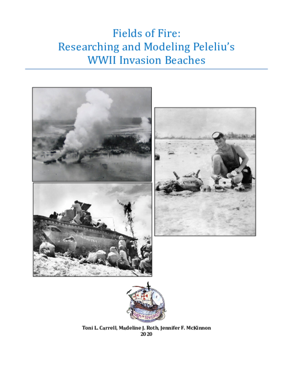
 Toni Carrell