GEOLOGICAL JOURNAL
Geol. J. 47: 30–40 (2012)
Published online 28 September 2011 in Wiley Online Library
(wileyonlinelibrary.com). DOI: 10.1002/gj.1329
Geomorphologic assessment of relative tectonic activity in the Maharlou Lake
Basin, Zagros Mountains of Iran
ALI FAGHIH1*, BABAK SAMANI 2, TIMOTHY KUSKY 3, SAMAN KHABAZI1 and
REIHANEH ROSHANAK 1
1
Department of Earth Sciences, College of Sciences, Shiraz University, Shiraz, Iran
2
Faculty of Earth Sciences, Shahid Chamran University, Ahvaz, Iran
3
State Key Lab for Geological Processes and Mineral Resources, Three Gorges Research Center for Geohazards, China
University of Geosciences, Wuhan, China
Spatial differences of Quaternary deformation and intensity of tectonic activity are assessed through a detailed quantitative geomorphic study
of the fault-generated mountain fronts and alluvial/fluvial systems around the Maharlou Lake Basin in the Zagros Fold–Thrust Belt of Iran.
The Maharlou Lake Basin is defined as an approximately northwest–southeast trending, linear, topographic depression located in the central
Zagros Mountains of Iran. The lake is located in a tectonically active area delineated by the Ghareh and Maharlou faults. Combined geomorphic and morphometric data reveal differences between the Ghareh and Maharlou mountain front faults indicating different levels of tectonic
activity along each mountain front. Geomorphic indices show a relatively high degree of tectonic activity along the Ghareh Mountain Front in
the southwest, in contrast with less tectonic activity along the Ahmadi Mountain Front northeast of the lake which is consistent with field
evidence and seismotectonic data for the study area. A ramp valley tectonic setting is proposed to explain the tectonosedimentary evolution
of the lake. Copyright © 2011 John Wiley & Sons, Ltd.
Received 8 February 2011; accepted 4 August 2011
KEY WORDS
neotectonics; tectonic geomorphology; geomorphic indices; faults; Maharlou Lake; Zagros Mountains
1. INTRODUCTION
The study of landforms that appear to be controlled by the
interaction between tectonic and geomorphic processes is
the focus of tectonic geomorphology (Mayer, 1986). Landscapes in tectonically active areas result from a complex integration of the effects of crustal block motion, erosion and/or
deposition by surface processes (Burbank and Anderson,
2001). Therefore, geomorphic investigation in regions of
active tectonics is a powerful tool for studies of tectonic
geomorphology. The quantitative measurement of landscape
is based on the calculation of geomorphic indices using
topographic maps or digital elevation models, aerial photographs or satellite imagery, and fieldwork (Keller and Pinter,
2002). Geomorphic indices are a tool for analyzing landforms and evaluating the degree of tectonic activity in a given
area (Keller, 1986). The most characteristic landforms
developed in semi-arid, tectonically-active zones are faultgenerated mountain fronts. These are large-scale tectonic
landforms with long survival periods (>100 ka), in which
*Correspondence to: A. Faghih, Department of Earth Sciences, College of
Sciences, Shiraz University, Shiraz, Iran. E-mail: afaghih@shirazu.ac.ir;
afaghihgeo@gmail.com
the erosional and depositional history are linked to the related
range-front fault (Mayer, 1986). Therefore, the geomorphologic analysis of mountain fronts, alluvial fans and related
drainage networks would provide valuable information about
the recorded tectonic history (Silva et al., 2003; Singh and
Tandon, 2008; Figueroa and Knott, 2010).
The aim of this study is to assess the relative intensity of
tectonic activity of fault-generated mountain fronts around
the Maharlou Lake Basin (Figure 1) through geomorphic
analysis, and to explain the origin and evolution of this lake
basin as a tectonic and morphologic feature in the Zagros
Mountains of Iran. The lake is located 18 km southeast of
Shiraz City in southwest Iran. Natural hazard assessment and
disaster management depend on an understanding of active
tectonics including studies of the patterns of deformation,
landscape development, and the determination of rates of
tectonic processes. In particular, earthquakes impact human
societies with huge attendant economic consequences (Singh
and Tandon, 2008). The fault-generated mountain fronts and
fluvial system are the most characteristic landforms in this
region. Therefore, geomorphological and morphometric analyses of these features may offer valuable information on the
Copyright © 2011 John Wiley & Sons, Ltd.
�TECTONIC ACTIVITY IN THE MAHARLOU LAKE BASIN, ZAGROS MOUNTAINS
31
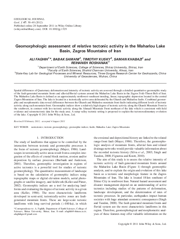
Figure 1. Geological map of the study area. The upper map shows tectonic subdivisions of the Zagros Orogeny (Zagros Fold–Thrust Belt, Sanandaj–Sirjan
Metamorphic Belt and Urumieh–Dokhtar Magmatic Arc) and the location of the study area.
Copyright © 2011 John Wiley & Sons, Ltd.
Geol. J. 47: 30–40 (2012)
�32
a. faghih
recorded tectonic history in the geomorphic features around
the lake which may inform hazard assessments in the region.
2. GEOMORPHOLOGICAL AND GEOLOGICAL
SETTING
The Zagros Fold–Thrust Belt is part of the Alpine–Himalayan
orogenic belt (Takin, 1972; Berberian and King, 1981) and
lies on the northeastern margin of the Arabian Plate. Regional
deformation (the Zagros Orogeny) arose from the LateCretaceous to Tertiary collision between the African–Arabian
continent and the Iranian microcontinents. Crustal shortening
led to thrusting and large-scale strike-slip faulting in the
Zagros Orogeny (Alavi, 1994; Sepehr and Cosgrove, 2005;
Sarkarinejad et al., 2008, 2009, 2010a, b). Postcollisional
ET AL.
crustal shortening is still active (Jackson and McKenzie, 1984;
Talebian and Jackson, 2002; Allen et al., 2004; Regard et al.,
2004; Tatar et al., 2004) with a N–S oriented convergence rate
of approximately 20 � 2 mm yr 1 (Vernant et al., 2004;
Molinaro et al., 2005). This fold–thrust belt is approximately 1800 km long and 200–300 km wide. It runs from
eastern Turkey to the Strait of Hormuz, where it terminates
against the Zendan Fault (Figure 2), which separates the
Zagros Belt from the Makran accretionary prism (Molinaro
et al., 2005; Regard et al., 2004).
Southwest of the Zagros Thrust (Figure 1), the Neogene Period is represented by the Fars Group (Gachsaran, Mishan and
Agha Jari formations) and Bakhtyari Formation. Shed from
the gradually rising Zagros Range, red clastic conglomerates,
sandstones and mudstones of the Razak Formation filled the
basin from NE to SW during the Lower Miocene. In Fars
Figure 2. Shaded SRTM topographic map which showing geodynamic setting of Iran and neighbouring regions. The rectangle represents the region shown in
later figures.
Copyright © 2011 John Wiley & Sons, Ltd.
Geol. J. 47: 30–40 (2012)
�TECTONIC ACTIVITY IN THE MAHARLOU LAKE BASIN, ZAGROS MOUNTAINS
Province they interfinger with limestones and marls of the
upper Asmari–Jahrum Formation and with evaporites and
interbedded limestones of the Gachsaran Formation. From late
Oligocene to early Miocene time, the Asmari Sea receded
from the Zagros Basin. On the Fars platform, evaporates were
deposited, comprising gypsum, anhydrite and halite beds of
the Gachsaran Formation. Fars Group deposition ended with
the Agha Jari Formation, a mudstone and sandstone sequence
of continental nature. After the strong uplifting of the Zagros
Range in the late Alpine phase, the Bakhtyari Conglomerates
(Upper Pliocene in age) were deposited from rivers in fold belt
valleys, with an irregular distribution pattern and preserved
thickness (James and Wynd, 1965; Falcon, 1974; Motiei,
1994; Alavi, 1994, Bahrami, 1997).
Maharlou Lake is located in the central part of the Zagros
Fold–Thrust Belt (Figures 1 and 2; Alavi, 1994). It is an
ephemeral saline lake that developed in an intra-continental
basin (Sonnenfeld, 1991). In wet seasons, the lake expands
to an area of 280 km2 (26 km long and 12 km wide). The
lake is located in an elevated depression (1455 m above
sea level) with a northwest–southeast trend.
The average annual precipitation and minimum and maximum temperatures are 341 mm, 9.8 � C and 25.6 � C respectively, with the maximum precipitation occurring in January
and December. The average annual evaporation rate is approximately 2391 mm. Average water depths in the northern
part of the lake range between 1.5 to 2 m. Vegetation cover
in the study area includes various species of Artemisia,
Astragalus and liquorice. The lake receives water from direct precipitation and inflow from surface run-off, a few seasonal rivers and several karstic springs which collectively
compensate for the high evaporation rates in the region
(Dumas et al., 2003). There are no permanent rivers entering
the lake, and the local drainage network is ephemeral, including the Nahre-Azam (the Khoshk), and Chenare-Rahdar (the
Babahaji) rivers (Fayazi et al., 2007). The Khoshk River, has
the largest discharge and plays the most significant role in the
hydrochemical composition of the Maharlou Lake. The maximum discharge of the Khoshk River in wet and dry seasons is
approximately 164 and 2.4 m3s 1, respectively. The Khoshk
River is approximately 62 km long, 40 km of which passes
through Shiraz City (Forghani et al., 2009).
The lake’s hydrogeological properties, former lake level
stands and the survival of relict Pleistocene fish species
(Djamali et al., 2009) indicate that the lake has been in existence since early Pleistocene times. The Lake Basin developed with a NW–SE- trend, and the floor of the Basin is
infilled with Plio-Quaternary alluvial fan and alluvium
deposits. Recent lacustrine deposits comprise predominantly
well-laminated carbonates, evaporites and siliciclastic sediments. Lake centre deposits are evaporitic and in the lake
margins are carbonates and siliciclastic sediments. (Lak
et al., 2008). A study of the recent evolution of the lake
Copyright © 2011 John Wiley & Sons, Ltd.
33
hydrochemistry has shown that the lake water has changed
from a Mg–SO4–Cl type in 1970 to a Na–Mg–Cl–(SO4) type
at the present time (Fayazi et al., 2007; Djamali et al., 2009).
The margins of the lake are defined by a series of mountain
ranges. The Ahmadi Mountains northeast of the lake and the
Ghareh Mountains to the southwest were uplifted as doubly
plunging anticlines. The mountain ranges are composed
of Cenozoic sedimentary rocks. The main rock type which
constitutes the mountain fronts in the study area is OligoMiocene limestone of the Asmari Formation (Figure 1).
3. METHODS
Geomorphic indices represent a quantitative approach to
geomorphic analysis. In this study we analyze the main morphological features of the mountain fronts, alluvial fans, and
fluvial networks surrounding Maharlou Lake. The geomorphological and morphometric analyses were carried out in
the field using 1:25 000 scale topographic maps and digital
elevation models. Most of the geomorphic and morphometric parameters used in this study were developed by Hack
(1973), Bull and McFadden (1977), Rantsman (1979), Wells
et al. (1988), Silva et al. (2003) and El-Hamdouni et al.
(2008). Six main parameters used in these analyses quantify
the relationships between tectonics, lithology, sedimentation
and erosion, and include mountain front sinuosity, facet,
valley width/height ratio, drainage basin shape ratio, basin
elongation ratio and alluvial fan topographic profiles.
3.1. Mountain front sinuosity index (Smf)
Mountain front sinuosity index is defined as Smf ¼ Lms =Ls ;
where Lmf is the length of the mountain front along the foot
of the mountain where a change in slope from the mountain
to the piedmont occurs; and LS is the straight line length of
the mountain front (Bull and McFadden, 1977). This index
reflects the balance between erosional processes and active
tectonism along the mountain front. Active vertical tectonics
(generally coincident with active faults or folds) tend to produce straight mountain fronts, however these become more
sinuous as streams cut both laterally and into the front (Bull
and McFadden, 1977; Keller, 1986; Keller and Pinter,
2002). Mountain fronts associated with active tectonics and
active uplift are relatively straight with low values of Smf;
but if the rate of uplift is reduced or ceases, then erosional
processes along the mountain front produce a more sinuous
front and thus lower value of Smf. Values of Smf are readily
calculated from topographic maps or aerial photography,
although they are scale dependant (Bull and McFadden,
1977). Small-scale maps (1:250 000) produce approximate
values of Smf, while larger scale topographic maps due to
their high resolution produce more accurate assessments of
Geol. J. 47: 30–40 (2012)
�34
a. faghih
Smf. Mountain front sinuosity is also sensitive to the local
climate, where the values need to be adjusted in areas of
higher rainfall and erosion rates (e.g. Kusky et al., 2010).
In this study, mountain fronts are defined as major faultbounded escarpments, and long escarpments were subdivided
along-strike into discrete segments with similar geological and
morphological characteristics (Figure 3). Following Wells
et al. (1988), the following criteria were applied: (1) intersection with cross-cutting drainage large in scale relative to the
front, (2) abrupt changes in the major morphological characteristics of the mountain front relative to adjoining front
segments, and (3) changes in mountain front orientation.
3.2. Facet
A facet is a triangular to polyhedral shaped hillslope situated
between two adjacent drainage structures within a given
mountain front escarpment (Ramírez-Herrera, 1998). Facets
are interpreted as variably degraded remnants of fault generated footwall scarps (Wallace, 1977). Two indices related to
facet development were used in this study: (a) the percentage
of faceting along mountain fronts (FCl), (b) the percentage of
dissected mountain fronts (Fd) as described by Wells et al.,
(1988). The FCl defines the proportion of a mountain front
that has well-defined triangular facets, using the ratio of
the cumulative lengths of facets to overall mountain front
length which can be expressed as:
ET AL.
FCl ¼ Lf =LS
where Lf is the cumulative length of facets and LS is the
overall mountain front length. Tectonically active fronts
display prominent, large facets that are generated and/or maintained by recurrent faulting along the base of the escarpments,
i.e. high percentage faceting (Wells et al., 1988).
Fd defines the proportion of a mountain front that has
been dissected into distinct facets (Bull, 1978). Most tectonically active mountain fronts tend to be less dissected, i.e.
low Fd values (Bull and McFadden 1977; Wells et al.,
1988). This index is defined as:
Fd ¼ Lmfd =LS
Where Lmfd is the length of the dissected mountain front
and LS is the straight line length of the mountain front (Bull
and McFadden, 1977).
3.3. The valley width/height ratio (Vf)
Vf is defined as the ratio of the width of the valley floor to its
average height (Bull and McFadden, 1977; Bull, 1978).
Comparison of the width of the floor of a valley with its
mean height provides an index that indicates whether the
stream is actively downcutting or is primarily eroding laterally
into the adjacent hill slopes. This index can be expressed as:
Vf ¼ 2Vfw =½ðEld
ESC Þ þ ðErd
ESC Þ
where Vf is the ratio of valley floor width to valley height; Vfw
is the width of the valley floor; Eld is the elevation of the divide
on the left side of the valley; Erd is the elevation on the right
side; and ESC is the average elevation of the valley floor.
Valley floors tend to become progressively narrower upstream from the mountain front in larger drainage basins
for a given mountain range (Ramirez-Herrera, 1998). For
this reason, in this work the transverse valley profiles were
located 0�5 km and 0�5 to 1 km upstream from the mountain
front in small and large drainage basins respectively as prescribed by Silva et al. (2003). Vf values was calculated for
the main valleys that cross mountain fronts using crosssections drawn from the digital elevation model and the
1:25 000 topographic map of the study area.
3.4. Drainage basin shape ratio (BS)
Figure 3. Digital elevation model of the Maharlou Lake and surrounding
mountain fronts. The numbers show the mountain front segments for assessing the Smf index in the study area.
Copyright © 2011 John Wiley & Sons, Ltd.
In tectonically active mountain ranges, basins have typical
elongate shapes which become progressively more circular
with time after cessation of mountain uplift (Bull and
McFadden, 1977). The horizontal projection of basin shape
may be described by the basin shape ratio, BS (Cannon,
1976; Ramírez-Herrera, 1998) expressed by:
Geol. J. 47: 30–40 (2012)
�TECTONIC ACTIVITY IN THE MAHARLOU LAKE BASIN, ZAGROS MOUNTAINS
BS ¼ Bl =Bw
where Bl is the length of the basin, measured from its mouth
to the most distant drainage divide, and Bw is the width of
the basin measured across the short axis.
35
activity of recent uplift along this front. Alternatively, Smf
values vary from 1.16–1.37 along the Maharlou Fault which
revealed less active tectonism (Figure 4).
4.2. Facet
3.5. Basin elongation ratio (Re)
The basin elongation ratio (Bull and McFadden, 1977), is
one of the proxy indicators of recent tectonic activity. This
parameter (Re) is calculated as a ratio of the drainage basin
area (A) to the maximum basin length (L), i.e. the distance
between the two most distant points in the drainage basin
which is expressed by:
� pffiffiffiffiffiffipffiffiffi�
Re ¼ 2 A : p =L
where A is the drainage basin area and L is the maximum
length of the basin.
3.6. Alluvial fan topographic profiles
Tectonic uplift creates elevated terrain and provides increased potential energy to the agents of erosion such as fluvial systems. Alluvial fan morphology sheds light on fault
activity and reflects the rate of the source mountain uplift
(Gürbüz and Gürer, 2008). The plan view morphologies
and the longitudinal profiles of eight alluvial fans around
the Maharlou Lake were used to define control mechanisms
on fan development.
4. RESULTS
4.1. Mountain front sinuosity
In this work, eight mountain fronts were evaluated. Obtained
values of Smf range from 1.03 to 1.37 (Figure 4). The lowest
values of Smf are associated with the southwest border of
Maharlou Lake with the Ghareh Fault (Tables 1 and 2).
The Smf values calculated for the Ghareh Mountain Front
vary from 1.03 to 1.08, which point to a relatively high
The obtained FCl (35.3%) and Fd (42.6%) values revealed a
high percentage faceting and a low percentage of dissected
mountain front along the Ghareh Mountain Front than the
Ahmadi Mountain Front (FCl = 21.6%; Fd = 65.2%) which
suggests a relatively higher degree of tectonic activity along
the Ghareh Fault than the Maharlou Fault (Figure 4). Tectonically active fronts display a high percentage of triangular
faceting and tend to be less dissected (Bull and McFadden,
1977; Wells et al., 1988).
4.3. Valley floor width-to-height ratio
Valleys dissecting the Ghareh Mountain Front display Vf
values (calculated for valley segments located 1 km upstream of the mountain front) ranging between 0.2–0.45
whereas those of Maharlou Mountain Front vary between
0.32–0.76 (Figure 4 and Tables 1 and 2). Most Vf values in
this study are relatively low, revealing that most valleys of
the study area are V-shaped. U-shaped valleys generally
have high values of Vf, whereas V-shaped valleys have relatively low values. Because uplift is associated with incision,
the index is thought to be a surrogate for active tectonics
where low values of Vf are associated with higher rates of
uplift and incision (El-Hamdouni et al., 2008).
4.4. Drainage basin shape ratio
The resulting values of BS calculations range from 1.3 to 4.8
(Figures 4 and 5). The highest values are along the SW border of the Maharlou Lake Basin. The index reflects
differences between elongated and more circular basins.
High values of BS are associated with elongated basins, generally associated with relatively higher tectonic activity
(Keller and Pinter, 2002). Low values of BS indicate a more
circular-shaped basin, generally associated with low tectonic
Figure 4. Geomorphic and morphometric parameters and relative tectonic activity in each mountain front in the study area. Arrow tip shows the increasing
intensity of tectonic activity. AMF and GMF letters indicate Ahmadi Mountain Front and Ghareh Mountain Front, respectively. Six used parameters are mountain front sinuosity index (Smf), facet (FCl), dissected facets (Fd), the valley width/height ratio (Vf), drainage basin shape ratio (BS) and basin elongation ratio (Re).
This figure is available in colour online at wileyonlinelibrary.com/journal/gj
Copyright © 2011 John Wiley & Sons, Ltd.
Geol. J. 47: 30–40 (2012)
�36
a. faghih
ET AL.
Table 1. Morphometric data of the Maharlou Fault
Maharlou
Fault
Station
Lmf (m)
LS (m)
Smf
Eld (m)
Erd (m)
ESC (m)
Vfw (m)
Vf
1
2
3
4
6307.6
13718.2
12892.9
11775.2
5437.5
11337.3
9767.3
8595.1
1.16
1.21
1.32
1.37
1685.5
1650.2
1710.5
1585.2
1682.8
1680.7
1696.8
1591.9
1618.8
1581.9
1660.5
1545.9
21
32.6
26.7
32.4
0.32
0.39
0.62
0.76
Table 2. Morphometric data of the Ghareh Fault
Ghareh
Fault
Station
Lmf (m)
LS (m)
Smf
Eld (m)
Erd (m)
ESC (m)
Vfw (m)
Vf
1
2
3
4
8368.4
9903.3
6421.5
11742.1
8124.6
9431.7
6058.1
10872.3
1.03
1.05
1.06
1.08
1686.2
1636.8
1625.3
1711.1
1709.3
1684.9
1654.2
1741.6
1616.9
1591.1
1549.5
1642.9
16.2
18.1
35.2
37.5
0.2
0.35
0.39
0.45
4.5. Basin elongation ratio
The Re values have been calculated for nine small drainage
basins located on the NE and SW borders of the lake in the
Ghareh and Ahmadi Mountain Fronts. These results range
from 0.435 to 0.689, pointing to a slightly active uplift of the
Maharlou Fault than the more active Ghareh Fault (Figures 4
and 5). Drainage basins in arid and semiarid climates tend to
show Re values ranging from <0.50, through 0.50–0.75 to
>0.75 for tectonically active, slightly active and inactive settings, respectively (Cuong and Zuchiewicz, 2001).
4.6. Alluvial fan topographic profiles
Figure 5. Shaded SRTM topographic map which shows alluvial fans and
fluvial systems used in the morphometric analysis.
activity. Rapidly uplifted mountain fronts generally produce
elongated, steep basins; and when tectonic activity is diminished or ceases, widening of the basins occur from the
mountain front up (Ramírez-Herrera, 1998; El-Hamdouni
et al., 2008). Elongated drainage basins characteristically occur in the southwestern part of the Maharlou Lake Basin,
suggesting a relatively higher degree of tectonic uplift in this
part of the study area.
Copyright © 2011 John Wiley & Sons, Ltd.
The fans generally present a profile with a similar mean slope.
They have concave upwards profile with slopes that gradually
decrease from the apex down. Most of these profiles are segmented into two parts with constant, but different, slopes.
These slope breaks were determined in the field and some of
them were identified by their observable fault scarps. Therefore, the slope breaks with dashed lines in the longitudinal
fan profiles may be caused by tectonic activity (Figure 6).
5. DISCUSSION
5.1. Geomorphology
The geomorphic and morphometric analyses carried out on the
mountain fronts, alluvial fans and fluvial system around
Maharlou Lake have significant value in providing information on the relative rate of tectonic uplift. Geomorphological
Geol. J. 47: 30–40 (2012)
�TECTONIC ACTIVITY IN THE MAHARLOU LAKE BASIN, ZAGROS MOUNTAINS
37
Figure 6. Longitudinal profiles of some studied alluvial fans along the mountain fronts (Ahamdi Mountain Front in this figure) bounding Maharlou Lake. Slope
breaks indicated by dashed lines interpreted as the location of the Maharlou Fault.
features such as fault scarps and triangular facets along mountain fronts reflect recent tectonic activity. Indices of active
tectonics may detect anomalies in the fluvial system or alluvial
fans along the mountain fronts. These anomalies may be produced by local changes from tectonic activity resulting from
uplift or subsidence (El-Hamdouni et al., 2008).
Alluvial fans are ubiquitous features of mountainous
range-fronts worldwide. Tectonic activity is now commonly
recognized as the primary controlling factor in dictating alluvial fan properties such as location, setting and morphology,
primarily through tectonic influences on drainage basin
relief and fan accommodation space (Allen and Hovius,
1998; Allen and Densmore, 2000; Densmore et al., 2007).
Alluvial fan morphology is an indicator of active tectonics
because the fan form reflects varying rates of tectonic
processes such as uplift of the catchment on mountains
along a fault or tilting of the fan surface. Several factors, in
particular tectonics, climate, and geomorphic history affect
the geomorphology of alluvial fans. Within the context of
the geomorphic setting, fan morphology reflects fan processes and evolution. In this study, slope breaks indicated
by dashed lines are interpreted to be caused by fault activity
along the mountain front associated with the Ghareh and
Maharlou faults (Figure 6). Slope morphology of scarps produced by faulting is a useful geomorphic indicator of
active tectonics (Keller and Pinter, 2002). The geometry of
faults and the structure of the basin surrounding the lake
indicate a ramp valley tectonic setting, with the lake developing in the topographic depression created by synclinal
buckling (Figure 7). The ramp valley (Willis, 1928)
developed in the structural accommodation zone created between the two thrust faults with opposing vergences. Other
examples of similar ramp valley basins have been described
by Bally (1982), Mann et al. (1991), Cobbold et al. (1993),
and Lavenu et al. (1996). Mann et al. (1991) accounted for
Miocene–Pliocene basin structures in Hispaniola by applying a similar tectonic evolution that developed along the
restraining bend between the North American and Caribbean
Figure 7. Simplified cross-section showing the two fault-generated mountain fronts bounding the Maharlou Lake Basin that developed in a ramp valley tectonic setting.
(See Figure 1 for location of section line).
Copyright © 2011 John Wiley & Sons, Ltd.
Geol. J. 47: 30–40 (2012)
�38
a. faghih
Plates. Lavenu et al. (1996) proposed that a compressional
setting prevailed in the Ambato-Latacunga area, which corroborates a full-ramp setting (Cobbold et al., 1993). These
authors assume that both the east-verging Victoria Fault in
the west and the west-verging Pisayambo Fault in the east
overthrust the basin margins.
Seismotectonic studies carried out by Andalibi and Oveisi
(1999) within the study area confirm the presence of the
Maharlou and Ghareh faults. A full-ramp basin model
(Cobbold et al., 1993), in which the opposite verging Maharlou
and Ghareh faults drive differential uplift of the Lake Basin
borders, most appropriately describes the tectonosedimentary
setting of the lake.
5.2. Geomorphic indices
Several authors have tried to categorize tectonic activity of
regions into different tectonic classes as measured by geomorphic indices. El-Hamdouni et al. (2008) introduced three
active tectonics classes corresponding to Smf values; class I
(Smf < 1.1), class II (1.1 ≤ Smf <1.5), and class III (Smf ≥
1.5). Smf values lower than 1.4 indicate tectonically active
fronts (Rockwell et al., 1985; Keller, 1986) while higher
Smf values (>3) are normally associated with inactive fronts
in which the initial range–front fault may be more than 1 km
away from the present erosional front (Bull and McFadden,
1977). Mountain fronts associated with active uplift are
relatively straight with low values of (Smf). For slightly
active and inactive regions, the Smf values tend to be between 1.4–3.0 and 1.8 to >5, respectively. When the rate
of uplift is reduced or ceases, erosional processes will begin
to form a sinuous front that becomes more irregular with
time (Keller, 1986). According to Silva et al. (2003), linear
mountain fronts with Smf < 1.5 are the main geomorphic
and structural character of regions with active tectonics
(class I). Irregular mountain fronts with Smf values ranging
from 1.8 to 2.30 characterize class II regions. Results in this
study indicate that the Ghareh and Maharlou Fault scarps belong to the class I of relative tectonic activity of Silva et al.
(2003) with associated uplift rates of >0.08 m/ka which is also
consistent with regions classified by high tectonic activity by
Rockwell et al. (1985) and Keller (1986). In addition, the
Ghareh Fault and Maharlou Fault belong to the tectonic classes I and II of El-Hamdouni et al. (2008) regarding the Smf
values respectively. Tectonically high active mountain fronts
display prominent and large facets, whereas tectonically less
active fronts display fewer and dissected facets (Bull, 1978).
High values of percentage of faceting and dissected escarpments that are associated with the Ghareh Mountain Front
characterize the high tectonic activity. In the same way, these
values are inverted in the Maharlou Mountain Fronts due to
less tectonic activity.
Copyright © 2011 John Wiley & Sons, Ltd.
ET AL.
The same conclusion is derived from analysis of valley
floor width and valley height ratios (Vf) in the study area.
This index differentiates between broad-floored valleys,
with relatively high values of Vf, and V-shaped canyons with
relatively low values. Low values of Vf reflect deep valleys
of actively incising streams, commonly associated with
the uplift (Keller and Pinter, 2002).The Vf values associated
with Maharlou Mountain Front are relatively higher than
those associated with the Ghareh Mountain Front. The elevation of the hills associated with the Ghareh Mountain
Front is greater than that associated with the Maharlou Mountain Front; this reflects the larger displacement on the Ghareh
Mountain Front. Thus, the width of the valleys on the hills associated with the Ghareh Mountain Front is less and also the
elevations of the valley walls are high resulting in a low Vf
value. El-Hamdouni et al. (2008) classified Vf values into three
classes: I (Vf ≤ 0.5); II (0.5 ≤ Vf < 1.0) and III (Vf ≥ 1).
According to Silva et al. (2003), V-shaped valleys (Vf < 0.6)
characterized by active incision and U-shaped valleys (Vf:
0.3 – 0.80) characterized by valley floor aggradation.
Corresponding to the obtained Vf values in the study area
(Figure 4) the Ghareh Fault is categorized in class I of ElHamdouni et al. (2008) and classes I and II of Silva et al.
(2003). The Maharlou Fault belongs to classes I and II of ElHamdouni et al. (2008) and class II of Silva et al. (2003) with
relation to Vf values. In addition, the data resulting from basin
shape and elongation ratio analyses carried out on the small
basins around the lake also reveal that the Ghareh Fault on
the SW border of the lake is more active than the Maharlou
Fault on the NE border of the basin.
In summary, the quantitative geomorphic and morphometric analyses on the mountain fronts surrounding the lake reveal
that the Ghareh Mountain Front is more active than the
Ahmadi Mountain Front. Seismotectonic studies (Andalibi
and Oveisi, 1999) indicate that the deepest part of the lake is
located along its southwest border (i.e. adjacent to the Ghareh
Mountain Front). Andalibi and Oveisi (1999) argued that the
tectonically-generated accommodation space developed by
the Ghareh Fault had more influence on the lake formation
than that generated by the Maharlou Fault.
6. CONCLUSIONS
Tectonic geomorphology of orogenic belts has become one
of the principal tools in the identification of active faults,
seismic-hazard assessment and the study of landscape evolution. Geomorphic analysis of two mountain fronts surrounding Maharlou Lake within the Zagros Fold–Thrust Belt
reveal marked differences between the fronts. Fault geometry in the study area is characterized by mountain front faults
on both sides of Maharlou Lake. The results of the geomorphic analysis show that the southwestern mountain front
boundary (Ghareh Fault) is more active than the northeastern
Geol. J. 47: 30–40 (2012)
�TECTONIC ACTIVITY IN THE MAHARLOU LAKE BASIN, ZAGROS MOUNTAINS
front (Maharlou Fault) which is consistent with field evidence and seismotectonic data for the study area. This study
indicates that Maharlou Lake developed in a ramp valley
tectonic setting that developed in the structural
accommodation zone between the two opposing basin
bounding faults.
ACKNOWLEDGEMENTS
The authors would like to thank R. Hillier and I. Somerville
for their helpful suggestions in editing the manuscript. We
are also thankful to S. Leleu and an anonymous reviewer
for their constructive and valuable comments that helped to
improve the manuscript. The Research Council of the Shiraz
University has supported the study which is gratefully
acknowledged.
REFERENCES
Alavi, M. 1994. Tectonic of the Zagros orogenic belt of Iran: new data and
interpretations. Tectonophysics 229, 211–238.
Allen, M., Jackson, J., Walker, R. 2004. Late Cenozoic reorganization
of the Arabia–Eurasia collision and the comparison of short-term and
long-term deformation rates. Tectonics 23, TC2008, 1–16. DOI: 10.1029/
2003TC001530.
Allen, P.A., Hovius, N. 1998. Sediment supply from landslide-dominated
catchments; implications for basin-margin fans. Basin Research 10,
19–35.
Allen, P.A., Densmore, A.L. 2000. Sediment flux from an uplifting fault
block. Basin Research 12, 367–380.
Andalibi, M.J., Oveisi, B. 1999. Modern seismotectonics with an explanatory note on the seismotectonic, structure-contour and geophysical
synthetic maps of Shiraz area. Perspolis publication: Shiraz, Iran, pp 318.
Bahrami, M. 1997. Sedimentology and morphotectonical evolution of
Aghajari and Bakhtyari Formations in northwestern of Shiraz. Journal
of sciences, Islamic Azad University 8, 1995–2010.
Bally, A.W. 1982. Musings over sedimentary basin evolution. Philosophical Transaction of the Royal Society of London A305, 325–338.
Berberian, M., King, G.C. 1981. Towards a palaeogeography and tectonics evolution of Iran. Canadian Journal of Earth Sciences 18, 210–265.
Bull, W.B. 1978. Geomorphic tectonic classes of the south front of the San
Gabriel Mountains, California. U.S. Geological Survey Contact Report
14, 08-001-G-394.
Bull, W.B., McFadden, L.D. 1977. Tectonic geomorphology north and
south of the Garlock Fault, California. In: Geomorphology in Arid Regions,
Proceedings of Eighth Annual Geomorphology Symposium, Doehring,
D.O. (Ed.). State University of New York, Binghamton, 115–138.
Burbank, D., Anderson, R. 2001. Tectonic Geomorphology. Blackwell
Science: Oxford.
Cannon, P.J. 1976. Generation of explicit parameters for a quantitative
geomorphic study of the Mill Creek drainage basin, Oklahoma. Geology
Notes 36, 3–16.
Cobbold, P.R., Davy, P., Gapais, D., Rossello, E.A., Sadybakasov, E.,
Thomas, J.C., Tondji, J.J., Urreiztieta, M.D. 1993. Sedimentary basins
and crustal thickening. Sedimentary Geology 86, 77–89.
Cuong, N.Q., Zuchiewicz, W.A. 2001. Morphotectonic properties of the
Lo River Fault near Tam Dao in North Vietnam. Natural Hazards and
Earth System Sciences 1, 15–22.
Densmore, A.L., Allen, P.A., Simpson, G. 2007. Development and
response of a coupled catchment fan system under changing tectonic
and climatic forcing. Journal of Geophysical Research, Earth Surface
112, 1–16.
Copyright © 2011 John Wiley & Sons, Ltd.
39
Djamali, D., Beaulieu, J., Miller, N.F., Ponel, V.A., Ponel, P., Lak, R.,
Sadeddin, N., Akhani, H., Fazeli, H. 2009. Vegetation history of the
SE section of the Zagros Mountains during the last five millennia; a
pollen record from the Maharlou Lake, Fars Province, Iran. Vegetation
History and Archaeobotany 18, 123–136.
Dumas, D., Mietton, M., Humbert, J. 2003. Le fonctionnement hydroclimatique de la cuvette lacustre de Maharlou (Iran). Sécheresse 14,
219–226.
El-Hamdouni, R., Irigaray, C., Fernandez, T., Chacón, J., Keller, E.A.
2008. Assessment of relative active tectonics, southwest border of Sierra
Nevada (southern Spain). Geomorphology 96, 150–173.
Falcon, N. 1974. Southern Iran: Zagros Mountains, in Mesozoic–Cenozoic
Orogenic Belts: Geological Society Special Publication 4, 199–211.
Fayazi, F., Lak, R., Nakhaei, M. 2007. Hydrogeochemistry and brine
evolution of Maharlou Saline Lake, southwest of Iran. Carbonates and
Evaporites 22, 34–42.
Figueroa, A.M., Knott, J.R. 2010. Tectonic geomorphology of the southern Sierra Nevada Mountains (California): evidence for uplift and basin
formation. Geomorphology 123, 34–45.
Forghani, G., Moore, F., Lee, S., Qishlaqi, A. 2009. Geochemistry and
speciation of metals in sediments of the Maharlu Saline Lake, Shiraz,
SW Iran. Environmental Earth Scieces 59, 173–184.
Gürbüz, A., Gürer, Ö.F. 2008. Tectonic Geomorphology of the North
Anatolian Fault Zone in the Lake Sapanca Basin (Eastern Marmara
Region, Turkey). Geosciences Journal 12, 215–225.
Hack, J.T. 1973. Stream-profiles analysis and stream-gradient index.
Journal of Research of the U.S. Geological Survey 1, 421–429.
Jackson, J.A., McKenzie, D.P. 1984. Active tectonics of Alpine–Himalayan
belt between western Turkey and Pakistan. Geophysical Journal of the
Royal Astronomical Society 77, 185–264.
James, G.A., Wynd, J.G. 1965. Stratigraphic nomenclature of Iranian oil
consortium agreement Area. American Association of Petroleum
Geologists Bulletin 49, 2182–2245.
Keller, E.A. 1986. Investigation of active tectonics: use of surficial earth
processes. In: Active Tectonics, Studies in Geophysics, Wallace (ed.).
National Academy Press: Washington DC, 136–147.
Keller, E.A., Pinter, N. 2002. Active tectonics: Earthquakes, Uplift and
Landscapes. Prentice Hall: New Jersey, 338 pp.
Kusky, T.M., Toraman, E., Raharimahefa, T., Rasoazanamparany, C.
2010. Active tectonics of the Alaotra–Ankay Graben System, Madagascar:
possible extension of Somalian–African diffusive plate boundary? Gondwana
Research 18, 274–294.
Lak, R., Kalani, M., Fayazi, F. 2008. Sedimentology of the Maharlou
Lake, SW Iran segnificance of evaporates. 33rd international Geological
Congress, SES-01 General contributions to Sedimentology, Oslo.
Lavenu, A., Baudino, R., Ego, F. 1996. Stratigraphie des depots tertiaires
et quaternaires de la dépression interandine d’Équateur (entre 0� et 2� 15"S).
Bulletin de l’Institut francais des études andines 25, 1–15.
Mann, P., Draper, G., Lewis, J.F. 1991. An overview of the geologic and
tectonic development of Hispaniola. In: Geologic and Tectonic Development of the North America-Caribbean Plate Boundary in Hispaniola,
P. Mann, G. Draper and J.F. Lewis (eds). Geological Society American
Special Paper 262, 1–28.
Mayer, L. 1986. Tectonic geomorphology of escarpments and mountain
fronts. In: Active Tectonics, Studies in Geophysics, Wallace (ed.),
National Academy Press: Washington DC, 125–135.
Molinaro, M., Leturmy, P., Guezou, J.C., Frizon de Lamotte, D.,
Eshraghi, S.A. 2005. The structure and kinematics of the southeastern
Zagros fold–thrust belt, Iran: from thin-skinned to thick-skinned tectonics.
Tectonics 24, TC3007. DOI: 10.1029/2004TC001633.
Motiei, H. 1994. Geology of Iran; Zagros Stratigraphy. Geological Society
of Iran Publications, Tehran, Iran, p. 630.
Ramirez-Herrera, M.T. 1998. Geomorphic assessment of active tectonics
in the Acambay Graben, Mexican Volcanic belt. Earth Surface Processes
and Landforms 23, 317–332.
Rantsman, E.Y. 1979. Places of Earthquakes and Morphostructure of
Mountain Territories, Nauka, Moscow, 170 pp.
Regard, V., Bollier, O., Thomas, J.C., Abbasi, M.R., Mercier, J.,
Shabanian, E., Feghhi, K., Soleymani, S. 2004. Accommodation of
Arabia–Eurasia convergence in the Zagros–Makran transfer zone, SE
Geol. J. 47: 30–40 (2012)
�40
a. faghih
Iran: a transition between collision and subduction through a young
deformation system. Tectonics 23, DOI: 10.1029/ 2003TC001599 TC4007.
Rockwell, T.K., Keller, E.A., Johnson, D.L. 1985. Tectonic geomorphology of alluvial fans and mountain fronts near Ventura, California. In:
Tectonic Geomorphology. Morisawa, M. (ed.), Proceedings of the 15th
Annual Geomorphology Symposium. Allen and Unwin Publishers:
Boston, MA, 183–207.
Sarkarinejad, K., Faghih, A., Grasemann, B. 2008. Transpressional
deformations within the Sanandaj–Sirjan Metamorphic Belt (Zagros
Mountains, Iran). Journal of Structural Geology 30, 818–826.
Sarkarinejad, K., Godin, L., Faghih, A. 2009. Kinematic vorticity flow
analysis and 40Ar/39Ar geochronology related to inclined extrusion of
the HP–LT metamorphic rocks along the Zagros accretionary prism, Iran.
Journal of Structural Geology 31, 691–706.
Sarkarinejad, K., Heyhat, M., Faghih, A., Kusky, T.M. 2010a. Heterogeneous ductile deformation and quartz c-axis fabric development within
the HP-LT Sanandaj–Sirjan Metamorphic Belt, Iran. Tectonophysics 485,
283–289.
Sarkarinejad, K., Samani, B., Faghih, A., Grasemann, B., Moradipoor,
M. 2010b. Implications of strain and vorticity of flow analyses to interpret the kinematics of an oblique convergence event (Zagros Mountains,
Iran). Journal of Asian Earth Sciences 38, 34–43.
Sepehr, M., Cosgrove, J.W. 2005. Role of the Kazerun fault zone in the
formation and deformation of the Zagros Fold–Thrust Belt, Iran. Tectonics
24, TC5005. DOI: 10.1029/2004TC001725.
Silva, P.G., Goy, J.L., Zazo, C., Bardajm, T. 2003. Fault generated
mountain fronts in Southeast Spain: geomorphologic assessment of
tectonic and earthquake activity. Gemorphology 250, 203–226.
Copyright © 2011 John Wiley & Sons, Ltd.
ET AL.
Singh, V. Tandon, S.K. 2008. The Pinjaur dun (intermontane longitudinal
valley) and associated active mountain fronts, NW Himalaya: tectonic
geomorphology and morphotectonic evolution. Geomorphology 102,
376–394.
Sonnenfeld, P. 1991. Evaporite Basin Analysis. In: Sedimentary and Diagenentic Mineral Deposits: A Basin Analysis Approach to Exploration, Force,
E.R., (ed.), Society of Economic Geologists: El Paso, Texas, 159–169.
Talebian, M., Jackson, J. 2002. Offset on the Main Recent Fault of NW
Iran and implications for late Cenozoic tectonics of the Arabia–Eurasia
collision zone. Geophysical Journal International 150, 422–439.
Takin, M. 1972. Iranian geology and continental drift in the Middle East.
Nature 235, 147–150.
Tatar, M., Hatzfeld, D., Ghafory-Ashtiyani, M. 2004. Tectonics of
the Central Zagros (Iran) deduced from microearthquake seismicity.
Geophysical Journal International 156, 255–266.
Vernant, P., Nilforoushan, F., Haztfeld, D., Abassi, M., Vigny, C.,
Masson, F., Nankali, H., Martinod, J., Ashtiany, A., Bayer, R.,
Tavakoli, F., Chéry, J. 2004. Contemporary crustal deformation and plate
kinematics in Middle East constrained by GPS measurement in Iran and
northern Oman. Geophysical Journal International 157, 381–398.
Wallace, R.E. 1977. Profiles and ages of young fault scarps, north-central
Nevada. Geological Society of America Bulletin 88, 1267–1281.
Wells, S.G., Bullard, T.F., Menges, C.M., Drake, P.G., Karas, P.A.,
Kelson, K.I., Ritter, J.B., Wesling, J.R. 1988. Regional variations in
tectonic geomorphology along a segmented convergent plate boundary,
Pacific coast of Costa Rica. Geomorphology 1, 239–265.
Willis, B. 1928. Dead Sea problem: rift valley or ramp valley? Geological
Society of America Bulletin 39, 490–542.
Geol. J. 47: 30–40 (2012)
�
 babak samani