Journal of
Plant Ecology
VolumE 9, NumbEr 4,
PagEs 421–433
august 2016
doi:10.1093/jpe/rtv069
advance access publication
14 october 2015
available online at
www.jpe.oxfordjournals.org
transition along gradient from
warm to mesic temperate forests
evaluated by gamm
Andraž Čarni1,2,3,*, Vlado Matevski3,4, Nina Juvan5,
Mitko Kostadinovski4, Petra Košir6, Aleksander Marinšek7,
Andrej Paušič8 and Urban Šilc1,9
1
Abstract
Aims
the aim of the study was to discover what set of variables best
explains the transition from warm to mesic forest vegetation.
based on various variables grouped into sets (geomorphological,
ecological, structural, soil characteristics and chorological), six
models were built and tested by generalized additive mixed models (gamms). We assumed that each set of variables has different
explanatory power. our aim was to compare the six different models (sets of variables), to test which model best explains the species
turnover in forest communities along the transition between warm
and mesic temperate forests and to try to find reasons for the different explanatory power of the models.
Methods
the research took place in the southern part of the balkan Peninsula.
Field sampling was done according to standard methods. the gradient from warm to mesic forests was defined as the turnover of
species and evaluated by projection of samples on the first unconstrained DCa axis. geomorphological, ecological, structural and
INtroDuCtIoN
The species composition of a biological community results
from the interplay between ecological and evolutionary
soil characteristics, together with chorological sets of variables,
were regressed on the turnover of species composition. based on
the five sets of variables, six models were constructed and tested by
generalized additive mixed models.
Important Findings
Ecological conditions best explain the change of forest communities
along the gradient; evolution and the development of vegetation
reflected in chorotypes are also of high importance; geomorphology
and structure seem not to change so dramatically and soil shows
the least significant differences of all. Ecological variables are the
most important set of variables in the transition between warm and
mesic temperate forests but eco-evolutionary dynamics after the
Pleistocene should also be taken into consideration.
Keywords: balkan, chorotypes, life forms, ecology plant ecology,
soil science, vegetation, evolution, refugium
received: 16 april 2015, revised: 18 september 2015, accepted:
8 october 2015
processes (Ricklefs 1987).The ecological conditions of a site
are reflected in various sets of variables, such as geomorphology, soil measurements, bioindicator values and plant functional traits. The last named is defined as non-phylogenetic
© The Author 2015. Published by Oxford University Press on behalf of the Institute of Botany, Chinese Academy of Sciences and the Botanical Society of China.
This is an Open Access article distributed under the terms of the Creative Commons Attribution License (http://creativecommons.org/licenses/by/3.0/), which permits unrestricted
reuse, distribution, and reproduction in any medium, provided the original work is properly cited.
Downloaded from https://academic.oup.com/jpe/article/9/4/421/2222523 by guest on 03 June 2022
Institute of Biology, Research Centre of the Slovenian Academy of Sciences and Arts, Novi trg 2, SI-1000 Ljubljana, Slovenia
University of Nova Gorica, Vipavska 13, SI-5000 Nova Gorica, Slovenia
3
Macedonian Academy of Sciences and Arts, Bul. Krste Misirkov, 2, P.O. Box 428, MK-1000 Skopje, Republic of Macedonia
4
Faculty of Natural Sciences and Mathematics, Institute of Biology, University of Ss. Cyril and Methodius, Gazi Baba b/b - P.O.
Box 162, MK-1000 Skopje, Republic of Macedonia
5
Anton Melik Geographical Institute, Research Centre of the Slovenian Academy of Sciences and Arts, Novi trg 2, SI-1000
Ljubljana, Slovenia
6
Faculty of Mathematics, Natural Sciences and Information Technologies, University of Primorska, Glagoljaška 8, SI-6000
Koper, Slovenia
7
Slovenian Forestry Institute, Večna pot 2, SI-Ljubljana, Slovenia
8
Kranjčeva 8, SI-9220 Lendava, Slovenia
9
Biotechnical Centre Naklo, Strahinj 99, SI-4202 Naklo, Slovenia
*Correspondence address. Institute of Biology, Research Centre of the Slovenian Academy of Sciences and Arts,
Novi trg 2, SI-1000 Ljubljana, Slovenia. Tel: +386-1-470-63-11; Fax: +386-1-425-77-97; E-mail: carni@zrc-sazu.si
2
�422
are non-linear (Danz et al. 2013). Our analysis was performed
by generalized additive mixed models (GAMMs), which allow
combined analysis of both linear and non-linear variables in a
single model. Modelling enables a set of variables to be combined in a single model and then various models to be compared with each other (Paušič and Čarni 2013; Seddon et al.
2015). GAMMs (Wood 2006) were then used to explain the
turnover of species along projection of samples on the first
unconstrained DCA axis as a proxy for turnover of species
composition along a gradient from warm to mesic temperate forests (AX1). Two factors contributed to the selection of
this approach. First, inspection of the raw data showed that
non-linear models were appropriate. Generalized additive
models (GAMs) are data-driven rather than model-driven.
These non-parametric regression models allow determination
of the response curve shape from the data, instead of fitting
an a priori parametric model that is limited in its available
shape of response (Armas et al. 2011; Caprio et al. 2009; Wood
and Augustin 2002). GAMs use smoothing functions to fit
non-linear response curves (Haslem et al. 2011; Wood 2006).
Secondly, the clustered distribution of relevés suggested a
mixed model approach. Mixed models are recommended
when data are structured by some factor that introduces systematic variation of the potential influence over the relationship between predictor and response variables (Haslem et al.
2011; Zuur et al. 2009). Models were applied using the R programme and mgcv package (R Development Core Team 2013,
Vienna, AT; Wood 2006).
Based on five sets of variables (geomorphological, ecological, structural, soil characteristics and chorological) and
model containing all variables, six models were built and
tested by GAMMs. We assumed that each set of variables has
different explanatory power. Our aim was to compare different models (sets of variables), to test which model best
explains the species turnover in forest communities along the
transition between warm and mesic temperate forests and to
try to find reasons for the different explanatory powers of
the models.
matErIals aND mEtHoDs
Study area
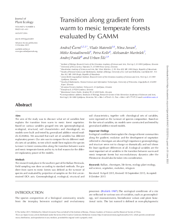
Figure 1: geographical location of the study area in the central part
of the Balkans: the Galičica mountain range.
We chose a study area of about 250 km2 in the central part
of the Balkan Peninsula: the Galičica mountain range, situated between Lake Ohrid (altitude of 695 m) and Lake Prespa
(850 m), with a highest point of 2255 m (Fig. 1). The mountain ridge extends in a south–north direction, so the influence of aspect is reduced. Slopes to the lakes are steep, while
the upper part is built as a karstic plateau. Since the bedrock
is limestone, higher biodiversity resulting from evolutionary and historical processes can be expected (Chytrý et al.
2003; Ewald 2003a). The climate is moderate continental,
with 780 mm of precipitation and an average temperature
of 11.2°C. The climate above an altitude of 1100 m can be
treated as cool continental, with 1067 mm of precipitation
Downloaded from https://academic.oup.com/jpe/article/9/4/421/2222523 by guest on 03 June 2022
groups of plant species sharing a similar function at an organismic level and having the same response to environmental
factors (Cornelissen et al. 2003; Kraft et al. 2015; Pignatti et al.
2005). At the same time, the importance of the species pool,
which reflects the evolutionary and historic angle, must also
be taken into consideration (Cubizolle et al. 2014). There
are two main phylogeographic patterns (Feliner 2014) that
influence the appearance of mesic and warm forests of the
region. The first is climatically driven north–south shifts by
which species responded to climatic oscillation during the
Pleistocene and afterwards. If the area is mountainous, latitudinal and altitudinal interactions should be included (Kropf
et al. 2008). The other determinant of the present vegetation
is the appearance of potential multiple refugia in the region
(Frajman et al. 2007; Kučera et al. 2010; Surina et al. 2011).
The research area lies in the transition zone between the
Mediterranean and Circumboreal floristic regions (Quézel
and Médail 2003) (Fig. 1). The influence of the Mediterranean
climate, i.e. mild rainy winters and hot dry summers, and of
the Continental one with cold, snowy winters and hot and
dry summers, can be recognized in the area. Contact between
two large groups of forests can be found, which forms zonal
vegetation in the area, as warm (dominated by Quercus sp.
div., Ostrya carpinifolia, Carpinus orientalis, Juniperus excelsa)
and mesic (dominated by Fagus sylvatica, Carpinus betulus, Acer
obtusatum) deciduous forests. Study of this contact is especially important in the light of the foreseen climatic changes,
which will induce further changes in the vegetation cover of
the region (Čarni and Matevski 2015; Ruiz-Labourdette et al.
2012).
We tried to evaluate relationships among geomorphological, ecological, structural, chorological and soil characteristics.
It would be possible to study the data by linear regression,
which is one of the most frequently used techniques for
developing prognostic models (Lang and Ewald 2014; Reger
et al. 2011; Wehn et al. 2014). Although this method is exceptionally accurate, it is practically impossible to develop models
by means of linear regression when the observed variables
Journal of Plant Ecology
�Čarni et al.
|
Warm and mesic forests
and an average temperature of 7.4°C. Summer droughts
appear in the lowlands but they are mitigated at higher altitudes, although winter frost is more severe at higher altitudes (Acevski 2001; Filipovski et al. 1994; Filipovski 1995;
Lazarevski 1993).
Vegetation sampling (relevés)
We measured the geomorphological variables in the field:
altitude in meters above sea level, aspect is direction of the
slope and is nominal variable, slope is a slope of terrain (in
percentage), bare rock is percentage bedrock on the surface not covered by soil or vegetation. Since aspect is not a
quantitative variable, we transformed aspect into angle to a
northern direction and the cosine function of this angle was
used in the analysis.
Ecological data
The second model (Model 2) was composed of ecological
variables. In order to evaluate other ecological factors (temperature, moisture, light, continentality, soil reaction and
nutrients), Pignatti indicator values (Pignatti et al. 2005) were
calculated using the JUICE program (Tichý 2002). We calculated them on basis of presence–absence data (unweighted).
They were determined for Italian flora but because historical and ecological similarity they can also be used for species on Balkan Peninsula (Bergmeier and Dimopoulos 2008;
Košir et al. 2008; Marinšek et al. 2013). Although some values
for some local species (e.g. Festuca galicicae, Abies borisii-regis)
are missing, this does not greatly influence the results (Ewald
2003b).
Turnover of species in forest communities along
the gradient
The DCA (Fig. 2) was performed in the CANOCO version
4.5 program with downweighting of rare species (ter Braak
and Šmilauer 2002). The eigenvalues of the first two axis are
0.693 and 0.476. We can detect along the first axis the gradient from mesic temperate forest to warm (thermophilous)
forests. On the other axis, the mesic temperate forests show
a rather unique groups, but we can detect the separation
between the warm (thermophilous) forest thriving on steep
slopes on relatively higher altitudes (Quercus pubescens and
Ostrya carpinifolia dominated) and lowland (Carpinus orientalis
and Juniperus excela dominated) warm (thermophilous) forests. The multivariate data of species composition is simplified
by using first (unconstrained) ordination axis as continuous
proxy of the gradient from mesic temperate forest to warm
(thermophilous) temperate forest; the scores of samples on
the first axis are therefore used as a proxy for species turnover
along the gradient.
Geomorphological data
The first model (Model 1) was composed of four geomorphological variables (altitude, aspect, slope and bare rock).
Figure 2: ordination diagram showing the result of DCA analysis of
communities. Eigenvalues of the first two axes are 0.693 and 0.476,
respectively.
Downloaded from https://academic.oup.com/jpe/article/9/4/421/2222523 by guest on 03 June 2022
Prior to field sampling, unsupervised classification of satellite
imaging of the area was performed (Aronof 2005; Halder et al.
2011). We thus obtained basic information about the diversity of forest vegetation, because we planned to sample all
forests types. The field sampling was done according to the
standard method for vegetation elaboration (Braun-Blanquet
1964) during two sequential years (2009 and 2010); sampling
plots with an area of 100 m2 were located in the centres of
larger polygons of forest communities obtained by satellite
image classification. In some cases, the satellite image classification produced single polygons dominated by several
forest types or the forests were cut during the recent period.
Those plots were neglected and we chose (homogenous) plots
dominated by single well developed forest type. We took up
to 10 samples, most often five, of each forest type determined
by classification of satellite images. On each sampling plot,
we made a floristic inventory of all presented plant species
and estimated their abundance and cover according to seven
grade scale according to Braun-Blanquet scale. Such samples
are termed relevés (Braun-Blanquet 1964). A total of 105
relevés were made. Relevés were stored in the TURBOVEG
database (Hennekens and Schaminée 2001). Raw data are
published in a book presenting the forest vegetation of the
region (Matevski et al. 2011).
423
�424
Structural and functional data
This model (Model 3) reflects the visual (number of species,
structural and functional) appearance of forests. Number
of species is the sum of species in each sampling plot (relevé). Structure is represented by percentage of cover of tree,
shrub, herb and moss layers and was visually estimated on
each sample plot. Functional data are represented by plant
traits (phanerophytes, nano-phanerophytes, chamaephytes,
hemicryptophytes, geophytes and therophytes) and derived
from species composition and reflect ecosystem functioning
(Campetella et al. 2011; Raunkiaer 1934).
Soil data
Chorotypes
We also determined the chorological spectrum of relevés
and integrated them into the fifth model (Model 5). Since
many classification schemes exist, we accepted the proposed
scheme of Pignatti (1982). This scheme is based on actual distribution of plants and was prepared for Italian flora. As this
scheme does not encompass the species distributed only in
the Balkan Peninsula, we added those species (Gajić 1980)
and named them Balkan species. Species were thus divided
into the following categories: endemic, steno-mediterranean,
euri-mediterranean, mediterranean-montane, eurasiatic,
atlantic, orophytes of south Europe, boreal, widely distributed and Balkan species. The species were divided into chorotypes according to various floras (Hegi 1946‒2003; Jordanov
1963‒1982; Josifović 1970‒1977; Diklić 1986; Micevski
1985‒2005; Strid and Tan 1997, 2002).
All variables
We have taken all variables used in all partial models and built
the last model (Model 6).
Statistical analysis and modelling techniques
Bivariate correlations between different predictor variables
were calculated by applying the Spearman rank-correlation
test in STATISTICA (StatSoft, inc. 2011). In order to avoid colinearity among the explanatory variables in the model, only
one of the highly correlated variables was selected (Alahuhta
et al. 2011; Paušič and Čarni 2013). The correlation coefficient
was set at ρ > |0.5| to consider the variables, except for the
more correlated ecological variables for which the coefficient
was set at ρ > |0.8|. Such a correlation coefficient was chosen
to include as many variables as possible in a model.
All sets of variables included a total of 30 of the potential 44
variables (Table1). In the geomorphological set, all four variables were included: altitude, aspect, bare rock and slope; in
the ecological set, four variables, temperature, continentality,
soil reaction and nutrient, were included and two, light and
moisture, were excluded; in the structural set, six variables
were included, chamaephytes, cover of moss layer, cover of
tree layer, nano-phanerophytes, number of species, phanerophytes and therophytes and four, cover of shrub layer,
cover of herb layer, geophytes and hemicriptophytes, were
excluded; in the soil set, seven variables, pH, organic matter,
C/N, clay, Mg, K and Na, were included and six, C, N, Ca, H,
silt and sand, were excluded; in the chorotype set, eight variables, atlantic, Balkan, boreal, Eurasian, mediterranean-montane, south European oreophytes, steno-mediterranean and
wide amplitude, were included and two, endemic and eurimediterranean, were excluded. Descriptive statistics were calculated for each variable included in the models (minimum,
maximum, mean and standard deviation) (Table 1).
The variables were selected using stepwise regression,
which is a combination of backward elimination, whereby
explanatory variables are removed from the model, and forward selection, whereby explanatory variables are added to
the model. The stepwise regression stops when maximized
residual deviance is achieved and new variables do not contribute to the residual deviance (Alahuhta et al. 2011; Faraway
2005).
Analysis of each individual variable included in a specific
model was carried out. We observed the response of variables
in a model (linear–non-linear) and the logic of each variable’s
response with regard to the relative measured frequency of
the independent variable (AX1).
While there is no universal measure of model performance,
the use of multiple measurements is common and more
objective (Aertsen et al. 2010; Dawson et al. 2007). One of
the most powerful approaches for model selection (Burnham
and Anderson 2002) is Akaike’s information criterion (AIC;
Akaike 1973). The model with the lowest AIC best explains
the data (Jiménez-Alfaro et al. 2014b). The Bayesian information criterion (BIC) is a similar measure, which was also
tested. Another criterion of model performance that was
used is the adjusted coefficient of determination (adjusted
R2; adj R2). It is a modification of R2 (Pearson 1896), which
also adjusts for the number of explanatory terms used in a
model. Unlike R2, adjusted R2 increases only if the new term
improves the model more than would be expected by chance.
Adjusted R2 can be negative and will always be less than or
equal to R2 (Aertsen et al. 2010).
All six models were validated using the percentage of
explained deviance (D2; Alahuhta et al. 2011). For the occurrence data, evaluation was also based on the area under
Downloaded from https://academic.oup.com/jpe/article/9/4/421/2222523 by guest on 03 June 2022
Since the ecological set of variables is derived from species
composition, we distinguished them from soil samples that
were measured in the field. The fourth model (Model 4) was
composed of soil samples collected at each sample plot at a
depth from 0 to 10 cm to give additional information about
the soil characteristics. The samples were treated in accordance with ISO 11464 and the following parameters were
measured pH (CaCl2) (ISO 10390), organic carbon was determined in accordance with the Walkley–Black method (ISO
14235); total nitrogen (N) content according to modified
Kjeldhal method (ISO 11261); exchangeable basic cations
(Ca2+, Mg2+, K+, Na+) were analyzed using atomic absorption
spectrophotometry.
Journal of Plant Ecology
�Linear R2
F
P value
0.627
119.5
<2e−16***
0.6198
Model 1
Non-linear
0.28
18.23
4.9e−8***
0.28
Model 1
Decrease
0.0156
2676
0.105
0.01364
21.73
Increase
0.16
11.09
0.00162**
0.1596
Model 1
6.14
0.72
Increase
0.0156
2,679
0.105
0.9003
Model 2
4.97
0.29
Non-linear
0.69
101.6
<2e−16***
0.668
Model 2
5.06
4.2
0.57
Non-linear
0.103
7683
0.00116**
0.0724
Model 2
4.42
6.44
4.42
0.94
Non-linear
0.758
124.9
<2e−16***
0.7398
Model 2
Value
10
64
36.49
12.37
Non-linear
0.281
41.98
3.22e−9**
0.2806
Model 3
%
0
95
63.43
25.96
Non-linear
0.299
45.74
8.36e−10***
0.2987
Model 3
Moss_layer
%
1
80
14.86
15.47
Non-linear
0.223
59.9
0.000722***
0.2229
Chamaephytes
Cham
%
1.64
21.95
8.14
4.58
Increase
Nano-Phanerophytes
N_Phan
%
1.56
20
6.11
4.11
Non-linear
Phanerophytes
Phan
%
8.7
69.57
33.41
11.2
Therophytes
Thero
%
1.79
46.15
9.58
9.84
pH
pH
Value
4.6
8
6.17
Organic matter
Org_mat
%
1.5
62.7
18.81
C/N
CN
%
1.3
25.9
Clay
Clay
%
4.3
57.3
Mg
Mg_per
%
0.3
K
K_per
%
Na
Na_per
Stenomediterranean
Mediterraneanmontane
Variable
Abbreviation
Unit
Minimum
Maximum
Mean
SD
Trend
Altitude
Altit
Meter
719
1810
1197.65
280.43
Non-linear
Aspect
Asp
Cos
−1
1
0.16
0.67
Slope
Slope
Degrees
2
43
18.95
11.71
Bare rock
Bare_rock
%
1
80
24.43
Temperature
Temp
Value
4.65
7.59
Continentality
Cont
Value
4.3
5.67
Soil reaction
SoilR
Value
2.82
Nutrient
Nutr
value
Number of species
NoSpe
Tree layer
Tree_layer
Cover moss layer
GAMM R2
Model selection
Geomorphology
Čarni et al.
Table 1: descriptive statistics of the variables included in the model selection
|
Warm and mesic forests
Ecology
Structure
0.0385
4657
0.0336*
−0.0105
0.192
0.663
0.03851
Model 3
Increase
0.0562
7268
0.0082**
0.05624
Model 3
Increase
0.194
18.35
5076e−5***
0.194
Model 3
0.74
Increase
0.268
11.61
6.53e−7***
0.1903
Model 4
12.22
Non-linear
0.043
1,916
0.151
−0.00979
14.1
3.6
Decrease
−0.00978
0.002
0.962
−0.00978
29.84
10.25
Increase
−0.00895
0.123
0.726
−0.00895
Model 4
34.1
5.51
4.39
Increase
0.0712
8,988
0.00341**
0.07124
Model 4
0.6
3.5
1.7
0.66
Non-linear
0.32
15.77
1.64e−8***
0.2199
Model 4
%
17
72
48.02
10.07
Non-linear
0.758
124.9
<2e−16***
0.010162
Model 4
SM
%
1.79
22.73
6.38
3.91
Non-linear
0.116
12.12
0.000799***
ME.MO
%
1.56
17.07
5.45
3.23
Decrease
0.0348
0.695
0.475
Eurasian
EURIAS
%
23.53
88.24
53.23
13.07
Decrease
0.298
45.56
Atlantic
ATLANT
%
1.56
6.67
2.83
1.07
Non-linear
0.0564
2599
South European
orophytes
ORO.S.EU
%
1.75
20
6.01
4.28
Non-linear
0.477
Boreal
BORE
%
1.64
26.67
9.36
4.65
Decrease
Wide amplitude
AMP
%
0
12.5
2.51
2.81
Non-linear
Balkan
BALK
%
1.85
30.77
5.91
5.7
Non-linear
−0.0105
Soil
Chorotypes
0.1155
Model 5
−0.01058
Model 5
8.92e−10***
0.2979
Model 5
0.12
0.05641
Model 5
61.29
6.46e−11***
0.4773
Model 5
0.133
16.26
0.00011***
0.1355
Model 5
0.0835
6578
0.0129*
0.08352
Model 5
0.262
7569
0.00607**
0.2357
Model 5
425
The trends of attributes were deduced from the scatterplots (see supplementary Appendix 1, for examples Fig. 4 in the text). Significance codes: ‘***’P < 0.001; ‘**’P < 0.01; ‘*’P < 0.05.
Downloaded from https://academic.oup.com/jpe/article/9/4/421/2222523 by guest on 03 June 2022
�426
rEsults
Considering floristic composition, the DCA diagram (Fig. 2)
shows the arrangement of the relevés in two-dimensional
space, along two most significant axis. Along the first axis
(AX1), a clear zonation of forests from the submediterranean
influenced warm temperate group dominated by Juniperus
excelsa, on the one hand, through more continental warm
temperate forests dominated by various Quercus species and
oriental hornbeam (Carpinus orientalis), to mesic temperate forests dominated by beech (Fagus sylvatica), hornbeam
(Carpinus betulus) and ravine forests on the other. This allows
the scores of samples on the first axis to be considered as a
proxy for a transitional gradient from warm to mesic temperate forests.
As variables present several complex phenomena, we
grouped them into five sets of variables (i.e. geomorphology, ecology, structure, soil, chorotypes) and, after excluding
highly correlated variables in each set, six models were built.
The details are presented in Tables 1 and 2, Fig. 3 and supplementary Appendix 1.
The first model (Model 1 – Geomorphology) comprises
geomorphological properties. The second model (Model 2 –
Ecology) comprises average ecological indicator values. The
third model (Model 3 – Structure) encompasses the structural
and functional characteristics. The fourth model (Model 4 –
Soil) comprises soil properties, while the fifth model (Model
5 – Chorotypes) encompasses the origin of species found on
sample plots. At last, we joined all variables into one model
(Model 6 – All variables) (Table 1).
The various explanatory powers for each model were
obtained through the inclusion and exclusion of individual
variables from each model (supplementary Appendix 2). In
each model, we therefore decided on the combination of variables that gives the best results. The selected variables and the
models’ explanatory power are presented in Table 2.
As seen in Table 2, models differ considerably with regard
to their explanatory power. Model 6 (Pearson’s correlation
coefficient is 0.99), in which all variables were used, has the
highest predictive power. Predicted AX1 values in this model
best fit the actual AX1 data (Fig. 4). This model also has the
highest percentage of explained deviance (D2) (Table 2). The
next highest explanatory power has Model 2 (0.98) in which
ecologycal data were used. Model 5 (0.94), in which chorotypes were used, and Model 1 (0.89), with geomorphology
data, come close to Model 2 (Table 2). Model 3 (0.85), which
comprises structure and function, and Model 4 (0.77) based
on soil parameters have the poorest explanatory power and
are therefore the least accurate explanatory model for the
evaluation of AX1.
Estimation of the models’ adequacy (their explanatory
power) is fairly abstract information, calculated with selected
measured statistical coefficients that (each in turn) describe
the power of an individual model. Therefore, there is often
a dilemma as to whether the result is truly satisfactory. In
order to provide a more illustrative presentation of the models’ explanatory power, a scatter diagram was created. The
original input data were entered into each of the six models,
presented on the x axis of the diagram and the result of prediction of each model is presented on the y axis. For the sake
of clarity, only the trend of the input function was preserved
for each model, while the values for relevés were excluded
(Fig. 4).
DIsCussIoN
The ordination diagram (Fig. 2) shows on the first axis a clear
distinction between warm and mesic temperate forest. Many
tree species can be found as dominants within warm temperate forests, such as various Quercus species: Quercus cerris,
Q. frainetto, Q. petraea, Q. pubescens and Q. trojana, as well as
Ostrya carpinifolia and Carpinus orientalis. Juniperus excelsa can
also be added to this group. This area is the richest region in
tree species in Europe (Adams 2009). The second DCA axis
reflects higher diversity of warm temperate forest then mesic
ones. Besides the climate the reason is that there is one of
the main Pleistocene refugial areas of warm (thermophilous)
forest vegetation in Europe (Médail and Diadema 2009; Petit
et al. 2002, 2008). Here, we can find origin of many thermophilous species and species that could potentially shift to the
north under foreseen climate change (Čarni and Matevski
2015).
The mesic temperate forests are mainly dominated
by Fagus sylvatica, occasionally co-dominated by Abies
borisii-regis. The main refugial area of beech forest during
Downloaded from https://academic.oup.com/jpe/article/9/4/421/2222523 by guest on 03 June 2022
the curve (AUC) in receiver operating characteristic (ROC)
plots. Model accuracy based on AUC was calculated with
the R package pROC. (Alahuhta et al. 2011; Swets 1988).
Additionally, visual validation of the response curves and
spatial predictions were conducted according to standard procedure (Lehmann et al. 2002; Saatkamp et al. 2010;
Tamstorf et al. 2007) (Fig. 4).
The explanatory power of the models was tested with the
input of the dependent variables that explain AX1. The command predict in the vegan package (Oksanen et al. 2013) in R
package was used. Real data for variables were entered into
the models. The result was the AX1 values calculated by each
of the six models.
Pearson’s correlation coefficient (r) was used to compare
the accuracy of the models. The correlations between the
real and the calculated AX1 were assessed in STATISTICA.
Pearson’s correlation coefficient is represented in the same
way as a correlation coefficient used in linear regression,
ranging from −1 to +1. A value of +1 is the result of a perfect
positive relationship between two or more variables (Nie et al.
2011).
The explanatory power of an individual model was presented in a scatter diagram that incorporated real data of AX1
and the results calculated by the models (Fig. 4).
Journal of Plant Ecology
�Čarni et al.
|
Warm and mesic forests
427
Table 2: generalized additive mixed models (GAMMs) describing differences in predictions for AX1 through different explanatory
variables
Model and terms
Estimate
F value
t value
P value
Model 1: Geomorphology
Bare_rock
0.020234
5.988
199.319
<2e−16***
s(Asp)
7.163
0.00215**
Model 2: Ecology
1.11857
14.448
9.841
s(SoilR)
5.349
s(Nutr)
66.017
r
221.6461
240.1569
0.766
100
78.8
0.89
0.952
100
95.9
0.98
0.022759*
0.0103*
Phan
0.012321
1.525
0.1304
Thero
0.059414
6.226
1.21e−08***
s(NoSpe)
24.85
6.89e−11***
s(Tree_layer)
45.97
5.48e−10***
Model 4: Soil
0.587198
3.960
−0.003517
−0.374
0.060097
2.642
20.135
s(Na_per)
5.119
100
73
0.85
290.42
313.8665
0.546
100
58.8
0.77
209.052
248.8614
0.84
100
87.9
0.94
58.748
143.3686
0.967
100
98.2
0.99
0.709157
0.009704**
4.94e−09***
−0.043831
−2.507
EURIAS
−0.084074
−16.641
BORE
−0.087124
−7.106
8.203
0.0139*
<2e−16***
2.57e−10***
0.00516**
4.314
0.01015*
s(ORO.S.EU)
29.375
1.14e−12***
s(AMP)
10.252
0.00186**
s(BALK)
27.247
9.92e−12***
Model 6: All variables
0.0053958
0.685
0.0059**
ME.MO
s(ATLANT)
283.4433
0.000148***
Model 5: Chorotypes
s(SM)
259.5577
2.276
0.025440*
1.99e−09***
Temp
0.8157872
6.738
Cham
−0.0020391
−0.250
0.803125
Phan
−0.0020771
−0.701
0.485578
Thero
0.0140625
3.468
0.000834***
CN
0.0001518
0.019
0.984933
ME.MO
0.0013124
0.126
0.899678
EURIAS
−0.0040922
−1.038
0.302346
s(Altit)
12.380
0.000703***
s(Cont)
14.211
0.000299***
s(SoilR)
0.268
s(Nutr)
13.408
0.605857
0.000433***
s(NoSpe)
4.506
0.036700*
s(Tree_layer)
0.546
0.461877
s(Moss_layer)
5.948
0.002965**
Downloaded from https://academic.oup.com/jpe/article/9/4/421/2222523 by guest on 03 June 2022
2.616
s(K_per)
85.86176
2.94e−13***
0.042584
Bare_rock
D2 (%)
<2e−16***
Cham
Mg_per
AUC (%)
0.000107***
Model 3: Structure
Clay
Adj R2
61.97611
s(Cont)
pH
BIC
3.4e−08***
s(Altit)
Temp
AIC
�428
Journal of Plant Ecology
Table 2: Continued
Model and terms
Estimate
F value
t value
P value
s(N_Phan)
8.416
0.004737**
s(Org_mat)
2.090
0.152015
s(SM)
6.700
0.011347*
s(ORO.S.EU)
5.061
AIC
BIC
Adj R2
AUC (%)
D2 (%)
r
Non-bracketed predictors were fitted as typical parametric terms; s(…) denotes predictors fitted as non-parametric smoothing terms. GAMMs
use F values to test the significance of non-parametric smoothing terms, while t values are used for parametric terms. Differences in explanatory
power based on calculated Akaike’s information criterion (AIC), Bayesian information criterion (BIC), adjusted coefficient of determination (adj
R2), area under the curve (AUC) of a receiver operating characteristic plot (ROC), percentage of explained deviance (D2) and Pearson’s correlation coefficient (r). ‘***’P < 0.001; ‘**’P < 0.01; ‘*’P < 0.05.
Downloaded from https://academic.oup.com/jpe/article/9/4/421/2222523 by guest on 03 June 2022
Figure 3: example of linear or non-linear response curves between explanatory variable and AX1. The most significant predictors in each
model are presented. Around the smooth terms, their 95% confidence intervals are shown. Each short bar on the x axis indicates the distribution of a sample site along that variable.
Pleistocene was in the north-western Balkan and the refugia in the southern Europe did not contribute to the population of the continent (Brus 2010; Magri et al. 2006). We
consider that Carpinus betulus dominated forests found in
humid valleys and Acer obtusatum and Corylus colurna dominated forests in ravines also belong to this group (Košir et al.
2008, 2013).
The first model is based on a geomorphological set of variables (Tables 1 and 2, Fig. 3, supplementary Appendix 1). It can
be seen that mesic forests can be found at higher elevations, on
steeper slopes and there is a lower proportion of bedrock on
the surface. Mesic temperate forests appear at altitude of 1100
m (Matevski et al. 2011), but they can appear at lower altitudes
in a special geomorphological conditions, as ravines and valleys
�Čarni et al.
|
Warm and mesic forests
and this lower the explanatory power of the model. Since no
precise digital elevation model exists, we used slope and aspect
as such, not considering other geomorphological features
(Jiménez-Alfaro et al. 2014a; Dirnboeck et al. 2003). The second
model comprises ecological variables (Tables 1 and 2; Fig. 3 and
supplementary Appendix 1). It is evident that temperatures are
higher in the lowlands and there is more nutrient in the soil due
to quicker decomposition. A certain caution is needed with this
model, since indicator values are calculated on the basis of species composition and often show too high correlation with the
data (Zelený and Schaffers 2012). The third model is based on
structural and functional characteristics (Tables 1 and 2, Fig. 3,
supplementary Appendix 1). Higher structural and functional
diversity in the lowlands can be observed: more species, trees,
scrubs, more chamaephytes and therophytes. The canopy is
closer at higher altitudes in mesic forest. Higher structural and
functional diversity of lowland warm temperate forest is also
due to the higher human impact (cutting, grazing etc.) that
lasted in the area since centuries (Matevski et al. 2008). Their
explanatory power is high but below that of the models Ecology
and Chorotypes (Pellisser et al. 2010). The fourth model was
built on the basis of the content of K, pH, C/N, sand, Mg and
clay (Tables 1 and 2, Fig. 3, supplementary Appendix 1). Only
pH shows a positive linear correlation with AX1. pH is lower
at high altitudes, since decomposition is slower and processes
of acidifications due to higher precipitation are more intense;
bedrock does not therefore have such an influence as in lowlands, where decomposition is much faster (Filipovski 1995;
Zilioli et al. 2011). The fifth model was based on Chorotypes
(Tables 1 and 2, Fig. 3, supplementary Appendix 1). The results
are in line with the previous models and show that more species originating from the north (Eurasian and boreal species),
as well as South European oreophytes can be found in mesic
temperate forests (Čarni et al. 2009; Marinšek et al. 2013). The
sixth model comprises all variables. As expected this model has
the best explanatory power. The best model comprises some
variables of all five models that show that all variables contribute to the diversity of vegetation.
Comparison of the six models (Fig. 4) shows that the most
important factor is ecological conditions. The reason for the high
explanatory power of this set of variables has already been discussed (Zelený and Schaffers 2012). Because the development
of vegetation since the Pleistocene is one of the main factors
that determines the actual vegetation of the Earth (RivasMartínez et al. 2011), the high explanatory power of chorotypes, representing the origin and development of flora and
vegetation, was expected. However, it is surprisingly high in
comparison to the model Structure, a combination of structural
and functional characteristics. The latter are based on life and
growth forms, which are among the most well-known plant
traits associated with ecosystem functions and revealing plant
strategies related to both biotic and abiotic factors (Wellstein
et al. 2013). But at the same time, we should also consider the
origin of flora and evolution during and after Pleistocene (see
further). On the other side, the reason might be also the relatively limited research area, with unique environmental conditions and fairly diverse origin of the flora and vegetation. The
low explanatory value of soil characteristics is to be expected,
because this set of variables seems to be the most conservative
among all sets (Paušič and Čarni 2013).
In addition to the origin of flora and the past development
of vegetation, horotypes reflect the evolutionary aspect. For
instance, Fagus sylvatica, one of the dominant species of mesic
forests, once treated as Fagus moesica (Czeczott 1933), shows a
certain degree of genetic peculiarity (Brus 2010). Research of
this kind of variability is hard to detect and there are hardly any
paper dealing with evolution on ecological scale in the region.
But we can find some evidences on phenotypic diversification.
For instance, European souslik (Spermophilus citellus) a common
animal species of the lowlands of Eastern Europe, appears in
a phenetically well-differentiated population in high altitudes
in the central part of the Balkan Peninsula and may be a relict
of the late Pleistocene, when expanding forests restricted it to
a few high mountain pastures, where it diverged allopatically
(Kryštrufek 1996). We can also detect a diversification within
the lineage of Cistus reflected in plant traits due to adaptive
radiation (Čarni et al. 2010; Guzmán et al. 2009; Onstein et al.
2014). During last years have appeared an increasing number of research papers about rapid evolutionary response to
Downloaded from https://academic.oup.com/jpe/article/9/4/421/2222523 by guest on 03 June 2022
Figure 4: comparison of accuracy of the models (their explanatory
power) for AX1. The thick full line represents the function for real
data, to which we added result functions for each individual model.
The chart clearly indicates the models’ explanatory power, presented
in the diagram with a function incline (k) with the formula y = k(x) + n.
429
�430
that remained within the region during the Pleistocene (Petit
et al. 2008; Rull 2010). These refugia are often too localized
or too small to be detected by pollen analysis or other conventional paleoecological techniques (Birks and Willis 2008).
The high diversity of chorotypes suggests that macorefugia for
warm temperate forests and also cryptic refugia of mesic temperate forests existed in the region. The macrorefugia were more
species rich but cryptic refugia also had their floristic individuality (Birks and Willis 2008). Both are reflected in the present
vegetation of the region. In the rather small region and under
stable and fairly uniform ecological conditions, chorotypes better explain the transition between warm and mesic temperate
forests than the model based on structure and function.
CoNClusIoN
The research took place in the Balkan Mountains where the
Pleistocene climatic oscillations were not so pronounced as in
other parts of the Europe. The results show that the model
based on all variables has the best explanatory power and it is
followed by models based on groups of variables, as: ecology,
chorotypes, geomorphology, structure and function and soil
properties. The relatively high explanatory power of chorotypes supports the idea about eco-evolutionary dynamics on
short ecological time-scale. In the future the results should be
tested also in regions with major climatic dynamics.
suPPlEmENtarY matErIal
Supplementary material is available at Journal of Plant Ecology
online.
FuNDINg
National Park Galičica, Research Centre of the Slovenian
Academy of Sciences and Arts, Slovenian Research Agency
(P1-0236).
aCKNoWlEDgEmENts
For help during the field work, we are grateful to director Zoran
Angeloski and the staff of the Public Institution Galičica National
Park and Til Dieterich (GFA Consulting Group), who provided us
with logistical support during the field work. The soil analyses were
performed by the Pedological Laboratory at the Biotechnical Faculty,
University of Ljubljana. We are grateful to Andrej Blejec for useful advice and comments during statistical elaboration of the data.
Thanks to Iztok Sajko for prepering the figures for printing. We also
thank two anonymous reviewers for their useful comments and
suggestions.
Conflict of interest statement. None declared.
rEFErENCEs
Acevski J (2001) Dendroflorata na planinata Galičica. Doktorska disertacija: Šumarski fakultet.
Downloaded from https://academic.oup.com/jpe/article/9/4/421/2222523 by guest on 03 June 2022
environmental change (Broennimann et al. 2007; Buswell et al.
2011). We can thus hypothesise the possibility of the beginning
of allopatric speciation in the Balkans, although further genetic
analysis should be done to confirm such an assumption.
In the past, relationship between evolutionary and ecological processes were decoupling, since the evolutionary processes
were understood as acting on a much longer scale that ecological ones shaping communities and vegetation. But in last
decades a growing realization emerged that evolution occurs
on ecological time scales and this should be accounted for
ecological research (Carroll et al. 2007; Eriksson 2013, 2014;
Qian and Jiang 2014). Changing of climate after Pleistocene
with new ecological circumstances could provoke an ecological
niche shift of species or even additional evolutionary response
affecting the fundamental niche (Eriksson 2013; Pearman et al.
2008). In this regard also, the species and trait distribution cannot be considered as constant but as dynamic and changing
with regard to their niche relationships (Pearman et al. 2008).
If we compare mesic temperate forest in the broader region
of southeast-Europe, we can find much larger differences in
their structural characteristics evaluated by traits then in their
floristic composition (Marinšek et al. 2013; Tzonev et al. 2006).
In this way, the species in the region might adapt to the new
ecological circumstances, maintaining their origin, but had
changed their niche and also traits consequently.
The development of vegetation since the Pleistocene is
crucial in the establishment of the region’s species pool that
builds the todays vegetation (Zelený 2009). The main refugia
of beech forests can be found in the north-western Balkans
(Magri et al. 2006; Médail and Diadema 2009; Marinšek et al.
2013; Willner et al. 2009), in the region beyond study area.
On the other hand, refugia of warm temperate forests can
be found in southern parts of the Balkans (Petit et al. 2002).
It seems that drought resistant species survived in southEuropean glacial refugia, whereas more mesophilous ones
disappeared (Michelot et al. 2012; Svenning 2003). Petit et al.
(2005) suggest that most tree species of mesic temperate
Euro-Asian flora survived in the north of the Mediterranean
region (higher than 45° latitude). In our case this would mean
north-western outcrops of the Dinaric Alps (Brus 2010).
Such anticipating is supported also by floristic analysis of
mesophilous beech forests of the whole Balkan Peninsula.
The flora of beech forests in the north-western Balkans is
much richer than in the central and southern Balkans. At
the same time, both groups have their own diagnostic species
(Marinšek et al. 2013). As the floristic inventory of individual
sample plots (relevés) in higher in warm temperate forests,
where more than 41 plant species on average can be found
on a single plot, whereas only 25 can be found in mesic temperate forests (supplementary Appendix 1). All these facts
allow us to look for the cradle of warm temperate forest in
the region (Petit et al. 2002).
However, the high endemism in the region, especially of
mesic temperate forests, and also genetic variability can be
explained only by cryptic refugia of mesophilous vegetation
Journal of Plant Ecology
�Čarni et al.
|
Warm and mesic forests
431
Adams J (2009) Species Richness. Patterns in Diversity of Life. Chichester,
UK: Praxis publishing.
Aertsen W, Kint V, van Orshoven J, et al. (2010) Comparison and
ranking of different modelling techniques for prediction of site
index in Mediterranean mountain forests. Ecol Model 221:1119–30.
Akaike H (1973) Information theory and an extension of the maximum likelihood principle. In Petran BN, Csari F (eds). International
Symposium on Information Theory, 2nd edn. Budapest: Akademiai
Kiado.
Alahuhta J, Heino J, Luoto M (2011) Climate change and the future
distributions of aquatic macrophytes across boreal catchments. J
Biogeogr 38:383–93.
Cubizolle H, Argant J, Fassion F, et al. (2014) Vegetation history
from the end of the late-glacial and human impact from the midHolocene in the Eastern Massif Central (France). Quaternaire
25:209–36.
Czeczott H (1933) A study on the variability of the leaves of beeches:
F. orientalis Lipsky, F. sylvatica L. and intermediate forms. Part I.
Rocznik Dendrologiczny 5:45–121.
Danz NP, Frelich LE, Reich PB, et al. (2013) Do vegetation boundaries
display smooth or abrupt spatial transitions along environmental
gradients? Evidence from the prairie-forest biome boundary of historic Minnesota, USA. J Veg Sci 24:1129–40.
Aronof S (2005) Remote Sensing for GIS Managers. New York, NY: ESRI
Press.
Diklić N (1986) Flora SR Srbije, Vol. X. Beograd: Srpska akademija
nauka i umetnosti.
Bergmeier E, Dimopoulos P (2008) Identifying plant communities of
thermophilous deciduous forest in Greece: species composition,
distribution, ecology and syntaxonomy. Plant Biosyst 142:228–54.
Dirnboeck T, Dullinger S, Gottfried M, et al. (2003) Mapping alpine
vegetation based on image analysis, topographic variables and
Canonical Correspondence Analysis. Appl Veg Sci 6:85–96.
Birks HJB, Willis KJ (2008) Alpines, trees, and refugia in Europe.
Plant Ecol Divers 1:147–60.
Ewald J (2003a) The calcareous riddle: why are there so many calciphilous species in the Central European flora? Folia Geobotanica
38:357–66.
Braun-Blanquet J (1964) Pflanzensoziologie.
Vegetationskunde. Wien: Springer.
Grundzüge
der
Broennimann O, Treier UA, Müller-Schärer H, et al. (2007) Evidence of
climatic niche shift during biological invasion. Ecology Lett 10:701–9.
Brus R (2010) Growing evidence for the existence of glacial refugia of
European beech (Fagus sylvatica L.) in the south-eastern Alps and
north-western Dinaric Alps. Periodicum Biologorum 112:239–46.
Buswell JM, Moles AT, Hartley S (2011) Is rapid evolution common
in introduced plant species? J Ecol 99:214–24.
Burnham KP, Anderson DR (2002) Model Selection and Multimodel
Inference: A Practical Information-Theoretic Approach. Vienna: Springer.
Campetella G, Botta-Dukát Z, Wellstein C, et al. (2011) Patterns of
plant trait–environment relationships along a forest succession
chronosequence. Agric Ecosyst Environ 145:38–48.
Caprio E, Ellena I, Rolando A (2009) Assessing habitat/landscape predictors of bird diversity in managed deciduous forests: a seasonal
and guild-based approach. Biodivers Conserv 18:1287–303.
Carroll SP, Hendry AP, Reznick DN, et al. (2007) Evolution on ecological time‐scales. Funct Ecol 21:387–93.
Čarni A, Matevski V, Šilc U (2010) Morphological, chorological and
ecological plasticity of Cistus incanus in the southern Balkans. Plant
Biosyst 144:602–17.
Čarni A, Košir P, Karadžić B, et al. (2009) Thermophilous deciduous
forests in southeastern Europe. Plant Biosyst 143:1–13.
Čarni A, Matevski V (2015) Impact of climate change on mountain
flora and vegetation in the Republic of Macedonia (Central part of
the Balkan Peninsula). In Ozturk M, Hakeem KR, Faridah-Hanum
I, Efe R (eds). Climate Change Impacts on High-Altitude Ecosystems.
Heidelberg: Springer, 189–214.
Chytrý M, Tichý L, Roleček J (2003) Local and regional patterns of
species richness in Central European vegetation types along the
pH/calcium gradient. Folia Geobotanica 38:429–42.
Cornelissen JHC, Lavorel S, Garnier E, et al. (2003) A handbook of
protocols for standardised and easy measurement of plant functional traits worldwide. Aust J Bot 51:335–80.
Ewald J (2003b) The sensivity of Ellenberg indicator values to the
completeness of vegetation relevés. Basic Appl Ecol 4:507–13.
Eriksson O (2013) Species pools in cultural landscapes–niche construction, ecological opportunity and niche shifts. Ecography
36:403–13.
Eriksson O (2014) Vegetation change and eco-evolutionary dinamics.
J Veg Sci 25:1141–7.
Faraway JJ (2005) Linear Models with R. Boca Raton, FL: Chapman &
Hall/CRC.
Feliner GF (2011) Southern European glacial refugia: a tale of tales.
Taxon 60:365–72.
Feliner GN (2014) Patterns and processes in plant phylogeography
in the Mediterranean Basin. A review. Persp Plant Ecol Evol Syst
16:265–78.
Filipovski G (1995) Počvite na Republika Makedonija. Skopje: MANU.
Filipovski G, Rizovski P, Ristevski P (1994) Karakteristiki na klimatskovegetacisko-počvenite zoni (regioni) vo Republika Makedonija. Skopje:
MANU.
Frajman B, Oxelman B (2007) Reticulate phylogenetics and phytogeographical structure of Heliosperma (Sileneae, Caryophyllaceae)
inferred from chloroplast and nuclear DNA sequences. Mol
Phylogenet Evol 43:140–55.
Gajić M (1980) Pregled vrsta flore SR Srbije sa biljnogeografskim
oznakama. Glasnik Šumarskog fakulteta, Beograd A 54:111–41.
Guzmán B, Lledó MD, Vargas P (2009) Adaptive radiation in mediterranean Cistus (Cistaceae). PLOS ONE 4:e6362.
Halder A, Ghosh A, Ghosh S (2011) Supervised and unsupervised
landuse map generation from remotely sensed images using ant
based systems. Appl Soft Comput 11:5770–81.
Haslem A, Kelly LT, Nimmo DG, et al. (2011) Habitat or fuel?
Implications of long-term, post-fire dynamics for the development
of key resources for fauna and fire. J Appl Ecol 48:247–56.
Hegi G (1946–2003) Illustrierte Flora von Mitteleuropa, Vol. I–VI. Berlin:
Paul Parey Verlag.
Downloaded from https://academic.oup.com/jpe/article/9/4/421/2222523 by guest on 03 June 2022
Armas C, Rodríguez-Echeverría S, Pugnaire FI (2011) A field test of the
stress-gradient hypothesis along an aridity gradient. J Veg Sci 22:1–10.
Dawson CW, Abrahart RJ, See LM (2007) Hydrotest: a web-based
toolbox of evaluation metrics for the standardised assessment of
hydrological forecasts. Environ Model Softw 22:1034–52.
�432
Journal of Plant Ecology
Hennekens SM, Schaminée JHJ (2001) TURBOVEG, a comprehensive database management systeme for vegetation data. J Veg Sci
12:589–91.
Matevski V, Čarni A, Avramoski O, et al. (2011) Forest Vegetation of the
Galičica Mountain Range in Macedonia. Ljubljana: ZRC-Publishing &
JU Nacionalen park Galičica.
ISO 10390 (1996) Soil quality – Determination of pH:5.
Médail F, Diadema K (2009) Glacial refugia influence plant diversity
pattern in the Mediterranean basin. J Biogeogr 36:1333–45.
ISO 11261 (1996) Soil quality – Determination of total nitrogen –
Modified Kjeldahlmethod:4.
ISO 11464 (1996) Soil quality – Pretreatment of samples for physicochemical analyses:9.
ISO 14235 (1999) Soil quality – Determination of organic carbon by
sulphocromic oxidation:5.
Jiménez-Alfaro B, Marceno C, Bueno A, et al. (2014a) Biogeographic
deconstruction of alpine plant communities along altitudinal and
topographic gradient. J Veg Sci 25:160–71.
Jordanov D (1963–1982) Flora na Narodna Republika Bulgarija, Vol.
I–VIII. Sofia: Bulgarskata akademija na naukite.
Josifović M (1970–1977) Flora SR Srbije, Vol. I–IX. Beograd: Srpska
akademija nauka i umetnosti.
Košir P, Čarni A, Di Pietro R (2008) Classification and phytogeographical differentiation of broad-leaved ravine forests in southeastern
Europe. J Veg Sci 19:331–42.
Michelot A, Bréda N, Damesin C, et al. (2012) Differing growth
responses to climatic variations and soil water deficiency of Fagus
sylvatica, Quercus petraea and Pinus sylvestris in a temperate forests.
For Ecol Manag 265:161–71.
Nie L, Chen Y, Chu H (2011) Asymptotic variances of maximum likelihood estimator for the correlation coefficient from a BVN distribution with one variable subject to censoring. J Stat Plan Infer
141:392–401.
Oksanen J, Kindt R, Legendre P, et al. (2013) Vegan-package. http://
cran.r-project.org, http://vegan.r-forge.r-project.org/ (27 March
2015, date last accessed).
Onstein RE, Carter RJ, Xing Y, et al. (2014) Diversification rate shifts
in the Cape Floristic Region: the right traits in the right place at the
right time. Persp Plant Ecol Evol Syst 16:331–40.
Pearman PB, Guisan A, Broennimann O, et al. (2008) Niche dynamics
in space and time. Trends Ecol Evol 23:149–58.
Košir P, Cassavechia S, Čarni A, et al. (2013) Ecological and phytogeographical differentiation of oak-hornbeam forests in southeastern
Europe. Plant Biosyst 147:84–98.
Pearson K (1896) Mathematical contributions to the theory of evolution. III. Regresion, heredity and panmixia. Philos Trans Roy Soc
Lond 187:253–318.
Kraft N J, Godoy O, Levine J M (2015) Plant functional traits and the
multidimensional nature of species coexistence. Proc Natl Acad Sci
USA 112:797–802.
Pellisser L, Fournier B, Guisan A (2010) Plant traits co-vary with
altitude in grasslands and forests in the European Alps. Plant Ecol
211:351–65.
Kropf M, Comes HP, Kadereit JW (2008) Causes of the genetic architecture of south-west European high mountain disjuncts. Plant
Ecol Divers 1:217–28.
Petit RJ, Brewer S, Bordács S, et al. (2002) Identification of refugia
and post-glacial colonisation routes of European white oaks based
on chloroplast DNA and fossil pollen evidence. For Ecol Manag
156:49–74.
Kryštrufek B (1996) Phenetic variation in the European souslik,
Spermophilus citellus (Mammalia: Rodentia). Bonner Zoologische
Beiträge 46:93–109.
Kučera J, Marhold K, Lihová J (2010) Cardamine maritima group
(Brassicaceae) in the amphi-Adriatic area: a hotspot of species
diversity revealed by DNA sequences and morphological variation.
Taxon 59:148–64.
Petit RJ, Hampe A, Cheddadi R (2005) Climate changes and tree phylogeography in the Mediterranean. Taxon 54:877–85.
Petit RJ, Hu FS, Dick CW (2008) Forest of the past: a window to
future changes. Science 320:450–2.
Pignatti S (1982) Flora d’Italia, Vol. 1. Bologna: Edagricole.
Lazarevski A (1993) Klimata vo Makedonija. Skopje: Kultura.
Pignatti S, Menegoni P, Pietrosanti S (2005) Valori di bioindicazione
delle piante vascolari della flora d`Italia. Braun-Blanquetia 39:1–97.
Lang P, Ewald J (2014) Predictive modelling and monitoring of
Ellenberg moisture value validates restoration success in floodplain forests. Appl Veg Sci 17:543–55.
Qian H, Jiang L (2014) Phylogenetic community ecology: integrating community ecology and evolutionary biology. J Plant Ecol
7:97–100.
Lehmann A, Overton J, Leathwick J (2002) GRASP: generalized
regression analysis and spatial prediction. Ecol Model 157:189–207.
Quézel P, Médail F (2003) Ecologie et Biogéographie des Forêts du Bassin
Méditerranéen, Vol. 572. Paris, France: Elsevier.
Magri D, Vendramin GG, Comps B, et al. (2006) A new scenario for the
Quaternary history of European beech populations: palaeobotanical evidence and genetic consequences. New Phytol 171:199–221.
Raunkiaer C (1934) The Life Forms of Plants and Statistical Plant
Geography. Oxford, UK: Charendon Press.
Marinšek A, Šilc U, Čarni A (2013) Geographical and ecological differentiation of mesophilous Fagus forest vegetation in the Southeast
Europe. Appl Veg Sci 13:131–47.
Matevski V, Čarni A, Kostadinovski M, et al. (2010) Notes on pyhtosociology of Juniperus excelsa in Macedonia (Southern Balkan
Peninsula). Hacquetia 9:161–5.
Matevski V, Čarni A, Kostadinovski M, et al. (2008) Flora and Vegetation
of the Macedonian Steppe. ZRC – Publishing.
Paušič A, Čarni A (2013) Records of past land use are best stored in
soil properties. Plant Biosyst 147:654–63.
Reger B, Kölling C, Ewald J (2011) Modeling effective thermal climate for mountain forests in the Bavarian Alps: which is the best
model? J Veg Sci 22:677–87.
Ricklefs RE (1987) Community diversity: relative roles of local and
regional processes. Science 235:167–71.
Rivas-Martínez S, Rivas Sáenz S, Penas A (2011) Worldwide bioclimatic classification system. Glob Bot 1:1–634.
Downloaded from https://academic.oup.com/jpe/article/9/4/421/2222523 by guest on 03 June 2022
Jiménez-Alfaro B, Chytrý M, Rejmánek M, et al. (2014b) The number of vegetation types in European countries: major determinants
and extrapolation to other regions. J Veg Sci 25:863–72.
Micevski K (1985–2005) Flora na Republika Makedonija, Vol. I–IV.
Skopje: MANU.
�Čarni et al.
|
Warm and mesic forests
Ruiz-Labourdette D, Nogués-Bravo D, Sáinz Ollero H, et al. (2012)
Forest composition in Mediterranean mountains is projected to
shift along the entire elevation gradient under climate change. J
Biogeogr 39:162–76.
Rull V (2010) On microrefugia and cryptic refugia. J Biogeogr
37:1623–5.
433
Ter Braak CJF, Šmilauer P (2002) CANOCO Reference Manual and
CanoDraw for Windows User’s Guide. Software for Canonical Community
Ordination (Version 4.5). Ithaca: Microcomputer Power.
Tichý L (2002) JUICE, software for vegetation classification. J Veg Sci
13:451–3.
Tzonev R, Dimitrov M, Chytrý M, et al. (2006) Beech forest communities in Bulgaria. Phytocoenologia 36:247–79.
Wehn S, Lundemo S, Holten JI (2014) Alpine vegetation along multiple environmental gradients and possible consequences of climate
change. Alpine Bot 124:155–64.
Saatkamp A, Römermann C, Dutoit T (2010) Plant functional
traits show non-linear response to grazing. Folia Geobotanica
45:239–52.
Wellstein C, Chelli S, Campetella G, et al. (2013) Intraspecific phenotypic variability of plant functional traits in contrasting mountain
grasslands habitats. Biodivers Conserv 22:2353–74.
Seddon AW, Macias-Fauria M, Willis KJ (2015) Climate and abrupt
vegetation change in Northern Europe since the last deglaciation.
The Holocene 25:25–36.
Willner W, Di Pietro R, Bergmeier E (2009) Phytogeographical evidence for post-glacial dispersal limitation of European beech forest
species. Ecography 32:1011–8.
StatSoft, Inc. (2011) Electronic Statistics Textbook. Tulsa, US: StatSoft.
http://www.statsoft.com/textbook/.
Wood S, Augustin N (2002) GAMs with integrated model selection
using penalized regression splines and applications to environmental modelling. Ecol Model 157:157–77.
Strid A, Tan K (1997) Flora Hellenica, Vol. I. Königstein: `Koeltz
Scientific Books.
Strid A, Tan K (2002) Flora Hellenica, Vol. II. Ruggell: Gantner Verlag.
Surina, B, Schönswetter P, Schneeweiss GM (2011) Quaternary range
dynamics of ecologically divergent species (Edraianthus serpyllifolius
and E. tenuifolius, Campanulaceae) within the Balkan refugium. J
Biogeogr 38:1381–93.
Svenning JC (2003) Deterministic Plio-Pleistocene extinctions in the
European cool-temperate tree flora. Ecol Lett 6:646–53.
Swets K (1988) Measuring the accurancy of diagnostic systems.
Science 240:1285–93.
Tamstorf MP, Illeris L, Hansen BU, et al. (2007) Spectral measures and
mixed models as valuable tools for investigating controls on land
surface phenology in high arctic Greenland. BMC Ecol 7:9.
Wood SN (2006) Generalized Models. An Introduction with R. Boca
Raton, FL: Chapman & Hall/CRC.
Zelený D (2009) Co‐occurrence based assessment of species habitat
specialization is affected by the size of species pool: reply to Fridley
et al.(2007). J Ecol 97:10–7.
Zelený D, Schaffers AP (2012) Too good to be truth: pitfalls of using mean
Ellenberg indicator values in vegetation analyse. J Veg Sci 23:419–31.
Zilioli DM, Bini C, Wahsha M, et al. (2011) The pedological heritage
of the Dolomites (Northern Italy): features, distibution and evolution of the soils, with some implications for land management.
Geomorphology 135:232–47.
Zuur AF, Ieno EN, Walker NJ, et al. (2009) Mixed Effects Models and
Extensions in Ecology with R. New York, NY: Springer.
Downloaded from https://academic.oup.com/jpe/article/9/4/421/2222523 by guest on 03 June 2022
R Development Core Team (2013) R: A Language and Environment
for Statistical Computing. R Foundation for Statistical Computing,
Vienna, Austria. http://www.R-project.org (27 March 2015, date
last accessed).
�
 Petra Košir
 Andraž Čarni