Rezensionen
In early 2021, the Federal Monuments Authority Austria
(Bundesdenkmalamt) published a monograph on the
Roman marble quarry at Spitzelofen in the Lavant valley
(Lavanttal) as the first volume of the new “Beihefte” series
of “Fundberichte aus Österreich”. The book, written by
Stephan Karl from the Institute of Classics, University of
Graz, Austria (Institut für Antike, Karl-Franzens Universität,
Graz), is also the first monograph entirely dedicated to
one of the marble quarries in the eastern Alps, the production of which not only marked a specific appearance
of towns and cemeteries in Noricum, but also significantly
contributed to shaping the monuments and architecture
of towns in Pannonia and partly Upper Moesia. In this
sense, the book marks an important turning point in the
traditional discussions on quarries in Central Europe, on
two important counts. Firstly, it discusses a single quarry
complex/landscape (Steinbruchrevier), which ranks it
among the rare such monographs on Mediterranean or
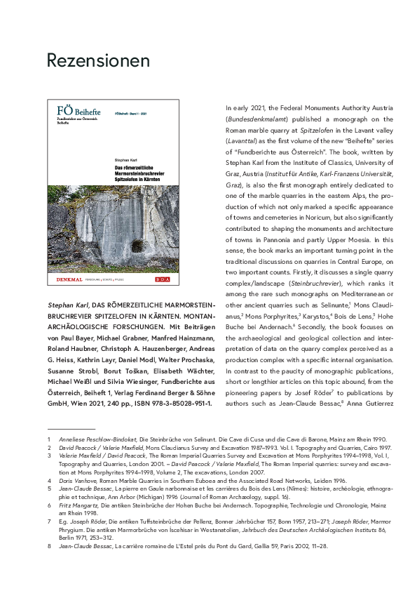
Stephan Karl, DAS RÖMERZEITLICHE MARMORSTEIN-
other ancient quarries such as Selinunte,1 Mons Claudi-
BRUCHREVIER SPITZELOFEN IN KÄRNTEN. MONTAN-
anus,2 Mons Porphyrites,3 Karystos,4 Bois de Lens,5 Hohe
ARCHÄOLOGISCHE FORSCHUNGEN. Mit Beiträgen
Buche bei Andernach.6 Secondly, the book focuses on
von Paul Bayer, Michael Grabner, Manfred Hainzmann,
the archaeological and geological collection and inter-
Roland Haubner, Christoph A. Hauzenberger, Andreas
pretation of data on the quarry complex perceived as a
G. Heiss, Kathrin Layr, Daniel Modl, Walter Prochaska,
production complex with a specific internal organisation.
Susanne Strobl, Borut Toškan, Elisabeth Wächter,
In contrast to the paucity of monographic publications,
Michael Weißl und Silvia Wiesinger, Fundberichte aus
short or lengthier articles on this topic abound, from the
Österreich, Beiheft 1, Verlag Ferdinand Berger & Söhne
pioneering papers by Josef Röder7 to publications by
GmbH, Wien 2021, 240 pp., ISBN 978-3-85028-951-1.
authors such as Jean-Claude Bessac,8 Anna Gutierrez
1
2
3
4
5
6
7
8
Anneliese Peschlow-Bindokat, Die Steinbrüche von Selinunt. Die Cave di Cusa und die Cave di Barone, Mainz am Rhein 1990.
David Peacock / Valerie Maxfield, Mons Claudianus Survey and Excavation 1987–1993. Vol. I. Topography and Quarries, Cairo 1997.
Valerie Maxfield / David Peacock, The Roman Imperial Quarries Survey and Excavation at Mons Porphyrites 1994–1998, Vol. I,
Topography and Quarries, London 2001. – David Peacock / Valerie Maxfield, The Roman Imperial quarries: survey and excavation at Mons Porphyrites 1994–1998, Volume 2, The excavations, London 2007.
Doris Vanhove, Roman Marble Quarries in Southern Euboea and the Associated Road Networks, Leiden 1996.
Jean-Claude Bessac, La pierre en Gaule narbonnaise et les carrières du Bois des Lens (Nîmes): histoire, archéologie, ethnographie et technique, Ann Arbor (Michigan) 1996 (Journal of Roman Archæology, suppl. 16).
Fritz Mangartz, Die antiken Steinbrüche der Hohen Buche bei Andernach. Topographie, Technologie und Chronologie, Mainz
am Rhein 1998.
E.g. Joseph Röder, Die antiken Tuffsteinbrüche der Pellenz, Bonner Jahrbücher 157, Bonn 1957, 213–271; Joseph Röder, Marmor
Phrygium. Die antiken Marmorbrüche von İscehisar in Westanatolien, Jahrbuch des Deutschen Archäologischen Instituts 86,
Berlin 1971, 253–312.
Jean-Claude Bessac, La carrière romaine de L‘Estel près du Pont du Gard, Gallia 59, Paris 2002, 11–28.
�114
Rezensionen
Garcia-Moreno9 and others. In recent decades, authors
field surveying and recording of the vast quarry land-
have increasingly focused on the technical and logistical
scapes performed in the last decades. In addition to
aspects of quarrying, also in connection with questions
the classic surveying and recording methods, these also
pertaining to the supply of individual towns and to the
employ newly developed techniques of gathering and
trading in products. The growing interest brought about
organising spatial data (aerial photography, satellite
a proliferation of known ancient quarries,10 but also
imagery, use of GPS, GIS, recently also LiDAR), which
numerous new lines of their research. In the early days,
are indispensable for a rapid and accurate recording of
research concentrated on historical11 and epigraphic12
vast landscapes.15 The largest, methodologically most
aspects that were and still are important in quarry
systematic and innovative, as well as most prolific in
studies.13 Recent decades, however, have witnessed a
terms of results is the QuarryScapes research project,16
wealth of contributions focusing on correlating products
conducted between 2005 and 2008. Its aim was to record
with their production sources, on characterising stones,
vast quarry landscapes, but even more so to evaluate and
studying their use and distribution across the markets of
protect such remains, as well as to recognise quarries as
the ancient world, as well as attempts to understand and
cultural heritage.17 An important end result of the project
interpret the economic dimension of stone productions.14
is the ‘QuarryScapes guide to ancient stone quarry land-
Particularly significant in studying the organisation and
scapes’ published in 2008,18 which presents the model
operation of Roman quarry complexes is the extensive
of a systematic approach to quarry landscapes, from
9
10
11
12
13
14
15
16
17
18
Anna Gutierrez Garcia-Moreno / Jordi López Vilar, La cantera de El Mèdol (Tarragona): técnicas, organización y propuesta
de evolución de la extracción del material lapídeo, in: Lapidum natura restat: canteras antiguas de la península ibérica en su
contexto (cronología, técnicas y organización de la explotación), Tarragona, Madrid 2018, 67–79.
For a comprehensive list up to 2013, see Ben Russel, Gazetteer of Stone Quarries in the Roman World. Version 1.0, Oxford
2013 (oxrep.classics.ox.ac.uk/databases/stone_quarries_database/).
Charles Dubois, Etudes sur l’administration et l’exploitation des carrières (marbre, porphyre, granit, etc.) dans le monde
romain, Paris 1908.
Luigi Bruzza, Iscrizioni dei marmi grezzi, Bullettino dell‘Instituto di Corrispondenza Archeologica 1870, 106–204.
E.g. Angelina Dworakowska, Quarries in Roman provinces, Warsaw 1983.– Robert Bedon, Les carrières et les carriers de la
Gaule romaine, Paris 1984.– François Braemer, Les marbres des Alpes occidentales dans l’Antiquité, in: Actes du 96e Congrès
national des Sociétés savantes, Toulouse 1971, section d’archéologie et d’histoire de l’art, Paris 1976, 273–286.– John Clayton
Fant, “Cavum Antrum Phrygiæ”: The organization and operations of the Roman imperial marble quarries en Phrygia, Oxford
1989.– Michael A. Hirt, Imperial mines and quarries in the Roman world, Oxford 2010. For a brief overview of the interest
in quarry research, see Jean-Claude Bessac, L’extraction des pierres de taille et des roches marbrières dans l’Antiquité: les
principales stratégies d’exploitation, in: Marbres en Franche-Comté, Actes des Journées d’études, Besançon 1999, Besançon
2003, 21–34.
A good insight into the diverse topics and the development of stone studies can be gained from the proceedings of the
triennial ASMOSIA meetings (http://asmosia.willamette.edu) – Proceedings 1 (1988) – 11 (2018). For a brief overview of the
development of the quarry studies, see Anna Gutierrez Garcia-Moreno, Roman quarries in the north-east of Hispania (modern Catalonia), Tarragona 2009; for the economic dimension of Roman stone trading, see Ben Russell, The economics of the
Roman stone trade, Oxford 2013.
E.g. Leah E. Long, Marble at Aphrodisias: The Regional Marble Quarries, in: Christopher Ratté, Peter D. De Staebler (eds.),
Aphrodisias Regional Survey: Special Studies, Aphrodisias Final Reports, Darmstadt 2012, 165–201; Patrick Degryse / Tom
Heldal / Elisabeth Bloxam / Per Storemyr / Marc Waelkens / Philippe Muchez, The Sagalassos quarry landscape: bringing
quarries in context, in: Sagalassos VI, Geo- and Bio-Archaeology at Sagalassos and its Territory, Leuven 2008, 261–290.
The QuarryScapes Project: conservation of ancient stone quarry landscapes in the Eastern Mediterranean, http://www.
quarryscapes.no. The project produced ten final reports: Deliverables 1–10.
E.g. Per Storemyr, Reflections on Conservation and Promotion of Ancient Quarries and Quarry Landscapes, in: Conservation
of Ancient Stone Quarry Landscapes in the Eastern Mediterranean, QuarryScapes First Symposium, 15–17 October 2006,
Antalya 2006, 31–35.– Elisabeth Bloxam / Tom Heldal, Identifying heritage values and character-defining elements of ancient
quarry landscapes in the Eastern Mediterranean: an integrated Analysis, QuarryScapes deliverable 10, 2008.– Elisabeth
Bloxam, Ancient quarries in mind: pathways to a more accessible significance, World Archaeology 43.2, New Approaches to
Stone Mines and Quarries: Materials and Materiality, London 2011, 149–166.
Tom Heldal / Elisabeth Bloxam, QuarryScapes guide to ancient Stone quarry landscapes: documentation, interpretation, and
statement of significance, Work Package 9, Deliverable No. 11, 2008 (www.quarryscapes.no/guide_content_text.php).
�Rezensionen
115
empirical characterisation, explanation on a micro level to
important contribution to systematising the different
assessment of their historical significance.19 In this model,
quarry types in spite of the difficulties associated with
characterisation and microanalysis are directly and closely
generalising formal features of quarry sites closely linked
linked, and include the resource(s), production, logistics
to the geometry of the production strata. The typology of
and social infrastructure that make up a quarry complex.
quarries was later adapted and schematically presented
These are the traits that the monograph on Spitzelofen
in the QuarryScapes guide.21
shares as well.
The heaps of spoil material at Spitzelofen, important for
The aim of the brief introduction above, by no means
understanding the different steps of quarry activities (ex-
intended to be a comprehensive history of research, was
traction, block reduction, core reduction, finishing) through
to provide a proper backdrop for reviewing the monograph
the shape and size of the debitage, have been carefully
on the Spitzelofen quarry complex. The starting point of
and precisely recorded, and interpreted in relative chron-
the monograph is the rescue investigations that followed
ological terms. Their scarcity in the north quarry complex
the machine damage at Kalkkogel caused by earthworks
is certainly the result of the extremely steep terrain that
to widen the forest road there in 2011. The investiga-
caused the debris to slide deep down the slope. Old pho-
tions involved very meticulous topographic mapping, as
tographs (Abb. 15) show that the only well-preserved spoil
well as archaeological and geological recording of an
heap was located in the area of the GO 38 quarry site,
11.5 ha large area (Chapter 3, Topographie, 39–65, Taf.
but was almost completely removed during excavations in
11–23) that comprises two independent quarry complexes
the 1920s and in 1930. The reason for the creation of this
(Bruchgebiete) – Kalkkogel and Spitzelofen. These two
extensive heap on a terrace measuring some 400 m2 is
complexes differ in geomorphology, directly linked to
thus unclear. Its interpretation is certainly a desideratum,
the differences in the marble strata cropping out from
as it may provide crucial data on the activities taking place
under the strata of other metamorphic rocks (gneiss,
there and as such on the spatial distribution and chrono-
mica schist, amphibolite; Taf. 60), to the degree that
logical sequence of individual activities. It would appear
required different techniques for extracting large marble
that the non-invasive recording processes in this phase
blocks. At Kalkkogel, there is a series of quarry sites on
of research did not allow the spoil heaps to be analysed
the same plane at altitudes between 1060 m in 1070 m
as to the size of the marble debris, though the recorded
(Taf. 14–15), while Spitzelofen boasts the well-known, ca.
data give the impression that all the production phases
12 m high quarry face, bearing an inscription of Saxanus,
of blocks ready for transport took place within individual
with individual quarry sites vertically succeeding each
quarry sites rather than in one or several places within
other at four altitudes between 1030 m in 1060 m (Taf.
the quarry complex. This hypothesis is supported by the
16–17). Forty-seven terrain features (Geländeobjekt, GO)
recorded internal quarry paths (Taf. 13) and the results of
were identified within the quarry complex that include
the small-scale excavations of the spoil heap associated
18 (6 Kalkkogel + 12 Spitzelofen) quarry sites of different
with the GO 3 quarry site (Fundstelle H-10) as visible on
shapes and sizes, some cut into the slope (Lehnenbruch),
photographs (Abb. 82). A final confirmation, however, must
some in form of niches (Nischenbruch) and others in pits
await further analyses.
(Grubenbruch). In the typology of individual quarry sites,
This small-scale excavation also revealed that blacksmiths
Karl leaned on the work by J.-C. Bessac,20 who made an
were present on site to repair tools. The remains of
19 Tom Heldal / Elisabeth Bloxam, QuarryScapes guide to ancient Stone quarry landscapes: documentation, interpretation, and
statement of significance, Work Package 9, Deliverable No. 11, 2008, 3, Figure 1.
20 Jean-Claude Bessac, L’extraction des pierres de taille et des roches marbrières dans l’Antiquité: les principales stratégies
d’exploitation, in: Marbres en Franche-Comté, Actes des Journées d’études, Besançon 1999, Besançon 2003, 21–34.
21 Tom Heldal / Elisabeth Bloxam, QuarryScapes guide to ancient Stone quarry landscapes: documentation, interpretation, and
statement of significance, Work Package 9, Deliverable No. 11, 2008 (www.quarryscapes.no/guide_content_text.php).
�116
Rezensionen
forging in the shape of hammer scale22 and fragments of
intact stratigraphic context. There are as many as ten
ceramic containers23 that could be interpreted as slack
heavy double-pointed picks (weighing roughly 3–4.5 kg),
tubs, represent characteristic remains of on site smithies
fifteen iron wedges, two single-pointed picks, one heavy
in quarries.24 According to Karl, the charcoal needed for
hammer, two iron crowbars and two flat chisels. One of
this activity was produced in immediate proximity to the
the double-pointed picks was also subjected to metal-
quarry, possibly in charcoal piles hypothetically identified
lographic analyses,25 which examined the possibility of
in some of the terrain features (Grubenmeiler, 58–60).
using several pieces of iron bloom to attain the desired
The rock extracted at the quarry sites of the Spitzelofen
weight of the product, but also examined the presence
complex was marble with the interesting exception of
of martensite at both points of the pick as evidence of
chronologically undetermined GO5 where platy gneiss
quenching; the analyses did not provide unambiguous
was extracted. As in all Roman quarries with thick rock
results in either case.
strata, the extraction techniques involved cutting narrow
The Spitzelofen quarry complex has been attracting
and deep channels and horizontally splitting the rock with
people’s attention since the early 19th century, mainly with
the use of iron wedges to free individual blocks. All these
its high quarry face bearing the inscription of Saxanus. In
procedures left behind characteristic tool marks on the
the monograph, Manfred Heinzmann wrote a contribution
surviving surfaces of the quarry – particularly the marks
on this inscription (Die “Steinbruchgottheit” Sax(et)anus
of heavy picks and iron wedges. Only the GO 39 quarry
im Ostalpenraum, 129–140), in which he studies all the
site revealed traces of levering, i. e. extraction of blocks
inscriptions mentioning the divinity known across the
involving the expansion of natural cracks or other planes
Roman Empire. The quarry face was long interpreted as
of weakness, which leaves no tool marks on the rock faces.
the sanctuary of Silvanus. The mining activities by Anton
Considerable attention and even an entire chapter of the
Deutschmann in the area of this ‘sanctuary’, which left
monograph (Schrämspuren, 67–75) is dedicated to the tool
behind a tunnel dug into the face in its lower part, led
marks observed on the faces and in one case (GO 38) the
the k. k. Bezirkshauptmannschaft Wolfsberg26 to declare
floor of the quarry. The publication brings the results of
a protected historical monument area in 1890. The min-
this most precise 3D recording of such evidence in any
utes of the monument visit even establish, for the first
known ancient quarry (Taf. 24–34), with several important
time, that the area holds the remains of a Roman quarry
observations. One of these is a great uniformity of tool
rather than a sanctuary. An echo of this erroneous, albeit
marks, which suggests the use of the same approach to
attractive interpretation is the possibility of a small shrine
extracting blocks throughout the time the quarry was ac-
in the small side niche of GO 45. Karl concludes that this
tive. The observed tool marks also indicate the size of the
hypothesis cannot be confirmed without archaeological
extracted blocks, which measured 15–69 cm in thickness
excavations; the round horizontal niche or hole there (Taf.
and 82–440 cm in length; the long blocks were certainly
39) could also be interpreted as a feature associated with
intended for architectural members. It is possible that
a machine used in quarry work.
acquiring monolithic blocks of this great size is among the
After protecting the area as a historical monument, the
main reasons for opening quarries at such high altitudes,
owner of the land, Ludwig Theodor Schütte, constructed
far above the lowland settlements.
a path (Promenadenweg) that led visitors to the rock face
In addition to tool marks, Spitzelofen also revealed
with the inscription, which is indirect evidence of the early
surprisingly numerous tools, though not always in an
interest that the general public had for the monument.
22 Chapter 6.1.4, author D. Modl. More extensive contribution in Stephan Karl / Daniel Modl / Susanne Strobl / Roland Haubner,
Untersuchungen von Hammerschlag aus einer Schmiedeesse im römerzeitlichen Marmorsteinbruchrevier Spitzelofen in Kärnten,
Österreich, Berg und Hüttenmännische Monatshefte 166, 2021, 370–378. (https://doi.org/10.1007/s00501-021-01123-0).
23 Chapter 6.1.3, author Christoph A. Hauzenberger. Pottery dated to the first half of the 1st century.
24 See Chapter 6.1.9, Schmiedeesse und Ambossplatz, 92–94.
25 Roland Haubner / Susanne Strobl, Metallurgische Untersuchungen eines Doppelspitzschlägels, 109–113.
26 See Anhang 13.3, 169 f.
�Rezensionen
117
The first archaeological excavations at the quarry were
to the first half of the 1st century AD, parallels across
conducted between 1909 and 1930, when the next land-
the south-eastern Alpine area suggest that the decline
owner, Gudmund Schütte, investigated the platform below
of activities after the peak in the 2nd and possibly early
the inscribed rock face (GO 38). Franz Jantsch was the
3rd century (dating based on products) can be placed to
last to excavate here, in 1930. The history of interest and
the 4th century. Only targeted archaeological excavations
research at Spitzelofen is certainly exhaustively presented
can provide a reliable answer to the latter question. The
in the monograph and accompanied with relevant docu-
small-scale excavations conducted at the edge of the GO
ments published in the appendices to the second chapter
38 quarry site have revealed how important such data
(“Forschungsgeschichte und Erschließung”).
can be for understanding the activities in the quarry as
The introductory chapter of the book is dedicated to the
they revealed, surprisingly, a brief resumption of quarry
archaeological and geological context of the Spitzelofen
activities in the 8th –9th centuries presumably linked to
quarry complex. It also brings a very useful and up-to-date
furnishing the interiors of local churches.
list of all known marble quarries in the south-eastern Alps,
Analyses could not provide conclusive answers concerning
a description of the Roman settlements in the Lavant valley,
the internal organisation of the quarry complex and its
as well as an excellent and newly drawn map of the marble
management, hence hypotheses can only be based on
deposits in this part of Carinthia (Taf. 2, by Kathrin Layr)
comparable data from other quarries in the Mediterranean.
that also shows the distribution of known marble products.
This involves questions regarding the seasonal accommo-
The map raises at least two issues. One is the possibility of
dation of the quarry masters and other workers, which
other, as yet unknown ancient quarries existing in the area,
could not be positively established, regarding the extent
which the author also raises. The other pertains to the rea-
of simultaneous quarry activities in individual work steps
sons behind opening the Spitzelofen quarry so high in the
related to the type of orders, and others.
mountains. The locations of numerous historical quarries,
Another important and as yet unresolved question is that
also marked on the map, are particularly exciting in this
of the products coming out of Spitzelofen. The few extant
respect. Having said that, the possibility of associating the
analyses of products involving material characterisation
Spitzelofen quarry complex with the owners of the Roman
(analyses by late Harald W. Müller) have revealed Spit-
villa at Allersdorf, as Karl suggested in one of his public
zelofen as a quarry of regional importance. It should be
lectures,27 can as yet not be proven.
noted, however, that the sample of analysed monuments
At the other end of the book, the final eleventh chapter
was small and biased in favour of funerary monuments.
(“Diskussion und Fazit”, 141–147) brings a summary and
Only a comprehensive analysis and characterisations of
interpretation of the results of individual analyses. In it,
the marbles used in Noricum will give a clear answer to
Karl raises several crucial and in many respects still open
the key question of production centres (quarries) and
questions. He emphasises the advantages of this quarry
their markets for different orders in different periods of
complex that was left almost undisturbed after the end of
time from the beginning of the 1st to and including the 4th
Roman activities, which is an exception among the known
century. The analyses that Walter Prochaska and Kathrin
ancient quarries in the Alps. The only post-medieval ac-
Layr (“Analysen des Spitzelofener Marmors”, 123–128)
tivity mentioned here is lime production, with associated
performed for Spitzelofen marble have provided results
lime pits, which probably gave the name (Kalkkogel) to
that offer hope in the possibility of distinguishing be-
the elevation.
tween marbles from different Norican quarries. The 18O,
One of the basic questions with regards to any quarry
16
is its chronological attribution. While the beginnings of
the analyses of trace elements and fluid inclusions have
marble extraction at Spitzelofen can be reliably dated
enabled a fairly clear-cut distinction between some of
O, 13C and 12C stable isotope analyses combined with
27 Stephan Karl / Meinhard Ranzinger / Kristian Bredies, Das römerzeitliche Marmorsteinbruchrevier Spitzelofen. Mathematisch
gestützte Wegfindung des Steintransportes in das Lavanttal, Archäologie im 21. Jahrhundert – Fragen und Methoden einer
modernen Geisteswissenschaft, Graz, Hauskolloquium am Institut für Archäologie, 22. Juni 2018, Graz 2018.
�118
Rezensionen
the most important marbles of Noricum, i. e. those from
Gummern, Spitzelofen, Salla and Pohorje. Particularly
exciting is the clear differentiation between Gummern and
Pohorje marbles, while the distinction between Gummern
and Spitzelofen marbles is less clear. From this point on,
the attribution of sources or production centres must
apply a formal analysis of the products as an additional
analytical tool.
The book subtitle is “Montanarchäologische Forschungen”, which continues the long tradition of naming this
particular field of study in German-speaking countries.
In recent years, researchers and Thomas R. Stölner in
particular28 wish to extend the term Montanarchäologie
(mining archaeology), derived from Latin res montanorum,
to encompass the whole chaîne opératoire of extracting
and working natural resources, i. e. to all the analyses and
procedures necessary for a comprehensive understanding
of this field of archaeology. Researchers in other countries
use different terms to refer to more or less the same field
– industrial archaeology or, to our preference, archaeology
of production.
Stephan Karl prepared an excellent, meticulous and
Ortwin Hesch / Heinz Kranzelbinder, ARCHÄOLOGI-
consistent publication presenting all possible aspects of
SCHE STREIFZÜGE DURCH DAS STEIRISCHE VULKAN-
the data gathered almost entirely non-invasively across
LAND KULTURGESCHICHTLICHE ERKUNDUNGEN IN
the vast quarry complex at Spitzelofen, which are dis-
DER SÜDOSTSTEIERMARK MIT DEM BESUCH EINIGER
cussed against the backdrop of the current knowledge
AUSGEWÄHLTER FUNDPLÄTZE UND MUSEEN IM BE-
of the quarries across the Roman Empire. The published
NACHBARTEN SLOWENISCHEN GRENZMURGEBIET,
results offer, for the first time, a penetrating insight into
Eigenverlag des Vereins zur Förderung des Steirischen
a typical Alpine quarry complex. In view of this, we can
Vulkanlandes und der Regionalmanagement Südost-
expect similar analyses to be performed for other quarry
steiermark, Steirisches Vulkanland GmbH, Graz-Gnie-
complexes across Noricum that are more prominent in
bing-Bad Radkersburg 2021, 202 Seiten, Abbildungen.
terms of their output. It is our hope that these analyses
be accompanied by an extensive characterisation of their
Heinrich Kranzelbinder als Herausgeber und Fotograf
products that include architectural members, which have
und Ortwin Hesch als Archäologe und Kunsthistoriker
been largely neglected in the studies published thus far.
bieten in dem das A4-Format elegant überschreitenden
200-seitigen Band einen Überblick über die Archäologie
Bojan Djuric
der Südoststeiermark und im benachbarten Slowenien:
28 Thomas R. Stölner, Montan-Archaeology and Research on Old Mining: Just a Contribution to Economic History?, in: Ünsal
Yalçın (ed.), Anatolian Metal IV. Der Anschnitt, Beiheft 21, Bochum 2008, 149–178.– Thomas R. Stölner, Methods of Mining
Archaeology (Montanarchäologie), in: Benjamin W. Roberts, Christopher P. Thornton (eds.), Archaeometallurgy in Global
Perspective. Methods and Syntheses, New York 2014, 133–159.
�
 bojan djuric