Location via proxy:   [ UP ]  
[Report a bug]   [Manage cookies]                
2012

TR1032 : Harmonium, All Saints' church, Burmarsh

taken 12 years ago, near to Burmarsh, Kent, England
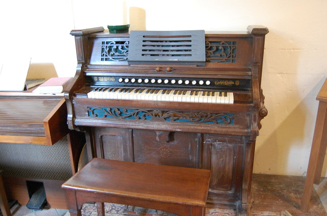
Harmonium, All Saints' church, Burmarsh
Made by Bell of Guelph, Ontario, Canada. Probably early 20th C. 5 octaves.
All saints' church, Burmarsh

Grade II* listed
Possibly built on site of an old Saxon site, church dates from 12th C. with a sturdy heavily buttressed west tower from the 15th C. with 6 bells, 2 dating from 14th C.
Nave and chancel are from 12th C. with no chancel arch.
The South door is Norman with a face over the tympanum.
Restored in 1878. The screen was erected after the First World War as a memorial, although previously a rood screen existed.

Approached via a footbridge over a drainage ditch, it is said to be 4m below sea level.


Creative Commons Licence [Some Rights Reserved]   © Copyright Julian P Guffogg and licensed for reuse under this Creative Commons Licence.
Geographical Context: Religious sites Church: All Saints Place: Burmarsh other tags: Reed Organ Harmonium Click a tag, to view other nearby images.
This photo is linked from: Automatic Clusters: · Saints [48] · Burmarsh Church [18] · Saints' Church [11] ·
1:50,000 Modern Day Landranger(TM) Map © Crown Copyright
+
1:50,000 Modern Day Landranger(TM) Map © Crown Copyright
TIP: Click the map for more Large scale mapping
Grid Square
TR1032, 68 images   (more nearby 🔍)
Photographer
Julian P Guffogg   (more nearby)
Date Taken
Saturday, 27 October, 2012   (more nearby)
Submitted
Saturday, 27 October, 2012
Subject Location
OSGB36: geotagged! TR 1011 3203 [10m precision]
WGS84: 51:2.9505N 0:59.7785E
Camera Location
OSGB36: geotagged! TR 1011 3203
View Direction
Northeast (about 45 degrees)
Clickable map
+
NW N NE
W Go E
SW S SE
Image classification(about): Supplemental image
This page has been viewed about 126 times
You are not logged in login | register