2014
TR1032 : Churches in the Romney Marsh area (D)
taken 11 years ago, near to Burmarsh, Kent, England
Churches in the Romney Marsh area (D)
Burmarsh
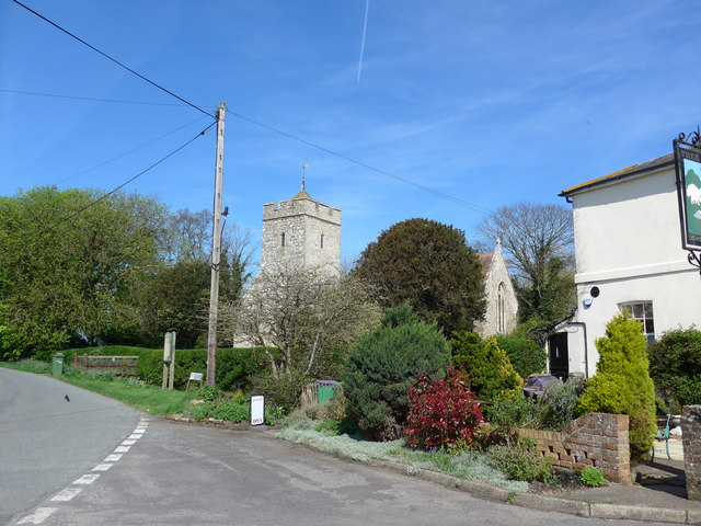
All saints' church, Burmarsh
Grade II* listed
Possibly built on site of an old Saxon site, church dates from 12th C. with a sturdy heavily buttressed west tower from the 15th C. with 6 bells, 2 dating from 14th C.
Nave and chancel are from 12th C. with no chancel arch.
The South door is Norman with a face over the tympanum.
Restored in 1878. The screen was erected after the First World War as a memorial, although previously a rood screen existed.
Approached via a footbridge over a drainage ditch, it is said to be 4m below sea level.
Not Rodney Marsh..... :: TR0722
..... cricketer Link
or footballer Link
 Map © Crown Copyright")
TIP: Click the map for more Large scale mapping
- Grid Square
- TR1032, 68 images (more nearby 🔍)
- Photographer
- Basher Eyre (more nearby)
- Date Taken
- Wednesday, 9 April, 2014 (more nearby)
- Submitted
- Friday, 11 April, 2014
- Subject Location
-
OSGB36:
 TR 1010 3204 [10m precision]
WGS84: 51:2.9561N 0:59.7703E - Camera Location
-
OSGB36: TR 1011 3204
- View Direction
- North-northwest (about 337 degrees)