Location via proxy:   [ UP ]  
[Report a bug]   [Manage cookies]                
2016

SX5155 : Tree in the parkland of Saltram

taken 8 years ago, 3 km from Plymstock, Plymouth, England
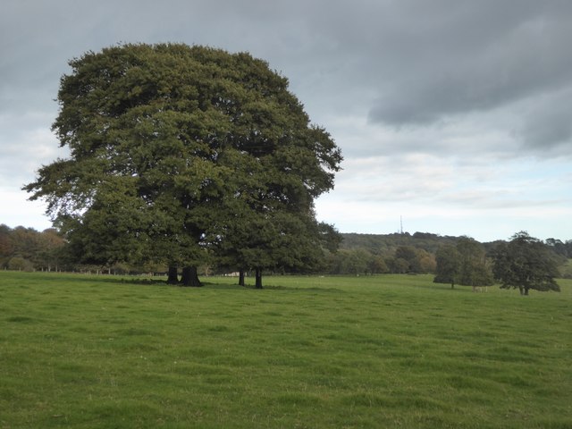
Tree in the parkland of Saltram
The house is hidden by the tree and gardens beyond. On the skyline is the TV mast in Hardwick Wood SX5355 : Television and Relay Masts, Hardwick Hill
Saltram Park

Saltram Park is centred on the 18th century designed landscape of Saltram which is owned and managed by the National Trust. Saltram is of exceptional interest as evidenced by its inclusion at Grade II* on the English Heritage Register of Parks and Gardens of Special Historic
interest and the array of listed buildings and structures which add to its uniqueness. The wider landscape of the Countryside Park also contains many historic features and evidence of past land use with fields divided by characteristic Devonshire hedge banks, the presence of quarries, and evidence of orchards, ponds and allotment gardens.

National Trust

A National Trust is an organization dedicated to preserving the cultural or environmental treasures of a particular geographic region. They generally operate as private non-profit organizations, although some receive considerable support from their national government. The first such organization was the National Trust for Places of Historic Interest or Natural Beauty, which is the National Trust of England, Wales and Northern Ireland, formed in 1895 and operating as a charitable organisation.

Extract from Wikipedia LinkExternal link

List of National Trust places LinkExternal link


Creative Commons Licence [Some Rights Reserved]   © Copyright David Smith and licensed for reuse under this Creative Commons Licence.
Geographical Context: Grassland Country estates Woodland, Forest Communications Primary Subject: Tree
This photo is linked from: Automatic Clusters: · Saltram Garden [16] · Saltram Wood [6] · Parkland at Saltram [4] ·
1:50,000 Modern Day Landranger(TM) Map © Crown Copyright
+
+
1:50,000 Modern Day Landranger(TM) Map © Crown Copyright
TIP: Click the map for more Large scale mapping
Grid Square
SX5155, 147 images   (more nearby 🔍)
Photographer
David Smith   (more nearby)
Date Taken
Friday, 21 October, 2016   (more nearby)
Submitted
Saturday, 22 October, 2016
Subject Location
OSGB36: geotagged! SX 5150 5543 [10m precision]
WGS84: 50:22.7980N 4:5.3980W
Camera Location
OSGB36: geotagged! SX 5145 5542
View Direction
EAST (about 90 degrees)
Clickable map
+
NW N NE
W Go E
SW S SE
Image Type (about): geograph 
This page has been viewed about 53 times
You are not logged in login | register