


Modern surveying instruments
- 1. TOPIC : Modern Surveying Instruments SUBJECT : Advanced Surveying Student name Pansuriya Mayank 141100106044 Parmar Parimal 141100106045 Patel Dhanik 141100106055 Kotila Jayvir 151103106008 Mistry Aditya 151103106009 Pandya Dhrumil 151103106010
- 2. Content -Introduction -Electromagnetic wave -Properties of Electromagnetic Waves -Principle of EDM -Types of EDM Instruments -Total Station -Types of Total Station -Measuring Angle -Advantages and Disadvantages -Digitals self and Levelling level
- 4. MODERN SURVEYING EQUIPMENT Revolutionary changes have taken place in last few years in surveying instruments that are used for measuring level differences, distances and angles. This has become possible because of introduction of electronics in these measurements. With rapid advancements in the technology and availability of cheaper and innovative electronic components, these instruments have become affordable and easy to use.
- 5. Introduction Direct distance measurement Optical distance measurement Electronic distance measurement
- 6. Electromagnetic waves The EDM method is based on generation, propagation, reflection and subsequent reception of electromagnetic waves The distance is measured indirectly using the characteristics of these waves The electromagnetic waves required no medium and they can travel even in vacuum
- 7. Properties of electromagnetic wave Cycle : when the wave moves through two identical point on its path it is said to have completed one cycle. Wave length : the distance two identical points on a wave is called wave length. Frequency : frequency refers to the number of cycles of wave passing a fixed point per unit time it is denoted by the Greek letter nu.
- 8. PRINCIPLE OF EDM The general principle involves sending a modulated Electro- magnetic (EM) beam from one transmitter at the master station to a reflector at the remote station and receiving it back at the master station. The instrument measures slope distance between transmitter and receiver by modulating the continuous carrier wave at different frequencies, and then measuring the phase difference at the master station between the outgoing and the incoming signals. This establishes the following relationship for a double distance (2D)
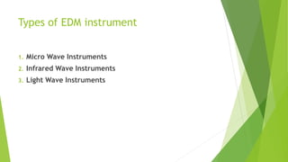
- 9. Types of EDM instrument 1. Micro Wave Instruments 2. Infrared Wave Instruments 3. Light Wave Instruments
- 10. Micro Wave Instruments These instruments make use of micro waves. Tellurometers come under this category. Tellurometers can be used in day as well as in night. The range of these instruments is up to 100 km.
- 11. Infrared Wave Instruments In this instrument amplitude modulated infrared waves are used. Prism reflectors are used at the end of line to be measured. These instruments are light and economical and can be mounted on theodolite. With these instruments accuracy achieved is ± 10 mm. The range of these instruments is up to 3 km.
- 12. Light Wave Instruments These instruments rely on propagation of modulated light waves. During night its range is up to 2.5 km while in day its range is up to 3 km. Accuracy of these instruments varies from 0.5 mm to 5 mm/km distance.
- 13. The following photographs show different types of EDM
- 14. Total station
- 16. TOTAL STATION These instruments can record horizontal and vertical angles together with slope distance and can be considered as combined EDM plus electronic theodolite. The microprocessor in TS can perform various mathematical operations such as averaging, multiple angle and distance measurements, horizontal and vertical distances, X, Y, Z coordinates, distance between observed points and corrections for atmospheric and instrumental corrections.
- 17. Advantages of total station Area of the field can be computed. Automation of old maps. Graphical view of plots and land for quick visualization. Local language support. Full GIS creation using map info software. The instruments can be easily set on tripod using laser plumber.
- 18. Disadvantages of total station For on overall check of the survey, it will be necessary to return to the office and prepare the drawing using appropriate software. The instrument is costly. Skilled personnel are required for conducting surveys.
- 19. Measuring angles For measuring angles optoelectronically, the absolute circle scanning system used to read the coded graduations of a glass circle. The circle contains only one coded graduation track which contains all the information's. The code is read by linear CCD array and an analogue to digital converter and displays with maximum accuracy.
- 20. Types of total stations Manual total stations Semi-automatic total stations Automatic total stations
- 21. Manual total stations In this type of total stations it was necessary to read the horizontal and vertical angles manually. Only slope distance could be read electronically.
- 22. Semi-automatic total station For these instruments the user had to manually read the horizontal circle. Vertical circle reading were shown digitally. Slope distances with their horizontal and vertical components are displayed digitally.
- 23. Automatic total stations This type is the most common total station used now-a- days. They sense both horizontal and vertical angle electronically. The coordinate information obtained can either be stored in the total stations memory card.
- 24. DIGITAL LEVEL Recently electronic digital levels have evolved as a result of development in electronics and digital image processing. Digital levels use electronic image processing to evaluate the special bar-coded staff reading. This bar-coded pattern is converted into elevation and distance values using a digital image matching procedure within the instrument.
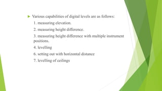
- 25. Various capabilities of digital levels are as follows: 1. measuring elevation. 2. measuring height difference. 3. measuring height difference with multiple instrument positions. 4. levelling 6. setting out with horizontal distance 7. levelling of ceilings