


PHLUP-Highlights-Ref-April 2011(2013)
- 1. Public Health and Land Use Planning: Highlights April 2011
- 2. 1 Public Health and Land Use Planning: Highlights Title Page Reference: Perrotta, Kim. (2011) Public Health and Land Use Planning: Highlights. Prepared for the Clean Air Partnership (CAP) in partnership with the Ontario Public Health Association (OPHA). April 2011. Background Report: All of the information captured in this report is drawn from, and referenced in, the background report, Public Health and Land Use Planning: How Ten Public Health Units are Working to Create Healthy & Sustainable Communities (2011), which can be downloaded from: http://www.cleanairpartnership.org/public_health_and_the_built_environment http://chase-canada.org/whats-new/ Project Advisory Committee: Eva Ligeti, Executive Director, Clean Air Partnership Jennifer Penney, PhD, Research Director, Clean Air Partnership Jennifer Croft, Grey Bruce District Health Unit* Sue Shikaze, Haliburton Kawartha Pine Ridge District Health Unit Kristie Daniel (2010) & Peter Steer (2011), Halton Region Health Department* Tami McCallum & Jackie Gervais, Niagara Region Public Health* Kiran Ghai, Peel Public Health, Peel Region & Co-Chair of OPHA Health and Built Environment Workgroup * Megan Williams (2010) & Marina Whelan (2011) Simcoe Muskoka District Health Unit* Carol Craig, Sudbury and District Health Unit Sudha Sabanadesan, Toronto Public Health, City of Toronto * Amanda Kroger, Region of Waterloo Public Health Branch Kevin Haley, York Region Public Health Branch, Community and Health Services, York Region* Pat Fisher, Co-Chair, OPHA Health and Built Environment Workgroup * Paul Young, OALA, CSLA, Public Space Workshop * Members of the OPHA Health and Built Environment Workgroup Funding: We are very grateful to the Ministry of Health Promotion and Sport for providing the funds that made this project possible through the Healthy Communities Fund. Contact: Kim Perrotta, Executive Director, Creating Healthy and Sustainable Environments (CHASE). kim.perrotta@cogeco.ca http://chase-canada.org/
- 3. 2 Public Health and Land Use Planning: Highlights Table of Contents I Introduction Page 3 Report Structure Public Health Units Ontario Public Health Standards Public Health Authority & the Built Environment II Public Health Interest in the Built Environment Page 5 Physical Activity, Health & the Built Environment Healthy Foods, Health & the Built Environment Injuries, Health & the Built Environment Air Quality, Health & the Built Environment Climate Change, Health & the Built Environment Water Quality, Health & the Built Environment III Discussion - Findings - Ten Public Health Units Page 28 Interventions Being Sought Interventions & Low Income Populations Strategies Employed by Public Health Units Complementary & Contradictory Interventions Program Areas, Functional Expertise & Roles Organizational Structures References Page 41
- 4. 3 Public Health and Land Use Planning: Highlights I Introduction The Clean Air Partnership (CAP), in partnership with the Ontario Public Health Association (OPHA), examined ten public health units in Ontario that are trying to create healthier and more sustainable communities by working through the land use planning processes in their districts/regions. This research was funded by the Ministry of Health Promotion and Sport (MHPS) Healthy Communities Fund. The findings are captured in a 238-page background report, Public Health and Land Use Planning: How Ten Public Health Units are Working to Create Healthy and Sustainable Communities (April 2011) which can be downloaded at: http://www.cleanairpartnership.org/public_health_and_the_built_environment or http://chase-canada.org/whats-new/. This report includes the health background and discussion chapters from the background report. It and the background report were produced as tools for public health professionals who are interested in improving health as it is affected by the built environment. We hope that both reports will stimulate discussion, encourage innovation, and invite others to share their ideas and success stories. This highlights report has also been prepared for professionals in fields such as land use planning, transportation planning, environmental coordination and sustainability planning. We hope that it helps them to appreciate both public health's interest in land use and transportation planning issues, and the many ways in which public health professionals can support them on these issues. Report Structure This summary report is divided into three sections. The first section, Introduction, provides a brief overview on the public health sector and the Ontario Public Health Standards. The second section, Public Health Interest in the Built Environment, provides an overview on the health and social science evidence which links human health to the built environment as mediated through six factors - physical activity, healthy eating, injury prevention, air quality, climate change and water quality. It includes a brief discussion of the health inequities that are experienced by low income populations as they relate to the built environment. The third section, Discussion - Findings - Ten Public Health Units, includes a discussion of the findings from all ten public health units. It discusses the interventions being sought by public health units through land use planning processes, the strategies they are employing, the expertise they are directing at these activities, and the structures they are using to encourage inter-disciplinary collaboration. Details on the work of individual public health units can be found in the background report.
- 5. 4 Public Health and Land Use Planning: Highlights "Addressing determinants of health and reducing health inequities are fundamental to the work of public health in Ontario" (Ontario, 2008). Public Health Units A public health unit (PHU) is an official health agency that provides community health programs under the Health Protection and Promotion Act. There are 36 PHUs in Ontario. Each one is governed by a Board of Health (BOH) and administered by a Medical Officer of Health (MOH) who reports to the local BOH. The BOH is largely made up of elected representatives from local municipal and/or regional councils. Approximately two-thirds of Ontario's BOHs are autonomous bodies created to provide public health services. Municipal or regional councils are the BOHs for the remaining third. Both forms have the same function within their communities. The Ministry of Health and Long-Term Care shares the costs of running PHUs with local municipalities (MOHLTC, 2011). Ontario Public Health Standards The Ontario Public Health Standards are guidelines for the programs and services that are mandated by the Ministry of Health and Long-term Care. They outline the expectations for BOHs, which are responsible for providing "public health programs and services that contribute to the physical, mental, emotional health, and well-being of all Ontarians" (Ontario, 2008). The new Ontario Public Health Standards, which were brought forward in 2009, are based upon a recognition that the health of individuals and communities is "significantly influenced by complex interactions between social and economic factors, the physical environment, and individual behaviours and conditions……known as the determinants of health". They further state: "Addressing determinants of health and reducing health inequities are fundamental to the work of public health in Ontario" (Ontario, 2008). The Ontario Public Health Standards include five Program Standards and one Foundational Standard. The Foundational Standard guides the assessment of population health, surveillance research, knowledge exchange, and program evaluation. The five Program Standards cover: Infectious Diseases Environmental Health Emergency Preparedness Chronic Disease and Injuries and Family Health (Ontario, 2008). Each of these Program Standards establish requirements for public health programs and services under four functional headings: assessment and surveillance; health promotion and policy development; disease and injury prevention; and health protection (Ontario, 2008). Public Health Authority & the Built Environment The public health interest in the built environment is expressed largely by professionals working under the Chronic Disease and Injuries Prevention program which is administered by the Ministry of Health
- 6. 5 Public Health and Land Use Planning: Highlights Promotion and Sport and the Environmental Health program which is administered by the Ministry of Health and Long-term Care. The Ontario Public Health Standards explicitly instruct and authorize public health professionals who work in these two programs to support the development of healthy public policies in the field of the built environment. The Chronic Disease Prevention subsection of the Chronic Disease and Injuries Program Standard states that: "The board of health shall work with municipalities to support healthy public policies and the creation or enhancement of supportive environments in recreational settings and the built environment regarding the following topics: healthy eating; healthy weights; comprehensive tobacco control; physical activity; alcohol use; and exposure to ultraviolet radiation" (Ontario, 2008). The Health Hazard Prevention and Management subsection of the Environment Health Program Standards states that: "The board of health shall assist community partners to develop healthy policies related to reducing exposure to health hazards. Topics may include, but are not limited to: indoor air quality; outdoor air quality; extreme weather; and built environments" (Ontario, 2008). II Public Health Interest in the Built Environment Over the last ten years, there has been a growing interest in land use planning processes among public health professionals in response to a growing body of health literature which demonstrates the substantial impact that the built environment can have on human health and well-being. The interest is not limited to one particular health condition, factor, or issue. The studies linking health to the built environment are coming out of a variety of fields simultaneously. A broad array of health conditions, mediated through a variety of risk factors, have been linked to the built environment: chronic diseases and deaths that are associated with physical inactivity, obesity, and unhealthy eating patterns; injuries, hospital admissions, and deaths associated with falls and vehicle- related collisions; acute and chronic respiratory and cardiovascular conditions associated with poor air quality; infections and disease resulting from contaminated water; heat stress, water-borne infections, and insect-borne diseases associated with climate change; and mental health issues, stress and social isolation associated with built form and long commutes. Health Inequities Experienced by Low Income Populations Overlaying all of these interests is a growing understanding that some groups are particularly vulnerable to health impacts because of their socio-economic status. In June 2009, the Canadian Standing Senate Committee on Social Affairs, Science and Technology released a report entitled "A Healthy and Productive Canada: A Determinant of Health Approach" which begins by stating that: "We must change our way of thinking and recognize that good health comes from a variety of factors and influences, 75 percent of which are not related to the health care delivery system.
- 7. 6 Public Health and Land Use Planning: Highlights Therefore we must become proactive and support communities, cities, provinces, territories and a country in producing citizens in good health, physical and mental well-being and productivity" (Senate, 2009). Income is considered the most important social determinant of health because it affects so many other factors that impact health including living conditions, levels of stress, working conditions, health-related behaviour, the quality and quantity of food, the quality of housing, and the safety of neighbourhoods (Mikkonen and Raphael, 2010). Research has demonstrated that men living in the wealthiest 20 per cent of neighbourhoods in Canada, live four years longer than men living in the poorest 20 per cent of neighbourhoods. In addition, a large number of studies have demonstrated that Type II diabetes and heart attacks are far more common among low-income Canadians (Mikkonen and Raphael, 2010). While many think of Canada as a wealthy country, there is substantial poverty in this country. In 2005, using the Low-Income Cut-Offs1 measure, 10.3 per cent of all people in Ontario were living in poverty (SPC of Sudbury, 2008). Ontario has the highest rate of childhood poverty in the country with one in six children in Ontario living in poverty. More than half of those children live in single parent homes with their mothers and nearly half are the children of new immigrants (SPC of Sudbury, 2008). The new Ontario Public Health Standards are built upon a Foundational Standard which acknowledges the impact of the determinants of health, and which encourages PHUs to strive to influence broader societal changes that reduce health disparities and inequities (Ontario, 2008). Consequently, interest in the built environment is coming from many directions within the public health sector: from those who work to promote physical activity, healthy eating, and injury prevention; from those who work to improve air quality, address climate change, and protect water resources; and from those who seek to address the health inequities in our society. Provincial Policy Statement and Public Health While there are a number of provincial planning documents that are of interest to public health, including the Greater Golden Horseshoe Growth Plan, the 2011 Growth Plan for Northern Ontario, the Greenbelt Plan, the Green Energy Act, and the Accessability for Ontarians with Disabilities Act, the one that has provided public health professionals with a clear opening into the land use planning process is the 2005 Provincial Policy Statement (PPS). 1 Low-Income Cut-Offs is the measure of poverty commonly used by Statistics Canada.
- 8. 7 Public Health and Land Use Planning: Highlights The PPS provides policy direction on matters of provincial interest related to land use planning and development. The current PPS opens with a commitment to "Building Strong Communities" which clearly articulates the link between land use development patterns, environmental health, economic well-being, and the notion of "livable and healthy communities": "Ontario's long-term prosperity, environmental health and social well-being depend on wisely managing change and promoting efficient land use and development patterns. Efficient land use and development patterns support strong, livable and healthy communities, protect the environment and public health and safety, and facilitate economic growth" (PPS, 2005). The PPS promotes development patterns which: Foster close live-work arrangements and access to public amenity space; Support the concept of complete communities by requiring a mix of housing types to meet a variety of lifestyles and incomes; and Direct new development to areas that have or are planned to have the necessary infrastructure (PPS, 2008). It encourages planning authorities to foster active communities by: Planning public streets, spaces and facilities to be safe, meet the needs of pedestrians, and facilitate pedestrian and non-motorized movement; Encouraging connectivity within and among transportation systems and modes; and Fostering a land use pattern, density, and mix of uses to minimize the length and number of trips and support the development of viable choices and plans for public transit and other alternative transportation modes, including commuter rail and bus (PPS, 2005). The PPS indicates that healthy, active communities should be promoted by: Planning public streets, spaces and facilities to be safe, meet the needs of pedestrians……..cycling; Providing for a full range and equitable distribution of publicly-accessible built and natural settings for recreation, including facilities, parklands, open space areas, trails and where practical, water-based resources; Providing opportunities for public access to shorelines; and Considering the impacts of planning decisions on provincial parks, conservation reserves and conservation areas. In addition, the PPS directs planning authorities to support energy efficiency and improved air quality through land use and development patterns which promote: Compact form; The use of public transit and other alternative transportation modes; The mix of employment and housing uses that shorten commute journeys and decrease transportation congestion; and Design and orientation which maximizes the use of alternative or renewable energy, such as solar and wind energy, and the mitigating effects of vegetation (PPS, 2005). The PPS also directs planning authorities to improve or restore the quality and quantity of water by, among other things:
- 9. 8 Public Health and Land Use Planning: Highlights Implementing necessary restrictions on development and site alteration to protect all drinking water supplies and designated vulnerable areas; and Promoting efficient and sustainable use of water resources, including practices for water conservation and sustaining water quality. Lastly, the PPS encourages planning to be done so that major facilities and sensitive land uses are appropriately designed, buffered and/or separated from each other to prevent adverse effects from odour, noise and other contaminants, and to minimize risk to public health and safety (PPS, 2005). By making a clear link between public health and land use planning policies, the PPS provides health professionals direction and legislative authority for addressing health concerns through the land use planning processes. With that said, the public health professionals interviewed feel that there is much more that the PPS could and should do to clarify the role and importance of health considerations in the land use planning processes. Pressures and Priorities Differ by Region For PHUs interested in the built environment, development pressures and health priorities vary significantly depending upon whether their populations are growing or declining. Over the past 20 years, the population in Ontario has grown from 10 million to more than 12.5 million with growth concentrated in urban centres, particularly in the Greater Toronto Area (GTA), Waterloo, Hamilton, Niagara Region, and Ottawa. At present, almost 85 per cent of Ontario's population lives in urban centres with a continuing trend of migration from rural areas to urban centres. Overall, the population in the northern and central regions of the province are declining while the population in the southern region is growing (Statistics Canada 2002 as cited by Lemmen et al, 2008). The population of Ontario is expected to grow by 31 per cent to 16.4 million by 2031. Sixty per cent of this growth is expected to occur in the GTA which is projected to grow from 5.8 million in 2005 to more than 8 million by 2031. The population in the rest of the southern Ontario is projected to grow from 6 million in 2005 to more than 7.5 million in 2031. Meanwhile, the population in the central and northern regions of Ontario are expected to decline by 7.4% from 810,000 in 2005 to below 750,000 in 2031 (MOF, 2006 as cited by Lemmen et al, 2008). So, while some PHUs have been trying to influence planning processes and policies that will guide significant growth expected over the next two decades, others are struggling to bring attention to built environment issues in communities that are lacking development-related investments. A Physical Activity & the Built Environment Physical Activity & Health In 1996, the U.S. Surgeon General released a report on physical activity and health which concluded that "the evidence was sufficiently strong to draw a causal relationship between physical activity and health outcomes" including lower mortality rates for both older and younger adults, a lower risk for heart disease and stroke, a decreased risk of colon cancer, a lowered risk of Type 2 diabetes, lower weight and
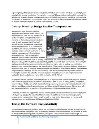
- 10. 9 Public Health and Land Use Planning: Highlights Physical Inactivity costs Canadians about $5.3 billion per year in health- related costs. reduced body fat, and improvement in mood and relief from symptoms of depression and anxiety (US DHHS, 1996 as cited by SMDHU, 2007). Physical inactivity poses a significant risk to human health and a significant burden to Canada's health care system. Katzmarzyk estimated that physical inactivity contributed to approximately 21,000 premature deaths in Canada in 1995 and cost Canadians about $2.1 billion in health-related costs in 1999 (Katzmarzyk et al, 2000 as cited by SMDHU, 2007). A most recent estimate put the health-related costs of physical inactivity at $5.3 billion per year (CFLRI, 2005 as cited by SMDHU, 2007). In 2003, the Public Health Agency of Canada concluded that physical activity: Can reduce the risk of colon cancer by as much as 50 percent; May protect women against breast cancer; can reduce the risk of developing Type 2 diabetes by as much as 50 percent; Undertaken in childhood and adolescence, can reduce the risk of osteoporosis in later life; Can maintain bone mass among adults; When conducted on a regular basis, improves function and relieves symptoms among people with osteoarthritis and rheumatoid arthritis (PHAC, 2003 as cited by HRHD, 2009a). Despite the significant health benefits associated with physical activity, most Canadian adults and youth do not get the exercise recommended by the Canadian Guidelines for Physical Activity . A study recently published by Statistics Canada staff found that: 85 per cent of Canadian adults do not get the 150 minutes of moderate to vigorous physical activity per week recommended by the Canadian Guidelines for Physical Activity (Colley, 2011a; CSEP, 2011); and 91 per cent of boys (6 to 19 years in age) and 96% of girls do not get the 60 minutes of moderate to vigorous physical activity per day recommended by the Canadian Guidelines for Physical Activity (Colley, 2011b; CSEP, 2011). Physical Activity & the Built Environment Physical activity has declined significantly over the last 50 years as a result of changes in our workplaces, homes, schools and communities. Researchers have observed that over the last 50 years there has been an overall decline in the levels of physical activity required in our jobs, in the maintenance of our homes, and in our transportation to and from schools, jobs and services (Brownson et, 2005 as cited by SMDHU, 2007). Particularly noteworthy from a built environment perspective is the change in transportation patterns that have resulted from the North American commitment to suburban living. Between 1950 and 2000, the percentage of U.S. residents who live in the suburbs doubled. During that same period, the number of daily vehicle miles travelled per person increased by 0.4 miles per year so that today, on average, U.S. residents drive 29 miles per day or 55 minutes per day (Brownson et al, 2005 as cited by SMDHU, 2007). Statistics Canada found that, in 2005, Canadian commuters spent on average, 63 minutes per day, with 25% of workers spending 90 minutes or more each day commuting (Statistics Canada, 2006).
- 11. 10 Public Health and Land Use Planning: Highlights A growing body of literature has demonstrated that the built environment affects the levels of physical activity in the general population. For example, a review of 19 quantitative studies which assessed the relationship between physical activity and elements of the built environment found that environmental factors such as accessibility, opportunities, safety and aesthetics have consistent associations with levels of physical activity (Humpel et al, 2002 as cited by HRHD, 2007d). Density, Diversity, Design & Active Transportation Many studies have demonstrated that population and/or employment density, the diversity of land uses, and the connectivity of roads, bike paths, and sidewalks are the elements of the built environment that are most strongly associated with levels of physical activity. For example, one review which analysed studies of six communities found that, on average, residents in highly walkable neighbourhoods took twice as many walking trips as people in less walkable neighbourhoods. Each of the studies reviewed demonstrated associations between built environment variables such as density, land use mix, and connectivity, with walking and cycling (Saelens, Sallis, and Frank, 2003 as cited by HRHD, 2007d). Residents from communities deemed highly walkable, according to environmental characteristics, had higher rates of walking and cycling than residents from communities deemed low for walkability. These studies demonstrated that utilitarian or purposeful trips, such as shopping, were responsible for the overall differences in walking trips between neighbourhoods rated high and low for walkability. The researchers found that patterns related to "walking for exercise" did not differ between residents in neighbourhoods rated high and low for walkability (Saelens, Sallis, and Frank, 2003 as cited by HRHD, 2007d). Studies indicate that between 70 and 83 per cent of all trips are short, for non-work purposes, and take place relatively close to home (Pulleyblank-Patrick et al., 2006 as cited by HRHD, 2009a). In addition, surveys indicate that there is a high degree of willingness among Canadians to walk or cycle instead of driving, with 82 percent willing to walk more, and 66 percent willing to cycle more, if there were safe and convenient facilities to use (Go for Green/Environics, 1998 as cited by HRHD, 2009a). Combined, these results suggest that policies which support active transportation can increase physical activity among groups who are difficult to influence with traditional health promotion programs, because active transportation allows people to walk or cycle for the dual purpose of exercise and transportation (Lee and Moudon, 2004 as cited by HRHD, 2007d). Transit Use Increases Physical Activity Studies have also demonstrated that transit use has the potential to increase physical activity levels in the community because people tend to walk or cycle to their transit connections. For example, a study by Besser and Dannenberg (2005) found that participants who used transit spend on average, 19
- 12. 11 Public Health and Land Use Planning: Highlights minutes daily walking to and from transit, while 29 percent spend 30 minutes or more walking to and from transit. This suggests that transit use can support adults in achieving the 150 minutes of physical activity per week recommended in the Canadian physical activity guidelines (CSEP, 2011). Research has also suggested that people who spend more time commuting to and from work in a car are less likely to be physically active and more likely to be overweight and obese (Frank, 2004a). Proximity to Facilities & Physical Activity A number of studies have also demonstrated that proximity to recreational and active transportation facilities influence behaviour related to physical activity. Lee and Moudon (2004) reviewed 20 studies and found that the presence of, and proximity to, facilities in a neighbourhood plays an important role in a person's level of physical activity. The facilities found to support and encourage leisure-time physical activity include public facilities such as footpaths, trails, parks, and open public spaces, as well as private facilities such as gyms and recreation centres (N. Humpel et al., 2002; Lee and Moudon, 2004 as cited by HRHD, 2007d). Physical Activity, Built Environment & Vulnerable Populations People who live on low incomes are more sensitive to the "walkability" of the built environment than the others in the general population. With the cost of a car estimated at about $7,000 per year, many individuals who live on low incomes do not have access to vehicles because they direct a greater proportion of their monthly incomes to food and shelter (HRHD, 2007d; Frank et al., 2003). This means that they rely more on public transit, walking, and cycling than others in the general population. It also means that they will have more difficulty reaching jobs, services, retail outlets and recreational facilities than more affluent individuals when the built environment does not support active transportation and/or an efficient transit system (Frank et al., 2003). The elderly are also particular sensitive to the "walkability" of their neighbourhoods. As a rule the elderly are more isolated and have greater mobility issues than the general population. For those who can no longer drive safely, there is a need for amenities and services to be nearby and easily walkable. Walking is also a prominent form of physical activity for older adults. The risk of falling is a major concern for the elderly because falls can be life threatening, so the design and condition of roads and sidewalks is critical to their mobility and independence (Loukaitou-Sideris, 2006 as cited by HRHD, 2007d). The design of the built environment can greatly enhance or prevent a person with disabilities from being active, using transportation systems, and being socially integrated into their community as well. Persons in wheel chairs benefit from communities that have sidewalks and curb depressions (Bray et al., 2005).
- 13. 12 Public Health and Land Use Planning: Highlights B Healthy Eating & the Built Environment Diet, Obesity & Health In 2005, Ontario's then Chief Medical Officer of Health, Dr. Sheela Basrur, put obesity on the public health agenda when she described weight gain and obesity as "an epidemic" that is threatening Ontario's health. Her report noted that: "In 2003, almost one out of every two adults in Ontario was overweight or obese. Between, 1981 and 1996, the number of obese children in Canada between the ages of seven and 13 tripled. This is contributing to a dramatic rise in illnesses such as Type 2 diabetes, heart disease, stroke, hypertension and some cancers" (Basrur, 2005). It is estimated that, from 1985 to 2000, 57,000 deaths in Canada were associated with overweight and obesity, and that the direct health care costs of obesity in 1997 were over $1.8 billion or 2.4% of total health care expenses in Canada (Katzmarzyk and Ardern, 2004; Birmingham et al, 1999). Physical inactivity is not the only risk factor contributing to the "epidemic" of weight gain, obesity, and associated chronic diseases in North America. Poor nutrition and the consumption of low-nutrient "fast- foods" and processed foods are also to blame. Studies have found that the availability of low-cost processed foods, which are typically high in sodium, fat and/or refined carbohydrates, is a contributing factor to the rise in obesity among children and adults (Raine, 2005 and Drewnowski, 2003 as cited by RWPH, 2005a). Healthy Foods & Income The 2004 Canadian Community Health Survey found that almost 9.2 per cent of Canadian households, representing about 2.7 million individuals, were not able to afford the foods needed for a healthy, balanced diet at least once in the 12 months preceding the survey. It found a clear relationship between income level and household food security with severe to moderate food insecurity among those living on the lowest income levels. The study found that certain groups experienced higher rates of food insecurity including: households living on social assistance, workers' compensation, and employment insurance benefits; off-reserve Aboriginal households; single parent households; and households with one or more children (Health Canada, 2007). (It should be noted that on-reserve Aboriginal households were not included in the survey.) It t and Stroke Foundation of Canada Food security impacts the quality of a household's diet and the health of those in the household. People who experience food insecurity are 80 per cent more likely to develop diabetes, 60 per cent more likely to develop high blood pressure, and 70 per cent more likely to develop food allergies than households with sufficient food (Mikkonen and Raphael, 2010). This is because people who experience food insecurity consume fewer servings of fruits and vegetables, milk products, and vitamins than those in food-secure households (Mikkonen and Raphael, 2010).
- 14. 13 Public Health and Land Use Planning: Highlights Food Access & the Built Environment Studies have demonstrated that people are more likely to meet dietary guidelines when they have ready access to grocery stories with healthy and affordable foods, than those whose only have access to food from nearby convenience stores that offer mostly packaged and processed foods (Morland, 2002 as cited by RWPH, 2005a). Access and availability to healthy foods can have a greater impact on low income households that have less mobility and fewer transportation options. Several studies have also demonstrated that the increased density of "fast-food" restaurants in lower-income neighbourhoods is a contributing factor to increased rates of obesity in some American cities (Block et al., 2004; Maddock, 2004; Reidpath et al, 2002 as cited by RWPH, 2005a). Community Food Security A number of PHUs in Ontario have taken a broader position on food security. The OPHA Food Security Workgroup has defined the concept of community food security as: “…a situation in which all community residents obtain a safe, culturally acceptable, nutritionally adequate diet through a sustainable food system that maximizes self-reliance and social justice.” This concept suggests that food security includes all the steps in the food production cycle, and the ability of communities to control and influence those steps to ensure their long-term health and well- being with respect to healthy, safe and nutritious foods. It is a concept that, in the built environment and land use planning context, raises questions about how to preserve local agricultural land, how to support local farmers, and how to support the local food industries in one's community. Need to Preserve Agricultural Lands Statistics Canada reports that: only about 5 per cent of Canada’s land is free from severe constraints to crop production; about 15 per cent of Canada’s Class 1, 2, and 3 agricultural land is in Ontario; about 56% of Canada's Class 1 agricultural land is in Ontario; and these lands are quickly disappearing. For example, Statistics Canada reports that there will be a 40 per cent reduction in the farmland in the GTA between 1976 and 2026 if current trends continue (Hoffman et al. as cited HRHD, 2007e). The need to preserve prime agricultural land is amplified by future uncertainties. Peak oil (i.e. Declining petroleum supplies) and climate change are predicted to have a significant effect on agricultural production around the world. Today’s agricultural productivity is dependent on energy-intensive cultivation methods and material inputs. With declining petroleum and natural gas supplies and increasing energy costs, there is reason to believe that agricultural outputs around the world will be affected (Rees, 2004 as cited by HRHD, 2007e).
- 15. 14 Public Health and Land Use Planning: Highlights Also, at present, Canada imports about 40 per cent of its vegetables (excluding potatoes) and 80 per of its fruit, with most of the imports coming from the USA and Mexico (RWPH, 2005b). In Toronto between 50 to 60 per cent of all produce consumed is imported, mostly from Florida, California and Mexico (Toronto Food Policy Council, 1999). These are areas of the world where agricultural outputs are likely to be affected by climate change. The Inter-governmental Panel on Climate Change has predicted that climate change may: increase droughts in the United States great plains and the Canadian Prairies; reduce citrus fruit yields in southern Florida and Texas because of excessive heat during the winter; and negatively impact Mexico's crop production because of changes in precipitation (IPCC, 2001 as cited by HRHD, 2007e). These predictions suggest that Canada's current sources of vegetables and fruit may not be as reliable or inexpensive in the future. Local Food has Enhanced Nutritional Value One of the reasons to emphasize the preservation of local farms and local food production is food quality. Fresh fruit and vegetables lose their nutritional value over time. As soon as produce is harvested, growth stops, but enzymes continue to act, altering nutrient content along with texture and taste (MacNair, 2004 as cited by HRHD, 2007e). The American Institute for Cancer Research (2006) recommends that consumers purchase locally grown produce since produce at its peak of ripeness contains the highest level of nutrients and it is much more likely that imported foods have been harvested days or weeks before purchase. As soon as produce is picked, vitamins and phytonutrient compounds begin to break down from exposure to heat, light, time, and natural processes (AICR, 2006 as cited by HRHD, 2007e). For example, studies have shown that tomatoes retain 0 to 22 per cent of their vitamin C after 5 to 9 days of storage at optimal temperatures, and spinach retains only 53 per cent of its folate after 8 days of storage at optimal storage temperature (George et al 2006). Increased Ability to Ensure Food Safety Another reason to preserve local farms and support local food production is food safety. Over the past decade, food safety has emerged as a consumer concern in response to outbreaks such as E. coli in spinach from California and cyclosporiasis in raspberries from South America (HRHD, 2007e). According to the World Health Organization, the food production chain has become more complex, providing greater opportunities for contamination and growth of pathogens. Many outbreaks of food borne diseases that were once contained within a small community may now take on global dimensions (WHO, 2002). The Canadian Food Inspection Agency is responsible for the regulation of imported foods into Canada. It has procedures in place to regulate fruits and vegetables from other countries which address issues such as unwanted animal/insects pests, plant pests and chemical residues. However it is much easier to ensure food safety with food produced locally. The Canadian government, Ontario Ministries and local health units can use existing regulations to closely monitor food production practices to ensure foods are being produced in a sanitary manner using potable water (HRHD, 2007e). Outbreaks involving Ontario grown fresh fruit and vegetable have not been previously identified (Chapman, 2003). However, in the event of an outbreak, a local food system allows for more control over the farm-to-fork chain. If a problem occurs the effect is more localized and allows for enhanced traceability (HRHD, 2007e).
- 16. 15 Public Health and Land Use Planning: Highlights C Injuries & the Built Environment Injuries, Hospital Admissions & Deaths Unintentional and intentional injuries are the leading cause of death among Canadians between the ages of 1 and 44, and the fourth leading cause of death for Canadians of all ages (PHAC, 2011a). In 2003, 13,906 Canadians died and 226,436 Canadians were admitted to hospitals as a result of injuries (PHAC, 2011a). It has been estimated that injuries in Canada cost about $19.8 billion in 2004 with $10.7 billion in direct health care expenditures and $9.1 billion in "costs" associated with reduced productivity, disability, and premature death (PHAC, 2011c). Falls are the most common cause of injury-related hospital admissions in Canada, accounting for two out of every three injury-related hospital admissions, while motor vehicle injuries are the second most common cause of injury-related hospital admissions accounting for 10 per cent of all injury-related hospital admissions (CIHI, 2011). SMARTRISK has estimated that falls and transportation-related incidents cost Canadians about $6.2 billion and $3.7 billion respectively annually in direct and indirect costs (PHAC, 2011c). While far more drivers and passengers are injured or killed in motor vehicle collisions than pedestrian and cyclists, pedestrians and cyclists face higher risks of fatality or injury per kilometre travelled than people who travel by automobile, bus or rail. The fatality risk per kilometre travelled for pedestrians and cyclists in the United States is 23 and 12 times higher, respectively, than the risk for those who travel by car (Pucher and Dijkstra, 2003 as cited by the NCCEH, 2010). Evidence suggests however, that injury and fatality rates among pedestrians and cyclists decrease as active transportation increases (Elvik R, 2009 as cited by the NCCEH, 2010). Injury Prevention Strategies Injury prevention strategies include enhancing protective factors and decreasing risk factors through education, enforcement, and changes in the environment. Education is directed at individuals in the community; helping people to understand how injuries occur and how to prevent them. Enforcement involves the establishment and enforcement of laws and regulations that can protect people from unsafe products or situations or reduce the risk of injury. Regulations related to speed limits on traffic corridors, bicycle helmets, pool fencing, and smoke detectors fall into this category. Changes in the environment includes changes in workplaces, public spaces, schools and homes that can affect the risk of injuries. From a land use planning perspective, this would capture the existence, design and
- 17. 16 Public Health and Land Use Planning: Highlights condition of roads, sidewalks, intersections, cycling facilities, and access routes to buildings (NRPH, 2010). Density, Transit & Vehicle-Related Injuries/Deaths Various environmental factors influence the rate of collisions, injuries and fatalities on roads. Studies have found that high density communities that are well served by public transit tend to have lower death rates from motor vehicle collisions. This phenomenon has been attributed to: reduced vehicle kilometres travelled by individuals living in high density communities that have efficient transit systems; lower average traffic speeds in higher density areas; and reduced driving by high risk motorists such as teenagers and impaired drivers because transit provides a viable alternative (Litman, 2005 as cited by TPH, 2006). A number of studies have shown that traffic speeds and volume are strongly linked to the number and severity of collisions. Generally traffic volumes are associated with the frequency of collisions while traffic speed is associated with the severity of collisions (Frank, 2008). One study conducted in the United Kingdom found that pedestrians have a 45 per cent chance of being seriously injured or killed when struck by a car travelling 30 miles per hour (mph) (48 km/hour) and a 5 percent chance of serious harm or death when struck by a car traveling at 20 mph (32 km/hour) (Pilkington, 2000 as cited by TPH. 2006). Street Design, Facilities & Injuries Street design and facilities have been shown to affect the safety of pedestrians and cyclists in a number of studies as well. For example, cycling facilities such as bike lanes and off-road bike paths reduce collisions and injuries involving cyclists (Retting et al, 2003 as cited by NCCRH, 2010). Sidewalks, traffic circles and four way stops have been linked to lower pedestrian-vehicle collision rates. In addition, street trees, landscaping, and on-street parking have been shown to lower the speed of vehicles on streets (Frank, 2008). Injuries & Low Income Populations Canadians who live on low incomes are more likely to be hospitalized for an injury than more affluent Canadians. When the Canadian Institute for Health Information (CIHI) examined hospitalizations related to injuries, it found that Canadians in the least affluent neighbourhoods were 30 per cent more likely to have an injury leading to hospitalization than people living in the most affluent neighbourhoods (CIHI, 2011). The CIHI study found that these disparities in injury hospitalization rates applied to most major types of unintentional injuries including falls, motor vehicle-related injuries, and injuries involving sharp objects or tools. The only exception was sports-related injuries where injury-related hospitalizations were greater among more affluent Canadians (CIHI, 2011). The CIHI study found that: Older adults (age 45 to 64) who live in the least affluent neighbourhoods in Canada are 50 per cent more likely to be hospitalized from falls than Canadians from the most affluent neighbourhoods;
- 18. 17 Public Health and Land Use Planning: Highlights In Canada, in 2008, air pollution resulted in approximately: 21,000 premature deaths 11,000 hospital admissions; 92,000 emergency room visits; 620,000 doctor's office visits; Over 20 million minor illnesses (CMA, 2008). Among all age groups, except adolescents (age 15 to 24), Canadians in the least affluent neighbourhoods are more likely to be hospitalized for a motor vehicle-related injury than their more affluent counterparts; Hospitalizations for assault related injuries, which represent 4.4 per cent of all injury hospitalizations, were three times higher among Canadian in the lowest income neighbourhoods than among those in the highest income neighbourhoods (CIHI, 2011). D Air Quality & the Built Environment Air Quality & Human Health Hundreds of studies conducted in communities around the world have clearly demonstrated that short-term increases in the levels of the common air pollutants are associated with increases in a broad range of acute health effects (OMA, 2005; TPH, 2004; Stieb, 2005; WHO-Europe, 2004; US EPA 2004; CMA, 2008; Brook et al, 2010). A number of studies have also demonstrated that long-term exposure to air pollution contributes to the development of chronic heart and lung diseases among adults (US EPA, 2004; Krewski, 2000; Samet, 2000; Pope et al, 2002). After conducting a comprehensive review of the health studies directed at fine particulate matter (PM2.5), the common air pollutant most strongly linked to chronic health effects, the American Heart Association concluded that: There is a causal relationship between exposure to PM2.5 and cardiovascular disease and death; Longer-term exposure (i.e. a few years) to elevated levels of PM2.5 increases the risk for cardiovascular mortality and reduces life expectancy; and Reductions in air levels of PM2.5 can decrease cardiovascular mortality within a few years (Brook et al, 2010). The overall evidence from cohort studies demonstrates that, on average, for every 10 ug/m3 increase in long-term air levels of PM2.5: Mortality from all causes increases by approximately 10 per cent; and Mortality from cardiovascular disease increases by 3 per cent to 76 per cent with some groups, such as women and obese individuals, having greater risks than members of the general population (Brook et al, 2010). Long-term studies directed at children have demonstrated that air pollution can have a significant effect on the long-term health of children as well. For example, the Children’s Health Study, a long-term study directed at about 6,000 children living in 12 communities in Southern California since 1993, has shown a three- to five-fold increase in decreased lung function among adolescents who grew up in communities with high levels of air pollution (Gauderman, 2000; Peters, 2004). It also found that physically active children living in high ozone communities are up to three times more likely to develop asthma than children living in low ozone communities (McConnell, 2002; Peters, 2004).
- 19. 18 Public Health and Land Use Planning: Highlights Over the last decade, a number of studies have suggested that air pollution also affects birth outcomes and reproduction. When a team of scientists reviewed these studies, they concluded that infants exposed to higher outdoor levels of airborne particulate matter (PM2.5/10) are at increased risk of death from respiratory ailments. They also concluded that air pollution can increase the risk of infants being born with low birth weights (Sram, 2005). Costs of Air Pollution-Related Health Impacts Using the strongest air pollution health studies, air monitoring results, and health statistics, the Canadian Medical Association estimated that, across Canada in 2008, the seven common air pollutants contributed to approximately: 2,682 premature deaths occurring from short-term elevations in air pollution; 42 per cent of them related to cardiovascular disease and 11 per cent to respiratory conditions; 18,318 premature deaths from long-term exposure to air pollutants; 11,000 hospital admissions; 60 per cent related to cardiovascular conditions and 40 per cent due to respiratory conditions; 92,000 emergency room visits; 620,000 doctor's office visits; and Over 20 million minor illnesses (CMA, 2008). Excluding chronic premature deaths and early childhood effects, the Canadian Medical Association valued the cost of these health effects at $8 billion in 2008 (CMA, 2008). The Canadian Medical Association and the Ontario Medical Association estimated that air quality in Ontario resulted in 9,500 premature deaths in Ontario in 2008 with more than 1,000 of those deaths occurring during or immediately after periods of increased pollution, and 8,500 occurring from long-term exposure to air pollution (OMA, 2008). Air Quality & Vulnerable Populations Many studies have shown that air pollution increases the risk of death and illness due to heart disease, stroke, and respiratory disease through both short term and long term exposures. While everyone faces increased health risks due to air pollution, the risk is greater for: People with cardiovascular conditions such as angina, congestive heart failure, heart rhythm problems; Those who have suffered a previous heart attack; People with respiratory conditions such as asthma and chronic obstructive lung disease; People with diabetes; The elderly, pregnant women and young children; and Women and obese individuals (Brook et al, 2004; Brook et al, 2010).
- 20. 19 Public Health and Land Use Planning: Highlights A new study conducted by the Canadian Institute for Health Information has demonstrated that low income populations in Canada's urban regions are more likely to live within close proximity of air pollution sources than high income populations. This study found that: The lowest income populations in Toronto and Montreal were 3.5 and 2.8 times, respectively, more likely to live within 200 metres of a highway than the highest income populations; and Twenty-five per cent of people from the lowest income populations in Canada's urban regions live within one kilometre of a pollution-emitting facility while only seven per cent of people from the highest income populations do (CIHI, 2011a). Walkable Communities & Air Quality Land use planning and transportation decisions made by local and regional governments can have a substantial impact on local and regional air quality because of the way in which they influence travel patterns, modes of transportation, and energy use in buildings. Emission inventories indicate that the transportation sector is one of the most significant sources of air pollutants within Ontario. While a great deal of progress has been made to reduce emissions from vehicles, this progress has been offset by the increasing number of vehicles on the road and the increasing number of vehicle kilometres travelled by Canadians (Probe, 2004). Many studies have demonstrated that the built environment can have a significant impact on emissions from the transportation sector and local air quality by influencing the extent to which people depend upon automobiles and other modes of transportation. For example: The California Air Resources Board found that “complete” neighbourhoods (i.e. compact neighbourhoods built around public transit with a variety of services within a five minute walk) can reduce vehicle-related air emissions by up to 20 per cent relative to more typical suburban neighbourhoods (CARB, 2005); In the Atlanta-based SMARTRAQ study, the people who lived in the most auto-oriented neighbourhoods drove an average of 39 miles per person each weekday or 30 percent more than those who lived in the most walkable neighbourhoods. The study found that each step up a five- part walkability scale was associated with a six percent reduction in emissions of nitrogen oxides (NOx) and a 3.6 percent decrease in emissions of volatile organic compounds (Frank and Chapman, 2004b as cited by Frank, 2008). One study has suggested however that, while compact neighbourhoods can reduce per capita vehicle- related emissions, they can also concentrate the emissions particularly if the neighbourhoods do not have a strong mix of land uses and an efficient public transit system (Marshall et al., 2009). Alternative Modes of Transportation & Air Quality Several studies have demonstrated the substantial impact that alternate modes of transportation can have on local air quality and/or human health. For example: In the City of Atlanta, researchers found that an alternative transportation strategy introduced during the 1996 summer Olympics, which shifted people from their vehicles on to public transit,
- 21. 20 Public Health and Land Use Planning: Highlights "The most susceptible (and overlooked) population in the US subject to serious health effects from air pollution may be those who live near major regional transportation routes, especially highways…." reduced traffic counts by 22.5 per cent, peak ozone levels by almost 28 per cent, and asthma- related hospital admissions among children by 11 to 44 per cent during the Olympics (Friedman, 2001); Using air modelling and road count data, the City of Toronto has estimated that 190 premature deaths could be avoided, and $900 million in health benefits could be realized, each year, if vehicle emissions in Toronto were reduced by 30 per cent by encouraging a shift to other modes of travel (TPH, 2007a). Air Quality & Incompatible Land Uses Air quality can vary substantially across a community as local emission sources, such as highways, industrial facilities, and truck depots, add to background levels of air pollution that include transboundary air pollution. In Ontario, the Ministry of the Environment (MOE) has responsibility for permitting industrial facilities and other emission sources with certificates of approval (CofAs) based on the emissions from a single facility or operation and, sometimes, on a single source within a facility. This approach does not take into consideration background levels of air pollution or the cumulative impacts of a variety of emission sources in a local area. Consequently, while the CofA process ensures that individual emission sources do not exceed air standards, it does not ensure that air levels within a community stay within health-based air standards (HRHD, 2009b). Historically, these shortcomings in regulatory control have been mitigated, to some extent, by recommending separation distances to keep industrial facilities separate from sensitive land uses such as homes, daycares, schools and hospitals (HRHD, 2009b). However, separation distances between sensitive land uses and industrial point sources have not always been preserved as development pressure on communities grows. In addition, in Ontario, high volume traffic corridors have not been included in the Land Use Compatibility Guidelines developed by the MOE (HRHD, 2009b). Air Quality & Traffic Corridors The principal source of variation in air quality within many communities is vehicle-related air pollution associated with high volume traffic corridors (HEI, 2010). A review of 15 different studies conducted by the World Health Organization found that concentrations of air pollutants along traffic corridors were 1.2 to 2.3 times higher than background levels in those urban areas (WHO 2005 as cited by BC MOE 2006). Health studies directed at high volume traffic corridors have demonstrated that these variations in air quality can have a significant impact on human health. After conducting a comprehensive review of the health literature, the Health Effects Institute Panel concluded that: The evidence demonstrates that traffic-related air pollution aggravates asthma; and The evidence suggests that traffic-related air pollution causes the onset of childhood asthma, non- asthma respiratory symptoms, impaired lung function, and increases total deaths, cardiovascular deaths, and cardiovascular disease in a community (HEI, 2010).
- 22. 21 Public Health and Land Use Planning: Highlights Climate change impacts could create economic and social disruptions on a similar scale to those experienced during the great wars or the depression. A number of organizations and health researchers have concluded that the evidence is sufficient to demand action to protect the public from air pollution associated with high volume traffic corridors. For example, an inter-disciplinary team from Tufts University that conducted a comprehensive review of the traffic corridor health literature concluded that: "There is a need for more research, but also a need to begin to explore policy options that would protect the exposed population” (Brugge et al., 2007). E Climate Change & the Built Environment The Significance of Climate Change Climate change is one of the most significant public health challenges of our generation. In 2006, Sir Nicholas Stern, former economist to the World Bank, led a study for the British Government which estimated that it would take about 1 per cent of the annual global Gross Domestic Product to fund the programs needed to stabilize greenhouse gas concentrations in the atmosphere below 550 parts per million (ppm) - the level required to limit global temperature increases between 2 and 3 degree Celsius. The study also found that failure to make this investment could result in climate change impacts that would result in a 5 to 20 per cent loss in the global Gross Domestic Product. The study concluded that these impacts could create economic and social disruptions on a scale similar to those experienced during the great wars or the depression (Stern, 2006 as cited by ICF, 2007). Mitigation & Adaption Needed In 2007, the Intergovernmental Panel on Climate Change issued a report in which it confirmed, with 90 per cent certainty, that the world's climate is warming and that warming is being caused by human activity. That report found that levels of carbon dioxide (CO2) in the atmosphere have increased from 280 ppm in 1750 to 379 ppm in 2005; an astounding increase when one considers that CO2 levels ranged between 180 and 300 ppm for the past 650,000 (IPCC, 2007a). Climate models demonstrate that atmospheric levels of CO2 must be stabilized at 450 ppm if global temperature increases are to be limited at 2 degrees Celsius. The Stern study determined that this level would be reached within a decade unless immediate and aggressive reduction strategies are implemented. It also found that global greenhouse gas (GHG) emissions must be reduced by approximately 60 per cent by 2050 if atmospheric levels of CO2 are to be stabilized at 450 to 550 ppm (Stern, 2006 as cited by ICF, 2007). The Intergovernmental Panel on Climate Change has also concluded that, even if immediate and aggressive action were taken to freeze emissions at 2000 levels, a 2 degree Celsius increase in global temperatures is "locked in" for the next two decades because of "carbon feedback cycles" (IPCC, 2007a). These findings suggest that action must be taken to adapt to the climate change that is inevitable as well.
- 23. 22 Public Health and Land Use Planning: Highlights The Walkerton E. coli outbreak in 2000… was the result of an extraordinary rainfall… combined with improper water disinfectant treatment. Climate Change - Global Health Impacts Global climate change is expected to have profound impacts on the health of whole populations in regions spanning the globe. The Intergovernmental Panel on Climate Change has concluded that the projected climate change is likely to affect the health status of millions of people, particularly those who live in countries that have little adaptive capacity, through: Increases in malnutrition and related disorders; Increased deaths, disease and injury due to heat waves, floods, storms, fires and droughts; The increased burden of diarrheal disease; The increased frequency of cardio-respiratory diseases due to higher concentrations of ground- level ozone related to climate change; and The altered spatial distribution of some infectious disease vectors (IPCC, 2007b). Africa is considered one of the most vulnerable continents because of multiple stresses and low adaptive capacity. Most continents are expected to experience decreases in fresh water supplies. Coastal areas around the world are at increased risk from flooding. Malaria is expected to shrink in range in some areas of the world in response to droughts, while cholera is expected to increase in others in response to increasing water temperatures. Europe and North America are projected to experience more flooding and more heat waves (IPCC, 2007b). Climate Change - Ontario Health Impacts In Ontario, climate change is expected to affect human health by: Increasing the frequency and severity of heat waves; Kalkstein and Smoyer have predicted that, with a doubling of CO2 concentration in the atmosphere, central Canada could experience a five-fold increase in air masses that bring smog episodes, high temperatures and high humidity. These projections suggest that heat-related death rates in the Toronto area could increase to between 9.63 and 33.65 per 100,000 (Kalkstein and Smoyer, 1993). Those living in urban areas are at greater risk during heat waves because of the "urban heat island effect" in which urban areas absorb and retain heat more than rural areas. One study suggests that suburban areas in North America may experience more frequent extreme heat events than compact urban centres because of factors such as the rapid loss of tree canopy (Stone et al, 2010). The poor can also be at greater risk from extreme heat because of substandard housing conditions, medical conditions that increase vulnerability to heat, or because they lack access to air conditioners, pools or cool recreational areas (McGeehin, 2001). Increasing the frequency and severity of smog episodes; Climate change could increase the frequency of smog episodes from 4.7 per cent of summer days to 23.3 per cent of summer days in Ontario (Chiotti et al., 2002). This increase in smog episodes is expected to significantly increase the number of air pollution-related health impacts experienced in Ontario, particularly among those who live in southern Ontario (Lemmen et al, 2008). Increasing the frequency of extreme weather events;
- 24. 23 Public Health and Land Use Planning: Highlights Several studies have demonstrated that people who live in more compact, mixed-use communities, drive 20 to 40 percent less than those in lower density communities. Ontario is expected to experience an increase in extreme weather events including snow storms, flooding, and tornados. While extreme weather events have a greater impact on human health in poorer countries that do not have the social infrastructures needed to mitigate their impacts or to respond to them when they occur, Canada is not immune to the effects of extreme weather events. For example, the 1998 ice storm that affected eastern Ontario, resulted in 29 deaths, approximately 60,000 physical injuries, and potentially tens of thousands of post-traumatic stress disorders in Canada (Env Can, 1999; Kerry, 1999; and Chiotti 2002 as cited by Lemmen et al, 2008). Increasing the risk of insect-borne diseases; and Projected temperature changes are expected to extend the range of insect- and tick-borne diseases such as West Nile virus, Lyme disease, and possibly malaria, in Ontario (TPH, 2001; Ogden, 2005 as cited by Lemmen 2008). While insect-borne diseases are highly dependent upon climatic conditions such as temperature, rainfall and humidity, they are also dependent upon living conditions (e.g. access to air conditioning and window screens), building materials, and social infrastructure. In wealthy nations such as Canada, it is expected that the impacts of these diseases can be minimized with a public investment in disease surveillance, education, habitat reduction and mosquito control (Gubler, 2001; TPH, 2001). Increasing the risk of water-borne diseases (Lemmen et al, 2008). While water-borne diseases have a much greater impact on countries that lack Canada's water and waste water infrastructure, Canada's systems are vulnerable to the impacts of climate changes. The Walkerton E. coli outbreak in 2000, which resulted in seven deaths and 2,300 illnesses, was the result of an extraordinary rainfall, which facilitated the transportation of pathogens into the municipal water system through a shallow well, combined with improper water disinfection treatment (O'Connor, 2002 and Richards, 2005 as cited by Lemmen et al, 2008). Climate Change Mitigation & the Built Environment The transportation sector, responsible for 30 percent of Ontario’s total GHG emissions, is the single largest source of GHG emissions in Ontario. As stated previously, while improvements in vehicle fuel efficiency and increased reliance on alternative fuels will reduce emissions of GHG from the transportation sector, research demonstrates that these improvements are likely to be offset by growth in the number of vehicle kilometres travelled (Ewing, 2008). Over the last three decades, the number of vehicle kilomotres travelled has grown faster than the population in both Canada and the U.S. People are driving longer distances, taking more trips by vehicle, relying less on public transit, and walking less (Probe, 2004; Ewing et al., 2008). The number of vehicle kilometres travelled is related to the way in which our communities are designed. They are affected by the distance between homes, jobs, schools and services (Ewing et al., 2008). Several studies have demonstrated that people who live in more compact, mixed-use communities, drive 20 to 40 percent less than those in lower density communities (Ewing, 2008; Frank 2008). This translates into a 20 to 40 per cent reduction in emissions of GHGs from the transportation sector in
- 25. 24 Public Health and Land Use Planning: Highlights those communities (LFC, 2005a). These findings suggest that the creation of walkable and transit- supportive communities is a major step that must be taken to mitigate emissions of GHGs and slow climate change. Energy use in buildings, responsible for approximately 10 per cent of GHGs nationally, is another important source of GHGs in Ontario that can be influenced through the land use planning processes (ICF, 2007). Local and regional municipalities can encourage reductions in energy use in buildings by encouraging: new buildings to be designed and built to energy efficiency standards beyond those required by the Ontario Building Code; the use of green roofs, trees, and building orientation to reduce energy needs; and the application of alternative energy systems and technologies (ICF, 2007; HRHD, 2007a). Climate Change Adaptation & the Built Environment There are number of actions that can be taken through local and regional land use planning processes to prepare for, or adapt to, the climate change that is currently occurring as well. For example, municipalities can: Consider the future irrigation needs of farmers when managing ground water; Encourage electricity generating systems that are less vulnerable to extreme weather events; Encourage new and renovated buildings that are resilient to predicted extreme weather events; Ensure that storm water management addresses extreme weather events; Update flood plain mapping in light of climate change projections; Assess and address the vulnerability of their communities to heat stress; Encourage recharging of groundwater tables in urban centres (i.e. reduce paved surfaces; utilize permeable paving, downspout disconnects and bioswales); Encourage actions that reduce the urban heat island effect (e.g. preserve greenspace, encourage green roofs, streets trees, and reflective surfaces); Encourage the development of buildings that conserve water, reduce energy use, and use alternative energy technologies and systems (Expert Panel, 2009; Stone et al, 2010). F Water Quality & the Built Environment Water Quality & Health Clean, accessible fresh water is essential to life. Water used for drinking and other purposes is drawn from ground water or surface water. When it rains or snows, water either seeps into the soil where it is filtered by vegetation before it reaches groundwater or it runs along the surface of the ground and flows into streams, rivers and lakes (SMDHU, 2007). Water can be contaminated with biological organisms such as bacteria, parasites, viruses and chemical contaminants. Generally speaking, the biological organisms of concern in water originate from animal or human waste, while the chemical contaminants come from point sources such as industrial facilities or non-point sources such as landfills, parking lots, farms and golf courses (SMDHU, 2007).
- 26. 25 Public Health and Land Use Planning: Highlights Biological organisms can produce a variety of health conditions ranging from mild gastro-intestinal symptoms to meningitis, kidney failure, cholera, pneumonia and dysentery. Water-borne diseases affect about 4 billion people each year globally. In Canada, where water and wastewater are treated and regulated, large scale outbreaks of water-borne disease are relatively rare. Two notable exceptions in Canada are the Walkerton E. Coli outbreak in 2000 which claimed the lives of seven people and caused 2,300 people to become sick, and the North Battleford, Saskatchewan cryptosporidium outbreak in 2001 which resulted in 7000 infections (Frumkin et al., 2004 as cited by SMDHU, 2007). Water sampling data suggests that small-scale outbreaks occur quite frequently in Ontario. A study conducted for the Ministry of Health and Long-term Care in 2001 found that, on average, between 25 and 40 per cent of water samples from private wells in Ontario had significant Coliform counts, with about 20 per cent having E. coli contamination2 (Krewski et al, 2001 as cited by GBHU, 2010). Heavy rainfall and outbreaks of waterborne diseases have been shown to be closely linked. Research conducted by John Hopkins University has shown that extreme rainfall preceded more than 50 per cent of water-borne disease outbreaks reported in the United States between 1948 and 1994. This phenomenon has been attributed to increased levels of contaminants in streams and storm sewers from run-off and/or increased levels of sediment in water which reduces the effectiveness of chlorination processes used to disinfect water (Barwick, 2000; Lee, 2002 as cited by Frumkin et al., 2004 as cited by SHDHU, 2007). While water-borne diseases can affect all members of the community, young children, pregnant women, the elderly, and people with pre-existing health conditions tend to be more susceptible to them than other members of the community (GBHU, 2010). Water Quality & the Built Environment Land use planning decisions can impact water quality in several ways. For those communities that rely on wells, the density of development can impact water quality as impervious surfaces reduce the water that is absorbed into the ground, which can reduce the quantity and quality of groundwater. In addition, as impervious surfaces cover the ground, run-off to surface waters can lead to soil erosion and increase the level of contaminants in surface water (Frumkin et al., 2004 as cited by SMDHU, 2007), which can present a health concern for those who use surface waters recreationally as well as for those who use surface waters as a source of drinking water. One study suggested that low density suburban areas produce 43 per cent more run-off when compared to higher density urban areas (Schmidt 1998 as cited by Bray et al, 2005). The greatest sources of water pollution in suburban areas are parking lots, wide roads, and lawn care products, with over-use of septic systems contributing to contamination in some cases (Frank et al, 2005; SMDHU, 2007). Water resources can be protected by preserving greenspace, decreasing the area covered by impervious surfaces, encouraging green roofs, and encouraging materials and storm water systems that help to reduce and filter run-off (Frumkin et al 2004 as cited by SMDHU, 2007). 2 Coliforms indicate that organic matter is present; they can indicate the presence of decaying vegetation, but can also indicate the presence of animal or human faecal matter. E. coli indicates the presence of animal or human faecal matter (GBHU, 2010).
- 27. 26 Public Health and Land Use Planning: Highlights IV Discussion & Recommendations Introduction For this project, ten public health units were examined to see how they are working to influence the land use and transportation planning processes in their communities in order to create healthier and more sustainable communities. The ten public health units were drawn from across the province; one from northern Ontario, one from eastern Ontario, three from western Ontario, and five from central Ontario. Four of them report to autonomous boards of health, five are situated in regional municipalities, and one is situated in a single- tier municipality. Four of the public health units are located in the Greater Toronto Area with well established urban centres, two are from regions characterized by an urban/rural mix of development, three are from rural areas, and one is from northern Ontario with one large urban centre and a number of remote communities. This report is based largely upon interviews conducted with staff in each of the ten public health units. The interviews were guided by questions that were developed in consultation with the Project Advisory Committee which included one representative from each of the ten participating public health units. The interview questions were directed at understanding: 1. The interventions being sought by these ten public health units through the land use and transportation planning processes in their communities; 2. The interventions being sought that could improve the health of low income populations; 3. The strategies that these public health units are employing to directly and/or indirectly influence land use and transportation planning processes; and 4. Where interventions being sought are complementary to one another and where they might be contradictory; 5. The health programs, disciplines and expertise these public health units are directing at land use planning processes; 6. The organizational structures public health units are utilizing to address built environment and land use planning processes given their multi-disciplinary nature; and 7. The research, policies, tools and/or data that public health professionals believe they need in order to be more effective in this field. A Interventions Being Sought Active & Alternative Modes of Transportation All of the ten public health units examined are promoting densities, land use mixes, and urban designs that support active modes of transportation such as cycling and walking, and/or alternative modes of transportation such as public transit.
- 28. 27 Public Health and Land Use Planning: Highlights In larger urban centres, the public health units are promoting live/work relationships and a range of housing that allow people to work in the communities they live in. They are encouraging employment and population densities that make it possible to provide efficient and affordable transit services. They are supporting mixed land uses that foster walking and other active modes of transportation. They are supporting policies that would locate schools, transit stops, parks, open spaces, recreational facilities, retail outlets and services within close proximity to residential neighbourhoods. In small and large urban centres, these public health units are encouraging community design elements that support active modes of transportation: street designs with a strong sense of place that foster active modes of transportation; pedestrian and cycling infrastructure that is safe and appealing with a high degree of connectivity; and trails, parks and greenspace that are accessible by active modes of transportation and/or public transit. In rural or isolated areas, efforts are directed towards the provision of trails and paved shoulders which could be used to increase levels of physical activity and/or access to jobs and services among those who cannot drive because of age, ability or income. In rural areas and smaller urban centres, physical inactivity, vehicle-related injuries and deaths, and accessibility issues are the primary arguments used to support and promote active transportation, trails, and paved shoulders. In larger urban centres, particularly in southern Ontario, active transportation and public transit are supported with arguments related to their air quality and climate benefits along with those related to physical activity, injury prevention, and access. Access to Recreational Facilities Many of these public health units are promoting or supporting policies to establish trails, parks and greenspace, often with a view to ensuring that they are equitably distributed across a community, to encourage recreational physical activity among all ages and income groups. A few PHUs such as the Haliburton Kawartha Pine Ridge District Health Unit are involved in the establishment of trails in their communities. Access to Healthy Foods Many of the public health units examined have developed health promotion programs that support local farmers and increased access to fresh foods among residents with a particular emphasis on people living on low incomes (Waterloo, Halton, Niagara, Sudbury, York and Toronto). Several have also attempted to fold food access issues into the land use planning processes by having policies related to mobile farmers' markets, community gardens, green roofs, and/or equitable access to retailers that sell fresh fruits and vegetables in the official plans for the regions, counties and/or local municipalities in their districts. A few have identified the provision of community gardens and/or retail space for fresh foods as a condition to be applied when reviewing secondary plans and/or site plans in high density areas that are not well served by grocery stores. In addition, a few public health units (Waterloo and Toronto) have conducted research into the food systems within their communities to inform and support land use planning policies and municipal programs that support local farms with a "broader determinants of health" approach to the issue.
- 29. 28 Public Health and Land Use Planning: Highlights Protection from Local Air Pollution Sources Many of the public health units examined have promoted walkable and transit-supportive communities, active transportation, public transit, energy efficient buildings, and alternative energies to improve local and regional air quality with educational programs and generic policies in local and/or regional official plans. Several of the ten public health units are also working to protect residents from the elevated levels of air pollution that can occur in close proximity to point sources such as industrial facilities, linear sources such as high-volume traffic corridors, and area sources such as quarries by reviewing certificates of approval and environmental assessments for issues associated with air quality using a cumulative air quality approach (York, Peel, Halton and Toronto). A few of these public health units (Halton, Peel, and York) have also worked to include specific policies into their regional official plans to address: cumulative air quality impacts; the need for air studies; the compatibility of land use mixes from an air quality perspective; and/or separation distances from high- volume traffic corridors. Two health units (Halton and Peel) have also been working to establish airshed modelling and/or air monitoring programs that can inform land use and transportation planning processes. Mitigating & Adapting to Climate Change Several of public health units examined have also adopted health promotion and/or health protection programs to address extreme heat, extreme cold, and insect-borne diseases that have been, and will be, exacerbated by climate change that is already occurring. As with air quality, several have been promoting the inclusion of policies related to walkable and transit-supportive communities, active transportation, public transit, energy efficient buildings, and alternative energy systems in to official plans to encourage actions that reduce emissions of greenhouse gases to mitigate climate change. Several have also been promoting official plan policies needed to adapt to climate change such as those which support green roofs, shade structures, permeable paving, urban forestry and reflective surfaces. In addition, a few have been promoting policies and actions needed to mitigate and/or adapt to climate change through land use planning processes and/or municipal programs. For example, a few public health units have conducted geospatial research work to identify areas of the city that experience higher air temperatures because of the "urban heat island effect" and neighbourhoods in the community with a greater percentage of vulnerable residents. This research will be used to inform implementation guidelines for official plans, municipal programs such as forestry programs, as well as hot weather alert and response programs. Protecting Ground Water Resources Several of the public health units examined (Sudbury, Grey Bruce, Simcoe Muskoka, Halton and York) work through the land use planning processes to ensure that residents are protected from contaminated ground water and to protect ground water resources. For some, this work includes the review of environmental assessments, certificates of approval, subdivision plans, site plans, and severances for their potential to impact ground water quality and quantity. For a few public health units, it also involves the review and approval of private sewage disposal systems under agreements with local municipalities that are required to do this work under the Ontario Building Code. One health unit reviews land use planning documents using hydrogeological guidelines appended to the regional
- 30. 29 Public Health and Land Use Planning: Highlights official plan. Under these guidelines, health unit staff can request hydrogeological assessments from proponents, which are peer reviewed by a hydrogeologist that the Region has on retainer, at the expense of the proponent. B Interventions & Low Income Populations Active Transportation and/or Public Transit The staff from all of the public health units interviewed expressed an interest in improving the health of low income populations by improving the built environment. Almost all of the staff interviewed expressed the view that changes in the built environment that improve the walkability of communities, active transportation options, and/or the efficiency of public transit, were changes that would have disproportionate benefits for individuals who live on low income who may not be able to afford vehicles or who may not be able to afford healthy foods because of the expenses associated with their vehicles. Many of the staff interviewed also noted the importance of active transportation and public transit for children, adolescents, the elderly, and people with physical or mental challenges who may not be able to drive. Staff from several public health units (Sudbury, Waterloo and Toronto) have worked to ensure that individuals living on low incomes, and other vulnerable groups, are consulted and considered when consulted on the development of transit plans, cycling plan, and pedestrian plans. These staff noted that it is particularly important to ensure that individuals who live on low incomes are well served by public transit and active transportation because they are more dependent on these mode of transportation than others in the general population. Access to Healthy Foods Link to Housing Staff in several public health units have noted that their annual Nutritional Food Basket reports indicate that a substantial percentage of the population in their communities cannot afford to eat healthy foods. These reports identify housing as the expense which requires most of the income of individuals who live on low incomes. These findings suggest that more individuals and households living on low incomes would be able to afford healthy foods if there were a greater supply of affordable housing in their communities. Several public health units make this information available to decision-makers and the community to support work for more affordable housing. At least one of the ten public health units (Sudbury) has been actively involved in community processes directed at poverty reduction and the creation of affordable housing. Several have used it to support official plan policies related to affordable housing. Community Gardens and Mobile Food Markets Three public health units (Waterloo, Toronto and Sudbury) have taken steps to increase access to healthy foods in low income neighbourhoods that are poorly serviced by food retail outlets. This has been done in response to health literature which demonstrates that rates of obesity and chronic disease can be impacted by the accessibility of healthy foods, particularly among low income populations. Staff in all three public health units articulated the positive co-benefits that can be associated with the siting
- 31. 30 Public Health and Land Use Planning: Highlights of community gardens or mobile food markets in low income and/or high risk neighbourhoods, including an increase in social cohesion and neighbourhood safety. Air Quality and Climate Change While much of the work directed at air quality and climate change will create health benefits for all residents in the community regardless of their income levels, some of the actions and policies are expected to have greater benefits for low income populations. With air quality, it is expected that policies directed at air studies, compatible land uses, and separation distances for high-volume traffic corridors could have greater health benefits for low income households that are more likely to be located in close proximity to emission sources. With climate change, Extreme Heat Vulnerability Maps are expected to result in programs and/or policies which prioritize low income neighbourhoods for adaptation measures such as tree-planting and cooling centres. C Strategies Employed by Public Health Units While there is a strong degree of overlap in the strategies employed by public health units to inform and/or influence the land use planning processes within their communities, there are significant differences in the emphasis for each. Health Promotion & Community Engagement Most of the ten public health units examined have health promotion programs directed at the built environment. These programs aim to increase awareness, shift attitudes, and change behaviour among residents in their communities on a broad array of issues in order to increase physical activity, prevent or minimize injuries, encourage healthy eating, and reduce emissions of air pollutants and greenhouse gases. Several of the public health units examined are also engaging communities more directly on land use planning issues. For example, several offer active transportation or walkON workshops for residents, municipal staff and/or councillors. These workshops can include: training on what makes a community "walkable" or supportive of active transportation; a "walking tour" to ground the points presented; a discussion among participants about improvements needed in their neighbourhoods; and meeting notes that record the comments and recommendations developed by participants. Cultivating Community Partnerships Several of the public health units examined have made it a priority to work with their community partners on built environment and land use planning processes. These public health units are working with their community partners to provide comments on official plans, secondary plans, and transportation plans. In some cases, they and their partners are leading the development of active transportation plans, sustainable mobility plans, and cycling plans that are being adopted by local councils and/or referenced in official plans. Supported by grants from the Ontario Government's Healthy Communities Fund and other sources, these public health units have collaborated with their community partners to produce comments and/or plans that benefit from professional planning expertise, public health expertise, and community consultation.
- 32. 31 Public Health and Land Use Planning: Highlights These public health units are also collaborating with community partners on the establishment of: recreational trails, fresh food programs that link local farms to community residents, community gardens, and affordable housing. Several are also collaborating with school boards on projects related to school travel planning; projects that are examining issues such as the safety and walkability of school routes and school properties. Developing Relationships with Planning Public health staff in autonomous public health units are developing relationships with decision-makers (i.e. councillors) and/or planners in the municipalities in their districts. For example, they have collaborated with their municipal partners on the organization of local conferences and the preparation of comments on the Provincial Policy Statement. One public health unit (Grey Bruce) assigned a staff person to work in-house with a local municipality for an extended period to develop a strong relationship between the municipality and the public health unit. Another public health unit (Simcoe Muskoka) assigned one person to be the point person for communications between the health unit and its many municipal partners to facilitate communication and collaboration between them. The five public health units situated in regional governments have worked to establish relationships with their counterparts in planning. While these relationships provide public health with the opportunity to be "at the table", they also require that public health staff participate in a process that is led by another department and subject to a great deal of external pressure. Two public health units (Waterloo and Halton) have assigned one staff person to coordinate health's involvement in the land use planning processes for an extended period to help establish working relationships and processes between the two departments. Another public health unit (Peel) is hiring a planner to represent the health unit in the planning department for an extended period to help facilitate the relationship between the two organizations. One public health unit (Niagara) has seconded a staff person to work directly with the region's restructured planning department for an extended period to ensure that health concerns are identified and addressed at all stages in the land use planning processes. Public health staff from Toronto Public Health have developed their relationship with their counterparts in planning by collaborating with them on municipal strategies (e.g. walking strategy), corporate programs (e.g. air and climate programs) and city standards (e.g. green building standard). They have also worked with planning to ensure that vulnerable populations are included in consultation processes directed at secondary plans and master plans. Research & Policy Development All of the ten public health units have conducted some research that supports and/or informs land use planning processes. This research has included literature reviews, policy analyses, public surveys, analyses of health and population statistics, geospatial analyses, air monitoring and airshed modelling. The research has been directed at a variety of issues including:
- 33. 32 Public Health and Land Use Planning: Highlights Physical activity, injuries, food access, air quality, and water quality as they relate to the built environment; The impact of densities, land use mixes, and urban design on active transportation and public transit; The burden of illness as it relates to injuries, air quality, extreme weather, and income; Community food security, economics of local food systems, food miles, redundant food trade; Public attitudes and behaviour related to active transportation, air quality, climate change, energy use practices, and public transit; Air quality beside high traffic corridors; Geospatial differences in temperatures, air quality, age, and incomes across the community; Policies to address land use compatibility and air quality; Ground water contamination as it relates to karst topographies; and Health impact assessments; and Traffic calming measures. Three public health units (Waterloo, Peel and Halton) have done research and/or policy development to directly inform and support the development of their regional official plans. Three public health units (Waterloo, Peel and Toronto) are collaborating with planning to develop tools that can be used to assess health issues related to physical activity as part of the on-going land use planning process. Two public health units (Halton and Peel) are developing air monitoring and/or airshed modelling tools that can be used to inform land use planning processes. One public health unit (Halton) is involved in the development of implementation guidelines for their regional official plan; one on healthy communities, one on air quality impact assessments, and one on land use compatibility. Two public health units (Simcoe Muskoka and Haliburton Kawartha and Pine Ridge) have participated in processes to develop urban design guidelines for local municipalities in their districts. In some cases, this research/policy development work has been conducted in-house by health staff who then use the expertise gained to review, and comment on, planning documents. In other cases, this work is conducted by external consultants who have specialized training. Commenting on Planning Documents All four of the autonomous public health units have provided comments on official plans when provided the opportunity. Three have done this directly while one has done so in collaboration with its community partners. Three have participated in consultation processes directed at the development of master plans for transit, cycling and/or trails when provided the opportunity. Three have provided comments on secondary plans, subdivision plans and site plans when provided the opportunity, while one has made a decision not to get involved in the review of these documents at this point because of resource constraints. All five of the regional public health units have been directly involved in the development of their regional official plans. Three of these (York, Peel and Halton) provide comments on local official plans and secondary plans as well. Four have participated in consultation processes for master plans related to the planning process. Three (York, Halton and Niagara) systematically review subdivision plans and site plans; two primarily for environmental health issues and one for issues related to active transportation and injury prevention as well as environmental health issues.
- 34. 33 Public Health and Land Use Planning: Highlights Certificates of Approval & Environmental Assessments Almost all of the public health units interviewed will review background documents related to certificates of approval or environmental assessments when there is the potential for substantial impact on the health of the community or in response to requests by decision-makers. These documents are usually reviewed from the health protection perspective for environmental health impacts related to water quality, air quality, contaminated soil, toxic substances and sometimes noise and electro- magnetic fields. A few public health units are using these opportunities to raise issues related to cumulative air quality impacts, active transportation (e.g. paved shoulders and access issues) and climate change. One public health unit, in response to requests from decision-makers, has conducted health impact assessments to inform land use policy discussions related to designated lanes for streetcars and a corporate decision related to waste management. D Complementary & Contradictory Interventions All of the staff interviewed recognized that much of the work that is being done by different staff on built environment and land use planning issues complement one another. For example, walkable and transit-supportive development patterns can have a positive impact on a number of risk factors that affect human health. The same can be said for: efficient transit services; active transportation infrastructure; equitably distributed trails, parks and greenspace; community gardens, mobile fruit markets, and green roofs; and shade structures including trees. Public health staff also recognize that there are situations where the messages directed at specific risk factors such as physical activity, heat stress and smog can contradict one another. Within the public health units examined, staff are working to address these situations to ensure that the public receives clear and consistent messages. Staff in a few public health units have also identified a few situations where the policies or guidelines directed at one risk factor through the land use planning process can contradict the action needed to protect health from another risk factor. In these cases, staff have worked to weigh the risks associated with one risk factor against the benefits associated with another to make recommendations that reflect consideration of both risk factors. Public health staff understand the many ways in which these risk factors and built environment interventions are inter-related but do not always have the opportunity to address them in a holistic way because of "silos" that can exist between program areas and provincial ministries. E Program Areas, Functional Expertise and Roles Program Areas & Functional Expertise As noted in the background of this report, the 2008 Ontario Public Health Standards identify four functional approaches to be applied to each of the five program areas: assessment and surveillance, health promotion and policy development, disease and injury prevention, and health protection. In the two programs areas that are involved with the built environment and land use planning processes, the