Location via proxy:   [ UP ]  
[Report a bug]   [Manage cookies]                
SlideShare a Scribd company logo
@tjcognc
Regional Bicycle and
Pedestrian Planning
Framework
Matt Day, AICP CTP
Triangle Area Rural Planning Organization
@tjcognc
Questions to Answer
 Why did TARPO choose to develop a regional bicycle
and pedestrian planning framework?
 What makes it a “framework”?
 What did we do, and how?
 What does successful implementation of the framework
look like?
 How do we interact with local and state partners?
@tjcognc
Origins of the Project
 In 2012, TARPO staff gathered existing local bicycle and
pedestrian plans with the goal of compiling them into a
single regional map
 We found that many of the plans did not have shapefiles
(either the files had been lost over time or the maps had
not been developed in ArcGIS), requiring that shapefiles
be developed
@tjcognc
The First Maps…
The original
maps from
2013 were
essentially just
compilations of
existing bike
and ped plan
files, and
contained a
number of
inconsistencies
@tjcognc
Reaction to First Maps
 TARPO committee members were happy to have all the
locally-developed bicycle and pedestrian plans on a
single set of maps, but were concerned about:
 Inconsistencies at borders of local plans (towns improving
different corridors, or with different improvement types,
overlapping recommendations)
 Inconsistencies between plans within a jurisdiction (bike
plan, ped plan, comprehensive plan, transportation plan,
etc. not in alignment)
 Gaps in recommendations, and how to handle areas without
local plans
 Lack of clear policy on bike and ped priorities at the RPO
@tjcognc
Our Approach
 We did not have the time or money to do a full-blown plan
with a consultant, but we also did not want to lose the
momentum from our initial mapping exercise
 The TARPO committees agreed to include an item for a
Regional Bicycle and Pedestrian Planning Framework as
part of the FY14 Planning Work Program to cover staff
time on the project. This work later continued into FY15
and FY16.
 What is a “framework”?
@tjcognc
Our “Framework” Approach
 Builds primarily on existing plans, but allows us to look at
potential recommended connections/changes for regional
consistency
 Includes policy guidance for the RPO to use in its decision
making on bike/ped issues (particularly related to project
funding/prioritization)
 Is adopted by the TARPO Rural Transportation Advisory
Committee (our governing board for the RPO)
 Does NOT supplant or replace local plans, but rather serves
as an additional source of information for local decision
making
 Provides useful information for local governments,
neighboring MPOs/RPOs, and others as they develop or
update their own bike and ped plans
@tjcognc
Step 1: Preparing the Data
 TARPO staff created a single geodatabase with
information on all existing and planned bicycle and
pedestrian facilities, as well as signed/mapped bicycle
routes
 8 layers in all: existing bike (line), existing ped (line/point),
proposed bike (line/point), proposed ped (line/point), and
mapped bike route
 The data were cleaned up to eliminate overlaps and
ensure logical segmentation into projects
 Each proposed project segment was assigned an ID
number and additional information was attached to each
project as shown in the following table:
@tjcognc
Step 1: Preparing the Data
@tjcognc
Step 1: Preparing the Data
Staff used
ArcGIS Online
as a platform
for distributing
the mapped
data, allowing
an easier
method for
users to read
and find
information on
projects, and
making future
map/plan
updates easier.
@tjcognc
Step 2: Steering Committee
 In 2013, the TARPO RTAC established the
membership for a steering committee to
guide the process, particularly with regard to
the policy recommendations
 The committee included one staff member
and one citizen/advocate from each TARPO
county, as well as staff from local NCDOT
offices and the NCDOT planning branch
 The committee held four meetings between
Fall 2014 and Summer 2015, culminating in
the development of a draft report
 The committee brainstormed the policy
issues that should be addressed through
the plan, which were then refined into a
series of goals and objectives
@tjcognc
Step 3: Policy Goals &
Objectives
 Resulted in 5 high-level goals
 Plan a robust bike & ped infrastructure within the TARPO region
 Implement appropriate bike & ped facilities as part of roadway
projects
 Increase funding for bike & ped facility construction
 Promote healthy lifestyles and improve quality of life
 Benefit the regional economy through improved bike/ped
infrastructure
 Under each goal was a series of objectives and action steps
to reach the goal
Vision: The Triangle Area RPO will work with its state and local
partners to create a connected and effective network of safe
and accessible facilities for use by bicyclists and pedestrians
throughout the region.
@tjcognc
Step 3: Policy Goals Example
 Goal 3: Increase funding for bicycle and pedestrian facility
construction and maximize the benefits of bicycle and
pedestrian projects that are funded for construction.
 Objective 3.1 – Increase the number of projects that are
successfully funded through the NCDOT STI prioritization
process
 Improve the quality (in terms of scoring) of projects that are
submitted to NCDOT for potential funding, to ensure that the set of
projects with the greatest potential benefits to the region is being
considered
 Improve the scoring methodology TARPO uses to assign local input
points in the STI process to better reflect appropriate prioritization
criteria
 Work with local project sponsors to identify potential sources for
required project matching funds and to aid in project development
 Encourage the NCDOT Prioritization Work Group to improve the
way that paved shoulder projects, which are a hybrid of highway
modernization and bicycle improvement, are scored in the STI
process
@tjcognc
Step 4: Review & Modify
Maps
 The steering committee was given an opportunity to
review the existing mapping (cleaned-up existing plan
data) and suggest changes:
 New facilities necessary to fill gaps in the system
 Changes to information from older plans
 Check for consistency with plans in neighboring
communities outside TARPO
 New plan sources that were not previously identified
 At the end of this process, we had identified nearly 1200
individual projects in the region (including existing plans
and recommended changes)
@tjcognc
Step 5: Focus on Prioritization
 The steering committee identified improvements to the
project prioritization/funding process as one of the key
outcomes of this project
 Based on the goals and objectives, the committee
developed a list of items to be included in TARPO’s local
point assignment methodology for NCDOT’s Strategic
Transportation Investments (STI) scoring process
 There were several rounds back and forth between staff
and the steering committee in developing these
recommended improvements
@tjcognc
Step 5: Focus on Prioritization
Old Method used by TARPO
 50% local project rankings
(county level)
 20% safety (crash data
and AADT data)
 10% connectivity (filling
gaps, connecting to
existing system)
 15% consistency with an
adopted plan
 5% jurisdictional
collaboration
New Method
 50% local project rankings
(county level)
 7.5% project purpose
(transport or recreation)
 10% access to
underserved populations
 15% safety (crash data
and AADT data)
 10% connectivity (filling
gaps AND connection to
activity centers)
 7.5% priority corridors
@tjcognc
Step 5: Focus on Prioritization
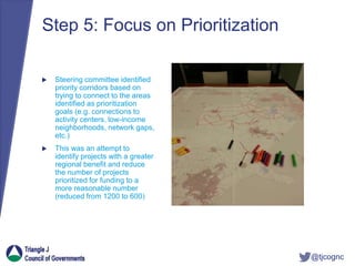
 Steering committee identified
priority corridors based on
trying to connect to the areas
identified as prioritization
goals (e.g. connections to
activity centers, low-income
neighborhoods, network gaps,
etc.)
 This was an attempt to
identify projects with a greater
regional benefit and reduce
the number of projects
prioritized for funding to a
more reasonable number
(reduced from 1200 to 600)
@tjcognc
Step 5: Focus on Prioritization
Example Full Project Set: Example Priority Network:
@tjcognc
Step 6: Report
The final report includes:
 Vision Statement, Goals, Objectives, Action Steps, and
Implementation Plan
 Discussion of the Benefits of Bicycle and Pedestrian
Infrastructure
 Tables and Maps of all planned projects (also links to the
online maps, which are easier to read/use)
 Recommended Prioritization Process Improvements
 Calculated scores for all “Priority Network” projects, to help
identify the projects with greatest funding potential
 Discussion of Funding Sources/Opportunities
@tjcognc
Use of the Framework With
Our State & Local Partners
 Modified our policy for scoring bicycle and pedestrian projects in the
STI process based on the framework recommendations
 After only getting 3 projects ($650,000) funded in previous NCDOT
prioritization round, received funding for 7 projects ($3.5M) under our
revised scoring system and submittal process
 Used the recommendations from the regional framework as the
basis for the bicycle/pedestrian element of the Moore County
Comprehensive Transportation Plan (joint plan developed and
adopted by local governments, NCDOT, and RPO)
 Used mapping and recommendations to inform NCDOT’s project
development consultants on needs related to highway projects
 Provided policy language as an input to a local bike/plan underway
in Town of Carthage
 Shared shapefiles with NCDOT, which was developing a database of
bicycle and pedestrian plans around the state
@tjcognc
Next Steps
 It is likely necessary to update the plan every 3-5 years in
order to keep the information up-to-date. Quite a few
recommendations are already changing due to new local
planning, changes in local priorities, development
impacts, more detailed design work being completed,
and construction of projects.
 TARPO committee members have expressed interest in
the tourism promotion potential, particularly related to the
bicycle touring routes. We will likely explore opportunities
in this vein, such as establishing a web map of the bike
routes that local tourism sites could point to, or the
development of maps/brochures of the routes.
@tjcognc
Questions?
Contact Information: Matt Day, AICP CTP
Principal Planner
Triangle J Council of
Governments
Triangle Area RPO
mday@tjcog.org
(919) 558-9397

More Related Content

Regional Bicycle and Pedestrian Planning Framework

  • 1. @tjcognc Regional Bicycle and Pedestrian Planning Framework Matt Day, AICP CTP Triangle Area Rural Planning Organization
  • 2. @tjcognc Questions to Answer  Why did TARPO choose to develop a regional bicycle and pedestrian planning framework?  What makes it a “framework”?  What did we do, and how?  What does successful implementation of the framework look like?  How do we interact with local and state partners?
  • 3. @tjcognc Origins of the Project  In 2012, TARPO staff gathered existing local bicycle and pedestrian plans with the goal of compiling them into a single regional map  We found that many of the plans did not have shapefiles (either the files had been lost over time or the maps had not been developed in ArcGIS), requiring that shapefiles be developed
  • 4. @tjcognc The First Maps… The original maps from 2013 were essentially just compilations of existing bike and ped plan files, and contained a number of inconsistencies
  • 5. @tjcognc Reaction to First Maps  TARPO committee members were happy to have all the locally-developed bicycle and pedestrian plans on a single set of maps, but were concerned about:  Inconsistencies at borders of local plans (towns improving different corridors, or with different improvement types, overlapping recommendations)  Inconsistencies between plans within a jurisdiction (bike plan, ped plan, comprehensive plan, transportation plan, etc. not in alignment)  Gaps in recommendations, and how to handle areas without local plans  Lack of clear policy on bike and ped priorities at the RPO
  • 6. @tjcognc Our Approach  We did not have the time or money to do a full-blown plan with a consultant, but we also did not want to lose the momentum from our initial mapping exercise  The TARPO committees agreed to include an item for a Regional Bicycle and Pedestrian Planning Framework as part of the FY14 Planning Work Program to cover staff time on the project. This work later continued into FY15 and FY16.  What is a “framework”?
  • 7. @tjcognc Our “Framework” Approach  Builds primarily on existing plans, but allows us to look at potential recommended connections/changes for regional consistency  Includes policy guidance for the RPO to use in its decision making on bike/ped issues (particularly related to project funding/prioritization)  Is adopted by the TARPO Rural Transportation Advisory Committee (our governing board for the RPO)  Does NOT supplant or replace local plans, but rather serves as an additional source of information for local decision making  Provides useful information for local governments, neighboring MPOs/RPOs, and others as they develop or update their own bike and ped plans
  • 8. @tjcognc Step 1: Preparing the Data  TARPO staff created a single geodatabase with information on all existing and planned bicycle and pedestrian facilities, as well as signed/mapped bicycle routes  8 layers in all: existing bike (line), existing ped (line/point), proposed bike (line/point), proposed ped (line/point), and mapped bike route  The data were cleaned up to eliminate overlaps and ensure logical segmentation into projects  Each proposed project segment was assigned an ID number and additional information was attached to each project as shown in the following table:
  • 10. @tjcognc Step 1: Preparing the Data Staff used ArcGIS Online as a platform for distributing the mapped data, allowing an easier method for users to read and find information on projects, and making future map/plan updates easier.
  • 11. @tjcognc Step 2: Steering Committee  In 2013, the TARPO RTAC established the membership for a steering committee to guide the process, particularly with regard to the policy recommendations  The committee included one staff member and one citizen/advocate from each TARPO county, as well as staff from local NCDOT offices and the NCDOT planning branch  The committee held four meetings between Fall 2014 and Summer 2015, culminating in the development of a draft report  The committee brainstormed the policy issues that should be addressed through the plan, which were then refined into a series of goals and objectives
  • 12. @tjcognc Step 3: Policy Goals & Objectives  Resulted in 5 high-level goals  Plan a robust bike & ped infrastructure within the TARPO region  Implement appropriate bike & ped facilities as part of roadway projects  Increase funding for bike & ped facility construction  Promote healthy lifestyles and improve quality of life  Benefit the regional economy through improved bike/ped infrastructure  Under each goal was a series of objectives and action steps to reach the goal Vision: The Triangle Area RPO will work with its state and local partners to create a connected and effective network of safe and accessible facilities for use by bicyclists and pedestrians throughout the region.
  • 13. @tjcognc Step 3: Policy Goals Example  Goal 3: Increase funding for bicycle and pedestrian facility construction and maximize the benefits of bicycle and pedestrian projects that are funded for construction.  Objective 3.1 – Increase the number of projects that are successfully funded through the NCDOT STI prioritization process  Improve the quality (in terms of scoring) of projects that are submitted to NCDOT for potential funding, to ensure that the set of projects with the greatest potential benefits to the region is being considered  Improve the scoring methodology TARPO uses to assign local input points in the STI process to better reflect appropriate prioritization criteria  Work with local project sponsors to identify potential sources for required project matching funds and to aid in project development  Encourage the NCDOT Prioritization Work Group to improve the way that paved shoulder projects, which are a hybrid of highway modernization and bicycle improvement, are scored in the STI process
  • 14. @tjcognc Step 4: Review & Modify Maps  The steering committee was given an opportunity to review the existing mapping (cleaned-up existing plan data) and suggest changes:  New facilities necessary to fill gaps in the system  Changes to information from older plans  Check for consistency with plans in neighboring communities outside TARPO  New plan sources that were not previously identified  At the end of this process, we had identified nearly 1200 individual projects in the region (including existing plans and recommended changes)
  • 15. @tjcognc Step 5: Focus on Prioritization  The steering committee identified improvements to the project prioritization/funding process as one of the key outcomes of this project  Based on the goals and objectives, the committee developed a list of items to be included in TARPO’s local point assignment methodology for NCDOT’s Strategic Transportation Investments (STI) scoring process  There were several rounds back and forth between staff and the steering committee in developing these recommended improvements
  • 16. @tjcognc Step 5: Focus on Prioritization Old Method used by TARPO  50% local project rankings (county level)  20% safety (crash data and AADT data)  10% connectivity (filling gaps, connecting to existing system)  15% consistency with an adopted plan  5% jurisdictional collaboration New Method  50% local project rankings (county level)  7.5% project purpose (transport or recreation)  10% access to underserved populations  15% safety (crash data and AADT data)  10% connectivity (filling gaps AND connection to activity centers)  7.5% priority corridors
  • 17. @tjcognc Step 5: Focus on Prioritization  Steering committee identified priority corridors based on trying to connect to the areas identified as prioritization goals (e.g. connections to activity centers, low-income neighborhoods, network gaps, etc.)  This was an attempt to identify projects with a greater regional benefit and reduce the number of projects prioritized for funding to a more reasonable number (reduced from 1200 to 600)
  • 18. @tjcognc Step 5: Focus on Prioritization Example Full Project Set: Example Priority Network:
  • 19. @tjcognc Step 6: Report The final report includes:  Vision Statement, Goals, Objectives, Action Steps, and Implementation Plan  Discussion of the Benefits of Bicycle and Pedestrian Infrastructure  Tables and Maps of all planned projects (also links to the online maps, which are easier to read/use)  Recommended Prioritization Process Improvements  Calculated scores for all “Priority Network” projects, to help identify the projects with greatest funding potential  Discussion of Funding Sources/Opportunities
  • 20. @tjcognc Use of the Framework With Our State & Local Partners  Modified our policy for scoring bicycle and pedestrian projects in the STI process based on the framework recommendations  After only getting 3 projects ($650,000) funded in previous NCDOT prioritization round, received funding for 7 projects ($3.5M) under our revised scoring system and submittal process  Used the recommendations from the regional framework as the basis for the bicycle/pedestrian element of the Moore County Comprehensive Transportation Plan (joint plan developed and adopted by local governments, NCDOT, and RPO)  Used mapping and recommendations to inform NCDOT’s project development consultants on needs related to highway projects  Provided policy language as an input to a local bike/plan underway in Town of Carthage  Shared shapefiles with NCDOT, which was developing a database of bicycle and pedestrian plans around the state
  • 21. @tjcognc Next Steps  It is likely necessary to update the plan every 3-5 years in order to keep the information up-to-date. Quite a few recommendations are already changing due to new local planning, changes in local priorities, development impacts, more detailed design work being completed, and construction of projects.  TARPO committee members have expressed interest in the tourism promotion potential, particularly related to the bicycle touring routes. We will likely explore opportunities in this vein, such as establishing a web map of the bike routes that local tourism sites could point to, or the development of maps/brochures of the routes.
  • 22. @tjcognc Questions? Contact Information: Matt Day, AICP CTP Principal Planner Triangle J Council of Governments Triangle Area RPO mday@tjcog.org (919) 558-9397