Santorini island 3
- 1. Photos and information’s Click to continue
- 2. SANTORINI ISLAND GREECE Cyclades
- 3. INFORMATION ABOUT SANTORINI ISLAND Santorini or Thira is located in the southernmost point of Cyclades. It is a popular island, with intense night life that attracts thousands of visitors each year. The capital of the island is Fira. Oia is one of the most popular settlements of Santorini. Thousands of people are visiting Oia in order to see the impressive sunset and the unique view. The inhabitants of the island are almost 7.000 shared in 10 villages of the island. Most beaches of Santorini have volcano rocks giving the sense of “black” colour. The island is surrounded by abrupt precipices giving a particular physiognomy. The island has a wealth of archaeology that includes the ancient city at Mesa Vouno and the prehistoric settlement at Akrotiri. Santorini’s cultural includes a unique vernacular architecture, best exemplified by the settlements at Vothonas, Messaria, Finikia, and Megalohori and the advanced fortified settlements at Pyrgos, Emporio, and Akrotiri. The island’s moderate climate is due to its exposure to northeasterly winds, while winters on the island are temperate with average temperatures in the region of 10oC. Rainy winters alternate with dry summers, and the fertile soil is ideal for the cultivation of vines and tomatoes. The island has meager freshwater resources and few wells. Santorini offers air links to Mykonos, Rhodes, Iraklio (Crete), as well as Athens and Thessaloniki. By sea, it’s linked to Piraeus and Thessaloniki, with connections to Paros, Ios, Mykonos, Anafi, Naxos, Sikinos, Syros, Kimolos, Kithnos, Milos, Serifos, Sifnos, Tinos, Folegandros, Astypalaia, Karpathos, Diafani, Kassos, Rhodes, Halki, Iraklio (Crete), Skiathos, Skyros, and Volos. There’s also a hydrofoil connection to Rafina and all the above-mentioned islands.
- 4. SANTORINI ISLAND HISTORY Santorini during the antiquity was known as Strogili. The island took its circular form because of the volcano explosions. The island was inhabited by Phoenicians which named it Kallisti or most beautiful, and the Dorians called it Thira because of their king. On the 15th century a big explosion affected the island and sunk its central part shaping the Caldera. The name Santorini dates from the 12th century and is a relic of Frankish rule when it was known as Santa Irini. Minoan culture flourished in Santorini until the 2000 B.C. when the island’s development was halted by a volcanic eruption. According to historical sources, the eruption darkened the entire Aegean, scattering ash and creating 250-meter high tidal waves that travelled with speeds of 300 kilometres per hour and washed away cities on Crete and Egypt. In some myths, Santorini is identified with the lost continent of Atlantis. Thira came under Persian rule and later allied itself with Sparta, although in 426 B.C. it passed under the hegemony of Athens. It was subsequently conquered by the Ptolemies and later the Romans. During the Byzantine era, Thira was a part of the Aegean Sea Province, or Thema, then later became part of the Duchy of Naxos before falling to the Venetians. The latter period is marked by the conversion of large segments of the population to the Catholic faith. In 1537, the island fell to Barbarossa’s pirates and in 1579 was taken by the Turks. From 1770 to 1774, it was under Russian rule and in 1832 became a part of the newly formed Modern Greek state.
- 7. Sunset from Oia Santorini
- 8. Sunset overlooking the volcano
- 9. The sunset in Oia
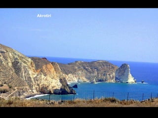
- 14. Akrotiri
- 15. Akrotiri
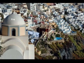
- 17. Fira
- 18. Fira
- 19. Fira
- 20. Fira
- 21. Fira
- 22. Fira
- 23. Fira
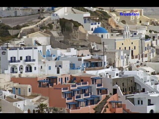
- 24. firostefani
- 25. firostefani
- 26. firostefani
- 27. firostefani
- 28. firostefani
- 29. imerovigli
- 30. imerovigli
- 31. imerovigli
- 32. imerovigli
- 33. Windmills in Oia
- 34. Oia
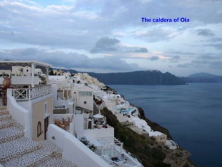
- 35. The caldera of Oia
- 36. Cafe - Bar in Oia - Santorini
- 37. ΟΙΑ
- 38. Caldera view from Oia
- 39. ΟΙΑ
- 40. kamari
- 41. Pirgos
- 42. Pirgos
- 43. kamari
- 44. Perissa - Santorini You Can Keep Listening To The Music Or Press ‘Esc’ To Exit COPYRIGHTS TO ALL PHOTOS AND MUSIC BELONG TO THE ORIGINAL AUTHORS.


