Site 25 rab nov 29 2012
•
0 likes•266 views

1) IR Site 25 encompasses approximately 230 acres that was constructed in 1953 as part of Moffett Field's storm water management system. Sediment removal activities were recently completed to remediate contamination. 2) Over 32,500 cubic yards of sediment were removed from 32 acres to depths ranging from 0.5 to 5 feet below ground. Vegetation will be restored through hydroseeding of native plants. 3) Biological monitoring occurred during excavations to protect nesting birds and small mammals. Remediation is now complete and vegetation will be monitored over the next two years.
Report
Share

Site 25 rab nov 29 2012
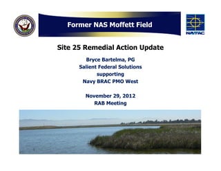
- 1. Former NAS Moffett Field Site 25 Remedial Action Update Bryce Bartelma, PG Salient Federal Solutions supporting Navy BRAC PMO West November 29, 2012 RAB Meeting
- 2. IR Site 25 IR Site 25 encompasses approximately 230 acres and was constructed for use as part of the Moffett Field storm water management system since 1953 AOI-14 The Navy is coordinating remedial action activities with NASA as they prepare to conduct their cleanup activities at Area of Investigation (AOI)-14 2
- 3. Remedial Design and Remedial Action Work Plan • Final Remedial Design and Remedial Action Work Plan (RD/RAWP) distributed on March 30 • Removal of over 32,500 cubic yards of sediment from nearly 32 acres • Planned excavation depths of 0.5 – 1.5 feet below ground surface • Restore vegetated areas with pickleweed and other native grass 3
- 4. Temporarily Re-route Storm Water & WATS effluent Storm Water Settling Vault Catch Basin 4
- 5. August 2012 Conditions at IR Site 25 5
- 6. Biological Observations at Site 25 NESTING • Alameda Song Sparrow • Western Harrier • Mockingbird, marsh wren, bushtit and killdeer OBSERVED • Harvest Mice (unidentified subspecies) • Deer Mice & Voles • California Least Tern (in flight) • Black Rail (vocalizing) • Fox, jackrabbit, and gopher snake NOT OBSERVED • Western Pond Turtle (WPT) • Western Snowy Plover • California Clapper Rail 6
- 7. Biological Protection Measures PROTECTION MEASURES 1. Visually inspect/clear vegetation prior to removal 2. Hand remove pickleweed 3. Silt fencing along access points and suitable habitat areas 4. Continuous biological monitoring 5. Coordination with CDFG and USFWS 7
- 8. Sediment Excavations • Planned excavation depths of 0.5 – 1.5 feet below ground surface • Field surveying to verify dig depths • Grid confirmation sampling 8
- 9. Over-excavations • Several samples confirmed additional over-excavation was required • Primarily in Eastern Diked Marsh (EDM) • Depths of up to 5 feet below ground surface (EDM) encountered groundwater 9
- 10. IR Site 25 Remedial Action Facts • Excavation depths of 0.5 to 5.0 feet below ground surface • 36,390 cubic yards of sediment from nearly 32 acres • 19,500 linear feet of biological silt fencing • Utilized up to 14 biologists • Bypassed 15,724,800 gallons of WATS and storm water • 236 confirmation samples • 173 days with up to 40 workers (over 23,502 hours) on site • 2,173 truck loads of sediment transported to landfill 10
- 11. Aerial Imagery 11
- 12. Aerial Imagery 12
- 13. Vegetation Restoration • All vegetation areas removed during Remedial Action will be restored (excludes EDM and Pickleweed inundated mud flats) Salicornia virginica • Two types of hydroseed palettes (High Salt Marsh and Transitional Upland) will be used with majority of seeds including pickleweed and saltgrass • Minimum of two years monitoring Saltgrass and maintenance Distichlis spicata • Options for irrigation services and additional hydroseeding/plantings 13
- 14. Schedule • Sediment Excavations and Disposal Completed • Vegetation Restoration Nov./Dec. 2012 • Vegetation Monitoring Ongoing • Submit Remedial Action Completion Report Spring 2013 14
- 15. Questions? Point of Contact: Scott Anderson BRAC Environmental Coordinator (619) 532-0938 scott.d.anderson@navy.mil 15