Location via proxy:   [ UP ]  
[Report a bug]   [Manage cookies]                
SlideShare a Scribd company logo
Richard Chappell
Geospatial Application Engineer
Richard Chappell – “Rick”
Geospatial Application Engineer
CADsoft Consulting, Inc
1295 W. Washington St., Suite 201,
Tempe, AZ 85281
480-820-0408
rick.chappell@cadsoft-consult.com
http://www.cadsoft-consult.com/blogs/geo/
http://www.linkedin.com/in/richardchappell
Water Is Wide
Watersheds of land where all the water
 Watersheds are the areas
 that is under it, or drains off of it goes into the same
 place.

 They are divided up into
 basins where all of the
 water drains to some
 outlet
Subdividing Basins
  All land drains to
   somewhere
  Major basins are
   further subdivided
   into smaller basins
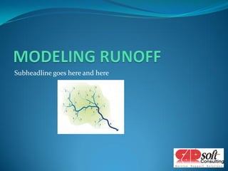
Subheadline goes here and here
Modeling
 Runoff is determined for a basin
 It is determined by
   o The anticipated rainfall – amount of water in
   o The imperviousness of the soil – how much gets
      absorbed
   o The characteristics of the ground cover – the rate of flow
GIS Overlays
Using your stream data to do calculations and analysis
US Army Corps of Engineers
Hydrologic Engineering Center


http://www.hec.usace.army.mil/
HEC-RAS
 The HEC-RAS system
 contains four one-
 dimensional river analysis
 components for:
    o steady flow water
      surface profile
      computations;
    o unsteady flow
      simulation
    o movable boundary
      sediment transport
    o water quality analysis.
Autodesk’s Interchange Tool
 HEC RAS Import/Export Extension
 for AutoCAD Civil 3D 2010
  Available from the Subscription
   Center
  Includes an import tool
     Converts Civil 3D objects into
      HEC-RAS format (.GEO)
  Includes an export tool
     Converts HEC-RAS GIS output
      file (.SDF) into Civil 3D objects
  Installs into the Toolbox
Process
 Create an alignment for the stream flow
 Create cross section sample lines
   o Draw polylines and convert to sample group
 Create polylines for the left and right bank
 Export data into .GEO file
 Open .GEO file in HEC-RAS
 Do Calculations and Analysis
 Export results to SDF
 Import SDF into Civil 3D
Stream
  Section Lines                 Alignment


                                 Bank edges


     Flow Direction


Stream data from Civil 3D loaded into HEC-
  RAS
Rick Chappell
Rick.chappell@cadsoft-consult.com

More Related Content

Water Is Wide

  • 2. Richard Chappell – “Rick” Geospatial Application Engineer CADsoft Consulting, Inc 1295 W. Washington St., Suite 201, Tempe, AZ 85281 480-820-0408 rick.chappell@cadsoft-consult.com http://www.cadsoft-consult.com/blogs/geo/ http://www.linkedin.com/in/richardchappell
  • 4. Watersheds of land where all the water Watersheds are the areas that is under it, or drains off of it goes into the same place. They are divided up into basins where all of the water drains to some outlet
  • 5. Subdividing Basins  All land drains to somewhere  Major basins are further subdivided into smaller basins
  • 7. Modeling  Runoff is determined for a basin  It is determined by o The anticipated rainfall – amount of water in o The imperviousness of the soil – how much gets absorbed o The characteristics of the ground cover – the rate of flow
  • 9. Using your stream data to do calculations and analysis
  • 10. US Army Corps of Engineers Hydrologic Engineering Center http://www.hec.usace.army.mil/
  • 11. HEC-RAS The HEC-RAS system contains four one- dimensional river analysis components for: o steady flow water surface profile computations; o unsteady flow simulation o movable boundary sediment transport o water quality analysis.
  • 12. Autodesk’s Interchange Tool HEC RAS Import/Export Extension for AutoCAD Civil 3D 2010  Available from the Subscription Center  Includes an import tool  Converts Civil 3D objects into HEC-RAS format (.GEO)  Includes an export tool  Converts HEC-RAS GIS output file (.SDF) into Civil 3D objects  Installs into the Toolbox
  • 13. Process  Create an alignment for the stream flow  Create cross section sample lines o Draw polylines and convert to sample group  Create polylines for the left and right bank  Export data into .GEO file  Open .GEO file in HEC-RAS  Do Calculations and Analysis  Export results to SDF  Import SDF into Civil 3D
  • 14. Stream Section Lines Alignment Bank edges Flow Direction Stream data from Civil 3D loaded into HEC- RAS