Location via proxy:   [ UP ]  
[Report a bug]   [Manage cookies]                
SlideShare a Scribd company logo
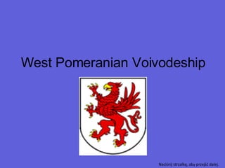
West Pomeranian Voivodeship Naciśnij strzałkę, aby przejść dalej.
West Pomeranian Voivodeship Województwo zachodniopomorskie Flag Coat of arms Location within Poland Division into counties Naciśnij strzałkę, aby przejść dalej.
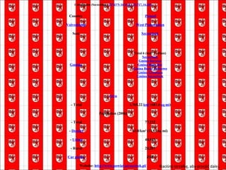
Naciśnij strzałkę, aby przejść dalej.  Coordinates (Szczecin):  53°25′N 14°35′E  /  53.417, 14.583 Country   Poland Capital Szczecin Counties 3 cities, 18 land counties  Koszalin Świnoujście Szczecin Białogard County Choszczno County Drawsko County Goleniów County Gryfice County Gryfino County Kamień County Kołobrzeg County Koszalin County Łobez County Myślibórz County Police County Pyrzyce County Sławno County Stargard County Świdwin County Szczecinek County Wałcz County Area   - Total 22,896  km²  (8,840.2  sq mi ) Population  (2006)   - Total 1,693,533   -  Density 74/km² (191.6/sq mi)   -  Urban 1,170,105   - Rural 523,428 Car plates Z
West Pomeranian Voivodeship (Polish: województwo zachodniopomorskie) is a voivodeship, or province, in north-western Poland. It borders on Pomeranian Voivodeship to the east, Greater Poland Voivodeship to the south-east, Lubusz Voivodeship to the south, Germany to the west, and the Baltic Sea to the north. It was established on January 1, 1999, out of the former Szczecin and Koszalin Voivodeships and parts of other neighbouring voivodeships, pursuant to the Local Government Reorganization Act of 1998. The voivodeship's name comes from the traditional name of the region, Pomorze Zachodnie (Western Pomerania). This corresponds roughly to the present-day voivodeship, although in a wider sense the term also includes Middle Pomerania and Germany's Vorpommern. • Geography and tourism West Pomerania is the fifth largest voivodeship of Poland in terms of its size. Among the largest cities of the region are the capital Szczecin, as well as Koszalin, Stargard Szczeciński, and Świnoujście. This is a picturesque region of the Baltic Sea coast, with many beaches, lakes and woodlands. Szczecin and Świnoujście are important ports. Other major seaside towns include Międzyzdroje, Dziwnów, Kołobrzeg, and Mielno. West Pomerania is considered one of the greenest regions of Poland, and one of the most attractive for tourists. It is characterized by incredible diversity of the landscape: beaches, hundreds of lakes, and forests full of wild life, spreading mainly up the hills of the glacial lakes areas. West Pomerania is also rich in various forms and styles of architecture that were built during the Middle Ages as well as the Gothic, Baroque, and Renaissance periods. There is a diverse repertoire of theaters, festivals, museums and galleries. During a few-day long annual Sea Festival in Szczecin, a number of free open air concerts take place. In Świnoujście during the summer, the FAMA Academic Youth Arts Festival takes place – an event with several years of tradition, which attracts not only young people but also older alumni. In Międzyzdroje, there is a Festival Of The Stars which draws many popular actors. In Wolin, a Viking Festival takes place, which draws "Vikings" from all across Europe. Another draw to the area is a wide array of health resorts. Brine and peloid dicsovered in the 19th century, together with geothermal water resources, are popular attractions in Świnoujście, Kamień Pomorski and Połczyn Zdrój. Naciśnij strzałkę, aby przejść dalej.
Szczecinek County powiat szczecinecki Naciśnij strzałkę, aby przejść dalej.
Szczecinek County powiat szczecinecki Flag Coat of arms Location within the voivodeship Division into gminas Naciśnij strzałkę, aby przejść dalej.
Naciśnij strzałkę, aby przejść dalej.  Coordinates (Szczecinek):  53°43′N 16°41′E / 53.717 ,  16.683 Country   Poland Voivodeship West Pomeranian Seat Szczecinek Gminas Total 6 (incl. 1 urban) Szczecinek Gmina Barwice Gmina Biały Bór Gmina Borne Sulinowo Gmina Grzmiąca Gmina Szczecinek Area   - Total 1,765.22  km²  (681.6  sq mi ) Population (2006)   - Total 77,232   -  Density 43.8/km² (113.3/sq mi)   -  Urban 48,945   - Rural 28,287 Car plates ZSZ Website:  http://www.powiat.szczecinek.pl/
Administrative division The county is subdivided into six  gminas  (one urban, three urban-rural and two rural). These are listed in the following table,  in descending order of population. Naciśnij strzałkę, aby przejść dalej.  Gmina Type Area (km²) Population (2006) Seat Szczecinek urban 37.2 38,756   Gmina Szczecinek rural 510.2 10,171 Szczecinek  * Gmina Borne Sulinowo urban-rural 484.2 9,230 Borne Sulinowo Gmina Barwice urban-rural 258.9 8,897 Barwice Gmina Biały Bór urban-rural 270.2 5,166 Biały Bór Gmina Grzmiąca rural 204.5 5,012 Grzmiąca * seat not part of the gmina
Szczecinek Naciśnij strzałkę, aby przejść dalej.
Szczecinek Flag   Coat of arms Location on the map Naciśnij strzałkę, aby przejść dalej.
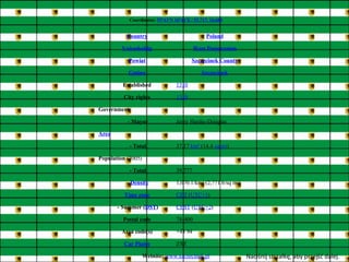
Naciśnij strzałkę, aby przejść dalej.  Coordinates:  53°43′N 16°41′E / 53.717, 16.683 Country Poland Voivodeship West Pomeranian Powiat Szczecinek County Gmina Szczecinek Established 1310 City rights 1310 Government   - Mayor Jerzy Hardie-Douglas Area   - Total 37.17  km²  (14.4  sq mi ) Population  (2005)   - Total 39,777   -  Density 1,070.1/km² (2,771.6/sq mi) Time zone CET  ( UTC+1 )   - Summer ( DST ) CEST  ( UTC+2 ) Postal code 78-400 Area code(s) +48 94 Car Plates ZSZ Website:   www.szczecinek.pl
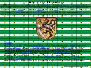
History and Etymology In 1310, the castle and town was founded under  Lübeck law  by Duke  Warcislaw IV  of  Pomerania -Wolgast and modelled after  Szczecin  ( German :  Stettin ) which is situated about 150km to the west. The initial name was "New Szczecin" ( Polish :  Nowy Szczecin ,  German :  Neustettin ,  Latin :  Stetin Nova ). It was also known as "Little Szczecin" ( Polish :  Mały Szczecin ,  German :  Klein Stettin ). In 1707 the town was known in  Polish  as  Nowoszczecin , while the  Mały Szczecin  name gradually developed into the modern name  Szczecinek . 1701-1918 The town was fortified to face the  Brandenburgers , with a wall and palisades. In  1356  Neustettin was hit by the  plague . Thankful for their survival, the Dukes  Bogislaw V ,  Barnim IV  and Wartislaw V founded the Augustine monastery Marienthron, on the Mönchsberg on the southern bank of lake Streizigsee. Under Duke Wartislaw VII Neustettin was from  1376  to  1395  seat of his Duchy. Afterwards, it was ruled by pommeranian Duchy  Rügenwalde  (-  1418 ), Wolgast (-  1474 ) and Stettin (until  1618 ). 1918-1947 On  15 September   1423 , the „great day of Neustettin“, the pommeranian dukes, the  Hochmeister  of the  Teutonic Order  and Nordic king  Eric VII (Denmark)  met to discuss defense against the union of Brandenburg and Poland. In  1461  Neustettin was sacked, looted and burned by Polish troops and  Tatars  because King  Casimir IV  wanted to took revenge on  Eric II (Pommerania -Wolgast who supported the Teutonic Knights. At the end of the  Thirty Years War  Neustettin became part of Brandenburg, and in  1701  under the crown of  Prussia . In 1945, the Red Army occupied the town and put it under Polish administration. Naciśnij strzałkę, aby przejść dalej.  Naciśnij strzałkę, aby przejść dalej.
Pictures Church Naciśnij strzałkę, aby przejść dalej.
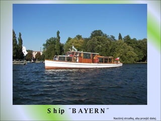
Ship ˝BAYERN˝ Naciśnij strzałkę, aby przejść dalej.
FOUNTAIN Naciśnij strzałkę, aby przejść dalej.
Town hall Naciśnij strzałkę, aby przejść dalej.
Szczecinek in the night Naciśnij strzałkę, aby przejść dalej.
Wykonał:  Zbyszek Chelis kl. IVtzd

More Related Content

West Pomeranian Voivodeship

  • 1. West Pomeranian Voivodeship Naciśnij strzałkę, aby przejść dalej.
  • 2. West Pomeranian Voivodeship Województwo zachodniopomorskie Flag Coat of arms Location within Poland Division into counties Naciśnij strzałkę, aby przejść dalej.
  • 3. Naciśnij strzałkę, aby przejść dalej. Coordinates (Szczecin): 53°25′N 14°35′E / 53.417, 14.583 Country   Poland Capital Szczecin Counties 3 cities, 18 land counties Koszalin Świnoujście Szczecin Białogard County Choszczno County Drawsko County Goleniów County Gryfice County Gryfino County Kamień County Kołobrzeg County Koszalin County Łobez County Myślibórz County Police County Pyrzyce County Sławno County Stargard County Świdwin County Szczecinek County Wałcz County Area   - Total 22,896  km²  (8,840.2  sq mi ) Population (2006)   - Total 1,693,533   -  Density 74/km² (191.6/sq mi)   - Urban 1,170,105   - Rural 523,428 Car plates Z
  • 4. West Pomeranian Voivodeship (Polish: województwo zachodniopomorskie) is a voivodeship, or province, in north-western Poland. It borders on Pomeranian Voivodeship to the east, Greater Poland Voivodeship to the south-east, Lubusz Voivodeship to the south, Germany to the west, and the Baltic Sea to the north. It was established on January 1, 1999, out of the former Szczecin and Koszalin Voivodeships and parts of other neighbouring voivodeships, pursuant to the Local Government Reorganization Act of 1998. The voivodeship's name comes from the traditional name of the region, Pomorze Zachodnie (Western Pomerania). This corresponds roughly to the present-day voivodeship, although in a wider sense the term also includes Middle Pomerania and Germany's Vorpommern. • Geography and tourism West Pomerania is the fifth largest voivodeship of Poland in terms of its size. Among the largest cities of the region are the capital Szczecin, as well as Koszalin, Stargard Szczeciński, and Świnoujście. This is a picturesque region of the Baltic Sea coast, with many beaches, lakes and woodlands. Szczecin and Świnoujście are important ports. Other major seaside towns include Międzyzdroje, Dziwnów, Kołobrzeg, and Mielno. West Pomerania is considered one of the greenest regions of Poland, and one of the most attractive for tourists. It is characterized by incredible diversity of the landscape: beaches, hundreds of lakes, and forests full of wild life, spreading mainly up the hills of the glacial lakes areas. West Pomerania is also rich in various forms and styles of architecture that were built during the Middle Ages as well as the Gothic, Baroque, and Renaissance periods. There is a diverse repertoire of theaters, festivals, museums and galleries. During a few-day long annual Sea Festival in Szczecin, a number of free open air concerts take place. In Świnoujście during the summer, the FAMA Academic Youth Arts Festival takes place – an event with several years of tradition, which attracts not only young people but also older alumni. In Międzyzdroje, there is a Festival Of The Stars which draws many popular actors. In Wolin, a Viking Festival takes place, which draws "Vikings" from all across Europe. Another draw to the area is a wide array of health resorts. Brine and peloid dicsovered in the 19th century, together with geothermal water resources, are popular attractions in Świnoujście, Kamień Pomorski and Połczyn Zdrój. Naciśnij strzałkę, aby przejść dalej.
  • 5. Szczecinek County powiat szczecinecki Naciśnij strzałkę, aby przejść dalej.
  • 6. Szczecinek County powiat szczecinecki Flag Coat of arms Location within the voivodeship Division into gminas Naciśnij strzałkę, aby przejść dalej.
  • 7. Naciśnij strzałkę, aby przejść dalej. Coordinates (Szczecinek): 53°43′N 16°41′E / 53.717 , 16.683 Country   Poland Voivodeship West Pomeranian Seat Szczecinek Gminas Total 6 (incl. 1 urban) Szczecinek Gmina Barwice Gmina Biały Bór Gmina Borne Sulinowo Gmina Grzmiąca Gmina Szczecinek Area   - Total 1,765.22  km²  (681.6  sq mi ) Population (2006)   - Total 77,232   -  Density 43.8/km² (113.3/sq mi)   - Urban 48,945   - Rural 28,287 Car plates ZSZ Website: http://www.powiat.szczecinek.pl/
  • 8. Administrative division The county is subdivided into six gminas (one urban, three urban-rural and two rural). These are listed in the following table, in descending order of population. Naciśnij strzałkę, aby przejść dalej. Gmina Type Area (km²) Population (2006) Seat Szczecinek urban 37.2 38,756   Gmina Szczecinek rural 510.2 10,171 Szczecinek * Gmina Borne Sulinowo urban-rural 484.2 9,230 Borne Sulinowo Gmina Barwice urban-rural 258.9 8,897 Barwice Gmina Biały Bór urban-rural 270.2 5,166 Biały Bór Gmina Grzmiąca rural 204.5 5,012 Grzmiąca * seat not part of the gmina
  • 9. Szczecinek Naciśnij strzałkę, aby przejść dalej.
  • 10. Szczecinek Flag Coat of arms Location on the map Naciśnij strzałkę, aby przejść dalej.
  • 11. Naciśnij strzałkę, aby przejść dalej. Coordinates: 53°43′N 16°41′E / 53.717, 16.683 Country Poland Voivodeship West Pomeranian Powiat Szczecinek County Gmina Szczecinek Established 1310 City rights 1310 Government   - Mayor Jerzy Hardie-Douglas Area   - Total 37.17  km²  (14.4  sq mi ) Population (2005)   - Total 39,777   -  Density 1,070.1/km² (2,771.6/sq mi) Time zone CET ( UTC+1 )   - Summer ( DST ) CEST ( UTC+2 ) Postal code 78-400 Area code(s) +48 94 Car Plates ZSZ Website: www.szczecinek.pl
  • 12. History and Etymology In 1310, the castle and town was founded under Lübeck law by Duke Warcislaw IV of Pomerania -Wolgast and modelled after Szczecin ( German : Stettin ) which is situated about 150km to the west. The initial name was "New Szczecin" ( Polish : Nowy Szczecin , German : Neustettin , Latin : Stetin Nova ). It was also known as "Little Szczecin" ( Polish : Mały Szczecin , German : Klein Stettin ). In 1707 the town was known in Polish as Nowoszczecin , while the Mały Szczecin name gradually developed into the modern name Szczecinek . 1701-1918 The town was fortified to face the Brandenburgers , with a wall and palisades. In 1356 Neustettin was hit by the plague . Thankful for their survival, the Dukes Bogislaw V , Barnim IV and Wartislaw V founded the Augustine monastery Marienthron, on the Mönchsberg on the southern bank of lake Streizigsee. Under Duke Wartislaw VII Neustettin was from 1376 to 1395 seat of his Duchy. Afterwards, it was ruled by pommeranian Duchy Rügenwalde (- 1418 ), Wolgast (- 1474 ) and Stettin (until 1618 ). 1918-1947 On 15 September 1423 , the „great day of Neustettin“, the pommeranian dukes, the Hochmeister of the Teutonic Order and Nordic king Eric VII (Denmark) met to discuss defense against the union of Brandenburg and Poland. In 1461 Neustettin was sacked, looted and burned by Polish troops and Tatars because King Casimir IV wanted to took revenge on Eric II (Pommerania -Wolgast who supported the Teutonic Knights. At the end of the Thirty Years War Neustettin became part of Brandenburg, and in 1701 under the crown of Prussia . In 1945, the Red Army occupied the town and put it under Polish administration. Naciśnij strzałkę, aby przejść dalej. Naciśnij strzałkę, aby przejść dalej.
  • 13. Pictures Church Naciśnij strzałkę, aby przejść dalej.
  • 14. Ship ˝BAYERN˝ Naciśnij strzałkę, aby przejść dalej.
  • 15. FOUNTAIN Naciśnij strzałkę, aby przejść dalej.
  • 16. Town hall Naciśnij strzałkę, aby przejść dalej.
  • 17. Szczecinek in the night Naciśnij strzałkę, aby przejść dalej.
  • 18. Wykonał: Zbyszek Chelis kl. IVtzd