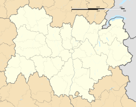
Anzat-le-Luguet
Appearance
Anzat-le-Luguet | |
|---|---|
 The road into Le Luguet | |
| Coordinates: 45°19′59″N 3°02′33″E / 45.3331°N 3.0425°E | |
| Country | France |
| Region | Auvergne-Rhône-Alpes |
| Department | Puy-de-Dôme |
| Arrondissement | Issoire |
| Canton | Brassac-les-Mines |
| Intercommunality | Agglo Pays d'Issoire |
| Government | |
| • Mayor (2020–2026) | Emmanuel Correia[1] |
Area 1 | 66.56 km2 (25.70 sq mi) |
| Population (2021)[2] | 173 |
| • Density | 2.6/km2 (6.7/sq mi) |
| Time zone | UTC+01:00 (CET) |
| • Summer (DST) | UTC+02:00 (CEST) |
| INSEE/Postal code | 63006 /63420 |
| Elevation | 790–1,551 m (2,592–5,089 ft) (avg. 1,140 m or 3,740 ft) |
| 1 French Land Register data, which excludes lakes, ponds, glaciers > 1 km2 (0.386 sq mi or 247 acres) and river estuaries. | |
Anzat-le-Luguet (French pronunciation: [ɑ̃za lə lyɡɛ]; Occitan: Antiac dau Luguet) is a commune in the Puy-de-Dôme department in Auvergne-Rhône-Alpes in central France. It is in the canton of Brassac-les-Mines.[3]
Geography
[edit]Anzat-le-Luguet is located in the heart of the volcanic massif of Cézallier, with its highest point situated near the village center: the Signal du Luguet (1,547 m).[4]
Administration
[edit]Population
[edit]| Year | Pop. | ±% p.a. |
|---|---|---|
| 1968 | 540 | — |
| 1975 | 448 | −2.63% |
| 1982 | 377 | −2.43% |
| 1990 | 295 | −3.02% |
| 1999 | 238 | −2.36% |
| 2007 | 202 | −2.03% |
| 2012 | 185 | −1.74% |
| 2017 | 178 | −0.77% |
| Source: INSEE[6] | ||
See also
[edit]References
[edit]- ^ a b "Répertoire national des élus: les maires" (in French). data.gouv.fr, Plateforme ouverte des données publiques françaises. 4 May 2022.
- ^ "Populations légales 2021" (in French). The National Institute of Statistics and Economic Studies. 28 December 2023.
- ^ "Décret n° 2014-210 du 21 février 2014 portant délimitation des cantons dans le département du Puy-de-Dôme | Legifrance". Retrieved 2017-07-12.
- ^ "Le signal du Luguet". Office de Tourisme du Pays D'Issoire (in French). Retrieved 2024-03-22.
- ^ "List of Mayors of Puy-de-Dôme" (PDF). Prefecture of Puy-de-Dôme. 9 April 2014. Archived from the original (PDF) on 6 October 2014. Retrieved 1 May 2015.
- ^ Population en historique depuis 1968, INSEE
Wikimedia Commons has media related to Anzat-le-Luguet.


