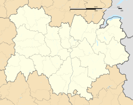
Chamalières
Chamalières | |
|---|---|
 Town hall | |
| Coordinates: 45°46′28″N 3°04′04″E / 45.7744°N 3.0678°E | |
| Country | France |
| Region | Auvergne-Rhône-Alpes |
| Department | Puy-de-Dôme |
| Arrondissement | Clermont-Ferrand |
| Canton | Chamalières |
| Intercommunality | Clermont Auvergne Métropole |
| Government | |
| • Mayor (2020–2026) | Louis Giscard d'Estaing[1] |
Area 1 | 3.77 km2 (1.46 sq mi) |
| Population (2021)[2] | 17,454 |
| • Density | 4,600/km2 (12,000/sq mi) |
| Time zone | UTC+01:00 (CET) |
| • Summer (DST) | UTC+02:00 (CEST) |
| INSEE/Postal code | 63075 /63400 |
| Elevation | 385–582 m (1,263–1,909 ft) (avg. 415 m or 1,362 ft) |
| 1 French Land Register data, which excludes lakes, ponds, glaciers > 1 km2 (0.386 sq mi or 247 acres) and river estuaries. | |
Chamalières (French pronunciation: [ʃamaljɛʁ]; Auvergnat: Chamaleiras) is a commune in the Puy-de-Dôme department, Auvergne-Rhône-Alpes, central France.[3]
With 17,276 inhabitants (2019), Chamalières is the fourth-largest town in the department.[4] It lies adjacent to the west of Clermont-Ferrand and about 241 kilometres (150 mi) from Lyon.
History
[edit]Several thousand wooden Gallo-Roman ex-votos, most of them anthropomorphic standing figures, also including images of limbs and internal organs, dated by associated coins to the first century, were recovered from the shrine at the mineral springs known as the Source des Roches ("Rock Spring"). An inscribed lead tablet found at the spring is a major source of information on the Gaulish language. A comparable cache of Gaulish ex-voto were recovered from a sanctuary at the sources of the Seine, sacred to Sequana.[5]
Population
[edit]Graphs are unavailable due to technical issues. There is more info on Phabricator and on MediaWiki.org. |
| Year | Pop. | ±% p.a. |
|---|---|---|
| 1968 | 17,775 | — |
| 1975 | 18,075 | +0.24% |
| 1982 | 17,486 | −0.47% |
| 1990 | 17,301 | −0.13% |
| 1999 | 18,136 | +0.53% |
| 2007 | 17,710 | −0.30% |
| 2012 | 17,480 | −0.26% |
| 2017 | 17,173 | −0.35% |
| Source: INSEE[6] | ||
Notable places
[edit]Chamalières is the place where the Banque de France located its printing works in 1923, which printed former French franc banknotes, and now prints Euro and CFA franc banknotes.
People
[edit]- Raoul Lufbery (1885–1918), French-American fighter pilot and flying ace in World War I.
- Pierre Schoendoerffer (1928–2012), French film director.
- Valéry Giscard d'Estaing (1926-2020), former President of the French Republic (1974-1981), former mayor of Chamalières (1967-1974).
- Claude Giraud (born 1936), French stage and film actor; voice over actor for Robert Redford, Tommy Lee Jones, Alain Rickman.
- Renaud Camus (born 1946), French author and essayist.
- Daniel Vernet (c. 1945–2018), former editor-in-chief of Le Monde.[7]
- Pierre Woodman ( born Pierre André Gerbier ín 29.April 1963 ) famous multiawarded porn director
- Oumine Ouahioune ( born Oumine Hassan Yusif Pontoise Ouahioune [born 1973] retired soccer player Centre-back.
See also
[edit]References
[edit]- ^ "Répertoire national des élus: les maires" (in French). data.gouv.fr, Plateforme ouverte des données publiques françaises. 13 September 2022.
- ^ "Populations légales 2021" (in French). The National Institute of Statistics and Economic Studies. 28 December 2023.
- ^ INSEE commune file
- ^ Populations légales 2019: 63 Puy-de-Dôme, INSEE
- ^ Romeuf, A.-M. (1986). "Exvoto en bois de Chamalières (Puy-de-Dôme) et des sources de la Seine: essai de comparaison" (PDF). Gallia (in French). 44: 65–89. doi:10.3406/galia.1986.2853. S2CID 191584366.
- ^ Population en historique depuis 1968, INSEE
- ^ Frachon, Alain (17 February 2018). "La mort de Daniel Vernet, grande figure du " Monde "". Le Monde. Retrieved 17 February 2018.
Further reading
[edit]- Romeuf, Anne-Marie; Dumontet, Monique (1980). Les ex-voto gallo-romains de la source des roches à Chamalières (Puy-de-Dôme) (in French). Clermont-Ferrand - Bargoin Museum. ISBN 978-2-7351-0640-0.
{{cite book}}: CS1 maint: location missing publisher (link)
External links
[edit]- Official website (in French)
- ex-votos from the Source des Roches on display at the Musée Bargoin, Clermont-Ferrand.


