Harford, Devon
Appearance
| Harford | |
|---|---|
 St Petroc's Church: the parish church | |
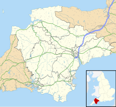
Location within Devon | |
| Population | 77 (2001)[1] |
| OS grid reference | SX63835946 |
| • London | 181 mi (291 km) |
| Civil parish |
|
| District | |
| Shire county | |
| Region | |
| Country | England |
| Sovereign state | United Kingdom |
| Post town | IVYBRIDGE |
| Postcode district | PL21 |
| Dialling code | 01548 |
| Police | Devon and Cornwall |
| Fire | Devon and Somerset |
| Ambulance | South Western |
| UK Parliament | |
| Website | Community page website |
Harford is a hamlet and civil parish located approximately 2 miles (3.2 km) north of the town of Ivybridge in the county of Devon, England. The parish lies in the local government district of the South Hams, which is a localised, second-tier governmental division of the non-metropolitan county of Devon, administered by Devon County Council.
With a parish population of just 77 people, it is the smallest civil parish in the South Hams by number of people.[1] Part of the village (now town) of Ivybridge — the district's largest civil parish with 12,056 people — used to lye in the parish boundaries of Harford, until the parish of St John's was formed in 1836 (later renamed the parish of Ivybridge in 1894).[2]

References
[edit]- ^ a b "Parish Headcounts in South Hams". The Office for National Statistics. 1 April 2001. Archived from the original on 3 March 2016. Retrieved 26 October 2010.
- ^ "Ivybridge Census statistics 1801-2001". Devon County Council. Archived from the original on 27 February 2006. Retrieved 26 April 2008.

