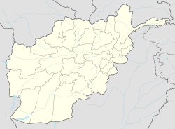
Khwaja Hijran District
Appearance
Khwaja Hijran Jalga (Jelga Nahrin) | |
|---|---|
 Baghlan province in Afghanistan | |
| Coordinates: 35°58′17″N 69°17′47″E / 35.9713°N 69.2963°E | |
| Country | Afghanistan |
| Province | Baghlan |
| Capital | Khvajeh Jeyran |
| Population | |
• Total | 22,800 |
| ISO 3166 code | AF-BL-KW |
| Languages | Dari Persian Pashto |
Khwaja Hijran is a district in the Baghlan Province of Afghanistan. The district was created in 2005 from part of Andarab District. The name of the district has already been changed and its new one is Jalga. It has a population of about 23,000 (52% male and 48% female),[1][2] and its main village is Pansíri.[citation needed]
References
[edit]- ^ a b Qarib, Zafar. "Afghanistan CSO population data 1390 (2011 - 12)" (PDF). USAID/AEAI/AEIC. p. 13. Archived from the original (PDF) on 2012-01-10.
- ^ a b "Province of Baghlan – A Socio-Econom ic and Demographic Profile – Household Listing—2003" (PDF). afghanag.ucdavis.edu. 2003. Archived from the original (PDF) on 2016-03-20. Retrieved 2014-04-16.


