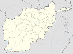
Zari District
Appearance
Zari
زاری | |
|---|---|
Location within Afghanistan[1] | |
| Coordinates: 35°51′00″N 66°43′48″E / 35.85000°N 66.73000°E | |
| Country | |
| Province | Balkh |
| Area | |
• Total | 846 km2 (327 sq mi) |
| Elevation | 900 m (3,000 ft) |
| Population (2012) | |
• Total | 42,600 |
Zari (Pashto/Dari: زاری) is a district in Balkh province, Afghanistan.[2] It was created in 2005 from part of Kishindih district.
District profile:[3]
- 104 villages
- Schools: 14 primary, 4 secondary, 4 high schools
- Health: 2 basic, 1 comprehensive, 33 posts
History
[edit]On 1 May 2020, the Taliban attacked Zari District overnight, killing 13 members of the Afghan security forces and injuring 17 others.[4]
References
[edit]- ^ "District Names". National Democratic Institute. Retrieved 11 August 2015.
- ^ "Settled Population of Balkh Province" (PDF). Central Statistics Organisation. Retrieved 11 August 2015.
- ^ "Summary of District Development Plan" (PDF). Zari District Development Assembly. Retrieved 11 August 2015.
- ^ "Taliban kills 13 Afghan soldiers in Balkh province". 1 May 2020 – via www.aljazeera.com.
External links
[edit]- Map of Settlements IMMAP, 2011.


