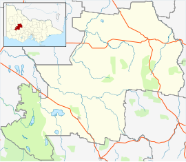
Marnoo, Victoria
Appearance
(Redirected from Marnoo)
| Marnoo Victoria | |
|---|---|
 Entering Marnoo | |
| Coordinates | 36°39′0″S 142°53′0″E / 36.65000°S 142.88333°E |
| Population | 99 (2021 census)[1] |
| Postcode(s) | 3387 |
| Location | |
| LGA(s) | Shire of Northern Grampians |
| State electorate(s) | Ripon |
| Federal division(s) | Mallee |
Marnoo is a town in the Wimmera region of Victoria, Australia. Its postal code is 3387. At the 2021 census, Marnoo and the surrounding area had a population of 99.[1]
Gallery
[edit]-
General store in Marnoo
-
Marnoo War Memorial
-
Marnoo Presbyterian Church
-
Newall Street
References
[edit]Wikimedia Commons has media related to Marnoo.
- ^ a b "2021 Census QuickStats Marnoo". Australian Bureau of Statistics. Retrieved 14 November 2022.


