Location via proxy:   [ UP ]  
[Report a bug]   [Manage cookies]                
Jump to content

Scronkey

Coordinates: 53°55′01″N 2°53′49″W / 53.917°N 2.897°W / 53.917; -2.897
From Wikipedia, the free encyclopedia

Scronkey
Scronkey
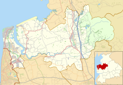
Scronkey is located in the Borough of Wyre
Scronkey
Scronkey
Shown within Wyre Borough
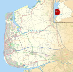
Scronkey is located in the Fylde
Scronkey
Scronkey
Shown on the Fylde
Scronkey is located in Lancashire
Scronkey
Scronkey
Location within Lancashire
OS grid referenceSD410471
Civil parish
District
Shire county
Region
CountryEngland
Sovereign stateUnited Kingdom
Post townPRESTON
Postcode districtPR3
Dialling code01253
PoliceLancashire
FireLancashire
AmbulanceNorth West
UK Parliament
List of places
UK
England
Lancashire
53°55′01″N 2°53′49″W / 53.917°N 2.897°W / 53.917; -2.897

Scronkey is a small rural hamlet in the county of Lancashire, England. It is in the Over Wyre region of the Fylde, west of Garstang near Pilling.

The combined population of Scronkey and Eagland Hill was 272 in 2001.[1]

References

[edit]
[edit]