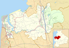
Shireshead
Appearance
| Shireshead | |
|---|---|
 St James' Church, Shireshead, 1887–90 | |
Location within Lancashire | |
| OS grid reference | SD501511 |
| Civil parish | |
| District | |
| Shire county | |
| Region | |
| Country | England |
| Sovereign state | United Kingdom |
| Post town | PRESTON |
| Postcode district | PR3 |
| Dialling code | 01524 |
| Police | Lancashire |
| Fire | Lancashire |
| Ambulance | North West |
| UK Parliament | |
Shireshead is a hamlet near Forton, Lancashire. It includes an Anglican church, St James', which was designed by the Leeds-based architectural firm Kelly & Birchall and built in 1887–90.[1]
References
[edit]- ^ "Search of files where Professional or Firm Name contains 'KELLY (JOHN) & BIRCHALL (EDWARD)'". Church Plans Online. Retrieved 19 April 2013.


