Twin Butte
Twin Butte | |
|---|---|
 Mount Dungarvan & Cloudy Ridge to the west of Twin Butte. | |
| Coordinates: 49°15′51″N 113°51′27″W / 49.26417°N 113.85750°W | |
| Country | Canada |
| Province | Alberta |
| Region | Southern Alberta |
| Census division | 3 |
| Municipal district | Municipal District of Pincher Creek No. 9 |
| Government | |
| • Type | Unincorporated |
| • Governing body | Municipal District of Pincher Creek No. 9 Council |
| Area (2021)[1] | |
| • Land | 0.17 km2 (0.07 sq mi) |
| Population (2021)[1] | |
• Total | 10 |
| • Density | 59.9/km2 (155/sq mi) |
| Time zone | UTC−07:00 (MST) |
| • Summer (DST) | UTC−06:00 (MDT) |
| Area code(s) | 403, 587, 825 |
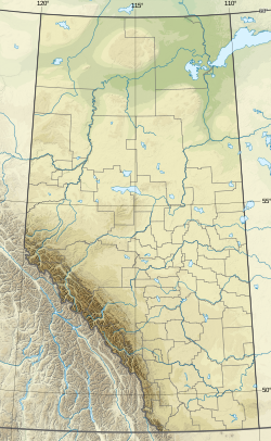
Twin Butte is a hamlet in Southern Alberta, Canada within the Municipal District of Pincher Creek No. 9.[2] It is located on Highway 6, approximately 88 kilometres (55 mi) southwest of Lethbridge. The hamlet of Twin Butte is historically known as a small ranching community located in the foothills of Alberta's Southwest region. The community has a general store, post office, Restaurant and a community hall along Highway 6 north of Township Road 40.
History
[edit]Between 1885 and 1915, 43 ranching families settled the region. The community was given its name by Tillie Mitchell a prominent earlier pioneer to the area in the early 1900s. The name was given after two small hills, visible landmarks similar in shape and size overlooking the Yarrow Creek to the north of Mitchell's property, both noticeable to many travelers, traveling through the area.[3]
The first post office in the area was the Yarrow Post Office, established on April 1, 1895, with Bob Christie as first Postmaster. It operated until closing in 1911. The Twin Butte Post Office was established on June 1, 1905, with Ed Mitchell Sr. as first Postmaster. The post office continues to operate over a century later, out of the Twin Butte General Store. A popular stopping point for travelers and tourists along The Cowboy Trail (Highway 6), between the town of Pincher Creek and Waterton Lakes National Park.
Education
[edit]In 1904 Ernest Hillier donated land 1 mile east of Twin Butte to build a schoolhouse. The Twin Butte School District No. 988 was then established, with classes first held September 1, 1904. The schoolhouse stood on the Southwest Quarter of Section 3, Township 4, Range 29, West of the 4th meridian. The school was used until consolidation of area schoolhouses in June 1958. Around 254 students attended school at Twin Butte. Today area children are bused to Pincher Creek for schooling.
Demographics
[edit]In the 2021 Census of Population conducted by Statistics Canada, Twin Butte had a population of 10 living in 8 of its 9 total private dwellings, a change of 0% from its 2016 population of 10. With a land area of 0.17 km2 (0.066 sq mi), it had a population density of 58.8/km2 (152.4/sq mi) in 2021.[1]
As a designated place in the 2016 Census of Population conducted by Statistics Canada, Twin Butte had a population of 10 living in 5 of its 6 total private dwellings, a change of 0% from its 2011 population of 10. With a land area of 0.17 km2 (0.066 sq mi), it had a population density of 58.8/km2 (152.4/sq mi) in 2016.[11]
See also
[edit]References
[edit]- ^ a b c d "Population and dwelling counts: Canada and designated places". Statistics Canada. February 9, 2022. Retrieved February 10, 2022.
- ^ "Specialized and Rural Municipalities and Their Communities" (PDF). Alberta Municipal Affairs. June 3, 2024. Retrieved June 14, 2024.
- ^ History of Twin Butte, AB - MD Pincher Creek - Source: Pincher Creek & District Historical Society.
- ^ 1981 Census of Canada (PDF). Place name reference list. Vol. Western provinces and the Territories. Ottawa: Statistics Canada. 1983. Retrieved September 26, 2024.
- ^ 1986 Census of Canada (PDF). Population. Vol. Unincorporated Places. Ottawa: Statistics Canada. 1988. Retrieved September 26, 2024.
- ^ 91 Census (PDF). Population and Dwelling Counts. Vol. Unincorporated Places. Ottawa: Statistics Canada. 1993. Retrieved September 26, 2024.
- ^ 96 Census (PDF). A National Overivew: Population and Dwelling Counts. Ottawa: Statistics Canada. 1997. Retrieved September 26, 2024.
- ^ "Population and Dwelling Counts, for Canada, Provinces and Territories, and Census Divisions, 2001 and 1996 Censuses - 100% Data (Alberta)". Statistics Canada. August 15, 2012. Retrieved September 19, 2024.
- ^ "Population and dwelling counts, for Canada, provinces and territories, and designated places, 2006 and 2001 censuses - 100% data (Alberta)". Statistics Canada. July 20, 2021. Retrieved September 19, 2024.
- ^ "Population and dwelling counts, for Canada, provinces and territories, and designated places, 2011 and 2006 censuses (Alberta)". Statistics Canada. February 8, 2012. Retrieved September 19, 2024.
- ^ a b "Population and dwelling counts, for Canada, provinces and territories, and designated places, 2016 and 2011 censuses – 100% data (Alberta)". Statistics Canada. February 8, 2017. Retrieved February 13, 2017.


