ABSTRACT The ”Adamów–Smulsko” exposure is situated in the eastern part of Wielkopolska about 5 km... more ABSTRACT The ”Adamów–Smulsko” exposure is situated in the eastern part of Wielkopolska about 5 km to the east from Turek. Three till horizons are exposed there. The oldest one is considered to be the deposits of South Polish Glaciation age (Elsterian), the middle one of Odranian age and the upper one — divided in two strata — of Warthanian age (Klatkowa, 1993). Indicator erratics in samples taken in two profiles, lying two kilometres apart, were analysed. The relationship between fundamental indicator erratics has been determined and the comparison with the contribution of particular alimentation areas in the supply of coarse material has been made, also the theoretical home centres of the boulder associations (TGZ) here been marked. The stratigraphical conclusions do not confirm the previous interpretation. The occurrence of Odranian tills has not been supported. The lowest till horizon has been attributed to Nida Glaciation, whereas the middle and upper ones to the Warthanian Glaciation.
In the middle section, the Warta River valley runs through the Adamów graben. The graben was char... more In the middle section, the Warta River valley runs through the Adamów graben. The graben was characterized by subsidence since the end of the Paleogene and favoured accumulation during the Neogene and the Quaternary. The Quaternary deposits consist of several till horizons separated mainly by a series of fluvioglacial sand and a thick series of glaciolacustrine sediments. The research was
This paper describes a unique succession of alluvial deposits from the Holsteinian Interglacial i... more This paper describes a unique succession of alluvial deposits from the Holsteinian Interglacial in eastern Poland. The succession was studied in terms of sedimentology, palaeobotany, and thermoluminescence (TL) geochronology. The interglacial alluvial succession includes two facies of a meandering river: point bar and oxbow. TL ages of point bar deposits and palaeobotanical analysis of oxbow lake deposits allow us to associate the deposits with the initial phases (preoptimum period) of the Holsteinian Interglacial. Specific palaeoenvironmental conditions did not favour the formation of a complete interglacial biogenic–clastic succession as it was deposited in the shallow oxbow lake, which underwent rapid eutrophication.
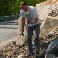
ERRATIC ”TRIPLETS” – A NEWLY ESTABLISHED NATURE MONUMENT IN TARNOW (SOUTHERN POLAND) Summary Thre... more ERRATIC ”TRIPLETS” – A NEWLY ESTABLISHED NATURE MONUMENT IN TARNOW (SOUTHERN POLAND) Summary Three erratics have been found in Tarnow (southern Poland). They probably represent fragments of a single boulder transported during one of the South-Polish glaciations from Arno Massif in Central Sweden. The largest erratic has a circumference of 10.2 m, making it the second largest dropstone known from the area between the maximum ranges of the ice-sheets of Mid-Polish and South Polish glaciations. In May, 2002, the boulders (named ”Triplets” and moved to a recreational area in Tarnow, were declared a protected monument of inanimate nature
W monografii zostały przedstawione wyniki wieloletnich badań skał narzutowych w Polsce na tle świ... more W monografii zostały przedstawione wyniki wieloletnich badań skał narzutowych w Polsce na tle światowych osiągnięć w tej dziedzinie. Przeanalizowano szereg zagadnień z geologii glacjalnej, mających bezpośredni lub pośredni wpływ na skład materiału morenowego. Po raz pierwszy w tak szerokim zakresie rozpoznano rozmieszczenie najważniejszych typów skał przewodnich na obszarze Polski. Na podstawie analiz eratyków zostały zweryfikowane współczesne modele termodynamiczne lądolodu fennoskandzkiego. Wskazano możliwości wykorzystania eratyków fennoskandzkich w korelacji osadów glacjalnych. „Praca w sposób wszechstronny porusza zagadnienia metodyki i historii badań eratyków w osadach glacjalnych Europy, ze szczególnym uwzględnieniem Polski. Zawiera szczegółową dyskusję i krytyczną ocenę danych literaturowych, pokazując jednocześnie nowoczesny sposób podejścia do analizy eratyków, co stanowi wyraźny postęp w metodologii badań. Uzyskane wyniki naukowe wnoszą wiele nowych danych w zakresie pale...
ABSTRACT The ”Adamów–Smulsko” exposure is situated in the eastern part of Wielkopolska about 5 km... more ABSTRACT The ”Adamów–Smulsko” exposure is situated in the eastern part of Wielkopolska about 5 km to the east from Turek. Three till horizons are exposed there. The oldest one is considered to be the deposits of South Polish Glaciation age (Elsterian), the middle one of Odranian age and the upper one — divided in two strata — of Warthanian age (Klatkowa, 1993). Indicator erratics in samples taken in two profiles, lying two kilometres apart, were analysed. The relationship between fundamental indicator erratics has been determined and the comparison with the contribution of particular alimentation areas in the supply of coarse material has been made, also the theoretical home centres of the boulder associations (TGZ) here been marked. The stratigraphical conclusions do not confirm the previous interpretation. The occurrence of Odranian tills has not been supported. The lowest till horizon has been attributed to Nida Glaciation, whereas the middle and upper ones to the Warthanian Glaciation.
In the middle section, the Warta River valley runs through the Adamów graben. The graben was char... more In the middle section, the Warta River valley runs through the Adamów graben. The graben was characterized by subsidence since the end of the Paleogene and favoured accumulation during the Neogene and the Quaternary. The Quaternary deposits consist of several till horizons separated mainly by a series of fluvioglacial sand and a thick series of glaciolacustrine sediments. The research was
This paper describes a unique succession of alluvial deposits from the Holsteinian Interglacial i... more This paper describes a unique succession of alluvial deposits from the Holsteinian Interglacial in eastern Poland. The succession was studied in terms of sedimentology, palaeobotany, and thermoluminescence (TL) geochronology. The interglacial alluvial succession includes two facies of a meandering river: point bar and oxbow. TL ages of point bar deposits and palaeobotanical analysis of oxbow lake deposits allow us to associate the deposits with the initial phases (preoptimum period) of the Holsteinian Interglacial. Specific palaeoenvironmental conditions did not favour the formation of a complete interglacial biogenic–clastic succession as it was deposited in the shallow oxbow lake, which underwent rapid eutrophication.
ERRATIC ”TRIPLETS” – A NEWLY ESTABLISHED NATURE MONUMENT IN TARNOW (SOUTHERN POLAND) Summary Thre... more ERRATIC ”TRIPLETS” – A NEWLY ESTABLISHED NATURE MONUMENT IN TARNOW (SOUTHERN POLAND) Summary Three erratics have been found in Tarnow (southern Poland). They probably represent fragments of a single boulder transported during one of the South-Polish glaciations from Arno Massif in Central Sweden. The largest erratic has a circumference of 10.2 m, making it the second largest dropstone known from the area between the maximum ranges of the ice-sheets of Mid-Polish and South Polish glaciations. In May, 2002, the boulders (named ”Triplets” and moved to a recreational area in Tarnow, were declared a protected monument of inanimate nature
W monografii zostały przedstawione wyniki wieloletnich badań skał narzutowych w Polsce na tle świ... more W monografii zostały przedstawione wyniki wieloletnich badań skał narzutowych w Polsce na tle światowych osiągnięć w tej dziedzinie. Przeanalizowano szereg zagadnień z geologii glacjalnej, mających bezpośredni lub pośredni wpływ na skład materiału morenowego. Po raz pierwszy w tak szerokim zakresie rozpoznano rozmieszczenie najważniejszych typów skał przewodnich na obszarze Polski. Na podstawie analiz eratyków zostały zweryfikowane współczesne modele termodynamiczne lądolodu fennoskandzkiego. Wskazano możliwości wykorzystania eratyków fennoskandzkich w korelacji osadów glacjalnych. „Praca w sposób wszechstronny porusza zagadnienia metodyki i historii badań eratyków w osadach glacjalnych Europy, ze szczególnym uwzględnieniem Polski. Zawiera szczegółową dyskusję i krytyczną ocenę danych literaturowych, pokazując jednocześnie nowoczesny sposób podejścia do analizy eratyków, co stanowi wyraźny postęp w metodologii badań. Uzyskane wyniki naukowe wnoszą wiele nowych danych w zakresie pale...
Na obszarze nadbużańskiego Podlasia (w pasie granicznym z Białorusią) linia maksymalnego zasięgu ... more Na obszarze nadbużańskiego Podlasia (w pasie granicznym z Białorusią) linia maksymalnego zasięgu lądolodu Warty była różnie kreślona (fig. 1A). Jego nasunięcie po Mielnik przyjmował Zaborski (1927), a na nieco większy (po okolice Niemirowa), wskazywali Rühle i Mojski (1968). Znacznie większy zasięg lądolodu (po Łęgi lub okolice Janowa Podlaskiego) kreślili Lindner (1988) oraz Marks i Pavlovskaya (2006), a największy (po Terespol) wyznaczała Nowak (1973). Z nowszych szczegółowych badań geologicznych Nitychoruka i in. (2006) wynika, że czoło lądolodu Warty w swym maksymalnym rozprzestrzenieniu sięgnęło po linię Mielnik – Niemirów. Tej koncepcji zdają się przeczyć zbieżne wyniki analizy porównawczej składu narzutniaków przewodnich najmłodszej serii glin lodowcowych w stanowiskach Mielnik i Neple, zlokalizowanych w obrębie form marginalnych położonych na linii najmniejszego (stanowisko Mielnik) i zapleczu największego rozprzestrzenienia lądolodu Warty (stanowisko Neple) – Czubla i in. (2010). Sugerują one transgresję lądolodu w formie lobu Bugu po Neple, czyli dalej na południe. W stanowisku Mielnik prezentujemy wyniki badań osadów moreny czołowej – formy zaliczanej do moren końcowych lądolodu Warty (Nitychoruk i in. 2006), w obrębie której przeprowadzona była analiza petrograficzna składu narzutniaków przewodnich z najmłodszego poziomu glin lodowcowych (Czubla i in. 2010).
This study presents the results of the research of erratic assemblages of the fraction >20 mm, co... more This study presents the results of the research of erratic assemblages of the fraction >20 mm, collected from the glacial deposits in Poland. A total of 138 samples were analysed from 60 sites located along the latitudinal transect from Lower Silesia, Central Poland to the Podlasie Region, and along the meridional transect from Gdańsk Pomerania to Kuyavia and Central Poland. The results were compared with those of other authors, which allowed a detailed analysis of the distribution of indicator and auxiliary erratics, not only in Poland, but also in the area of the neighbouring countries.
The current erratics research methods and presentation of the results developed in Germany, Denmark, the Netherlands and Poland were verified, and the new methods were proposed and tested. The collected petrographic data were subjected to statistical analysis, which helped identify the most differentiating features of the variously aged glacial sediments.
The possibilities of the correlation of glacial deposits based on assemblages of indicator erratics in local and regional scale were defined. The petrographic features of tills representing all three glacial complexes in different regions of Poland were compared. The study confirmed the possibility of using petrographic features for distinguishing between the Sanian and the Odranian/Wartanian glacial tills in the area stretching from the eastern Wielkopolska to the Poland’s borders in the east. The research also verified the older analysis of sediments from Central Poland (40 samples), including the reinterpretation of the stratigraphy of sediments filling the Kleszczów Graben as well as proposal of the new Pleistocene stratigraphy of Poland.
The qualitative analysis of pre glacial and other processes influencing the petrographic composition of glacial deposits was conducted. The author analysed mechanisms of inclusion of the bedrock fragments into the ice, as well as glacial erosion, transport and possible processing of the moraine material in the ice sheet. A minor role of the subglacial bed deformation in the ice sheet transgression on the territory of Poland has been shown. The petrographic results were confronted with the thermodynamic models of the Fennoscandian ice sheet, which allowed disproving the models involving a large extent of the cold thermal regime of the ice sheet sole.
Based on the petrographic studies, the importance of the Baltic ice stream in the formation of sediments of the Weichselian Glaciation in Poland was questioned. The author was unable to identify the spreading zones of the Boothia erratics, which is indicative of the stream ice sheet motion. Widespread presence of rocks from the southern and central Sweden in glacial sediments of the Weichselian in Poland precludes the long term separation of the rock source areas in Scandinavia and deposition areas on the Polish territory by the postulated ice stream.
Zespół osadniczy z epoki kamienia – Rzucewo, gmina Puck, stanowisko 1, 2018
The analysed set of stone objects from Rzucewo site (334 items) consists of different types rocks... more The analysed set of stone objects from Rzucewo site (334 items) consists of different types rocks, but the most frequent are sandstones (42.8%) following by diabases (15.0%), amphibolites (13.8%) and granitoides (13.5%). If only specimens recognised as a tool are taken to account (251 items), proportions of the hardest rocks increase (40.2%, 17.9%, 15.9%, and 11.2% respectively). This suggest the sorting of collected raw material and using its specific sorts preferred for the manufacturing of given type of a tool. Axes and their fragments are the most frequent in the analysed set (91 items). They are associated by chisels (13 items) and some hammers and hatchets (the latter ones only as fragments of tools). Very common are artefacts which are an evidence of such tools manufacturing, especially polishing slabs (66 items, commonly only as their fragments), moreover 7 polishing boulders were found. This is the prove that in Rzucewo the workshop of stone tools existed. The high intensity of tool using is identified, including re-using of worn out and damaged tools, simultaneously with the quite common presence of semi-manufactured tools and tools without signs of use. This confirm previous reports that Rzucewo site shows not only the record of stone-tool manufacturing but as well as the regular processing of a different material, like a wood for dugout canoes. The analysed stone artefacts were found in different stratigraphic positions, like: the colluvium material (layers I and II), the anthropogenic layer and in selected archaeological objects. The recognised complex of intentionally prepared places for stone-tool manufacturing is a very rare archaeological find in the eastern Pomerania. The Kujawy region is the closest one were analogies for it were found. Those similar objects were recognised in archaeological sites of the Funnel Beaker culture and the Globular Amphora culture.
Uploads
Papers by Piotr Czubla
Z nowszych szczegółowych badań geologicznych Nitychoruka i in. (2006) wynika, że czoło lądolodu Warty w swym maksymalnym rozprzestrzenieniu sięgnęło po linię Mielnik – Niemirów. Tej koncepcji zdają się przeczyć zbieżne wyniki analizy porównawczej składu narzutniaków przewodnich najmłodszej serii glin lodowcowych w stanowiskach Mielnik i Neple, zlokalizowanych w obrębie form marginalnych położonych na linii najmniejszego (stanowisko Mielnik) i zapleczu największego rozprzestrzenienia lądolodu Warty (stanowisko Neple) – Czubla i in. (2010). Sugerują one transgresję lądolodu w formie lobu Bugu po Neple, czyli dalej na południe.
W stanowisku Mielnik prezentujemy wyniki badań osadów moreny czołowej – formy zaliczanej do moren końcowych lądolodu Warty (Nitychoruk i in. 2006), w obrębie której przeprowadzona była analiza petrograficzna składu narzutniaków przewodnich z najmłodszego poziomu glin lodowcowych (Czubla i in. 2010).
The current erratics research methods and presentation of the results developed in Germany, Denmark, the Netherlands and Poland were verified, and the new methods were proposed and tested. The collected petrographic data were subjected to statistical analysis, which helped identify the most differentiating features of the variously aged glacial sediments.
The possibilities of the correlation of glacial deposits based on assemblages of indicator erratics in local and regional scale were defined. The petrographic features of tills representing all three glacial complexes in different regions of Poland were compared. The study confirmed the possibility of using petrographic features for distinguishing between the Sanian and the Odranian/Wartanian glacial tills in the area stretching from the eastern Wielkopolska to the Poland’s borders in the east. The research also verified the older analysis of sediments from Central Poland (40 samples), including the reinterpretation of the stratigraphy of sediments filling the Kleszczów Graben as well as proposal of the new Pleistocene stratigraphy of Poland.
The qualitative analysis of pre glacial and other processes influencing the petrographic composition of glacial deposits was conducted. The author analysed mechanisms of inclusion of the bedrock fragments into the ice, as well as glacial erosion, transport and possible processing of the moraine material in the ice sheet. A minor role of the subglacial bed deformation in the ice sheet transgression on the territory of Poland has been shown. The petrographic results were confronted with the thermodynamic models of the Fennoscandian ice sheet, which allowed disproving the models involving a large extent of the cold thermal regime of the ice sheet sole.
Based on the petrographic studies, the importance of the Baltic ice stream in the formation of sediments of the Weichselian Glaciation in Poland was questioned. The author was unable to identify the spreading zones of the Boothia erratics, which is indicative of the stream ice sheet motion. Widespread presence of rocks from the southern and central Sweden in glacial sediments of the Weichselian in Poland precludes the long term separation of the rock source areas in Scandinavia and deposition areas on the Polish territory by the postulated ice stream.
Axes and their fragments are the most frequent in the analysed set (91 items). They are associated by chisels (13 items) and some hammers and hatchets (the latter ones only as fragments of tools). Very common are artefacts which are an evidence of such tools manufacturing, especially polishing slabs (66 items, commonly only as their fragments), moreover 7 polishing boulders were found. This is the prove that in Rzucewo the workshop of stone tools existed.
The high intensity of tool using is identified, including re-using of worn out and damaged tools, simultaneously with the quite common presence of semi-manufactured tools and tools without signs of use. This confirm previous reports that Rzucewo site shows not only the record of stone-tool manufacturing but as well as the regular processing of a different material, like a wood for dugout canoes.
The analysed stone artefacts were found in different stratigraphic positions, like: the colluvium material (layers I and II), the anthropogenic layer and in selected archaeological objects. The recognised complex of intentionally prepared places for stone-tool manufacturing is a very rare archaeological find in the eastern Pomerania. The Kujawy region is the closest one were analogies for it were found. Those similar objects were recognised in archaeological sites of the Funnel Beaker culture and the Globular Amphora culture.