
Old Warden
Na mapach:  52°05′N 0°20′W/52,083333 -0,333333

| |
| Państwo | |
|---|---|
| Kraj | |
| Region | |
| Hrabstwo ceremonialne | |
| Unitary authority | |
| Populacja (2007) • liczba ludności |
|
| Nr kierunkowy |
01767 |
| Kod pocztowy |
SG18 |
Położenie na mapie Bedfordshire 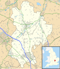 | |
Położenie na mapie Wielkiej Brytanii 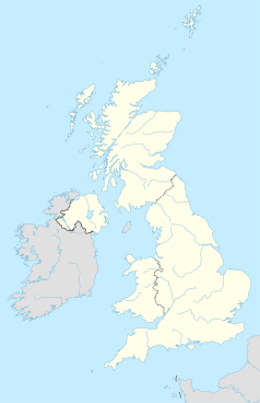 | |
Położenie na mapie Anglii 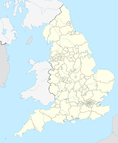 | |
Old Warden – wieś w Anglii, w hrabstwie ceremonialnym Bedfordshire, w dystrykcie (unitary authority) Central Bedfordshire. Leży 11 km na południowy wschód od centrum miasta Bedford i 66 km na północ od centrum Londynu[2]. W 2007 miejscowość liczyła 340 mieszkańców[1].
Przypisy
[edytuj | edytuj kod]- ↑ a b Bedfordshire County Council, Population Estimates and Forecasts, estimate for 2007.
- ↑ Old Warden na mapie. getamap.ordnancesurvey.co.uk. [dostęp 2010-10-01].