Bourg-Saint-Andéol
Appearance
Bourg-Saint-Andéol | |
|---|---|
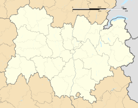
| Coordinates: 44°26′53″N 4°35′56″E / 44.44816968°N 4.59886997°E | |
| Country | France |
| Region | Auvergne-Rhône-Alpes |
| Department | Ardèche |
| Arrondissement | Privas |
| Canton | Bourg-Saint-Andéol |
| Intercommunality | Rhône aux gorges de l'Ardèche |
| Government | |
| • Mayor (2001-2008) | Serge Martinez |
| Area 1 | 43.74 km2 (16.89 sq mi) |
| Population (1999) | 7,798 |
| • Density | 180/km2 (460/sq mi) |
| Time zone | UTC+01:00 (CET) |
| • Summer (DST) | UTC+02:00 (CEST) |
| INSEE/Postal code | 07042 /07700 |
| 1 French Land Register data, which excludes lakes, ponds, glaciers > 1 km2 (0.386 sq mi or 247 acres) and river estuaries. | |
Bourg-Saint-Andéol is a small commune of the Ardèche département in the Rhône Valley in the southern part of France. It is the capital of a canton in the arrondissement of Privas, with a population of about 8,000 as of the year 1999.
Twin cities
[change | change source]- Monschau in Germany (Eifel) since 1975
- Albertirsa in Hungary since 1998
- Gaggiano in Italy since 2002
Related pages
[change | change source]Wikimedia Commons has media related to Bourg-Saint-Andéol.


