Dornas
- Asturianu
- 閩南語 / Bân-lâm-gú
- Català
- Cebuano
- Deutsch
- English
- Español
- Euskara
- Français
- Հայերեն
- Italiano
- Kapampangan
- Latina
- Lombard
- Magyar
- Malagasy
- Bahasa Melayu
- Nederlands
- Нохчийн
- Occitan
- Oʻzbekcha / ўзбекча
- Piemontèis
- Polski
- Português
- Română
- Русский
- Shqip
- Slovenčina
- Српски / srpski
- Srpskohrvatski / српскохрватски
- Svenska
- Basa Ugi
- Українська
- Vèneto
- Tiếng Việt
- Winaray
- 粵語
- Zazaki
- 中文
Appearance
From Simple English Wikipedia, the free encyclopedia
- Dornas also refers to a small fishing vessel, known to have derived from the viking fishing vessels. Note the shape and construction to be able to break ocean waves near and away from shore.
Dornas | |
|---|---|
 | |
| Coordinates: 44°51′11″N 4°21′14″E / 44.853°N 4.3538°E / 44.853; 4.3538 | |
| Country | France |
| Region | Auvergne-Rhône-Alpes |
| Department | Ardèche |
| Arrondissement | Tournon-sur-Rhône |
| Canton | Le Cheylard |
| Intercommunality | Pays du Cheylard |
| Government | |
| • Mayor (2001-2008) | Lucien Vialle |
| Area 1 | 17.63 km2 (6.81 sq mi) |
| Population (1999) | 247 |
| • Density | 14/km2 (36/sq mi) |
| Time zone | UTC+01:00 (CET) |
| • Summer (DST) | UTC+02:00 (CEST) |
| INSEE/Postal code | 07082 /07160 |
| Elevation | 584–1,201 m (1,916–3,940 ft) (avg. 630 m or 2,070 ft) |
| 1 French Land Register data, which excludes lakes, ponds, glaciers > 1 km2 (0.386 sq mi or 247 acres) and river estuaries. | |
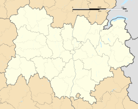
Dornas is a commune in the Ardèche département in southern France.
Wikimedia Commons has media related to Dornas (Ardèche).
Retrieved from "https://simple.wikipedia.org/w/index.php?title=Dornas&oldid=7138177"


