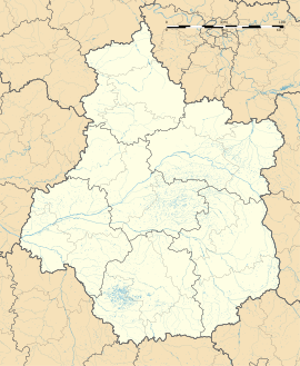
Bourges
Appearance
Bourges | |
|---|---|
Prefecture and commune | |
 | |
| Coordinates: 47°05′04″N 2°23′47″E / 47.0844°N 2.3964°E | |
| Country | France |
| Region | Centre-Val de Loire |
| Department | Cher |
| Arrondissement | Bourges |
| Intercommunality | CA Bourges Plus |
| Government | |
| • Mayor (2014–2020) | Pascal Blanc |
| Area 1 | 68.74 km2 (26.54 sq mi) |
| Population (2009) | 66,786 |
| • Density | 970/km2 (2,500/sq mi) |
| Demonym | Berruyers |
| Time zone | UTC+01:00 (CET) |
| • Summer (DST) | UTC+02:00 (CEST) |
| INSEE/Postal code | 18033 /18000 |
| Elevation | 120–169 m (394–554 ft) (avg. 153 m or 502 ft) |
| 1 French Land Register data, which excludes lakes, ponds, glaciers > 1 km2 (0.386 sq mi or 247 acres) and river estuaries. | |
| Year | Pop. | ±% |
|---|---|---|
| 1793 | 15,964 | — |
| 1800 | 16,330 | +2.3% |
| 1806 | 17,552 | +7.5% |
| 1821 | 18,910 | +7.7% |
| 1831 | 19,730 | +4.3% |
| 1836 | 25,324 | +28.4% |
| 1841 | 22,826 | −9.9% |
| 1846 | 24,799 | +8.6% |
| 1851 | 25,037 | +1.0% |
| 1856 | 26,799 | +7.0% |
| 1861 | 28,064 | +4.7% |
| 1866 | 30,119 | +7.3% |
| 1872 | 31,312 | +4.0% |
| 1876 | 35,785 | +14.3% |
| 1881 | 40,217 | +12.4% |
| 1886 | 42,829 | +6.5% |
| 1891 | 45,342 | +5.9% |
| 1896 | 43,587 | −3.9% |
| 1901 | 46,551 | +6.8% |
| 1906 | 44,133 | −5.2% |
| 1911 | 45,735 | +3.6% |
| 1921 | 45,942 | +0.5% |
| 1926 | 44,245 | −3.7% |
| 1931 | 45,067 | +1.9% |
| 1936 | 49,263 | +9.3% |
| 1946 | 51,040 | +3.6% |
| 1954 | 53,879 | +5.6% |
| 1962 | 60,632 | +12.5% |
| 1968 | 70,814 | +16.8% |
| 1975 | 77,300 | +9.2% |
| 1982 | 76,432 | −1.1% |
| 1990 | 75,609 | −1.1% |
| 1999 | 72,434 | −4.2% |
| 2008 | 68,980 | −4.8% |

Bourges is a commune. It is the prefecture of the Cher department.
Sister cities
[change | change source]Bourges is twinned with:
 Augsburg, Germany
 Aveiro, Portugal
 Forlì, Italy
 Koszalin, Poland
 Palencia, Spain
 Peterborough, United Kingdom
 Yoshkar-Ola, Russia
Wikimedia Commons has media related to Bourges.


