- Anthropology, Archaeology, Humanities, Prehistoric Archaeology, Landscape Archaeology, Maritime Archaeology, and 13 moreLiDAR, Marine Technology, Experimental Archaeology, Scientific Diving, Computer Simulations and Modeling, 3D printing, Digital Archaeology, Nautical Archaeology, Spatial archaeology, Archaeological Informatics, Illicit Antiquities Trade, Digital Heritage, and Digital Photogrammetry applied to Archaeologyedit
Laser scanning, photogrammetry, and multi-beam sonar generate millions of points within a highly complex, XYZ co-ordinate system, but in doing so, create different types of datasets and errors depending on a wide range of operational and... more
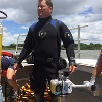
Laser scanning, photogrammetry, and multi-beam sonar generate millions of points within a highly complex, XYZ co-ordinate system, but in doing so, create different types of datasets and errors depending on a wide range of operational and environmental factors. As the availability of these powerful recording techniques reach ubiquity due to cost depreciations from rapid developments in advanced computing and robotics, several questions emerge when it comes to their full efficacy of use in maritime archaeology. In October and November of 2016, a team of scientists from the University of Southampton, Biscayne National Park and the University of Miami, conducted diver deployed underwater laser scans and DSLR based photogrammetry of the bow section of an early 20th century, steel-hulled schooner, "Mandalay" in Biscayne National Park, Florida. The results of this paper are part of a third case study that investigates the use of these advanced technologies/methodologies in a relatively shallow (~3.65m), clear (>5m of visibility), saline, coral reef environment, under ambient and non-ambient light conditions. The team compared the use of a mid-range (.38 – 2.5m) ULS-200 triangulation scanner developed by 2G Robotics and a D90 Nikon camera for the multi-image photogrammetry. Timings of the recordings were tabulated, data quality outputs were compared and recording accuracies were measured using a series of metrologically certified reference objects, which were used in a Phase I controlled indoor lab test that took place in 2014. The results indicate that photogrammetric capture of shipwrecks like the "Mandalay" under variable lighting conditions can render severely degraded datasets and significant spatial distortions with as much as 6cm of deviation from laser scans over a 1.2m area. However, while laser scanning has an ambient light filtration mechanism as a means of resolving subject material with some amount of light present, imagery could not be resolved with light intensities reaching 1000 lumens. Under non-ambient, near zero turbidity conditions, laser scanning provides an unprecedented amount of spatial and geometric accuracy and can be used most effectively for micro-change analytics of a shipwreck site over time. However, photogrammetry renders visually attractive textures that can be of diagnostic value to the archaeologist in light conditions where underwater laser scanning cannot function. A combination of the two datasets with capture taken at different times of the day, provides a powerful means for the researcher to gather more information compared to traditional 3D capture techniques and to formulate the most effective shipwreck preservation strategy possible for shallow water sites.
