�Cover Photographs by Heather Burke and Genevieve Cabrera, 2013
��Title page photograph by Genevieve Cabrera, 2013
�Dedicated to the late Escolastica B. Tudela-Cabrera
1930 - 2013
She was known by the community of Saipan as “the champion of common causes.” Her energy,
knowledge and passion for passing on history made her an inspiration to all that knew her.
iii
�Abstract
The focus of this project and planning document is the WWII Battle of Saipan that occurred in June and
July of 1944 on the island of Saipan in the Commonwealth of the Northern Mariana Islands. This project
builds upon two previous American Battlefield Protection Program (ABPP) projects: 2009-2010 WWII
Invasion Beaches Underwater Heritage Trail GA-2255-09-028 and 2011-2012 Management Plan for
WWII Submerged Resources in Saipan GA-2255-11-018. However the focus of this grant is on the
terrestrial historic properties related to the Battle, specifically cave sites. The project aimed to:
1. conduct consultation and public meetings to gauge interest in protecting archeological cave
sites on private property, identify the values associated with such sites, and examine
issues/problems/solutions related to their protection;
2. produce public service announcements to increase awareness about the importance of
protecting archeological cave sites on private property; and
3. develop an initial planning document for the long-term protection of archeological cave sites on
private property.
The results of the public consultation process indicate that there is strong local support for protecting
WWII-related cave sites on private and public lands. Members of the local community have many
memories of using caves or their family members using caves for shelter and protection during WWII.
There is also a strong ancestral connection with caves that supersedes WWII, and evidence of this can
be found in the rock art on cave walls and the Indigenous artifacts scattered on the cave floors.
This document describes many of the natural and cultural factors affecting the preservation of historic
cave properties. Tourism and development are the two biggest concerns with regards to the
preservation of caves, and sustainable tourism must be implemented in order to preserve these
properties for generations to come.
This document also describes the process of developing two types of public service announcements –
radio and television. It outlines the process, content and delivery of these products with regards to their
ability to increase awareness about the importance of protecting historic resources.
Finally, this is a planning document that outlines a ten-year plan for both a community-run organization
and the Historic Preservation Office. Key strategies are identified and specific actions are outlined yearby-year. This document is meant to empower the local community and government to manage their
historical properties and should be read with this sentiment in mind.
iv
�Acronyms and Abbreviations
ABPP
AMP
CNMI
CRM
CZMP
DEQ
DFW
DLNR
DOI
DPL
FU
HPO
MARC
MVA
NEPA
NMC
NMICH
NPS
NRHP
SHARC
Ships
SEARCH
US
UXO
WWII
American Battlefield Protection Program
American Memorial Park
Commonwealth of the Northern Mariana Islands
Coastal Resources Management
Zoning Management Program
Department of Environmental Quality
Division of Fish and Wildlife
Department of Lands and Natural Resources
Department of the Interior
Department of Public Lands
Flinders University
Historic Preservation Office
Micronesian Area Research Centre
Marianas Visitors Authority
National Environmental Policy Act
Northern Marianas College
Northern Mariana Islands Council for the Humanities
National Park Service
National Register of Historic Places
Swift and Harper Archaeological Research Consultants
Ships of Exploration and Discovery Research, Inc.
Southeastern Archaeological Research, Inc.
United States
Unexploded Ordnance
World War II
v
�Table of Contents
Abstract ........................................................................................................................................................ iv
Acronyms and Abbreviations ........................................................................................................................ v
Table of Contents ......................................................................................................................................... 6
List of Figures .............................................................................................................................................. 10
List of Tables ............................................................................................................................................... 13
Acknowledgements .................................................................................................................................... 14
Chapter 1: Introduction .............................................................................................................................. 15
The Battle of Saipan 1911-1944 (after Burns 2008) ................................................................................ 17
Japanese Defences on Saipan............................................................................................................. 17
The Mariana Islands in WWII, 1941-1944 .......................................................................................... 18
Operation Forager .............................................................................................................................. 18
The Battle of Saipan – Operation Tearaway, 1944 ............................................................................. 20
The aftermath of the Battle of Saipan ................................................................................................ 23
Chapter 2: The Battlefield Today ................................................................................................................ 24
The battlefield ......................................................................................................................................... 24
Potential National Register boundary ................................................................................................ 25
Previous cave research in the Mariana Islands ....................................................................................... 28
Oral histories ........................................................................................................................................... 30
Phelan and Denfeld’s cave research in the Pacific .................................................................................. 30
Previously recorded cave sites on Saipan ............................................................................................... 34
The cave sites survey ............................................................................................................................... 36
Chapter 3: Cave Geology and Historical Background ................................................................................. 39
Geology .................................................................................................................................................... 39
Types and locations of caves .............................................................................................................. 39
Prehistoric Indigenous use and adaptation of caves on Saipan .............................................................. 43
Historic and Ethnographic Accounts .................................................................................................. 43
Archeological Evidence ....................................................................................................................... 44
WWII use of caves: pre-, during and post-battle .................................................................................... 46
6
�Indigenous and non-Japanese civilians .............................................................................................. 47
Japanese civilians................................................................................................................................ 48
Japanese military ................................................................................................................................ 49
US military .......................................................................................................................................... 54
Archeological Evidence ....................................................................................................................... 55
Post-war cave use .................................................................................................................................... 56
Local community ................................................................................................................................ 56
Japanese bereavement bone collection missions .............................................................................. 56
Chapter 4: Cave, Rockshelter and Tunnel Sites .......................................................................................... 61
Sites ......................................................................................................................................................... 61
Uncle John’s Cave ............................................................................................................................... 61
Papagu Cave ....................................................................................................................................... 65
Japanese Field Hospital Cave and Swiftlet Cave................................................................................. 68
Ayuyu Family Caves ............................................................................................................................ 74
Gen’s Research Cave .......................................................................................................................... 79
Camacho Family Cave ......................................................................................................................... 82
“Naftan” Cave at Lao Lao Bay Golf Resort .......................................................................................... 86
Ben Sablan Family Caves .................................................................................................................... 87
1000 Men Cave or Liyang I Falingun Hanum...................................................................................... 89
Achugao Caves.................................................................................................................................... 91
Cabrera Family Cave ........................................................................................................................... 93
Chalan Galaidi Cave ............................................................................................................................ 96
Esco’s Caves ........................................................................................................................................ 97
Kalabera Cave ..................................................................................................................................... 97
Impacts on sites ....................................................................................................................................... 98
Looting, “salting,” or moving artifacts................................................................................................ 98
Spelunking .......................................................................................................................................... 98
Vandalism ........................................................................................................................................... 99
Japanese bereavement bone collecting missions ............................................................................ 100
Refuse dumping ................................................................................................................................ 100
Memorialization ............................................................................................................................... 100
Storm activity and erosion ............................................................................................................... 100
7
�UXO detonation ................................................................................................................................ 101
Fire .................................................................................................................................................... 101
Wildlife ............................................................................................................................................. 101
Livestock grazing............................................................................................................................... 101
Hunting ............................................................................................................................................. 102
Chapter 5: Planning: Community Engagement and Public Service Announcements............................... 103
Community engagement and planning meeting ................................................................................... 103
Public service announcements .............................................................................................................. 105
Chapter 6: Preserving WWII Cave Sites from the Battle of Saipan .......................................................... 107
Areas currently protected ..................................................................................................................... 107
Land protection options ........................................................................................................................ 108
Public and private property easements ........................................................................................... 108
Leasing .............................................................................................................................................. 109
Land purchase .................................................................................................................................. 109
Zoning and local ordinances ............................................................................................................. 110
Community battlefield group ................................................................................................................ 110
Preservation partners ............................................................................................................................ 110
Sustainable tourism ............................................................................................................................... 111
Restricting access .................................................................................................................................. 111
Education ............................................................................................................................................... 112
Enforcement .......................................................................................................................................... 112
Chapter 7: Recommended Actions ........................................................................................................... 113
Part 1: Community actions .................................................................................................................... 113
Form a community organization ...................................................................................................... 113
Apply for funding .............................................................................................................................. 113
Form partnerships ............................................................................................................................ 113
Work with landowners ..................................................................................................................... 113
Maintain momentum ....................................................................................................................... 114
Part 1: community action plan .............................................................................................................. 114
2014-2015......................................................................................................................................... 114
2015-2016......................................................................................................................................... 114
2016-2017......................................................................................................................................... 114
8
�2017-2018......................................................................................................................................... 115
2019-2020......................................................................................................................................... 115
2021-2022 more ............................................................................................................................... 115
2022-2023 more ............................................................................................................................... 116
2023-2024......................................................................................................................................... 116
Part 2: HPO actions ................................................................................................................................ 116
Conduct a grey literature survey and develop a database of known sites ...................................... 116
Develop a management plan ........................................................................................................... 116
Form partnerships ............................................................................................................................ 117
Develop interpretation ..................................................................................................................... 117
Work with landowners ..................................................................................................................... 117
Develop a monitoring program ........................................................................................................ 117
Develop a tour guide certification program ..................................................................................... 118
Develop a restricted access, user fee system at Kalabera Cave* ..................................................... 118
Develop an archeological project ..................................................................................................... 118
Maintain momentum ....................................................................................................................... 119
Part 1: HPO action plan ......................................................................................................................... 119
2014-2015......................................................................................................................................... 119
2015-2016......................................................................................................................................... 119
2016-2017......................................................................................................................................... 119
2017-2018......................................................................................................................................... 120
2019-2020......................................................................................................................................... 120
2021-2022......................................................................................................................................... 120
2022-2023......................................................................................................................................... 121
2023-2024......................................................................................................................................... 121
Chapter 8: Conclusion .............................................................................................................................. 122
Conclusion ............................................................................................................................................. 123
References ................................................................................................................................................ 125
Appendix A ............................................................................................................................................... 131
Appendix B................................................................................................................................................ 138
Appendix C................................................................................................................................................ 140
Appendix D ............................................................................................................................................... 142
9
�List of Figures
Figure 1. Photograph from website of handling human remains inside a cave on Saipan
(http://saipanpictures.blogspot.com/2010/05/caves-in-saipan.html, accessed February 2014). 16
Figure 2. Photograph from website of handling human remains inside a cave on Saipan
(http://saipanpictures.blogspot.com/2010/05/caves-in-saipan.html, accessed February 2014). 16
Figure 3. Photograph from website of handling WWII artifacts inside a cave on Saipan
(http://saipanpictures.blogspot.com/2010/05/caves-in-saipan.html, accessed February 2014). 16
Figure 4. Invasion beaches of Saipan (Ships of Discovery 2009). .................................................. 20
Figure 5. Study area as defined by KOCOA analysis (McKinnon 2014). ........................................ 26
Figure 6. Core area as defined by KOCOA analysis (McKinnon 2014). .......................................... 27
Figure 7. Sketch of a series of H-caves found in Peleliu (Phelan 1945:7)...................................... 31
Figure 8. Sketch of U-cave found in Peleliu (Phelan 1945:7). ....................................................... 31
Figure 9. Sketch of Y-cave found in Peleliu (Phelan 1945:11). ...................................................... 32
Figure 10. Map of approximate cave locations based on Operation Forager accounts (H. Burke
2013).............................................................................................................................................. 35
Figure 11. Project team. Front Row: Genevieve Cabrera; Middle Row, Left to Right: Jun Kimura,
Jason Raupp, Jennifer McKinnon, and Julie Mushynsky; Back Row, Left to Right: Heather Burke,
Herman Tudela, and Betty H. Johnson (missing from photo Toni Carrell, Fred Camacho, and John
San Nicolas). .................................................................................................................................. 37
Figure 12. General geology of Saipan (Carruth 2003). .................................................................. 40
Figure 13. Cross-section of geological section on Saipan (Carruth 2003). .................................... 41
Figure 14. Locations of cave development on carbonate islands. Category D (complex island)
represents Saipan's carbonate island karst model (Stafford et al. 2002:2). ................................. 42
Figure 15. Skulls in Kalabera ca. 1920s (Hans Hornbostel Collection; Cabrera 2009:18).............. 44
Figure 16. "Man in canoe" pictograph in Kalabera Cave - 8cm scale (J. Mushynsky 2012). ......... 45
Figure 17. "Headless man" pictograph in Kalabera Cave - 8cm scale (J. Mushynsky 2012).......... 45
Figure 18. "Gecko/lizard" pictograph in Kalabera Cave - 8cm scale (Julie Mushynsky 2012). ...... 46
Figure 19. Supply and storage uses for caves: food and other stores inside a Saipan cave
(www.ww2incolor.com). ............................................................................................................... 49
Figure 20. Natural cave enhanced by Japanese (Department of Defense USMC 83566). ............ 53
Figure 21. Marines using flamethrower in the approach to Paradise Valley, the Marianas
(www.ww2incolor.com). ............................................................................................................... 54
Figure 22. War memorial by the MHLW on Saipan (http://www.mhlw.gov.jp). .......................... 57
Figure 23. Current state of recovered human remains in the Asia-Pacific region
(http://www.mhlw.go.jp, accessed 20 Jan 2012). ........................................................................ 58
Figure 24. Uncle John's Cave entrance, note reinforced cement on entrance (J. McKinnon 2013).
....................................................................................................................................................... 62
10
�Figure 25. Shell on downward slope outside Uncle John's Cave (J. McKinnon 2013). .................. 62
Figure 26. Sinkhole containing Uncle Frank Diaz's Cave (J. Mushysnky 2013). ............................. 63
Figure 27. Opening of cave (J. Raupp 2013). ................................................................................. 64
Figure 28. Inside cave looking out at entrance (J. McKinnon 2013). ............................................ 64
Figure 29. Tea kettle (J. McKinnon 2013). ..................................................................................... 65
Figure 30. Japanese ceramics (H. Burke 2013). ............................................................................. 66
Figure 31. Norbert Diaz standing in the cave (G. Cabrera 2013)................................................... 66
Figure 32. WWII era metal artifacts including a fuel container, bucket and cooking pot (G.
Cabrera 2013). ............................................................................................................................... 67
Figure 33. Norbert Diaz rappelling into his cave (H. Burke 2013). ................................................ 68
Figure 34. Fish and Wildlife sign outside hospital cave entrance (J. Musynsky 2013). ................. 69
Figure 35. Inside the hospital cave looking out with team member standing on rock wall (J.
McKinnon 2013). ........................................................................................................................... 70
Figure 36. Outside the hospital cave looking in with concrete platform in foreground (J.
McKinnon 2013). ........................................................................................................................... 70
Figure 37. Hospital cave entrance, note cement platform in background (G. Cabrera 2013). ..... 71
Figure 38. Memorial offering in back of hospital cave (J. McKinnon 2013). ................................. 71
Figure 39. Walking into the second cave entrance (H. Burke 2013). ............................................ 72
Figure 40. Looking out from the second cave (J. Mushynsky 2013). ............................................ 72
Figure 41. Wooden stupa in the second cave (H. Burke 2013). .................................................... 73
Figure 42. Concentration of artifacts in second cave (likely collected and placed in location) (J.
Mushynsky 2013). ......................................................................................................................... 74
Figure 43. View looking out of cave (H. Burke 2013). ................................................................... 75
Figure 44. Green bento box lid (J. Kimura 2013). .......................................................................... 76
Figure 45. Alcohol bottles (J. Kimura 2013)................................................................................... 76
Figure 46. Rockshelter (J. McKinnon 2013). .................................................................................. 77
Figure 47. Tunnel with Ayuyu family members (J. Mushynsky 2013). .......................................... 77
Figure 48. Gas mask and components (H. Burke 2013). ............................................................... 78
Figure 49. WWII era artifacts outside of tunnel (H. Burke 2013). ................................................. 79
Figure 50. Cave entrance (J. McKinnon 2013). .............................................................................. 80
Figure 51. Rock art (J. Kimura 2013). ............................................................................................. 80
Figure 52. Wooden barrel parts (J. Kimura 2013). ........................................................................ 81
Figure 53. Hair comb (J. Kimura 2013). ......................................................................................... 81
Figure 54. Bottle and shoe parts (J. Kimura 2013). ....................................................................... 82
Figure 55. Entrance to cave (G. Cabrera 2013). ............................................................................ 83
Figure 56. Looking out from the inside of cave (J. McKinnon 2013). ............................................ 83
Figure 57. Indigenous mortar fragment (J. Mushynsky 2013). ..................................................... 84
Figure 58. Haphazard tin can pile (J. Mushynsky 2013). ............................................................... 84
Figure 59. Japanese ceramics (H. Burke 2013). ............................................................................. 85
Figure 60. Metal drum and gray ash (H. Burke 2013). .................................................................. 85
Figure 61. Naftan cave entrance and memorial offerings (J. Mushynsky 2013). .......................... 86
Figure 62. Small, restricted cave entrance (J. McKinnon 2013). ................................................... 87
11
�Figure 63. Team member standing inside rock ring (H. Burke 2013). ........................................... 88
Figure 64. Second small cave (H. Burke 2013). ............................................................................. 88
Figure 65. Entrance to cave, note the mermaid statue immediately outside the entrance (H.
Burke 2013). .................................................................................................................................. 89
Figure 66. Inside cave looking out (H. Burke 2013). ...................................................................... 90
Figure 67. Scaffolding bridge erected inside cave (H. Burke 2013). .............................................. 90
Figure 68. Hair comb (H. Burke 2013). .......................................................................................... 91
Figure 69. Wall of pocket caves (J. Mushynsky 2013). .................................................................. 92
Figure 70. Gathered artifacts and memorials (J. Mushynsky 2013). ............................................. 92
Figure 71. Gathered human remains (J. Mushynsky 2013). .......................................................... 93
Figure 72. Genevieve Cabrera at the entrance of her family's cave (J. McKinnon 2013). ............ 94
Figure 73. Inside the large open space beneath the road bed (H. Burke 2013). .......................... 95
Figure 74. Adult and child shoe soles (J. Mushynsky 2013). ......................................................... 95
Figure 75. Chalan Galadi cave (J. McKinnon 2013)........................................................................ 96
Figure 76. Inside the cave suspected to be used by Esco (J. Mushynsky 2013). ........................... 97
Figure 77. Graffiti panel 1 with canoe pictograph (Swift et al. 2009:71). ..................................... 99
Figure 78. Graffiti panel 2 with canoe pictography (Swift et al. 2009:72). ................................. 100
Figure 79. Cow inside the Ayuyu family tunnel (H. Burke 2013). ................................................ 102
Figure 80. Newspaper advertisement announcing public meetings (J. McKinnon 2012). .......... 105
12
�List of Tables
Table 1. Mariana Island natural cave types, descriptions and locations (Mylroie and Mylroie
2007:61-62; Stafford et al. 2002:11-13). ....................................................................................... 43
Table 2. Number of individuals recovered since 2007 (http://www.mhlw.go.jp). ....................... 58
Table 3. Recovery missions by date (http://www.mhlw.go.jp)..................................................... 59
Table 4. Identification results for DNA analysis (http://mhlw.go.jp). ........................................... 60
Table 5. Conservation areas of Saipan. ....................................................................................... 108
13
�Acknowledgements
This project would not have occurred without the help of a number of individuals and groups.
First and foremost we would like to thank the CNMI Historic Preservation Office for their
continuous support. Special thanks are extended to Herman Tudela (no longer at HPO) and “JP”
John Palacios.
The agencies and organizations that have supported this project on island include: the National
Park Service American Memorial Park; the NMI Humanities Council; and Power 99.
Thank you to the volunteers on the project as well as general support while on island: John D.
San Nicolas, Scott Eck, Betty H. Johnson, and Fred Camacho.
Thank you to the archeological team for your assistance and knowledge: Jason Raupp, Heather
Burke, Genevieve Cabrera, Herman Tudela, Jun Kimura and Julie Mushynsky.
Thank you to the local community who were very enthusiastic and supportive of this project and
protecting their heritage.
Special thanks go to Flinders University for providing staff time and equipment, and East
Carolina University for providing staff time to this project.
Thank you to Windward Media for their support and assistance with this project and the fine
products they produce.
A big thank you should be extended to the American Battlefield Protection Program for
providing the funding for this project. We would particularly like to thank Kristen McMasters for
her availability and willingness to help us through this process.
Jennifer McKinnon, Greenville, NC
Toni Carrell, Santa Fe, NM
14
�Chapter 1: Introduction
This project involved a planning and consensus-building effort focused on the protection of
threatened caves on private property that were occupied and used prior to, during and after the
WWII Battle of Saipan by Japanese and US troops and civilians. The project was designed to
assess local interest in protecting sites on private property and sought to increase awareness
and advocacy of their protection into the future. This was accomplished through a series of
public meetings, consultation with land owners, Historic Preservation Office (HPO), National
Park Service (NPS), and other stakeholders, and the development and implementation of radio
and television (TV) public service announcements (PSAs) that focus on the conservation and
protection of cave sites.
This project was developed as a result of local and international concern for archeological cave
sites on Saipan. A range of cave types exist in various forms from natural, to modified, to fully
human-made intricate tunnel systems. Due to the excellent preservation environment of caves,
these sites still contain valuable historical and archeological material culture and context which
is actively being compromised and destroyed by cave explorers, souvenir hunters and tourists.
During 2010 while Ships of Exploration and Discovery Research, Inc. (Ships) archeologists were
on island conducting research as part of a previous ABPP grant, it was reported that
photographs of cave sites and their locations were being publicized on the Internet through a
private blog (http://saipanpictures.blogspot.com/2010/05/caves-in-saipan.html), a Flicker
account (https://www.flickr.com/photos/saipanpictures/sets/72157623893765702/) and on
YouTube (http://www.youtube.com/user/SaipanPictures?feature=watch). The photographs and
videos show individual(s) picking up both artifacts and human remains, which is prohibited by
both Commonwealth and Federal law (Figure 1, Figure 2 and Figure 3). This raised concern with
the HPO and NPS about access to sites and their protection, particularly on private property. It
also alarmed local Indigenous community members who were concerned with the publication of
Indigenous rock art on the Internet. Inappropriate or unmonitored public access to archeological
sites can contribute to an overall loss of archeological and historical context and affect the
structural integrity of the sites and their long-term survival, particularly if individuals are seeking
to remove or move artifacts. Whether harm is intentional or unintentional these impacts are
irreversible and therefore an understanding of public access is crucial to developing a plan for
how these sites can be protected and managed.
15
�Figure 1. Photograph from website of handling human remains inside a cave on Saipan
(http://saipanpictures.blogspot.com/2010/05/caves-in-saipan.html, accessed February 2014).
Figure 2. Photograph from website of handling human remains inside a cave on Saipan
(http://saipanpictures.blogspot.com/2010/05/caves-in-saipan.html, accessed February 2014).
Figure 3. Photograph from website of handling WWII artifacts inside a cave on Saipan
(http://saipanpictures.blogspot.com/2010/05/caves-in-saipan.html, accessed February 2014).
Further, because many of these sites are on private property owned by Chamorro and Carolinian
peoples it is crucial to gauge their understanding of these sites, what values they hold and how
they might be involved in their protection into the future. Involving the community in this effort
is vital to the success of any plan for protecting sites. Local voices must be heard and considered
and the local community must be at the center of the movement to protect these sites.
Over the course of the project, researchers from Ships and Flinders University (FU) traveled to
Saipan several times to evaluate the caves, conduct research, speak with stakeholders, hold
community meetings and produce PSAs. The preservation plan for the Battle’s caves is based on
thorough evaluation of the resources. It also incorporates the ideas, wants and needs of the
community and stakeholders as expressed in the individual and community meetings concerning
the future of the sites and battlefield. Protection for significant cave sites rests solely in the
16
�hands of local landowners and the government agencies charged with managing these
resources. Outlined within this plan are strategies for addressing preservation through
partnership opportunities and as well as information about financial and technical sources of
support.
The ABPP’s willingness to fund this plan demonstrates that preserving these caves and
battlefield is more than a local initiative and that the NPS understands the significance of the
battlefield and the importance of preserving it into the future. This project demonstrates to the
NPS that the community is also serious about preserving the cave sites on their island. It is the
purpose of this plan to provide a blueprint for future preservation efforts.
The Battle of Saipan 1911-1944 (after Burns 2008)
As destructive as World War I was in other parts of the world, the Mariana Islands were spared.
Still, the end of the war had important ramifications for the islands. The League of Nations
approved Japan’s occupation of the Mariana (sans Guam), Caroline, Marshall, and Palau Islands
in 1921 with the stipulation that Japan not develop fortifications in the region. For over a
decade Japan complied with the agreement and focused on infrastructural development that
strengthened the economy of their possessions.
Increasingly expansionist, Japan sought to strengthen its presence in the Pacific in the late
1930s. For example on Saipan, Aslito Airfield on the southern end of the island and a seaplane
base at Flores Point (northeast of Garapan) were constructed. Japan withdrew from the League
of Nations in 1933 which abrogated their agreement. Barracks, ammunition storage, air raid
shelters, and other facilities preparatory for an offensive war were installed elsewhere on
Saipan in 1941 (Russell 1984).
Japanese Defences on Saipan
The Japanese defensive strategy used for Saipan and the other Mariana Islands was identical to
that of earlier battles at the Gilbert and Marshall Islands: the enemy was to be met and
destroyed at the beaches and, if allowed inland, they were to be pushed into the sea by way of
counterattacks (Denfeld 1992). Prior to the outbreak of the war, Japan’s need for troops and
material elsewhere in the Pacific hampered the pace of developments on Saipan and the other
islands of the Marianas. The Japanese forces established two bases on Saipan by early 1944. The
airfield at Aslito (built in the 1930s) served as a repair and maintenance facility for aircraft
involved in battles to the east and south. At Tanapag Harbor, a naval base served as a staging
area for troops and ships bound elsewhere (Denfeld 1992). Due to needs in other parts of the
Empire, Japanese troop numbers were fairly low; in early February 1944, there were only 1,500
troops on Saipan.
The impending US campaign against the Marianas hurried Japanese defensive measures and by
the end of February thousands of troops were sent to the Marianas to prepare for Battle. US
submarine attacks on Japanese transports prevented an estimated 2,000 troops from reaching
the islands (Denfeld 1992), but by early June some 30,000 troops were prepared for Battle on
Saipan (Rottman 2004b).
Once they had sufficient troops and materials available, the Japanese forces commenced
defensive improvements on Guam, Tinian, Rota, Pagan, and Saipan. On Saipan, another airfield
was built by Lake Susupe near the town of Chalan Kanoa, but this was little more than an
17
�emergency landing strip. More airstrips were planned on Saipan and throughout the islands, but
most were never completed (Denfeld 1992). Forty-six gun installations were established on the
beaches and ridges of Saipan, but twelve were not operational on D-Day. An additional three
units lay on railcars awaiting installation at the start of the Battle and another 42 were in
storage at the Navy base at Tanapag. Construction of three blockhouses on the beaches of
Saipan, each a concrete structure with four ports housing heavy guns, began in early 1944.
Between Obyan Point and Agingan Point stand two of the three blockhouses. The third is at
Laulau Bay (Purple Beach). None of the three blockhouses housed the large guns intended for
the fight against US forces. (Denfeld 1992).
The Mariana Islands in WWII, 1941-1944
Across the Pacific, word spread that war was coming, however, only Japan knew when and
where it would start. Shortly after the December 7, 1941 attack on Pearl Harbor in Hawaii,
Japanese forces initiated air attacks over Guam, which they had been openly monitoring since
November. Commercial airline buildings, fuel supplies, the US Navy yard, vessels in Apra Harbor,
and the capital at Agana were bombed. Poorly defended by the US, Guam fell on 10 December
within six hours subsequent to the Japanese invasion. Guam became the only part of the US to
fall under enemy occupation during WWII. With this prize under its belt, the Japanese Imperial
Army and Navy mounted very successful aggressive operations across the Pacific in the early
years of the war (Rogers 1995; Rottman 2004a).
As these events were occurring in the Marianas, Allied powers meeting in Egypt agreed upon a
Pacific strategy consisting of two offensive drives. The first, led by General Douglas MacArthur,
was an advance from New Guinea to the Philippines. The second, led by Admiral Chester Nimitz,
was a push through the Gilbert and Marshall Islands across the Central Pacific to take the
Marianas. Once accomplished, a strategic bombing campaign could be mounted against the
Japanese mainland. By the start of 1944, this broad strategy proved successful for the US and
the Japanese government realized an invasion of the Marianas was imminent. As Marine
historian O.R. Lodge wrote, “A strangling noose was tightening around the inner perimeter
guarding the path to their homeland” (Lodge 1954).
Operation Forager
The US’s plan to take control of the Marianas from Japanese forces was code-named Operation
Forager and included the island of Guam. The plan to invade and take control of Saipan was
called Operation Tearaway. This massive operation involved thousands of troops from all
branches of the military and a bewildering number of vessels, vehicles, and weapons. Japan’s
defenses focused on five islands in the Marianas: Guam, Rota, Tinian, Saipan, and Pagan. Saipan,
home of the administrative center of the Japanese Marianas, was chosen as the first target with
Tinian and Guam as secondary. US war planners opted to bypass a full assault on Rota and
Pagan (Rottman 2004a).
Air attacks were the first phase of Operation Forager. In February 1944, US bombers destroyed
the Orote Peninsula airstrip on Guam. General air raiding also began across the Marianas,
resulting in US dominance of the skies. In response, Japanese forces prepared Operation A-Go,
which relied upon the support of the Imperial Japanese Navy and air forces to support troops on
the ground in the Marianas.
18
�Operation Forager was in full swing by June 1944 when the invasion of Saipan was planned. The
invasion was set for June 15, D-Day. Responsible for this task was the Marine V Amphibious
Corps (VAC) that consisted of the 2nd and 4th Marine Divisions, the 27th Infantry Division (Army),
and the XXIV Corps Artillery (Army). US military planners considered landing points on all sides
of Saipan. On the eastern side of the island, an area designated Brown Beach on the Kagman
Peninsula was considered but rejected because it was well-defended and would offer a poor
exit. Three other beaches, Purple Beach on Magicienne Bay and White Beach 1 and 2 near Cape
Obiam on the southern reach of the island, were kept as alternates. At Tanapag Harbor were the
well-defended Scarlet Beaches 1 and 2, and to the north of this area were Black Beaches 1 and
2, which offered insufficient space for the large unit landing that was planned (Rottman 2004a).
The lower western side of Saipan was chosen as the primary invasion area. Stretching
approximately four miles and divided into several zones, this area was most favorable because
the size would allow two Marine divisions to land simultaneously. A landing here also allowed
the immediate capture of the airstrip at Chalan Kanoa placing direct pressure on nearby Aslito
Airfield. Once secure, these air strips were used to support the penetration northward across
Saipan. Afetna Point divided the landing beaches. To the north were Red Beaches 1, 2, and 3 and
Green Beaches 1 and 2 while to the south were Green Beach 3, Blue Beaches 1 and 2, and
Yellow Beaches 1, 2, and 3 (Rottman 2004a) (Figure 4).
As favorable as the lower western side of Saipan was for the US invasion, certain limitations
remained. Because of its distance from the northern sector of the island, beaches in this area
(Scarlet 1 and 2 and Black 1 and 2) had to be captured in order to facilitate the off-loading of
supplies from landing craft. Another problem at the beaches off the lower western side of
Saipan was the extensive coral reef that abutted the shore. These had to be negotiated with
amphibious vehicles including AMTRACS or Landing Vehicle Tracked (LVTs) and amphibious
tanks, also known as Landing Vehicle Tanks (LVT(A)s). Both the 2nd Marine Division and the 4th
Marine Division had three AMTRAC battalions each, plus one amphibian tank battalion, for the
initial shore assault. This amounted to approximately 1,400 AMTRACS, the largest use to date of
amphibious vehicles. Once ashore, the AMTRACS were required to push inland from the beach,
a tactic that was equally unprecedented and also potentially dangerous. AMTRACS, with their
thin armor and low ground clearance, were not designed for cross-country movement.
19
�Figure 4. Invasion beaches of Saipan (Ships of Discovery 2009).
The Battle of Saipan – Operation Tearaway, 1944
An intensive barrage presaged the beach invasion foreshadowing the massive confrontation
that was set for June 15. On June 12, 200 carrier aircraft bombed Japanese airfields in the
southern Marianas, decimating the enemy’s air force. That same day, US B-24 bombers began
around-the-clock raids on Saipan and Tinian. The following day (June 13), seven fast battleships
leveled the towns of Chalan Kanoa and Garapan and on June 14, more battleships as well as 11
cruisers and 26 destroyers attacked Japanese coastal defenses.
20
�On June 14, other crucial preliminary actions took place along the coast of Saipan. Early that
morning, Underwater Demolition Teams began their mission to demolish reefs, enemy mines,
and mark lanes along the Red, Green, Blue, and Yellow beaches. This effort was largely
successful. Simultaneously, a mock attack was held by a “Demonstration Group” off the
northwestern coast at Scarlet and Black beaches (refer to Figure 1) in an attempt to trick the
Japanese into thinking that the invasion was to occur there. Another was held in the early
morning hours of June 15, D-Day. The Demonstration Group consisted of the 2nd Marines, the
1st Battalion, 29th Marines, and the 24th Marines. The feint was supported by naval gunfire as
landing craft approached the beach to within 5,000 yards, circled for a few minutes, wheeled
about, and returned to their ships. Troops were not embarked, the landing craft drew no fire,
and no activity was observed on the shore. Although clearly not convinced by the ploy, the
Japanese stopped short of removing troops from here and redeploying them to other beaches.
Interestingly, Japanese commanders did wire Tokyo to report that they had repelled an invasion
in this area (Rottman 2004a).
As the sun rose on June 15, the enormous US amphibian force was assembled for the invasion.
AMTRACS and DUKWs were unloaded and LSDs (Landing Ship, Dock) launched LCMs (Landing
Craft, Mechanized) that held tanks. Battleships, cruisers, and destroyers closed in on the
invasion beach with aircraft screaming overhead toward the shore. With nearly 1,500 vessels in
all, this great unpacking of men, weaponry and ammunition was surely an intimidating sight for
the Japanese forces and the islanders. At exactly 0830 hours, the AMTRACS carrying hundreds of
marines stormed for the beach as supporting ships and aircraft opened fire. The Japanese
troops generally held their fire until the AMTRACS reached the lip of the coral reef when they
poured artillery, mortar, and machine gun fire on the Marines. Due to the condition of the seas,
the Marines had a great deal of difficulty reaching the beach. Numerous AMTRACS were
rendered inoperable or destroyed as a result. Dozens of Marines lost their lives when AMTRACS
were overturned in the rough surf, but by 0900 hours nearly 8,000 Marines were ashore (Crowl
1960; Rottman 2004a).
The beaches, especially the northern Red and Green Beaches, were chaotic and crowded.
Because of the heavy swell and long shore current, the US landing in this area was several
hundred yards north of its intended location. In all areas Japanese fire was very heavy and came
from the high ground beyond, as well as trenches and spiderholes along the immediate
shoreline. The overland AMTRAC charge, a calculated risk, proved disastrous as the flimsy
AMTRACS became stranded in marshy areas, craters, and other obstructions on the ground. As
casualties for the Marines mounted, many chose to abandon their machines in favor of walking
or crawling. Problems increased as the morning wore on. At the northern beaches, two 2nd
Marine Division command posts were destroyed, killing battalion commanders and key staff and
on the south, the 4th Division indecisively struggled with Japanese tanks for hours. The arrival of
US tank battalions, howitzer batteries, and other support forces improved the overall situation
by the end of the day, although the beachhead remained unconsolidated. On this day, the first
of the battle for Saipan, some 2,000 Marines were killed. Mortar and artillery fire were the
principal causes of death. Offshore hospital vessels were completely overwhelmed and
wounded men were transferred to other, non-hospital ships for treatment (Crowl 1960;
Rottman 2004a).
Over the next two days, the Marines secured and expanded the beachhead. The morning of
June 16 was spent closing the gap between the two divisions, which were separated by a strong
21
�Japanese force on Afetna Point. By noon, this goal was accomplished. A huge Japanese
counterattack was successfully repelled that afternoon and the Marines engaged in the largest
tank battle of the Pacific War. Aslito Airfield was under pressure at the close of the day. In
contrast, the 27th Infantry Division (Army) came ashore to support the Marines on the morning
of June 17 and bore the brunt of a door-to-door fight through Garapan village, another
innovation in the Pacific War.
After the beaches were secured, support groups landed on the beachheads to facilitate the
massive unloading of supplies. The post-invasion landscape they witnessed was grim. Disabled
AMTRACS and boxes of c-rations were scattered across the beach. Bodies of dead Marines that
were not yet recovered bobbed in the surf. “The leaves on battered trees and underbrush were
covered with a fine, gray dust,” wrote former Naval Construction Battalion (Seabee) commander
David Moore. “This whole scene gave an eerie feeling of war” (Moore 2002).
On the evening of D-Day, Seabees were ordered to launch the floating causeways held in the
LSTs (Landing Ship, Tanks). Throughout the night, the Seabees maneuvered the various pieces
through the channel and assembled them at the Chalan Kanoa beachhead. By daybreak supplies
were being unloaded from landing craft. Other craft towed pontoon sections that were made
into floating piers to unload supplies. Pontoon barges were used to haul ammunition. While vital
to the continued success of the American operation on Saipan, unloading supplies and
ammunition from barges on the beachhead became monotonous as combat moved farther
inland. This “grueling mission of moving ammunition and other supplies to the beach…became a
routine of eating bland c-rations and sleeping on the barge for a boring 54 days of blazing sun or
miserable rain,” remembered one Seabee who served at Saipan. “The Coxswain often grumbled:
it is noble to suffer. We [the Seabees] were granted the undistinguished title, ‘Bastards of the
Beaches’” (Moore 2002).
There were nevertheless many soldiers on the mainland that would have traded places with the
Seabees. Japanese attempts to call in reinforcements from neighboring islands were fruitless,
but they continued to fight with resolve. On June 18, they attempted a daring counter-landing
from their tattered Navy base at Tanapag Harbor. Japanese infantrymen were hastily loaded
onto 35 barges and sent toward the US landing beaches. In route, US infantry gunboats and
Marine artillery intercepted them, destroying many and deterring all. A larger-scale encounter
played out in the Philippine Sea between June 19 and 20 when the US Navy defeated the
Japanese Imperial Navy in what is known at the “Marianas Turkey Shoot.” In the meantime, the
US secured Aslito Airfield and the southern reaches of the island and prepared the northward
fight (Crowl 1960; Rottman 2004a).
More gruesome scenes followed in this monstrous battle as June became July and US troops
pushed deeper into the island of Saipan. Garapan was secured on July 3, the Tanapag seaplane
base on July 4, and on July 6 the Japanese forces staged their last massive banzai charge. After
Saipan, Japanese commanders deemed such suicidal charges as wasteful. Rarely effective, they
were not used in later battles. Through mountainous terrain, tropical conditions, and intense
resistance, US forces reached the northern end of Saipan at Marpi Point on July 9, 1944 (Crowl
1960; Rottman 2004a).
22
�The aftermath of the Battle of Saipan
The loss of life during the Battle of Saipan was tremendous. Approximately 3,426 of the 67,451
US troops who participated in the Battle were killed or reported missing in action. Four times
this number were confirmed wounded. Japanese losses were far greater. Of the approximately
31,629 Japanese troops who participated in the Battle, 29,500 were killed or missing (Rottman
2004b). Japanese sources, however, estimated the total number killed on Saipan to be well over
40,000 (Bulgrin 2005).
The long-fought and costly victory at Saipan, the fiercest of the three major battles in the
Marianas, was politically and militarily decisive. US successes in the opening two weeks of the
Battle induced Japanese Emperor Hirohito to attempt a diplomatic end to the war. When news
of Saipan’s fall reached Japan, political pressure forced Prime Minister, War Minister, and Chief
of Army General Staff Tojo Hideki and his cabinet, as well as Navy officials, to resign (Rottman
2004a).
Equally as important to the decisiveness of the victory at Saipan was the island’s proximity to
Japan. This was also true of Guam and Tinian. The Mariana Islands were ideal for the
development of bases for long range, B-29 bombers that were capable of reaching the Japanese
mainland. On Saipan, the US wasted no time in developing these bases. Aslito Airfield was
renamed Conroy Field and then Isely Field. By December 1944, it was used as the main
operating field on the island. Two new airfields, Kobler Field and another at Kagman Peninsula,
were also built at this time. The seaplane base at Flores Point was rebuilt and improvements
were made to the Marpi Point airfield.
Saipan and the Mariana Islands paved the road for more decisive battles at Okinawa and Iwo
Jima. Together, the great sacrifices of these and other battles of the Pacific War gave US military
planners an impression of what could be expected from an invasion of the Japanese mainland.
Plans for such an invasion were in the making when the decision was made to drop the atomic
bombs on Hiroshima and Nagasaki, resulting in the surrender of the Japanese Empire and the
conclusion of WWII.
23
�Chapter 2: The Battlefield Today
The Saipan battlefield retains considerable integrity in certain areas of the island and the
viewshed from many points is excellent and a constant reminder of the activities that took place
during 1944. Locals and visitors are reminded of the Battle daily by the remnants of the war,
such as tanks and guns scattered inland and along the coastline, pre-war and WWII Japanese
structures covering the island and large and small caves hidden in the bush. While the island is
easily recognizable as a battlefield site, it has also been the location of years of development
and commercial and private building which can obscure prominent features and sites.
The battlefield
Three battlefield boundaries were addressed as a result of the application of KOCOA analysis in
a 2009-2010 project that assessed the significance of the central and northwestern portions of
waters surrounding Saipan (McKinnon and Carrell 2011). These include:
1. Study Area, which encompasses the ground over which units maneuvered in
preparation for combat;
2. Core Area, which defines the area of combat; and
3. Potential National Register Boundary (PotNR), which contains only those portions of the
battlefield that have retained integrity.
In most cases KOCOA has been applied to Revolutionary and Civil War battlefields which are
clearly bounded and defined (Legg et al. 2005; Bedell 2006; GAI Consultants 2007; Fonzo 2008).
These conflicts, lasting one to several hours, were brief encounters on a discrete portion of land.
Combat consisted of hand-to-hand combat and close range artillery, such as guns and cannon. In
the survey and analysis of this type of battlefield site archeologists are dealing with a short
moment in time and an enclosed space. Conversely, the battle for Saipan was several months
long if aircraft bombing missions are considered, or, if only the ground invasion is considered, a
three week engagement that slowly spread across an island 115 km2 in size. Further, it was not
only fought over land, but also in the surrounding lagoon and sea and in the airspace above. This
type of combat was made possible through advances in combat vehicles and aircraft and
increased artillery range.
Study area
The study area for the Battle of Saipan is much larger than the island of Saipan and its
immediate surrounding waters. Broadly speaking, the approach to the island from Pearl Harbor
where the expeditionary forces left on 5 June 1944 could be considered part of the study area;
however this space will not be included for the purposes of this project. Rather the study area
encompasses the waters and airspace above the adjacent Philippine Sea, approaches to the
island, the island, and the immediate surrounding waters that both US and Japanese forces used
to maneuver and prepare for battle (Figure 5). For example, the US and Japanese forces utilized
the sea and airspace to conduct aerial and underwater reconnaissance and to position
themselves strategically in the lead up to and during the Battle of Saipan. Historical records
indicate that several reconnaissance missions both in the air and underwater were launched by
the US in early 1944. Further, Japanese forces conducted their own reconnaissance flights to
gain more knowledge about the invading US forces. There are also records of the US using
diversionary tactics such as a mock attack prior to invasion and on the day of invasion. These
demonstrations, maneuvers, staging, and reconnaissance activities all can be considered part of
the study area of the Battle of Saipan.
24
�Core area
The core area for the Battle of Saipan is similar in scope to the study area of Saipan, particularly
on the western side of the island. This research has defined the core area as the space in which
either side engaged in combat in the form of hand-to-hand, close range, and long range
weaponry. For example, the offshore position from which US shelling and bombardment
occurred several days prior to the invasion of the island is considered part of the core area, as is
the space just outside of and above the lagoon where aircraft strafed and bombed surface
vessels and other aircraft. Thus the core area incorporates the whole island of Saipan as well as
those spaces on the water and in the air where combat occurred (Figure 6).
The study and core area for this project has not been altered and will remain the same as
previous projects.
Potential National Register boundary
The WWII landing beaches on the west coast, Aslito/Isley Field in the south and Marpi Point in
the north were listed on the NRHP and designated a National Historic Landmark (NHL) on
February 4, 1985. The NHL encompasses 1,366 acres of land and water (Thompson 1984). The
NHL was designated based on the history and integrity of the areas; however, no archeological
fieldwork was conducted. (See Thompson’s [1984] nomination for sites located within the
Landmark). It was not within the scope of this project to delineate a second or expanded
boundary for this area. Further, because this project did not cover the entire battlefield, but
only specific cave properties on private lands, the integrity of the battlefield cannot be assessed
for those areas not surveyed. Nevertheless, the individual sites that were surveyed can be
assessed on a case-by-case basis for archeological integrity (see following chapters).
25
�Figure 5. Study area as defined by KOCOA analysis (McKinnon 2014).
26
�Figure 6. Core area as defined by KOCOA analysis (McKinnon 2014).
27
�Previous cave research in the Mariana Islands
While the existence of cultural remains in cave sites has been documented by numerous
researchers over the past one hundred years, few projects have focused specifically on caves. To
date there has been no systematic island-wide archeological survey of caves on Saipan and
there are very few published works on archeology conducted in caves. Like most other Pacific
islands where caves have been documented by archeologists, it has generally been undertaken
only when they are encountered though cultural resource management projects or surveys of
WWII battlefield sites. Although in many other parts of the world archeological research in cave
environments has been considered highly important and excavations have provided new
information about local cultural histories, until recently caves sites on Saipan have been given
little attention.
Following the end of WWII, the islands of Micronesia were established as a trusteeship of the
United Nations and were known as the Trust Territories of the Pacific Islands, which were
administered by the US. Apart from Guam, which became a Territory of the US in 1898, the
Northern Marianas existed under Trust Territory status (18 July 1947) until they were declared a
Commonwealth of the US in 1976. During the Trust Territory period little archeological research
was conducted on the Northern Marianas aside from the 1949-1950 Chicago Natural History
Museum investigations conducted by Alexander Spoehr. This project involved excavations on
the archipelago’s three southern islands and the results of these formed the basis for Spoehr’s
major work entitled Marianas Prehistory: Archaeological Survey and Excavations on Saipan,
Tinian and Rota (1957). This seminal volume included not only descriptions of his excavations
and discussions of the results, it provided brief discussions of previous research that had been
carried out in the pre-war period. Of interest in this discussion is the reference to Laura
Thompson’s investigations of cave sites on both Tinian and Saipan, though no further
information about her research is given. Spoehr’s own surveys included the investigation of 25
limestone caves on Saipan and numerous others on Tinian (Spoehr 1957). However, all but one
of these were found to have been disturbed “by Japanese defense forces and converted into
machine gun positions and military strong points for the defense of the island during the
American invasion” (Spoehr 1957:29). The only cave site to be excavated and documented by
Spoehr was the Laulau Shelter site, which is located near the large bay of the same name on the
island’s east side. Excavations at the site indicate that it was used primarily as a place for burial
and cremation; just under the topsoil a thick stratum of densely packed ashes and fragments of
charred human bones, some plain pottery and three shallow burial pits was found. Below this
layer several other burial pits where found in a clay layer that was devoid of artifacts other than
those associated with the burials. These contained the remains of several adults and children, as
well as ceramics that predate those found in the upper level (Spoehr 1957:52-58). Spoehr
(1957:52) also mentions that the surface in the northern part of this cave had been cleaned out
by Japanese forces and that it was used as a military strong point.
Dave Lotz (1998) documented over 400 WWII related resources in Guam, Rota, Tinian, Saipan,
and Aguiguan in World War II Remnants – Guam, Northern Mariana Islands: A Guide and
History. Lotz’ survey and publication contain a few of the cave and rock shelter sites, but little indepth research was conducted other than noting their locations.
28
�The next research project that focused directly on the archeological investigation of Saipan’s
caves was carried out by Genevieve Cabrera and Herman Tudela of the CNMI Historic
Preservation Office. Cabrera and Tudela conducted a research project on Indigenous rock art
located in various caves around the island, but primarily reported on Kalabera Cave. They
outlined the historical, cultural and archeological significance of cave sites and rock art, and
provided a useful interpretation of the imagery, which they supported with archeological
evidence and Indigenous oral histories (Cabrera and Tudela 2006).
The private consulting firm SHARC conducted both archeological and environmental
assessments of the well-known Kalabera Cave site in 2009/2010 when government plans were
considered for developing the cave into a tourist attraction (Swift et al. 2009). The government
plans proposed several option for tourism development including a full-scale tourism operation
with food venues, parking, etc. SHARC’s survey and excavation focused primarily on Indigenous
use and occupation of the cave system; however they provided significant information regarding
management options for cave sites. Their report should be consulted with regards to any future
research on cave sites. Also, in conjunction with the work by SHARC, the LAMAR Institute
conducted a GPR survey at Kalabera Cave as part of a larger GPR training project on the island
(Elliot and Elliot 2008). This survey also focused on the Indigenous contexts.
Caves and their associated artifacts have also been identified as part of cultural resource
management archeological surveys in various areas of Saipan (Eakin et al. 2012; Mohlman
2011). For example, an archeological survey conducted by the consulting firm Southeastern
Archaeological Research, Inc. (SEARCH) was conducted of the Sabanettan i Toru area in the
north of Saipan and several cave sites were recorded (Eakin et al. 2012). Another archeological
survey of the Ginalangan Defensive Complex on Rota, conducted by Moore and HunterAnderson (1988) identified thirteen different property types on the island of Rota, including
bulwarks, caves, concrete slabs, parapets, pillboxes, pits, revetments, rock-faced terraces,
stone steps, stone wall enclosures, stove bases, vehicles, and water tanks. Another archeological
survey conducted by SEARCH was of the Chudang Palii Defensive Complex in Rota. A portion of
the complex had been documented in 1992 by Swift et al. (1992). Among the 133 features
recorded, including those recorded previously, and of relevance to this research were 27
tunnels, nine overhangs and one rock shelter (Mohlman 2011:50).
Environmental geologists Danko Taboroši of the Hokkaido University and John Jensen of the
University of Guam published an article on the use of caves in WWII in the Mariana Islands, and
more specifically on Guam in 2002; however, the article is historical in nature. Another article
published by Boyd Dixon and Richard Schaefer (2014) focusses on the caves and rock shelters of
Guam and Tinian and primarily is concerned with the pre-historic period use of cave.
Wider cave research has focussed on the non-cultural aspects of caves. In 2006 and 2007,
geologists conducted fieldwork on Saipan to update and reinterpret the geology of island, which
was last documented in 1956. This included documenting the geological composition of caves
found in Saipan’s karst topography (Weary and Burton 2011). In 2009, biologists attempted to
establish a prehistoric fossil record for the vertebrate fauna of Guam. To achieve this, they
excavated animal bones in Guam’s caves, particularly Ritidian Cave and Gotham Cave. Results
expanded on the reptilian, rat, and bird fauna of Guam and indicate that human impact had led
to declines or losses of vertebrate populations by late prehistoric times (Carson 2012:347; Pregill
and Steadman 2009:984, 991–994).
29
�Oral histories
In 1980 a private research and writing firm, Ted Oxborrow and Associates, conducted an oral
history project for the Micronesian Area Research Centre (MARC). They collected 20 interviews
from residents, primarily Chamorro and Carolinian, in Saipan, Tinian, and Rota who lived on the
islands from 1943–1945. The interviews are split into two volumes. The volumes are in the
archival collections at MARC at the University of Guam. Out of the 20 interviewees, 14 mention
Indigenous people digging caves, seeking caves as places of refuge and as places where family
members and co-habitants died during the Battle (MARC 1981:16, 22, 24, 34, 39, 43, 64, 69, 76,
82–83; MARC 1981a:9, 11–12, 19, 57–58, 65–66, 77–79).
In 2004, a book entitled We Drank Our Tears: Remembering the Battle of Saipan was published
(Pacific STAR Center for Young Writers 2004). It is a collection of stories by mostly Chamorro and
Carolinian elders of Saipan which were told to the younger generation (i.e. grandchildren and
great grandchildren) about their experiences during the Battle. There are 79 short stories and
the majority of the interviewees describe hiding in caves (see Appendix D for table of caves
mentioned).
Phelan and Denfeld’s cave research in the Pacific
The most comprehensive publication on cave types dating to the war period was that produced
by W.C. Phelan, USNR, entitled Japanese Military Caves on Peleliu, “Know Your Enemy!” (1945).
The publication was prepared for those currently serving in the Pacific. Phelan (1945) indicates
that in Peleliu, human-made caves were created in different shapes and for different naval and
army purposes. He states that the majority of the human-made caves were for naval purposes
and were more spacious, while the human-made Army caves were smaller and more crudely
constructed (Phelan 1945:16). Phelan identifies different human-made cave types based on
their shape (H, E, U, Y, I, L, and T) (Figure 7, Figure 8, and Figure 9). Most of these caves were
used for shelter while the U and Y-shaped caves were used for combat, and the rectangular
were used for storage. E and T caves were used as shelter and for combat. Those used for
combat were modified with stacked rock, gasoline drums and tree logs for protection (Phelan
1945:4-16). Human-made Army caves came in seven types: I, L, T, U, W, J, and Y. Most were
used for combat while W caves were used as shelter and as field hospitals. The Y caves were
used for combat and shelter or storage (Phelan 1945:20-24). The Army appeared to be the ones
who primarily used and modified natural caves which were used for storage, combat, and
personnel purposes (Phelan 1945:3-4). Certain improvements occurred in every natural cave
including levelling floors, removing hanging rocks, preparing the entrance, camouflage,
providing against water seepage, and enlarging the interiors. Further modifications were
completed based on their intended purpose (Phelan 1945:25-26). Three types of natural caves
were modified: water cavity, balcony cavity, and vertical fault (Phelan 1945:26-34). Use of
unmodified caves was rare although the Japanese appeared to pile gear and supplies in them
out of desperation (Phelan 1945:25).
30
���evolution of Japanese defensive fortifications and the role these facilities played in the Japanese
defensive strategies for the Pacific War” (Denfeld 2002:1). The book’s text is divided into four
parts pertaining to various themes, including historical background (Part I: Japanese
Militarization and Defense of Micronesia); geographic locations (Part II: Island Defenses);
fortifications and armaments (Part III: Emplacements and Weapons); and related structures
(Part VI: Buildings).
With regards to the current research, the most relevant component of this volume is Part III, in
which special consideration is given to caves and tunnel positions (Section S) among the many
different site types discussed. This section presents a discussion on the use of both natural and
human-made caves on the island of Peleliu in Palau and provides a cave and tunnel typology
which was developed as a result of his research. Located on the island’s interior, human-made
caves or tunnels were used as secondary defensive positions for Japanese soldiers retreating
after the collapse of beach defenses (Denfeld 2002:80). His research showed that the Japanese
Navy and Army each used human-made caves built according to standardized designs, but that
they followed different plans due to their intended use (Denfeld 2002:80).
Denfeld identified eight main types of defensive human-made cave and tunnel positions in use
by the Japanese Navy based on their general configuration; these include H, E, U, Y, I, L, and T
shapes, as well as large rectangular caves. Navy caves were generally used as shelters,
warehouses and as firing positions, with different types having specifically intended uses.
Strategically positioned in the landscape, Navy shelter cave entrances were often reinforced
with fuel drums or log barriers for protection, and were often modified to be used as fighting
positions during battles. Entrances to Navy combat positions were commonly reinforced with
rocks piles or rock-filled drums to protect their occupants from enemy fire. Certain types of
combat caves, including I and T shapes, were used to hide field artillery pieces and were
sometimes equipped with rails to facilitate movement of those guns when needed (Denfeld
2002:81). Used as underground warehouses, the large rectangular caves were heavily reinforced
and were accessed via tunnels secured with heavy metal doors (Denfeld 2002:82).
The Japanese Army constructed six different types of human-made caves and tunnels which
were also based on their general configuration; these include the I, L, T, and U shapes, as well as
J (modified from I designs) and W (modified versions of the Navy E cave) shapes. These were
generally smaller and better camouflaged than the Navy caves and their locations were selected
with tactical positioning in mind. Though the main purpose of Army caves was combat, some of
them (such as the Y and W shapes) included sections for storage and/or living quarters.
Entrances to Army combat caves incorporated large revetment and blast walls for protection,
very small openings for firing, and small niches for shielding personnel from enemy fire. Some of
the designs (such as the J and W shapes) also offered the advantage of protection from small
arms fire and US flame thrower attacks via rooms placed far in the back (Denfeld 2002:82).
Though most of the section is devoted to the description of human-made caves and tunnel
positions, Denfeld concludes with some brief statements regarding the use of natural caves on
the island of Peleliu. Though some natural caves were also used for gun positions, many others
were used as shelters, hospitals and command posts. In order to improve them, they were
reinforced and modified with human-made tunnels to provide living spaces and access (Denfeld
2002:82). Overall the discussion of Japanese caves and tunnel positions presented in the
33
�publication provides a basic understanding of the various designs and types employed.
Denfeld’s other significant publication pertaining to Japanese use of caves during WWII is Peleliu
Revisited: An Historical and Archaeological Survey of World War II Sites on Peleliu Island (1988).
Published in 1988, this report provides a synopsis of surveys undertaken by the author on the
island of Peleliu in 1981 for the Trust Territory Office of Historic Preservation. These surveys
were funded by a grant from the NPS and were intended to “locate and assess the sites,
features and objects associated with the Pacific War” to allow for development on the island
through a determination of “which sites are significant and worth preserving from those sites
which can be destroyed” (Denfeld 1988:1). As a result of this study, the island was designated as
a NHL by the NPS to honor the courageous efforts of both the Japanese and US forces in the
Battle (Denfeld 1988:1).
The text is divided into two sections: the first presents an historical overview of the Battle and
the use of the island after the invasion, which was gleaned from primary source documents, and
the second presents the results of field surveys. Accompanying the text are historic photographs
and maps, as well as a map of the island showing the locations of sites identified during the
surveys and photographs and illustrations of individual archeological sites. For the most part the
discussions of the cave sites identified in the surveys are very basic and are much the same as
those found in the 2002 publication. Included is information about the intended function of
caves and their physical descriptions, including measurements and modifications. Of particular
use to the present study is the inclusion of an appendix entitled “Examples of Japanese Tunnel
Construction on Peleliu.” Here the author provides sketches of the nine different types of
tunnels that were documented as part of the survey; these include I, J, L, T, W, Y, and U Types,
as well as “Water Cavity Caves” and “Rectangular Caves” (Denfeld 1988:95-102). Together these
drawings and descriptions formed the basis for the cave and tunnel typology described in the
2002 publication.
Previously recorded cave sites on Saipan
Unfortunately, attempts to procure a list of previously recorded cave sites in Saipan were
unsuccessful. The HPO site files are not digitized and a list of recorded cave sites would require
thumbing through each paper site file, as well as all of the reports that have been produced over
the years. This type of background research was beyond the capability of this project; however
having easy access to files is critical to understanding the resource.
War documents can be useful in identifying the location of caves and may be used as a guide for
future archeological survey. The Operation Forager journals recount numerous discussions
about caves and their location with relation to quadrants, named features, and areas of the
island. An attempt was made to place those locations on a map to look at the distribution of
caves across the island. Figure 10 depicts the approximate locations of mentioned caves and
Appendix A contains the information about those entries.
34
�Figure 10. Map of approximate cave locations based on Operation Forager accounts (H. Burke
2013).
35
�The cave sites survey
The project was supported by the Division of Historic Resources HPO, the Governor’s Office and
the NPS. It met and followed the Secretary of the Interior’s Standards and Guidelines for
Archeology and Historic Preservation (Federal Register, September 29, 1983 [48FR44716]). In
accordance with Section 110 of the National Historic Preservation Act, as amended, all activities
associated with this project were carried out in consultation with other Federal, State and local
agencies, and Indian tribes as appropriate. The HPO was consulted prior to field work, and this
project was determined to have no adverse effects on any cultural resources.
The project team consisted of a number of specialists who contributed in their knowledge areas,
including: Jennifer McKinnon and Toni Carrell; Heather Burke, an archeologist specializing in
Indigenous archeology, rock shelter and rock art archeology, community archeology and WWII
archeology; Genevieve Cabrera, a historian of Chamorro and Carolinian decent specializing in
rock art and WWII research; Herman Tudela, an archeological technician, of Chamorro and
Carolinian decent, previously with the HPO, specializing in human remains identification; Jason
Raupp, an archeologist with rock shelter and WWII archeological experience; and Jun Kimura, a
Japanese archeologist. In addition to the core team, several local volunteers assisted with site
location and fieldwork including John John San Nicolas, Betty H. Johnson, Fred Camacho, and FU
student Julie Mushynsky (Figure 11). Julie Mushynsky has since begun a PhD at FU to study the
WWII-related caves.
36
�Figure 11. Project team. Front Row: Genevieve Cabrera; Middle Row, Left to Right: Jun Kimura,
Jason Raupp, Jennifer McKinnon, and Julie Mushynsky; Back Row, Left to Right: Heather Burke,
Herman Tudela, and Betty H. Johnson (missing from photo Toni Carrell, Fred Camacho, and John
San Nicolas).
Previous ABPP projects have conducted the bulk of historical research necessary to provide a
basic outline of the battlefield and activities related to the Battle (McKinnon and Carrell 2011).
Thus, historical research specifically into the use of caves was conducted as a part of this survey.
Historical research and synthesis focused on specific data related to the use of caves sites
before, during, and after the Battle.
Limited archeological fieldwork took place during the project. Visits to cave sites were
undertaken under the direction of, and in conjunction with, local landowners. Notes and
photographs were taken at each site. All notes, records, and photographs will be prepared
according to guidelines set forth by the NPS and HPO. Copies of all records (paper and digital)
will be provided to and stored at the HPO as well as Ships. These records include: field notes,
daily logs, maps, and photographs.
Limited human remains were encountered during the project. The human remains found were
not disturbed and the local HPO was notified. Human remains and their associated artifacts
were treated in a respectful and professional manner. No removal or analysis of human remains
37
�was undertaken as a part of this project. Publicly accessible publications and displays will not
include photographs of any human remains.
The battlefield was not comprehensively surveyed due to its size and complexity and the need
to focus specifically on cave sites, and more specifically, cave sites on private property. Instead,
sites were identified and located based on local informants and stakeholder conversations. Thus
the Civil War Sites Advisory Commission Survey (CWSAC) methodology was not applied, nor
were the Core and Study Areas redefined.
This survey methodology targeted known cave sites on private lands that may be in danger of,
or subject to, impacts, or that were examples of pristine preservation. It was found during the
course of the survey that all of the sites retain a great deal of archeological integrity in relation
to their original purpose and use during WWII. They are all equally recognizable as WWII cave
sites and their locations relate specifically to the activities that took place before, during, and
after the Battle in those areas. Some of the sites have been subject to post-war salvage and
demolition, but to segregate this behavior from the actual battle would be difficult and
uncharacteristic of the holistic approach this survey has taken. Other sites have been heavily
affected by their natural and cultural environment; however this has not greatly affected their
archeological integrity. Thus, for the sites surveyed during this project it was found that their
archeological integrity is generally high (see following chapters for specific details on individual
sites).
38
�Chapter 3: Cave Geology and Historical Background
Geology
The Mariana Islands were formed during the Eocene epoch, 56 to 34 million years ago, by the
convergence of the Pacific and Mariana Plates. The consequential subduction of the Pacific Plate
formed the Mariana Trench and uplifted the Mariana Island chain to the west of the trench
(Bowers 2001:8; Stafford et al. 2002:4). The five southern islands in the Mariana Island chain
consist of raised platforms of limestone formed around volcanic cores. The northern islands are
younger volcanic peaks (Butler and DeFant 1991:5).
Saipan, the second largest island in the Mariana Island chain, is approximately 21 km long and
6.5 km wide with an overall area of approximately 115 km². Saipan consists of a consolidated
volcanic core overlain by younger coral limestone (Bowers 2001:8; Cloud et al. 1956:1). The
central core is comprised of Eocene-age volcanic Sankakuyama, Hagman, Densinyama and
Miocene-age Fina-sisu formations. The island’s limestone formations comprise over 75 percent
of the island’s surface and include Miocene-age Tagpochau and Pleistocene-age Mariana and
Tanapag units. Pleistocene and Holocene-age terrace, marsh and beach deposits, sandstone and
elevated limesands make up about 15 percent of the surface lithology (Carruth 2003; Cloud et
al.1956:33–34; Stafford et al. 2002:3; Weary and Burton 2011) (Figure 12 and Figure 13).
Uplift on Saipan has raised the coral limestone on Mount Tapochau to 474 m, the island’s
highest point. The island’s step-like appearance is due to wave action cutting the slope into a
succession of thirteen limestone terraces on five distinct levels. The landscape is modified by
subsequent faulting, cutting, tilting and offsetting, and further complicated by the interfingering
of different lithologies and the presence of both carbonate and non-carbonate rocks. Saipan’s
principal fault lines are high-angle and primarily run in a north-northeast or northeast direction,
parallel to the Mariana Ridge. Fault activity has extended from the middle Tertiary to the
present (Bowers 2001:8, 13; Cloud et al. 1956:1, 21, 94–95; Stafford et al. 2002:3; Weary and
Burton 2011).
Types and locations of caves
Saipan is a complex carbonate island (Figure 14). The island’s primarily limestone surface results
in karst topography of natural solution caves, sinkholes and streams. Solution caves are formed
by the dissolution of bedrock through circulating groundwater. As groundwater mixes with
carbon dioxide from the soil it creates carbonic acid, which dissolves the limestone over
thousands of years, creating solution caves. The Mariana Islands exhibit five distinct types of
natural caves: banana holes, flank margin caves, fracture caves, pit caves and stream caves
(Stafford et al. 2002:11; Taboroši and Jenson 2002:2). The location of each cave mentioned
above is determined by the hydrology of the island. Table 1 describes cave types found in the
Mariana Islands and their locations. On Saipan, natural caves can be found almost anywhere
within the Mariana and Tagpochau Limestone (Stafford et al. 2002:11–13).
39
�Figure 12. General geology of Saipan (Carruth 2003).
40
�Figure 13. Cross-section of geological section on Saipan (Carruth 2003).
41
�Figure 14. Locations of cave development on carbonate islands. Category D (complex island)
represents Saipan's carbonate island karst model (Stafford et al. 2002:2).
42
�Table 1. Mariana Island natural cave types, descriptions and locations (Mylroie and Mylroie
2007:61-62; Stafford et al. 2002:11-13).
Cave Type
Banana Holes
Flank Margin Caves
Fracture Caves
Pit Caves
Stream Caves
Description
isolated oval chambers 5m to
10m in diameter and 1m to 3m
high
isolated, spherical chambers that
are the most common type in
Rota and Tinian
large tubular features that can
extend from 10s of meters to
100s of meters
vertical shafts typically 5m to
10m deep that are formed by the
dissolution of descending
meteoric waters
long, narrow features formed by
allogenic recharge. Allogenic
recharge occurs where meteoric
water cannot penetrate volcanic
rocks and thus forms surface
streams, which channel water
into more penetrable carbonate
rock
Location
top of the freshwater lens
formed in the distal margin of the
freshwater lens where thinning of
the lens and mixing of fresh and
saline waters creates
dissolutionally aggressive
phreatic waters
developed along joints, fractures,
or faults that have effectively
enhanced dissolution rates
form independently of sea level
and freshwater lens position and
can form in any exposed
carbonate rock on an island
along contacts between
carbonate and noncarbonate
rocks
Prehistoric Indigenous use and adaptation of caves on Saipan
Historic and Ethnographic Accounts
The first historical mention of caves in the Marianas is a brief reference to rock art in the
seventeenth century accounts of Spanish Jesuit, Father Diego Luis de San Vitores (Higgins et al.
2004). Much later, Georg Fritz, District Administrator of the Northern Mariana Islands during the
German Period, noted Saipan’s rock shelters and caves in his 1904 ethnography. He suggested
that almost all the caves were occupied as dwellings or meeting places. He specifically
mentioned visiting Kalabera Cave and one other cave in the vicinity. He also noted a rock wall
with darkened cavities at Unai Lagua and several previously inhabited caves at Naftan Point
(Fritz 2001:18–19). Fritz described finding human remains, bamboo poles and signal horns in
two of the caves he visited, and described Kalabera Cave as a mass grave prepared by the
Spanish on account of the abundance of human bones and skulls found inside. During Fritz’
administration he noted that the ancient Chamorro people would extract the skulls of the dead,
place them in specialized containers, and bring them into the home as part of ancestor worship
(Cabrera 2005:35; Fritz 2001:18). Based on this, he believed the Spanish rather than the
Chamorro people placed the skulls and bones in Kalabera Cave.
A 1913 report by Czech scientist Stanislaus von Prowazek mentioned visiting a cave at As Teo.
He described and illustrated pictographs that resembled the rock art motifs found in Kalabera
Cave (Prowasek 1913:41, Spennemann 2004). In the 1920s, former US Marine and artifact
collector Hans Hornbostel also visited Kalabera Cave while working for the Bernice P. Bishop
43
�Museum in Honolulu, Hawai’i. He photographed a number of the pictographs found within the
cave and the few skulls remaining in the cave’s entry (Cabrera and Tudela 2006:42–44) (Figure
15).
Figure 15. Skulls in Kalabera ca. 1920s (Hans Hornbostel Collection; Cabrera 2009:18).
Archeological Evidence
The use of Saipan’s caves from the prehistoric period results in a range of material culture,
including rock art, artifacts, and human remains. One of the most well-known and visited sites
with rock art is Kalabera Cave, which contains over 50 rock art images (Cabrera 2009a:11), many
of which are located in the first 9 m of the cave entrance. The images are located across a
number of concave, recessed niches along the southern wall and on the flattened portions of
the northern and eastern wall. All pictographs in these three locations are rendered in white
pigment, which Cabrera and Tudela (2006:44) suspect is slaked lime. The majority of the images
depict human figures, often headless, in standing and burial positions (Cabrera and Tudela
2006:50). Other images of human figures appear to be engaged in maritime activites. A few
zoomorphic images are also present, including a gecko or lizard (Figure 16, Figure 17 and Figure
18). Human skulls were also present in the cave from at least the Spanish Period through to the
1920s, indicating that Kalabera Cave has ancestral significance for the Chamorro people
(Cabrera and Tudela 2006:44–45).
44
�Figure 16. "Man in canoe" pictograph in Kalabera Cave - 8cm scale (J. Mushynsky 2012).
Figure 17. "Headless man" pictograph in Kalabera Cave - 8cm scale (J. Mushynsky 2012).
45
�Figure 18. "Gecko/lizard" pictograph in Kalabera Cave - 8cm scale (Julie Mushynsky 2012).
Rock art exists in several more caves on Saipan, but it is not well-known or the details have not
been recorded in the site files.
Ancestor worship among the Chamorro people was not only about collecting ancestral skulls,
but also included the use of the physical remains of ancestors in manufacturing tools. People
who used ancestral bones invoked the spiritual strength and skill of the ancestor to increase
success in battle, craftsmanship, farming, hunting, and fishing (Russell 1998:155–156). Clavicles
and the long bones of arms and legs were removed for use in the manufacture of tools,
weapons, fish hooks, spears and awls or needles for sewing fishing nets. Although a skilled fisher
or brave warrior may have died, the use of his/her bones as fish hooks or spear points meant
that he/she was still able to provide food and protection for his/her family. The utilization of
human remains may also explain why only the skulls of the dead remained in the Kalabera Cave
until the 1920s (Cabrera and Tudela 2006:48–50).
A number of Indigenous artifacts related to occupation and ritual have been found and are still
located in caves. These include bone tools, pottery sherds, shell adzes, slingstones and grinding
stones. Often Japanese troops would clear out caves prior to utilization, and as a result these
artifacts are often found along the perimeter or outside the caves.
WWII use of caves: pre-, during and post-battle
Modified caves and human-made caves exist in the Mariana Islands as a result of human
activity. Prior to the outbreak and during WWII, the Japanese military fortified Saipan. These
fortifications included modifying existing natural indentations and caves. Caves were excavated
by hand in limestone cliff faces and facades were built up for camouflage and protection at the
entrances. Modified and human-made caves were used by Japanese forces as gun
emplacements, workshops, command posts, storage, shelter and hospitals (Eakin et al.
2012:11). Prior to the US invasion in 1944, many Indigenous residents also modified existing
caves and excavated their own to use as places of refuge during the Battle of Saipan (MARC
1981:16; 1981a:9).
46
�Indigenous and non-Japanese civilians
The various stories told in the volume We Drank Our Tears (Pacific Star Center for Young Writers
2004) emphasize the critical role that caves played in the survival of multiple generations of
civilian families during the Battle of Saipan. The majority of stories in this volume contain an
account of hiding in caves, although the specific experiences of different people varied widely. A
more detailed collection of oral histories made in 1980 by MARC contain many local accounts of
the use of caves, as well as maps of their individual locations (MARC 1981; MARC 1981a).
In 1943 prior to the Battle, the Japanese government had sent many people from Garapan back
to their farms and requisitioned their town houses for use as barracks. This meant that many
families were located physically close to caves, either on their property or nearby, when the
Battle broke out. As a result they were able to pre-prepare these locations. For instance, Adela
Rasiang recalled:
I was so sad when we were sent off to our farms to live there. The Japanese
Government made us do it. So everybody left their village. We know that the
war was coming, so we built our cave and prepared for it. When war erupted we
hid in our cave (MARC 1981: 24).
A similar story was told by Amada Kaipat:
We hid inside a cave before the invasion came because the Japanese
(Government) warned all the people over the loud speakers that Americans
were going to be attacking … we were well prepared for the (invasion) war if it
were to come. We would simply run to our cave and hide because we had
everything there, already in the cave. Just as the invasion came, we went to the
cave and two families were already hiding in the cave. We couldn’t get inside
because there was no room, so Uncle David told us to move out and find
another place to hide (MARC 1981: 9).
Pre-preparation of cave locations by local Indigenous families was not universal, however, and
many other oral history accounts note that people were unaware of what was going on until the
Battle actually began.
The conditions within caves also varied. Lack of water was an almost universal experience, and
for those who were not pre-warned, or living close to known caves, food was also scarce. This
implies that at some locations there may be very little material signature of Indigenous
occupation during the Battle, since material items were few, and even food and water was often
lacking.
Some cave sites were used more opportunistically, as people moved about looking for shelter
and there was sometimes a high degree of movement between caves. Some people
remembered moving every night to a new cave, others only once or twice, usually because a
particular event, such as a bomb or the arrival of Japanese soldiers to requisition their cave,
forced them to move them on. Others were lucky enough to be able to stay in the one location
for the entire duration of the Battle— in some cases up to 21 days:
47
�We were lucky because we had many caves on our farm. We hid in one that was
very big, but the Japanese came and kicked us out. They wanted to use it as a
hospital cave. We had to go to a smaller one. We couldn’t even stand up inside
it. There were about forty-five of us there. It was very tight, but nobody
complained. We stayed there for nineteen days. There was a spring near our
cave so we had plenty to drink (Escolastica B. Tudela-Cabrera quoted in Petty
2002: 26).
Similarly, the number of people taking shelter also varied widely. Some sites were occupied only
by the one family, others by many people, and others from related families and/or strangers.
According to some accounts up to 50 people were sometimes occupying the same space:
There were about fifty of us, the Seman family, ourselves, the Cabrera family,
and a couple of others. We all ended up in this cave for fear that if the Japanese
came they would definitely kill my dad. … We were in that cave for three weeks.
We did a lot of praying. In the cave there was a small hole that gave us a
panoramic view of all of southwest Saipan and we could see ships as far as the
horizon. We could see the landing craft coming toward the landing beaches
(David Sablan quoted in Petty 2002: 42).
In almost all cases, people remained in the caves during the day and only emerged at night to
forage for food and water. This pattern was typical of the military as well, both US and Japanese.
Japanese civilians
Unlike the Indigenous civilians who were left to fend for themselves, Japanese civilians retreated
with the troops as they moved first east and then north. In terms of supplies, the experiences of
Japanese civilians were very different from those of Indigenous people (although Japanese oral
histories have not been explored yet). Juan Blanco, for example, recalled:
There is a large cave not far from Calabara cave. There were maybe 1,000
Japanese in the cave. I stayed there for about two weeks. There was a large
boulder in front of the mouth to that cave, and one day while I was in there with
my NKK co-workers a bomb landed between that boulder and the mouth of the
cave, killing many people. … We had plenty to eat. The Japanese soldiers had
lots of canned food: luxury food, corned beef, tuna, salmon and things like that.
But water, that was the problem (Petty 2002: 30).
Food caches, as well as ammunition dumps, were located by marines around the island in a
variety of places, including caves (Figure 19). According to the G-2 Intelligence Report for
Operation Forager (United States Army 1944a: 27-28): “Enough food alone was taken on Saipan
to feed the interned civilian population for a period estimated as 7 months.” This food—
approximately 1,930 tons of it—was subsequently used to feed all the Indigenous people in
Camp Susupe, with the exception of those sick in the hospital and the workers whose noon
meals were allowances from Army rations. Most of the supplies were recovered from cave
storage used by the Japanese. (United States Army Forces, CPA 1944: 426).
48
�Figure 19. Supply and storage uses for caves: food and other stores inside a Saipan cave
(www.ww2incolor.com).
Guy Gabaldon, a private with the Second Marine Division who entered many caves as part of
missions to encourage Japanese soldiers and civilians to surrender, when asked what ‘booty’ he
normally found at these sites, replied:
Rock candy, canned crab meat and lemon soda. Man, did the Japs ever like rock
candy and lemon soda! It was in every cave and bunker. And many cases of Kirin
beer. That was real Kirin Beer, bottled in Kirin, Manchuria, not like the Kirin Beer
today, made in Tokyo. Those Manchurian troops brought the best with them
(http://www.wtj.com/articles/gabaldon/).
The death toll for Japanese civilians—men, women and children—was immense during the
Battle. Many killed themselves inside caves rather than surrender to US troops, or were killed by
Japanese soldiers when trying to surrender in the last tumultuous stages of the Battle.
Some caves were used for many years following the war. Caves were used as hiding places for
Japanese civilian holdouts following the war (Spoehr 2000:60).
Japanese military
The most intensive and physically visible use of caves was by the Japanese military on Saipan,
including both the Imperial Japanese Navy with 6,200 men and the 32nd Army with various
estimates ranging between 25,800 and 31,600 men (Caporale 1984: 19). The biggest material
signature naturally arises from this occupation.
Coastal caves intersecting with the freshwater lens were used as water sources (Mohlman
2011:127; Taboroši and Jenson 2002:2–3; War Department 1944:155). For the Japanese the high
49
�ground and ridgelines were highly strategic positions, enhanced by heavily defensive and
fortified ground works in and around cave locations:
It was apparently the enemy's plan to occupy sides of the high ground and from
positions in caves, take our troops under enfilade fire as opportunities arose.
These cliff positions were practically invulnerable to our Artillery and mortar
fire. Each position had to be definitely located and brought under direct fire of
self-propelled mounts or tanks before neutralization could be effected. In
addition, it was necessary to occupy these positions with Infantry (Forager
Operations Report 1944: 6).
The strategy focused on protecting the beaches and then moved on to organizing defences in
the interior. Caves were used for both offensive and defensive actions and could also function as
pre-prepared fallback positions to allow the Japanese to defend themselves against advancing
US marines. Mohlman (2011:50) identifies 133 features such as walls, tunnels, enclosures,
terraces, overhangs, stairs, ramps, trenches, depressions, berms, platforms, ammunition
clusters, fences, bulwark, chamber, insulator, landscape, and rock shelter. Lieutenant W. C.
Phelan, in a 1945 study of fortified caves on the island of Peleliu, distinguished between those
constructed by the Navy and those by the Army:
The … Army appears to have used natural caves wherever possible, whereas the
Navy almost completely ignored these and prepared more comfortable and
spacious shelters for itself. The Naval caves were primarily shelters – few of
them were prepared for ground defense – whereas the Army concentrated on
combat positions. The construction battalions of the Navy were not available to
the Army, and Army personnel apparently were not permitted to use Navy
shelters. … Caves in naval areas will usually be extensive air raid shelters or
coast artillery emplacements. Army caves will be smaller, more numerous, will
be interlocked with pillboxes and communication trenches, and will contain
prepared defenses against ground attack (Phelan 1945: 5-6; 42).
While comparisons between Peleliu and Saipan are instructive, Saipan may have been less well
fortified than other islands in the Pacific:
I know the Japanese had been charged with fortifying the islands before the
war, but I think the only one they had fortified was Truk. Saipan they hadn’t.
The biggest guns they had, the naval guns, weren’t even mounted yet when we
landed. They were still at Tanapag Harbor. The only real fortifications they had
were pillboxes and air raid shelters. …their defenses, even though they gave us a
hell of a time, were not very good. And they didn’t really have first class troops
there. …Saipan was not the fortress that Iwo Jima was, for example (Harris
Martin quoted in Petty 2002: 157).
On Saipan some Indigenous people had been made to help build and fortify cave sites, or stock
them with ammunition prior to the Battle and were later used by the US Marines to relocate
these sites. For example, Antonio Borja, a native Tinian in the merchant marine, was forced to
dig tunnels for cannon placement. The work schedule was from seven in the morning until
midnight, six days a week for 18 months (Petty 2002:62–63; Mohlman 2011:22).
50
�The Japanese forces modified many natural caves (Figure 20). Natural caves and crevices were
modified in different ways by levelling floors, removing overhanging rocks, preparing the
entrances for combat, enlarging areas, preparing gun positions, camouflaging, connecting caves,
adding walls, and reinforcing ceilings and entrances with concrete, steel and lumber. Due to the
effectiveness of US submarine actions in the Pacific, the Japanese in the Marianas suffered from
a shortage of armament and fortification construction materials and had to use natural
materials like stone, earth and discarded fuel drums to reinforce and build walls and enclosures
(Denfeld 1992; Eakin et. al. 2012:11, 47; Mohlman 2011:17; Phelan 1945:25–26, 28). Across the
Pacific islands, local materials were often used in construction, particularly coconut logs and
coral rock because both were strong materials that did not splinter (Military Intelligence Service
1944: 156). Additionally, Japanese forces booby-trapped the caves as part of island defence. In
Guam, environmental scientists identified numerous strategically placed boreholes filled with
picric acid: a highly sensitive bulk explosive detonated by heat, shock, or friction. When located,
fortunately, the trigger mechanisms had deteriorated (Taboroši and Jenson 2002:6–7).
Defensive positions were usually well positioned to provide fields of cross fire and all-round
defense, sometimes connected by tunnels or trenches. A well-known tourist location in Saipan,
known as the Last Command Post (although it was not the last command post), is a large
Japanese fortification of natural stone and poured cement which is half cave, half bunker. The
view from this position is such that the lower tiers of the island, the water and areas to the
north and south can be seen easily. Today, the site also includes and a collection of military
artifacts assembled for public display (Eakin et al. 2012:23, 160).
Human-made caves range in size from fissures and pits a few meters deep to intricate tunnel
systems, usually hand-dug by civilian forced labour into natural escarpments and limestone cliff
faces (Eakin et al. 2012:11). Caves were sometimes constructed as a series of interconnected
caves or built on top of each other (Eakin et al. 31; Phelan 1945:4–24; Taboroši and Jenson
2002:4). There were several key military uses for caves and their surroundings on Saipan:
Bunkers (artificial constructions usually placed between rock outcrops, and
often opportunistically using natural boulders and cliff faces to enhance their
construction). Bunkers could be built above or below ground, with oil drums
filled with earth or sand to provide additional reinforcement for walls and their
entries angled or otherwise protected by fire walls to deflect grenades
(Japanese Soldier 162). Typically bunkers were part of larger integrated
defensive networks, consisting of rifle pits, machine gun emplacements,
pillboxes, and other strong points where each position could provide covering
fire (Military Intelligence Service 1944: 157).
Tunnels were artificially constructed, although they may have begun as natural openings in the
rock, and often in various configurations. Phelan (1945) notes the range of standard tunnel
shapes and configurations used by both the Navy and the Army. Rockshelters or overhangs were
an opportunistic use of natural overhangs to provide protection to people and weapons.
Caves or natural sinkholes were used as offensive positions, storage, accommodation or
protection). Notes in the Operation Forager reports attest to the variety of uses for these sites:
51
�Noteworthy was an enemy field piece, located in TA 108G (NAFUTAN Point),
which operated from a cave with an entrance covered by steel doors. The doors
opened, the gun was run out, fired, and returned to the interior of the cave
immediately, after which the doors were closed (27th Infantry Division G-2
Section 1944 Enclosure D: 16).
In area 212 L is cave evidently used as Jap CP (Command Post), 30-40 dead
including 8 Os; many documents. 1 wounded POWs sent back direct. Med & Sig
supplies around area (27th Infantry Division G-2 Section 1944: 99).
Rpt finding cave in TA165 D with 10 cases of Jap rations which were 40% down
and required a rope ladder to descend to the food (27th Infantry Division G-2
Section 1944: 150).
Ren of CP area by G-2 personnel reveals cave which contained 100 60 lb sacks of
rice and approx 100 cases of 47mm and 57mm ammo (27th Infantry Division G-2
Section 1944: 154).
1st Bn found approx 50 cases 81mm mort ammo in TA 167 A; found stoves in
cave at 180 W. 2d Bn located cave in 152 M in which were 60-70 sea mines;
cave was approx 100 feet deep. Also found 30 60mm star clusters, 10 cases MG
ammo, 10 cases carbine ammo, 10 cases 30 cal ball ammo in TA 175 V (27th
Infantry Division G-2 Section 1944: 178).
A POW states there are 100-150 soldiers in caves in TA 286M, these caves have
a water hole & are 30-40 feet deep (27th Infantry Division G-2 Section 1944:
210).
Numerous ammunition dumps in caves inside of cliffs from 117 Q to 109 D (27th
Infantry Division G-2 Section 1944: 4).
In some cases the areas in front of, above or around cave positions had additional structures or
features to enhance their strategic or domestic use. Phelan’s study of caves on Peleliu noted
that:
Army caves were not as large, complete or ingenious in their construction [as
Navy caves] but they were exceptionally well chosen for tactical purposes. Army
supply caves had simple protected lines of communications to gun
emplacements. Army personnel caves likewise were adjacent to or immediately
behind mortar or MG positions. … In many places the gun installation was in the
very mouth of the caves, ammunition and personnel both being located therein.
Mortar and artillery emplacements had protective automatic weapon caves
located above or beside them (Phelan 1945: 16-17).
Living quarters were often erected immediately adjacent to defensive points, along with
facilities for storing food and ammunition (Military Intelligence Service 1944: 157). Modifications
related to living include features such as walls, enclosures, overhangs, cupboards, walkways,
and stairs made of rock (Mohlman 2011:25). According to Phelan (1945: 26) personnel or ‘living’
52
�caves were usually equipped with a wooden floor, tin roof and lights, with cooking areas, and
equipment also available:
Living areas were the most protected locations, providing safety from counterbattery fire. Where personnel were required to live in the cave they fought
from, protected niches were always constructed. Where they used adjacent
caves, the living cave was always larger, more comfortable and just as well
camouflaged (Phelan 1945: 26).
Although its use is unknown, a 1944 photograph of a Paradise Valley cave in Saipan clearly
shows a large two-story timber structure built on a concrete foundation outside the mouth of
the cave – possibly for domestic use prior to the Battle (Figure 21).
Some caves were also used as field hospitals, including Kalabera cave. According to Private
Robert Graf from the 23rd Marines, a fellow rifleman told him this story:
You should go up and see the huge cave that I was just in. It was large and
contained a completely equipped operating room, all the medical equipment,
surgical tools, etc. The tools were made from German surgical steel. When the
battalion and regimental doctors were told about it, they almost went crazy
over finding such excellent equipment. Each doctor wanted some tools for his
use (Chapin 1994: 18-19).
Figure 20. Natural cave enhanced by Japanese (Department of Defense USMC 83566).
53
�Figure 21. Marines using flamethrower in the approach to Paradise Valley, the Marianas
(www.ww2incolor.com).
Immediately following the Battle and for some time afterward, some Japanese soldiers
did not surrender in the Marianas and elsewhere in the Pacific (Dixon et al. 2012: 113).
According to Dixon (2012:113), “They continued to honor the Bushido code, believing
that ‘to rush into the thick of battle and to be slain in it, is easy enough…but, it is true
courage to live when it is right to live, and to die only when it is right to die’ (Nitobe
2006:33). Indeed, ‘for a true samurai to hasten death or to court it, was like cowardice’
(Nitobe 2006:88). Some Japanese soldiers considered surrender a way of courting
death, therefore contrary to the Bushido code. They chose to continue hiding in the
jungles instead.” One such holdout on Saipan was Sakae Oba who was an officer of the
Imperial Japanese Army. Oba led a group of soldiers and civilians evading capture by US
forces until he surrendered in December 1945 over a year after the Battle, three months
after the war (Jones 1986). The last person found utilizing caves for shelter on Guam
was Japanese Sergeant Shoichi Yokoi. He was hiding out in caves until he was located on
January 24, 1972 (Taboroši and Jenson 2002:4).
US military
As opposed to the Japanese occupation and use of caves, the US military was largely responsible
for the destruction of caves during the Battle. The standard practice was first to fire on caves
and other defensive installations using ships’ artillery and then to destroy each one individually
on the ground with tanks, grenades and flame throwers:
Company C requested two tanks to assist in eliminating enemy machine gun and
mortar positions, and due to the densely wooded terrain, changed its method of
54
�attack from an effort to maintain a line into a series of combat patrols. Visibility
was from ten to twenty feet. Fighting all the way, Companies A and B reached
the top of the ridge after knocking out many enemy positions. One strong point
was encountered housing about twenty of the enemy, which contained three
American BARs and two enemy machine guns. Engineer flamethrower and
demolition teams were employed to augment Companies A and B. By 1500, the
enemy in cave positions holding up these two units had been wiped out. At
1600, Companies A and B were halted to establish a night perimeter (106th
Infantry 1944: 11).
In the process caves were often sealed with people still inside them, particularly as many
Japanese—both military and civilian—refused to surrender and viewed death as the preferable
option. The Operation Forager reports record many such events, for example:
The 3rd Battalion, 105th Infantry, on the left had orders to remain in its present
location. Our troops, flame throwers and demolitions moved down the draw,
encountering numerous enemy-infested caves. These caves were sealed or
rendered ineffective by the assault teams. In all cases, the enemy refused to
surrender and an unknown number were killed or buried alive in the caves
(106th Infantry 1944: 24).
Archeological Evidence
The majority of Saipan’s caves contain artifacts directly related to battle. Artifacts found and
reported throughout the caves in the Mariana Islands include helmets, radios, batteries,
canteens, gas masks, gas mask components, shoe parts, personal effects, metal and porcelain
bowls, tin cans, scrap metal, wrapped chalk blocks, glass shards, lumber, eating utensils, tea
pots, beer, wine, sake, medicine and soy bottles, aircraft parts, and toothbrushes. There is also
an abundance of ordnance and personal armament, including Japanese and US grenades,
canons, anti-aircraft guns, rifle shell casings, bullets, bullet clips, projectiles, and weapon and
artillery parts (Eakin et al. 2012:42, 44, 47; Mohlman 2011:22, 35, 165; Taboroši and Jenson
2002:5–6). Evidence of the Battle still lies adjacent to the caves in the form of UXO, which are of
high concern for locals. Many cave sites also contain indications of civilian utilization. Domestic
cooking items found include glassware, decorated ceramic cups and bowls, and civilian shoes of
varied types and sizes, as well as other personal effects (Eakin et al. 2012:31; Taboroši and
Jenson 2002:4).
In addition to manufactured materials, there are many human remains still in caves from
civilians and soldiers. The battle had devastating consequences and it is estimated that close to
3,400 Americans, 29,000 Japanese, more than 900 Chamorro and Carolinian people, and an
unknown number of Korean and Okinawan people were killed (OHP 2011:9; Spoehr 2000:59).
The death toll in and around caves was incalculable. Apart from those who were deliberately
sealed in caves as a result of military action, many civilians died in their refuges from thirst,
malnutrition, disease, and injuries. As US troops advanced many Indigenous and Japanese
civilians were also killed in caves as a result of mistaken identity or crossfire. The issue was
compounded by the deliberate misinformation spread by the Japanese military. During the war,
Japanese civilians were told that they would be tortured and killed if taken prisoner by the
marines (Spoehr 2000:60). The consequence was that many Japanese military and civilians
55
�chose to commit suicide in caves or threw themselves off Suicide or Banzai Cliff rather than
surrender (Eakin et al. 2012:12; Taboroši and Jenson 2002:3–4). As a result Saipan’s caves hold
human remains from men, women, and children of Indigenous and non-Indigenous descent
(Eakin et al. 2012:132, 251). From a research standpoint, this ethnic mixing presents particular
challenges for the accurate identification of human remains.
Post-war cave use
Local community
Today local landowners use caves in a variety of ways. Some allow livestock to shelter in the
caves, while others store equipment or tools inside. Anecdotal stories have been told about
landowners filling in their caves for various reasons. Additionally, caves have and continue to be
used as dumping grounds for garbage.
Japanese bereavement bone collection missions
In 1952 the Japanese government initiated teams to visit major battlefields to collect the human
remains of deceased Japanese; these are known as “bone missions” in the Pacific. Saipan’s caves
were and still are visited as part of these bone collection missions and many of the bones are
repatriated to Japan, often without knowing the ethnicity of the person to whom they belong.
Jun Kimura relates that there is an awareness of the management and protection of WWII
cultural heritage within Japan, but that recognition does not extend to heritage located outside
of Japan. There are several WWII heritage sites in Japan that are registered or protected under
the current heritage registration system. Of the registered sites, caves located in Haebaru,
Okinawa Province are significant because the site was designated as a War Heritage site in 1990
by a local Japanese municipality. Okinawa was the fiercest battlefield in Japan during WWII and
the Haebaru Caves (called Gama or Gou) were used as field hospitals. Haebaru town has custody
of the designated heritage within the legislative framework controlled by the Agency for Cultural
Affairs (ACA) under the Ministry of Education, Culture, Sports, Science, and Technology (MEXT).
The MEXT, however, has yet to provide support for the active management and protection of
heritage places overseas.
The aftermath of WWII is complex within Japanese culture and this underlies the relative lack of
recognition of battlefields and battle sites as cultural heritage outside Japan. Even though over
65 years have passed since the end of the war, a number of Japanese still feel the war is not
really over, particularly due to the fact that the remains of many soldiers have not been
recovered from battlefields scattered across the Asian-Pacific region and Russia. The Ministry of
Health, Labor, and Welfare (MHLW) is the organization responsible for various matters related
to post-war processes, including the human remains recovery effort. The Planning Division of
the Social Welfare and War Victims’ Relief Bureau is the primary contact and the agency that
collects information about Japanese remains. MHLW carries out the Memorial Projects for War
Dead which consists of five major components (http://www.mhlw.go.jp/english/wp/wphw4/08.html). These components are:
DNA analysis project on the remains of war dead abroad
Since 2003, MHLW has organized DNA analysis on some of the recovered remains upon requests
by the bereaved relatives.
56
�Pilgrimages for memorial services and visits to burial sites
The Japanese government has delegated pilgrimages to and conducted memorial services at
WWII battlefields with the involvement of the war-bereaved relatives and survivors since 1976.
Friendship and goodwill memorial project
Since 1991, the Japanese government has supported war-bereaved relatives to visit WWII
battlefields outside of Japan where their family members died. This project includes memorial
ceremonies in the countries and encourages the war-bereaved relatives to make a commitment
to permanent peace.
Erection of monuments to the war dead
Since 1970, the Japanese government has been involved in the establishment of cultural
monuments at the site of former major battlefields for those who died in the war. As part of the
Erection of Monuments to the War Dead mission, a war memorial monument was erected in
Marpi on 25 March 1974 (Figure 22). The MHLW committed maintenance work to the MVA. In
the Asia-Pacific region, a total of 15 monuments have been built under this program.
Figure 22. War memorial by the MHLW on Saipan (http://www.mhlw.gov.jp).
Recovery of the Remains of War Dead
MHLW provides assistance to groups and individuals who are engaged in the collection of
Japanese human remains. The formal missions started in 1952 after the San Francisco Peace
Treaty came into effect. As of the year 2013, approximately 1,260,000 bodies out of 2,400,000
reported dead abroad, along with those who died in Iwo Jima and Okinawa, have been collected
(Figure 23).
57
�Figure 23. Current state of recovered human remains in the Asia-Pacific region
(http://www.mhlw.go.jp, accessed 20 Jan 2012).
The MHLW’s “Recovery of the Remains of War Dead” program is a cooperative project with nonprofits organizations, such as the Japan War-Bereaved Families Association (Nippon Izokukai:
http://www.nippon-izokukai.jp/). There is little information available regarding the exact
number of groups and individuals who have engaged in the recovery missions. The MHLW’s
missions also include the recovery of civilian remains, but the proportion of recovered civilian
remains to soldier remains is unclear from available information.
Table 2 shows the number of individuals that have been recovered since 2007 according to the
MHLW website. In some years there are particularly large numbers of remains recovered, for
example, in the Philippines between 2009 and 2010. These numbers have led to the suspicion by
MHLW that the Japanese non-profit organization who conducted these missions may have
collected human remains from modern graveyards.
Table 2. Number of individuals recovered since 2007 (http://www.mhlw.go.jp).
Area/Year
Russia
Mongolia (Nomonhan)
Sakhalin
Philippines
Eastern New Guinea
Bismarck Archipelago
Solomon Islands
2007
95
26
0
161
94
1
118
2008
307
24
3
1,230
114
2
144
2009
95
30
0
7,740
415
8
94
2010
219
14
4
6,289
214
2
163
2011
296
129
0
0
0
0
38
58
�Western New Guniea
Indonesia
Saipan and Tinian
Guam
Palau
The Marshall Islands
Kiribati
Wake Island
Okinawa
Iwo Jima
Total
115
0
2
0
0
0
9
0
96
43
760
108
0
0
0
0
0
0
0
80
26
2,038
291
10
49
3
2
4
0
0
173
51
8,965
216
0
1
8
11
0
5
1
128
822
8,097
0
0
575
0
0
7
0
0
0
0
1,052
Based on the statistics, there has been a decrease in unidentified remains recovered in some
regions in recent years. In contrast, some regions, including Russia, areas of New Guinea, and
Iwo Jima, show larger numbers of recoveries. This is likely due to the fact that body recovery
missions were very active in these regions in recent years.
The large number for Saipan and Tinian in 2011 is the result of the recovery of 575 human
remains from a mass burial near Tanapag Beach. Whereas the identification of the mass burial
place led to the recovery of the substantial number of the body remains, the recovered number
is relatively low for the last four years prior. This can be compared to the data of recovery
missions that were carried out from 1951 to 1993 in Table 3.
Table 3. Recovery missions by date (http://www.mhlw.go.jp).
#
1-3
4
5
6
7
8
9
10
11
12
13
14
15
16
17
18
19
20
21
22
23
24
(Year/Month)
1953–70
71/3
71/10–12
72 /10–11
73 /7–8
74/10–11
75/7–8
75/11–12
76/7–8
77/2–3
77/7–8
77/12
78/4
79/2–3
79/6–7
80/2–3
81/2–3
81/3
82/2–3
83/3
84/2–3
85/2 –3
86/2–3
87/2–3
Saipan
5,848
1,100
2,097
1,737
1,636
1,688
1,561
1,287
1,094
1,563
314
30
1,063
1,372
788
478
845
1
307
530
278
181
121
349
Tinian
2,446
870
1,483
1,354
1,308
868
821
257
116
27
5
10
50
68
17
11
48
N/A
74
74
22
30
N/A
15
Notes
Groups of missions start to cooperate
by war-bereaved families
by delegation of gov
remains sent to Japan
59
�#
25
26
27
28
29
Total
(Year/Month)
88/2–3
89/2–3
90/1
90/3
92/1–2
1993/11
27,336
Saipan
115
183
2
130
490
148
10,179
Tinian
90
29
93
N/A
15
33
10,234
Notes
remains sent to Japan
mass burial located
mass burial located
mass burial located
When remains are recovered they are cremated on the island from which they are recovered.
The ceremony takes place outside and the mass cremation is conducted using firewood. The
ashes are brought back to Japan, and most of the ashes are placed into the Chidorigafuchi
National Cemetery, which was the national Japanese cemetery for unidentified remains of
WWII.
The body recovery missions have presented unresolved problems for the Japanese government
because most of the remains are not identified. DNA analysis on recovered human remains only
began very recently in Japan. The first government meeting on this issue was announced by
MHLW on 11 June 2001 in a press release (http://www.mhlw.go.jp/houdou/2003/06/h06231a.html . The conclusive results of the DNA analysis carried out since 2003 is summarized in
Table 4. Of the 839 identified individuals, 833 were of remains recovered from Russia. Because
all of the remains recovered from Saipan are cremated during the MHLW missions, no
individuals have ever been identified by the DNA analysis.
Table 4. Identification results for DNA analysis (http://mhlw.go.jp).
Year
2003
2004
2005
2006
2007
2008
2009
2010
2011
2012
Total
Positive
8
47
157
168
149
145
86
46
30
3
839
Negative
0
24
36
245
187
71
76
60
15
19
733
Total
8
71
193
413
336
216
162
106
45
22
1,572
Two memorial missions, the “Pilgrimages for Memorial Services and Visits to Burial Sites” and
“Friendship and Goodwill Memorial Project,” have been conducted for many years in Saipan.
The latest mission of the “Pilgrimages for Memorial Services and Visits to Burial Sites” consisted
of a group of the 12 war-bereaved family members and two government officials. They visited
Saipan from 19-26 January in 2013
(http://www.mhlw.go.jp/stf/houdou/2r9852000002sz37.html). The “Friendship and Goodwill
Memorial Project” is organized annually, and it appears that a larger number of war-bereaved
families have been participating in this mission. Apart from people who participated in these
government missions, a number of Japanese soldiers and civilians who survived the Battle
individually visit the monuments, Battle sites, and caves that are accessible by the public.
60
�Chapter 4: Cave, Rockshelter and Tunnel Sites
As part of the planning project, the team completed basic archeological survey at each site
visited. Archeological survey was not of primary importance, because this project was a planning
and consensus-building endeavor. Nevertheless, details about the sites were recorded (e.g. size,
location, features, artifact presence) and photographs were taken. Also cultural and natural
impacts were assessed and noted for future planning purposes. The locations of cave sites were
not recorded, other than very generally, at the request of local landowners. A full-scale CWSAC
survey and KOCOA analysis was not developed because it was beyond the scope of the project.
General cave site locations were put into a geographic information system (GIS) using ArcMap
software. The survey data will be provided to HPO and ABPP at the conclusion of the project for
incorporation into their database. This information will prove useful when development, road or
other improvements involving Federal funding are proposed within the areas.
Twenty-one cave, rockshelter and tunnel sites were identified and recorded as a result of this
project. For the purposes of description and identification, the following definitions were used:
caves are recessed areas set within rock walls or rock formations and not created by human
design; Rockshelters are shallower than caves and may have been created naturally by rock fall
or fissures, or culturally through digging beneath rocks in the soil; and tunnels are sites which
have been purposefully dug out of rock and run parallel to the land surface.
Sites
Uncle John’s Cave
This cave was suggested by G. Cabrera whose uncle is John Camacho. J. Camacho lives in the
Navy Hill area. The cave is not associated with his family but was a hideout in a sniper area
where the Japanese had range to shoot down upon advancing US troops (Pers. comm. with John
Camacho, 16 January 2013). According to John, the cave was cleared after the Battle by four
trucks that carried loads of 105 explosives, which are 5” or 10” explosive projectiles. He reports
that a lot of UXO recovery missions were conducted in the area as well.
The cave is a natural cave reinforced with poured cement at the entrance. It is approximately 2
m x 3.5 m wide at the west facing entrance (Figure 24 and Figure 25). The cave also has a small
entrance facing north. The total size of the cave is approximately 5 m x 5 m with a height of 2.5
m. In the rear there is a dog leg which creates a smaller pocket that is approximately 2.5 m wide
and 5 m deep. It is not known if this section was human-made or if it is natural. The pocket is big
enough for one or two people to occupy or to store ammunition or equipment. The cave itself is
set against a rock wall that is approximately 8-10 m tall and, according to J. Camacho, there are
small caves along the entire length of the wall; however the team did not visit these caves.
Outside the cave the ground slopes downward to the west and shells litter the slope. There are
also large pieces of prehistoric ceramic sherds outside the cave entrance on the slope.
61
�Figure 24. Uncle John's Cave entrance, note reinforced cement on entrance (J. McKinnon 2013).
Figure 25. Shell on downward slope outside Uncle John's Cave (J. McKinnon 2013).
Uncle Frank Diaz’s Cave
This cave was suggested by volunteer John John San Nicolas and is on the property of his uncle
Frank Diaz, who is 72 years of age. Frank Diaz was on Guam during the Battle so neither he nor
62
�his family used the cave that is on his property. The cave is set within a large sinkhole and has
two entrances separated by large boulders between the openings (Figure 26, Figure 27, Figure
28 and Figure 29). The openings are each approximately 2-3 m wide by 2 m high. Inside the cave
there is a constructed rock wall at the entrance that is partially intact. The wall is less than a
meter high but may have been constructed as a blind. The cave measures approximately 15 m in
width and 10 m in depth.
There is a multitude of artifacts, including a prehistoric shell midden and pottery and WWII era
remains. Glass, wooden objects, a tea kettle and iron objects of WWII era were identified within
the cave. According to F. Diaz there is History Channel footage of that very sinkhole which shows
the US throwing hand grenades in upon the Japanese; he said that today they still find hand
grenades all around the cave (Pers. comm. with Frank Diaz, 19 January 2013). Japanese “bone
collectors” have visited this cave (Pers. comm. with Frank Diaz, 19 January 2013), and shallow
pits excavated into the floor of the cave may be the results of their efforts.
Figure 26. Sinkhole containing Uncle Frank Diaz's Cave (J. Mushysnky 2013).
63
�Figure 27. Opening of cave (J. Raupp 2013).
Figure 28. Inside cave looking out at entrance (J. McKinnon 2013).
64
�Figure 29. Tea kettle (J. McKinnon 2013).
Papagu Cave
Nobert Diaz responded to the advertisement in the newspaper calling for landowners to
participate in the cave survey. His farm is located in the Papagu area and contains two caves.
The first cave is a shallow shelter that was very likely larger and may have been affected by
bombing due to the large boulders that appear to have collapsed around the entrance. It is
narrow and approximately 10 m deep by 2-3 m wide (Figure 30, Figure 31 and Figure 32).
Artifacts found within the cave include tin cans, shoe or boot remains, Japanese ceramics and
glass bottles. There are pockets of artifacts in the floor that are now covered with rock debris,
suggesting that the cave was impacted by explosives during the Battle. Norbert recollects that in
the 1990s, Japanese “bone collectors” came to his caves and collected but he could not recall
any details.
The second cave was inaccessible because of its depth. It is a small hole in the ground that drops
to 8.5 m deep and opens significantly at the bottom (Figure 33). According to N. Diaz there are
WWII-era artifacts in the base of the cave. Years ago, when he had to retrieve a goat that fell in
the cave, he saw the WWII material. Today he covers it with sheets of metal roofing material to
prevent livestock from falling inside.
65
�Figure 30. Japanese ceramics (H. Burke 2013).
Figure 31. Norbert Diaz standing in the cave (G. Cabrera 2013).
66
�Figure 32. WWII era metal artifacts including a fuel container, bucket and cooking pot (G.
Cabrera 2013).
67
�Figure 33. Norbert Diaz rappelling into his cave (H. Burke 2013).
Japanese Field Hospital Cave and Swiftlet Cave
Both caves are located on the Flores property in the I Denni area (Denni means pepper in
Chamorro) and were shown to us by Tony Flores, a friend of N. Diaz. T. Flores does not live on
the property but his brother does. Both caves are open to public visitors, particularly the
Japanese field hospital cave which Japanese tourists visit, some guided and others not, and is
located down a well-trodden path.
A sign was erected by Fish and Wildlife just outside of the entrance which outlines the cultural
and natural importance of the site (Figure 34). Swiftlets, a protected bird species, live in the
cave. As part of protecting the birds, Fish and Wildlife have set roach traps to kill roaches who
feed on their nests. Roaches are attracted to the candy and food offerings left by the tourists, so
people are no longer allowed to leave food products as offerings.
The cave entrance is rather large, approximately 10-12 m wide and the cave is approximately
14-15 m deep. The entrance has a constructed rock and cement wall, which likely was built to
protect the entrance, and just in front of it is a rock and concrete step or platform (Figure 35 and
Figure 36). A large boulder sits in the middle of the cave, and in front of the boulder there is a
cement altar with fresh offerings of flowers and paper cranes (Figure 37). Behind the boulder
light is restricted, and against the back wall there are dozens of wooden stupas, flowers and
paper crane offerings (Figure 38).
The cave is absolutely void of all cultural material. This is likely due to the open access to the
site. According to a Japanese website, survivors of the Battle said the hospital was located there
because of the fresh water that was available during the rainy season (Pers. comm. Jun Kimura,
February 2013). Another survivor story by Torazo Kariyama (born in 1919), who was 25 years old
68
�at the time, notes that on 26 June the hospital was closed (Pers. comm. Jun Kimura, February
2013). On 26 June he left the hospital and went to Bonsai Cliff with those that could walk. He
surrendered to the US and was sent to Hawai’i, San Francisco and Chicago before being returned
on 15 August to Japan. Those who could not walk when the hospital was closed were given
grenades with which to commit suicide, which occurred on 6 July. According to Kariyama, 3000
people died there during the mass suicide.
The second cave is smaller in size and less visited by tourists. A knotted rope is used to access
the cave, which is approximately 2 m below the ground surface (Figure 39, Figure 40 and Figure
41). The cave opens into a larger room which then tapers towards the rear and ends in a large
open shaft, the depth of which is unknown. There are two concentrations of artifacts: one in the
large room itself and another on a small platform just behind a restricted area before it opens
into the large deep shaft (Figure 42).
Figure 34. Fish and Wildlife sign outside hospital cave entrance (J. Musynsky 2013).
69
�Figure 35. Inside the hospital cave looking out with team member standing on rock wall (J.
McKinnon 2013).
Figure 36. Outside the hospital cave looking in with concrete platform in foreground (J.
McKinnon 2013).
70
�Figure 37. Hospital cave entrance, note cement platform in background (G. Cabrera 2013).
Figure 38. Memorial offering in back of hospital cave (J. McKinnon 2013).
71
�Figure 39. Walking into the second cave entrance (H. Burke 2013).
Figure 40. Looking out from the second cave (J. Mushynsky 2013).
72
�Figure 41. Wooden stupa in the second cave (H. Burke 2013).
73
�Figure 42. Concentration of artifacts in second cave (likely collected and placed in location) (J.
Mushynsky 2013).
Ayuyu Family Caves
Felix and Linda Ayuyu lease property in the Marpi Point area known as “Tent City” on which
several caves are located. The Ayuyu family (Ayuyu means “coconut crab” in Chamorro) uses the
property for cattle farming and growing food. The first cave visited in 2013 has a small entrance
open to the northeast which is set into the cliff wall approximately 5 m (Figure 43).
A small amount of prehistoric ceramic is located in the first shallow pocket of the cave. Beyond a
large rock and higher on an elevated area there are WWII artifacts, including a green bento box
lid (Figure 44) and glass alcohol bottles (Figure 45). The elevated area has a commanding view
over the slopes and across to the coastline. Outside the cave there are over 50 scattered intact
beer and sake bottles, as well as a large consolidated pile of bottles. A small jade or green milk
glass button was found, as well as the canister for a gas mask. Just nearby the cave is another
small shelter with an elevated area which could have been used as a blind or hideout.
In another area of the property there is a rockshelter which has been created by large boulders
stacked against each other and a large very old banyan-like tree (Figure 46). There are scattered
bottles and Japanese ceramics within the small shelter, which is not very deep (approximately 4
m) and is open at the rear. This shelter is on the path to a larger set of tunnels and may have
been in conjunction with the tunnels.
Upslope and south-southwest from the rockshelter are two tunnels in the cliff wall. Built by or
under the direction of Japanese forces, both tunnels are U-shaped and extend for approximately
74
�10-11 m into the cliff before forming a rectangular room, which opens up to about 4 m by 8 m
and then forms into a tunnel again for another 10-11 m (Figure 47). The cliff face is
approximately 35 m high and both tunnel entrances face due east. Within the northern tunnel
there are quite a few artifacts including bottles, Japanese ceramics, and large battery cells. The
southern tunnel has been cleaned out nearly completely, but all of the artifacts, including
bottles, gas mask parts, ceramics, battery cells, etc., are located near the entrance (Figure 48
and Figure 49). A cow was found inside one tunnel when the team visited. The floors are heavily
enriched with cow dung, particularly the southernmost tunnel in which the cow was located. It
is likely that there are more artifacts buried in the sediments and dung. Depending on how long
the cows have had access to the cave, artifacts may be broken or crushed from trampling
Figure 43. View looking out of cave (H. Burke 2013).
75
�Figure 44. Green bento box lid (J. Kimura 2013).
Figure 45. Alcohol bottles (J. Kimura 2013).
76
�Figure 46. Rockshelter (J. McKinnon 2013).
Figure 47. Tunnel with Ayuyu family members (J. Mushynsky 2013).
77
�Figure 48. Gas mask and components (H. Burke 2013).
78
�Figure 49. WWII era artifacts outside of tunnel (H. Burke 2013).
Gen’s Research Cave
A cave that is located on public lands in the region of Kalabera Cave was visited. The site abuts a
wildlife sanctuary/mitigation bank to the immediate north and northwest perimeters. The site
was identified much earlier by team member G. Cabrera during some of her research field work.
The cave is very large and has three openings: two at ground level (which are restricted) and
open to the east and one through the ceiling. The top of the cave is partially open and allows
water and light to penetrate. There are large boulders in the center of the cave which may have
collapsed from the ceiling. The cave is approximately 20 m wide and 15-20 m deep (Figure 50).
The cave includes Indigenous rock art, as well as a considerable amount of WWII and Japanese
artifacts (Figure 51, Figure 52, Figure 53, and Figure 54). Such artifacts include: leather shoes,
wooden barrel remains, tin wares, ceramics, bottles, a hair comb, and other unidentifiable
objects. The site appears to be relatively unknown due to its condition and the number of
artifacts remaining. The rock art is painted in yellow and black (G. Cabrera believes the yellow to
be slaked lime and the black charcoal). The yellow figures include dynamic images of people that
look like they are moving. One, possibly two, yellow figures are turned sideways and depict an
object (possibly a stick or adze) being held in their hand. The black charcoal images are in
another section of the cave on the opposite wall and are very high up in a small cavity
approximately 6-8 m high. These are more difficult to discern in terms of motif.
79
�Figure 50. Cave entrance (J. McKinnon 2013).
Figure 51. Rock art (J. Kimura 2013).
80
�Figure 52. Wooden barrel parts (J. Kimura 2013).
Figure 53. Hair comb (J. Kimura 2013).
81
�Figure 54. Bottle and shoe parts (J. Kimura 2013).
Camacho Family Cave
Fred Camacho volunteered on this project and is an avid explorer and preservation activist on
the island. Fred has previously taken team members to other cave sites on the island. He has
also worked with Japanese bereavement collection missions, including the mass grave at
Tanapag Beach near Aqua Resort for which SHARC was the archeological firm overseeing the
work.
The team visited his family cave, which is a large cave approximately 16m wide by 18m deep,
situated within a larger sinkhole (Figure 55 and Figure 56). The entrance opening faces
northeast. The cave contains both prehistoric and WWII artifacts. Prehistoric artifacts include
mortars, ceramics and a shell midden (Figure 57). Ceramics are scattered throughout the cave,
particularly near the entrance and in the far back corner. The cave was likely used in WWII as a
storage or supply cave due to its size and the artifacts remaining (Figure 58 and Figure 59). In a
large area at the rear is a very large pile of full food tins which have been burnt by an extremely
hot fire to the point where the contents have been transformed into a solid charred state. There
are hundreds of cans in this area. Additionally there are pockets of cans in other areas around
the edges of the cave. Toward the opening there is a large area where several metal drums have
been deliberately buried and covered over by sediment. All around the drums is gray ashy
sediment which may be related to fire or heat. The entire roof of the cave is charred and it
appears that fire or heat has made the ceiling friable in some areas and has collapsed some
sections of it.
Other WWII-era artifacts include bottles, ceramics, and wooden crate or barrel fragments. The
cave has been impacted by farm animals but it is still in relatively good condition with activity
areas clear and visible. The site is largely protected because of the family restricting access to it.
F. Camacho relates that some in his family were hesitant to access the cave over the years for
cultural and religious reasons.
82
�Figure 55. Entrance to cave (G. Cabrera 2013).
Figure 56. Looking out from the inside of cave (J. McKinnon 2013).
83
�Figure 57. Indigenous mortar fragment (J. Mushynsky 2013).
Figure 58. Haphazard tin can pile (J. Mushynsky 2013).
84
�Figure 59. Japanese ceramics (H. Burke 2013).
Figure 60. Metal drum and gray ash (H. Burke 2013).
85
�“Naftan” Cave at Lao Lao Bay Golf Resort
In Chamorro “Naftan” means “grave” or “grave site”; the term does not denote a “type” of
grave/grave site. Moreover, for a site to qualify as a “naftan” it must contain human remains.
This site is adjacent to the Lao Lao Bay Golf Resort property. The site was visited with with
Herman Tudela and Jesse Tenorio (Herman’s fishing partner/apprentice and assistant greens
keeper at Lao Lao Bay Golf Resort for the past 15 years). The golf course staff required an escort
in order to access the cave. It is uncertain whether this site is located on public land that is
leased to the resort or if it is private.
The cave is approximately 2 m high at its highest point, 3.5 m wide and 4-5 m long. The entrance
to the cave is a small wedge-shaped hole approximately 1-1.5 m in size. The cave ceiling dips
near its center, essentially creating two niches. Approximately 1 m into the cave is several
Japanese offerings and flowers, including a small grave stone with the inscription of a Japanese
family name (Suzuki). The memorials and flowers are said to be placed by a member of a
Japanese family who survived the war. As a young boy he and his family took refuge in this cave
(Pers. comm. with H. Tudela, 21 January 2013). His father killed his wife, older son, and
attempted to kill him, and then committed suicide. US troops recovered the boy. The man is in
his 80s and has been returning to the cave around May each year since 2005. He has health
problems and is escorted by local people to the cave, and J. Tenorio has escorted him to the site
a few times. The cave contains several bone fragments, likely human, Japanese glass bottle
shards, a few Latte Period ceramic sherds along the perimeter and Indigenous rock art. The rock
art is located in the niche on the right when looking into the cave from the outside. The
pictographs depict human figures, curved objects possibly representing canoes and other motifs
that are difficult to identify.
Figure 61. Naftan cave entrance and memorial offerings (J. Mushynsky 2013).
86
�Ben Sablan Family Caves
Ben Sablan replied to a newspaper article that described the project. He takes care of an area of
land which was once his grandfather’s homestead in the As Teo area. He remembers the caves
on his property from the age of about eight. He used to go in them when he was little and says
they are the same today as he remembers them (Pers. comm. with B. Sablan, 23 January 2013).
The first cave is a very small opening approximately 50 cm square (Figure 62). It drops down into
a slightly larger area approx. 5 m x 4 m x 1.5 m. No artifacts were found in the cave. The cave
itself is situated just below an area where there is a blind or hideout, which includes stacked
rocks against a small shelter. Ben recalls there being more blinds on the property. Nearby there
are two circular rock structures. Rocks are piled approximately 25-50 cm high in circles
approximately 2-3 m in diameter (Figure 63). The origin or use of these is unknown but Denfeld
recorded similar “rock rings” (Denfeld 1981). Further down the slope there is an area where
eight rock circles are located of varying sizes. If reconstructed the circles would be
approximately 50 cm high. The maximum circle is 3 m in diameter and the minimum is
approximately 2 x 1.5 m and oblong.
A second small, shallow cave was also shown to the team (Figure 64). The cave was only a
couple meters deep and wide and contained a small amount of WWII-related artifacts including
a few pieces of iron and couple broken bottles. Other caves/shelters exist on the property in a
creek bed area but active wasp nests prevented access to the sites.
Figure 62. Small, restricted cave entrance (J. McKinnon 2013).
87
�Figure 63. Team member standing inside rock ring (H. Burke 2013).
Figure 64. Second small cave (H. Burke 2013).
88
�1000 Men Cave or Liyang I Falingun Hanum
The 1000 Men Cave, as known by the Japanese, or Liyang I Falingun Hanum, (in Chamorro this
means cave of disappearing water) is located in the Marpi Point area and is cared for by Juan
Reyes. Reyes leases the property from the government to use as a farm. Reyes has been trying
to find a way to develop his cave into a tourist attraction for years and made one attempt in
1999 before giving up in 2000 when he moved to Hawai’i for a short period. When he developed
the cave into a tourist attraction he built a large platform/walkway into his cave, put up a
concrete mermaid statue at the entrance and “salted” the site with artefacts he found
elsewhere on his property (Figure 65, Figure 66, Figure 67 and Figure 68). Juan also created a
legend for the site about a mermaid.
Reyes is always considering ways in which he can utilize the cave and his latest idea was to grow
mushrooms within the cave that are said to have cancer curing properties. He has provided a
few groups with access to explore the cave to determine its depth. The cave is as large, if not
larger, than Kalabera Cave, which is popularly known to be the largest cave on the island. The
main cave is approximately 50 m wide inside. Near the bottom it drops approximately 10 m into
another large chamber of unknown depth and width. There are large amounts of WWII-era glass
and ceramics inside the cave, as well as prehistoric ceramics. It is unclear how much of the WWII
material is original to the cave and what has been collected and placed in the cave.
Figure 65. Entrance to cave, note the mermaid statue immediately outside the entrance (H.
Burke 2013).
89
�Figure 66. Inside cave looking out (H. Burke 2013).
Figure 67. Scaffolding bridge erected inside cave (H. Burke 2013).
90
�Figure 68. Hair comb (H. Burke 2013).
Achugao Caves
F. Camacho escorted the team to two caves in the Achugao area just northeast of Tanapag and
down slope from the Mobil Gas Station. He is uncertain whether the area is public or private but
said a Chamorro family with the last name Songao owned land nearby. The first cave is a series
of five pockets in a rock wall. Each pocket has several artefacts, including glass bottle shards,
unidentified metal, ceramic cup and bowl fragments, human bones including a tooth, two bed
pans and mess trays (Figure 69, Figure 70 and Figure 71). At least one cave contains rock art.
Most of the artefacts have been collected and placed together in each pocket. Camacho knows
that the area was metal detected by a person who believed the site was related to where
General Saito was said to have hidden gold. In the second pocket there are a number of paper
crane wreaths as memorials. According to Camacho, tourists frequent this location because it is
easy to access.
91
�Figure 69. Wall of pocket caves (J. Mushynsky 2013).
Figure 70. Gathered artifacts and memorials (J. Mushynsky 2013).
92
�Figure 71. Gathered human remains (J. Mushynsky 2013).
The second cave is just south of the first one and near a military dumping ground. The cave is
approximately 8 m deep and 5 m tall and 3 m wide at its entrance. A few metal pieces and glass
shards were located in the cave. The military dumping ground nearby contains quite a bit of
metal, pipes, and glass. Camacho’s grandfather built three houses of scrap metal and material
reclaimed from this dumping ground.
Cabrera Family Cave
Team member G. Cabrera took the team to the cave where her father and his family hid during
the Battle. The site entrance is located on her Aunt Alejandra Cabrera Snodgrass Cruz’ (her
father’s sister) property. See Appendix B for transcript of interview with A. Cruz. The cave is
well-preserved because it is protected on private property. It is located in a shallow sinkhole and
has two entrance/exits. The opening is narrow at approximately 2-3 m wide and it drops down
several meters into a larger cave where there are various WWII-related artefacts including tin
cans, shoes (adults and children), glass, and ceramics. Crawling through a narrow tunnel the
cave then drops and opens up further into a much larger chamber which is damp and has a mud
floor. Within the chamber there is rock art and possibly the remains of human skeletal material.
At the end of the chamber is the other exit/entrance where large amounts of modern trash have
been dumped. The large chamber lies beneath a roadway (Figure 72, Figure 73 and Figure 74).
93
�Figure 72. Genevieve Cabrera at the entrance of her family's cave (J. McKinnon 2013).
94
�Figure 73. Inside the large open space beneath the road bed (H. Burke 2013).
Figure 74. Adult and child shoe soles (J. Mushynsky 2013).
95
�Chalan Galaidi Cave
There are several rockshelters located in the area which is higher up on Navy Hill on the
northwest face of Mt. Tapotchau in an area known as Chalan Galaidi (Galaidi means canoe in
Chamorro). These shelters are where Frank Camacho and his brother John Camacho (of Uncle
John’s Cave) hid, as well as volunteer team member Betty H. Johnson’s mother. The shelters are
small holes dug from under several large boulders. The shelters are quite small but likely were
larger before being backfilled. Scattered around the site are bottles, broken glass, and ceramics.
Just downslope from the caves are a Japanese well and pump, which were guarded during the
Battle, according to Frank Camacho.
Frank Camacho was four years old at the time of the Battle. His father dug out the shelter for
them to hide in, but since that time it has been backfilled and goats have used it as shelter.
There were eight in his family at the time: two girls and four boys, plus his mother and father
who stayed in the cave. John, Frank’s brother, was 3 months old on 21 June 1944 when he was
left in a cave by accident. His sister came back to get him, which is how he survived. John
recalled that one of his brothers was killed on the 3 July 1944 when the US was sweeping an
area and shot rounds to clear the area before they entered. According to John, the Camacho
family property is huge because they are one of the biggest families on island. It stretches from
the east side to the west side of the island over Navy Hill.
Betty’s mother, Carmen Camacho Wesley, had eight in her family, including three girls, two
boys, her mother and father and an aunt. Carmen was 19 years old at the time. All of the
families from nearby knew there were caves on the Camacho property so they came to hide
there. According to Frank and Betty, it was all of the Camacho extended family and some Sablan
family members as well who used the shelters.
Figure 75. Chalan Galadi cave (J. McKinnon 2013).
96
�Esco’s Caves
The late Escolastica (Esco) B. Tudela-Cabrera (see Appendix C for transcript of interview)
escorted the team to her family caves. Due to her age and health issues she sat on the lawn of
the family’s property that now uses the land while the team accessed the caves. There are
several small caves and one larger cave which are dotted along a small cliff front that ranges in
height from approximately 2 m to 5 m. The cave suspected to be the one Esco hid in has two
entrances that connect. One entrance is a small crack approximately 50 cm by 1 m, which can
only be accessed by crawling on one’s stomach. The second entrance can be accessed standing
upright and is approximately 3 m by 2 m. Between the two entrances there is a larger cavity
which is hidden from sight. Within the cave there is modern debris, as well as WWII-era
material, including tins of food, bottles, and ceramics (Figure 76). Outside the entrance there
was a Japanese grenade and several unspent 50 caliber bullets scattered around the slope. Esco
recalls the cave being small and that they could not stand up or lie down, but had to kneel or
squat inside.
Figure 76. Inside the cave suspected to be used by Esco (J. Mushynsky 2013).
Kalabera Cave
Kalabera Cave is a tourist destination located on the north end of the island. It is accessed via an
unpaved dirt road which at times (during the rainy season) can be traversed only via 4WD.
Cabrera described the cave as (Cabrera 2009a:5):
… [lying] on a raised coral limestone terrace approximately 9I.44 meters above
sea level and at the same distance, due west of the coral fill dirt road that serves
as its main access. The entrance is fairly large and measures approximately 9.14
to 13.72 meters long, I6.46 meters wide, and 13.72 meters high. The floor of
this open, well ventilated first chamber gives way to a receding slope of silicarich, dry packed earth and worn rock formations, some of which may have
97
�fragmented and fallen from the cave walls in centuries/ millennia past (Fig. I).
Beyond these features the cave opens up in every direction including the 24.3 8
meter vertical drop to the interior's lower chamber (Fig. 2). This lower or second
chamber measures approximately 23 meters long and I 0 meters wide at its
widest point and maintains a NW -SE orientation. At the northern end of the
chamber is a large tubular opening to a sheer drop stretching 29.57 meters (Fig.
3). According to APEC's (Allied Pacific Environmental Consulting, Inc.) findings, a
182.88 meter lateral chamber lies at the bottom of this vent (Cabrera 2009a).
There are over 50 pictographs and petroglyphs within Kalabera depicting what has been
interpreted as both human and animal forms (Cabrera 2009a:5). Prehistoric artifacts, including
ceramics and tools, as well as a hearth, have been identified archeologically. Human skulls were
also present in the cave which was noted in the Spanish period through the 1920s. A prehistoric
latte house and artifact scatter are located outside of the cave opening, as well as grinding
surfaces on bedrock mortars. Kalabera Cave is currently being listed as a NRHP as a result of
recent government plans which were aimed at making it a more accessible tourist site. Kalabera
is the most heavily visited cave on the island and is displayed on all tourist maps. Tourists can
visit the site individually or in tour groups, although the road currently precludes buses from
traveling to the site. Unfortunately, this visitation combined with its remote location have
caused quite a bit of degradation at the site. Foot traffic, rubbish, looting and vandalism (i.e.
graffiti) are concerns at the site.
Impacts on sites
Impacts that have affected or are affecting cave sites on the island are listed below. Some are
more serious and detrimental to the sites than others, and as such they are listed below in order
from most serious and detrimental to least.
Looting, “salting,” or moving artifacts
One of the most destructive impacts to a cave site is looting regardless of whether the artifacts
are on the surface or are being “dug”. According to a report on Kalabrera Cave (Swift et al.
2009:111), an alleged tour operator dug a looter’s pit and recovered medicinal objects from the
interior of the cave. Additionally, the team noted potential looter holes in caves visited during
the project. Removing artifacts from a site is incredibly destructive for both the artifacts (change
in environment can cause artifacts to deteriorate without proper conservation) and the context
of the cave site.
Related to looting is intentional “salting” or moving artifacts which involves collecting artifacts
from outside of and within the caves and piling them in specific areas. This is often done with
the best of intentions; however, salting or moving artifacts can alter the true context of past
activity, which significantly impacts our understanding of the history that occurred in those
caves.
Spelunking
This project was developed as a result of individuals on the island who have been spelunking on
both private and public property and altering the context of artifacts. YouTube videos are
abundant online of particular individuals exploring caves, picking up artifacts, moving artifacts,
etc. People visiting cave sites can damage sites in numerous ways, including displacing or
98
�altering the context of artifacts or damaging/destroying them through touching or stepping on
treading.
Vandalism
Several forms of vandalism have affected, and continue to affect, the caves sites. Graffiti is one
of the most blatant and destructive forms of vandalism when considering the overall feeling of a
historic environment and ancient rock art. At Kalabera, “Although vandalism has occurred at the
cave since the 1970s, major graffiti incidences were noted in the late 1980s to early 1990s
(Genevieve Cabrera, Joseph DL Guerrero, Scott Russell 2009: pers. comm). Recently, however,
there has been a rash of paintings and drawings across the same rock face above another
petroglyph panel which lies to the east” (Swift et al. 2009:69) (Figure 77 and Figure 78).
Geological souvenir collecting of stalagmites and stalactites also detracts from the general
feeling of the cave, as well as destroying natural heritage for generations to come.
Figure 77. Graffiti panel 1 with canoe pictograph (Swift et al. 2009:71).
99
�Figure 78. Graffiti panel 2 with canoe pictography (Swift et al. 2009:72).
Japanese bereavement bone collecting missions
For many years the Japanese bereavement bone collection missions were not managed properly
through the HPO and did not require permits or the oversight or involvement of archeologists or
forensic scientists. This undoubtedly resulted in the collection of non-Japanese human remains,
including prehistoric remains from many caves as well as the disturbance of archeological
context. Only recently have these missions been made to comply with historic preservation laws
and permits, such as the more recent discovery of the mass grave near Tanapag Beach, which
included a private consulting company to manage the archeological aspects (Pers. comm. with
Marilyn Swift, 22 January 2013). This concerns the local population, particularly people of
Chamorro and Carolinian decent who have ancestors that may have been buried in caves or
even died during the Battle within caves.
Refuse dumping
Sites have been used in the past as refuse pits with both good and bad intentions. Some
landowners have filled caves in to prevent access and thereby protect them, while others have
simply thrown refuse into them as an “out of sight, out of mind” strategy for disposing of
garbage. Disposing of garbage can attract rodents and pests which may further harm organic
cultural material, such as exposed human remains or leather artifacts.
Memorialization
Memorialization can cause impacts to sites through visitation (trampling, destroying, moving,
etc. artifacts) as well as introducing material, which may attract pests, such as candies or food
offerings that attract rats and/or paper that attract roaches.
Storm activity and erosion
Natural processes are always a concern at heritage sites and caves are susceptible to these
processes as well. Heavy rains or storms can cause water erosion which not only impacts soils
100
�but also rock art. Water drip lines can erode rock surfaces and the rock art on those surfaces. In
many areas farmland is cleared for grazing and agriculture which can inadvertently affect cave
sites through erosion and additional water activity.
UXO detonation
Unexploded ordinance detonation is a regular activity that occurs on island and is required for
public safety. However, detonation occurs in an area in the northern part of the island where a
significant number of unrecorded caves exist. Each time UXO is detonated, there is potential for
significant impacts to caves through collapse. Local informants during this project reported
having seen caves collapse as a result of UXO (Pers. comm. with Fred Camacho, 22 January
2013).
Fire
Wildfire occurs seasonally and with regularity in certain areas of the island. There are also
prescribed fires set on private properties and public lands. Building fires as a result of camping in
caves can also destroy archeological context and material culture. Fire can impact cave sites
because it compromises the physical structure of the rock, which may become friable in very hot
conditions. Further, fire can burn artifacts and disturb or destroy rock art. Unfortunately
flamethrowers were a common method used by the US troops to clear enemy caves and much
impact already occurred through this process during the Battle.
Wildlife
Wildlife including wild pigs can create impacts in caves due to their natural rooting behaviour.
Rooting can disturb archeological contexts and destroy artifacts. Other pests and rodents such
as rats and cockroaches can feed on organic artifacts.
Livestock grazing
Grazing livestock in areas where caves are located can impact the sites through the trampling of
artifacts and impacting context (Figure 79). It also introduces animal feces, which may attract
rodents or pests.
101
�Figure 79. Cow inside the Ayuyu family tunnel (H. Burke 2013).
Hunting
Hunting wildlife and setting traps for coconut crabs can impact cave sites. Using caves to set
traps increases the degradation of artifacts and their context. Furthermore it introduces foreign
materials that can attract pests and rodents.
102
�Chapter 5: Planning: Community Engagement and Public Service
Announcements
Community engagement and planning meeting
In January 2013 team members met with several stakeholders, including the HPO, NMICH, and
AMP, to evaluate cave resources from the point of view of locals, visitors and management
agencies. The meetings were to determine how cave sites associated with the Battle could best
be preserved in a way that respects the local community, who are the stewards for, and the
owners of, the properties on which the sites exist. The objective of the project was to produce a
plan that helps those trying to preserve such sites make informed decisions.
In addition to agencies and stakeholders, the project team met with local landowners in person
and via email and phone. The first priority was to assess how local landowners felt about caves
and if there existed local interest in protecting them. If the local landowner wished to share
stories about the caves and their experiences with them, these were collected as well.
On Tuesday 22 January 2013 a community meeting was held at AMP to gather input from the
public (Figure 80). The meeting was advertised in the two newspapers and on a local radio
station, flyers were posted around the island, and email lists were targeted. The meeting was
attended by 18 people. It included a PowerPoint about the project and a question and answer
session, which was followed by a break-out session in which small groups of attendees had the
chance to talk about the project and caves. The attendees shared their thoughts and feelings
concerning the protection of caves and their stories about what caves meant to their families.
These insights were helpful in preparing the plan and also provided the team with more
contacts and sites to visit. In some cases the break-out groups were recorded as voice files and
in others written transcripts of discussion were taken. Below are some of the comments
recorded:
Attendee 1 (JR): That place [Kalabera Cave] is completely open to the public,
there is no security and some things are very valuable in there, not just the
pictograph, they should look at not just from the tourist you have to protect we
have to protect things in there, once that thing disappeared that thing would be
useless. So imagine if we destroyed in five seconds. That pictograph that was
there maybe 3000 years ago, that’s a waste. So there’s another suggestion that
maybe we should educate the people, but see even if you educate the people,
some are just plain stupid you know? There are a lot of ways that maybe we can
come up, but see my suggestion that never materialized, you can write the
Secretary of the Lands and Natural Resources, I requested for that to be the
caretaker for that but have never been granted. But my caves actually when I
first obtained that property I don’t know any history about that cave there is no
that I know, during the war or what because that place was just completely
covered with vegetation so when I obtained that property I tried to gather some
historical the history behind that and I never come up with it.
Attendee 2 (EW): I think we should try to protect them. I’ve been in caves all my
life and seen them trashed pretty badly. Attendee 3 (FC): (in response to 2) In
two or three caves there’s graffiti—graffiti and trash.
103
�Attendee 4 (EC): We need to keep history going. People complain a lot but not a
lot of people are doing anything about it. I’d like to see things visible. I want
people to see the uniqueness of Saipan and its heritage… Anything that
identifies us, the uniqueness of Saipan and its heritage, is important.
Attendee 3 (FC): There’s a problem with detonating ordinance—the effect of
this on the grotto, one day there will be no grotto. It’s a big issue.
Attendee 6 (LB): We should be opening up new caves for tourism. Need to raise
awareness. Local history isn’t taught at schools anymore—it used to be, but isn’t
anymore—it went out the window.
Attendee 7 (TF): (Responding to a question about tourists) We just let them in.
It’s a dead end and there’s usually someone there. It’s only once in a while. They
don’t come in without our consent and we always go with them. The problem is
that they come in every time. ‘It’s best if we just protect the cave’. Japanese
tourists often have incense that they want to burn inside the cave, but that
affects the Swiftlets. The smoke stays at the top of the cave and affects the
small chicks in nests – they fall out. Department of Fish and Wildlife come in and
put cockroach baits in the caves. The Swiftlets are also contributing to the
deterioration of the cave. In the second there used to be a downslope, but now
there’s an upslope because of the amount of guano inside the cave (from
Swiftlets).
The response to the meeting and discussion was positive and all attendees indicated that they
favoured preserving the sites. They also felt that the sites had personal and familial meaning for
them as both their home and part of their history. The caves are both a source of sadness and
pride, and are what make their island unique. They are reverent and recognize that humans lost
their lives in the caves. Several suggested that they wished there was more known about the
history of the caves and maybe more interpretation and regulation for tourists.
Several issues were raised during the meeting that the local landowners wished could be
addressed or considered in the planning process including:
•
•
•
•
•
•
•
With regard to caves on private property, it ultimately depends on the property owner’s
decision whether a cave should be opened or not. An increase in access to caves is
preferable, but the matter of UXO and systematic survey must be considered before
opening to the public.
Insurance issues in cave tours must be considered.
There is a lack of understanding of history in each cave, and stories should be shared
more.
Material for education and books are not readily available because a limited number of
books were published in the past.
The HPO is understaffed/underfunded and cannot, or do not, assist with requests.
Detonation of UXO is collapsing caves and destroying sites.
Sites are being harmed by tourists.
104
�•
•
•
•
•
•
•
Local and federal government agencies do not respond to local requests.
Tour guides are not properly educated and tell incorrect stories about the caves.
Concerned that the Japanese bone collecting missions were collecting their ancestors’
bones. Wanted to know more about the process and how it is being regulated.
Concerned about the willingness or interest of future generations to care for the sites.
Avoid restrictions being placed on landowners for developing or using their property.
More promotion of cave sites as tourism resources.
Finding funding for landowners to protect or promote caves on their property.
Figure 80. Newspaper advertisement announcing public meetings (J. McKinnon 2012).
Public service announcements
One of the aims of this project was to utilize information produced during the public
consultation process to raise awareness about the protection of archeological cave sites.
Education has proven to be one of the most effective ways in which managers and archeologists
can communicate messages about protection of cultural heritage. If a community understands
the importance of the heritage and why it needs to be protected, there is a better chance that
they will assist in that process.
PSAs have proven effective in the past in raising awareness about biological concerns (See
Hawley 2007 for a discussion on PSAs and eradicating brown snakes in the “Don’t give snakes a
break” campaign). So it was determined that PSAs would be a useful outreach and education
tool for this project. The title chosen for the PSA campaign was This is our history – These are
our Stories. While the project is highlighting the caves and WWII heritage specifically, the
105
�benefit of this title is that it can also apply to a much broader range of cultural heritage sites and
time periods and be built upon in the future.
The PSAs are limited to 60 seconds, which is typical of media standards for both TV and radio.
This length also allows for more airtime as well. The TV station on which the PSAs will be played
is KSPN2 News, which is the #1 watched program in the CNMI. Live at 6:00p.m.; KSPN2 News
spots air five times per day on Channel 2 News, one time per day on Magic 100.3 radio station
and is streamed over the internet at www.kspn2.com. The PSAs will also be uploaded to the
Ships YouTube site where they can be viewed by the public at any time.
Six versions of a TV PSA were produced which allowed for featuring as many community
members as possible. Efforts were made to interview both men and women and younger and
older community members from several families. The PSAs incorporated various stories so that
each one is slightly different in order to keep them new and fresh. The opening and closing was
kept the same with the same narrator and script. All are produced in English and subtitled in
Japanese.
The radio PSAs are audio soundtracks of the TV versions. By doing this it retained the local
voices and local stories, making it more meaningful to the listeners, as opposed to having a nonislander narrate the script. The transcripts and a few talking points were given to the radio
station to encourage announcers to introduce the PSAs in their own words. The radio station
that will play the PSA is KKMP (1440 AM and 92.1 FM) licensed to Garapan-Saipan, Northern
Mariana Islands, simulcasting from the CNMI and owned by Blue Continent Communications,
Inc. http://cnmiradio.com/contact.php. Programming combines an island music format with a
mixed-language (Chamorro, Carolinian, Palauan, and English) talk-radio format. KKMP is the only
local-language radio station in the CNMI. Because the radio station selected is multi-lingual, the
introduction and discussion afterwards can be in Carolinian, Chamorro and English, so the PSAs
will not be translated from English.
TV and radio stations in the US typically offer some limited free airtime for PSAs. Because of the
economic downturn that is particularly acute in the CNMI, free PSA airtime on the TV station is
not an option. Because of the importance of this public outreach effort, money was found
within the budget to air the PSAs for as long as possible. The PSAs will play as a targeted
campaign for a period of time restricted to available funding.
106
�Chapter 6: Preserving WWII Cave Sites from the Battle of Saipan
The preservation of any historic battlefield or site is a long-term endeavor that transcends
generations. Besides cave spelunkers and looters, the most pressing issues or threats to the
preservation of cave sites related to the Battle of Saipan are tourism and development. As the
island of Saipan attracts more tourists and the population grows there will be more
development pressures and increased visitation that will adversely affect the battlefield and
cave sites. The CNMI Comprehensive Economic Development Strategic Plan (2009-2014) dated
2009 states, “In the case of the CNMI, tourism has served as the primary industry followed by
the garment industry. However, with the complete closure of the garment industry by 2009,
tourism remains the only major industry to support the islands” (Commonwealth Economic
Development Strategic Planning Commission 2009) Further, it identifies two growth areas:
agriculture for local consumption and benefits such as increased tourism from recent military
build-up in the region.
Tourism, co-existing with development, and agriculture present challenges and concerns for
those interested in preserving historic resources. While development in this small island chain
may seem small in comparison to the broader US, when it does happen, there are often fewer
checks and balances in place for protecting historic resources. Land that seems safe because it is
in the jungle away from the center of Garapan may only be one generation away from being
sold or used for development. Any development that occurs in areas that have not been
developed previously may not destroy the battlefield, but would certainly have an adverse
effect upon its integrity and viewshed.
CNMI’s system of land ownership outlined in Article XII of its constitution prevents foreign
investors from owning land, which has been a huge benefit for protecting natural and cultural
resources because it deters landowners from selling their land to investors. Private lands can be
negotiated for long-term lease from landowners for a term of 55 years. Public lands are
available for lease for a term of 25 years, with an extension of no more than 15 years, upon
approval by three-fourth of the members of the Legislature. Lease of public lands over 5
hectares must be approved by the Commonwealth legislature and any size less than 5 hectares
is at the Department's discretion.
Many would-be investors are discouraged by the fact that they cannot own property they wish
to develop because at the end of a lease, all improvements belong to the local landowners. This
is applicable to both public and private lands. These factors control the market for land
acquisition and subsequent development (Commonwealth Economic Development Strategic
Planning Commission 2009:11). Saipan only needs to be compared to Guam, which does not
have the same constitutional restrictions, to see how an island can be affected by foreign
acquisition and development.
Areas currently protected
The National Historic Landmark comprises 1,366 acres of land and water which is protected
through the NRHP. Kalabera Cave is currently being listed on the NRHP and one other cave site,
the Unai Laggua Japanese Defense Pillbox is listed.
Several areas have been set aside for the conservation of terrestrial wildlife and marine species
in the CNMI. These conservation areas were established through various legal means, including
107
�the CNMI Constitution, CNMI public laws and local laws, by agreement between government
agencies and by regulation. Table 5 provides the details of each of the conservation areas in
Saipan. The total amount of conservation lands is 4.3255 mi2 which is almost 10 percent of the
total lands. Of those six conservation properties only one mention historic properties within the
management plan.
Table 5. Conservation areas of Saipan.
Conservation Area
Area Protected
Manager
Saipan Upland Mitigation
Bank
Bird Island Wildlife Preserve
1.6178 mi2
Bird Island Marine
Sanctuary*
Kagman Wildlife
Conservation Area
Forbidden Island Sanctuary
0.5681 mi2
Susupe Wetland
0.7799 mi2
Division of Fish and
Wildlife
Division of Fish and
Wildlife
Division of Fish and
Wildlife
Division of Fish and
Wildlife
Division of Fish and
Wildlife
Division of Fish and
Wildlife
0.3427 mi2
0.039 mi2
0.978 mi2
Heritage mentioned in
management plan
No
No
No
No
No
Yes
*includes submerged lands within area protected calculation
Land protection options
The battlefield is currently situated within a variety of environments, from urban to agricultural
to rural. In order to maintain the battlefield and preserve its integrity, action will have to be
taken by the local community and government. Protecting the land in perpetuity is the only way
to insure the survival of the battlefield. There are four principal protection options but not all
may be within the ability of Commonwealth law. They are: public and private property
easements, leasing, land purchase, and zoning and local ordinances.
Public and private property easements
Generally easements provide an option to preserve land without owning it. This option keeps
the land on the tax rolls and keeps it in the hands of the owner for use such as agriculture, which
generally is how the land was used during WWII. Easements can be purchased from the
landowner or the landowner can donate the easement. There are a few types of easements that
could be pursued – “Historic Preservation” or “Conservation Easements” and “Agricultural
Easements.” Both require landowner consent.
An agricultural easement is a good option if landowners wish to continue farming. There are
currently 46 programs in 15 US states that provide funding and support to governments and
landowners who wish to set up agricultural easement programs. The “Farm and Ranch Land
Protection Program” provides federal funds for such programs. Easements can be purchased
outright for fair market value or a farmer can donate an easement and receive a tax deduction.
Benefits include: lowered taxes due to lowered property value, proceeds from the sale of an
easement can be used for any purpose, it enables landowners to realize a portion of the equity
in their land without having to sell it, it can make land and farming more affordable to children
108
�and younger generations of farmers by effectively reducing the value of the land, and it can aid
in the transition from one generation of farmers to another.
A historic preservation or conservation easement is a legal agreement between a landowner
and a land trust that permanently limits uses of the land in order to protect its historic or
conservation values. Landowners can continue to own and use their land and sell it or pass it on
to their heirs. When the landowner donates or sells a conservation easement to a land trust
certain development rights are sacrificed (i.e. a landowner might give up the right to build
buildings or other structures on that easement). If the land is currently used as a farm, it can be
maintained as a farm. The terms of the agreement bind future owners to those restrictions as
well. The “Land Trust Alliance” is good source of information for conservation easements but
there are several organizations that support developing conservation easement programs. The
NPS provides information about historic preservation easements and what organizations are
qualified to hold easements. The benefits of historic and conservation easements are similar to
those of agriculture easements.
As mentioned previously, Article XII of the CNMI Constitution prohibits individuals with less than
25 percent NMD blood from owning land. Thus, the option of easements, which is a useful
strategy in the mainland US for protecting historic resources, is more complicated in the CNMI
and deserves more consideration.
Leasing
Leasing is another option that is familiar to CNMI residents who own property. This option
allows property owners to lease all or a portion of their property for a term of 55 years. Leasing
is generally conducted through a real estate office and is arranged between the property owner
and the lessee.
Public lands are also available for lease and this process is regulated by the DPL through an
application process. However, the first ever “Request for Proposals” was issued by the DPL in
early 2013 in which DPL asked for development proposals and bids for three public land tracts
totaling 139,832 square meters. This development in requesting proposals may be an indication
that the government is trying to increase development on public lands. This could be cause for
concern for historic properties. A special program to lease lands for historic protection could be
developed in conjunction with the CNMI government to protect some of the more vulnerable or
significant sites.
Land purchase
The best way to protect a battlefield is to buy the land on which it is situated. Purchasing
property and placing an easement on it ensures that it will be protected into the future. A
community battlefield watch group could be developed to brainstorm opportunities for
purchase and protection of battlefield properties; however they will need to be creative and
develop partnerships to be successful.
One of the crucial elements of protecting a battlefield is to ensure that the opportunity exists to
purchase property when it comes up for sale and a Right of First Refusal agreement can assist in
this process. One of the tasks a community battlefield watch group could do is begin
conversations with battlefield landowners who are not currently interested in selling their land,
to obtain a “Right of First Refusal” should an option exist in the future. A “Right of First Refusal”
109
�is a legally binding agreement that specifies a time span during which the holder of the
agreement has the opportunity to purchase the land. These agreements allow more time for
finding the necessary funding for purchase and can be a very effective, proactive tool.
Another tool in purchasing is the “Option,” which can be used when a significant property and a
willing landowner have been identified. An “Option” can be purchased which provides a group
or individual time to raise money to purchase the land. The “Option” prevents the landowner
from selling the land for the length of the “Option” while funds are being secured. If funds
cannot be secured within the time, the cost of the “Option” is lost. In most cases the cost of the
“Option” is applied to the cost of the land.
A “Bargain Sale” is yet another option and it occurs when a property is sold for an amount less
than the fair market value. This type of sale allows the seller to access State and Federal
deductions for charitable contributions. This type of sale depends upon the seller’s willingness
to take a loss in order to receive a tax benefit.
Zoning and local ordinances
There are no zoning and local ordinance options for historic preservation in CNMI, however, a
community group and HPO could seek government assistance and support for developing a
historic preservation zoning or ordinance law. Further, a community group or HPO could seek a
designation as a rural historic district which would require approval of the landowners and
create a district in a significant area. This would provide the property owners with a voice in
how the land within the district is used.
Community battlefield group
Battlefield protection in the CNMI will be less successful if there is not a grassroots effort to
protect the resources. Community battlefield protection or watch groups have been very
effective in other parts of the world, and one that has members who are also battlefield
landowners has the greatest advantage for protection. A 501(c) 3 made up of landowners and
other interested persons would provide a watch group that could lead the process of protecting
important sites in the battlefield. The group could work with the HPO to get sites listed on the
NRHP or extend the boundaries of the existing Landmark. They could raise money for purchasing
properties where significant sites are located. Important to raising awareness and increasing
sustainable tourism to sites would be the development of interpretive literature and signs. This
could be a project of the group. A group could conduct activities that raise awareness of
preservation issues and draw attention to preservation strategies through community meetings,
information tables at festivals and markets, and school talks. A group could also conduct
reconnaissance and site mapping to locate and record more sites. The group could develop an
easement program. There are many effective community groups which provide good examples
of what a group of concerned individuals can achieve and it would be beneficial to examine the
possibilities.
Preservation partners
The largest source of funding for preserving battlefields is the ABPP. Thus far approximately
$19800.00 in grant funding has been awarded by the ABPP for projects related to the Battle of
Saipan. Unfortunately because the battlefield consists of the entire island and surrounding
waters, more funds are needed to understand the Battle and provide further protection.
110
�The conservation areas already protected for natural or environmental significance could be
amended to consider or include historical significance. These conservation areas are managed
by the DFW. This would be an excellent opportunity for environmentalists, historic
preservationists and landowners to work together to find creative ways of preserving the
battlefield and land. Additionally, there are sites already managed because of their wildlife
significance (i.e. Swiftlets in caves), suggesting that a two-pronged approach that includes
historic conservation would be easy to implement.
The NMICH functions as a non-profit, governmental organization that supports humanities
efforts and funds grants to support humanities research. Any effort to develop a community
group or develop preservation efforts should include input or partnership with the NMICH.
Another partner is the AMP. The park has supported many grassroots and community efforts
over the years and may be a funding opportunity or partner for projects.
Sustainable tourism
Any sustainable tourism related program or grant would be a great initiative to pursue. There
are local tour companies on the island who offer tours of cave sites, although not all are
reputable or considered sustainable. Pacific Development Inc. (PDI) represents one of the tourist
agencies with the most infrastructure and strongest ethics in terms of historic place tours.
Under the direction of Gordon Marciano, they have been trying to work with the government
and MVA to create tourism certifications or training for tour guides. They have produced their
own history tour booklet which they provide to the tour guides in an effort to train them in the
correct historical knowledge. Efforts to apply for funding to develop sustainable tours to cave
sites could potentially be useful in raising awareness, but also in curtailing unsustainable
behavior within the tourism industry.
An accreditation program for tour operators and guides is key to developing any sustainable
tourism effort. Tour guides must understand the need and benefits of protecting heritage sites
in order for their business to thrive. Additionally, providing the correct historical information is
crucial to earning the trust of tourists and locals and building a strong successful business. An
accreditation program could be developed and operated by the MVA, Chamber of Commerce,
NMC or any other tourism board or organization. Certificates or logos could be provided to tour
operators who have completed the accreditation to use as advertisement in attracting business.
Restricting access
In some areas of the world access is restricted to caves that contain significant cultural material,
particularly rock art. Access can be restricted through a variety of methods, including the very
minimal option of posting “no access” signs, to creating a physical barrier such as fencing or
cages with key access. A significant cave on the island of Rota, Liyang Chugai, is restricted
through the use of a locked gate, thus it is not out of the question for caves on Saipan or other
islands within the northern Marianas to be restricted. This is a useful option for sites that may
be relatively easy to access or for those containing significant cultural material deposits or rock
art. This option should be considered for caves that will not be utilized for tourism purposes, as
restrictive methods can detract from the overall aesthetics of a cave environment.
111
�Education
Education is one of the most powerful methods for conveying the importance of heritage. A
community will understand and appreciate heritage and its preservation if they are stewards of
that heritage, and being a steward involves understanding why that heritage is important and
how it is significant to individuals, groups and a community. Fortunately, the island of Saipan has
many community members who already value and understand the importance of their heritage.
However, there are smaller sectors such as younger generations, tourists or newly migrated
peoples who may not yet understand the value of this heritage. For these people a program in
education is likely the best and most effective way to communicate that caves are significant
and should be protected.
This project begins the process of education through the public outreach components it has
already undertaken but also through the development of PSAs. Other steps could be taken to
strengthen the education focus, such as the production of a small brochure. The brochure could
include information about the history of the sites, what they can tell us about the past, that they
are non-renewable resources protected by Commonwealth and Federal law, and how local
landowners and visitors to the sites can limit their degradation of the sites. The brochure could
be freely available at the airport, MVA, AMP, the NMI Museum and other places on island.
Another option includes interpretive literature on site in the form of signs. Again, the content
could be similar to that found on a brochure. Little work is needed to design content for these
signs as this was completed in an earlier project (see Cabrera 2009b). Signs do, however, need
maintenance and care as they are often the target of vandalism in areas where no monitoring
occurs. There are several granting agencies that assist with funding for interpretive literature at
historic sites, including the ABPP.
Finally, education of the next generation is crucial to passing on the preservation message.
School programs could be developed in conjunction with community groups, the HPO and other
interested agencies. A lesson plan and field trip to sites that are both pristine and heavily visited
would demonstrate to the next generation the importance of caring for their heritage. Much
could be learned in a cave lesson plan from the sciences (i.e. geology, biology) to the social
sciences (i.e. anthropology, archeology, history).
Enforcement
One of the major issues in the CNMI with regard to protecting heritage sites is the lack of
enforcement of heritage legislation. The HPO lacks the legislative ability to enforce heritage laws
and investigate infractions; therefore it relies upon police to conduct investigations and make
arrests for infractions. Depending on the work load and priorities of the police, heritage
infractions may rank lower than other infractions. In the past there has been a lack of support
generally to the HPO for investigating and follow-up with actual charges and arrests on heritagerelated infractions (Pers. comm. with Ronnie Rogers 2009). It is uncertain what if anything can
be done about the lack of enforcement of laws. Perhaps training local law enforcement officers
in heritage legislation and infractions may create a positive move in the direction for action.
112
�Chapter 7: Recommended Actions
Portions of the battlefield have already been listed as a National Landmark in the NRHP. An
interpretive display is located at AMP. Sites are listed in a number of tourism maps and
publications and promoted by tourism companies and the MVA, and it is a large draw for
tourists visiting Saipan. The most important task remains – to preserve the battlefield. The
following is divided into two parts: the first part includes a list of recommended actions that any
community group could follow to assist with the preservation of the battlefield and the second
part includes a list of recommended actions that the HPO could follow to assist with the
preservation of the battlefield.
Part 1: Community actions
Form a community organization
Preserving the battlefield will only succeed if a grassroots effort develops. A community action
group for preserving the battlefield would provide the impetus to undertake the recommended
actions listed below. Developing into a 501(c) 3 or partnering with a 501(c) 3 would allow the
group to have an organizational structure as well as apply for funding to undertake actions.
Alternatively a community group could partner with an existing 501(c) 3 to undertake
preservation action.
Apply for funding
The ABPP is one source of funding that has been successfully utilized in Saipan. With a planning
document now completed, the ABPP may be more likely to fund future requests outlined in the
document. The ABPP can fund archeological investigations, interpretive planning, research, and
mapping. Other funding options for protecting heritage include: Getty Foundation
www.getty.edu/grants/; National Center for Preservation Technology and Training
www.ncptt.nps.gov; NPS’s programs The Challenge Cost-Share Program and Historic
Preservation Fund www.nps.gov; National Science Foundation www.nsf.gov; National Trust for
Historic Preservation www.nthp.org; and National Historical Publications and Records
Commission www.archives.gov/grants/.
Form partnerships
There are a number of organizations and agencies that can form partnerships to apply for
funding or develop projects related to battlefield protection. The following organizations do, or
should, have a stake in the preservation of the historic battlefield: HPO, AMP, NMICH, CRM,
MVA, NMC, CZMP, DEQ, DFW, DLNR, and DPL. Inviting representatives from these organizations
to public or community meetings to speak would be a useful way to investigate their interest for
partnering and what they can do for battlefield preservation. Working with tourism
organizations to develop protocols for sustainability is critical.
Work with landowners
Landowners of cave properties love their land and their historic sites, as demonstrated by the
outpouring of interest associated with this project. They also want to preserve it for the
purposes of farming, ranching, recreation, and for the future generations of children and
grandchildren. Taking active steps to help landowners preserve sites related to the battlefield,
their land, and their way of life is of utmost importance.
113
�Maintain momentum
With the development of a community group to protect battlefield cave sites, a good degree of
forward momentum is needed. Hosting events, organizing tours, annual clean-ups, collecting
oral histories, holding fund-raising events, etc. will provide the momentum for preservation.
Part 1: community action plan
The action plan below outlines specific steps that a community group could take over the next
ten years to achieve greater preservation of battlefield cave sites.
2014-2015
Get started
Hold a community meeting to invite interested individuals to discuss the formation
of a community group for protecting cave sites. Invite all of the participants/
landowners of this project. Choose a name. Pick a regular date to meet, preferably
monthly to start. Develop a contact list and mode of contact (i.e. email). Consider
the 501(c) 3 status.
Develop partnerships
The community group has the opportunity to partner with several organizations to
move its agenda of preserving the battlefield forward. Invite representatives of
organizations and agencies to speak at each meeting about their role in heritage
protection. Consider all those listed above as well as national and international
organization such as The Nature Conservancy, Marianas Archaeological Research
Center, etc.
Advertise and outreach
Create a Facebook page, website, and/or a blog. Let the community and world know
what you are doing. Develop a PowerPoint or slideshow that you can show to
potential partners what your organization does. Do a radio program. Go on the
news.
2015-2016
Raise funds
Hold fundraising events (i.e. bake sales, cave tours, barbeques, etc.) to earn start-up
funds.
Record and save oral histories
Develop a program to start recording and saving oral histories from elders in the
community about cave stories. NMICH would be a good partner from which to seek
funding and support.
Archaeological research
A joint archeological project between the community group and a university
archeology department could be developed. This project could provide community
members with training in archeological techniques and preservation. It would also
be a good opportunity to learn more about the archeological context of caves.
2016-2017
Target landowners
Develop and continue dialog with battlefield landowners regarding their long-term
plans for their land. Make it known that your group would like first option to buy the
land if it goes on the market. Encourage landowners to place easements on their
property.
114
� Apply for ABPP funding
The locations of many significant cave sites are not known. Seek ABPP funding for a
cultural resource inventory/survey. Consider partnering with an existing 501(c) 3 if
the group does not have this status. The inventory/survey could be conducted as a
partnership with a university archeology department and could involve volunteers
from the group. In this way sites could be recorded in detail and volunteers could be
trained in archeological methods in order to continue the recording whenever new
sites are identified.
Create an annual battlefield event
The group could host an annual event (i.e. barbeque, dinner, garage sale/flea
market, tour, etc.) to raise awareness and draw in funds.
2017-2018
Continue land preservation activities
Continue working with landowners to purchase land and/or obtain easements.
Work with partners to locate and secure funding.
Lobby the government for more protection
Write letters and visit lawmakers to educate them on the importance of protecting
your heritage. Invite lawmakers to your meetings. A special program to lease lands
for historic protection could be developed in conjunction with the CNMI
government to protect some of the more vulnerable or significant sites. Also,
request the government to set up a historic preservation ordinance or zoning law
that protects properties with heritage sites.
List sites on the National Register
Research as a group the process of National Register listing. Enlist HPO to assist with
listing significant sites on the National Register. The sites can be on public and
private land. If on private land, liaise with the landowner. Further assistance can be
sought with a university archeology department.
2019-2020
Continue land preservation activities
Continue working with landowners to purchase land and/or obtain easements.
Work with partners to locate and secure funding.
Seek rural historic district designation
Work with the HPO to seek a rural historic district designation for several significant
cave sites. Get permission and support from landowners to begin designation
procedures. Further assistance can be sought with a university archeology
department.
Reach out to the next generation
Partner with a school or teacher to develop a lesson plan that incorporates cave
sites and protecting the battlefield. Work with schools to deliver this lesson plan.
Develop school tours to sites or make clean-up days for specific sites or properties.
2021-2022 more
Continue land preservation activities
Continue working with landowners to purchase land and/or obtain easements.
Work with partners to locate and secure funding.
Seek funding for an interpretive plan
115
�Evaluate all existing interpretive signage and materials related to caves and the
battlefield. Apply for ABPP funding for a comprehensive interpretive plan. The
interpretive plan could be conducted as a partnership with a university archeology
department.
2022-2023 more
Continue land preservation activities
Continue working with landowners to purchase land and/or obtain easements.
Work with partners to locate and secure funding.
Open on-site interpretive trails
If land has been purchased or public lands are available, use the new interpretive
plan to design an interpretive site or trail for the public. This would be the first-ever
battlefield trail or tour developed by the group. The occasion should be celebrated
and used as a fundraising event as well.
2023-2024
Continue land preservation activities
Continue working with landowners to purchase land and/or obtain easements.
Work with partners to locate and secure funding.
Apply for ABPP funding for a new preservation plan
Regardless of how much the group has accomplished, after ten years much has
changed. A new plan will give the group fresh ideas, new perspective and more
focus. Apply for funding for a new preservation plan.
Part 2: HPO actions
Conduct a grey literature survey and develop a database of known sites
The HPO site files are not currently digitized or in a digital database, therefore it is difficult to
know how many and what types of cave sites have already been recorded. The first step in
managing sites is to know what has to be managed. Thus a thorough data research project that
reviews all site file forms and survey reports and creates a digital database of known and
recorded cave sites should be conducted. This could be a project funded by the annual funds
received from the NPS. Alternatively, the HPO could work with a university which can assist with
providing a student intern capable of this task. The HPO does not have to utilize their staff time
or money in this instance, which is a benefit for an underfunded, understaffed organization.
Develop a management plan
Different from a preservation plan such as this plan, management plans are crucial for
preserving cave sites that can be easily accessed and impacted. They provide concrete guidance
for the steps needed to manage sites. Plans can be drawn up for significant or well-known or
visited sites, such as Kalabera Cave, and can include strategies for counteracting impacts, such
as graffiti and tourism-related issues. Recommendations for restoring the caves to their natural
beauty by removing graffiti and garbage could be addressed. A management plan could be
funded through the annual funds received from the NPS. Alternatively, the HPO could work with
a university who can assist by writing a grant to find funding. The ABPP is a source of funding for
developing management plans. The HPO does not have to utilize its own staff time or money in
this instance which is a benefit for an underfunded, understaffed organization.
116
�Form partnerships
Cave sites have both historical and natural significance for the community in Saipan. The
following organizations do, or should, have a stake in the preservation of the historic battlefield:
AMP, NMICH, CRM, MVA, NMC, CZMP, DEQ, DFW, DLNR, and DPL. HPO should consult with
these agencies on ways that sites can be protected and managed. HPO should also take steps to
have language added that protects cultural heritage within existing conservation areas. HPO
should work with tourism organizations to develop protocols for accessing sites and minimizing
impacts. Requirements for having a tour guide when visiting a site should be considered in
conjunction with tourism operations. HPO should work with the CNMI government to develop
historic preservation ordinances or zoning laws.
Develop interpretation
One of the most effective ways of counteracting vandalism is to create a managed presence on
site (Swadley ND; Swift et al. 2009). Developing and installing interpretive panels on site as well
as maintaining the parking area, footpath, and site would demonstrate a management
presence. Signs that warn of penalties for damaging historic sites and encourage visitors to
report vandalism could be installed and may deter future vandalism. Additionally, interpretive
signs are useful in educating the general public about the natural and cultural importance of a
site. This educative process can often discourage vandals from defacing sites. Content for an
interpretive panel was developed for Kalabera Cave and could be used by HPO to erect panels at
the site (see Cabrera 2009b). Interpretation projects could be funded through the annual funds
received from the NPS. Alternatively, the HPO could work with a university who can assist by
writing a grant to find funding. The ABPP is a source of funding for developing interpretive plans.
The HPO does not have to utilize its own staff time or money in this instance, which is a benefit
for an underfunded, understaffed organization.
Work with landowners
Landowners of cave properties love their land and their historic sites, as demonstrated by the
outpouring of interest associated with this project. They also want to preserve it for the
purposes of farming, ranching, recreation, and for future generations of children and
grandchildren. Taking active steps to help landowners preserve sites related to the battlefield,
their land, and their way of life is of utmost importance. HPO should work with landowners to
record their sites. They should also assist with NHR listings of properties. HPO should develop
and provide a brochure or a simple one-page document that provides guidance to landowners
about how to protect sites on their property and what laws apply to the sites.
Develop a monitoring program
With the completion of a management plan and interpretation installation, HPO could begin a
monitoring program that would involve visiting sites on a regular basis (twice a year for
significant or highly visited sites, once a year for others) to monitor cultural and natural impacts.
Rapid responses to vandalism should be an important part of that monitoring program, with
plans to record and report vandalism to authorities, assisting with evidence collection and
prosecution. Regular clean-up, as well as general maintenance, to properties and interpretive
signs could be part of the plan. Identifying issues related to the exposure of human remains is
also important. Funding for such a program may be difficult to find, however annual NPS funding
could be used to support this or grants could be obtained by working with a university,
community group or other agency related to natural resources.
117
�Develop a tour guide certification program
More and more tourists are becoming aware of the impacts they cause to places they visit. Ecotourism, sustainable tourism, and green products are key developments within the tourism
market and tourists seek out those companies which advertise such practices. Further, tourists
want authenticity and seek accurate, correct historical information from tour guides and
companies. HPO could develop a curriculum for a training that certifies tour operators and
guides operating historic tours. The program could be developed in conjunction with MVA, the
Chamber of Commerce, NMC or larger tourism companies. It could be an online module or a
training that is held bi-annually or on a need basis. The training could include a fee which would
assist in developing and maintaining the curriculum or holding future trainings. It could be held
for free the first couple times which may generate interest and a desire for inclusion, thus
ensuring that future operators will seek the training. A certification, sticker or symbol could be
developed for tourism companies to market their certification to tourists.
Develop a restricted access, user fee system at Kalabera Cave*
Kalabera Cave is a unique, culturally significant and well-known site. It is the most heavily visited
tourist cave and therefore is the most impacted cave on the island. It is unlikely tourist traffic
will decrease and more likely that, with the development of Route 36, there will be more
impacts. According to Saipan biologist John Starmer, “The tourism model we seem to continue
to follow in CNMI is a numbers game: many tourists providing small bits of revenue and much
wear and tear on sites, rather than a few tourist that spend big money with less "use". While
high volume tourism works for beaches and scenic overlooks where wear and tear is repaired
with each tide or kept at bay by distance, it is not the best way to maintain a cave site.”
The HPO has the opportunity now to work with the government to develop a restricted access,
user fee system such as what has been done with the very popular Managaha Island. The site
could be restricted to small guided groups led by licensed or approved guides. Tourists could pay
a small fee to visit the site with a guide and those funds could be put into an interest bearing
account where the monies or interest could be spent on the upkeep of the cave or on future
research and protection of other caves. The guides could feed back information about the
condition of the site and flag any issues. Tourists could also add a visit to the NMI Museum as
part of their cultural tour. Making the site exclusive will increase the value and significance of
the tour and the willingness of the tourists to pay, as is evidenced already by the success of
Managaha Island.
*This idea was suggested by John Starmer during the review process of Kalabera Cave
development plans (Swift et al. 2009).
Develop an archeological project
Much is yet to be learned about the use of caves during WWII. While this project attempted to
document basic archeological information found within a limited amount of caves, a large-scale
survey for identifying sites, as well as, in-depth archeological survey of specific sites is
warranted. A cross-section of sites exist that could be recorded and/or excavated and compared
including Japanese Navy, Army and civilian caves. Some of the caves visited during this project
have intact activity areas that need to be recorded before they are disturbed. The Operation
Forager journals provide a useful source of information for locating new sites and identifying
activities that occurred within specific sites. Many questions exist about cave use prior to, during
and after the Battle.
118
�Maintain momentum
With the development of a preservation plan to protect battlefield cave sites, a good degree of
forward momentum is needed. The preservation plan has to have long-term goals for protecting
sites. Preservation needs will never stop and have to be considered for future generations.
Developing agency partnerships and working with the community will provide the needed
momentum for preservation.
Part 1: HPO action plan
The action plan below outlines specific steps that HPO could take over the next ten years to
achieve greater preservation of cave battlefield sites.
2014-2015
Get started
Begin with meetings within HPO with all staff to review this planning document and
consider the options presented herein. This document was developed to empower
the community and HPO in their interest and efforts to protect battlefield caves.
Brainstorm with staff to consider the most effective action plan for preservation.
Start gray literature review and database
Begin reviewing all gray literature to compile known cave sites into a database
which can be used to manage and monitor sites.
Develop partnerships
HPO has the opportunity to partner with several organizations and agencies to
move its agenda of preserving the battlefield forward. Invite representatives of
organizations and agencies to HPO for discussions about how sites can be protected
within existing and future conservation areas. Discuss options for developing joint
monitoring programs with other agencies. Discuss options for grant applications or
joint funding proposals with other agencies, community groups, or universities.
Discuss plans with the Governor to develop a special program to lease lands for
historic protection to protect some of the more vulnerable or significant sites.
2015-2016
Engage the community
Hold a community meeting to invite interested individuals to discuss protecting cave
sites. Get input from landowners about how HPO can assist with protecting sites on
their property. Invite input from all of the participants/landowners of this project as
well as any that may be interested in forming a community group. Develop a contact
list and mode of contact (i.e. email).
Develop a management plan
Develop a management plan for a significant or well-known or visited site, such as
Kalabera Cave, or for cave sites in general. Include strategies for reducing cultural
impacts to sites. Explore options for restoring the caves and removing graffiti.
Develop a regular monitoring program for Kalabera Cave
Kalabera cave is a significant historical property. A regular monitoring program
would assist in demonstrating a presence for HPO. It would also cut down on regular
acts of vandalism. Cutting the grass, maintaining signs and removing garbage should
be part of the monitoring activities.
2016-2017
Continue management plan and monitoring activities
119
�Continue with implementation of the management plan and continue with the
monitoring program. Consider adding new sites to the monitoring program.
Target landowners
Develop and continue dialog with battlefield landowners regarding their long-term
plans for their land. Make it known that HPO has a vested interest in their
protection of sites on their property. Encourage landowners to consider listing their
caves on the NR.
List sites on the National Register
Consider properties for the National Register listing. List significant sites. One to two
sites per year would be effective.
2017-2018
Continue management plan and monitoring activities
Continue with implementation of the management plan and continue with the
monitoring program. Consider adding new sites to the monitoring program.
Develop a heritage law enforcement training
Develop a law enforcement training program which can be presented during a one
or two-day excursion. The training could be given to each unit of law enforcement.
The training should include the laws that protect historic resources and the
penalties that follow, proper reporting of infringements, what to look for in terms of
collecting evidence, etc. It could include site visits to caves that have been impacted
and mock exercises of infractions.
Reach out to the next generation
Give presentations to schools that incorporate the history of caves sites and
messages about protecting the battlefield.
2019-2020
Continue management plan and monitoring activities
Continue with implementation of the management plan and continue with the
monitoring program. Consider adding new sites to the monitoring program.
Seek rural historic district designation
Develop and continue dialog with battlefield landowners regarding their long-term
plans for their land. Make it known that HPO would support a historic district
nomination that includes cave sites. Seek support and permission from landowners
for this process. Develop a plan to list sites as a district to the NR.
Develop an interpretive plan
Evaluate all existing interpretive signage and materials related to caves and the
battlefield. Consider funding or apply for outside funding for a comprehensive
interpretive plan. The interpretive plan could be conducted as a partnership with a
community group or university archeology department.
2021-2022
Continue management plan and monitoring activities
Continue with implementation of the management plan and continue with the
monitoring program. Consider adding new sites to the monitoring program.
Open on-site interpretive trails
Use the new interpretive plan to design an interpretive site or trail for the public on
public lands, or private lands with permission. This would be the first-ever
battlefield trail or tour developed.
120
� Develop a tour guide certification program
Develop a curriculum for a training that certifies tour operators and guides for
operating historic tours. Partner with MVA, the Chamber of Commerce, NMC, or
large tourism companies to develop the program.
2022-2023
Continue management plan and monitoring activities
Continue with implementation of the management plan and continue with the
monitoring program. Consider adding new sites to the monitoring program.
Develop a restricted access, user fee system at Kalabera Cave
Work with the government and other agencies to develop a user fee-based,
restricted access system for Kalabera Cave. Develop plans for restricting access and
collecting fees.
Develop and archeological research project
Partner with a university archeology department to conduct much needed
archeological research. Either large-scale survey using historical documents for
locating caves, or archeological recording and excavation at specific sites would
reveal useful information about cave use during the war.
2023-2024
Continue management plan and monitoring activities
Continue with implementation of the management plan and continue with the
monitoring program. Consider adding new sites to the monitoring program.
Apply for funding for a new preservation plan
Regardless of how much HPO has accomplished, after ten years much has changed.
A new plan will give HPO fresh ideas, new perspective and more focus.
121
�Chapter 8: Conclusion
Saipan’s caves have high historical, archeological, cultural, and spiritual significance to both local
and international communities. For the Indigenous Chamorro peoples caves have strong cultural
and ancestral significance. Kalabera Cave, for example, provides evidence that caves have been
used since prehistoric times through the rock art on the walls and artifacts and archeological
features in the soil. The Kalabera Cave rock art has been carefully studied (Cabrera and Tudela
2009) and has been shown to communicate ancestral activities and cultural practices, as well
the importance of particular animals to the ancient Chamorro culture. It is a permanent written
record of cultural activities, such as the practice of ancestral worship through the fashioning of
tools out of ancestral bones and burial practices. As Cabrera and Tudela (2006:51) state, “the
rock art of the Mariana Islands slowly begins to reclaim the Chamorro people’s rightful ancestral
voice and by doing so, hopes to rejuvenate the inherent cultural wisdom lodged in the hearts of
its modern-day descendants.”
Caves are also significant to Chamorro and Carolinian peoples during times of trouble such as
the Battle of Saipan. In the interviews compiled by MARC, many of the interviewees describe the
caves they sought shelter in as “our caves” and even today, people often refer to caves in this
way. The caves were and are still are linked to specific families whose property they are/were
located on, and individual and groups of families used them for shelter and protection during
the Battle. These caves are a reminder of the strength and resilience of their people during
times of devastation, but also act as reminders and memorials for those who have passed.
Japanese, Korean and Filipino individuals and families also have a deep connection to these
caves for many of the same reasons as Chamorro and Carolinian people. Civilians caught in the
middle during the Battle of Saipan suffered, survived, and died in these caves. Each year
hundreds of Japanese tourists visit Saipan to pay homage and memorialize those lost in the war.
One particular cave has been visited by a Japanese man in his late 80s every year since 2005. As
a young boy he and his family took refuge in this cave and only he survived. Memorialization by
tourists is apparent in many of Saipan’s caves. Several caves have ceremonial objects, shrines
and offerings. These offerings consist of food, wooden stupas and origami paper cranes held
together by string and presented to wish good luck and happiness.
The use of caves during WWII and the artifacts found within them have high historical
significance and exemplify Japanese defensive ingenuity. They are a reflection of the
circumstances surrounding WWII and the Battle in the Marianas, and record the technological
and strategic achievements of the Japanese and US forces. The Unai Laggua Japanese Defense
Pillbox is already part of the NRHP. It is a pillbox between two natural coral limestone outcrops
that act as walls for the structure. The roof and walls were expanded upon with concrete and
steel from the Japanese railway system. The pillbox is linked to a limestone crevice used for
ammunition storage and a second unfinished pillbox. This singular example of the complex
nature in which these natural spaces were considered and modified demonstrate the
importance of their study and preservation. These fortified caves, defensive positions, hideouts,
tunnels and final resting places individually and collectively contribute to the broad patterns of a
history related to warfare and technological advances.
Caves also have high research potential for geologists, historians, biologists and archeologists. In
Saipan several endangered species rely on the habitat provided by caves, such as the protected
Swiftlet. Significant geological features have been identified, but many more are yet to be
122
�located due to the lack of any comprehensive survey. From a historical perspective little is
known about prehistoric use of caves, as well as the rock art, which is a permanent written
record of the Chamorro culture. Significant research into the use of caves in WWII has yet to be
conducted. The artifacts of WWII, the use of caves as fortifications and caves as places of refuge
are areas where much more research is needed. Further, comparison with other Pacific Island
caves used during WWII would provide a tremendous amount of knowledge regarding caves’
importance in the context of war. The significance of caves in WWII across the cultures that
used them is difficult to capture; the Battle simply cannot be understood without considering
the role caves played in both strategy and as shelter for troops and civilians.
Lastly, caves have significance for tourists who visit the island. As natural wonders and places of
heritage, caves hold many secrets yet to be revealed and discovered, and tourists are attracted
to them for that very reason. Caves as locations for heritage tourism and as a source of income
for locals is an option in which many local people have expressed an interest in. However, any
venture undertaken to promote caves to tourists must be conducted with an eye towards
sustainability. Caves are fragile ecosystems and are filled with fragile artifacts from the past.
They are non-renewable resources that, if not protected, will not be around for future
generations to appreciate.
Conclusion
It is pertinent to acknowledge that the CNMI and the Pacific region in general have their own
unique sets of challenges and issues that are quite different from other parts of the world.
Therefore, it is important when developing planning documents that other “models” are not
applied wholesale to this region. An approach that considers the challenges and difficulties that
the CNMI is facing, and a plan that is suited to deal with these challenges and resolve them into
the future is the most likely long-term planning approach to be successful.
This planning document was written with the intention of assisting the community and HPO in
researching, protecting, and managing their WWII-related caves. The information in this
document empowers the local community with knowledge about their sites and how they might
initiate further investigation and research into such sites and protect them from further
degradation through cultural and natural factors. The preservation plan includes a range of
recommendations and actions that could be carried out in tandem, or they might be
implemented one at a time as resources allow. All of the plans and actions are dependent on a
number of issues local to the island, including: interest, training, equipment, funding, and
priorities. However, care and attention has been paid to find alternatives to funding
requirements, such as partnerships with agencies or universities. When staff and funding are
restricted, creative partnerships will provide the most support and often a more holistic
approach.
While this planning document focuses more on the WWII context, it is important to remember
that there are many more contexts from previous and later time periods that are significant to
the history of the island and the story of caves. It is hoped that this planning document will
assist the community and HPO in understanding those contexts as well. Inclusive and
collaborative efforts should be made with all regulatory agencies that deal with the
environment in relation to caves, as well as other stakeholders, such as tourism companies and
the community. Further, it is important to understand that not only the interests of the US and
Japanese government are at the core of this heritage, but a local perspective that incorporates
123
�Chamorro, Carolinian, Filipino and Korean values with regards to these sites should be
considered. This is our history – These are our Stories.
124
�References
106th Infantry
1944 Forager Narrative Report 15 April-5 August 1944. ‘Forager’ Operations Report. United
States Army.
27th Infantry Division G-2 Section
1944 Journal Forager Operation, United States Army.
Bedell, J.
2006 Archaeological and Historical Investigation of the Buckland Mills Battlefield, Buckland
Virginia. The Louis Berger Group, Inc., Washington, D.C.
Bowers, N. M.
2001 Problems of Resettlement on Saipan, Tinian, and Rota Mariana Islands. Occasional
Historical Papers Series, No. 7, CNMI Division of Historic Preservation, Saipan.
Bulgrin, L. E.
2005 The Tudela Site: Fire and Steel Over Saipan, 15 June 1944. The Journal of Conflict
Archaeology 1:1-17.
Butler, B. M. and D. G. DeFant
1991 Archaeological Survey on the Leeward Coast of Saipan: Garapan to Oleai. Micronesian
Archaeological Survey Report Number 27, Saipan.
Cabrera, G. S.
2005 Historic and Cultural Sites of the CNMI: The National Register Sites. CNMI Division of
Historic Preservation, Saipan.
Cabrera, G. S.
2009a A Cultural Resource Survey of Liyang Kalabera, Marpi, Saipan. Prepared for Herman B.
Cabrera & Associates.
Cabrera, G. S.
2009b A Cultural Resource Survey of Liyang Kalabera, Marpi, Saipan; Development of Interpretive
Panels and Signage to Mitigate Visitor Impact to the Site’s Cultural Resources. Prepared for
Herman B. Cabrera & Associates.
Cabrera, G. S. and H. Tudela
2006 Conversations with I Man-Aniti: Interpretation of Discoveries of the Rock Art in the
Northern Mariana Islands. Micronesian Journal of the Humanities and Social Sciences 5(1-2):4252
Caporale, L. G.
1984 The Marianas. Marine Corps Gazette (pre-1994) June 1984 68(6): 18-27.
Carruth, R. L.
125
�2003 Ground-Water Resources of Saipan, Commonwealth of the Northern Mariana Islands. US
Geological Survey Water–Resources Investigations Report 03–4178. Available:
http://pubs.usgs.gov/wri/wri034178/htdocs/wrir03-4178.html, accessed February 2013.
Carson, M. T.
2012 History of Archaeological Study in the Mariana Islands. Micronesica 42(1/2):312–371.
Chapin, J.
1994 Breaching the Marianas: The Battle for Saipan. Marine Corps Historical Center,
Washington, D.C.
Cloud, P. E., Jr., R. G. Schmidt, and H. W. Burke
1956 Geology of Saipan, Mariana Islands, Part I. General Geology. US Geological Survey
Professional Paper 280-A. Government Printing Office, Washington, DC.
Commonwealth Economic Development Strategic Planning Commission
2009 Comprehensive Economic Development Strategic Plan 2009-2014. Report prepared for the
US CNMI.
Crowl, P. A.
1960 US Army in World War II: The War in the Pacific: Campaign in the Marianas. Office of the
Chief of Military History, Department of the Army, Washington, DC.
Denfeld, D. C.
1981 Field Survey of Truk: World War II Features. Micronesian Archaeological Survey Report
Number 6. Historic Preservation Office Trust Territory of the Pacific Islands, Saipan.
Denfeld, D. C.
1988. Peleliu Revisited: An Historical and Archaeological Survey of World War II Sites on Peleliu
Island. Micronesian Archaeological Survey Report Series Number 24. CNMI Division of Historic
Preservation, Saipan.
Denfeld, D. C.
1992 Japanese World War II Fortifications and Other Military Structures in the Central Pacific.
CNMI Division of Historic Preservation, Saipan.
Denfeld, D. C.
2002. Japanese World War II Fortifications and Other Military Structures in the Central Pacific,
3rd Edition. CNMI Division of Historic Preservation, Saipan.
Dixon, B. and R. Schaefer
2014 Archaeological Investigation of Caves and Rock Shelters on Guam and Tinian: a synthesis of
their use through time. Journal of Pacific Archaeology 5(1):52-74.
Dixon, B., L. Gilda and L. Bulgrin
2012 The Archaeology of World War II Japanese Stragglers on the Island of Guam and the
Bushido Code. Asian Perspectives 51(1): 110-127.
126
�Eakin, J., K. Higelmire, E. Salo and D. DeFant
2012 Final Report Intensive Archaeological Survey of Sabanettan I Toru, Saipan, CNMI. Prepared
for Commonwealth of the Northern Mariana Islands Department of Community and
Cultural Affairs Division of Historic Preservation by Search Archaeological Research Inc.
Elliot, D. T. and R. F. Elliot
2008 GPR and Archaeology on Saipan. Lamar Institute Publication Series Report Number 134,
Savannah, GA.
Fonzo, S.
2008 A Documentary Landscape Analysis of the Buckland Mills Battlefield (Va042). Buckland
Preservation Society, Gainsville, VA.
Fritz, G.
2001 The Chamorro: A History and Ethnography of the Mariana Islands. Occasional Historical
Paper Series, No. 1. Third English Edition, edited by Scott Russell. CNMI Division of Historic
Preservation, Saipan.
GAI Consultants, Inc.
2007 Fort Ethan Allen Cultural Landscape Documentation Report, Arlington, Virginia. GAI
Consultants, Inc. and Hardlines Design Company, Homestead, PA.
Graham, M. B.
1994 Operation Forager: Moving through the Marianas. VFW, Veterans of Foreign Wars
Magazine May 1994 81(9):18-20.
Hawley, N. B.
2007. Custom Trucks, Radio Snake Jingles, and Temporary Tattoos: An overview of a successful
public awareness campaign related to brown treesnakes in the Commonwealth of the Northern
Mariana Islands. Managing Vertebrate Invasive Species. Paper 15.
Higgins, M. et al. (Translators).
2004. The Life and Martyrdom of the Venerable Father Diego Luis de San Vitores, S.J.
Micronesian Area Research Center, Guam.
Jones, D.
1986 Oba, The Last Samurai: Saipan 1944-1945. Presidio Press, New York.
Legg, J. B., S. D. Smith, and T. S. Wilson
2005 Understanding Camden: The Revolutionary War Battle of Camden as revealed through
historical, archaeological, and private collections analysis. South Carolina Institute of
Archaeology and Anthropology, Columbia, SC.
Lodge, O.R.
1954 The Recapture of Guam. Reprinted 1998. Awani Press, Fredericksburg, Texas.
Lotz, D.
127
�1998 World War II Remnants – Guam, Northern Mariana Islands: A Guide and History. 2nd ed.
Arizona Memorial Museum Association, Honolulu.
McKinnon, J. F. and T. L. Carrell
2011 Saipan WWII Invasion Beaches Underwater Heritage Trail. Ships of Exploration and
Discovery Research, Corpus Christi, Texas.
Micronesian Area Research Center
1981 The War Years on Saipan Transcripts of Interviews with Resident, Volume One. US Park
Service/MARC oral history project. Miscellaneous Publications No. 6 University of Guam.
Micronesian Area Research Center
1981a The War Years on Saipan Transcripts of Interviews with Resident, Volume Two. US Park
Service/MARC oral history project. Miscellaneous Publications No. 6 University of Guam.
Military Intelligence Service
1944 Soldier’s Guide to the Japanese Army. Military Intelligence Service Special Series No, 27.
War Department, Washington, D. C.
Mohlman, G.
2011 Final Report Archaeological Survey and National Register Nomination for Japanese
Defensive Complex Rota Island, CNMI. Prepared for Commonwealth of the Northern Mariana
Islands Department of Community and Cultural Affairs Division of Historic Preservation by
Search Archaeological Research Inc.
Moore, D.
2002 The Battle of Saipan—The Final Curtain. Electronic document, http://www.battle
ofsaipan.com/seabee.htm, accessed October 29, 2008.
Moore, D. R. and R. L. Hunter-Anderson
1988 Report on a Survey of the Ginalangan Defensive Complex, Rota, Commonwealth of the
Northern Marina Islands.
Mylroie, J. R. and J. E. Mylroie
2007 Development of the Carbonate Karst Model. Journal of Cave and Karst Studies 69(1):59–
75.
Office of Historic Preservation
2011 Preservation CNMI Caring for the Past in an Uncertain Future: Commonwealth of the
Northern Mariana Islands Historic Preservation Plan 2011-2015. CNMI Office of Historic
Preservation, Saipan.
Pacific STAR Center for Young Writers
2004 We Drank Our Tears: Memories of the Battles for Saipan and Tinian as Told by Our Elders.
Pacific STAR Center for Young Writers, Commonwealth of the Northern Mariana Islands, Saipan.
Petty, B.
2002 Saipan: Oral Histories of the Pacific War. McFarland and Company, Jefferson, N.C.
128
�Phelan, W.C. USNR
1945. Japanese Military Caves on Peleliu. “Know Your Enemy!”. CinCPac-CinCPOA Bulletin 17345. United States, Navy, Pacific Fleet and Pacific Ocean Areas.
Pregill, G.K. and D.W. Steadman
2009 The prehistory and biogeography of terrestrial vertebrates on Guam, Mariana Islands.
Diversity and Distributions 15(6):983–996.
Prowazek, Stanislaus von
1913 Die Deutschen Marianen. Ihre Natur und Geschichte. (The German Marianas. Their Natural
Environment and History). Johann Ambrosius Barth. Iv, 126, Leipzig.
Rogers, R. F.
1995 Destiny’s Landfall: A History of Guam. University of Hawaii Press, Honolulu, Hawaii.
Rottman, G. L.
2004a Saipan and Tinian 1944: Piercing the Japanese Empire. Osprey Publishing, Oxford, United
Kingdom.
Rottman, G. L.
2004b US World War II Amphibious Tactics; Army and Marine Core, Pacific Theater. Osprey
Publishing, Oxford, UK.
Russell, S.
1984 From Arabwal to Ashes: A Brief History of Garapan Village; 1818 to 1945. Micronesian
Archaeological Survey Report Number 19, Department of Education, CNMI.
Russell, S.
1998 Tiempon I Manmofo ‘na: Ancient Chamorro Culture and History of the Northern Mairana
Islands. Micronesian Archaeological Survey No. 32. CNMI Division of Historic Preservation,
Saipan.
Spennemann, D.
2004 An Annotated Bibliography of German Language Sources on the Mariana Islands. CNMI
Division of Historic Preservation, Saipan.
Spoehr, A.
1957 Marianas Prehistory: Archaeological Survey and Excavations on Saipan, Tinian, and Rota.
Fieldiana: Anthropology 48. Field Museum of Natural History, Chicago.
Spoehr, A.
2000 Saipan: The Ethnology of a War-Devastated Island. CNMI Division of Historic Preservation,
CNMI.
Stafford, K. W., J. E. Mylroie and J.W. Jenson
129
�2002 Karst Geology and Hydrology of Tinian and Rota (Luta), CNMI: A Preliminary Report.
Technical Report No. 96. Water and Environmental Research Institute of the Western Pacific,
University of Guam.
Swadley, B.
ND Actively Managing rock Art Sites. Arkansas Department of Parks & Tourism.
http://arkarcheology.uark.edu/rockart/printerfriendly.html?pageName=Actively%20Managing%
20Rock%20Art%20Sites, accessed 12 February 2014.
Swift, M. K., R. S. Brown and A. E. Haun
1992 Phased Archaeological Inventory Survey, Rota Southern Cross Resort Development Parcel,
Paul H. Rosendahl, PhD, Inc., Hawai’i.
Swift, M. K., R. A. Harper and M. A. Fleming
2009 Archaeological Assessment Kalabera Cave Development Project Marpi, Saipan. Report
prepared for Herman B. Cabrera & Associates by Swift and Harper Archaeological Resource
Consulting, Saipan, MP.
Thomspon, E. N.
1984 National Register of Historic Places Nomination Form for Landing Beaches, Aslito/Isley
Field and Marpi Point, Saipan Island. United States Department of the Interior.
Taboroši, D. and J. W. Jenson
2002 World War II Artefacts and Wartime Use of Caves in Guam, Mariana Islands. Capra: 4.
Available at: http://capra.group.shef.ac.uk/4/danko.html, accessed February 2013.
United States Army Forces, Central Pacific Area
1944 Participation in the Marianas Operation Volume II. Headquarters, United States Army
Forces, Pacific Ocean Areas.
United States Army Forces, Central Pacific Area
1944a G-2 Intelligence Report for Operation Forager. Headquarters, United States Army Forces,
Pacific Ocean Areas.
War Department
1944 Handbook on Japanese Military Forces. Technical Manual TM-E 30-480.
http://www.ibiblio.org/hyperwar/Japan/IJA/HB/index.html.
Weary, D.J., and W.C. Burton
2011 Preliminary Geologic Map of the Island of Saipan, Commonwealth of the Northern Mariana
Islands. US Geological Survey Open-File Report 2011-1234, a http://pubs.usgs.gov/of/2011/1234
accessed on February 2013.
130
�Appendix A
Map Reference
104 B-105 D
Type
Military
107 CG
Civilian
108 G (Nafutan
Point)
Military
Military contents
Stocks of ammunition
Civilian contents
Action
Comments
Caves (plural)
‘Civilians in caves’
Artillery gun in a cave fitted with
steel doors
‘The field piece located at
TA108G operated from a cave
with entrance overed by steel
doors. Doors opened, gun was
run out and fired, returned to
cave, and doors closed.’
‘100 POWs in cave in TA 111? W’
(typescript difficult to read”
Caves (plural)
111 W?
117 ST
Military
Dumps of gas, 8” shells and
grenades
117 Q – 109 D
Military
‘Numerous ammunition dumps’
SE coast: 117 Q109 D
Military
Stocks of ammunition
123 O
Military?
100 prisoners and documents
137 Q
Military
Machine gun
‘Am dumps in caves of cliffs’
(Journal Forager Operation G-2
Part A)
Encountered resistance
Cleaned out
131
Source
Report of Intelligence
Activities 27th Infantry
Division Saipan
Operation
Journal Forager
Operation G-2 Part A
Report of Intelligence
Activities 27th Infantry
Division Saipan
Operation
Journal Forager
Operation G-2 Part A
Report of Intelligence
Activities 27th Infantry
Division Saipan
Operation
Journal Forager
Operation G-2 Part B
Report of Intelligence
Activities 27th Infantry
Division Saipan
Operation
Journal Forager
Operation Div/Arty
Journal Forager
Operation G-2 Part B
�Map Reference
140 W-124 E
Type
Military
Military contents
145 F
Military
146 QRMID
Military
Booby-trapped (‘… both were
bomb fuses’)
MG post
152 M
Military
165 FD
Military
167 A
Military
168 A, 152 M?H?,
175 S?
Military
50 cases 81mm mortar
ammunition
3 ammunition dumps
175 Q
Military
‘documents etc’
175 V
Military
30 60mm star clusters, 10 cases
MG ammunition, 10 cases
carbine ammunition, 10 cases
30 calibre ball ammunition
176 B
?
Sea mines 9’… 2d Bn located
cave … in which were 60-70 sea
mines; cave was approx. 100
feet deep’
10 cases rations
Civilian contents
Action
Comments
‘… the enemy has been isolated
in groups of mangrove and coral
caves at intervals along the coast’
’24 RCT cleaning up MG nest in
caves … & other caves on right
flank’ (Journal Forager Operation
G-2 Part A
Source
Report of Intelligence
Activities 27th Infantry
Division Saipan
Operation
Journal Forager
Operation G-2 Part B
Journal Forager
Operation G-3
Journal Forager
Operation G-2 Part B
‘Rpt finding cave in TA 165 D with
10 cases of Jap rations which
were 40ft down and required a
rope ladder to descend to the
food’
Typescript unclear
‘Rcn rpts cave with documents
etc, in 175Q in side of hill’
‘8 bodies at cave entrance …
uniformed with blankets covering
them’
132
Journal Forager
Operation G-2 Part B
Journal Forager
Operation G-2 Part B
Journal Forager
Operation G-4
G-4 journal, Section V
Journal Forager
Operation G-2 Part B
Journal Forager
Operation G-2 Part B
Journal Forager
Operation G-2 Part A
�Map Reference
180 W
Type
Military
Military contents
Stoves
186(?) M21
Military
Field piece approx. 75mm in
cave
186 - 187 KG
?
186 N
Civilian
(indigeno
us)
186 X – 195 U
Military
187 Q
Military
187 K
?
189 Y
Military
Two people
195 Y
Military
Cliff ‘honeycombed with caves
and small pockets from which
the enemy maintained machine
Civilian contents
Action
Comments
Removed to
outside
Numbering for location unclear
on typescript
‘Caves on ridge line’
One man and three
children: ‘Have
discovered some
natives in cave at
186N and request
interpreter to aid
in getting them out
… Pfc Burgess and
interpreter
returned to CP
after getting one
man and 3 children
out of cave in
186N’
‘Evidence of concrete
reinforcements of caves along
cliff’
Machine gun
‘5 Japs located at base of hill in
cave’
133
Source
Journal Forager
Operation G-2 Part B
Journal Forager
Operation Div/Arty
Journal Forager
Operation G-2 Part A
Journal Forager
Operation G-2 Part B
Journal Forager
Operation G-2
Part A
Journal Forager
Operation G-2
Part A
Journal Forager
Operation G-2 Part B
Journal Forager
Operation G-2 Part B
Headquarters
Expeditionary Troops
Task Force 56 Report
�Map Reference
Type
Military contents
gun and small arms fire’
195 K
Military
Booby-trapped
195 SY
Civilian?
Civilian contents
Action
Comments
Source
by G-2 on Forager
Enclosure D
Journal Forager
Operation G-2 Part B
Journal Forager
Operation G-2 Part B
Fr Ln I 249 FA_‘Many caves full of
Japs wounded. Some are civilians
refusing to surrender. Proceeding
to mop-up.’
Journal Forager
Operation Div/Arty
‘Killed 1 woman in
cave at 195 SY and
found 1 child’
205 (on top of
ridge?)
206 S
Military
Tank
212 L
Military
Command Post, incl. documents
212 T
Military
5 people
212 RW near
Brown beach 2
Military?
‘More were believe d to be in
cave so used flame throwers but
could not get into cave; believe
they killed all En in cave’
213 N
?
215 O
Military?
‘In area 212L is cave evidently
used as Jap CP, 30-40 dead
including 8 Os; many documents’
‘The 106 Inf sent a plat to clean
[cave] out … at 0700 this AM
flame throwers Fr 102d Engrs
were used. 5 dead Japs found in
cave.’
Journal Forager
Operation G-2
Part A
Journal Forager
Operation G-2 Part B
Journal Forager
Operation G-2 Part B
Journal Forager
Operation G-2 Part B
‘Large fire rptd in cave’
1 soldier and 2 wounded POWs
captured
‘... believed more were killed
when cave was destroyed.’
134
Journal Forager
Operation G-2
Part A
Journal Forager
Operation G-2 Part B
�Map Reference
221 U
Type
Military contents
224 K
Military
Machine gun
233 V
Military
3-4 soldiers trapped in cave
237 B
Military
Command Post – two entrances
247 L
?
249 FA
Military
249 WX
Military
1 soldier killed in cave
266 S-279 M
Military
‘hideouts’ – by individuals
276 T
?
276 RSY
?
276
?
Civilian contents
Action
‘Request for
Inf to clean
out caves in
TA 221 U’
Sealed (both
entrances)
Attempt made
to get enemy
out of caves
via PA system
Comments
‘…. A cave believed to have been
a CP was closed by blowing both
entrances; Japs entombed.
Possible there might be some
documents in the cave’
‘Unknown number of Japs sealed
in caves.’
‘If unsuccessful, will be closed’
‘3 persons seen in cave at TA 276
T’
‘LCI rpts they killed 7 Japs &
destroyed all caves.’
‘In area 276 is a large cave at
edge of shore. 2 people, 1 a child
and a woman can be seen there’
135
Source
Journal Forager
Operation G-2 Part B
Journal Forager
Operation G-2 Part B
Journal Forager
Operation G-2 Part B
Journal Forager
Operation G-2 Part B
Journal Forager
Operation G-2 Part B
Journal Forager
Operation Div/Arty
Journal Forager
Operation G-2 Part B
Headquarters
Expeditionary Troops
Task Force 56 Report
by G-2 on Forager
Enclosure D
Journal Forager
Operation G-2 Part B
Journal Forager
Operation G-2 Part B
Journal Forager
Operation G-2 Part B
�Map Reference
Type
Military contents
279 X
Military?
23 bodies
286 PQ
?
286 M
Military
100-150 soldiers?
Military
Artillery
Nafutan Point
Military
Civilian
50 soldiers
Marpi Point
Civilian
Brown Beach
Military?
South shore
Civilians
Civilian contents
Comments
Probably same as 276T?
Priest, nuns and
staff Os.
‘… heard 5 grenades explode
inside a cave, believe En in cave
were committing suicide.’
‘These caves have a water hole &
are 30-40 feet deep.’
‘There are caves all along shore.
Saw about two dozen dead
enemy; signs they crawled back
in caves and died. No rifles or
pistols there but plenty of naval
shells, grenades, mines etc. ‘
‘During afternoon of the 20th,
artillery in caves in Purple Beach
area opened fire from the rear on
our forces.’
‘Many individuals refused to
come out of caves. Caves were
blown in making it impossible to
even estimate number of dead
sealed therein.’
‘Rpt of POW who states that
there are 200 civilians and 50 En
soldiers in caves in Nafutan Point’
‘Chamorros rpt priest, nuns and
staff Os in cave at Marpi Pt’
‘Large number of
civilians are being
taken in caves in
‘En in caves along S shore; 1 cave
containing soldiers sealed up
when they refused to come out’
White beach
Purple Beach
Action
General
200 civilians
‘Found 7 rifles in cave near
Brown beach 2.’
136
Source
Journal Forager
Operation G-2 Part B
Journal Forager
Operation G-2 Part B
Journal Forager
Operation G-2 Part B
Journal Forager
Operation G-3
Report of Intelligence
Activities 27th Infantry
Division Saipan
Operation
Report of Intelligence
Activities 27th Infantry
Division Saipan
Operation
Journal Forager
Operation G-2 Part B
Journal Forager
Operation G-2 Part B
Journal Forager
Operation G-2 Part B
Journal Forager
Operation G-2 Part B
�Map Reference
Type
Military contents
Unknown:
SW of CP area??
Military
13 cases of ammunition
Civilian contents
the cliffs along the
South shore’
Action
Comments
(Journal Forager Operation G-2
Part A)
‘Ren Tr men rpt am in caves (13
cases) among hills SW of CP area’
137
Source
Journal Forager
Operation G-2 Part B
�Appendix B
Alejandra Cabrera Snodgrass Cruz, interviewed on 24 January 2013, Saipan
Interviewers: Jennifer McKinnon and Heather Burke
Alejandra was 5 years old when war broke out on Saipan. There was Alejandra (5), her three
brothers: Juan (10), Maximo (8), and Lorenzo (2). Alejandra’s mother, Maria, was five months
pregnant with her second daughter, Ana, to whom she gave birth in Camp Susupe October
1944. Natividad, the youngest child was born in 1947. Maria’s husband was Prudencio.
Before the Battle started the family had to go around the neighbourhood looking for any bottles
or water containers. Her father made corks from coconut husks to seal the bottles without lids.
When she asked ‘Why are we doing this?’ her father told her ‘We have to go somewhere
because it’s going to get very scary’. Her mum packed up a lot of household things – cups,
plates, pillowcases, clothes.
The family lived near where the school (San Vicente School) is now and walked down to the
cave. Her father knew about the caves because he hunted for coconut crabs and knew where
the caves were. When they got there Alejandra could see the ocean sparkling and at first
thought it was starts but saw that it was from the many ships that were offshore. She could also
hear sounds like a firecracker – ‘a big sound, not a loud sound’.
They went to the cliff and into a cave that faced the ocean – from the cave they could see all
kinds of boats. Some of them were firing cannons.
The family stayed in that cave for a while (Alejandra is unsure how long), but had to leave when
one shell hit the cave very close to the opening.
‘We cannot go outside the cave during the day. Dad didn’t know who was fighting who.’
They moved to a second cave to be safer. There were 6 or 7 families in the cave with them.
They were all relations – her dad went out one night and came back with a family. They only
had the cave to themselves for a couple of nights. It was very crowded and smelly in the cave.
Every night Alejandra’s dad would walk back to where they lived and cook food for them and
bring it back to the cave. He carried this in a big pot with a big handle, it would be something
like rice and chicken and if it wasn’t cooked properly nobody complained.
They had no problem with water because they had loaded up the cave before they went there.
In the cave there was a table to one side.
Alejandra doesn’t know how long they stayed there. They weren’t allowed to go out during
daylight. One night her oldest brother decided to go out. He stepped out and she waited for
him at the cave entrance. She heard a dog barking and thought that was strange. She
wondered if her brother had thought it was their dog that was missing them and gone off to find
it. Her brother came back and the next morning the US soldiers came.
138
�The older people were scared when the soldiers came, but Alejandra wasn’t. The soldiers were
very dirty and also very tall. They had white skin. She thought ‘They’re so tall. Who are they?’.
One soldier gave her chewing gum – because she didn’t know what to do with it, she swallowed
it because she was hungry. The soldiers gave everyone a capful of water from their canteens.
They also checked them over [patted them down?]. No one spoke any English, but everyone
spoke Japanese. One person came out holding a crucifix and people said (in Chamorro) ‘We’re
Chamorro! We’re Catholic!’.
‘When we came out there were trees and no leaves. So empty. Some were burned.’ The first
thing she said was “We’re in America” because she thought it looked like America with all the
empty trees.
Before the war neighbours would often come and visit – people were friendlier before the war.
The house where Alejandra lives now was once the site of the 369 Army Hospital. The concrete
slabs are still there and they have some of the glass stoppered medicine bottles in their house.
139
�Appendix C
Escolastica Tudela Cabrera, interviewed on 24 January 2013, Saipan
Interviews: Jennifer McKinnon, Heather Burke and Genevieve Cabrera
Esco was 14 years old when the Battle of Saipan occurred. The Japanese told her family to hide
in the cave when they knew the Americans were coming. That day was June 11 1944 at 1pm in
the afternoon. Esco remembers the day and time because she was getting ready to go into
town with her cousin but she couldn’t because they had to move to the cave.
Luckily they lived on property that had caves on it. Her family farm was in the As Teo area. They
had a very large cave on their property which could have fit about 200 people but the Japanese
would not let them use it. So they found a much smaller one, so small you couldn’t stand up in
it. But they didn’t complain. They had to sit on rocks but nobody complained. In her family she
had two sisters (10y.o. and 12y.o.) and three brothers (one was 22y.o.), as well as her mother
and father, all of whom lived in the cave. Her mother was about 60 years old and her father 70.
Her father had been a German soldier during the German time. He had a German flag tattoo on
his arm. One of Esco’s brothers worked for the Japanese. He was sent to Guam on secret
business for about 3 months, possibly to build something.
When they left for the cave they took a box of good clothes (for church) and a crucifix, but they
put the clothes in the other cave. She remembers saying the rosary so much that her mouth got
tired and she couldn’t say it anymore. There was another lady who was about 90 who was with
them in the cave; she and Esco’s mother always stayed together.
Her family stayed a total of 19 days in the cave. At one point they had five families in the cave
with them, probably about 40 people (one of them was the Arriola[?] family). The families
joined them after her family settled in the cave—no one brought anything with them. They
came from all over the island and knew her family had caves on their property so they came to
their property. There was another cave in which 3 or 4 other families stayed—approximately 50
people could fit into this cave.
Within one week of moving into the cave the American planes arrived and started bombing the
island. They were flying so high that they looked like “dulalas” which is dragonflies in Chamorro.
There were so many of them that they couldn’t count them. And then a few days later out on
the water the ships started shelling too.
The cave was small and they had a cow skin that was covering the entrance along with some
banana leaves in layers that provided good cover. There was a spring nearby for water. The
men and boys were the only ones allowed to go out and get water and food (but Esco says she
and her cousins went out too). Her older brother boiled taro on the farm and take it to the
family to eat and they drank coconuts (coconut juice) for water. She doesn’t remember how or
where people went to the bathroom but maybe because they weren’t eating or drinking much
they didn’t have to go as much.
Before they covered the entrance to the cave (with the cow skin), she remembered one day that
there were three high-ranking Japanese officials walking past their cave with those nice long
swords. Her mom called out but she put her hand over her mom’s mouth to be quiet because
she understood what they said in Japanese but her mom couldn’t. She said that they were
140
�saying that they were allowed to cut anyone they found: ‘Anybody we see, we can cut.’ They
hid their own ammunition in one of the big caves. [At the end] Some soldiers were walking
around with no more guns because they couldn’t beat the Americans.
Approximately one week before they were extracted by the US, the US troops came in and shot
at the area when the men were out gathering water because they couldn’t tell if they were
Japanese soldiers or not. The men were scared and ran back to the cave, leaving their containers
behind—they could see the soldiers walking around outside. The children (2 of Esco’s sisters)
were so thirsty that they began to cry and the men told them to be quiet so they wouldn’t be
caught and to catch their own tears and drink them. That is the story that sparked the title of
the book “They Drank Their Own Tears” which her younger sister related in her story. Esco
never cried.
When the US came to get them the adults were scared and her mother was saying “Chamorro
men! Christian men! Paz Chamorro!” and her brother said “Hello friend, never mind, I don’t
know”, which was the only English he knew. And the soldiers asked “Anyone speak Chamorro or
Spanish?” They were told to walk down to the spring, but because they hadn’t had any water for
a week one man was so thirsty he ran down to the spring and started to drink the water. The
soldier shouted at him not to drink it because there were two dead Japanese soldiers in the
water. But it was too late and he drank it anyway.
The US gave them a box of rations to each and a tank of water and told them to wait. They
waited 2-3 hours for the truck to come back and get them.
They were taken to Camp Susupe and it was only a tent city with no buildings. Her family lived in
tents for 2-3 weeks on the white sand. Day and night they just stayed in the tent. When they
put up huts they had no walls, just floor and a roof. They ate all together and sometimes the
rice was “brown” and ashy from being burnt in the large pots. They also ate #10 size (large tin)
corned beef but had no plates or napkins – they used breadfruit leaves for plates. They had no
cutlery. The public bathroom they built was only of palm leaves and you could hear each other
going to the bathroom and it was funny when they had a bad stomach. They took baths in the
ocean; there were no public showers.
In October they moved to Camp Chalan Kanoa where there were houses built for them. Several
families—at least two, but Esco’s house had four—lived in each house. They built public
bathrooms out of concrete, which gave more privacy.
141
�Appendix D
Name (pg#)
Sister Antonieta Cepeda
Ada (9)
Activities
Material Culture
Duration
of Stay
Location
Joseph Borja Ada (12)
cooking rice, preparing food
(cooking
implements)
30 days
Farm at As Teo
Rosa Reyes Agulto (15, 19,
22)
bomb
fragments?
Another cave
1 day
Mariana Sablan Aldan (24)
Maximo Tudela Arriola
(26)
Carmen Cabrera Austin
(28)
Francisco (Frank) Igwer
Babauta (30)
Alejandro Blanco Barcinas
(34)
Faustina Sablan
Benavente (35)
Engracia Aguon Borja (37)
Escolastica Tudela Cabrera
(40)
< 1 day
cooking, drinking
burning mosquito coils or
incense
eating, bathing nearby
sleeping
eating
Notes
2 deaths in cave (youngest brother - sick,
and father - machine gun wounds to leg)
Kanat I'Amot cave at As
Mahetok
Near Tun Pedro's farm at
Lower Base
grenade
fragments
towels (cooking,
drinking
implements)
cans, aluminium
pot, food
packaging,
incense,
matches?
"special holy"
belt left in cave
bomb
fragments?
clothes, pots,
cart, tin cans
15-20
days
Juan Taisague Cabrera's
Copra farm; in Chalan Piao
Coconut hulls and hearts of banana trees
cut open for water
"She was hiding in a dugout 'cave' behind a
large tree"
above Matansa Village (San
Roque village)
Coconuts for water, he is discussing
Japanese soldiers living in a cave next to
them
Near Wing Beach
Near San Roque
~ 14
days
"All the caves were filled up already so Jose
dug a tunnel underground to hide his
family in."
Bomb went off very close to cave, family
moved; Stream of water filled with blood
Grenade thrown into cave by American
soldier kills Japanese man
"underground ditch-like hideout"
Farm at I Denni (Capitol Hill)
Her family's farm (large cave)
142
Japanese kicked them out of this cave
�Name (pg#)
Another cave
Activities
Rosa Blanco Camacho (43)
sleeping
Visitacion Mendiola
Camacho (46)
Dolores Babauta Castro
(48)
Benita Borja Cepeda (51)
Cristino Sablan Dela Cruz
(54)
Remedio Santos Dela Cruz
(57)
Juan Atalig DeLeon
Guerrero (62)
Another shelter
Material Culture
Duration
of Stay
19 days
(cooking
implements)
talking
praying, eating, drinking,
breast feeding
clothes, cloth
diapers, blankets
building the shelter
(shovels)
"bunker…digging a seven-foot hole walled
with plywood and a little window"
Papago
I'Denni (Capital Hill)
Mr. Francisco Borja's (Tun
Kiku Kachasa's) land
Dandan near airport site
eating
Juan Camacho Diaz (81)
observing American ships
tin roof on
shelter, (all
supplies left)
21 days
Another cave
Carmen Tudela Flores (89)
eating, drinking
bomb fragments
7 days
21 days
eating, cooking
Farm at Fanaganom (Chalan
Galaide)
Near Bird Island
On their land
(cooking
implements),
canned food; tin
roof on shelter
(knife to harvest
sugar cane)
Maria Mangloña
Concepcion DeLeon
Guerrero (66, 69)
Maria Hocog Santos
Deleon Guerrero (72)
Trinidad Agulto Deleon
Guerrero (74)
Notes
Her family stayed in caves and foxholes,
not her
3 days,
came
back
later
cooking, praying
Location
Her family's farm (small cave)
Moving caves, Sadog Tasi > I
Denni, another near Esco's
Market
"underground shelter"
Work force dug large underground shelter,
covered in gravel, then again with dirt to
camoflage
"underground shelter or bunker that was
an "L" shape
Talofofo
2 days
Family's land in upper San
Roque
Calabera Cave on family's
property (can see Bird Island)
"8' x 15' foxhole that was about 5' deep"
Coconuts for water
143
�Name (pg#)
Maxima Reyes and
Edward Briggiman Flores
(92)
Fermina Pangelinan
Garcia (97)
Another cave
Carmen Wesley Hamilton
(99)
Pedro Juarez Lian Igitol
(103)
Activities
Rosa Taman Maliti (122)
Steve Sablan Mendiola
(125)
Location
Notes
"underground shelter"
shrapnel, (all
supplies left)
60 days
60 days
Talofofo
Talofofo
7 days
Chalan Galaide
Lower side of family lot where
house stood (destroyed)
As Mahetok (across from PSS,
lower base)
Tuturam Hills (San Vicente
area) American trenches
burlap bag
Another cave
Rita (Ilo) Titibau Lieb (114)
Mariano Cisostomo
Lizama (116)
Primitiva Reyes Lizama
(118)
Duration
of Stay
eating
Another cave
Henry Taimanao Indalecio
(108)
Lucy Seman Iriarte (110)
Victoria Itibus Kapielo
(112)
Material Culture
eating
shrapnel
harmonicas,
guitars
canned food,
clothes,
bullet/grenade
fragments
several
days
44 days
several
days
praying, eating, drinking
Mt. Tapochao (lower side of
mountain)
Farm in Kannat Tabla
Body of mother buried, covered over by
rocks
Told by Japanese to be in caves while
airraid sirens were going off
crying
eating, drinking
Sister died from bomb, took back to cave
Hidden in mountains
praying
praying, donating money to
church
"dug out shelter"
rope, shirt
water tanks
nearby
5 days
Dandan
Mother died in cave
Kannat Tabla
Under the mango tree on
their land
"man-made cave"
144
�Name (pg#)
Nieves Cruz Ngeskebei
(128)
Anunciacion Sablan
Palacios (132)
Estella Magofna
Pangelinan(133)
Adela Ilisari Quitugua
(135)
Gregorio Muña Quitugua
(138)
Luisa (Iching) Borja
Quitugua (147)
David Mangarero Sablan
(152)
Maria Masga Sablan (157)
Pedro Camacho Sablan
(160)
Joaquin Taitano Salas
(162)
Engracia Blas Santos (163)
Mercedes Roligat Selepeo
(164)
Guadelupe Lisua
Somorang (167)
Activities
Material Culture
Duration
of Stay
eating, praying
American tanks crushed the
shelter and a different family
in it
drinking, eating
cooking, eating
eating, praying
praying, eating
Location
Next to the breadfruit tree
across from Pacific Islands
Club
Notes
"underground shelter"
"underground shelter"
white cloth,
(eating/cooking
implements)
food packaging,
(cooking
implements),
white cloth
tin cans, clay
pots
(cooking
implements)
3 days
As Matuis, then different one
at San Roque
Mt. Tapochao, under an old
farmhouse
> 10
days
Near Chalan Galaide farm
Variety of caves
On ridge mile south of Mt.
Tapochau
Farm-like place called Manglo
in mountains
breast feeding
waiting for American
supplies
bomb fragments,
Am. supply
food/water
containers
praying, eating
"all of their
supplies," Am.
Area near Capitol Hill
Moving caves every night,
then cave in Papago
Pagan
months
Chalan Kanoa
Pagan
145
"deep hole beneath the farmhouse"
�Name (pg#)
Activities
Pedro Arriola Tenorio
(175)
Mariana Cepeda
Tomokane (180)
Asuncion Ada Torres (182)
Roman Muña Tudela
(185)
Manuel Seman Villagomez
(187)
Mariana Satur Taisakan
Wabol (190)
eating
Material Culture
leaflets
Duration
of Stay
Location
Notes
Saipan
"underground shelter"
green clothing
canned food,
water container,
jewelry, paper
As Teo near stream
food packaging
Tuturam (San Vicente)
Kingfisher Golf Course on
Capitol Hill
Kannat Tabla, below Benigno
Fitial's house now
Kannat Tabla
25 days
bag of clothes
146
"bokkongo - Japanese for underground
shelter"
Previously at a wedding - specific clothing?
�
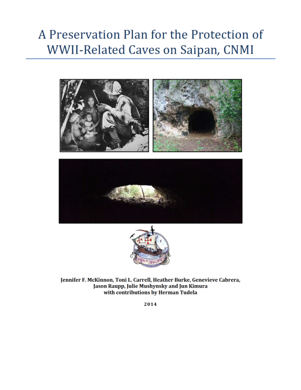
 Jennifer McKinnon
 Jason Raupp
 Toni Carrell