Location via proxy:   [ UP ]  
[Report a bug]   [Manage cookies]                
2023

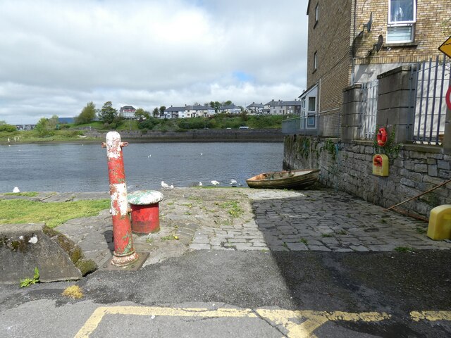
G6936 : Slipway at Custom House Quay

taken 2 years ago, near to Sligo, Co Sligo, Ireland
Slipway at Custom House Quay

Slipway to the River Garavogue at Custom House Quay.
River Garavogue :: G6935

The Garavogue or Garvoge (Irish: An Gharbhóg) was known historically as the Sligeach or Sligo River. The river gave its name firstly to the town that grew up on its banks from the 13th century, and then to the county that was established in the late 16th and early 17th century. By the time of early Ordnance Survey work in the 19th century, the common name had become the Garavogue, at least for the river from Lough Gill to below the bridge in the town of Sligo. From Lough Gill, the Garavogue winds through Sligo town and flows into Sligo Bay. This pre-tidal course is less than two miles (3.2 km) long, making it possibly the shortest significant river in Ireland.[6] The river's estuary continues for roughly four miles (6.4 km) out to Rosses Point.


Creative Commons Licence [Some Rights Reserved]   © Copyright Gerald England and licensed for reuse under this Creative Commons Licence.
Geographical Context: Rivers, Streams, Drainage City, Town centre Estuary, Marine River: Garavogue Place: Sligo other tags: River Riverside Quay Slipway Mooring Bollard Click a tag, to view other nearby images.
Loading map... (JavaScript required)
Grid Square
G6936, 47 images   (more nearby 🔍)
Photographer
Gerald England   (more nearby)
Date Taken
Monday, 1 May, 2023   (more nearby)
Submitted
Monday, 5 June, 2023
Subject Location
Irish: geotagged! G 6902 3622 [10m precision]
WGS84: 54:16.4333N 8:28.5773W
Camera Location
Irish: geotagged! G 6902 3622
View Direction
North-northeast (about 22 degrees)
Clickable map
+
NW N NE
W Go E
SW S SE
  • Discuss G6936
  • geotagged!
  • Navigate with Google Maps
Image Type (about): geograph 
This page has been viewed about 34 times
You are not logged in login | register