Cartography in the 21st Century
KiG 2005, 4
� ����� ����� ������������ ����
Nedjeljko FRANÈULA
+ ���� ���!�,� ��-�.�/���� ���!�0��������1 � � ��!������ � �� ���� �& 2�����3��,� ��-��(4.5�����
!�� ���6 ��!��������� ��!���78 !�� ���
@
Abstract9�"� ��������� ����� ��� �� � � � ��-��
��������� ���!� ���-�� ���!������ � � %� � ����������� �
�!����� ��� � ����� �� ���� ��� ������ �������
-�� ���� %��� � ��� � ���:�� �� ��� � �� � �
���� � � ���1 � ��� �� ���� �� �� ������������ �
�� �� �� ���� �������� �������������������������
�� �� ����� � �� ��� ��� � �� ��� ��� ��� - � ��� �!
���� � �� � � ��-�� ��� ������� ������� �� � � �!
��� � �� ���� ����� ������ ���� ����� ��� ��-����!
�� ��� �� ���� �� �� ��� � �� � �� ��� - � ��� �� !���
�� � �� ���� � ��� ��� ��� �!� ��� ��� � �� ��� ��
� �� � ����!� ����� ���- � ���-����� ���!����� �
�� � � � ��� ����� � � �!� ��� ���� ��� � �� � �
���� � � ���1 ��������!���� �� ��� ���� �� �� � �
��� ����� � ��!� � ���� ����� ��� ��;���� �� �<
�� �� � �� �� ��� � �� � ��� �!� 0=��� 01��� 1 �� �
� �� $>�� ;$��� � � >����� ���� ���<� � �����
��� � �� ���
Key words9���� � �� �����5� ��� �����0=���01��
$>�
1. Introduction
�$ � �� � ��� ��� ��������� ���� � �& � �: � �$
���� ��� ����9<� ��� ��������� �� &��������$9� -� �$
����� �$ � :�� � & �� ������&���� � �: � �$ �� ���
��� �$ ���� �� ����� ����9� $�: � �� �� &�� 9 :��$
��&� ����� ������� ��� � �� ��� ��&���� �� �$ : �� �$ ��%
&� � � ��&���������� �� &��������$9 �&����� � ��
��&� ����� ���� � �� � �� �� �� �$ �� &��������$�&
��� ���� � �� �$ �� =� ��� �$ 9 � &�� ������ �!
��� � �� ��� ��� ��� ��� ������ �!� �� �� � ����� ����
���� �� �A��� 'BB( �
A������ ����� �$ :�� � �� �$ '(�� & ����9� A���
�'BB( &��& �� � �$�� �$ � �� �� ����� :��$���
&��������$9� 5� �$ : � ��� � �� �$ /�������
/��������$�& +���&������ �"6C ( �� � ��� ��� � �$�� ��
�� ���� &$���&� �����& �� &��� ������9 &��������$9 ��
��� ��������& � 3��� $�� � ������ ��� ���
������ ���� �� �� �� �� �$ ��� ��������� ��
&��� �������� 3��� $���� �&������ � � �� � �� ���& ��
$��� �� � � �� :��$��� �� D��� &��������$�&
� �� � ��������� *�� �� �$ � �� ��� �� � �������
���� ��9 �:� ��$��� : ��$ � ��� &������� ����
&������&����� �&����� ��� 9���� � �� �&9 � ����� �
��� �� ����� � ��� ��� �� ����� &����� ���������� �&�
+� �$ � ������� �� �$�� ����& � �$ � �� � &��� �� ��
�$ � ��� � ������ :$�&$ �� ���� ����� �� � �$ ����
��������� � ������� ���� &� &���� � �$�� ��
&��������$9� -� �� �� �: � �9 � � �&������� �� ����
�����&�� �� &��� ������9 &��������$9 % ��� � ���
�� ��� ��� ��
&�����& ����� +�� � �$�� �� �:� �
� �� � ������� �� � ������ �� 8�*� C2*� �$ -�� �� � ���
&��������$9� �$ � �� � �� � � �� : �� �$ �� ��
&��������$9 �� �$ � ������������ �&� �& ��� �$
��������& �� ����&�� ��������$�&%&��������$�&
����������� �9�� �� ��� E� ����� ������� �� ����&��
�� ��� �� ��
+� �$ &��� � �& ��� � �� ����0�� !���� � �� �
?��� ���� ��� �� ������� � �9 �$ /�������
/��������$�& *�&� �9 �� 7��� �� * �� �� � (F%(G� 'BB@�
- $ � �� ����� � &��� ��� � �� ��� � ����5� ��� ����
+ ��� �� D��� ��� �� �$ &��� ��� �$�� ����& :�� �
� ��� � �� ��������� � &��� - � � 9 &��<� ��� � :$��
:� $��� � �� �$ �� �� �$�� & ����9�
2. Remote Sensing and Cartography
6 ��� � ����� �� � � �$�� �� ���$ ���� ���
��� ��� ���� ����������� ����� � ��� �� &�� :��$��� �
�$9��&� &����&� :��$ �$ �� +��� �� �� ��� �� �� ���
���& ���� � �� ���� � ������� ��� ��� ������� ��
� ��� � ������
�KiG 2005, 4
Kartografija u 21. stoljeæu
� ����� ��� ���������������
Nedjeljko FRANÈULA
����& � ) ����,� ��-��.�0���� �# �!�#�� � ��,�����%��#�� � ��! ���� �& 2�����3��,� ��-��(4.5�����
!�� ���6 ��!��������� ��!���78 !�� ���
Saetak: �� �� ����� ����� �� � � ��#�� � ��- ����� �
#������ ������� ���� �)��� � � %�� ����@�2 �������# �
����� �� ���%� ���%� ��� ��� �)#������� ��� ���-�%
�� �������2 �� #�� � ��!�# �� � #�%��� +� ��)���
��2 ������ ��#�� ���� ��� �- ���#�#���#� �# ����#�� ����
- � ���������#�� � � ��*� ������A� ��� ���- ����
������2 ���� �2 �� ��� ���# � �� � ����-��� %��
����#�� %�� ���#�� � ��! �������-�����������2 �-���
���� � ��� �� � ��� ���� � �#�� � �� ������ #�� � ��!�#�
� � � ������+�&�� #������#�%� �� ��������2����' ��
��� �#����- �� ������ �# �� � ��' �� � ����� %���
��%� & �� #�� � ��!�# �� � #�%��� *� � ��� ���� � �
�� �) ��� � � ��� �� %��� � � � � �� � ��� ��� ��# �
;���# �� &# �<�#��� �� ������#�%� �� ����' �� �0=�.
���01�.��� �� � �� �$>�.��; ���'�� ����%� ������ �<
��������� ���#�� � ��! � �
Kljuène rijeèi9�#�� � ��! �����5��� ����2���0=���01��
�� � ��$>�
1. Uvod
" �$��)�� � ���������� � ���� ���� � ����� ����� �
�� �� � � ����� ��� ���� " ���� ���� ����� � � ����
��� ��� ��� .� �� ��� � #�� � #� ������� ������ � .�����
��� ��� �� �� � )�� ����)������� ��� ����������� ��
: ��� ���� � ���������&� � ���������� �$����� �� � )�
��� ��� �� � ���� � �� �������� ��� �����������
��� �&� � � 5�� ����� � #�� � � �#�� � ��! ��� � � ����
#�� � � �#��� ��#���������� � %��� � �A��� 'BB( �
����)� � ��� �� � '(� ��� )�� A��� �'BB( ��������
�� � �� ����)����� � � ���������� � ����. � � �� : �%
������&��� ���������� ������������� ������� �"6C (
������ � ��
����� ������ ������� ���� � �
���������� � ���� ��!����� ���� ��� � � � �� � ��� ��
���� ��� � ��� ��� ��� �� ������ ��� &��� ���&� �
4 )��� �����$ � ������� � ����$ �� ������� � ���
��������� � � �������� �)�$ ������������$ ��������
#���� ��� ���� � � I ��������� � ������ � ��� �&� �
� �������� ��� � � ��� �� �������� �� � ��� ������� �
���� ���&�� $��� � �!� � ����� �� �������
������������ ��� �� ��$ ��������� ������&� � ����
#� �� ��� ���� ���� ���
����� �� � ����
�� �����$ �����!���� �� � � ���� ����)����� �� ��!�� �
� ���� ������ �� � �������� � ���������� �� * � �� �����
�� � ��� �������� ���� � � ���������� � �������� �
�� ��� �� �� � � ������ � ���� � ������ ������ 8�*%
�� C2*%�� ��� �� �� � ���������� � �� � ����� �� � ���
���������� � � ��������&� ��� ��������� ��� �����
��!���� � �!� ��$ �����������%������������$ �������%
&� ���$ ������� � E�%����� ���&� ��� � ����
#� ��� ����� � �� � ��! ���� �� !����� ��� � ���
�� ��� �� ��� ��
� 7��� �� (F�%(G� �� �� 'BB@�
���������� � �������� ������������ ������� ���!�� ���
������� �� ����� �� � ��! ������5��� ����2�� ���� ���� �
����� �� ����� � � ����� ���� ��� �� �� � ��! ����� ���
� ��� ) � �������� �� ��� � ���� ��� )�� ������ �����
� ���� � �� ���� ���
2. Daljinsko istraivanje i kartografija
�� ����� �����!���� � �� ��� � ��� � �����
� ���� ������ �� � � ��� ��� ��&� �������&� � � ��� ���
�� ����� � � ���� ��� ������ � �� ����� 7����� ����
��� ��� � �� ����� ���� �� ���� � � � ������ ��
���!�� � � �� ������ �����!���� ����
3���)���� ���� � �������� �� �����$ �����!���� �
� ���������� � ����� ���� ���� ��� ���� ������� �
��� ��� -�5#5*%' �� �� � ����� *��& -����� � �� ��
(JJJ� ����&� � ��� ��� ��� � ���������� � �� �&� �� ��
( � � ������������� ����� � � @ � � �� ���� ���� ���
����� � �� � ( ��� �&� � �� �� �������� �� �!� �� 'BBB�
H
�Cartography in the 21st Century
KiG 2005, 4
����9� ��� � ���� �� � ���� =& ���� 9 �����& �
�9 ������ � &$�� ��9� �$
D���� �� � D��� � % �
� ����� &����� � ��� &��������$�& ����:�� ��
�� =� ���� ��� ���� �� �� � �9�� � �$ -������� ���
/��������$9 �� �$ ;�&� �9 �� 8 �� �9 �� 7��� �
�&D��� � �$ 5/+� ����:�� �� (JJG� �$ ����:�� $��
���& � � ��� � � �� � �&$��� ��� ��� �$ �����&���� ��
������� ����� �� �$ ��� � & �� ��� � � �� -�� �� �
���� �;��� ' �M����� ;���� � 'BBE � + &��9 �� 5/+�
G ���� ������ � :$�&$ �������� :������ :��$ � ������� �
&���� GHE ���� �"6C E �
�$ �����&���� �� ���� �� ����� �� � ��&� ���� � � �
��� :$ � ���� �� �$ � D��� � ���� �� �� ������ �����
;�� �$ �� � �� /������� : �� &�� 9 ����� ��� �$ � �
��� �$ &� ����� � ��� �� � �����$�& ��� �� �$�� �� �
��� &� :��$�� �$ �&�� �� �$ :��� �� �$ /�������
8 �� ��& -������� �"6C @ �
/ ��5��1 C?C�.���� ��� �� �� ���!�C��� ��� �� ��
�D �� ��;+4$��<
����5��C� � ��# �� �� � ���D � �� ���� ���1 C?C�.�
;+4$��<
F
�$ ������� ��9 �� ��� 9��� � ��� � ����� ���� ��
&��������$9 :�� �������&��� 9 ������ � :��$ �$ ��&& ����
���&$��� �� �$ -�5#5*%' ��� �� �� �$ +� ��&��
&�����9 *��& -����� �� * �� �� � (JJJ� ���� ����
�$�� ��� �� :��$ ������ � �� ����� �� ( � �� ���&$������&
&$��� ��� @ � �� �� ���� &��� &$��� �;��� ( $�� � �
&��� �&�� 9 ���� �� ���& 3��&$ 'BBB�
-� 5&��� � 'BB( ������ 8 �� ����� � >���$A��&$ � �
������ +� ��&�� &�����9� ���&$ � �$ K��&����� �'
��� �� :��$ ������ � �� ����� �� B�F( � �� ���&$������&
&$��� ��� '�@@ � �� �� ���� &��� &$��� � ;�� &���
� ��� �$�� �� �� ��� �$ � �� ������ � �� ����� ���
� &������ �$ >���$ ���� ���& �5 ��) 'BB' �
3 �� �� �� 5>>�> � &�� �� :��$�� �$ �&�� �� �
� � ��&$ ��� &�� �� � � ��&$ �$ ������� ��9 �� �����
���� � ���� -�5#5* ��� �$ �����&���� ��� � ������ ��
��������$�& ����� �$ � � ��&$ $�� �$�:� ���� �
���� ��� ��9 �� ���� � ���� -�5#5* ��� ���& � �� �� �
�$�� ���� ���& � �� � ���$�������� ���&� ���� 9� �$
� � ��&$ &����&� � �9 �$ #����� C��� *��� 9 ��
*: � � $�� �$�:� �$�� �$ ���� � ���� -�5#5* &��
� �� � �� � ��� ���� �� &�� �� � ��� �� �&� (I(BLBBB
��� ��� � � � 'BB' �
3. Paper Maps
4�� ��� C�:� �& � �$ ��� &��� � � �� �� 5�����&
*��� 9 % �$ ������� ������� ������������ �� 8� ��
2������� ������ ��� �$�� ����9� :$ � 5�����& *��� 9
� &�� � � ��� �.-�� ���� ��� ��� �� �� ������ �����&��
:� ��� � �� �$ =� �� �� ���������� ��� � ����
� &��� ���$ $�� �� D�� ��������& ��� ������������
�� ������������ � &$�� ���&� �����& � $�� ����� � �
�$ ������� ��� � �� :$�&$ ��� � ���� &�� � �&& �� �
��� � �� � �� ;�� =��� � : � ��� � :$ � �$ � &�����
�� ��� &�� � ����� � �� �� &�� ������ :��$ ���� ��
&����� ��� � �C�:� �& 'BB' �
4. Multimedia or Electronic Maps
+ �� ��� ��� �� &�����& ��� �� � ��� &��� &� �
:��$ � =��� ����$�� �$�������$�� ��&��� �� ��� �� �� � ���
���� �� ��$ � ����� ����� �� ������ ��&��� �&� ����
�� ��� ��� �� ��� � �� ������ �� ��������� � ��
����������� ��� � ��� &��� � �� : �� � � ��9 �*���
8 �� ��& +������������� 'BBE �
�$ �� �� �� �������� �� �� ��� ��� ����� ���
�� &�� 9 �� � �� ��� ��� �� �� :��$ � �� &� �� �$ ����� �
�� �� �$ �� � �� � ��&$���� �&� &$��� � ������ ����
�� ���� �� �$ >���$ �� ����$ �� ������ ��� � �� &���&
��� �&� 2 ��� �� : �� ��� ���� � �9 ��� � ��������
���& : &$��� �$ � &���� : �� ��� � �� � ���
;���$ ���� � �� �� �� �� ����� ���� ���� � �� � �9
$�� �� $ � �:� ����� ��� &���� � ���������� $�� ��
�� &� �� � ���� � �� � �� �� ��$ � :���� : �� ������
�� � ������ � �� � �$�� �� �����&� �� 9 ��� �� �� ��� %
�&� ���� �� 3�&������<� >�&���� �� �� �;��� � � (JJN �
:$ � : &�� �� : �� 9 � $ ����$ � �� ��& � � &���
� ���� �� �� �$ ���$�����$�& ��� &����� 8���&$� �
�'BBB ������ ��� �$�� �� �� �� � �� � �� �� � �� &��
�������� � � &��� $ � � � � �$��� ��� �� �� ��� �� ��
:������ :��$ ��&$ � ������ � �� �� ��&$ ���� � �$��
:������ :��$ ��� � ������ ��� �� �$ 3 �&���� ��� &�����
�$ �� �� �$ 'B�$ & ����9 �� �$ ��� �� &� �����
&�����& ����������� +� ����� :��$ �$ $ � �� ������&��
B��� �� ������ ���� �����>/* � ��� ����9� ���� 9� :��$
� �������&��� �� �� ����&�� �9�� � �� �$ 1 �� � � ��
"�� ��� C� � %� � �-35 ��� � B��� �� �� ����
* � ����� ��1 !���� � ���� �� �>/�-* �;��� E � ���
B��� �� ��?�� � � ������� � �>#/ � �� � �� �� �6�& ���
'BB@ �
> &�����& ����������� &$���� �� ������� � :��$
���������� � &��� ��� ����&��� ��� ������� ;�� �� :��$
>/�-*� �$ 9 �� ��� ��$ � �9 ����&�� ��� ���$���� �
$9�������$�& ����& �� >#/ &������� � ����������� �� �
&$��� � D��� � ��� ��� ����������� -� ��9 � �� &������
����������� ��$ � �$�� �$�� ��& �� � �9 ��� � ���� � ���
���������� ��� &����� � :$�&$ &�� � � � � � & ����9
��� ��� ���������� �6�& ��� 'BB@ �
�KiG 2005, 4
Kartografija u 21. stoljeæu
+� �� �� ������ ������ 8 ��
���� >���$A��&$ ������ �
�
�������� 'BB(� ��� �� K��&�2��� �'
� ���������� � �� �&� �� �� B�F( �
� ������������� ����� � � '�@@ �
� �� ���� ���� ��� ����� �� ��
�� ���� �� �� � ��������� � �� �&� �
� ������ � 7 � �� �� ���� ��
&��� � ���� � �5 ��) 'BB' �
O ���& 5>>�>%� �� � � �� �
������ �����!��� ��� ��� ���
�����!��� ����)���� ����� �
������� � -�5#5*%� �� ������ �
������ �����������$ �������
-��������
������ � ������ ��
���������� ������� � -�5#5*%� �
� ) &� � �� ���� � ��$ &� ��
� ���������� ��� �� ��� � �
/ �����D���� � ��!����� � ��������� ��C�D*
-�������� ��
���� � #�����
�������1���&�#�#�� �� %��A� ��C�D*.��
C��� *��� 9 �� *: � � ������ �
�� � ����&� � -�5#5*%� ����
������ ���� �� ����� �� � )�� �� ���� � ���� � �� � ������ ����� �������&� � � ������� � ��� �� ��
��������� ��8" 'BBE �
(I(B BBB ��� ��� � ��� 'BB' �
3. Papirnate karte
4� C�:� �& � ��� �����&� 5�����& *��� 9� % ��!���
� �� ����%����������� �������&� 4� 2������ � ���� ��
������ ���� 5�����& *��� 9 � ��� � ����� �. ������ ���
��� ���&� � ������ � �������� � ��� �� ������
�����&���� ��$ ���������$ ������� � ��� � �� � ��� �
����� ��!���� � ��� � � �������&� �� � $�� ����
���� ��� �������� ����)����� �� �� � ��������
���� ���� �������������� ���� � �� : �%������& � �� �$
� ���� ���� ��&������� � � ��� ��� ����&� �� � � ���
����)������� �C�:� �& 'BB' �
�������� ���� ����.� � � ����� ������ ��� � ���
������ ��� � $�� ��� ��� ���� ��� ��� �� % ������
�� ��� � � ������������ ����� � ����� �� � ����� ���������
7���� �� ���������� � 8 �� ����� ���� � �� � 7��� ��
������� (JJG� ����� ����� � 5/+�� �� � � �� ����
���� � � � ������� � ������ ��� ���� �� ������
����������$ ������� � ��� �� ��� � � ��� �� ����$ �� �
' �M����� ;���� � 'BBE � /� �� ��� �& 5/+� G
���� ������ � �� � ����!��� ��� � ����� ��������� ������
GHE ��� �"6C E �
-����� ������ �� ) � ��� � ������ ���� � )���
���� ���$ �������� ��� � ������ ��� �� ���� 7� �����
������� ��� ��� ��� ���� �� ���� �� �� ������� ���
� ��������$ �� ��� ��
��� �� ��� ���� � � ������
���� ���������� � �� ����� ��������� �"6C @ �
4. Multimedijske ili elektronièke karte
3� ��� �� ��� � � ������ �� ����� ����� ��� ����
� � ������ ������������ ��������� ���� � ������ ��� ������
� � ��� ��� ����&���� ������ �������� ������ � �
���� ���� � ����� ���� � �� ��� �� � ���� ���!�� �
#� � )� �� ����� �� ��� �� �� ���� � � ��� ���
�� ��� �� ���� �� ���� � ������� �� �������� ������
�� ���!���� �� �� � �� � �� �� �� ��&���� � ����
�� � 7 � �� ��� �� ������ ���! � ��� . ��� �� �� �
� � 5��� ����� ����� ������ �� ����� ���������� � )
�� �� �� � ��� ������ ������ ����� #��� � ����� �����
����� �� � ������� ����&��� ��! �� �������� �� ������
*� � � � � � �� �� ���. � �� �� &� � � �����&� �
��� �&� � ������ �� ��� ����� �� � ����� ������ ��
� ����� �� ��� ��� �� ��� �� ����!� � �� ������� �����$
� �� � � 3�&���������� >�&���� �� ��� �;��� � � (JJN �
���� ���� ��� ���� ��� �� � ������ ��! �� ���$������
���� �� ��� ��� � �� �� ���� ����. � � �����������
��� �&� �� 8���&$� � �'BBB ���� �� �� � ��!�# � � ��� ���
��� ��� �� ������ � ������ �� ���� ��� ���������
��� � ������ ������ ��� � ������ ����� �������� � ��
���� � ���� ������ ��� ������ � 3 �&������� ��� �&� ��
��� 'B� ��� )� �� � ���� ������� � ������ �
������&� � " �� ��� ����)� � � �!� ��$ ���# �� &# �
��� ���� �����# ��#��� � �> &�����& /$��� *9�� �� %
>/* � � ������ ���� ��� ��� � ��� ��������
� �!� ��� ������� "�A� ���� �� �����#���� � %�� ��
�-�� �������� 3������ 5����������� % -35 ��� �������
!����� ��# � ��� ��� � � #�%� ���# �� &# �� #��� �
�> &�����& /$��� ���� �9 ��� -���������� *9�� � %
>/�-* �� � E � � �� � �� � ���
������ � �������
������&� �� ���� �> &�����& #���������� /$��� % >#/
�6�& ��� 'BB@ �
> ������ �� �������� ������&� ��� ����� �� ����
�������� � ���������� ����!� �� ���������� � ���������
# � �� ����� �� � >/�-*%�� ���� � � �!� �� � �� ��� ��
$����������� �� ��� >#/ ����!��� �� �������&�
������� ���� ��!� �� ������� ������&� �� 3�!
����!����� � ������ �������&� ���� ���$ ��� �$ ����!���
��������� ���� ����� �� ���� � ����� � � ���� �
�������� ��!���� �� ������� ������&� � �6�& ��� 'BB@ �
N
�Cartography in the 21st Century
KiG 2005, 4
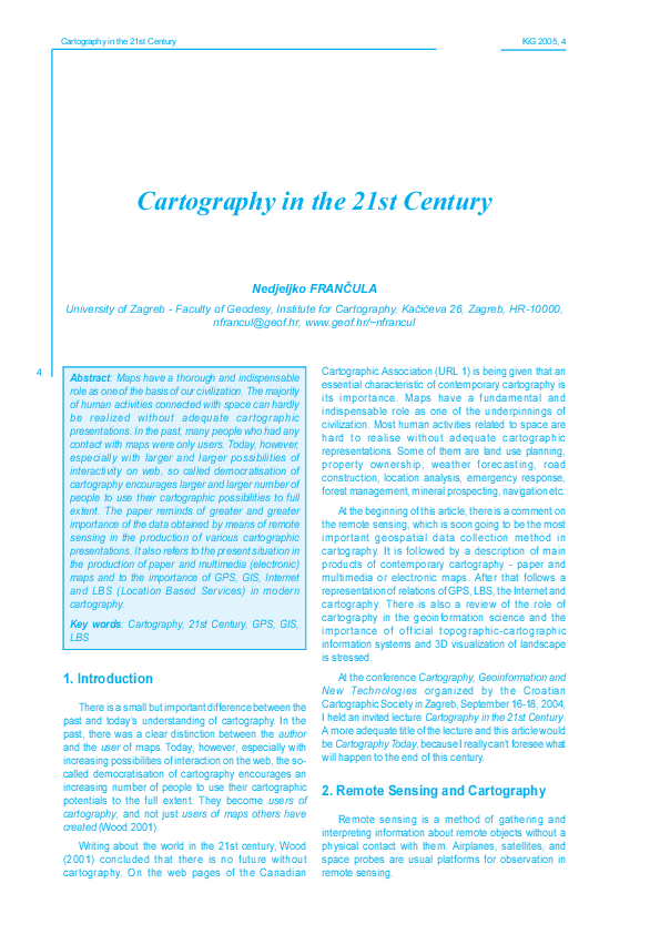
6. Location Based Services and
Cartography
/ ��E��B�*1�� � ���� � � � ����� �;+4$��<
����E��B�*1�� ��%� ����� &#������ ��-�����;+4$��<
5. GPS and Cartography
G
8�* �� ��� ���������� �9�� � �� � � �:��� ��
��� �� � �$�� &��������� 9 ��������� �&�� � ������������
:$�&$ ��� � �� &�� ����������� �� �$ >���$� 8�* ��
��� � �� � ����� �� ��� �� � �� �$ 3������9 �� � � �&
�� �$ "*+ �$�� ����� �$ >���$� *�� �� � �������� � �9
: �� ����� ����� � ��� ��� �$ 8�* � & �� � ��
� � ���� ��� �������� �� �$ >���$� 8�* $�� �������
��� �&������ �� ���� � � ��� �� �$ ���� 2���&� 9� 8�*
��� � �$ �� &�� ����������� ��� ��&� ���� �����������
�$ � �� � �� ��� $���$ � 8�* � & �� �� :��$ �$
������� ��9 �� ������ � � ��� � ��� ���� � /�%653� 3��
���� &�� � ��� ���� � ���� �$ � & �� � ��$ � �9 ����� �
���� &��� �� ������ ��� &� 9 ���� � /� �� � 8�* � & �� ��
*�� � & �� �� &�� $�� ���� ��� � ��� &� 9 ���� ��� ���
� ���9 :��$��� �$ � � �� � ���� &��� �"6C F �
C�&����� 2�� � * ���& � �C2* ��� � &��������$9
� ��� �� �$ �� � �� � : �� � � ��&$ �� &��������$9�
C�&����� 2�� � * ���& � ��& �� � �$ ����������� �
�� � &�� ������ ��� � & �$�� �� � $���$ � &����� �
��� �� � �� � �� �$ �������� � �&����� $ �� �$ ��
&��� �� 9 ��� ;�� =��� � �$ �� � �� �� � & ����� &��9
��� :�� � �� �� ���� �$ � �� �� $�� � $������ �� �
���� �&� + �� �� ��&$ ����������� &�� � ������ �� � ��
�$ �� � ���� ���&� �� 9 �� �$ ���� �� &��������$�&
� �� � �������� �� �$ ���� �9 �� �$ & �$�� �� �$
$���$ � &����� �� �$ ��� �� &��������$9 �� �� &� ��
&��������$�& � �� � �������� ������ ��� ��� ���� �9�
�� �$�� � ��& �� 2 &��� �� � �9 ��� ���� �9� ��
������ � ��& �� �� �� � & ����9 �� ��� ���� �� ��� ���
� ��� ���� �$ &��������$�& &������&����� ���& ��
�8���� � 'BB@ �
�$ &�����9 8-*�+�+ �� � ���� � �� �$ �� � ��
C�&����� 2�� � * ���& � �� /������� ;�� 7��� �� 6� ���
*� ��� ��� 5�� �� �$ 9 ������ ����������� �����
� ���������� ��� ��������� ���� ����& �� &�� ���� �$ ��� ��
$�� �� ������ � ��%�%&���� ��� �& ����� �� �$����&� ��
��� ����� ��� ���� �"6C G �
�$ &�����9 4-��� � ������ ��� �� �$ 4-�����������
� ���& � ���� �� 4-�����������<� ������� � ��� �$�� �� ���
�$�� 'BB �� &� &�� ���� � �� ���������� $�� �� &�� ����
�$ ��� �� ��� ���� ����� �&� ��� 'NB �$������
���� �� � ��� E@ /������� &��� � ��� NBBB � �� � ���
�� ���� �� �� � �$ -�� �� � �� �� &$��� � ��� ��� �
& �$�� ��� � � � ������ � �����$�& ���� :��$ � ��� �
�&������ �� �� &�� ���� �$ ���� � ������9 �� /������
8�* �� � �: 9 � &����� � ���� ��� �� �������� ��
*��$����&�� � �9�� �� �� �� �� ����&�� �$ ��������
�� � � $�& �� �� &�����& ��� ��� ��� �$ ���� �� ��
���� �$ �� ��������� ��� ��� ��� �� ���� ��� ��� =���
� ��� �� � � ��������� � $�� �� ����$ � � ���������� *��
�9�� �� &�� � � ��������&� 9 &� �� � ���� ���
������ ������&����� ��� �&$ �������� ���� �$ � ��� �
�������� �� � �&$ � �C����� � � � 'BB@ �
�$ &�����9 3�� � ������ �"6C N �����& � � ������
��� �� /������� ����� �� � ������ ������ ��� 3�&������
��&� � �/ �;��� @ � ��&� � �/ :��$ �� ��� ���� � 8�* ��
&��� &� � :��$ �� ��� 2 � ����$ :�� �� � &$�� ��9
������ � ������� ������&����� ���� �$ &��� �� �������� ��
��9 ���� �� �� /������� -� �� ��� � & ����9 �� ��� �� �$
��� ������ �$ ���� � �� �� �����&� �� �� �� �: ��&�
������&����� �� /��������
"���� � 8�* � & �� � ��� � $���$ � &����� � :��$
�� D��� &��������$�& �� 8-* ����:�� � �� �� �� ��
��� ���� � ��������$�& ���� 9 �� � ��� �� �� �$ 9
&�� � �� ���&� �� 9 � ��� � � �� �$ � ����� :��� ��
��������$�& ��� � ������ �� �$ ����� �� ��
� ���$�������� ���& ���� 9�
/ ��F��=��#� �=��� ��� � � �� ���� ����� ��!
���� ��;+4$�G<
����F��=��#� �=����� �� ���#�� ���(��� �#��;+4$�G<
�KiG 2005, 4
Kartografija u 21. stoljeæu
5. GPS i kartografija
8�* �� ��� ���������� �9�� �
�� !� ��� ���
�� � ������������ ����� ������� �������&� � � ����)�
�� �$ �����) �� �� &���� ��� .���� �� �!� � ��
7 � �� 8�* � � � � �� ������� ��� ��� 3�����������
����� *+�%� �� � ��� �� ���! ��� 7 � � *�� ���
����� � �� � � �� ����� ����� �����)� �)� 8�*%
��� ������ �� ��� �� ��� �� �!� �� 7 � �� 8�* ���
��������� ���� � �� ������ ���� � � ������ " �������
8�* �����)� �� � ���� ! �� �!� � �� ��� �� 7 � �
� ������ ������&� � �� ��$ �� ��� � �� � �$�
����� � ) � �� � �� �� 8�*%��� ����&� � ����)�����
��� ��� � � �� � ���� � /�%653%�� ����&� ���� ����
� �������� � ��� ����� �� � ����� ��� �����& � ����&���
� � � ������ � ������� � /�%� � 8�*%��� ������ # ��
��� ����&� ���� ����� ������ ����� � ������� � ��� ���
� ���� � � � ���� � �� �����&�� � ����&��� �"6C F �
8�* �� ��� ����� ���� � �� ������ � � �
�������� �� *������&����� ������� ���� �������� �� �!�
���� � �� ������ �� ����� �� �)� ���� ��� ����)����
�� ��� ! ��� �� �!� � �����! � �� ��� ��� ���� � �&��
� ������� $�� � � � �� ����� ��� ���� � # �� ������� ����
�� ���������� �� ����� ����� ����� � ������ ���� �� �����
��� ��� �� ���! ��� �� �!� � �C����� � ��� 'BB@ �
������ 3�� � ������ �"6C N ������ � ������ �� �����
& ��� ������� � ������� ���� ����� �� 3�&������ ��&� �
�/ �� � @ � ��&� � �/ � ����. ��� 8�*%�� � � ��� ��� �
� �� 2 � ����$ � $�� ��� �� ��� ���) � �� � ����������
���� � �������� � ���!� ���� �� ��!� � �� �� ������
�� �!� � �� �� � �� ��� � � �������� � �� ��� ��!�
�� ���� ��� � ���� ����� � ) ���� �� ������� � �����
���� �� $�������� �����
8�* � �� �� �� ��� � � �������� �)�� �������������
� � 8-*%����� ��� �����)� � � �� ���� ��� �� � ���
��� � ����� �� >������� � ���� ����� ���� �
� � ����� �� � ��� � �� ������ �����������$ ������ ��
������ � ���������� ��� �� ��� � �
6. Poloajno vezane usluge i
kartografija
�����
�� ���� �$ �����!���� � � ���������� � ��
�� �!� �� � ��� �� �� �C�&����� 2�� � * ���& � %
C2* � � ���������� �� �� �!� �� � ��� �� �� �� ��
�� �������&� �� �������� ��! ������ �� �� ����� �
� � �� ��� �� ��� �� � ����� � �� �� �!� � ���&� � ��
�� � � �� ���� �� �� ���� #��� �� ��� � � � ��� �����
� ���!� �� � �!� $�� � �� ��&�� �������� � � � 3��� ����
�������&� �� ������� � ���� �� �� �� �� ��������� �
�� ��� ������������$ ������� �� ����� ����� � � � �� ���
�� ��� �� 7������ ���������� �� ������ �����������
������ ���� ��� �� �� ���� ��$ �� .� �� 7��� �� �
�� �$ ����� ���� ��$ �� .� �� ��!�� � ������������
��������&� ��� ���& � �� � ��� �� ��� �� ��
� ��
�8���� � 'BB@ �
/ �����@1=� �� � ��
�������@1=� �� � ��
#� ����� � �� �!� �� � ����$ �� ��� � ��������
��������� � ��� ��� ������ 8-*�+�+� 7� 7��� �� 6� ���
*� �� � 5�� � ��� �������&� �I � ���������� � ��������
�������� �������� ������� ���� ������� $�� ����
�������� ������������ ���� � ���� � ���� � �� ��%�%
&�� � ����� ����!���� ������� � ��& �� ��� �"6C G �
������ 4-��� � ������ ���� �� ��� 4-������������ ����&�
�� ��� ����� �! 4-������������ � ��
� ��� �� 'BB
��� ���� � �� ���� �� �������� $�� �� ����� ���� ����� ��� ��
���� � ���������� � ����� � 'NB ����)� ��� �� �� E@
$������� ����� � ���� �$ NBBB ��� � �������� ��
� �� ���� �� �� ��� �� ��� � �� �� ����� � ��
�������� �)� ��� ���� ����. � �� �� ����� ���� � ������ �
� ������� ���� � �&������ ���&� ��� �� ���� ���
����� &�
������� � ��� � ������ �������&� �
�� ����� �"6C J � #� ����� � � �� ���� ���� ,�����
, � �)� � 7��� �� � �����!��� � �������&� � ����� ���
���&� ����� ) �� ���&� �� � �!�$ ������ �� � H �
�� ���� � �� � $�� ��� � ���!� ������ ��
����)����� ����� ��� � ���� ������ �����
�
�� ���&� � �� ���� � � ��� ��-�"D=� ��� �� ������ �
��� �&� �����$ � ���� ��� ��� � ������� � ����)�$
���� ��� ;��� � �� ����� $��� � �� �������� �"6C (B �
"�-�"D= �� � F �����)� �� � ����� ������ ��
���� ��� � ����� ��� ����. �� �� ���!���� � �&��
��! ��������� �� � �� � �! � �� ��� �� � ���!��
� ������ ������ � ������� ����� � � �� ���� ��
������� ���� 7��� �� � ��� ��&�� 7� ���� ������
���� �� � ������� +����� ��� �������� ������ � ���%
�� �������$ ������ ������� �� ����! ���� � ��� � �&
� �������� ����� �� � ����� � �� �� � �� � � ��� �
����� ��&����� � ��� �� � ����� � " ������ �� �� �$����
���� ���� 4-������������ �� � ��% �� �� ���� ��-�"D=
,���%�� ���&� �� ��� ��� � �� �� ���� � ����� ��
��� ����� � ����� � � �� ��� �� ���������� *����
��!� � ����� ��
J
�Cartography in the 21st Century
KiG 2005, 4
������ ��� 'H ��� ��� &������ -� ��� � �$
�������������� �� � ���� ����� �� �� ���� �� � + ��� ��
�������������� ����� � �� � �: � ������� � �� ��&
������ �� � � ���� �$�� ��� � �$ ������� �� �� ��� �
�$ � �� �������������� ����� � �� � �: � �$ �����
��� �� � �� /������� �$ �� :��$ � ������ ��� �����
� �������P� � �� 4� ��� ��� �$ A8*G@ ������ �$��
�� �� &�� 9 �� �� ��� ����� $���$ � 8�* � ��& � :$ �
�$ � �� �� � � ��� �� �� �� &����� ������ (B � � �� �����)
'BB@� � �$ � �� � �� &����� �� �� �� �� �� :$ �
������������ ������ ����� �$ ��� �����Q ��� =��� �
:$ � ������������ &�������� � ���� �$ Hth ��� Fth �9�� �
�� 8����%��R� � ��� &���� �� /������ �� �$ �9�� � :��$
�$ � �� � ������ :��$ �$ ������� �� (FSEBT�
/ ��3����-�"D=
����3����-�"D=
(B
��� ��&$ ��������� �� &� ����������� �� � �� ���� ��
�"6C J � -� : �� �� �$ ,���� , � �) �D��� ��� :
:�� � �� ����������� ����� ����� ��� ������ : ��
����� �� � � �$ �&������ �� � �� �� ����� �;��� H �
+���$ � ����� ��� �$ ���� � �� �$�� &��� ������9
� &$�� ��9 ������ � =����������9 ������� ��� � �� ���� �
9���� � �� �� �� ��� �&����� ��� & �$�� � ��� �
��-�"D=� �����& � �9 �:� ���� ��� �� � $��$ �&$��
���� ��� ���& �"6C (B � ���93+� �;��� F ��� �
�� :��� ���� �� �$ & �$�� � $�� �� ��� ���� � ��� �
� ��&$� &�� �$�: �$ ��� &���� �� �$ � �� �� �� &� 9��
�� ������ ��� ��$����&9� ����� ��� ������� � 3��� ��
7��� � ��� ��� ���& �� ���� �� �� �$�� ��� ��� 3���
�� ��$ � &��� � �� � ��� �����& �� �$ ���$��� ��� �
&������ � �$ �����&���� �� � ����� �� � &��9 �����
:$�&$ �� 9 &������ �$ ���� ��� �� ��� :�9� �� �&& ��
�$ &�����9� ��� �$ 9 � �� �$ ���� �� �$ &�����9 ����
��9 �&����� �� �$ &��9� -� &������� �� �$ ��% �� � ���&
4-������������ ���93+� �� � ,��� ��� �&������ :$�&$
� ��� �$�� : �� 9 $�� �� ��� �� ���� � & �$�� ��& �
��� �� �� �� &������� 9 �� �� ��� �:����� �$�� ��� �
�� D��&� � ��� &$ �� ��
86+** �8 �����$�& 6 ����& � +�� 9��� *������
*9�� � �� � �� 8-* &���� �� ���& ����� ���� � ���
� &��� ����� ��� :���� �� ������� �� ������ �9�� ��
�"6C (E � +� ��&�� 3� ����9 ����� � ��� � � ��� �� ��
(JG'� ��� ����9 �� �� �� � �9 ���9 +� ��&�� ��� ��� ��
�� �&� �� 86+** &������� �� ��� �$�� EHB ��������
��� ��� � �� � ��� � ������ ���� ��� ���� � �� �$
������� �� �� �$ ��� �� ���& ����� ���� �� � &��� ���
��� � ���� �����) 'BB@� � 5� �$ ����� �� � ������ � � �
��� � 86+** ��� �� ����� ��$ � �$����� �$
� �� � ������� �� � � � �9 �$����� �;��� G �
7.2. Maps on the Internet
3��� �� �$ -�� �� � �� � �� &� � : � ����� �$ �
�� �����& ��� �9����& : � ����� 2��$ ������ ��& ��
���� �$�� &�� �� 9 � �� : � ��� �$�� �$�� �� ��� ��&��� �
7. Internet and Cartography
7.1. Free programs for cartography and GIS
�$ � �� ��� �������� �� �$ -�� �� � �$�� ��9 � �� 9
���� �$ � :��$ �$ �� ����& ������� &�� �� �� &��� ��
&$��� � ��� ��������� �� �$ 9 �� &� � !������! ���� ���
� � ������� �"6C (( � �������� 8>5�6+#* ��� 86+**
�� =��� � �� =& ������ 9 �� ��� �� ���������
8>5�6+#* �8 �����$�& ����� ���� �;��� N �� �
������� �$�� ��� � �� �� ��������� &�������� � � �: �
������� &�������� �9�� ��� ��� ��� &����� ��� � �� ��&
������ �"6C (' � -� &��� �� 9 �������� �� � 'BB � �� ��&
/ ��G��0BC�4D?�H�� ��!���
����G����&�����0BC�4D?�.�
�KiG 2005, 4
7. Internet i kartografija
7.1. Slobodni programi za kartografiju i GIS
#� ��� �� �� ����� �������� �� � � � ������
��� ��� � �������� ����������� ����� ����
����� � ������ ��������� �� � ��� � �� ��������������
#����� � � !������! ���� � � � ������� �"6C (( � �� �
� .� � ������� ���������� ��� ���� ��� ��� ���$
�������� � �������� )� � � ��� ����)������� ��������
8>5�6+#* � 86+**�
8>5�6+#* �8 �����$�& ����� ���� �� � N
������� �� � �����)� ����������&� � ����������
��� .� ��� � ���$ �����������$ �������� ������������$
��� �&� � � � �� ����$ ������� �"6C (' � �� ���� ��
����!��� �� �� 'BB � �� ����$ ������ � 'H ������������$
��� �&� �� 5����)� ����������&� � �� �� � � � &�
����� � � 5�� ��� ��� ��� ��� ��� � ��� ��������
����� ����������&� ���$ ����� ���� ��� .� ��� � ���$
� �� ����$ ������� ���� ����� � ����� ��� ��
����������&� � ��� .�� �� ��� � � �������� ��! ) �
������ � ������ ��� ��� �� ��� � �������P� � ���
2 �� � ������ A8*G@� �� ��� ��� �� ������� ��� ����
����� � �� ��$ 8�*%�� .� � ���� ��$�� ���� �� ����
�� �� � ��� �� �� � � �� (B � ���� �����) 'BB@� � "
����������&� � �� ��� ������ ����� ������� ���� �
����������&� � ���������� �� H� � F� ������� 8����%
��R� ��� ��� �&� � �������� � ������ �� �� �� ��
� ���� ���� � ������� ��!�� (FSEBT� �����! �
�� �� ������ �� �����
86+** �8 �����$�& 6 ����& � +�� 9��� *������
*9�� �
� ������ 8-* � ����)������� �����
���� ����$ � � �������$ ��������� � ���� �� ��� � ����
�� ��&� ���� ��������� �"6C (E � # ��� ����� ���� �
�� �� �� �� ��� (JG'� ����� � � ����� ��
����� � ��� � ���� �� �� � � ���� �� �&� � 86+**
� ����� � �� ��� �� EHB �������� � � ��� �� ��� �
��&����� � ���� � � �� �� ����� �������� � � �� �������
����.� � ���� ����� � ������� � �� ����� ��������� ����&�
�����) 'BB@� � #� ������ ������ ��� ��� � �
��
86+**� ��� .� ���� ��� �����)� � ������ � ��
� � �� � �� � G �
7.2. Karte na internetu
���� �� ��� �� �� �������� � : �%�������� 5�
���� ���� ����� � � ������ � � 5� ������ �� � � �
���� �� � ���� ���� �� � ������ ��� : �� 9 �
��� ������� � 4 )��� ������ �� : �� ����� �� �� ��� �
����� � � ���� ��� ������� � �� �� ���� �� ����� ����
������ � �� : �� # � �� � ���� � � ��� �������
���� ����� � �� �� �� �� ������� �������� *���� �
���� ���� ���� � ��� ������� � 5��� � � �� � �� �����
: �%������&� �� �� � ��! ���� ����� ����� � � � �� ��������
��� ��� ���������)� � ��������� �� � ����)���� �� )�%
��� �U���� ���� �� ����&�� � �� ������ � ������� �
������������� ����!� � ��� � ���� � � �� � �%��� �
��� � ���$ � � ��� ������ � ���� � �� ��� � ��� � ����
�����&�% ���� ���� �� ��� � �� ��� �� � � ��� �����
�������� -�� �������� ������ ���� �����)��� ������ ���%
��� � ������ � �� ��� ���� ��������
Kartografija u 21. stoljeæu
5� ������ ������ �� : � ������ � � �������
����������� �� ��$�� �� ��� �� �� �� ������ ��
���������� � ���� � ��� ������ ���� ���� ��� ����� ��� �
��� � ! �� ��!�� ��� ��!���� �� ������� ���� � �&���
�����$ ������ �;��� � �� ����) 'BB' �
#� � � J� ��������� ��� �������� : �%����� ����������
� � ��� ��� �& �"6C (@ � ����� �� �� ����� ����� � �
������ ��� ������� ���� �� 8 �� ����� ���� � �� �� ����
����� ��� �&� *� ;���� � � � ��� �������� ����� �� ��� �� �
�������� ��� �&� 6�� �� M����� ����� �� � 7����� ��
���������� �� ����� ����!� �� �������&� I ����� � �&��
� !��� � �!� � $�� �� �������� � �� �� � �� $�����
�� �� � � ������ �� ���� � ������� ������� � +�� � .�
���������� �� ���� �%�-��� ���!��� ���� =�����# ���%���
���� �� �����!��� � ������ � � � ����� � � ���� ��������
�� �� � ��� ����� � ������� � �� � �� ��� �&�� �� �
������ ��� � " � ����� ��� ������� � � �� �����
�� ������� � ��� ��� � ��� � ���� ������ �������&� �
-�� �� ��� ��� ������� ���� ����.� � � ���� ���
8 �� ����� ���� � �� �� ��� � � � ;������� ��� � �
���������� � �"6C (H �
7.3. Kartografski tekstovi na internetu
#� : �� ����� � ����� �� � � ����$ ��!� ���� �� � ��
���� �������� ��� �&� � ��� ���� �������� ��!� �����
* �� � ��� ) � � �) ���������$ � ��� � � �������
������$ � $�� �� ����� ��� �� ��� ��� )������ 5������
� $�� �� ��� � �� $�� �� ����� ��$ � ������ �� � � � ��� �
4 � ��� �� � �� �� � ���� � ������ �� ����� � �����
�� �) �� �� � � ��$ �� �� � � ����� ���� ����
�� � ��� � ������& �� �� ��$��� � �� � ��� ������
��� �!�� � �� ������ ������ ��� � ��� ��� "
$�� �� ����� �� ����� �� ������ �� � ������ �� � �
� �� � ��� �%� �� �& � �������� � ��� � � �����&� �
#� ���� ���� � ��� �� � � �� � � � � ���� ��� � �� �� � �
�� : �� �� ����� ����� ��&�� � ��&�� ������� � �&�� �� �� �
���� � �� : �%������&� 0�� !���� #.���� �� *� � � ����
6����&� �"6C (F �� ��� � ��� � ������ �� � ����������� �
��� ��&� �� IJ� ��-��� �6 ��� �� ��� � ���!� �&� � �� �
� ��! ������� �� �� �� ���� � � � �� ��� ���� �
��� ) ��������� �� � ���� � ��� �� �� �� � � ����&�
�� ��� ���� �� � �� ��� �����
8. Geoinformacijska znanost i
kartografija
8 ��������&� ��� ������� �8-* ������ � �� �� ���
(JFB%�$ ������� >������� � ��!�� ��� � ��� � (JGB%�$
��$�� � �)� ���� ��� �� ��� � � $�� ��� � � )�
����������� ���������$ ���� ��������� 8� �� ������� ���
�������� �(JJH ����� �� �� � ���� �� 8-*%� ���
�� ��
���� ��� I 8-*%���� �� 8-*%���� �� 8-*% ����� � �
�� ���&� 8-*%���� ���� � 6 �� ��� �� � ���� ���
� ���� � � ����� ���� �� � ��� � " ���$� ���� ��� ��
��� ����� � ������� (JGG� � * ��� ��� +� �� ���
��!����� ?� � ����� ���!���0�� �� � ��1 !���� �
� �� D ���� � ;?�01D<� ������&� ��� � �� � � ���� ��
����)�� �����. � � � � ��$ �����!���� �� "����� ��
((
�Cartography in the 21st Century
KiG 2005, 4
�� ������ ��� ��� �& ������������� -�� ��� =��� � : ��
������ ��� �$ "�� ���"����� ����� ������������ ��
��� ����� ��B �� � �� � : �� ����� �� ��� ��� �� ��
�$ ��� �� �$ ��� ��� & �&���� �� �� � � &���� �� �$ &��9
� �� �� � ��� �&� :� �$�: ��� :��$ �� ����: ��������
�� �$ ��� ��� �$ � =��� :����: �� �$ ���$� �$�:�
�$ ��� �� �$ ������������ ��� ���� ��� �$�� ���� ��
��� ��$ � �� �� ������������
-�� �� � ��� ��&��� ���� �� � �� �����& � �9
���� ��� �� �$ ;�&� �9 �� 8 �� �9� ��� ������� %
�$�������� ��9 ��� /��������$9 �"6C (H �
7.3. Cartographic texts on the Internet
/ ��K��4� ���� � � ��!���� �!�-������ �� �
04D���;�� 2����F-<
����K��=� #�%������!����� &� ���� ���2��04D��.�
;�� 2����F-<
('
����9� ���� ���� �� �$ -�� �� � �� ��� �����& ��� �� �<�
��� ��&��� � >=��� � �� ��&$ ���� �� �&��� � ���� ���
�� �$ -�� �� �� *�� � �9 � � ���� �����&� � �� �&& ��
� &�� ���� �� �� ���9 � �� �$�� :�9� *����& ����
&�� � �� � ��� ��&��� � -� ��9 $�� � ��� �� ����$ � : �
��� :��$ ����$ � ��� �� ��� ����� ��� ��&���� � ��
�&������ � �$ ������� ��9 �� ���� �� ��� ���� ���
������ �$ ���� ��� � ��� &��������$�& &��� �� �9 �������
������� �9 �� �� ��� ���� �9����& ���� �� &$���&� ��� �
�9 ������� ����������� ��� =��� ������ & ���� ��
� � ��� ���&� ����� -�� ��&��� �9����&� ��� �$� %
��� ������ � �� � �������� ��� ������ �$����$ ���& �
5� �$ : �� �$ � �� ���� ����9 � =������ �$�� ��
��� &�����& &��� � �� & ����&� ����� � � =������� A��$
�$ ������ �� ��� � �$ ������� �� ��&������ ��� ���
������� 9 :���� � �� $9� �� =��� ���� :� ��&� �� � 2���&
� &$��&� &$���&� �����& �� $9� �� =��� � =�� �� �����
C���� &��� &� ����� �� � =� :��$ ��$ � ����� �� � =��� ����
��� � ��� � 9 :����� ��� ��9 � �� ��& �� ��� � ���� �
�� ����$ � � �� � �� � &��� � 9 ���� � �� ���� �� �$
:�� �� 4������ ��&��� �� ��� � � D� �& �� ������ � ���
����� � ���������� �� ��� ���� � ���� � $9� �� =���
��&�� �� � �9 ��� ��
�$ ���� ���� �� ��� ��� ��� ����� �� �$ : � ��
�� �� ���� �� �� ������� $��������� ��&������� ��
=�&���� ��� �&9& ��� ����� ;�� =��� � �$ : �
��� �� �$ 0�� !���� #.���� �� �� �$ 6����&�
"��� ����9 �"6C (F &������� � � ����������&� ��&������9
��� =�&��� �$ ������ IJ� ��-�������&������9 ��& �� �
� � ��&$ �������� ���� :$�&$ � :��� �� >�� ��$ ��
8 ���� &�� � �� � �� ��� �� :� �$�: � � ��� � �� �
�� �$�� :���� �$ � ��������� �� ��� �� 8 �����
/� ����� ���� ��� �$ : � �� ��
=� ����� �� &��������$ ��<
�&������ �� ��� �� � D��� � � :
&� ����� � �$���� /��������$ ��
$�� �� � ��&�� �$ �� � � �� �$��
� : :��� �������� 9 ��
���� ������ � �� ��$ � ���� ������
:� � �� �$�� ��������� ���� �� �$
���� � �;��� � �� ����) 'BB' �
;��� J� �$�:� �� ��� ��&��� : �
��� �� ��������� ��� ���
������������ �"6C (@ � �$ ���
�&��9 � �� :�� �����& � :��$�� �$
�&�� �� � ��� ��� �$ ��� �� �$
;�&� �9 �� 8 �� �9 �� ���� ����� *�
;���� � � ��� �$ ��� ��&��� ���
:�� ��� �� �$ -�� �� � �9 3*&�
6�� �� M����� ��������� �� �$
� ����� �� ��� /��������$9� �$
��� &������� �$�� �����������I � ���
�� ��� ��� � ���& � �� ���9� $�� ��
$ � �$ � ���& �� ����� � ���& � ���
� ���� �$���� &� ���
���
/ ��L��1 ���� �����-��� ��!�*�-��� #
����L��1 �� � �#�� ���# � ��#�� ��*�-��� #�
�KiG 2005, 4
Kartografija u 21. stoljeæu
������&� � � ) (JJ(�� ��� ���&� ���� ������� � ��������&� �
����� � )�� ��� � ���&�� ���� ������ + ���� �
�� ��� ���!���0�� �� � ��1 !���� � ��� � ���;+�01�<
� �� � ����� � �� �� ��� �� FB �� � � ���� � �����!��� ��$
��������&� � �� *+�%� �"6C (N � *��$� "/8-*%�
�����&� � � ����� . � ��� ��������� "/8-* ��� �����
�� �����&�� ������ ������� � ��������&� �� �������� �
���� �� �� ������� ! ���)� � ������ �� ���$ ���&�� ����
#�� � � ��I ���������� �� ���������� �������� �� ��� ��
�������� ������ �� � ��! � ���� � �� �� �� �������� �
��� ���� ��� ����� � ������ �� � �� �� �� � ������ �� � ��!��
��$�� ������ ����� � ���� �� ������ �������� ��� � � �� �����
�����!���� �� �����������
������ �/65�-* � ������������� ��� �� ��������
���3 ������ �� ����������� � /65�-*%�� �� )
���� �����) �� ������ ����������� ��� �� ����������
�2� &�� � ��� 'BBE �
�� ��� � ��������&� ��� ������� ����� �� ���������� �
��� ��� � �� ��� � ��� �� ������ �� "�A� ���� �
#�� � ��!�#� � ���) �� �-�� �������� /��������$�&
+���&������ % -/+ ��� ���� 1 �� � � ��� ��� � �� !��
��� � �� ���� ��0�� �� � ��1 !���� � ��� � ���
" ������ ��� � �� ��
�)� ��$� �� ��
������ ������ ��� ��� ��� �� ��� � �� ��� �� �
���� �&� � ����� ���&� �� � (B � , ��� �� �� ��� �����
�����$ ��� �
�������&� � ����� )�$ ��������
������� �� ��� � � ��� ���������� ���� � �������� �)�$
��������� ��� ���� �� �������� �� � � � � ) ��� I
(� ����� ���&� � � �� �� ������ ������ ��$ ��� �
� �� ��36
'� ������ ������ �� ����� ���&� � �����&�
��������&� � � �� � ����
E� ����� ���&� � E�%�� �����
E�%��� � ��� � ��� ���� � �������� � ��� ���
�� ����� �� � ���� �C-�+6%��� �� ������ ��� � �
$ ����� ��� �� �!� C-�+6%� � �������� ��� .� �
8�*%�� � �� �&� � ��� � ���� �� .� ���� � C-�+6 � ��
$�������� � � � ����� � ����� � ��� ����� �� � ����
��� � �� ��� �� 7 � ��� �������� �����)� �)� ����
��� .���� ���������$ ���������� ��$ �� ����
#� ����� �� ��� ����� ���� � ��� 'BBE%'B((� -/+
���� �� ! � ���� �� ������� ��� ������������� �� � ��
���������� � � � ��������&� ��� ������� �8-*&� �&
�"6C (G �
9. Slubeni topografsko-kartografski
informacijski sustavi
3��� ���� ���������� �� �� � � ������� �������&�
�� �� �� ��� �� � 5�������&� �� ��������� � � � ��
������&� �� �� � � ��� �� � � �� ���� ��������
�������&�
�� ��!��� � �� ����%�����������
��������&� �#������ 3������ 5������������ � " ��������
�� ��!���� � �� ���� ������� 2���)� �� � �����
V�������� �V � ��������$ �������&� � �� �� � �� �� ��� � �
��� ��������� ����� �� �� � �� ����%�����������
������&� ��� ���������� ��� ����� ����
���
����� � � ����� � ����� ����� ��������
, ��� �� �� ��� � � �� ����%���������� ������&
�� � � �!� �� �����������%������������ �������&� ���
�������� #� ������� � ����� ������ �����
� �� ��
+��-* �+�� �&$ �%��������$��&$%���������$��&$ �
-������������9�� � �
�� ����� �� +��-* � �������� � ������ *�5�-*
�* �!� �� �����������%������������ �������&� ��� ������ �
5����� ��� ������� ��� �������� ����������� �������&� ���
*�5�-* ) � ����)����� ���� � �!� �� ������ �� � )���
�����$ ���������$ �������&� ��$ ������� � �������� � "
� �� ����� � ��� ��������� �������� /65�-* ) ���� ����
�������� ���������� ���� � ������������ ���� �����)��
) ������ ���������$ �����������$ �������
10. 3D-vizualizacija krajolika
4 )��� � ��������&� ���$ ������� ����� �� '� 8-*%
���� � �� ����� � � �� ������ ������ ���&� ����� )�$
������� 2��� ����� �� ��� � � $�� ��� � ������ � � ����
������ �� � �������� �8�*� C-�+6 ����� ��� � �������
E� 8-*%���� 2���)� �� ��� � �� �� �� � ��� ��� ��� �
�� � ��� ���� ��� � ��� ��$�� �� E�%�������� E� 8-*%
��� �����)�� ) � ��� .� ���� ��� � E�%����� ���&� �
��� � ��� � � � ��� �� � �� �"6C (J �
11. Zakljuèak
���������� ������ � ���� ��� ���� ��� � ���� ������
����� ���� ��� ������
���� �� �� ���������� �������� �� �� �� � ���& ���
��� � ) ����� ���� 3 .����� �� ������ ����� ��� �����
�� �&� ������������$ ������� ���� ��� ) �������� ���� �
� �������� �������� �� ���&�� �� ��� �! � � �������� �
���! � ��� . ��$ �������&� � �� ��� ) � � �!���
�� ��� 8�*%��� �� ��� �� ��� ��� � ����� ����
" �������� ������&� � �������� ���� � �!�� ) �
����)����� ���� ��� � � ���� ���� �����
/ ��5���E*��������!��� ���� �;+4$�K<
����5���E*������� �������;+4$�K<
� �� �� � ��� ������ � �!�� ) � 8-*%����� � E�%
��� ��� ��� � ��� ���������� �� � �!� ���
�����������%������������� �������&� ���� ���������� E�
8-*%��� ��� ) �� � �� � � � �
(E
�Cartography in the 21st Century
8. Geoinformation Science and
Cartography
(@
8 �����$�& ����������� �9�� �� �8-* ��� ���� �$
���� �� (JFB<�� �$ 9 =���� � �� �$ �� �� (JGB<�
�$���� �� �$ �����& � �� �� &����� � � &$�� ��9 ���
�� �� � ���� ��� ��9 �� ������ ������� �� �$ 8� � �&� �����
�������� �(JJH ������ ��� ���� �$�� � �$�� &�� ��� � �
� � �� �$ ��� �&����� �� 8-*I 8-*%�$����� 8-*%������ 8-*%
��$����� ��� ���� 9� 8-*%����������� ��� �$�� �� �$ � �� �
�� �������&� �� ��� ��� �� �� �$ � � ��� �� �� � � D��� �
�$ ��9� -� ��� � �� �����& �$�� �� �� �$ ?� � ����� ��
!��� 0�� �� � �� 1 !���� � � � �� D ���� � �#/8-+ :��
����� � �� �$ "��� � *��� � �� +� ��&� �� (JGG� -� �� �
&��������� �� �$� ���� ����� � :��$ �$ ���� �� &����&����
������ ��� � � ��&$� -� :�� �$�� &��������� �$�� :��� ��
(JJ(� �$ ��������� �� ���� ��$��� �� ������������ :��$ �
�� �� � ���� � �� � �� ��� �$�� ������������ :�� �$
+ ���� ���� ��� ���!���0�� �� � ��1 !���� � ��� � ��
�"/8-* �$�� $�� �� � FB ���� ����� � ��� � � ��&$
������������� ���� �$ "*+ �� � �� �� �"6C (N � �$
������ �� "/8-* �� �$ ��������� ��� �����& � �� ��
�$ � : �&� �& � "/8-* ��� �� � �� �����&�� ����9 �����
�� �$ � ������������ �&� �& ��� �$ � � ��� �� ��&
��� &� ��������� �� � �$ ���&�� �� �� �$ � �� ��� �I
&��������$9� &������� �&� �& � &����� � �&� �& �
���� ���� ��� ��� ���� 9���� ������� ��� �&� �& ��
� �� ��& �&� �& � � �����$9� ����&�� ��&$�� &��� � �:
��� ��� �& �� �&9� � ��� � ����� ��� �$�������� ��9�
��������&�� �$ ��������& �� �$ � ������������ �&� �&
��� &��������$9 &�� � �� � � � ���� �$ ������� �$��
�$ �1 �� � � ������ � �� � ��D���� � � ��-/+���$�� � �
D�� ��� � :��$ �$ ���%��� � ���� 1 �� � � ��� ��� � �� !��
��� � �� ���� ��0�� �� � ��1 !���� � ��� � ��� +� �$
� �9 � ������� �� ��� ����� ��& � �� ��� �$ 'BBE%'B(( � �����
-/+ ������ ��� �$�� ��� :��$ �� �� � � &����� � �� �$
���$�������� ���9 ��� &��������$9 ��� 8-*&� �& �"6C (G �
9. Official Topographic-Cartographic
Information Systems
3��9 $���� �&������ � � D��� � �����$�& �����������
�� ��� � �� � ��&& ���� � 5������������ �$�� ����� �$
����& ���� :��� ��� � ��$ � ������ ����������� ��
#������ 3������ 5������������ �#35 � �$ #35 ��
/������ �� �$ *��� 8 �� ��& +�������������� *��& �$
����9<� W�������9X �� � �����$�& ����������� � � � ��
&����� �� ��� ������� �� �� �� � & ����9 ��� �$��
� �� ��&%��������$�& ���� :��� �� � ���������� �� ��9
�� ��� ������� ��� � ��� ���� � ��� : ��&�� �� ��
5���&�� ��������$�&%&��������$�& ����������� �9�� ��
�� � ���� �� ��&$ � � �� ��&%��������$�& ���� :���� �$
���� ������ ��&$ �9�� � �� �$ 8 ���� +��-* �+�� �&$ �%
��������$��&$%���������$��&$ � -������������9�� � �
5� �$ ��� �� +��-*� /������ �� �����&��� *�5�-*
�5���&�� ��������$�&%/��������$�& -���������� *9�� � �
/������� ��������$�& -���������� *9�� � �/65�-* ��
�$ ��� ��� *�5�-*� �$ /��������$�& ���� ��� $��
KiG 2005, 4
���� ��$ � �$ &��������9 :��$ /65�-* ��� ��� �
� � ������ �� &��������$�& ������� �2� &�� � � � 'BBE �
-� �$ ����� � *�5�-* �� ����� �� � �$ ����&�� ���
��� ���� ��$ � ������ ����������� �9�� �� �� /�������
/65�-* �� ����� �� � � �& ��� � ��������$�& ���� ��
� ������ ��� ��� &� :�����
10. 3D-Visualization of Landscape
�$ � �� �� ��&� ����� ���� � �� � D� ��� ��� �$� %
��� ������ ��� � ��� ������� ��� 9� �� ���� ������ ���
����� �������� �;��� (B � 5� � �$�� �� �����&��� ��&$
��� � �� �� &����� =������ ���� �������
������
��� �� ��������$�& ���� ��� &��� �������� ��� ���
���& ��� �� �$ ���& ��� ��& �� � �� �:��� �$�� �I
(� 6 � � ����� ������� �� �$ ����� �� ������
��� �
������
'� 4���� ������� �� �$� %��� ������ ���������
�&���������� �� � � � ��� � ���
E� E�%�� &� ����� ��������
E� ����&�� ��� � &�� � �� � �����& � �9
���� 9��� :��$ �� � �&��� �� �C-�+6� ���� �� ���� ��
�� � $ �&��� �� �$ �������� �� � C-�+6 �� ���& ��
� � ���� � �9 � 8�* ��� �� ���� � ������� ������ ���
�$ C-�+6 � ���� � $�������� ��� � ���&� ��� � ���
������& � �� � ��� ���� � �� ������ �� �$ >���$<� �����&
��� ��� �$ � � ��������� �� ������ &�������� � �� �$��
�������
3��� �� ����9<� � ������������ �9�� �� �� '� 8-*�
� &��� �$ 9 : � &� �� � �� �$ ����� �� ������ �������
�� =������ ����� 6���� � � ��� �� �� &����� �
� &$�� ��9� ����$�&� ��� ���� ���$ ���� � �$��� �8�*�
C-�+6 ����� �� �$ �����&���� �� E� 8-*� *��& �$
����&�� �� � �$� %��� ������ �� &�� ����&��
��� ��� � �� � D��� � � E�%������&$� E� 8-* :�
��� � ����� ��$ � �$����� E� ����&�� ����� �������
�� � � ��� �"6C (J �
11. Conclusion
# � � �� $�����9 $�� �$ &��������$ �� $�� ��&$ �
:�� �&�� �� ����9�
39 ��������� �� �$�� �$ � :� � :�9� � � � � ���
��� � ����� ��: � �� ��$ � ����� �� &��������$�&
� �� � ������� �� ����� �� � � �& ��� � ���� �� ���9
�� ��� 3������� ��� ��������� ��� =&���������� �� �����
�� �� $���$ � 8�*� $���$ � &����� �� ��� & �$�� �
��� ��� ������� �� ���& ��� ������ ��� & ����� ������������
-� �$ ����� � ��� � ���� :� � �� � �� �������
���������� �� 9 �� ��&�%�� ��&�� ���
� ��� �� ��� � ���� �� �� ����� �� ��� �� 8-* ���
E� ����&�� ��� � ��� � �� ����&�� ��������$�&%
&��������$�& ����������� �9�� ��� E� 8-* �� ����� ��
� �$ �� � �� ������
�KiG 2005, 4
Kartografija u 21. stoljeæu
� �!�"#�$�%��&'�!(')!(
2 �. �- / G)/ 6���� .�/ 6)/ 0 �-��/ ')/ !��� �� 7/ �)/ 1� -�� 7/ 1)/ ;�� 7/ �)/ 1������ �/ J)/ 0 � 7/ ') H�%%$I: ����� � ���������� �
���� ��� �/ �� �� � � � ��� � �� � O 6�����- -���������- ��� � ������-�/ -� �� . ��� � ��� .�) "�������� .�
� � ������ . �/ ��+#��,)
'�K H�%%$I: � �� ��- �. 4 -/ "� �4 =�. 3��.) G���� =� -�������� .� � �� ��-�� ��-��� �� �� �4 � 3�� � G��� (�/ '�8�� �
� �� ��-� ������/ G��� ()
;�� 4���/ ?) H�EE,I: & �������P� A ����� E, @���� �����) � �� ��- � �� �/ ��*#��,)
;�� 4���/ ?)/ 1�� 7/ ') H�%%�I: ���������� / ��� � � � � � �O "�������� .�/ ��� � � �) "�������� .� � � ������ . �/ �,%#�+*)
���� �/ �) HA�)I H�%%�I: 5���� � 2�� � � �� � � Q 1 � -��������� ) 0��� � �� �� �� � ���� �� �%%�/ ���� �� � � � �
���� � ���� � J �� ��� ��@ � � � � � ������ � 1 �� ��� K � �� �R� S / � �@ �� ������� �� & �� �� � /
6 �� ?�) ��)
������ ��/ &) ;) H�%%%I: ���������� � ����� � � � � � ��� ����) ���������� � � ��� �� � � ?��( � $�/ �#E) ����:TT@@@) �� �)���T
��T��$�T������ ��)��� H��) ,) �%%�I
6���� �/ ')/ �� �����/ 2)/ &���� / ") H�%%�I: ! � #0��. �� � ��������� � ���� � ���� � �� � ����� � ���� � ����) !AA0A
��(� ��� � ?� ��)
"�������/ &): H�EE*I: ;���� �� ����
� �
� � U � � ��� �� � ���� �� � ) V��� �� �� ����
�A �
� �) $/ ��+#
�$*)
5��� / &)/ 5��� / & �)/ 1�� 7/ ') H�%%�I: �0� =� ��4 � - ) @@@)-�������� .�)�� H��) ,) �%%�I)
5�@� � / J) H�%%�I: &��� � ��� � � � ��� ����� ��� !�� � � ���� ) 1� ���������� � V��� �� �/ ,,#+%)
!�� 7/ ') H�%%�I: 5� � �� �� ��� � � W� �-2 ��) � �� ��- � �� �/ �*#��)
�� � / �) H�%%�I: A� -��� 4- ������- -��� ������ U . 4 -) " . 8 � -��� ��� �)
1�� 7/ ') H�%%��I: ���(�� ������� =� -�������� .� ���) A-�� ��� �/ �+#$$)
1�� 7/ ') H�%%�(I: ' � ��� � =���� �. � � -������) ���. ���� . "�������� .�/ � � ������ .
�� � � ���� . / G��� ()
S �� ��/ �): H�%%�I: 5 ��� ���� ���- � �� �� ���@ �) ��& +/ *�#**)
S���/ &) H�%%�I: 1� ��st � ��� @���� U � ����� @ ����� ���������� ) V��� �� �� � ����� �� A �
� � �/ ,,#+�) ����:TT
@@@)��� )��� �) ��)�-T�1�;;T=�)� T���X$X�T%�X@���)��� H��) ,) �%%�I)
G� / &) H�EE+I: '� � � � � �� � �� � ��� 5� ������� U S �� �(�� �� �� � � � � ��
-� ����-� � � �
J ���� � �� � ����( =�� � � ������ � ) � �� ��� �Y� � ��R� � � 0��������� �� � � � A16 GY� ��/ & �� �� � ?�)
��/ GY� ��)
Z��� / )/ ;�� � 3/ �) H�%%$I: ���� ��� � �� !��' ���������� � ��(. ��� �� �� ;����� �� � �� � ) 0��� � �� �� �� �*��
� � � �� � �� �� � � � � � ������ � 1 �� ���� � � ���� �/ ������ : � �A # K � �� � ������ � � �� / +,#E�) ����:TT
( () �()��T����� -�T�$���+)� � � � )��� H��) ,) �%%�I)
K 5P�
K 5 �: 1� �� �� � ���������� � ����� �� � / ' � ��� 0����� �: ��� �� ���������� U ����:TT@@@)� ��)�(�)��T���T
��� �X�)���� H�$) �) �%%�I
K 5 �: ���� ���� � U ����:TT@@@)���� ��� �)���T
K 5 $: !��' ��� ���������� U ����:TT@@@)����)��� H+) ,) �%%�I
K 5 �: 6�����- � �� ��- �� ��� U ����:TT@@@)�� )�� �)��T H��) ,) �%%�I
K 5 *: ������� � 6 �������� � � �� � # ����:TT@@@)� ���)���)��T ��������T ����� �T B��� �)��� H�%) ,) �%%�I
K 5 �: ?�� �� � �� � �)�)�) U ����:TT �� ��#� �� �)�� H�*) +) �%%�I
K 5 ,: & � � U ����:TT@@@)� � �)�� H��) �%) �%%�I
K 5 +: ���'�1� U A�� �� � ����� � � U ����:TT@@@)� �����)�� H��) ,) �%%�I
K 5 E: J�0) �� ����� U ����:TT� �) �� �����)�� H$�) +) �%%�I
K 5 �%: ��( &�0 U ����:TT��( ���) ����)�� H��) +) �%%�I
K 5 ��: ;� ��� U ����:TT@@@)�� � �)��� H��) ,) �%%�I
K 5 ��: �)�)�) � ������ � 1�� ������ U ����:TT ����# ��) ��)� �T�� ��T� ���� � H��) ,) �%%�I
K 5 �$: � ��� ��� 6�� ��� U ����:TT�����) ��) � H��) ,) �%%�I
K 5 ��: � � ��-� ��� ����� '�(��� -� U ����:TT@@@)� ��)��T[�=��� T��(��� -T��(��� -)��� H�*) +) �%%�I
K 5 �*: ���� � � ���. � .� ;������� �� .� -�������� .� U ����:TT@@@)� ��)��T-�������T���� � )���
K 5 ��: � � ������ -#� �� � / K � �� �R� �����- U ����:TT@@@)� � ������ -)� #������-)� H��) +) �%%�I
K 5 �,: K � �� � �� ���� �� ��� � ������ � � ������ � �� � U ����:TT@@@)��� �)��� H$�) +) �%%�I
K 5 �+: � � � �� � �� ���������� � ����� �� � U ����:TT@@@) ��� )��� H$�) +) �%%�I
K 5 �E: � � &�� � �)�)�) U ����:TT@@@)� ���� �)�-T� � ����T�����T$�� �)��� H�) +) �%%�I
(H
�
 Nedjeljko Frančula