The boat shaped fibulae of Šmarjeta type are in Northeast Alpine region considered, thanks to the frequent occurrence in the cemeteries of Dolenjska group in Slovenia, as an import from the Southeast Alpine area. However, the gradually... more
The boat shaped fibulae of Šmarjeta type are in Northeast Alpine region considered, thanks to the frequent occurrence in the cemeteries of Dolenjska group in Slovenia, as an import from the Southeast Alpine area. However, the gradually increasing number of finds of these fibulae in Northeast Alpine region (Moravia, Slovakia, Austria) indicates the hypothetic question of their local manufacture and distribution. The research of the authors aims to verify this hypothesis focusing on the technical features of individual fibulae (21 pieces from Moravia and 17 pieces from Slovakia) as well as by the XFRF measurement of the composition of the alloy, they are made of. The present paper brings the preliminary results of this research.
Research Interests:
Research Interests:
Research Interests:
Research Interests:
Research Interests:
Research Interests:
The Monuments Board of the Slovak Republic (MB SR) and the Regional Monuments Boards have been the state administrators of the cultural heritage, including archaeology, since 2002. This article aims to map the current state of... more
The Monuments Board of the Slovak Republic (MB SR) and the Regional Monuments Boards have been the state administrators of the cultural heritage, including archaeology, since 2002. This article aims to map the current state of archaeological digital archives within MB SR and eight Regional Monuments Boards, as well as present the usage and management of digital datasets within ongoing projects. The central archive of the MB SR maintains historical plans and cultural heritage documentation, created since the 1920s and continuously digitised (the collections of negatives, diapositives, projects, plans, schematic maps, and fieldwork documentation). Since 2012, MB SR has taken part in the Digital Monuments Fund project. Within this project, 2D and 3D documentation of a great number of cultural monuments has been created. In 2019 the implementation phase of the Monuments information system (PAMIS) project started. Its basic modules are the presentation layer, the knowledge agenda and sta...
Research Interests:
Molpír hillfort was situated in a strategically important location beside an important trade route going from the south-east Alpine region through the Bratislava Gate along the eastern slopes of the Little Carpathians and continuing north... more
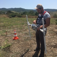
Molpír hillfort was situated in a strategically important location beside an important trade route going from the south-east Alpine region through the Bratislava Gate along the eastern slopes of the Little Carpathians and continuing north through the Váh valley. The proximity of the Jablonec Pass also allowed a direct connection of the Váh valley with the Morava valley. The material culture of the inhabitants of Molpír was not only rich but also diverse and distinctive, due to their contacts with close and more distant regions. Smolenice-Molpír is part of the settlement structure of the western Carpathians in the early and later phases of the Early Iron Age. It is one of the most important fortified upland settlements from this period and region. The majority of information came from the highest part (370 m above sea level) of the site, i.e. the IIIrd enclosure. Photographs from previous excavations illustrate the situation prior to reforestation, and before recent changes that can be seen and documented today. The old photographs, together with the new mapping results, as well as geophysical and LiDAR data, represent the basis for a reconstruction of the internal organisation of the hillfort. But first we must analyse the data so as to exclude recent structures and impacts, for example old excavation trenches. The aim of the research was to identify potential settlement features and their configuration using geophysical methods (see above) and excavation. Areas 1 and 2 were surveyed in detail in order to investigate the relief and to recognize settlement terraces and ramparts. Trenches 1/2015 and 2/2015 were delimited based on the results of these surveys (for trench 2/2015 the basic data was accompanied by the ERT results).